Mori Atlas logo
Protected areaLake Amvrakia

A tectonic semipolje basin defined by limestone deposits and riparian wetland habitats.

Lake Amvrakia Protected Area: Mapping the Karstic Landscapes of Aetolia-Acarnania, Greece

Lake Amvrakia serves as a significant protected freshwater ecosystem within the Aetolia-Acarnania region of western Greece. Formed within a tectonic depression of Mesozoic limestone, this karstic semipolje exhibits complex hydrological fluctuations and unique sulphuric water chemistry. The landscape is characterized by a dual-sided shoreline, featuring cultivated eastern plains that contrast with the more natural, vegetated riparian corridors found along its western margins.

freshwater lakekarstic lakesemipoljetectonic basinNatura 2000protected wetland

Lake Amvrakia

Protected area

Park overview

Structured park overview, official facts, and landscape profile for Lake Amvrakia

Lake Amvrakia park facts, protected area profile, and essential visitor context

Review the core facts for Lake Amvrakia, including designation, size, terrain, visitor scale, habitats, and operating context in one park-focused overview.

About Lake Amvrakia

Lake Amvrakia lies in western Greece within the regional unit of Aetolia-Acarnania, positioned in a narrow lowland corridor between Agrinio to the southeast and Amphilochia to the north. The lake is a freshwater body that occupies a tectonic depression formed by the same geological forces that shaped much of central and western mainland Greece, and its basin is a clear example of a karstic semipolje: an elongated depression in soluble limestone that fills with water, partially because underground drainage is restricted.

Geologically, the lake's origin is tied to deposits of Mesozoic limestone, which give the surrounding terrain its characteristic karstic behavior. The lake is closely related hydrologically to nearby Lake Ozeros, lying roughly five kilometres to the southeast, and west of the lake rises Mount Thyamos (also called Petalas). Together these features define the broader landscape topology of the area: a chain of tectonic basins separated by uplifted limestone massifs, drained by surface and underground flows.

The lake currently measures about 13.8 kilometres in length and 3.8 kilometres at its widest, with a maximum depth near 40 metres, though the surface area has shrunk in recent decades. Historic records suggest a former surface area of around 13.6 square kilometres, and in the 1990s the shallow northern portion of the lake, on the side toward Amphilochia, was effectively cut off by an embankment built for the national highway. This intervention, combined with persistent drought and irrigation withdrawals, has reduced the open water area and changed the shape of the lake.

Ecologically, Lake Amvrakia is included in the Natura 2000 network of protected European habitats and is recognized as a significant wetland. Local records emphasize its rich birdlife and the presence of dense lakeside vegetation along its western shore, while its eastern shore is heavily cultivated, with fields extending almost to the water's edge. Unvegetated patches along the shore are commonly used as pasture for cattle, reflecting the long coexistence of pastoral and agricultural land use with the remaining aquatic habitat.

Quick facts and research context for Lake Amvrakia

Lake Amvrakia is located in the Aetolia-Acarnania regional unit of western Greece, in the broader Sterea Ellada geographic region. The lake sits in a tectonic, karstic basin and reaches a maximum depth of around 40 metres (130 ft), with a maximum length of roughly 13.8 kilometres and width of about 3.8 kilometres. Its small drainage basin, combined with karstic activity and seasonal evaporation, produces strongly variable water levels and an unusually high concentration of sulphuric anions compared with neighboring lakes. The lake is formally recognized as a Natura 2000 site and contains the endemic mollusk Pseudobithynia ambrakis, known only from this water body.

Protection and recognition

Analysis of terrestrial protected area parameters and international recognition

Lake Amvrakia Protection Status and Documented Conservation Scope

Lake Amvrakia maintains a documented terrestrial protection scope without international recognition sources or transboundary designations on record. Systematic evaluation details the official conservation framework governing this regional water body across baseline environmental databases.

Protection details

Protection scope
Terrestrial
Transboundary protection
No
Park context

Deeper park guide and search-rich context for Lake Amvrakia

Lake Amvrakia history, landscape, wildlife, and travel context

Explore Lake Amvrakia through its history, landscape character, ecosystems, wildlife, conservation priorities, cultural context, and seasonal travel timing in a structured park guide built for atlas discovery and search intent.

Why Lake Amvrakia stands out

Lake Amvrakia is best known as a karstic, Natura 2000-protected freshwater lake in western Greece that harbors the endemic snail species Pseudobithynia ambrakis. It also stands out among regional lakes for its high sulphuric anion content, its semipolje origin in Mesozoic limestone, and its importance as a seasonal habitat for waterbirds that depend on its fringing wetland vegetation and open water surfaces.
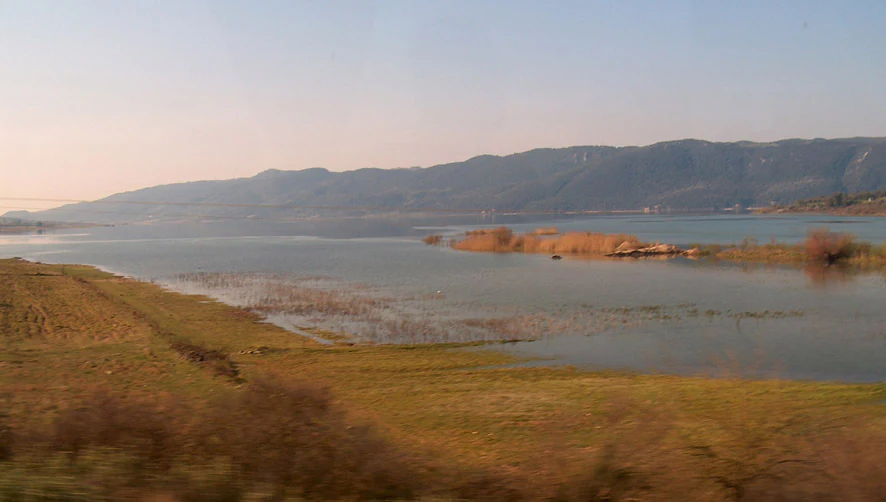
A wide, eye-level shot of Lake Amvrakia with rolling hills in the background and grassy, marshy shoreline in the foreground.
A scenic view across the calm waters of Lake Amvrakia.

Lake Amvrakia history and protected-area timeline

Lake Amvrakia's modern identity is closely tied to the hydrological and infrastructural changes of the late twentieth century rather than to any single founding date. Its northern section was largely drained in the 1990s when an embankment constructed for the national road effectively isolated the shallow end of the basin. Combined with prolonged drought in the region, this drainage caused a marked reduction in the lake's overall surface area, transforming what had once been a more expansive water body into a more compact lake with a clearly truncated northern reach.

Although the lake itself is a natural feature, its formal ecological recognition came through its inclusion in the Natura 2000 network, underscoring its importance as a protected freshwater and wetland habitat in the European conservation framework. The surrounding landscape carries a much older human history, with the broader region associated with the ancient city of Ambracia, but the lake basin as such gained modern prominence largely because of its ecological status and its supporting role for regional biodiversity.

Lake Amvrakia landscape and geographic character

The landscape around Lake Amvrakia is shaped by the geology of western Greece: a low-lying tectonic basin flanked by limestone uplands. The lake itself is long and narrow, with a stretched north-south orientation that mirrors the structural grain of the surrounding bedrock. To the east and southeast the terrain opens into cultivated plains, while to the west and north the topography rises toward the slopes of Mount Thyamos (Petalas), giving the lake a clearly defined western shore backed by hills.

The shoreline is uneven in character. On the western side, natural or semi-natural riparian vegetation is retained, creating a more typical wetland interface between land and water. By contrast, the eastern shore is heavily modified by agriculture, with tobacco plantations and other cultivated fields running almost to the water's edge. In the north, the embankment associated with the highway marks a clear artificial boundary, beyond which the historic shallow extension of the lake basin has effectively dried out. This contrast gives the lake a dual face: a more developed, agricultural eastern margin and a more natural, vegetated western edge.

Lake Amvrakia ecosystems, habitats, and plant life

Lake Amvrakia functions primarily as a freshwater wetland habitat, with ecological character shaped by a combination of open water, fringing marshy vegetation, and adjacent terrestrial land uses. The lake belongs to a chain of tectonic lakes in Aetolia-Acarnania, and its karstic foundations mean that groundwater exchanges with the surrounding limestone aquifers strongly influence water chemistry and seasonal water levels.

Vegetation patterns around the lake are distinctly zoned. The western shore retains denser lakeside and wetland vegetation, supporting the ecological functions typically expected from such habitats, including cover for waterbirds and a buffer against sediment runoff. The eastern shore offers far less natural habitat, since cultivation frequently extends right up to the waterline. Smaller uncultivated zones around the shore are regularly grazed by cattle, which adds an additional layer of human pressure on the remaining natural vegetation.

Chemically, the lake is notable for its relatively high concentration of sulphuric anions, setting it apart from the other lakes in its immediate region. This distinctive water chemistry, combined with the small size of its 112 square kilometre drainage basin, makes the lake sensitive to catchment-level disturbances, including nutrient and chemical runoff from agriculture.

Lake Amvrakia wildlife and species highlights

Wildlife interest around Lake Amvrakia centers on birds and on a small group of specialized aquatic invertebrates. The lake is identified locally and in conservation literature as a habitat with rich avifauna, and its open water and fringing wetland vegetation, particularly along the western shore, provide typical conditions for waterbirds. Seasonal and migratory use of the lake is consistent with the broader role of Greek freshwater lakes as stopover or wintering sites within regional flyways.

The lake's most distinctive faunal feature is the mollusk Pseudobithynia ambrakis, a small snail in the family Bithyniidae that has so far been recorded only from Lake Amvrakia itself. The species is classified as vulnerable and reflects the lake's role as a refugium for narrowly endemic freshwater fauna. The combination of unusual water chemistry, fluctuating water levels, and a fragmented shoreline creates a habitat mosaic that supports a specialized but ecologically significant assemblage of species.

Lake Amvrakia conservation status and protection priorities

Lake Amvrakia's principal conservation significance lies in its formal inclusion in the Natura 2000 network, the European Union's ecological network of protected sites that safeguards habitats and species of conservation concern. This designation reflects the lake's value as a freshwater wetland with notable birdlife, distinctive water chemistry, and an endemic invertebrate species of high conservation interest.

Yet the lake is also under sustained pressure. Prolonged drought, irrigation withdrawals, and the historical draining of its northern basin have all contributed to a substantial decrease in open water area. Hydraulic interactions with karstic aquifers and evaporation during summer further drive annual fluctuations in water levels, complicating long-term habitat stability. Pollution from agricultural runoff, particularly from tobacco plantations on the eastern and southern parts of the drainage basin, is described as present but not yet alarming, although the proximity of cultivation to the shoreline means that nutrient and chemical inputs remain a continuous concern. Grazing on uncultivated shore areas adds another layer of pressure on remaining riparian and lakeside vegetation.

Lake Amvrakia cultural meaning and human context

The name Amvrakia echoes the older regional identity of western Greece, where the ancient city of Ambracia once stood on the eastern side of what was then the Ambracian Gulf. While the present-day lake is a freshwater body distinct from that ancient coastal setting and from the modern town of Ambracia associated with the gulf, the shared name reflects a long-standing regional toponym that still anchors local identity. The lake forms part of a broader cultural landscape in which agriculture, including traditional tobacco cultivation, and pastoral cattle-keeping are deeply woven into the everyday life of the lakeside communities of Aetolia-Acarnania.

Top sights and standout views in Lake Amvrakia

Lake Amvrakia is defined by its tectonic origin, its karstic and semipolje character within Mesozoic limestone, and its unusual sulphuric water chemistry relative to other lakes in the region. Its Natura 2000 status highlights both its ecological value and its vulnerability, while the presence of the endemic snail Pseudobithynia ambrakis and the rich birdlife underscore its scientific and conservation importance. The contrast between heavily cultivated eastern shores and more natural, vegetated western shores gives the lake a distinctive two-sided landscape and a clear story of human-environment interaction.

Best time to visit Lake Amvrakia

Lake Amvrakia experiences a Mediterranean climate, with hot, dry summers and cooler, wetter winters. Late spring and early autumn are generally favorable for visiting, when temperatures are milder and the bird populations are at their most active, particularly around the vegetated western shore. Summer visits can be very warm, and evaporation in that season can noticeably lower water levels, while winter and early spring may coincide with higher water levels and a wetter, greener appearance around the basin.
Monthly climate preview

Long-term representative measurements of monthly temperature and precipitation patterns for Lake Amvrakia

Lake Amvrakia Climate Normals, Annual Temperature and Precipitation Rhythm

Lake Amvrakia records mean monthly temperatures ranging from 5.16 degrees Celsius to 26.28 degrees Celsius alongside varying daily precipitation rates across the twelve-month cycle. Reviewing the complete monthly profile provides detailed historical temperature ranges and precipitation metrics for comprehensive geographic analysis.
Annual mean15 °C
5 °C26 °C
Jan
Feb
Mar
Apr12°
May18°
Jun23°
Jul26°
Aug26°
Sep21°
Oct16°
Nov11°
Dec
Warmest month
July

26.3 °C

Coolest month
January

5.2 °C

Wettest month
December

3.9 mm/day

Driest month
July

0.5 mm/day

Park location guide

Geography guide, regional context, and park location map for Lake Amvrakia

Lake Amvrakia park geography, regions, and map view in Greece

Understand where Lake Amvrakia sits in Greece through a broader geographic reading of the surrounding landscape, nearby location context, and its mapped position within the national park landscape.

How Lake Amvrakia fits into Greece

Greece, officially the Hellenic Republic, is a country in Southeast Europe occupying the southern Balkans. It borders Albania, North Macedonia, Bulgaria, and Turkey, with coastlines on the Aegean, Ionian, and Mediterranean seas. The country has over 10 million people and is renowned for its ancient Greek heritage, philosophy, democracy, and the Olympic Games.

Wider geography shaping Lake Amvrakia in Greece

Greece occupies the southern tip of the Balkan peninsula in Southeast Europe. It shares land borders with Albania to the northwest, North Macedonia and Bulgaria to the north, and Turkey to the east. The Aegean Sea lies to the east of the mainland, the Ionian Sea to the west, and the Sea of Crete and Mediterranean Sea to the south. The country spans thousands of islands across nine traditional geographic regions and has the longest coastline in the Mediterranean basin.

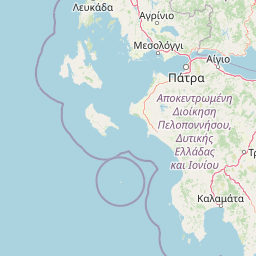
Map view of Lake Amvrakia

Use this park location map to pinpoint Lake Amvrakia in Greece, understand its exact geographic position, and read its mapped placement within the surrounding landscape more clearly.

Pigeon | © OpenStreetMap contributors

Location context for Lake Amvrakia

Aetolia-Acarnania

Visualizing tectonic wetland habitats and limestone terrain within the protected basin

Lake Amvrakia Photos and Landscape Scenery in Western Greece

Examine detailed Lake Amvrakia photos to observe the stark contrast between cultivated eastern agricultural shores and vegetated western wetland margins. Visual records clarify the karstic topography, limestone geology, and regional habitat structure supporting local wildlife populations.

A wide, eye-level shot of Lake Amvrakia with rolling hills in the background and grassy, marshy shoreline in the foreground.

A wide, calm freshwater lake in Greece, with golden-brown grassy fields in the foreground, small patches of reeds near the water, and low, rolling hills in the background under a pale sky.

Park atlas

Compare adjacent wetland habitats and limestone landscapes across western Greece.

Explore Parks Near Lake Amvrakia and Surrounding Protected Areas

Continue exploring protected areas near Lake Amvrakia to examine related wetland ecosystems and regional conservation geography. Broader park comparisons reveal how tectonic basins and limestone uplands shape natural habitats throughout the surrounding territory.
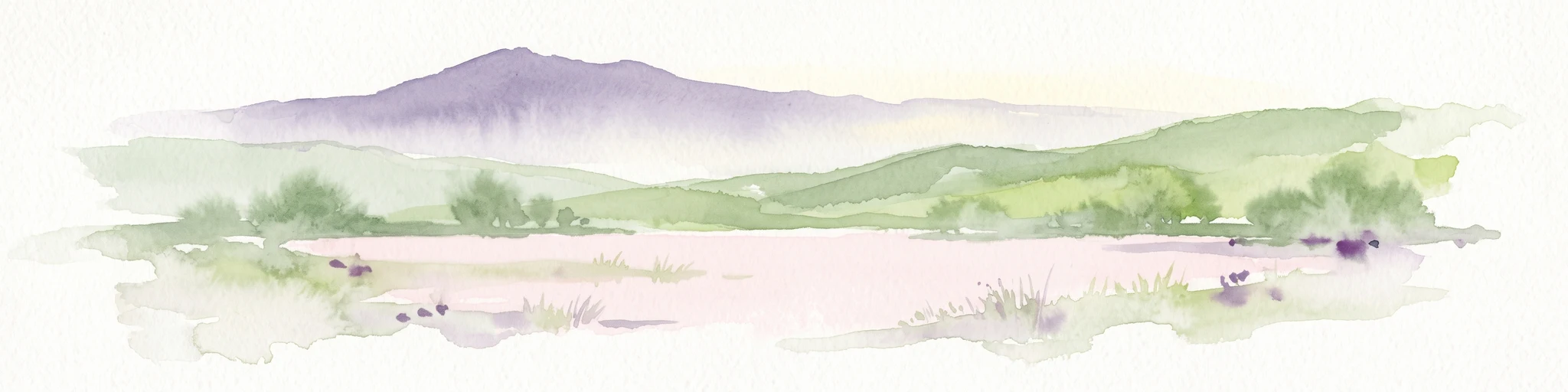
A watercolor painting showing a soft, atmospheric landscape with a pink-toned lagoon in the foreground, green hills in the midground, and a hazy purple mountain in the background.
National parkGrèce-Occidentale
About 38 km away#1 closest

Southeast

Parc national de Missolonghi-Etolikó: Coastal Lagoons and Limestone Geography

Protected wetlands and river delta landscapes in Western Greece

Tracing the interface of the Acheloos and Evinos river deltas with the Ionian Sea, this national park protects a mosaic of saltpans, reedbeds, and mountain massifs. Its mapped boundaries encompass the historic Missolonghi lagoon, the vertical limestone cliffs of Mount Varasova, and rare riverine woodlands, providing a detailed look at one of the most vital wetland complexes in the Mediterranean.

Area
360.73 km²
Established
2006
IUCN
VI
National parkGreece
About 90 km away#2 closest

North

Parc national de Tzoumérka-Achelóos-Ágrafa-Météores National Park: Geography and Landscape Atlas

Central Greece Pindus mountain protected wilderness zone

An extensive protected landscape bridging Thessaly and Epirus, this national park showcases the ecological and geological diversity of the central Pindus Mountains. Analyze the geographic layout of the Athamanian ranges, the Acheloos river corridor, and the unique conglomerate formations at Meteora through a detailed protected-area lens.

Area
3,379.94 km²
Established
2009
IUCN
VI
Relief
Mountain
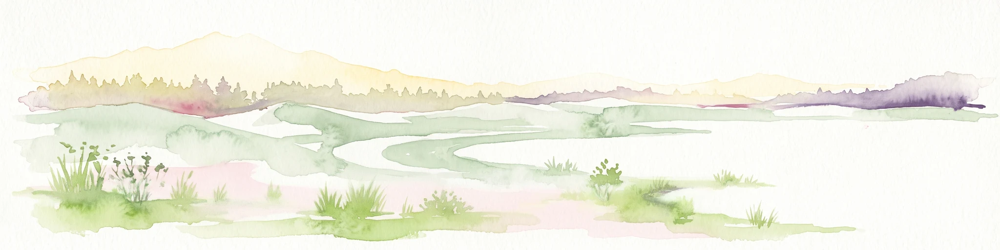
Watercolor illustration of a mountain range with greenery and distant peaks under a light sky
Marine protected areaGreece
About 119 km away#3 closest

South

National Marine Park of Zakynthos: Detailed Protected Marine Area & Geographic Context

Mapping Zakynthos's protected marine territory and regional geography

Investigate the National Marine Park of Zakynthos, a distinguished marine protected area situated in Greece. This dedicated page provides detailed insights into its protected landscape, focusing on its mapped geographic extent and its significance within the Mediterranean. Users can explore the specific boundaries of this protected marine territory and understand its place in the wider regional geography, enhancing atlas-based discovery of Greece's conservation areas.

IUCN
II
Scope
Marine
Water
Water-dominated
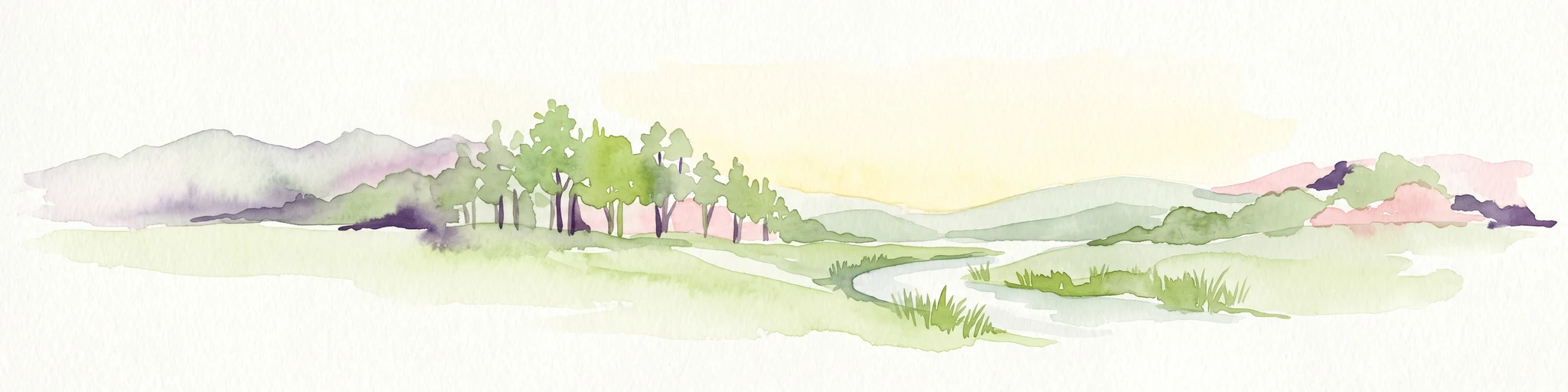
A watercolor painting showing a wide view of the Foloi plateau with rolling hills, a small grove of deciduous trees, and a winding stream, set against a pale background.
Protected areaElis
About 122 km away#4 closest

Southeast

Foloi Oak Forest Protected Area and Plateau Landscape in Elis, Greece

Deciduous mountain woodland and regional plateau geography

Examine the geographic profile of the Foloi Oak Forest, a rare seed-regenerated deciduous woodland spread across an elevated plateau in the Elis region. This protected landscape forms an essential ecological boundary in the western Peloponnese, featuring a dense canopy of Hungarian oak and deep gorges that define the surrounding mountain terrain and local drainage systems.

Area
42 km²
Relief
Upland
Climate
Mediterranean
Access
Moderate access
Watercolor illustration of a mountainous landscape with a river, forests, and distant hills
National parkGreece
About 128 km away#5 closest

North

Pindus National Park: A Protected Greek Mountain Wilderness with Ancient Forests

Explore its rugged terrain, biodiversity, and alpine landscape.

MoriAtlas presents Pindus National Park, a significant protected area in Greece known for its dramatic mountainous terrain, deep valleys, and ancient old-growth forests. This page details its geographic context, featuring rugged highland landscapes, serpentine soils, and vital habitats for species like the Eurasian brown bear. Understand its place within the Pindus mountain range and its importance as a mapped wilderness area for conservation.

Area
69.27 km²
Established
1966
IUCN
II
Relief
Mountain
A soft, watercolor painting of a mountain range in the distance, featuring a band of evergreen trees in the midground and a grassy foreground on a plain white background.
National parkGreece
About 128 km away#6 closest

East

Parc national du Mont Parnasse: Mapping the Limestone Massif and Alpine Geography of Greece

A protected national park blending karst geology and mountain ecosystems.

Parc national du Mont Parnasse stands as a prominent protected landscape in Central Greece, defined by its fractured limestone geology and subalpine forests. This national park serves as a vital ecological refuge that preserves karst terrain, sinkholes, and diverse Mediterranean mountain habitats rising toward steep alpine summits.

Relief
Mountain
Climate
Mediterranean
Scope
Terrestrial
Water
Minor water
A soft watercolor painting of a coastal lagoon featuring dunes, grassy vegetation, and a distant treeline under a light sky.
Protected areaIonian Islands
About 134 km away#7 closest

Northwest

Korission Lagoon Protected Area: Coastal Wetlands and Dune Geography in Corfu, Greece

A coastal landscape defined by sand dunes, freshwater, and juniper forests

Korission Lagoon represents a rare ecological convergence on the Ionian Islands, where a tall sand dune barrier separates a freshwater lagoon from the open sea. This protected area supports an intricate mosaic of reed beds and unique juniper woodlands, providing a crucial habitat for a vast array of bird species and endemic wildlife within the coastal plains of Corfu.

Area
4.27 km²
Relief
Lowland
Climate
Mediterranean
Access
Easy access
National parkGreece
About 141 km away#8 closest

North

Vikos-Aoös National Park: Deepest Gorge and Protected Mountain Landscape Atlas

Discover protected area boundaries and regional geography in Epirus.

Vikos-Aoös National Park in Greece's Pindus mountains is a premier destination for exploring dramatic natural geography. Best known for the Vikos Gorge, considered the world's deepest canyon relative to its width, the park also features towering alpine peaks like Mount Tymphe, glacial lakes such as Drakolimni, and rich botanical diversity. As a UNESCO Geopark and part of the Natura 2000 network, it safeguards critical habitats, including significant brown bear populations. This park offers a profound look into protected landscapes, offering detailed geographic context and mapped terrain for atlas-based discovery.

Area
126 km²
Established
1973
IUCN
II
Visitors
100K annual

Common questions about visiting, size, designation, and location context for Lake Amvrakia

Lake Amvrakia FAQs for park facts, access, geography, and protected area context

Find quick answers about Lake Amvrakia, including protected-area facts, park geography, trail and visitor context, and how the park fits into its surrounding country and regional landscape.
MoriAtlas Explorer

Continue Your Protected Areas Search Across the Global Atlas

Deepen your exploration by continuing the structured search for national parks and protected areas worldwide. Utilize the comprehensive filtering capabilities to compare different conservation landscapes and refine your understanding of global park geography. Discover more about the distribution and characteristics of protected natural areas.

Global natural geography