

Mori Atlas logo
National parkLake Bindegolly National Park

Discover the mapped boundaries and unique bird sanctuary of this vital Queensland national park.

Lake Bindegolly National Park: Queensland's Vital Inland Wetland and Protected Landscape

Lake Bindegolly National Park represents a crucial protected wetland ecosystem within Queensland's vast semi-arid Mulga Lands bioregion. Established to conserve rare flora and provide critical habitat, this national park is renowned as a significant bird sanctuary, particularly for its importance to waterfowl and desert-adapted species. The park's three-lake system, comprising both saline and freshwater bodies, creates a dynamic landscape that transforms the outback into a thriving haven during wetter periods, offering unique opportunities for understanding inland Australian geography and protected nature.

WetlandsBirdwatchingImportant Bird AreaMulga LandsProtected AreaQueensland

Lake Bindegolly National Park

National park

Park overview

Structured park overview, official facts, and landscape profile for Lake Bindegolly National Park

Lake Bindegolly National Park park facts, protected area profile, and essential visitor context

Review the core facts for Lake Bindegolly National Park, including designation, size, terrain, visitor scale, habitats, and operating context in one park-focused overview.

About Lake Bindegolly National Park

Lake Bindegolly National Park represents one of Queensland's most important inland wetland ecosystems, situated in the heart of the Mulga Lands bioregion in the state's remote south-west. The park's three-lake system, comprising two saline lakes and one freshwater body, creates a unique ecological environment that draws wildlife from across the region during favourable conditions. The Mulga Lands bioregion covers extensive areas of semi-arid Queensland and New South Wales, characterised by low, unpredictable rainfall and vegetation dominated by mulga (Acacia aneura), a hardy tree adapted to the harsh climate. Within this otherwise dry landscape, Lake Bindegolly provides a vital refugium for biodiversity, its periodic filling during wet seasons transforming the area into a rich wetland that supports populations of waterbirds, migratory species, and terrestrial birds that depend on the water and surrounding vegetation. The park's establishment in 1991 reflected growing recognition that even remote outback wetlands merit formal protection, both for their ecological significance and for the survival of specialist species like Acacia ammophila that cannot persist in degraded or unprotected habitats.

Quick facts and research context for Lake Bindegolly National Park

Lake Bindegolly National Park covers approximately 140 square kilometres in the Shire of Bulloo, within South West Queensland. The park was formally established in 1991 by the Queensland Parks and Wildlife Service to protect the rare Acacia ammophila and the broader wetland ecosystem. The park features three interconnected lakes: two with saline water and one freshwater, a combination that creates unusual ecological conditions in this arid region. The area is classified as IUCN Category II (National Park) and forms part of the Mulga Lands bioregion, a vast area of eastern Australia characterised by low rainfall and distinctive vegetation communities.

Protection and recognition

Analyzing the terrestrial conservation framework and official environmental designation records

Lake Bindegolly National Park Protected Area Status and Designations

Documented records for Lake Bindegolly National Park outline its official status as a terrestrial protected area dedicated to regional conservation. Accessing verified designation frameworks helps researchers compare official terrestrial boundaries and park management classifications across the region.

Protection details

Protection scope
Terrestrial
Transboundary protection
No
Park context

Deeper park guide and search-rich context for Lake Bindegolly National Park

Lake Bindegolly National Park history, landscape, wildlife, and travel context

Explore Lake Bindegolly National Park through its history, landscape character, ecosystems, wildlife, conservation priorities, cultural context, and seasonal travel timing in a structured park guide built for atlas discovery and search intent.

Why Lake Bindegolly National Park stands out

Lake Bindegolly is best known for its exceptional significance as a bird sanctuary, particularly for waterfowl and desert-adapted bird species. The lake system has been identified by BirdLife International as an Important Bird Area, recognised for supporting globally significant populations of blue-billed ducks and red-necked avocets. Beyond these flagship species, the park provides critical habitat for a suite of inland bird species including the biome-restricted inland dotterel, Bourke's parrot, various honeyeater species, and the distinctive Hall's babbler. The rare plant Acacia ammophila that prompted the park's establishment also remains a key reason for its protection, as this species has a very limited distribution in the Mulga Lands region.

Lake Bindegolly National Park history and protected-area timeline

Lake Bindegolly National Park was established in 1991 through the Queensland Parks and Wildlife Service, created with the specific purpose of protecting the rare plant Acacia ammophila and the broader wetland ecosystem that surrounds the lake system. The establishment came during a period of increased environmental awareness in Australia during the late 1980s and early 1990s, when numerous protected areas were declared to address gaps in the national reserve system. The park sits within the historical pastoral region of Dynevor in the Shire of Bulloo, an area that has been grazed by livestock since European settlement but where the wetland areas remained largely unsuitable for intensive agriculture. This relative land-use incompatibility actually helped preserve the ecological character of the lake system before formal protection was granted. The Queensland Parks and Wildlife Service has managed the park since its establishment, maintaining the wetland habitats and monitoring the populations of rare species that depend on the protected area.

Lake Bindegolly National Park landscape and geographic character

The landscape of Lake Bindegolly National Park is defined by its three-lake system set within the broader Mulga Lands, a region of flat to gently undulating terrain with sparse vegetation cover. The two saline lakes and single freshwater lake occupy depressions in the landscape that fill during periods of above-average rainfall, creating wetland habitats that are transient in nature but critically important for wildlife during wet phases. The surrounding terrain consists of typical semi-arid Australian vegetation including mulga woodland, saltbush plains, and ephemeral grasslands that respond rapidly to rainfall events. The horizon in this part of Queensland extends across vast, relatively flat terrain with minimal topographic variation, interrupted only by the water bodies and the lines of trees that mark drainage lines and watercourses. The visual character of the park shifts dramatically between wet and dry periods, with the lake system either full and alive with bird activity or reduced to dry salt pans and scattered waterholes during droughts.

Lake Bindegolly National Park ecosystems, habitats, and plant life

The ecological character of Lake Bindegolly reflects the distinctive conditions of the Mulga Lands bioregion, where rainfall is low and unpredictable but biodiversity remains surprisingly high in the right conditions. The park's wetlands provide essential habitat for waterbird populations that may travel great distances to reach these inland water bodies during wet periods. The vegetation communities around the lakes include samphire flats around the saline water bodies, freshwater marsh and reed beds in the perennial water areas, and mulga woodland on the surrounding plains. The rare Acacia ammophila that prompted the park's establishment occurs in specific habitats within the protected area, reflecting the species' particular requirements for soil type, moisture availability, and microclimate that exist in few other locations. This combination of wetland and arid-land ecosystems within a single protected area creates ecological diversity that supports both water-dependent species and desert-specialist fauna.

Lake Bindegolly National Park wildlife and species highlights

Lake Bindegolly's wildlife is dominated by its extraordinary bird populations, which have earned the area international recognition as an Important Bird Area. The lake supports over 1% of the world population of both the blue-billed duck and the red-necked avocet, two species that depend on inland wetlands in Australia's arid and semi-arid zones. The park also provides crucial habitat for several bird species with restricted distributions, including the inland dotterel that inhabits the arid interior, Bourke's parrot of the inland woodlands, and multiple honeyeater species including the grey-headed, black, and pied honeyeaters. Ground-dwelling birds such as Hall's babbler, chirruping wedgebill, and chestnut-breasted quail-thrush inhabit the woodland and shrubland surrounding the lakes. The wetland environment supports migratory waterfowl that may visit during appropriate seasons, while the surrounding mulga lands provide habitat for reptiles, small mammals, and invertebrates adapted to this harsh environment.

Lake Bindegolly National Park conservation status and protection priorities

Lake Bindegolly National Park represents significant conservation value in an Australian context, protecting both a rare plant species and one of the country's important inland wetland systems. The park's designation as an Important Bird Area by BirdLife International acknowledges the global significance of the bird populations it supports, particularly the blue-billed duck and red-necked avocet populations that exceed 1% of their world totals. The protection of Acacia ammophila was the founding rationale for the park, and this species continues to benefit from the formal protection status that prevents habitat destruction within the park boundaries. Wetlands in Australia's arid interior face multiple pressures including climate variability, water extraction, and changed fire regimes, making protected areas like Lake Bindegolly critical refugia for species that depend on these periodically wet environments. The park contributes to the national reserve system by representing the Mulga Lands bioregion in the protected area network, ensuring that this distinctive Australian landscape type has representation in conservation planning.

Lake Bindegolly National Park cultural meaning and human context

Lake Bindegolly National Park sits within the traditional Country of Aboriginal peoples, though detailed cultural information specific to the park is not extensively documented in available sources. The broader Bulloo region has historical significance for Aboriginal communities who utilized the wetland resources over millennia, with the lake system likely serving as important camping and resource-gathering locations during wet periods when water was available. The pastoral history of the Dynevor area, dating from European settlement, has shaped the surrounding landscape though the wetland areas remained relatively unmodified due to their impracticality for intensive grazing. The park is located in one of Queensland's most sparsely populated regions, with Thargomindah as the nearest town representing a small outback community that forms the human context for this remote protected area.

Top sights and standout views in Lake Bindegolly National Park

Lake Bindegolly National Park offers exceptional birdwatching opportunities in a remote outback setting, with the chance to observe significant populations of blue-billed ducks and red-necked avocets in their natural wetland habitat. The park provides one of the most reliable locations in Queensland's arid interior for viewing waterbirds, particularly during wet periods when the lakes fill and attract species from across the region. The combination of saline and freshwater lakes creates habitat diversity that supports both waterfowl and desert bird species, making a single visit potentially rewarding for varied birdlife. The rare Acacia ammophila represents a botanical highlight for those interested in Australia's unique flora, while the overall experience of visiting a protected wetland in the semi-arid Mulga Lands offers a distinctive outback nature experience quite different from Australia's coastal parks.

Best time to visit Lake Bindegolly National Park

The optimal time to visit Lake Bindegolly National Park depends significantly on rainfall patterns, as the wetland environment is highly responsive to weather conditions. Visiting after periods of rainfall when the lakes have filled offers the best wildlife viewing opportunities, with waterbird populations increasing dramatically during wet phases. The cooler winter months from May to September generally provide more comfortable conditions for exploring the park, though summer temperatures can be extreme in this part of Queensland. Birdwatching tends to be most productive during the wet season (roughly November to March) when migrant species arrive and resident birds are more active around the water. Checking current conditions with the Queensland Parks and Wildlife Service before visiting is advisable, as access and conditions can vary substantially based on recent weather.
Monthly climate preview

Long term monthly temperature patterns and precipitation trends in Southwest Queensland

Monthly Climate Normals and Average Temperature for Lake Bindegolly National Park

Long term climatology at the representative coordinate shows an arid profile with mean temperatures ranging from twelve degrees Celsius in July to thirty-one degrees in January. Comparing historical weather by month averages reveals the seasonal shifts in temperature and daily precipitation across the protected wetland basin.
Annual mean22 °C
12 °C31 °C
Jan31°
Feb30°
Mar27°
Apr22°
May17°
Jun13°
Jul12°
Aug14°
Sep19°
Oct23°
Nov27°
Dec29°
Warmest month
January

31.2 °C

Coolest month
July

12.2 °C

Wettest month
February

1.8 mm/day

Driest month
August

0.4 mm/day

Park location guide

Geography guide, regional context, and park location map for Lake Bindegolly National Park

Lake Bindegolly National Park park geography, regions, and map view in Australia

Understand where Lake Bindegolly National Park sits in Australia through a broader geographic reading of the surrounding landscape, nearby location context, and its mapped position within the national park landscape.

How Lake Bindegolly National Park fits into Australia

Australia is a constitutional monarchy and federal parliamentary democracy comprising six states and ten territories. With a population of nearly 28 million, it is one of the world's most urbanised countries, with most people concentrated on the eastern seaboard. The country has a high Human Development Index and is known for its cultural diversity, ancient Aboriginal heritage, and unique wildlife.

Wider geography shaping Lake Bindegolly National Park in Australia

Australia occupies the entire Australian continent, the island of Tasmania, and numerous smaller islands. It is the world's flattest and driest inhabited continent, featuring vast deserts in the interior (the Outback), tropical rainforests along the eastern coast, and a coastline bordering the Indian and Pacific Oceans.

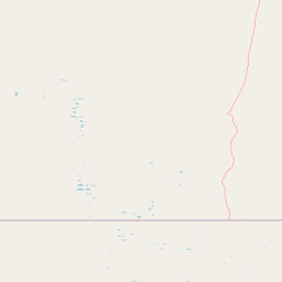
Map view of Lake Bindegolly National Park

Use this park location map to pinpoint Lake Bindegolly National Park in Australia, understand its exact geographic position, and read its mapped placement within the surrounding landscape more clearly.

Pigeon | © OpenStreetMap contributors

Location context for Lake Bindegolly National Park

Queensland
Park atlas

Map adjacent conservation landscapes and compare regional park geography across the vast Mulga Lands bioregion.

Explore Other National Parks Near Lake Bindegolly National Park in Southwest Queensland

Explore additional national parks and protected areas sharing geographic context or unique wetland features with Lake Bindegolly National Park, extending your discovery across Queensland's Mulga Lands. Comparing these diverse conservation landscapes provides deeper insight into regional ecosystem patterns and the broader protected area mapping in Australia's semi-arid interior.
National parkQueensland
About 73 km away#1 closest

South

Currawinya National Park: Queensland's Ramsar Wetland and Mulga Lands National Park

Discover its arid landscape and protected area identity.

Currawinya National Park is a major protected area in Queensland, Australia, recognized for its significant Ramsar-listed wetland system, including Lakes Numalla and Wyara. These ephemeral lakes are vital drought refuges for waterbirds across inland Australia and represent a unique ecological feature within the park's expansive mulga lands landscape. The park also champions conservation initiatives, notably a large predator-exclusion enclosure for the greater bilby, showcasing its commitment to arid-zone biodiversity and landscape preservation.

Area
1,513 km²
Established
1991
IUCN
II
Relief
Lowland
Nature reserveQueensland
About 137 km away#2 closest

East

Bowra Sanctuary: Mapping a Protected Nature Reserve in the Queensland Outback

Arid zone geography and Mulga Lands conservation

Bowra Sanctuary represents a significant conservation effort in the southern Queensland interior. This protected landscape contains a dense variety of woodland, gidgee, and coolabah plains intersected by river-fed creeklines. Examine the reserve through its diverse landforms, ranging from elevated ridges to temporary gilgai wetlands.

Area
140 km²
Established
2010
IUCN
VI
Relief
Upland
National parkNew South Wales
About 182 km away#3 closest

Southwest

Narriearra Caryapundy Swamp National Park: National Park Protected Landscape and Geographic Atlas

Explore mapped boundaries and regional context within New South Wales.

Narriearra Caryapundy Swamp National Park is a designated national park focused on preserving its unique protected landscape. This entry provides essential geographic context, detailing the park's mapped boundaries and its role within the regional atlas of New South Wales. Understand the protected natural area's identity and its place within the broader geographic framework for atlas exploration.

Area
1,534 km²
Established
2020
Relief
Lowland
Climate
Arid
Nature reserveNew South Wales
About 199 km away#4 closest

South

Nocoleche Nature Reserve: Mapping the Paroo River Floodplains in New South Wales

A large-scale protected wetland and arid-zone woodland ecosystem.

Nocoleche Nature Reserve preserves the largest wetland network of its kind in New South Wales, characterized by its position along the unregulated Paroo River. The landscape transitions from vibrant riverine corridors with rare yapunyah woodlands to dry mulga and box shrublands. This protected expanse is an essential refuge for wildlife in the surrounding pastoral outback, offering a distinct study in arid-zone hydrology and land management.

Area
711.08 km²
Established
1979
IUCN
Ia
Relief
Lowland
National parkQueensland
About 223 km away#5 closest

North

Mariala National Park: Queensland's Premier Mulga Lands Protected Landscape

Explore mapped terrain and regional geography.

Mariala National Park stands as a landmark designation, preserving the extensive mulga woodlands and semi-arid plains characteristic of Queensland's Mulga Lands bioregion. As the first protected area of its kind, it offers a profound insight into the ecological distinctiveness of inland Australia. This park provides a unique opportunity to explore a largely unmodified landscape, understand its role in conserving rare bird habitats, and appreciate its geographic significance within the broader Queensland atlas.

Area
269.2 km²
Established
1992
IUCN
II
Relief
Lowland
National parkNew South Wales
About 227 km away#6 closest

Southwest

Sturt National Park National Park: Discover Protected Landscape and Regional Geography in New South Wales

Explore the mapped boundaries and natural terrain of this Australian protected area.

Sturt National Park in New South Wales stands as a key national park within Australia's network of protected landscapes. This page offers detailed geographic context, focusing on the park's mapped boundaries and its role as a distinct natural area. Users can explore how Sturt National Park fits into the broader regional geography of New South Wales, providing an atlas-level view of conservation within the state and continent.

Area
3,253.29 km²
Established
1972
IUCN
II
Relief
Mixed relief
State or regional parkNew South Wales
About 255 km away#7 closest

Southeast

Toorale State Conservation Area: A Landmark Protected Landscape in the Western New South Wales Outback

Floodplain ecosystems and joint-managed riverine wilderness.

Toorale State Conservation Area stands as a major protected region in New South Wales, anchoring critical habitat along the Darling-Baaka River system. This vast, former pastoral landscape features extensive floodplains, arid outback terrain, and elevated lookouts that reveal the scale of the Murray-Darling Basin. As a cooperative conservation area, the land reflects both deep indigenous heritage and focused ecological restoration in a sparsely settled, semi-arid environment.

Area
543.85 km²
Established
2010
Relief
Lowland
Climate
Arid
National parkQueensland
About 269 km away#8 closest

North

Hell Hole Gorge National Park: Queensland National Park Atlas and Landscape Discovery

Mapped boundaries and regional geographic context for this protected area.

Hell Hole Gorge National Park serves as a key protected landscape within Queensland, Australia. This detail page provides essential geographic context, detailing the park's mapped boundaries and its location within the larger regional geography of northeastern Australia. Explore how this national park contributes to the protected lands atlas, offering structured insights into its natural terrain and regional significance for map-based exploration.

Area
127 km²
Established
1994
IUCN
II
Relief
Upland

Common questions about visiting, size, designation, and location context for Lake Bindegolly National Park

Lake Bindegolly National Park FAQs for park facts, access, geography, and protected area context

Find quick answers about Lake Bindegolly National Park, including protected-area facts, park geography, trail and visitor context, and how the park fits into its surrounding country and regional landscape.
MoriAtlas Explorer

Continue Your Protected Areas Search Across the Global Atlas

Deepen your exploration by continuing the structured search for national parks and protected areas worldwide. Utilize the comprehensive filtering capabilities to compare different conservation landscapes and refine your understanding of global park geography. Discover more about the distribution and characteristics of protected natural areas.

Global natural geography