
Why Lake Chapala stands out
Lake Chapala is best known as Mexico's largest freshwater lake and as a vital highland wetland on the Lerma-Santiago watershed. Its Ramsar designation reflects its role as habitat for migratory birds and a remarkable concentration of endemic aquatic species, most famously the Chirostoma, or charal, fish flock, along with the Chapala chub, unique mud turtle subspecies, and Mexican garter snake subspecies found nowhere else. The lake is also recognized for its dramatic ecological decline. Twentieth-century urban growth around Guadalajara, agricultural expansion, deforestation-driven sedimentation, and untreated wastewater from the Lerma basin have repeatedly stressed the system, harming fish stocks and inviting invasive water hyacinth blooms. The resulting conservation and water-management challenges have made Chapala a focal case study in Mexican freshwater ecology.
Lake Chapala history and protected-area timeline
Humans have lived around Lake Chapala since pre-Hispanic times, when Tecuexe communities tracing descent to the Toltecs settled along its shores and called the lake Chimaloacán, meaning roughly the region where the shield is used. The settlement that became Chapala was traditionally founded under a leader named Chapa, and for centuries the lake was a focal point of regional life in western Mexico. By the early sixteenth century, the area had been drawn into the Spanish colonial orbit, eventually falling under the authority of New Galicia.
Early European chroniclers such as the friar Antonio Tello and later the naturalist Alexander von Humboldt described Lake Chapala in terms reserved for great bodies of water. Tello compared it to a 'sea' and Humboldt emphasized its exceptional extent relative to European reference lakes. In the nineteenth century, the lake became one of Mexico's earliest resort destinations, attracting visitors from Europe and the United States and later drawing steamship excursions and rail travelers from Ocotlán. The Porfirio Díaz era reinforced Chapala's reputation as a fashionable lakeside retreat.
The late twentieth and early twenty-first centuries brought a much more troubled chapter. From the 1950s onward, the lake became a primary source of water for the greater Guadalajara area, and a sequence of droughts, intensified withdrawals, deforestation-driven sedimentation, and industrial and municipal pollution transformed it into a national symbol of water crisis. In 2004, the Global Nature Fund named Lake Chapala its Threatened Lake of the Year, and in February 2009, the lake earned Ramsar Wetland status in recognition of its ecological value. Today, the lake continues to balance its heritage as a cultural and scenic landmark with the urgent need to address shrinking water levels and ecological decline.
Lake Chapala landscape and geographic character
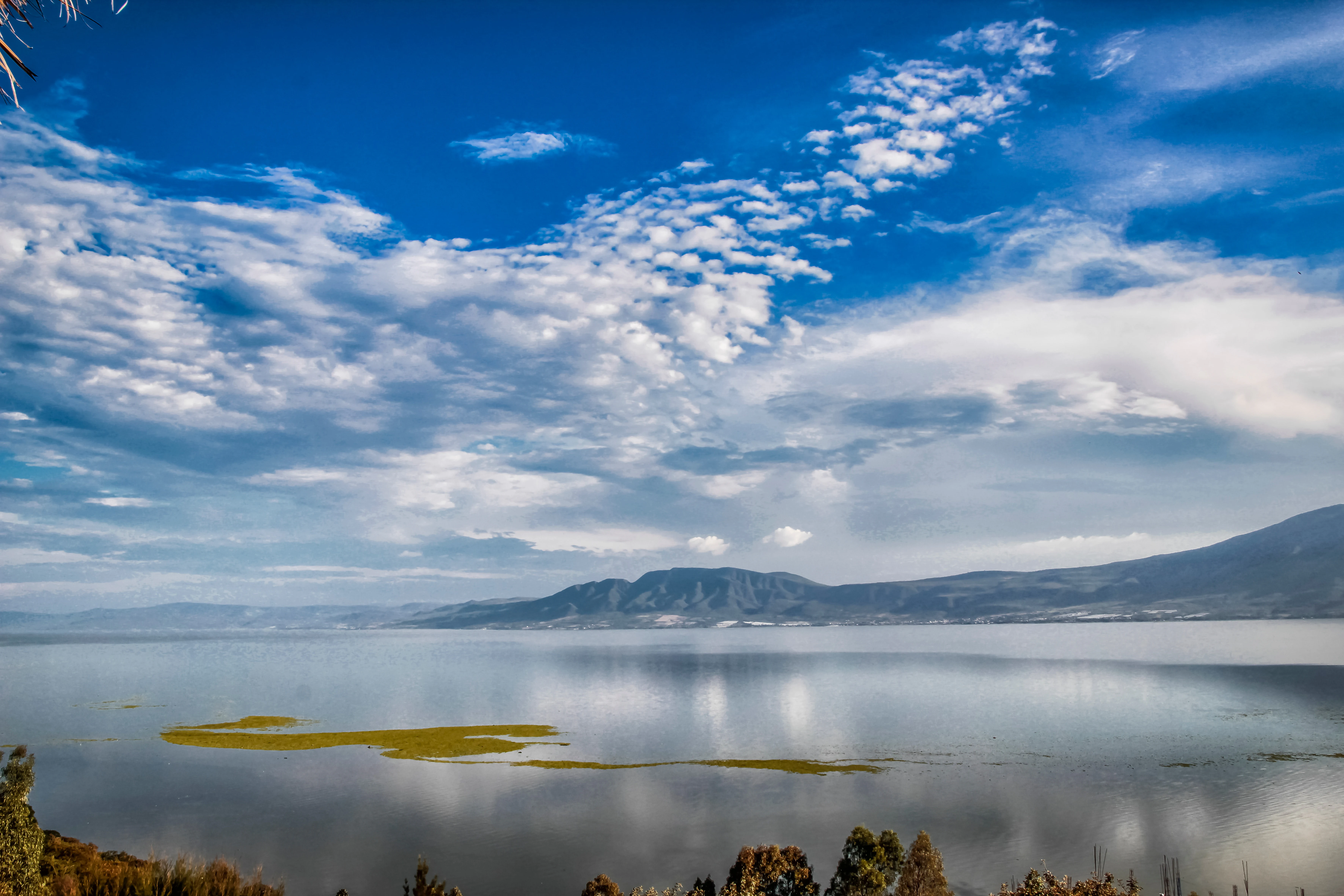
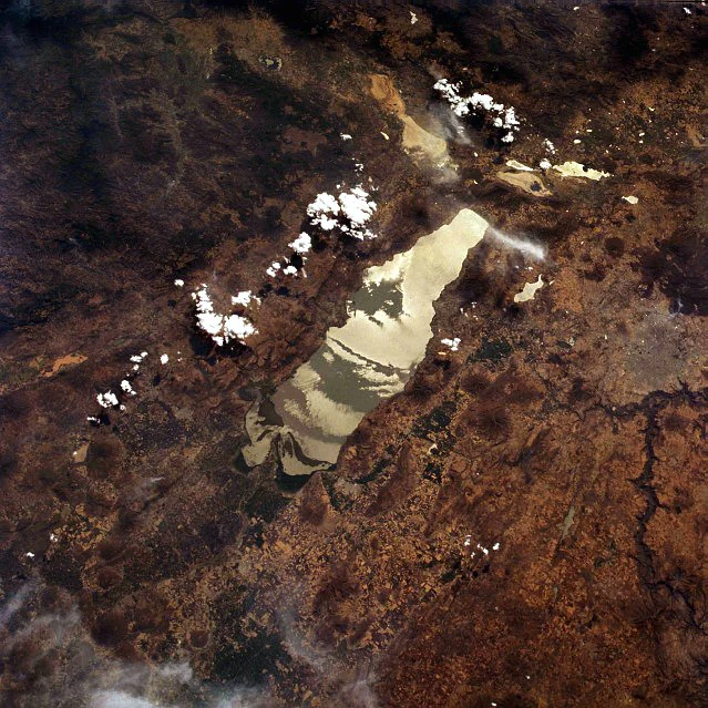
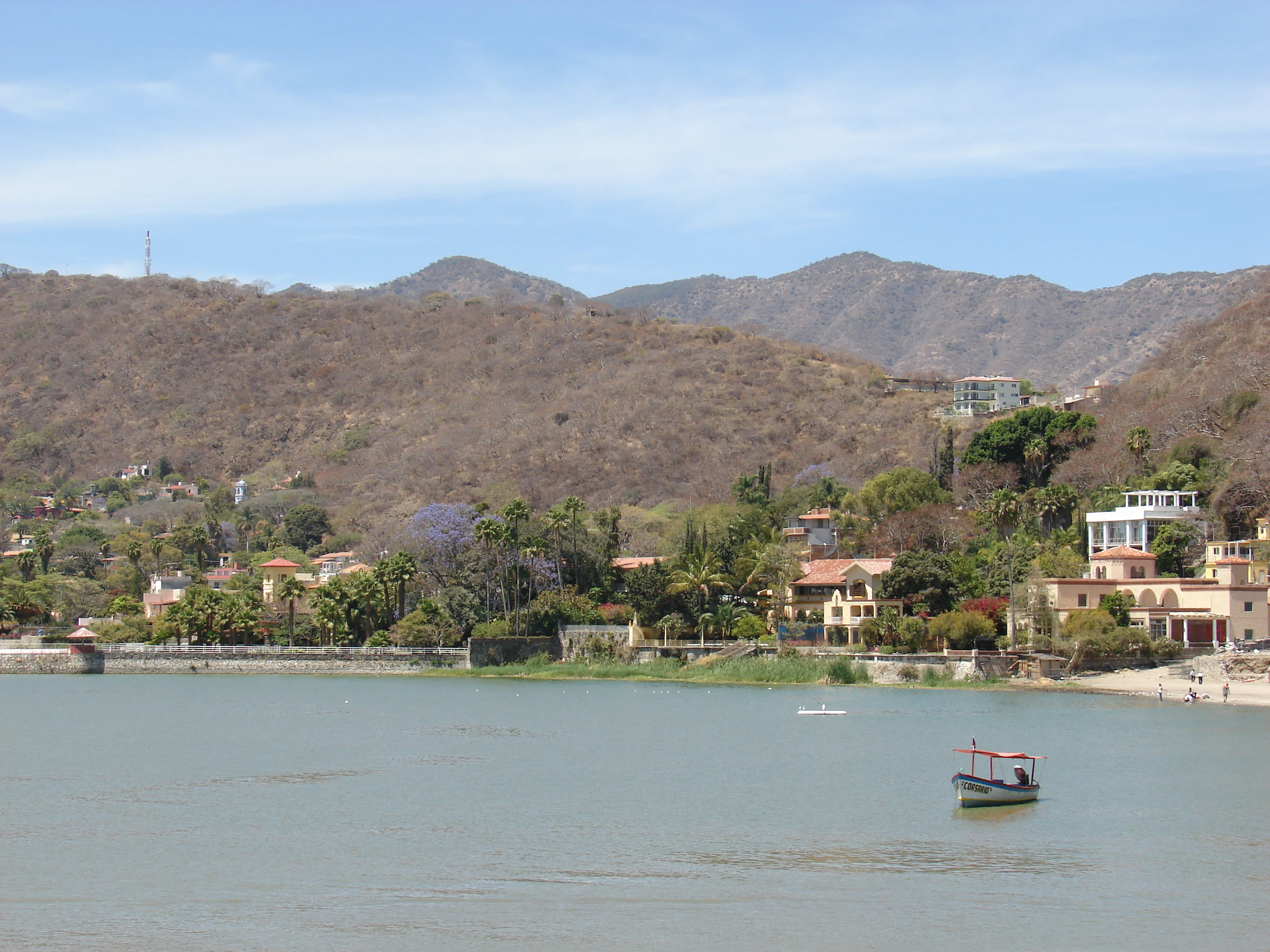
Lake Chapala lies within a broad, shallow depression framed by multiple volcanic ranges. To the north and west, the Cerro Viejo, Sierra San Juan Cosalá, Cerro San Miguel-Chiquihuitillo, Cerro San Bartolo-Los Ocotes, and Sierra del Tigre form a broken, mountainous skyline. The surrounding terrain is a mosaic of old volcanoes, exposed fault scarps, rolling agricultural plains, and narrow river valleys that funnel water into the lake.
Within the lake itself, three small islands break the expanse of water. Isla de los Alacranes is the most visible from the town of Chapala, Isla Mezcala is the largest and carries the remains of an old Spanish fort and a former Mexican prison, and a smaller islet, La Isla Menor, lies close to Isla Mezcala. Shallow shores, low cliffs, and reed-lined margins characterize much of the perimeter, while the encircling mountains create the gentle basin climate that has made the lakeshore famous for its pleasant year-round weather.
The lake's setting at about 1,524 meters elevation gives the entire region a temperate highland character. Combined with the moderating effect of the water itself, this landscape supports both agriculture along the alluvial flats and a distinctive lakeside vegetation pattern along the shoreline.
Lake Chapala ecosystems, habitats, and plant life
Lake Chapala supports a transitional ecological profile shaped by its highland position, hydrology, and long-term connection to the Lerma-Santiago system. The lake and its associated wetlands form resting, feeding, and breeding habitat for a wide range of migratory and resident waterbirds, and the broader region blends Nearctic and Neotropical faunal elements. Riparian and aquatic plants, including extensive reedbeds, water hyacinth, and submerged vegetation, coexist with surrounding terrestrial habitats that include pine, oak, nopal, and a range of seasonal scrub and woodland species.
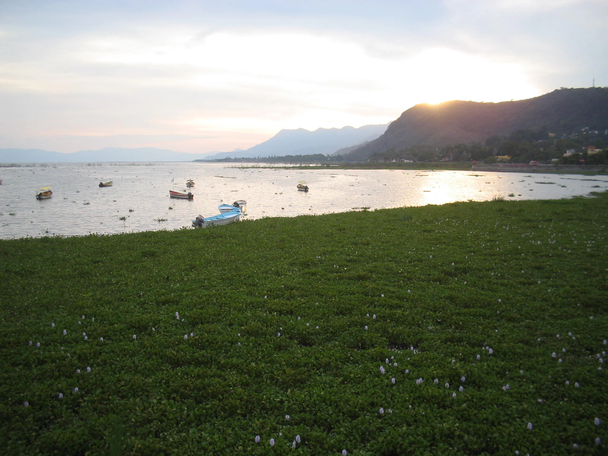
Nutrient-rich inflows combined with warming shallow water have at times fueled explosive growth of invasive water hyacinth, dramatically altering the lake's surface ecology. Despite ongoing stress, the lake remains a defining freshwater ecosystem of central-western Mexico, and the surrounding basin retains strong ecological ties between its upland forests, agricultural valleys, and lacustrine habitats.
Lake Chapala wildlife and species highlights
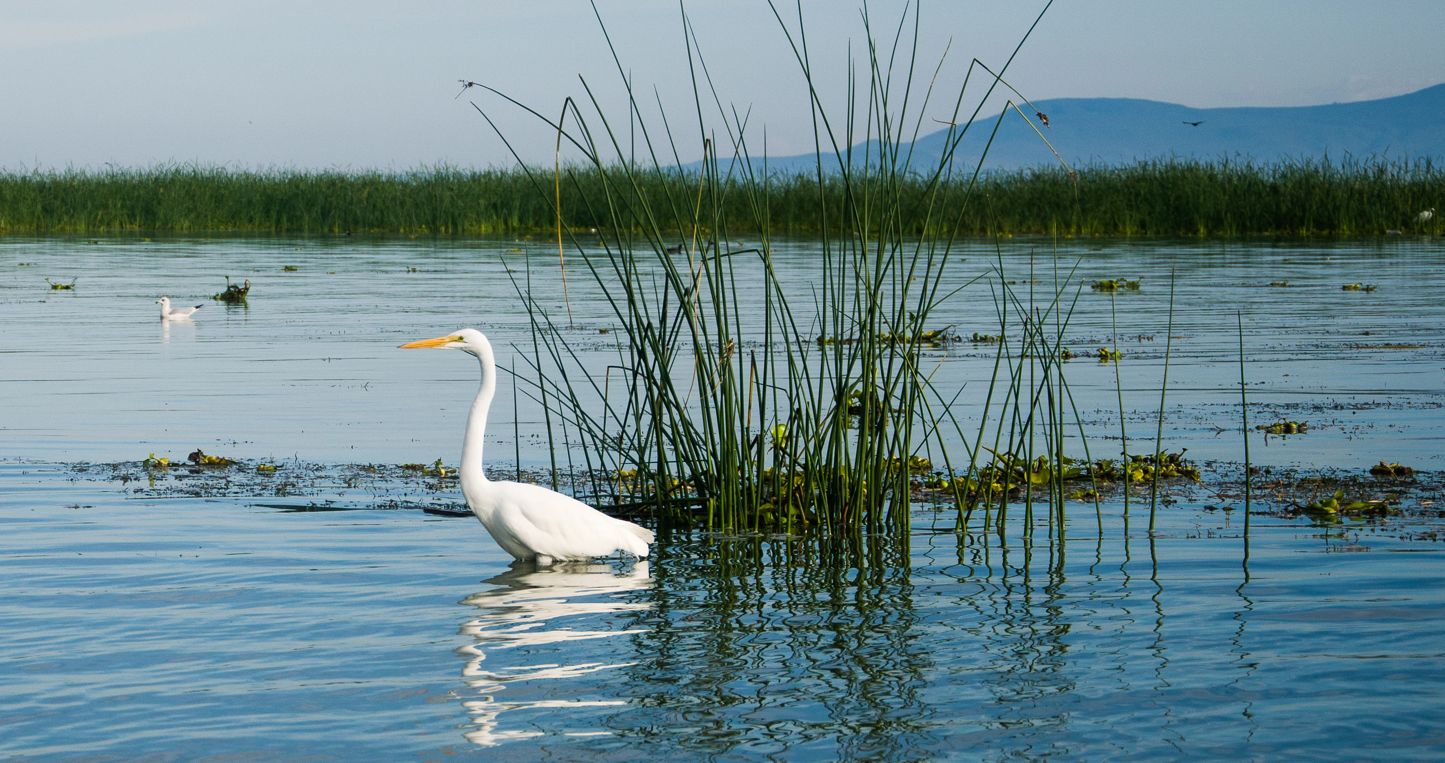
Lake Chapala is internationally important for migratory birds, hosting species such as the American white pelican and a rich mix of resident and wintering waterfowl documented through annual Christmas Bird Counts. Beyond the waterbirds, the lakeshore and surrounding countryside support terrestrial species including deer, coyotes, skunks, rabbits, and rattlesnakes, while the broader region reflects a blend of Nearctic and Neotropical mammal origins.
The lake is perhaps most remarkable for its endemic aquatic life. The Chirostoma, or charal, species flock includes several fish found only in the Chapala basin, and the area is also home to endemic goodeids, Algansea chubs, two lamprey species, indigenous catfishes, and the Chapala chub. The Chapala subspecies of the rough-footed mud turtle and the obscurus subspecies of the Mexican garter snake are essentially restricted to the lake. Local crayfish, including several Cambarellus species found only in the Chapala-Lerma system, further underscore the basin's evolutionary uniqueness, even as many of these species hover near extinction under mounting environmental pressure.
Lake Chapala conservation status and protection priorities
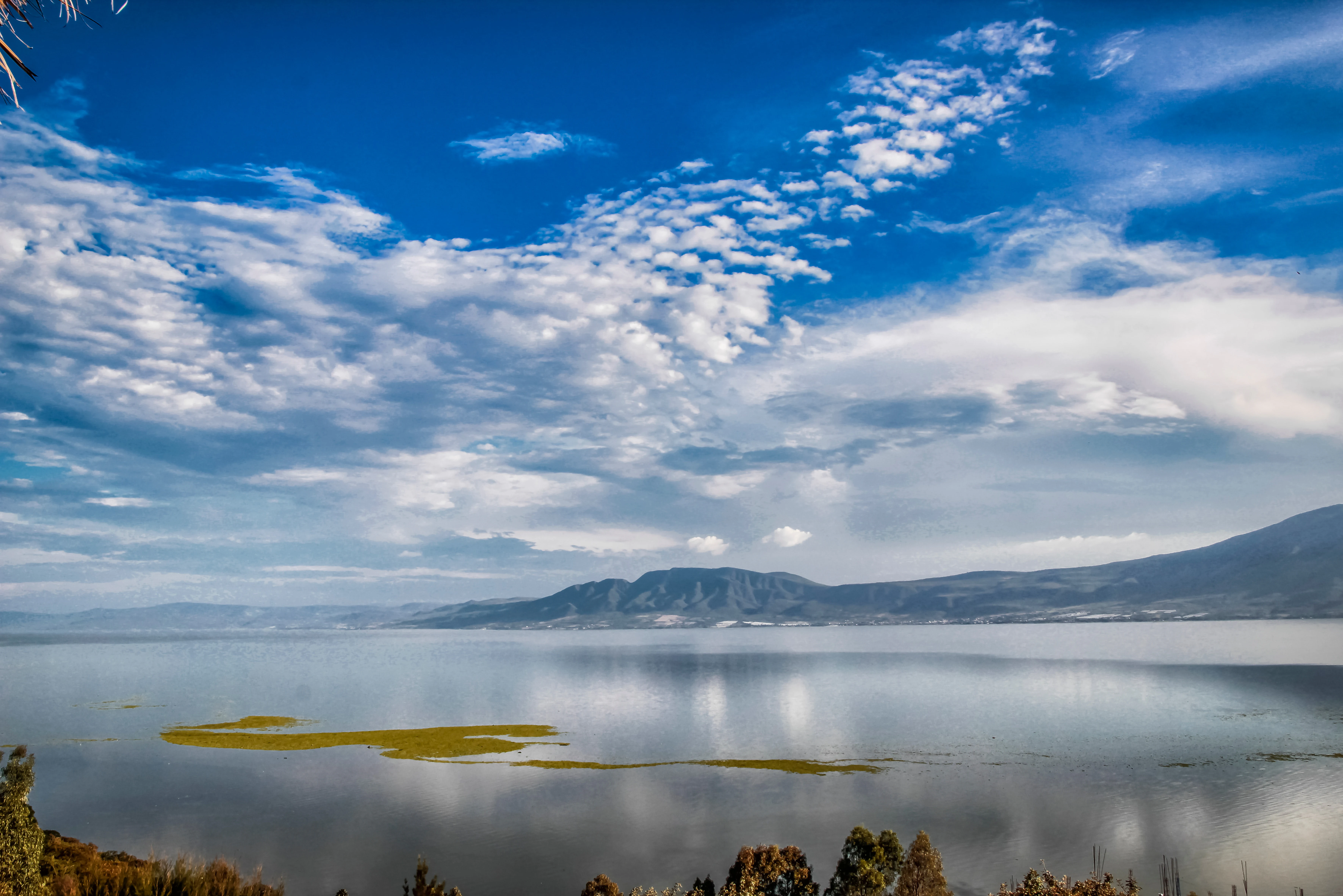
Lake Chapala's conservation importance is formally recognized through its 2009 designation as a Ramsar Wetland of International Importance, and ecologically the lake represents one of the most irreplaceable freshwater systems in Mexico. Its combination of high endemism among fish, amphibians, and reptiles, and its function as stopover habitat for migratory waterbirds, place it at the intersection of regional biodiversity priorities.
The lake's conservation status is deeply tied to the broader Lerma-Santiago watershed. Excessive water extraction for the Guadalajara metropolitan area and surrounding agriculture, deforestation along tributary riverbanks, sedimentation, and pollution from municipal, industrial, and agricultural sources have driven repeated declines in water level and quality. Invasive water hyacinth blooms, fish stock collapses, and contamination events have made Chapala a national focal point for water governance. Restoration proposals, including the proposed Chapala Lake Green Ring protected area and additional state-level polygons in surrounding sierras, reflect an ongoing effort to secure nearly 100,000 hectares around the lake under formal protection in order to safeguard the vegetation cover and ecological services on which the lake depends.
Lake Chapala cultural meaning and human context
Lake Chapala has long been a center of regional identity in western Mexico. In the pre-Hispanic period, the Tecuexe peoples living around the lake gave it the name Chimaloacán, and the lakeside settlement now known as Chapala emerged from that older cultural landscape. The arrival of Spanish forces in the sixteenth century drew the region into the colonial orbit of New Galicia, and subsequent centuries linked the lake to Mexican national history through figures such as Porfirio Díaz and the early tourism boom of the nineteenth century.
In modern times, the lake has become one of the most famous expatriate retirement destinations in Mexico. Beginning especially in the 1950s, a substantial community of retirees from the United States and Canada settled in towns like Ajijic, Chapala, and neighboring villages, contributing to a distinctive cross-cultural lakeside culture. Today, the region is known for its artisan traditions, lakeside dining, waterfront promenades, and an enduring blend of Mexican small-town life and international retirement migration, while still serving surrounding municipalities whose economies rely heavily on agriculture, livestock, and fishing.
Top sights and standout views in Lake Chapala
Mexico's largest freshwater lake, set on a volcanic highland plateau at about 1,524 meters elevation.
Ramsar Wetland of International Importance supporting migratory waterbirds and a major radiation of endemic fish, including Chirostoma species and the Chapala chub.
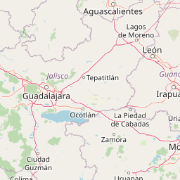
Straddles the Jalisco-Michoacán border and feeds the broader Lerma-Santiago watershed, with the surrounding shores lined by historic towns such as Chapala, Ajijic, Jocotepec, and Ocotlán.
A defining case study in Mexican freshwater conservation, recognized worldwide through its 2004 designation as Threatened Lake of the Year by the Global Nature Fund.
Home to three small islands, including Isla Mezcala with its historic Spanish fort, and surrounded by a ring of volcanic sierras, agricultural valleys, and culturally rich lakeside communities.
Best time to visit Lake Chapala
Lake Chapala benefits from a mild temperate highland climate moderated by the lake itself, with warmest conditions generally in the spring and early summer before the rainy season. The rainy months, typically running from June through October, refresh the landscape and affect water levels, while the cooler months from December through February bring crisper mornings and clearer skies. Bird-focused visitors often favor the winter months, when migratory waterfowl are most visible and the region's Christmas Bird Counts take place, while travelers drawn to the lakeside towns and surrounding countryside generally enjoy the comfortable temperatures of late autumn through early spring.