
Mori Atlas logo
National parkLake Skadar

A Transboundary Karst System Defined by Seasonal Wetlands and Exceptional Biodiversity

Lake Skadar National Park: Mapping the Largest Protected Freshwater Landscape in Montenegro

Lake Skadar represents a critical protected landscape at the heart of the Balkan Peninsula. This national park captures a dramatic geographical contrast between rugged, limestone-carved karst shorelines in the south and vast, seasonally fluctuating wetlands in the north. Recognized as a significant freshwater ecosystem, the basin supports endemic species and serves as a vital habitat for waterbird populations within its unique cryptodepression landscape.

transboundary lakekarst landscapefreshwater biodiversitybird reserveDalmatian pelicannational park
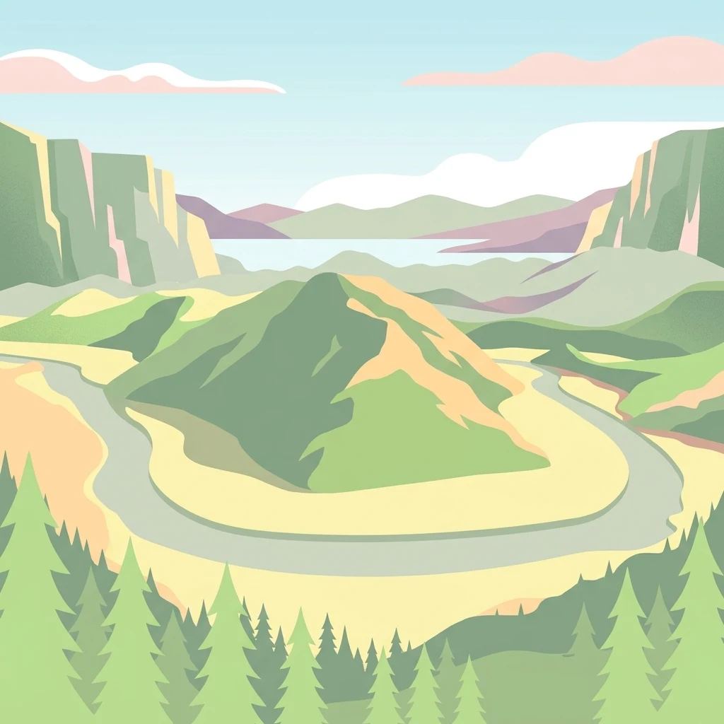
A flat vector-style illustration featuring a winding river flowing around a central green hill, surrounded by mountains and a foreground of stylized evergreen trees.

Lake Skadar

National park

Park overview

Structured park overview, official facts, and landscape profile for Lake Skadar

Lake Skadar park facts, protected area profile, and essential visitor context

Review the core facts for Lake Skadar, including designation, size, terrain, visitor scale, habitats, and operating context in one park-focused overview.

About Lake Skadar

Lake Skadar is a large transboundary lake in the western Balkans, forming part of the natural boundary between Montenegro and Albania. It is the largest lake in Southern Europe and the largest on the Balkan Peninsula, with a surface area that changes significantly with the seasons due to the karst hydrology that feeds it and the rivers that drain from it.

The lake occupies an elongated basin oriented roughly northwest to southeast, extending over approximately 44 kilometers in length. Surrounding scenery varies dramatically: the southern and southwestern shorelines are steep and rocky, carved against high karst terrain, while the northern side opens into broad, seasonally inundated wetlands. Several small islands dot the lake, including Beška, which hosts historic churches, and Grmožur, a former fortress and prison island that is now a recognizable cultural landmark.

Lake Skadar is a cryptodepression, meaning parts of its bed sit below sea level even though the lake surface is several meters above it. The lake is primarily fed by the Morača River and a network of karst springs, some of which emerge directly from beneath the lake through openings known locally as "oko." Its waters exit via the Buna River, which flows to the Adriatic Sea and forms part of the Albania-Montenegro border in its lower reaches.

Ecologically, the lake system is one of the most significant freshwater habitats in Europe. It has been recognized as an Important Bird Area, hosts more than 270 bird species, and supports major populations of Dalmatian pelicans, herons, and gulls. Its fish fauna includes several endemic species, while its freshwater snail fauna is among the most diverse in any European lake, with endemism levels exceeding those of famous ancient lakes elsewhere in the world.

The Montenegrin portion of the lake and its surrounding catchment was designated as a national park in 1983. The Albanian portion is protected as a Managed Nature Reserve. Both sides are included in the Ramsar List of Wetlands of International Importance, underscoring the lake's transboundary conservation value.

Quick facts and research context for Lake Skadar

Lake Skadar is a transboundary karst lake located on the Albania-Montenegro border and is the largest lake in Southern Europe. Its surface area fluctuates seasonally, and the lake basin is shared roughly 65% by Montenegro and 35% by Albania.

The lake is designated as a Ramsar Wetland of international importance and recognized as an Important Bird Area by BirdLife International, supporting one of the most significant wintering and breeding bird populations in the region. More than 270 bird species have been recorded, including some of Europe's last wild pelicans, alongside a rich endemic freshwater fauna.

Protection and recognition

Examining designated protection scope, management frameworks, and official recognition records

Lake Skadar Protection Status and Transboundary Conservation History

Lake Skadar holds a documented mixed protection status established in 1995 across a transboundary geographic setting. Official records assemble management history and conservation designations for comparative atlas analysis.

Protection details

Protection scope
Mixed
Designated year
1995
Transboundary protection
Yes
Park context

Deeper park guide and search-rich context for Lake Skadar

Lake Skadar history, landscape, wildlife, and travel context

Explore Lake Skadar through its history, landscape character, ecosystems, wildlife, conservation priorities, cultural context, and seasonal travel timing in a structured park guide built for atlas discovery and search intent.

Why Lake Skadar stands out

Lake Skadar is best known as the most important freshwater bird habitat in the region, in particular as a stronghold for the Dalmatian pelican, one of Europe's rarest and most iconic species. The lake's combination of open water, reed beds, submerged springs, and seasonal inundation zones makes it a magnet for herons, gulls, pelicans, and many other waterbirds. It is also recognized for its exceptional freshwater biodiversity, with high rates of endemism among fish, snails, and amphipods. This places Lake Skadar alongside globally significant ancient lakes such as Lake Malawi and Lake Titicaca in terms of its unique gastropod fauna, despite being a much younger system by geological standards.
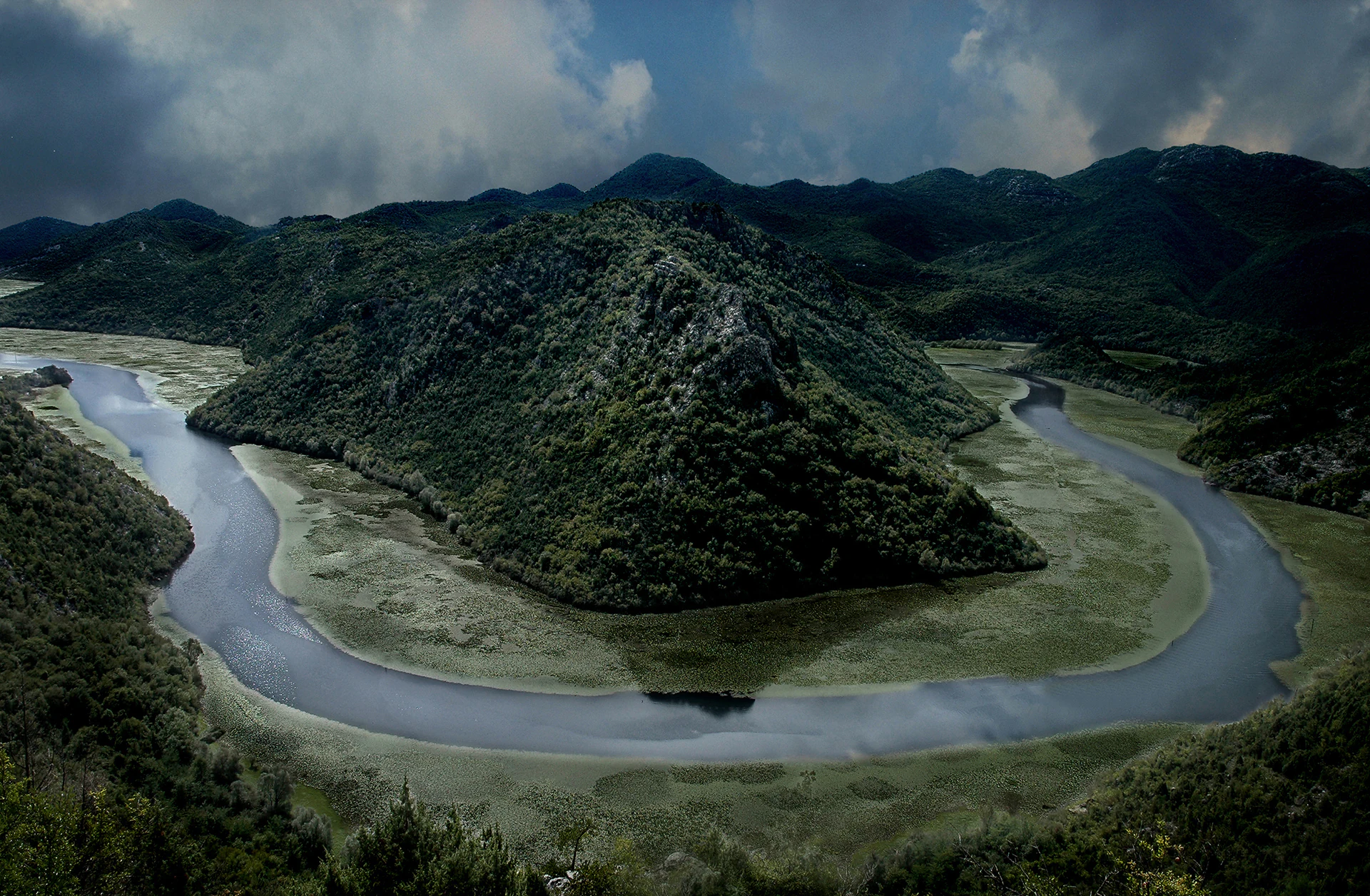
A high angle view of the Rijeka Crnojevica river looping in a dramatic horseshoe bend around a steep, green, forested hill, under a moody, partially cloudy sky.
The distinctive horseshoe bend of the Rijeka Crnojevica river as seen from the Pavlova Strana viewpoint.

Lake Skadar history and protected-area timeline

Lake Skadar's modern protected status dates to 1983, when the Montenegrin section of the lake and its surrounding land were formally established as a national park. The Albanian portion of the lake has since been designated as a Managed Nature Reserve under Albania's protected-area framework.

The lake's international conservation profile grew substantially in the mid-1990s. The Montenegrin sector of Lake Skadar was added to the Ramsar List of Wetlands of International Importance in 1995, with the Albanian sector and the connected Buna River system added in 2006. BirdLife International has separately recognized the lake as an Important Bird Area based on its nationally important congregations of pelicans, herons, and other waterbirds.

Geological research indicates that Lake Skadar occupies a tectonically formed basin shaped by folding and faulting in the high karst zone of Old Montenegro. Although it is described as a relatively young ancient lake, elements of its geological history, including past marine incursions into the Zeta Plain during the Miocene and Pliocene, are thought to have shaped the evolutionary history of its freshwater fauna and contributed to the lake's unusually high level of endemism today.

The lake also carries traces of modern history. Near the mouth of the Rijeka Crnojevića, the wreck of the partisan steamboat Skanderbeg, sunk in 1942 during the Second World War, still rests on the lake floor and has become a minor site of historical interest beneath the water.

Lake Skadar landscape and geographic character

Lake Skadar sits within a high karst landscape, bordered by steep, rocky, and largely barren slopes on its southern and southwestern sides. These dramatic shorelines are carved into limestone terrain and indented by bays where sublacustrine springs typically emerge from beneath the lake's surface.

In striking contrast, the northern side of the lake opens into a vast, shallow, periodically inundated zone. This area expands and contracts with seasonal water-level fluctuations, creating shifting wetlands, marshy edges, and drowned forest patches that gradually emerge and resubmerge across the year. The dynamic nature of this wetland boundary gives the lake a constantly changing character from season to season.

The lake basin itself is elongated, stretching roughly northwest to southeast. Above the surface, small islands interrupt the open water, including Beška with its historic churches and Grmožur, a fortress island associated with the lake's more recent human history. Below the surface, the lake is a cryptodepression: although its water stands several meters above sea level, parts of the lakebed descend below it, and karst springs feed the lake from beneath.

The surrounding region experiences a hot-summer Mediterranean climate with dry summers, which strongly shapes the lake's hydrological cycle, shoreline character, and the rhythm of seasonal wetland expansion.
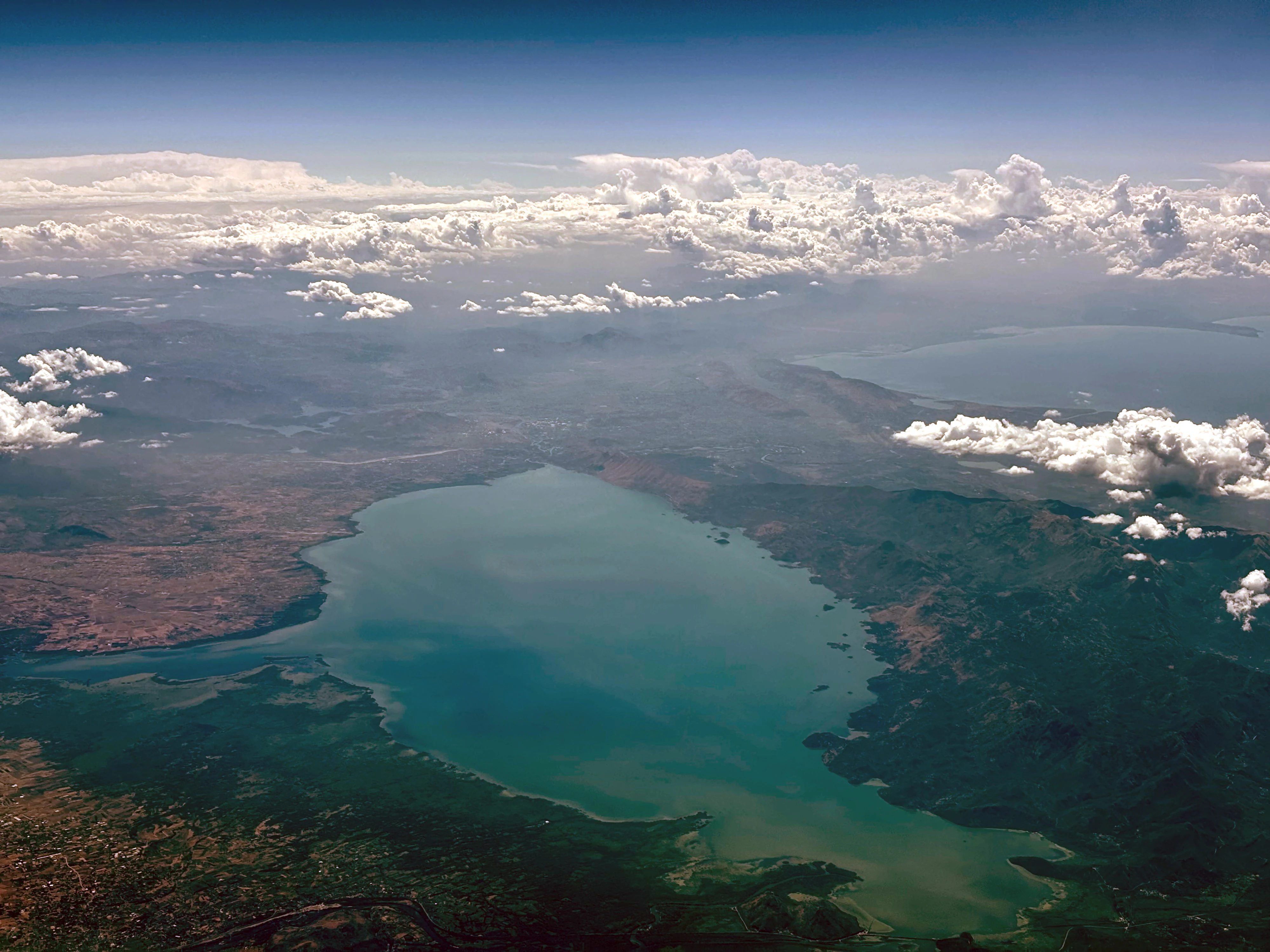
An aerial, wide-angle photograph looking down at Lake Skadar, featuring a large, blue-green lake basin surrounded by rolling hills, patches of dry vegetation, and scattered white clouds.
An aerial view of Lake Skadar, showing its expansive water body and surrounding terrain.

Lake Skadar ecosystems, habitats, and plant life

Ecologically, Lake Skadar represents a transitional zone between Mediterranean and central European freshwater systems, with both characteristics strongly represented in its habitats. Open water, shallow bays, reed beds, submerged springs, rocky shorelines, and seasonally flooded wetlands all coexist within a relatively compact geography.

The lake's defining natural feature is its karst hydrology. Sublacustrine springs known as "oko" emerge through openings in the lakebed and feed directly into the lake, creating localized upwelling zones and pockets of clear, cool water within the larger basin. These springs, together with surface inflows like the Morača River, support an unusually diverse freshwater ecosystem.

Vegetation patterns around the lake reflect the interplay between rocky uplands on the south and extensive wetlands on the north. Reed belts, aquatic meadows, and inundated scrubland are particularly characteristic of the northern shore, while the southern and southwestern banks support sparse Mediterranean vegetation on rocky karst soils.

The lake is considered a hotspot of freshwater biodiversity within the Balkans. Beyond its birdlife, it harbors significant numbers of endemic fish, freshwater snails, and amphipods, with the gastropod fauna in particular showing evolutionary patterns more typical of ancient lakes.
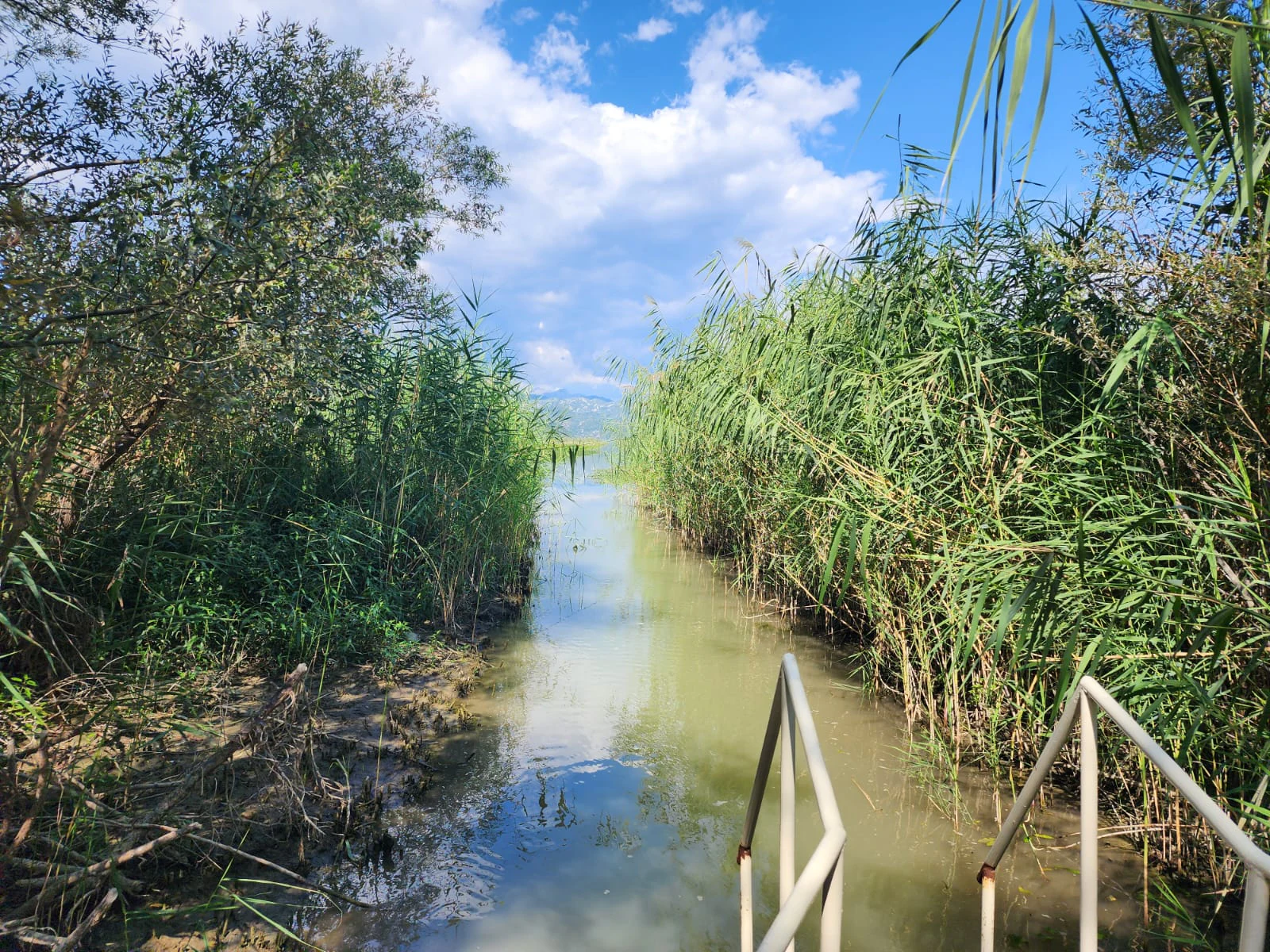
A narrow waterway channel flanked by tall green reeds and trees leading into the distance under a blue sky, with a metal railing visible in the foreground.
A narrow channel lined with dense reeds leading into the waters of Lake Skadar.

Lake Skadar wildlife and species highlights

Lake Skadar is one of the most important bird sites in Europe. More than 270 bird species have been recorded in and around the lake, supporting its recognition as an Important Bird Area by BirdLife International. Its most iconic residents are the Dalmatian pelicans, part of one of the very last remaining breeding populations of the species in Europe.

Beyond pelicans, the lake provides habitat for gulls, herons, and a wide range of other waterbirds that use the lake as a breeding, wintering, or stopover site. The combination of open water, reed beds, and seasonally flooded shore areas creates a rich mosaic of conditions for waterbirds across the year.

Fish are also a major component of the lake's wildlife. The lake is especially known for carp, bleak, and eel, and supports a total of approximately 34 native fish species, of which about 7 are endemic to Lake Skadar. This makes the lake significant for understanding Balkan freshwater fish evolution.

The lake's invertebrate fauna is even more distinctive. Freshwater snails are particularly diverse, with around 50 species recorded across the lake basin and roughly 38% of gastropod species being endemic to the basin. The lake is also notable for its diversity of Bithynia snails, functioning as an important evolutionary hotspot for this genus. Amphipods are similarly rich, with about 17 species recorded in the watershed and around 10 of those endemic, especially in subterranean habitats.

This high concentration of endemic species, combined with ongoing environmental pressures, makes the lake's wildlife particularly significant from a conservation standpoint.
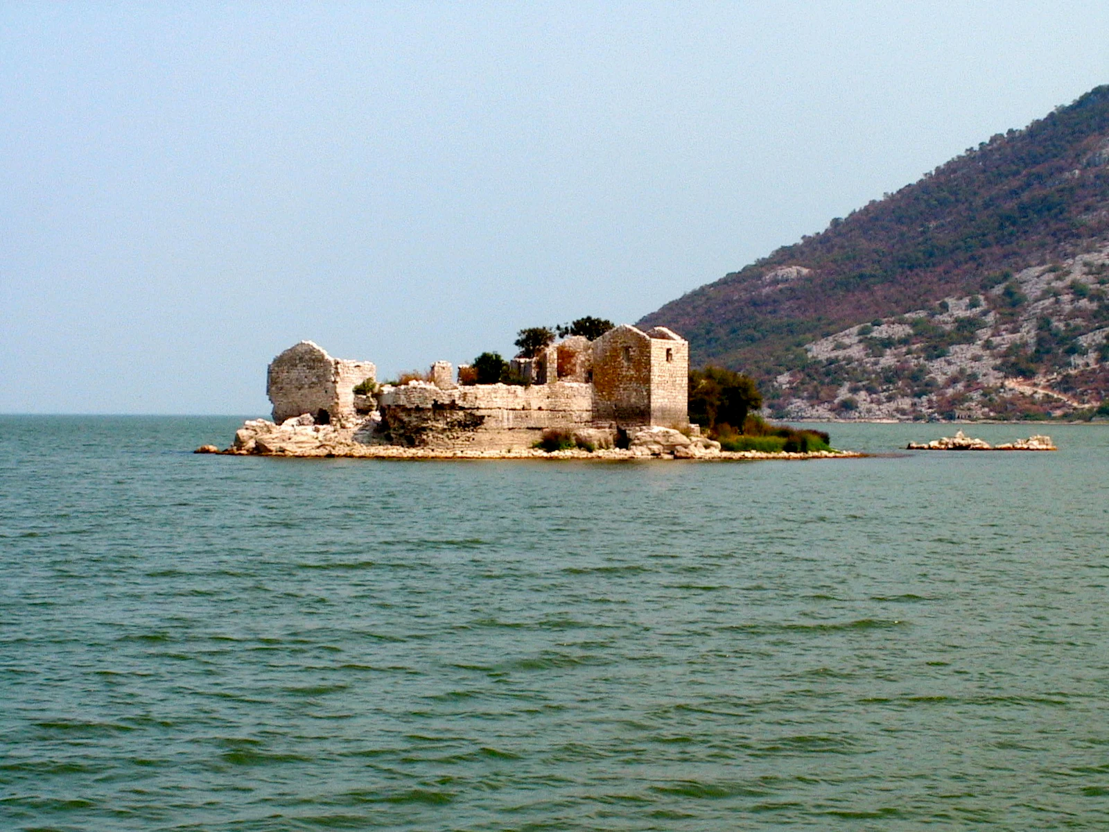
A small island with stone ruins of a fortress surrounded by lake water, with a large, rocky mountain slope in the background.
The stone ruins of Grmozur Fortress situated on a small island in Lake Skadar.

Lake Skadar conservation status and protection priorities

Lake Skadar holds recognized status under multiple international conservation frameworks. The Montenegrin portion of the lake and surrounding land have been protected as a national park since 1983, while the Albanian portion has been designated a Managed Nature Reserve.

Both sides of the lake are listed under the Ramsar Convention on Wetlands: Skadarsko Jezero was designated in 1995, and Lake Shkodra and the connected Buna River system were designated in 2006. BirdLife International has also recognized the lake as an Important Bird Area, highlighting its globally significant congregations of pelicans, herons, and other waterbirds.

The lake's conservation importance is closely tied to its unusually high level of freshwater endemism. The 2011 IUCN Red List included 21 endemic species from the Lake Skadar basin, reflecting its role as a reservoir of unique Balkan biodiversity.

Despite these protections, the lake faces ongoing environmental pressures. Research indicates moderate organic pollution levels, with evidence of eutrophication in parts of the system. Other concerns include water pollution from surrounding human activity, sand and gravel extraction, and the intensive use of sublacustrine springs as drinking-water sources. The combination of small endemic species ranges and increasing human pressure makes the lake's fauna especially vulnerable to long-term environmental change.

Lake Skadar cultural meaning and human context

Lake Skadar has long shaped life and identity on both sides of the Albania-Montenegro border. The lake's name itself, and the alternate name "Lake Shkodër," connects it directly to Shkodër, one of Albania's oldest and most historically significant cities, which sits at the lake's southeastern shore.

The lake also holds tangible landmarks of regional history. The island of Beška carries two churches that reflect the area's religious heritage, while Grmožur, a small island in the Montenegrin portion of the lake, preserves the remains of a fortress that once served as a prison. Beneath the lake's surface near Rijeka Crnojevića rests the wreck of the steamboat Skanderbeg, sunk by partisans during the Second World War, forming a quieter but still meaningful historical trace.

Cultural references to the lake extend into modern local life as well. Radio Skadar, a radio station based in Podgorica, takes its name from the lake, underscoring how strongly the body of water is woven into regional identity and everyday reference.
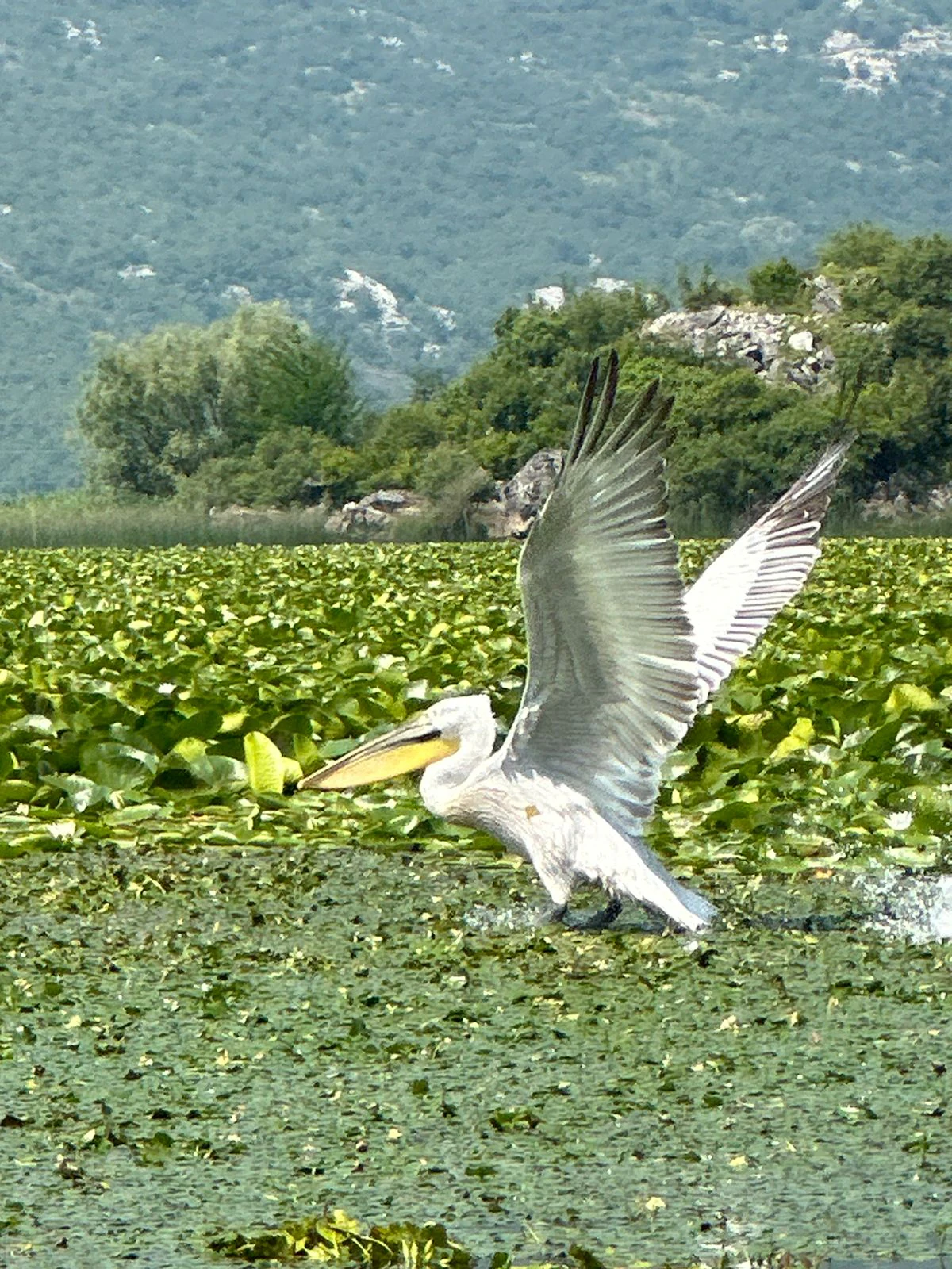
A large Dalmatian pelican with wings spread, taking flight from the surface of a shallow lake covered in floating lily pads, with a forested hillside in the background.
A Dalmatian pelican taking flight from the lily-covered surface of Lake Skadar.

Top sights and standout views in Lake Skadar

Lake Skadar is distinguished by being the largest lake in Southern Europe and by its position as a transboundary system shared between Montenegro and Albania. The lake combines rare ecological qualities, exceptional freshwater biodiversity, and internationally recognized conservation status within a single landscape.

Its most celebrated feature is its birdlife, in particular its Dalmatian pelican population, but the lake is equally notable among scientists for its freshwater snails, fish, and amphipods, many of which are endemic to the basin. From the rocky karst shorelines of the south to the seasonally expanding wetlands of the north, the lake offers both ecological richness and striking scenic contrast.
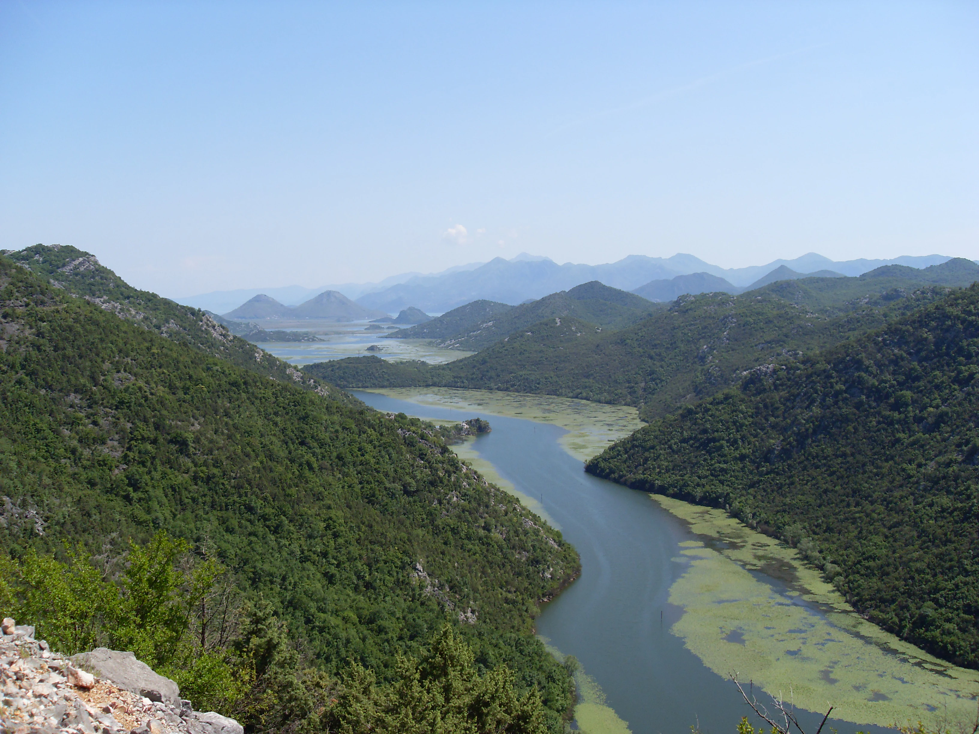
A wide, high-angle landscape shot showing a winding river-like section of Lake Skadar surrounded by lush, green, forested hills under a clear blue sky.
A scenic view of the western section of Lake Skadar, featuring winding water channels and surrounding karst hills.

Best time to visit Lake Skadar

Lake Skadar's character shifts considerably with the seasons due to the lake's distinctly Mediterranean climate. Spring and early summer tend to be among the most rewarding periods, as water levels are generally high, wetlands are expanded, and birdlife is at its most active, with breeding colonies, passing migrants, and growing concentrations of waterbirds around the reed beds and flooded northern shoreline.

Summer brings warmer, drier conditions typical of the Mediterranean climate, with stable, open water and reliable boat access to many parts of the lake, though bird activity may shift toward early morning and evening.

Autumn and winter bring their own attractions, particularly for birdwatchers, as the lake hosts important wintering populations, including pelicans. Water levels fluctuate, and the wetlands on the northern shore expand and contract visibly through the year, giving each visit a slightly different landscape.
Monthly climate preview

Long-term representative coordinate records for monthly temperature and rainfall spread

Lake Skadar Climate Normals, Annual Temperature and Precipitation Rhythms

Lake Skadar records a measured annual temperature span from sub-zero winter minimums to warm summer highs alongside shifting monthly precipitation rates. Consulting the complete twelve-month climate profile reveals exact long-term averages across all recorded periods.
Annual mean15 °C
6 °C26 °C
Jan
Feb
Mar10°
Apr13°
May18°
Jun23°
Jul26°
Aug26°
Sep21°
Oct17°
Nov12°
Dec
Warmest month
August

26.2 °C

Coolest month
January

5.9 °C

Wettest month
November

5.4 mm/day

Driest month
July

1.1 mm/day

Park location guide

Geography guide, regional context, and park location map for Lake Skadar

Lake Skadar park geography, regions, and map view in Montenegro

Understand where Lake Skadar sits in Montenegro through a broader geographic reading of the surrounding landscape, nearby location context, and its mapped position within the national park landscape.

How Lake Skadar fits into Montenegro

Montenegro is a unitary parliamentary republic in Southeast Europe on the Balkan Peninsula. With a population of approximately 623,000 and an area of 13,883 km², it borders five countries and has a coastline on the Adriatic Sea. The capital and largest city is Podgorica, while Cetinje serves as the old royal capital. The country declared independence in 2006 following the breakup of Serbia and Montenegro.

Wider geography shaping Lake Skadar in Montenegro

Montenegro is located on the Balkan Peninsula in Southeast Europe. It is bordered by Serbia to the northeast, Bosnia and Herzegovina to the northwest, Kosovo to the east, Albania to the southeast, and Croatia to the west. The country has a coastline along the Adriatic Sea to the southwest. The terrain is predominantly mountainous, with the Dinaric Alps running through the country.

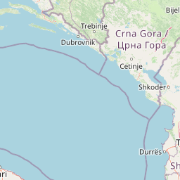
Map view of Lake Skadar

Use this park location map to pinpoint Lake Skadar in Montenegro, understand its exact geographic position, and read its mapped placement within the surrounding landscape more clearly.

Pigeon | © OpenStreetMap contributors

Explore national park imagery capturing limestone shores, shallow waters, and vital bird habitats.

Lake Skadar Photos and Landscape Scenery: Visualizing Karst Terrain and Protected Wetlands

Visual documentation reveals the stark contrast between rocky southern karst slopes and expansive northern wetlands across the protected basin. Examining these natural environments provides deeper insight into the transboundary geography and rich freshwater ecosystems of Lake Skadar.

A high angle view of the Rijeka Crnojevica river looping in a dramatic horseshoe bend around a steep, green, forested hill, under a moody, partially cloudy sky.

Top-down satellite imagery of Lake Skadar, displaying a large body of turquoise water with visible swirling sediment patterns surrounded by rugged, mountainous terrain.

An aerial, wide-angle photograph looking down at Lake Skadar, featuring a large, blue-green lake basin surrounded by rolling hills, patches of dry vegetation, and scattered white clouds.

A narrow waterway channel flanked by tall green reeds and trees leading into the distance under a blue sky, with a metal railing visible in the foreground.

A small island with stone ruins of a fortress surrounded by lake water, with a large, rocky mountain slope in the background.

A calm, still lake framed by tall green reeds on both sides, with distant mountains under a blue sky with scattered clouds.

A large Dalmatian pelican with wings spread, taking flight from the surface of a shallow lake covered in floating lily pads, with a forested hillside in the background.

A wide, high-angle landscape shot showing a winding river-like section of Lake Skadar surrounded by lush, green, forested hills under a clear blue sky.

Park atlas

Compare regional conservation areas, karst terrain, and wetland habitats across the Balkan Peninsula

Other Parks Near Lake Skadar and Surrounding Protected Landscapes

Visitors exploring Lake Skadar can browse nearby national parks and protected areas to study regional karst topography and wetland habitats. Expanding the search helps map related conservation landscapes across the surrounding transboundary border region.
A watercolor painting showing a panoramic view of green rolling hills and a body of water under a soft, light sky.
Nature reserveShkodër District
About 18 km away#1 closest

Southeast

Lake Shkodër Nature Reserve: Mapping Protected Wetland and Riverine Geography in Albania

A critical Balkan freshwater protected area.

The Lake Shkodër Nature Reserve serves as a foundational protected landscape in northern Albania, encompassing the extensive shoreline and riverine floodplains of Lake Skadar. This geographic entity showcases a transition from fertile lowlands to mountainous ridges, offering a detailed look at how hydrologic processes and alpine proximity define Balkan wetland habitats.

Area
265.35 km²
Established
2005
IUCN
IV
Relief
Lowland
A watercolor painting showing a soft, panoramic landscape of low hills, green fields, and water, with a light and ethereal style.
Protected areaMontenegro
About 23 km away#2 closest

Northwest

Cijevna Protected Area: Mapping the River Canyon and Balkan Highlands Geography

An alpine river system spanning the Montenegro and Albania border

The Cijevna represents a striking natural corridor carved into the Prokletije mountains. This protected landscape is defined by its deep V-shaped valleys, high-altitude gorges, and seasonal discharge patterns that sustain important freshwater biodiversity across the Balkan highlands.

Watercolor painting showing a mountainous landscape with a lake, green hills, and pink flowers
National parkAlbania
About 25 km away#3 closest

Northeast

Alps of Albania National Park: Explore Albania's Largest Protected Alpine Wilderness

Dramatic karst, glacial valleys, and high-altitude ecosystems await.

The Alps of Albania National Park offers an expansive view into one of the Balkans' most significant mountain protected areas. This national park encompasses a spectacular landscape characterized by towering limestone peaks, deep glacial valleys carved over millennia, and intricate karst formations like Grunas Canyon. Its pristine wilderness protects diverse high-altitude ecosystems and unique geological features, serving as a key destination for understanding regional geography and protected landscapes.

Area
828.447 km²
Established
2022
IUCN
II
Relief
Mountain
Watercolor painting of a wide wetland area with distant purple mountains, green grassy banks, and water channels.
Protected landscapeUlcinj
About 27 km away#4 closest

South

Saline Ulcinj: Coastal Wetland Geography and Protected Landscape Mapping

A large-scale saline nature park near Ulcinj in southern Montenegro.

Saline Ulcinj represents a significant coastal wetland complex nestled in the Buna delta. This protected landscape is defined by its unusual industrial history and modern transition into a vital nature reserve, characterized by expansive saline pools and shallow mudflats. Its geographic footprint offers a clear look at how coastal water management shapes the surrounding terrain and provides essential stopover habitats for Adriatic migratory birds.

Area
15 km²
Established
2019
Relief
Lowland
Water
Water-dominated
A horizontal watercolor painting of a serene river landscape with green trees on both banks and small boats floating on the water at sunset.
Protected landscapeShkodër County
About 28 km away#5 closest

Southeast

Buna River-Velipojë Protected Landscape: Albania Coastal and Wetland Geography

Mapped protected landscape in Shkodër County

The Buna River-Velipojë Protected Landscape encompasses the crucial junction of riverine systems and the Adriatic Sea. This protected area features a mosaic of marshes, lagoons, and alluvial forests that form a significant migratory corridor in northwestern Albania.

Area
230.27 km²
Established
2005
IUCN
V
Relief
Lowland
National parkMontenegro
About 48 km away#6 closest

Northwest

Lovćen National Park: Karst Mountain Geography and Protected Landscapes in Montenegro

Dinaric Alps limestone terrain and historic mountain heritage

Spanning from 400 to 1,749 meters, Lovćen National Park protects the symbolic limestone massifs of southwestern Montenegro. The terrain is defined by complex karst formations, deep gorges, and distinct ecological zones, forming a critical observation point across the rugged Dinaric mountain interior.

IUCN
II
Scope
Terrestrial
Water
No major water
National parkMontenegro
About 49 km away#7 closest

Northwest

Lovćen National Park: Karst Geography and Protected Mountain Landscapes in Montenegro

Dinaric massif rising above the Adriatic coastal basin.

Lovćen National Park encompasses a dense, rocky landscape of limestone and dolomite in southwestern Montenegro. Known as the namesake for the country itself, the massif creates a sharp geographic boundary between the Adriatic Sea and the inland highlands. The area offers a profound look at Dinaric karst features, including dramatic cliffs and endemic botanical habitats, preserved within a culturally rich mountain setting.

Area
62.2 km²
Established
1952
Relief
Mountain
Climate
Mediterranean
A watercolor illustration of a soft mountain range landscape with pine trees in the foreground against a white background.
Protected areaAlbania
About 51 km away#8 closest

Northeast

Accursed Mountains: Geographic Analysis of Albania High Alpine Protected Terrain

Rugged karstic relief and glacial mountain landscapes.

Discover the Accursed Mountains, a formidable high-mountain range in northern Albania known for its sheer limestone cliffs and profound glacial sculpting. This protected area provides a critical habitat for relict flora and fauna while maintaining one of the most intense relief profiles in the Balkans. Examine the mapped canyons, alpine cirques, and jagged ridges that shape this landmark range.

Relief
Mountain
Climate
Alpine
Access
Moderate access
Scope
Terrestrial

Common questions about visiting, size, designation, and location context for Lake Skadar

Lake Skadar FAQs for park facts, access, geography, and protected area context

Find quick answers about Lake Skadar, including protected-area facts, park geography, trail and visitor context, and how the park fits into its surrounding country and regional landscape.
MoriAtlas Explorer

Continue Your Protected Areas Search Across the Global Atlas

Deepen your exploration by continuing the structured search for national parks and protected areas worldwide. Utilize the comprehensive filtering capabilities to compare different conservation landscapes and refine your understanding of global park geography. Discover more about the distribution and characteristics of protected natural areas.

Global natural geography