Why Lam Khlong Ngu National Park stands out
Lam Khlong Ngu is best known for its exceptional limestone karst scenery and the extraordinary monolithic cave that contains what is believed to be the world's tallest natural monolithic pillar at 62.5 meters in height. The park also features two significant waterfall systems, Nang Kruan and Kliti, both cascading over limestone formations with year-round water flow. The combination of towering cave formations, multi-tiered waterfalls, and the rugged mountainous backdrop creates a distinctive landscape that differentiates this park from other protected areas in the Kanchanaburi region.
Lam Khlong Ngu National Park history and protected-area timeline
Lam Khlong Ngu National Park was officially established on December 25, 2009, making it one of Thailand's more recently designated national parks. Its creation reflected a growing recognition of the ecological and geological significance of the Tanaosri mountain region in western Thailand. Prior to national park designation, the area had been managed under broader protected area classifications, but the establishment provided formal recognition and dedicated resources for conservation and management.
The park's relatively recent establishment means that its management history is still being written, with infrastructure development and visitor services continuing to evolve. The decision to create a national park in this location was influenced by the area's distinctive limestone formations, the presence of significant waterfalls, and the biological diversity supported by the mountain and valley ecosystems. Like other Thai national parks, Lam Khlong Ngu falls under the jurisdiction of the Department of National Parks, Wildlife and Plant Conservation, which oversees protection, research, and visitor engagement activities.
Lam Khlong Ngu National Park landscape and geographic character
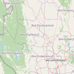
The physical landscape of Lam Khlong Ngu National Park is defined by its position along the Tanaosri Mountains, a range that extends through western Thailand and forms part of the broader Tenasserim Hills system. The terrain is characterized by a succession of ridges and valleys, with elevation changes creating diverse microhabitats throughout the park. The underlying limestone geology has produced a karst landscape with characteristic sinkholes, caves, and rocky outcrops that distinguish the visual character of the area.
Water plays a defining role in shaping the park's landforms. The Nang Kruan waterfall, fed by waters from Thong Pha Phum creek and Chalae creek, drops over limestone tiers in a series of seven distinct levels, creating a dramatic scenic feature. Similar limestone formations characterize Kliti waterfall, while the most remarkable geological feature is the monolithic cave where an underground river passes through a cavern containing a towering natural stone column. This monolithic pillar, reaching 62.5 meters in height, is considered exceptional on a global scale and represents a remarkable example of natural cave formation.
The elevation range from 100 to 1,000 meters creates environmental gradients that influence vegetation patterns and wildlife distribution. Bor Ngam hill stands as one of the park's notable high points, offering elevated perspectives over the surrounding terrain.
Lam Khlong Ngu National Park ecosystems, habitats, and plant life
The natural environment of Lam Khlong Ngu reflects the tropical monsoon climate that characterizes much of mainland Southeast Asia. The seasonal weather patterns shape both the ecosystem dynamics and the visitor experience throughout the year. Summer months from March to May bring the highest temperatures, while the rainy season from June to October delivers the majority of annual precipitation and brings lush green conditions to the landscape. The cool season from November to February offers the most comfortable conditions for exploration, with reduced rainfall and clearer skies.
The vegetation across the park varies with elevation and slope aspect, ranging from lowerland forest types in the valley bottoms to more montane vegetation at higher elevations. The limestone substrates support specialized plant communities adapted to karst conditions, while the numerous watercourses provide habitat for aquatic species and maintain moisture levels that support dense vegetation in riparian zones. The combination of forest cover, water features, and structural complexity from the karst geology creates diverse ecological niches.
Lam Khlong Ngu National Park wildlife and species highlights
While the source material does not provide detailed species lists for Lam Khlong Ngu National Park, the protected area's location within the Tanaosri mountain range and its proximity to other conservation lands in the Kanchanaburi region suggests the presence of diverse fauna. The mix of forest habitats, watercourses, and cave systems typically supports communities including various bird species, small mammals, and invertebrates adapted to the karst environment. The downstream connectivity to broader ecological systems in the region likely enables wildlife movement through the protected area.
Lam Khlong Ngu National Park conservation status and protection priorities
Lam Khlong Ngu National Park contributes to Thailand's protected area network, which aims to preserve representative samples of the country's ecological diversity. The park's karst landscape contains geological features of international significance, particularly the exceptional monolithic cave formation that represents a rare natural phenomenon. Protection of this cave system ensures the preservation of both the geological feature itself and the unique ecosystem it supports.
The watershed functions provided by the forested slopes of the Tanaosri Mountains have downstream implications for water quality and availability in surrounding areas. Maintaining forest cover within the park boundaries helps regulate water flow and protects against soil erosion on the steep terrain. The integration of Lam Khlong Ngu into the broader network of protected areas in western Thailand helps maintain ecological connectivity across the landscape.
Lam Khlong Ngu National Park cultural meaning and human context
The park exists within a region with rich cultural history, though the source material does not provide detailed information about specific cultural connections to the landscape. The Thai name 'Lam Khlong Ngu' (ลำคลองงู) reflects local naming traditions and suggests historical recognition of the serpent-like watercourses that characterize the area. The Thong Pha Phum District has been home to communities whose relationship with the forested mountains predates formal protected area designation.
Top sights and standout views in Lam Khlong Ngu National Park
The most compelling highlights of Lam Khlong Ngu include the extraordinary monolithic cave with its 62.5-meter natural pillar, recognized as the tallest of its kind globally. The Nang Kruan waterfall presents a major scenic attraction with its seven limestone tiers fed by perennial streams, while Kliti waterfall offers similar limestone cascade beauty. The park's substantial area of approximately 673 square kilometers encompasses diverse terrain within the Tanaosri Mountains, providing exploration opportunities across varied elevations and valley systems. The combination of surface waterfalls and underground cave systems creates a landscape where water is both visible and hidden, above ground and below.
Best time to visit Lam Khlong Ngu National Park
The optimal time to experience Lam Khlong Ngu National Park aligns with the cool dry season from November through February, when temperatures are more comfortable for outdoor exploration and rainfall is minimal. This period also brings clearer skies and reduced cloud cover compared to the monsoon months, allowing for better visibility of the park's scenic features. From June to September, the southwest monsoon brings increased cloud cover and regular rainfall, which while contributing to the waterfall flows, may limit some visitor activities. The hot summer months of March to May can make extended outdoor activities uncomfortable, though the waterfalls will still be flowing. Visitors seeking the most visually clear conditions and comfortable temperatures should target the November-to-April window, while those interested in seeing the waterfalls at peak flow may appreciate the additional water from the rainy season.