
Why Landschaftsschutzgebiet Briloner Kalkplateau und Randhöhen stands out
The area is best known for combining a forested limestone plateau landscape with visible remains of historic mining activity. Its mix of spruce and beech forest, traditional grassland use, and scattered relics such as old adits, spoil heaps, and subsidence pits defines its character as both a natural and a cultural-historical landscape.
Landschaftsschutzgebiet Briloner Kalkplateau und Randhöhen history and protected-area timeline
The protected area was formally established in 2008 when the Hochsauerlandkreis district council adopted the Briloner Hochfläche landscape plan. Within this plan, the Briloner Kalkplateau und Randhöhen was designated as a Type A general landscape protection area, one of a small number of large Type A zones in the Brilon municipal area.
The landscape itself, however, carries a much older human history. The forests and grassland of the limestone plateau and its marginal heights have long been shaped by traditional forestry, livestock grazing, and the agricultural use of valley meadows. Mining also left a lasting imprint on the area; adits, spoil heaps, and surface subsidence features along the southern and western sections testify to extractive activity that has become part of the cultural-historical landscape visible today.
Landschaftsschutzgebiet Briloner Kalkplateau und Randhöhen landscape and geographic character
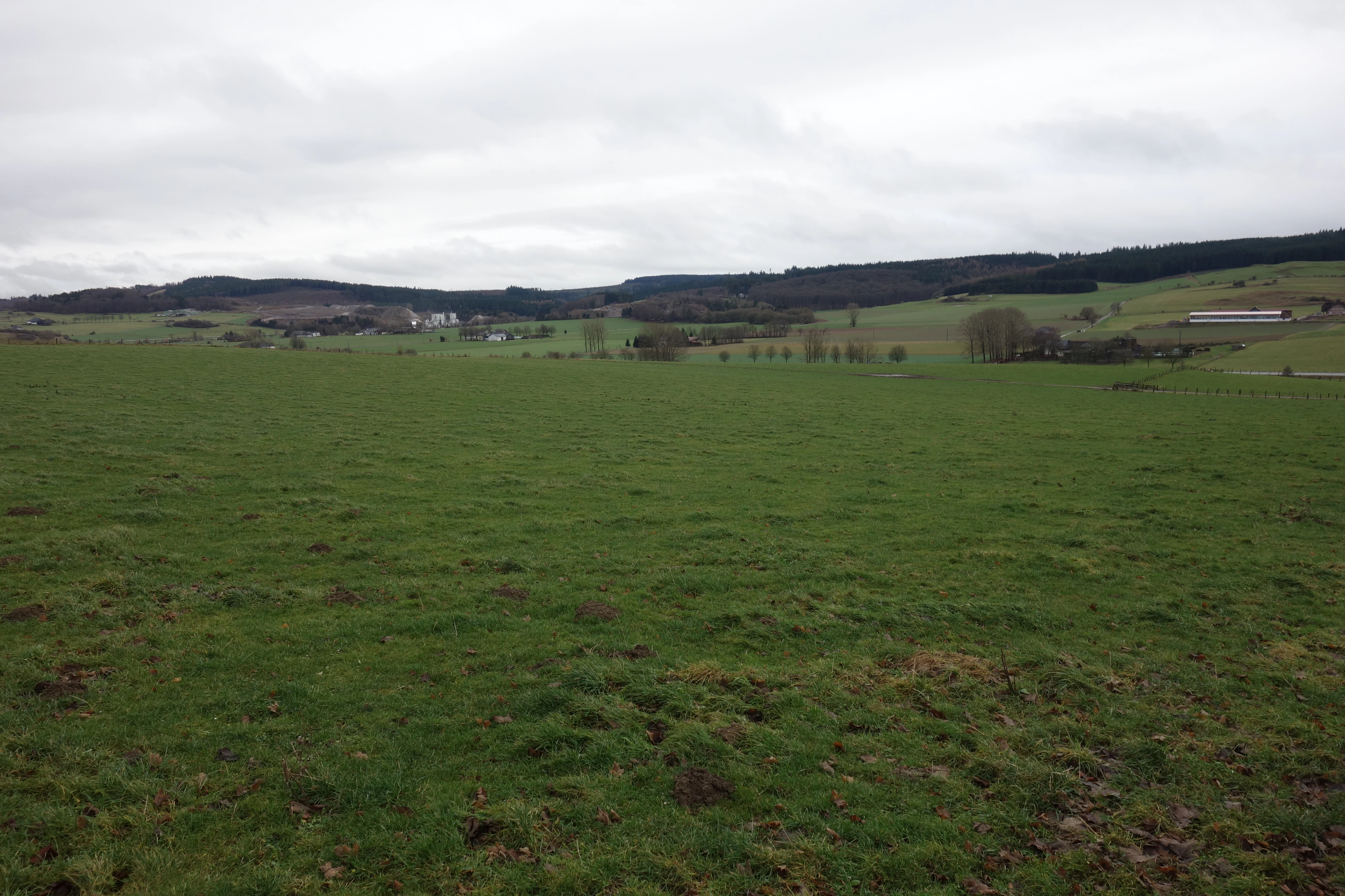
The terrain is defined by the Briloner Kalkplateau, a relatively flat limestone plateau, and by the surrounding Randhöhen, the marginal highlands that rise and fall around its edges. This combination of plateau and bordering heights gives the area a varied topographic character, with broad forested uplands interspersed by descending slopes and small valleys.
Forest dominates the visual impression of the area, largely composed of spruce with a substantial component of beech. Where agriculture does occur, it is most often in the form of open grassland rather than tilled fields, fitting the upland character of the region. In the southern and western parts of the protection area, the smooth forested surfaces are interrupted by the uneven ground of former mining sites, including raised spoil heaps and shallow pits that mark old workings for mineral extraction.
Landschaftsschutzgebiet Briloner Kalkplateau und Randhöhen ecosystems, habitats, and plant life
Ecologically, the area is characterized by the typical upland forest communities of the Sauerland. Spruce-dominated stands dominate much of the plateau and its marginal heights, while beech shares the canopy in many places, contributing to the mixed forest character that defines the wooded appearance of the region.
Open agricultural areas are used as grassland, supporting meadow vegetation rather than arable crops. The landscape protection area is intended to maintain the overall ecological balance of the Briloner Kalkplateau natural region and to act as a buffer between the settled edges of Brilon and the more sensitive areas that are protected as nature reserves. Its mosaic of forest, meadow, and mineral-soil relicts supports a varied local habitat structure despite the relatively modest protected status of the zone.
Landschaftsschutzgebiet Briloner Kalkplateau und Randhöhen conservation status and protection priorities
The conservation purpose of the area is to preserve the distinctive character of the Briloner Kalkplateau and its surrounding Randhöhen, to safeguard the functional capacity of the natural balance against harmful interventions, and to protect small-scale cultural-historical and regional-historical features. By being designated as a Type A general landscape protection area, it provides a protective buffer around the more strictly regulated nature reserves of the same natural region.
Regulations governing the area restrict new construction in general, while allowing certain developments tied to horticulture, agriculture and forestry, public utilities, wastewater management, and existing adjoining commercial uses, as well as wind and hydropower installations subject to building permits. New forest plantings and the establishment of Christmas tree, decorative greenery, or nursery plantations require approval from the lower nature conservation authority, reflecting the careful balancing of land use that the protection regime is designed to enforce.
Landschaftsschutzgebiet Briloner Kalkplateau und Randhöhen cultural meaning and human context
The cultural identity of the landscape is closely tied to both forestry and mining. The forest pattern of spruce and beech reflects generations of managed woodland use, while the agricultural grassland parcels represent continuing traditional farming on the plateau soils.
Mining has left the most visible cultural-historical traces. In the southern and western sections of the protection area, old adits, spoil heaps, and Pingen mark places where mineral resources were once extracted. These features are recognized within the protection objectives as small-scale cultural-historical and regional-historical structures worth preserving, integrating the industrial heritage of the region into the protected landscape.
Top sights and standout views in Landschaftsschutzgebiet Briloner Kalkplateau und Randhöhen
The defining features of the area are its forests of spruce and beech on a limestone plateau, its traditional grassland use, and the widespread relics of historic mining in the south and west. Its role as one of four Type A general landscape protection areas in the Brilon municipal area and as a buffer around stricter nature reserves gives it broader significance within the Hochsauerland protected-area network.