
Mori Atlas logo
Nature reserveLange Dammwiesen und Unteres Annatal

Mapping the osar ridges, meadow habitats, and conservation zones in Brandenburg, Germany

Lange Dammwiesen und Unteres Annatal: Protected Glacial Landscapes and Regional Geography

(Naturschutzgebiet Lange-Damm-Wiesen und Unteres Annatal)

Lange Dammwiesen und Unteres Annatal stands as a significant nature reserve within the Ostbrandenburgische Platte, defined by distinctive glacial landforms shaped during the Weichselian period. This protected area showcases a complex mosaic of sandy osar ridges and damp valley meadows, offering a clear view into regional geology and conservation-led land management. The site serves as a vital habitat for recovered plant populations, maintained through intentional grazing practices that highlight the interaction between historical land use and natural restoration.

nature reserveBrandenburgglacial landscapeosar ridgesmeadow habitatvalley landscape
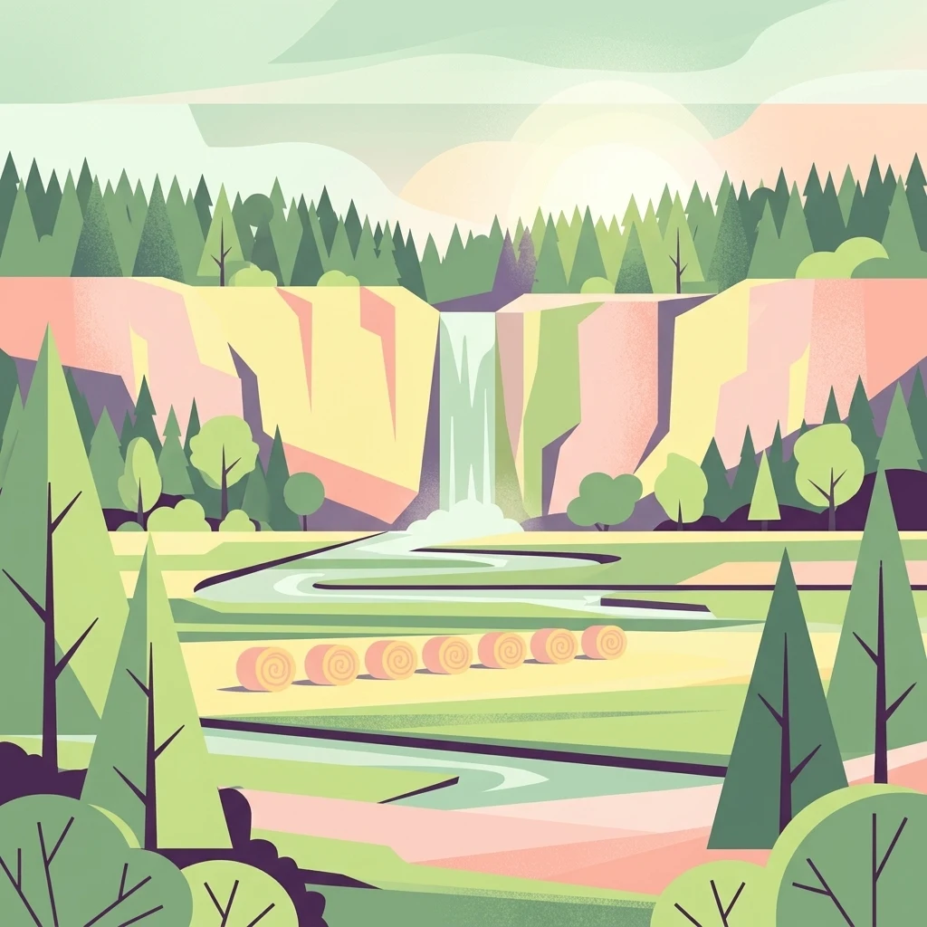
Vector illustration of a scenic valley with a waterfall flowing over cliffs, a winding river, forest surroundings, and several hay bales in the foreground.

Lange Dammwiesen und Unteres Annatal

Nature reserve

Park overview

Structured park overview, official facts, and landscape profile for Lange Dammwiesen und Unteres Annatal

Lange Dammwiesen und Unteres Annatal park facts, protected area profile, and essential visitor context

Review the core facts for Lange Dammwiesen und Unteres Annatal, including designation, size, terrain, visitor scale, habitats, and operating context in one park-focused overview.

About Lange Dammwiesen und Unteres Annatal

Lange Dammwiesen und Unteres Annatal sits on the Ostbrandenburgische Platte, a gently undulating part of the North German Plain that was shaped during the Weichselian glaciation. The protected area combines two closely linked landscape elements: the long, ridge-like Lange Dammwiesen and the lower section of the Annatal, a shallow valley that drains toward the wider countryside around Strausberg. Although the reserve itself is tiny in absolute terms, it is characteristic of the glacial terrain that defines much of eastern Brandenburg.

The most striking geological feature is the presence of osar, the long ridges of sand and gravel deposited by subglacial meltwater streams. These landforms have shaped both the appearance and the hydrology of the area, creating elevated, dry ridges alongside lower, often wetter meadows. The combination of dry sandy ridges and damper valley habitats supports a surprising variety of plant communities in a small footprint.

The reserve has been shaped by centuries of human use as well as natural processes. Forests on the higher ground were historically grazed, while the valley floor remained too wet to cultivate until after the Thirty Years' War, when local citizens began to establish hay meadows. Pine planting, forestry, railway construction, and other land uses continued to alter the landscape into the twentieth century. A particularly significant event was the lowering of the Stienitzsee water level by 2.5 meters in the nineteenth century, which affected groundwater conditions across the area.

Today the reserve is managed by the NABU Strausberg-Märkische Schweiz regional association, with Heck cattle playing a central role in maintaining open habitats. The grazing regime reflects a modern conservation philosophy that emphasizes natural processes over intensive human intervention, making the reserve a small but instructive example of process-based conservation in Brandenburg.

Quick facts and research context for Lange Dammwiesen und Unteres Annatal

The reserve is located in Brandenburg, in eastern Germany, within the district of Märkisch-Oderland near Strausberg. It was formally designated on 16 May 1990 and is listed in the World Database on Protected Areas under WDPA ID 164339, classified as an IUCN Category IV Habitat/Species Management Area. The site covers around 1.26 hectares and includes the long glacial ridges of the Lange Dammwiesen and the lower reaches of the Annatal valley.

Although very small in size, the reserve sits within the broader Ostbrandenburgische Platte, a glacial landscape formed during the last ice age. Its protection status and active management by the local NABU chapter make it a recognizable node within Brandenburg's network of nature reserves.

Protection and recognition

Documented terrestrial conservation scope and official designation records

Lange Dammwiesen und Unteres Annatal Protection Status and Administrative Records

Territorial records for Lange Dammwiesen und Unteres Annatal outline the documented conservation scope and administrative framework governing the protected landscape. Verified database entries provide structured reference metrics for tracking international recognition sources and baseline management parameters.

Protection details

Protection scope
Terrestrial
Transboundary protection
No
WDPA ID
164339
Park context

Deeper park guide and search-rich context for Lange Dammwiesen und Unteres Annatal

Lange Dammwiesen und Unteres Annatal history, landscape, wildlife, and travel context

Explore Lange Dammwiesen und Unteres Annatal through its history, landscape character, ecosystems, wildlife, conservation priorities, cultural context, and seasonal travel timing in a structured park guide built for atlas discovery and search intent.

Why Lange Dammwiesen und Unteres Annatal stands out

The reserve is best known for its glacial osar, the long, sinuous ridges of sand and gravel deposited by melting ice at the end of the last glaciation. These landforms are a defining geological feature of the Ostbrandenburgische Platte and give the Lange Dammwiesen their characteristic elongated shape. Equally distinctive is the reserve's use of Heck cattle for conservation grazing. The animals maintain open meadow habitats through their natural browsing behavior, and this approach has been credited with the recovery of threatened species and even the rediscovery of plants long thought to have vanished from the area.
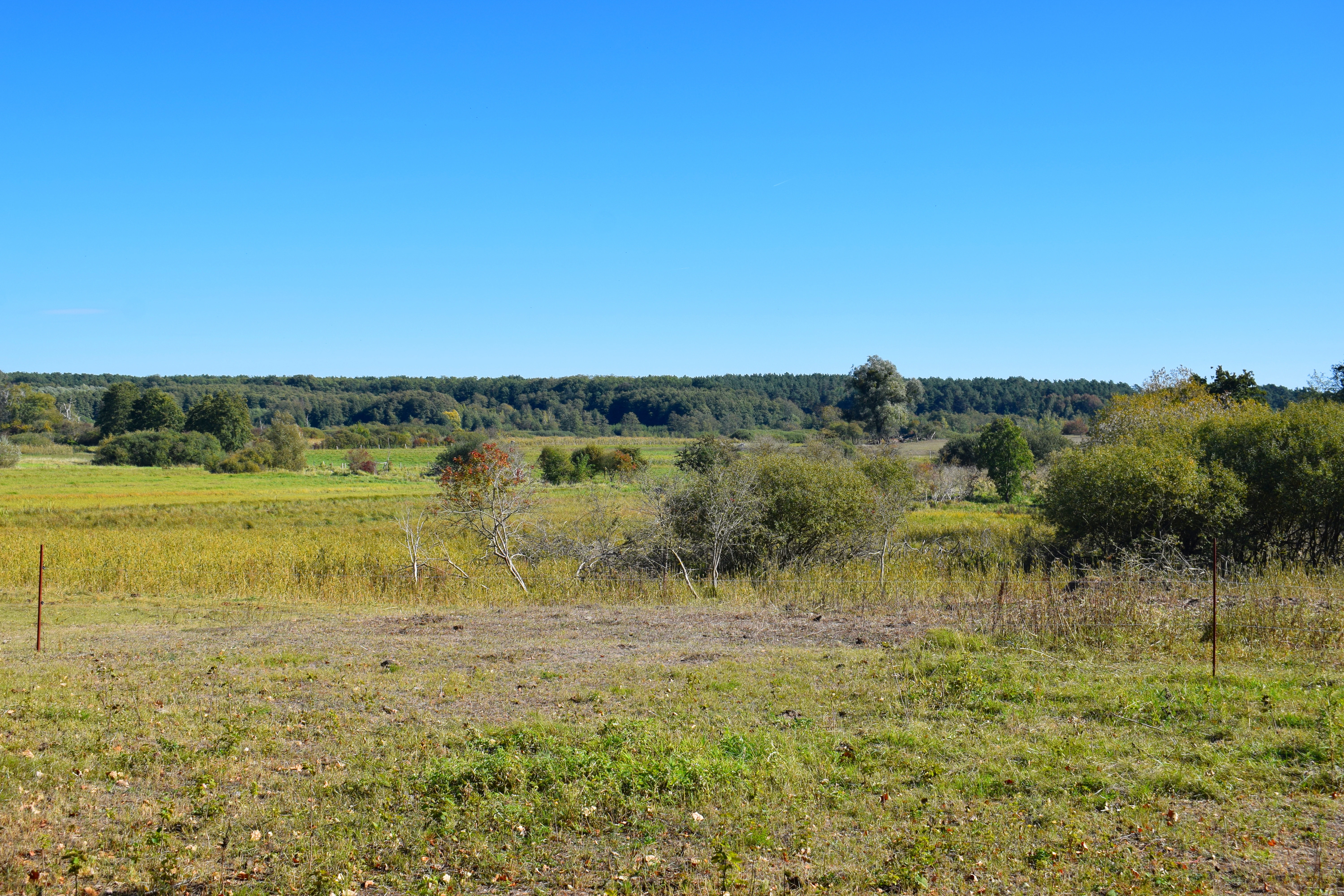
A wide landscape view of an open meadow and wetland area with scattered trees, under a clear blue sky, featuring a forested ridgeline in the background.
A wide view of the meadow and wetland landscape within the Lange Dammwiesen und Unteres Annatal nature reserve.

Lange Dammwiesen und Unteres Annatal history and protected-area timeline

The human history of the Lange Dammwiesen and the lower Annatal reaches back several centuries. Even before the Thirty Years' War, the woodlands on the higher ground were used as forest pasture. In contrast, the low-lying valley remained densely vegetated and too wet for grazing, leading the people of nearby Strausberg to use the area, known as the Hennickendorfer Winkel, as a refuge during times of conflict.

After the Thirty Years' War, the land was distributed among local citizens, and this redistribution became the foundation of the meadows that still define parts of the reserve today. By the early eighteenth century, pine planting had begun on areas left bare by overexploitation of oak stands, marking the start of organized forestry in the Strausberger Stadtforst.

The nineteenth century brought one of the most consequential land-use changes: the lowering of the Stienitzsee by 2.5 meters, which created new land near Torfhaus and shifted groundwater conditions across the meadows. Later centuries added further layers of impact, including railway construction, agriculture, sand and gravel extraction, gas pipeline installation, military training, and wastewater irrigation. A railway line connecting Strausberg-Vorstadt with Hennickendorf ran along the eastern edge of the area into the mid-1970s.

On 16 May 1990, the area was formally designated as a nature reserve. Since then, the NABU regional chapter Strausberg-Märkische Schweiz has overseen its management, introducing Heck cattle and rewilding-style grazing to restore and maintain the meadow and woodland mosaic.

Lange Dammwiesen und Unteres Annatal landscape and geographic character

The reserve lies within the Ostbrandenburgische Platte, part of the broader Jungmoränenland of the North German Plain. The terrain reflects the imprint of the Weichselian glaciation, with characteristic glacial landforms defining both the surface morphology and the underlying geology. The result is a subtly rolling landscape of low plateaus, shallow valleys, and elongated ridges.

The most distinctive features are the osar, the long, narrow ridges of sand and gravel that give the Lange Dammwiesen their name. These ridges rise gently above the surrounding land, creating drier, warmer microhabitats that contrast with the cooler, wetter conditions of the valley floor. The lower Annatal adds a different character, with meadowland and valley features that contrast with the upland woodlands.

Together, the ridges and the valley create a compact but variegated landscape within a very small area. Shifts between sandy, drier elevations and damp meadow hollows drive much of the ecological interest here, and they are the reason that such a small site can support such a diverse mix of habitats.
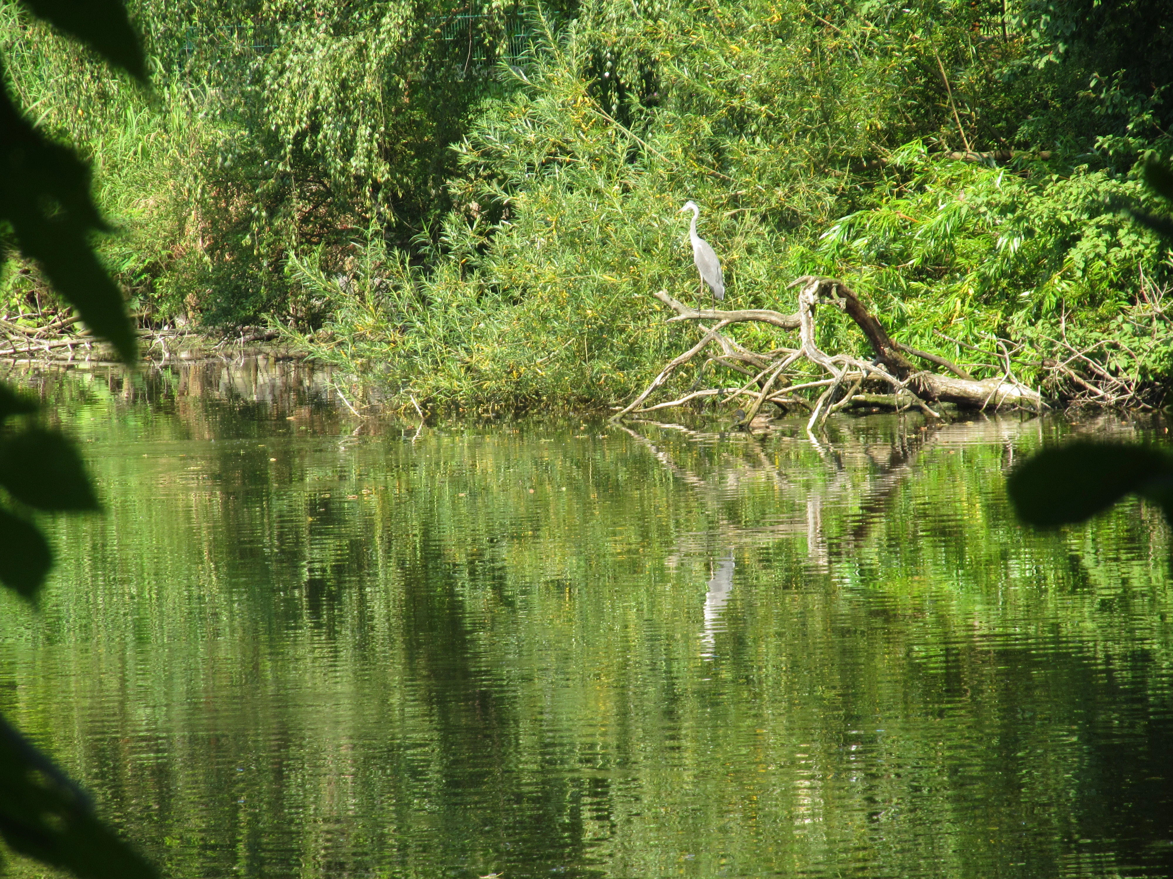
A grey heron stands on a fallen tree limb over a calm, green pond surrounded by dense vegetation in the Annatal nature reserve.
A grey heron perched on a fallen branch over the Swan Pond in the Annatal nature area.

Lange Dammwiesen und Unteres Annatal ecosystems, habitats, and plant life

The reserve's ecological character is closely tied to its glacial morphology. The dry sandy ridges of the osar support open, often pine-influenced woodland and dry grassland communities, while the lower Annatal favors wetter meadow habitats. The juxtaposition of these two landscape settings within a single small protected area is central to its ecological value.

Historically, much of the woodland on the higher ground was shaped by long-term grazing and forestry, while the valley floor developed as hay meadow after the Thirty Years' War. Modern management seeks to restore ecological complexity through grazing and process-based stewardship rather than intensive intervention.

Conservation grazing with Heck cattle has had a measurable positive impact. Their browsing helps maintain open meadow habitat and contributes to seed dispersal, while the dynamic disturbance created by grazing benefits a wide range of plant and insect species. The reserve's ecological story is therefore one of small-scale but meaningful habitat recovery within a historically modified landscape.
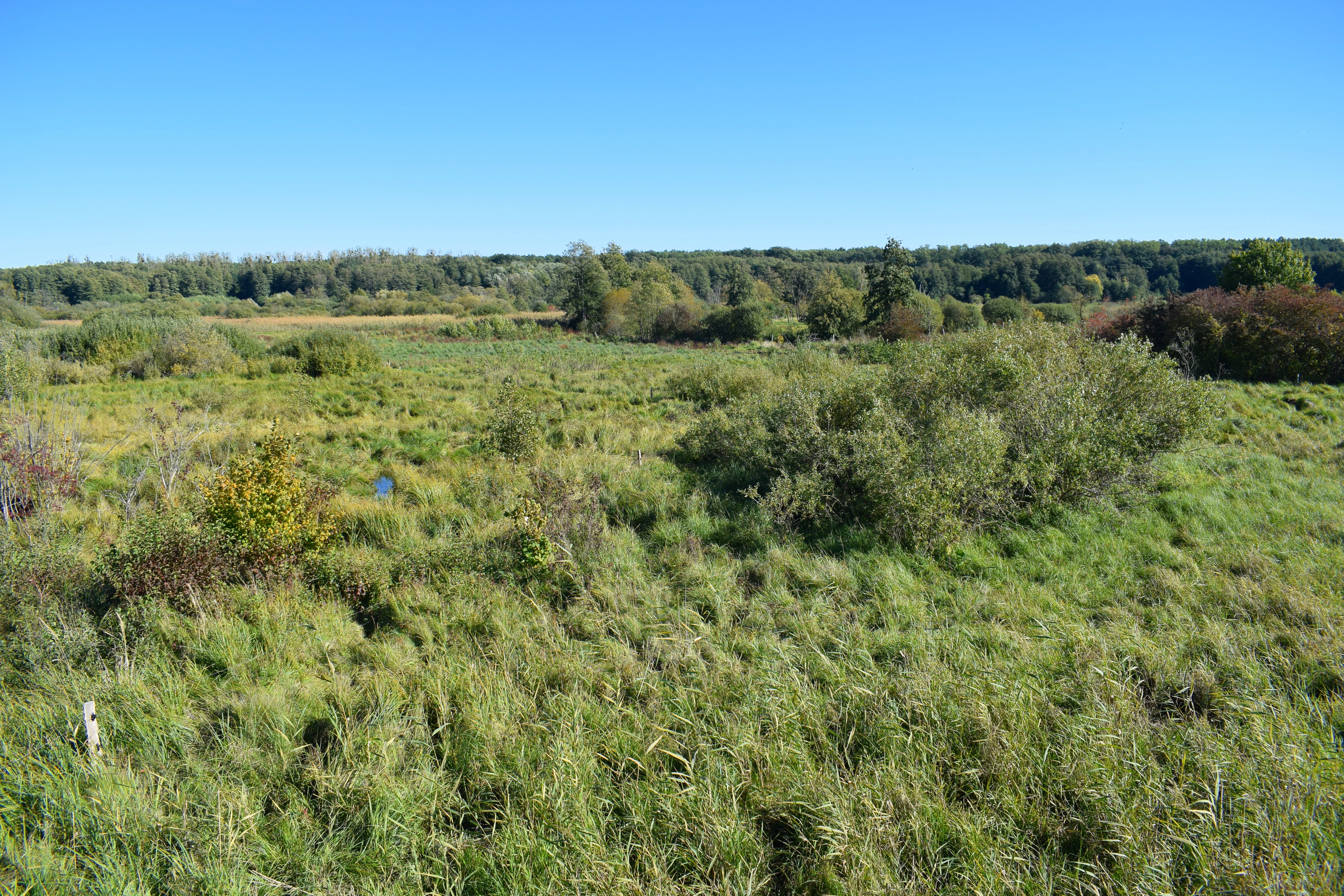
A wide landscape view of a grassy, brush-filled wetland area under a clear blue sky, with a forest line in the background.
A wide view of the wetlands in Lange Dammwiesen und Unteres Annatal.

Lange Dammwiesen und Unteres Annatal wildlife and species highlights

The reserve's wildlife profile is best understood in the context of its grazing-based management. Heck cattle perform a role equivalent to large ungulates that historically shaped European lowland landscapes, creating varied vegetation heights and disturbances that benefit many smaller species.

While the available source material emphasizes habitat-level outcomes rather than specific species lists, it notes that the conservation approach has led to population increases in threatened species and to the rediscovery of plant species previously thought to be lost from the area. This suggests a recovering insect and plant fauna, supported by research referenced on entomology-focused investigations within the reserve.

The mix of dry ridges and wet valley meadows provides habitat diversity for invertebrates and other small fauna, while the surrounding agricultural and forest landscapes of eastern Brandenburg form a broader ecological context for the reserve.
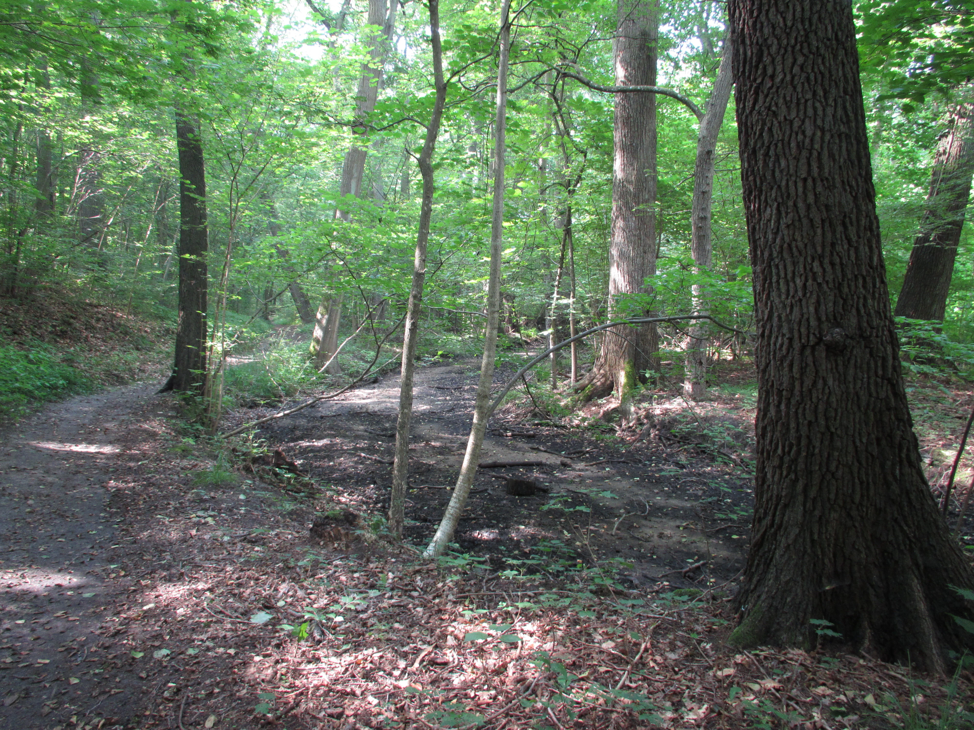
A dirt hiking trail curves through a dense deciduous forest with sunlight filtering through the canopy onto the forest floor.
A shaded forest path winding through the Annatal valley area of the nature reserve.

Lange Dammwiesen und Unteres Annatal conservation status and protection priorities

The reserve is officially classified as an IUCN Category IV Habitat/Species Management Area, reflecting its focus on managing specific habitats and species rather than on strict wilderness protection. This designation is consistent with its small size and its dependence on active management to maintain ecological value.

Conservation work is led by the NABU Strausberg-Märkische Schweiz regional chapter, which uses grazing as the primary management tool. The approach reflects a broader trend in European conservation that draws on the grazing behavior of hardy, traditional cattle breeds to maintain open habitats. At Lange Dammwiesen und Unteres Annatal, Heck cattle are central to this effort.

The site's small footprint makes it ecologically significant at the local and regional level rather than at the national scale, but its combination of glacial landforms and active rewilding grazing gives it clear value as a demonstration of process-based conservation in Brandenburg. The visible recovery of threatened plant species and the rediscovery of species previously thought lost underscore the tangible ecological impact of this management approach.

Lange Dammwiesen und Unteres Annatal cultural meaning and human context

The area has a layered cultural history tied closely to the land. The low-lying parts of the valley were used as a refuge called the Hennickendorfer Winkel by residents of Strausberg during the Thirty Years' War. After the conflict, the redistribution of land to local citizens created the foundation of the meadow-based land use that persists in modified form today.

The forests of the surrounding Strausberger Stadtforst became an organized forestry landscape in the early eighteenth century, with pine planting marking a shift away from earlier oak-dominated woodlands. Successive generations of land use, including railway construction, mining of sand and gravel, military activity, and wastewater irrigation, have each left their traces in the reserve's recent history. Today the area reflects a transition from utilitarian land use toward ecological recovery and nature-oriented management under NABU stewardship.

Top sights and standout views in Lange Dammwiesen und Unteres Annatal

The Lange Dammwiesen und Unteres Annatal combine geological interest, long cultural land use, and modern conservation practice in a compact protected area. The osar ridges are its most unusual physical feature, while the seasonal meadows of the lower Annatal provide the ecological counterpoint.

Equally notable is the reserve's management approach, in which Heck cattle drive the maintenance and recovery of habitat. The visible recovery of plant populations and the rediscovery of species thought extinct in the area illustrate the impact of grazing-based stewardship. Together, these qualities make the reserve a small but informative example of contemporary nature conservation in Brandenburg.

Best time to visit Lange Dammwiesen und Unteres Annatal

Seasonal timing can influence the character of the reserve considerably. Late spring and early summer typically bring the strongest display of meadow flowering and insect activity, when conservation grazing is in full effect and the contrast between drier sandy ridge habitats and damper valley meadows is most visible. Summer offers warm conditions suitable for walking and observation of the open landscape.

Autumn brings quieter conditions and more muted colors as meadow growth slows, while winter can emphasize the glacial morphology of the osar ridges and offer a clearer sense of the reserve's underlying landforms. Visitors should be aware that this is a working nature reserve, with management activities such as grazing taking place throughout much of the year, and that the small size of the area makes it better suited to short, focused visits than extended exploration.

Monthly climate preview

Long term temperature and monthly precipitation averages across the protected landscape

Lange Dammwiesen und Unteres Annatal Climate Normals and Weather by Month

Representative coordinate measurements trace the multi year temperature range and monthly precipitation rhythm across Lange Dammwiesen und Unteres Annatal. Opening the complete climate profile reveals detailed twelve month averages and extended statistical comparisons for this Brandenburg location.
Annual mean9 °C
-1 °C20 °C
Jan-1°
Feb
Mar
Apr
May14°
Jun18°
Jul20°
Aug20°
Sep15°
Oct
Nov
Dec
Warmest month
July

20.3 °C

Coolest month
January

-0.9 °C

Wettest month
July

2.4 mm/day

Driest month
April

1.1 mm/day

Park location guide

Geography guide, regional context, and park location map for Lange Dammwiesen und Unteres Annatal

Lange Dammwiesen und Unteres Annatal park geography, regions, and map view in Germany

Understand where Lange Dammwiesen und Unteres Annatal sits in Germany through a broader geographic reading of the surrounding landscape, nearby location context, and its mapped position within the national park landscape.

How Lange Dammwiesen und Unteres Annatal fits into Germany

Germany is a federal republic in Western and Central Europe with a population of over 83 million across sixteen constituent states. It is Europe's largest economy by nominal GDP and a major global exporter and importer. The capital is Berlin, and the country borders Denmark, Poland, Czech Republic, Austria, Switzerland, France, Luxembourg, Belgium, and the Netherlands.

Wider geography shaping Lange Dammwiesen und Unteres Annatal in Germany

Germany is located in Western and Central Europe, spanning 357,022 km². It borders Denmark to the north, Poland and the Czech Republic to the east, Austria and Switzerland to the south, and France, Luxembourg, Belgium, and the Netherlands to the west. The country has coastlines on the Baltic Sea and North Sea to the north, with the Alps located in the southern region.

Map view of Lange Dammwiesen und Unteres Annatal

Use this park location map to pinpoint Lange Dammwiesen und Unteres Annatal in Germany, understand its exact geographic position, and read its mapped placement within the surrounding landscape more clearly.

Pigeon | © OpenStreetMap contributors

Location context for Lange Dammwiesen und Unteres Annatal

Brandenburg

Visualizing glacial osar ridges, meadow habitats, and protected valley terrain

Lange Dammwiesen und Unteres Annatal Landscape Photos and Scenery

Photographic collections reveal the complex terrain and glacial landforms defining Lange Dammwiesen und Unteres Annatal. Visual records document the unique mix of dry elevated ridges and damp valley meadows shaped by conservation grazing.

A wide landscape view of an open meadow and wetland area with scattered trees, under a clear blue sky, featuring a forested ridgeline in the background.

A line of round, light-colored hay bales sits in a grassy field bordered by a dense forest under a bright blue sky.

A grey heron stands on a fallen tree limb over a calm, green pond surrounded by dense vegetation in the Annatal nature reserve.

A wide landscape view of a grassy, brush-filled wetland area under a clear blue sky, with a forest line in the background.

A dirt hiking trail curves through a dense deciduous forest with sunlight filtering through the canopy onto the forest floor.

A wide outdoor landscape view showing a meadow and marshy area under a cloudy sky, with a small elevated wooden hunting stand visible on the right side.

Park atlas

Compare regional glacial landscapes, meadow reserves, and connected lowland terrain.

Other Parks Near Lange Dammwiesen und Unteres Annatal and Surrounding Protected Areas

Browsing other parks near Lange Dammwiesen und Unteres Annatal reveals related protected areas across the surrounding regional terrain. Expanding the geographic comparison highlights shared glacial landforms and similar conservation habitats throughout Brandenburg.
A horizontal watercolor painting of a calm river or wetland area with trees, shoreline grasses, and rolling hills in the background, executed in a soft, muted style.
Nature reserveBerlin
About 15 km away#1 closest

Southwest

EU-Vogelschutzgebiet Müggelspree: Protected Nature Reserve and Spree Valley Geography

Bird sanctuary and wetland landscape in southeastern Berlin

As a protected bird sanctuary within the European Natura 2000 network, the EU-Vogelschutzgebiet Müggelspree features an intricate mix of river corridors, fens, and pine forests. This reserve maintains significant ecological connectivity through the Spree lowlands, providing stable breeding and passage environments for numerous avian species. Its unique landscape architecture offers a clear view into the intersection of glacial sand formations and active floodplain ecosystems on the outskirts of Berlin.

Area
8.002 km²
Established
1997
A wide watercolor illustration showing a calm lake with small tree-covered islands, bordered by green forests and distant hills under a pale sky.
Protected areaBrandenburg
About 16 km away#2 closest

Southwest

Wernsdorfer See Protected Area: Geographic Mapping and Landscape Context in Brandenburg

Glacial wetland mosaic featuring dunes and reedbeds

Wernsdorfer See is an essential nature reserve in Brandenburg that showcases a rare mix of habitats, from open sandy dunes and grasslands to shallow marshland and reedbeds. Managed as part of the Natura 2000 network, the site serves as a vital refuge for bird species and rare wetland flora. This overview traces the geography and terrain of the Spree valley lowland, offering a structured perspective on its conservation landscape.

Area
1.387 km²
Established
1967
Relief
Lowland
Climate
Temperate
A horizontal watercolor painting showing layers of soft-toned hills in green and purple, with tall blades of grass in the foreground.
Nature reserveBrandenburg
About 17 km away#3 closest

East

Klobichsee Nature Reserve: Protected Landscape and Glacial Lake Geography in Brandenburg

Mapping aquatic ecosystems and protected boundaries in eastern Germany

Klobichsee Nature Reserve covers roughly 5.59 square kilometers, centering on the Großer Klobichsee and Kleiner Klobichsee glacial lakes. This protected area in Brandenburg preserves essential forest and wetland habitats, maintaining the ecological character of the region situated between Buckow and Münchehofe.

Area
5.59 km²
Established
1990
IUCN
IV
Climate
Temperate
Watercolor painting of a rolling landscape with green grass, bushes, and soft-colored hills in the background.
Protected landscapeBerlin
About 17 km away#4 closest

West

Kaulsdorfer Seen: A Protected Landscape in Berlin with Glacial and Industrial History

Exploring the groundwater protection zones and post-mining lakes of eastern Berlin

The Kaulsdorfer Seen area represents a distinct protected landscape located in Berlin. It showcases the transition between ice-age glacial regions, featuring two prominent lakes that evolved from sand and gravel pits into a mature ecosystem of willow thickets, woodland, and reeds. This site functions as an important drinking-water protection zone, offering a structured look at the complex interplay between urban development and natural resource conservation.

Area
0.937 km²
Water
Major water bodies
A soft watercolor painting of a pastoral landscape featuring green rolling hills, distant trees, and a foreground with grassy vegetation and pinkish marsh-like reflections.
Protected landscapeBrandenburg
About 18 km away#5 closest

East

Naturpark Märkische Schweiz: A Protected Landscape Discovery in Brandenburg

Glacial terrain, kettle lakes, and river basin geography.

Situated near Berlin, this protected landscape features a textbook glacial relief shaped by retreating ice sheets. The area encompasses the Schermützelsee, deep kettle ponds known as Sölle, and the narrow valleys of the Stobber river. Learn about the park's layered conservation framework, which combines European habitat protection with rich fieldstone architecture and cultural history.

Area
205 km²
Established
1990
Relief
Upland
Climate
Temperate
Nature reserveBrandenburg
About 18 km away#6 closest

East

Stobbertal Nature Reserve: Geography, Mapped Boundaries, and Protected Landscape Context

A detailed geographic study of the Stöbber river valley in Brandenburg, Germany

Stobbertal represents a compact yet ecologically dense protected area in Brandenburg. This study provides access to information regarding its diverse forest and wetland habitats, ranging from ancient oak-hornbeam woodlands to rare floodplain remnants. Gain insight into the regional importance of the river corridor, its hydrologic features, and the protected species that inhabit this distinct northeastern German landscape.

Area
8.84 km²
Established
1990
IUCN
IV
Nature reserveBerlin
About 18 km away#7 closest

Southwest

Teufelsseemoor Köpenick: Protected Kettle Bog Geography and Urban Wetland Atlas

Glacial landscape and conservation zone in Berlin, Germany

Teufelsseemoor Köpenick is a key nature reserve in Berlin that showcases the transition from post-glacial kettle hole to a thriving peatland and swamp forest. This protected area stands out for its ecological gradient and serves as a model of urban wilderness conservation. The site is defined by the contrast between its still waters and the surrounding moraine ridges of the Müggelberge.

Area
0.065 km²
Established
2016
IUCN
IV
Nature reserveBrandenburg
About 19 km away#8 closest

South

Swatzke- und Skabyberge Nature Reserve and Protected Inland Dune Geography in Brandenburg

Mapping the sand heaths and forest ecosystems of northeastern Germany

Swatzke- und Skabyberge is a designated nature reserve in Brandenburg that preserves a rare inland dune complex. Originally shaped by long term military usage, this protected land now functions as a vital habitat for dry acid grasslands, lichen-rich pine forests, and wetland woodland fringes. It provides a unique study in how sand, fire, and moisture processes maintain biodiversity within the lowland German landscape.

Area
5.2 km²
Established
1999
IUCN
IV

Common questions about visiting, size, designation, and location context for Lange Dammwiesen und Unteres Annatal

Lange Dammwiesen und Unteres Annatal FAQs for park facts, access, geography, and protected area context

Find quick answers about Lange Dammwiesen und Unteres Annatal, including protected-area facts, park geography, trail and visitor context, and how the park fits into its surrounding country and regional landscape.
MoriAtlas Explorer

Continue Your Protected Areas Search Across the Global Atlas

Deepen your exploration by continuing the structured search for national parks and protected areas worldwide. Utilize the comprehensive filtering capabilities to compare different conservation landscapes and refine your understanding of global park geography. Discover more about the distribution and characteristics of protected natural areas.

Global natural geography