

Mori Atlas logo
Nature reserveLapalala Wilderness

Explore the geographic terrain, river networks, and conservation boundaries of this South African protected area.

Lapalala Wilderness Nature Reserve: Mapping the Protected Bushveld Landscapes of Limpopo

Lapalala Wilderness encompasses a significant bushveld mosaic within the Waterberg region of Limpopo, South Africa. This nature reserve provides a complex environment of rocky ridges, wooded savanna, and riverine corridors spanning the Palala and Blocklands river systems. Understanding the geographic distribution of these land types is essential for mapping the ecological connectivity and protected landscape integrity found within this South African territory.

bushveldbig fiveriver systemsbiosphere reserveblack rhino reintroductionprivate reserve
A stylized, flat-design illustration of a river winding through a valley flanked by steep, tiered cliffs on one side and a forested hillside on the other under a sunset-colored sky.

Lapalala Wilderness

Nature reserve

Park overview

Structured park overview, official facts, and landscape profile for Lapalala Wilderness

Lapalala Wilderness park facts, protected area profile, and essential visitor context

Review the core facts for Lapalala Wilderness, including designation, size, terrain, visitor scale, habitats, and operating context in one park-focused overview.

About Lapalala Wilderness

Lapalala Wilderness is a privately managed conservation area of roughly 48,000 hectares in the Limpopo province of South Africa. It sits within the Waterberg Biosphere, a region recognised by UNESCO for its ecological importance, and forms part of the broader Central Bushveld biome that characterises much of northern South Africa. The reserve is operated by the Lapalala Wilderness Foundation and is one of the country's most prominent examples of a large-scale, private-led conservation initiative.

The reserve's value rests on the diversity of habitats packed into a single property. Eight different land types have been mapped across Lapalala, an unusually high figure for bushveld terrain, and this heterogeneity translates directly into a wide range of wildlife and birdlife. The Palala and Blocklands rivers run through the reserve for more than sixty kilometers and are classified as National Freshwater Ecosystem Priority Areas, giving the wilderness a strong freshwater conservation profile that complements its terrestrial habitats.

Lapalala is also a Big Five reserve, with lion, leopard, elephant, rhinoceros, and buffalo all present on the property. This combination of large mammal diversity, varied terrain, intact river systems, and biosphere status has made the reserve a reference point for private conservation in South Africa. Beyond its ecological role, Lapalala hosts the Lapalala Wilderness School, founded in 1985, which has become a leading centre for environmental education among young South Africans, particularly those from historically disadvantaged communities.

Quick facts and research context for Lapalala Wilderness

Lapalala Wilderness covers about 48,000 hectares in Limpopo, South Africa, and lies within the UNESCO Waterberg Biosphere. The reserve was established in 1981, is classified under South Africa's National Environmental Management Protected Areas Act, and is managed by the Lapalala Wilderness Foundation. Eight distinct land types have been identified on the property, signalling unusually high habitat heterogeneity for the Central Bushveld biome.

Protection and recognition

Examine terrestrial protected area designations, management scope, and recognition history

Lapalala Wilderness Protection Status and International Recognition Data

Lapalala Wilderness features documented terrestrial protection status and structured conservation management records. Systematic data compilation tracks official designation history and international recognition frameworks without assuming speculative outcomes.

Protection details

Protection scope
Terrestrial
Transboundary protection
No
Park context

Deeper park guide and search-rich context for Lapalala Wilderness

Lapalala Wilderness history, landscape, wildlife, and travel context

Explore Lapalala Wilderness through its history, landscape character, ecosystems, wildlife, conservation priorities, cultural context, and seasonal travel timing in a structured park guide built for atlas discovery and search intent.

Why Lapalala Wilderness stands out

Lapalala Wilderness is best known for being the first privately protected area in South Africa to reintroduce black rhinoceros, a milestone that took place in 1981. It is also recognized for its position within the Waterberg Biosphere, its Big Five status, and the Lapalala Wilderness School environmental education programme.
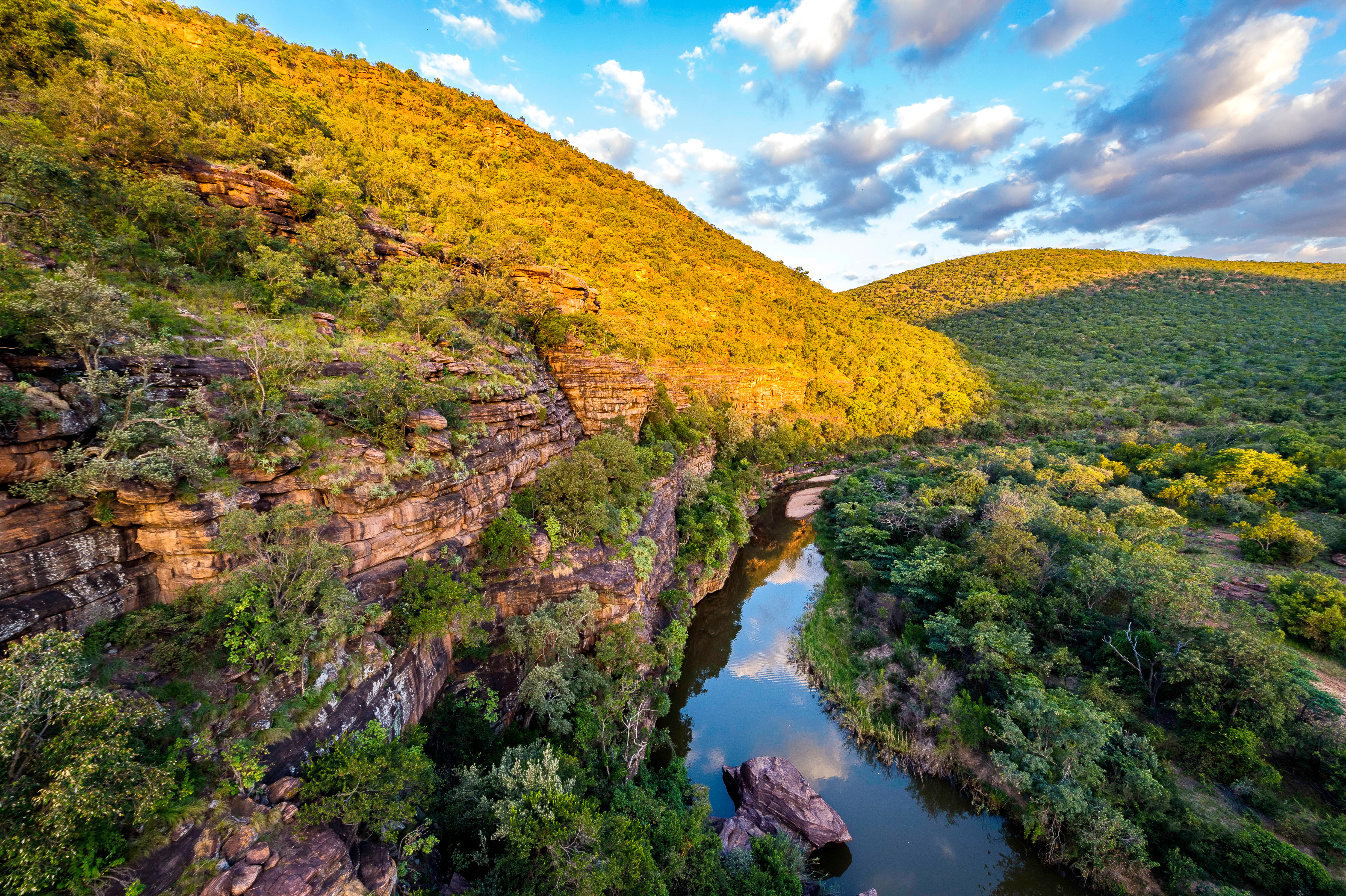
A high-angle view of a calm, reflective river flowing through a deep valley between steep, tree-covered rocky hills under a partially cloudy blue sky.
A scenic view of the river winding through the rugged hills of the Waterberg landscape at Lapalala Wilderness.

Lapalala Wilderness history and protected-area timeline

Lapalala Wilderness was established in 1981, the same year it became the first privately protected area in South Africa to reintroduce black rhinoceros, a move that established the reserve as a pioneer in private rhino conservation during a period of intense poaching pressure across southern Africa.

In 1985 the Lapalala Wilderness School was founded with the aim of promoting wildlife conservation among young people, including those from historically disadvantaged communities. Over time the school has expanded into a widely recognised centre of excellence offering teacher training, internships, and outreach programmes, and in 2022 new eco-friendly facilities were officially opened, reinforcing its long-term educational role alongside the reserve's conservation mission.

Lapalala Wilderness landscape and geographic character

Lapalala sits within the Waterberg, a region of gently undulating terrain shaped by ancient sandstone and diverse geological substrates. The reserve encompasses a mosaic of bushveld landscapes typical of the Central Bushveld biome, with eight different land types identified across the property. This heterogeneity produces a varied terrain of wooded savanna, open grasslands, rocky ridges, and denser thicket areas rather than a single uniform habitat.

The defining hydrological feature is the presence of the Palala and Blocklands rivers, which together flow for more than sixty kilometers through the reserve. These riverine corridors create greener, more sheltered bands of habitat that cut across the broader bushveld matrix and add significant vertical and structural diversity to the landscape.

Lapalala Wilderness ecosystems, habitats, and plant life

The ecological character of Lapalala is shaped by its position in the Central Bushveld biome and by the unusually high number of land types mapped on the property. Eight distinct land categories reflect a mix of soil, vegetation, and topographic variation, producing a habitat mosaic that supports far more biodiversity than a typical uniform bushveld reserve.

The Palala and Blocklands rivers are designated National Freshwater Ecosystem Priority Areas, giving the reserve a strong wetland and riverine dimension. Together, the terrestrial heterogeneity and the intact riparian systems create a layered environment in which woody savanna, grassland, rocky outcrops, and riverine woodland each contribute different ecological roles.

Lapalala Wilderness wildlife and species highlights

Lapalala is established as a Big Five reserve, with lion, leopard, elephant, rhinoceros, and buffalo present on the property. This combined presence is a defining element of the reserve's identity and signals that the habitat mosaic is healthy enough to support large predator and megaherbivore populations together.

Historically, the reserve's most significant wildlife event was the reintroduction of black rhinoceros in 1981, making Lapalala the first privately protected area in South Africa to undertake such a reintroduction. The combination of varied habitats and long-term protection continues to support a wide community of birds and mammals, with the riverine corridors adding particular value for species tied to freshwater environments.

Lapalala Wilderness conservation status and protection priorities

Lapalala Wilderness holds a strong conservation profile due to its location within the UNESCO Waterberg Biosphere, its protection under South Africa's National Environmental Management Protected Areas Act, and its status as a Big Five reserve. The identification of eight different land types on the property is treated as an indicator of ecological heterogeneity, which in turn underpins biodiversity value.

The reserve also carries notable freshwater conservation weight, as the Palala and Blocklands rivers are classified as National Freshwater Ecosystem Priority Areas. Its pioneering role in privately led black rhino reintroduction in 1981 established an enduring institutional commitment to threatened species recovery, while the Lapalala Wilderness School extends the reserve's conservation influence into environmental education and capacity building.

Lapalala Wilderness cultural meaning and human context

Lapalala's most distinctive cultural contribution lies in its environmental education work rather than in archaeological or built heritage. The Lapalala Wilderness School, founded in 1985, is widely recognised as a centre of excellence for conservation education in South Africa, working particularly with young people from historically disadvantaged communities through teacher training, internships, and outreach programmes.

Top sights and standout views in Lapalala Wilderness

Lapalala Wilderness stands out as a large, privately managed Big Five reserve nested within the UNESCO Waterberg Biosphere, with eight distinct land types supporting an unusually rich bushveld habitat mosaic. Its sixty kilometers of National Freshwater Ecosystem Priority river systems and its pioneering 1981 black rhino reintroduction give it a clear identity in South African conservation history, while the long-running Lapalala Wilderness School adds a strong educational dimension to its broader mission.

Best time to visit Lapalala Wilderness

Lapalala's bushveld setting means seasonal character is shaped primarily by the dry and wet phases typical of Limpopo. The wetter summer period brings greener vegetation, more active water systems along the Palala and Blocklands rivers, and peak bird activity, while the drier winter months produce thinner bush, easier game viewing around remaining water sources, and cooler conditions that contrast with the surrounding lowveld heat.
Monthly climate preview

Long-term monthly temperature and precipitation patterns derived from representative coordinate records

Lapalala Wilderness Climate Normals and Annual Temperature Rhythm

Historical climatology data reveals distinct annual temperature and precipitation shifts across the representative coordinate for Lapalala Wilderness from 1991 through 2020. Reviewing the complete twelve-month normals provides detailed context on long-term thermal ranges and precipitation distribution.
Annual mean20 °C
13 °C24 °C
Jan24°
Feb24°
Mar23°
Apr20°
May17°
Jun14°
Jul13°
Aug16°
Sep20°
Oct23°
Nov24°
Dec24°
Warmest month
January

24.4 °C

Coolest month
July

13.4 °C

Wettest month
January

2.8 mm/day

Driest month
August

0 mm/day

Park location guide

Geography guide, regional context, and park location map for Lapalala Wilderness

Lapalala Wilderness park geography, regions, and map view in South Africa

Understand where Lapalala Wilderness sits in South Africa through a broader geographic reading of the surrounding landscape, nearby location context, and its mapped position within the national park landscape.

How Lapalala Wilderness fits into South Africa

South Africa is the southernmost country in Africa, spanning 1.22 million km² with a population of over 63 million. The country operates with three capital cities, Pretoria (executive), Cape Town (legislative), and Bloemfontein (judicial), and is renowned for its biodiversity, national parks, and multicultural society.

Wider geography shaping Lapalala Wilderness in South Africa

South Africa occupies the southernmost region of Africa, with coastline along both the Atlantic Ocean to the west and the Indian Ocean to the east. The interior features elevated plateaus including the Highveld, with the Drakensberg escarpment marking the eastern highlands. The country shares borders with Namibia, Botswana, Zimbabwe, Mozambique, Eswatini, and Lesotho.

Map view of Lapalala Wilderness

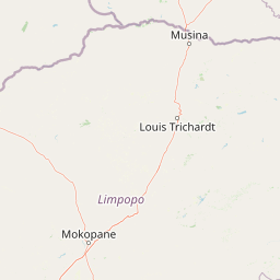
Use this park location map to pinpoint Lapalala Wilderness in South Africa, understand its exact geographic position, and read its mapped placement within the surrounding landscape more clearly.

Pigeon | © OpenStreetMap contributors

Location context for Lapalala Wilderness

Limpopo

Explore protected area photography, bushveld terrain, and riverine environments across the reserve.

Lapalala Wilderness Photos and Landscapes: Visual Guide to Scenery and Habitats

Visual records capture the varied bushveld terrain, riverine corridors, and protected habitats that define Lapalala Wilderness within the Waterberg Biosphere. Examining high-resolution photography helps visitors understand the ecological character, geological diversity, and expansive landscape features of the reserve.

A high-angle view of a calm, reflective river flowing through a deep valley between steep, tree-covered rocky hills under a partially cloudy blue sky.

Park atlas

Compare adjacent bushveld reserves and regional conservation landscapes

Parks Near Lapalala Wilderness and Surrounding Protected Areas

Visitors exploring Lapalala Wilderness can browse other parks and protected areas situated throughout the surrounding region. Extending the geographic comparison reveals broader patterns in regional terrain, riverine corridors, and protected bushveld habitats.
Biosphere reserveLimpopo
Mapped location lies within the park boundary#1 closest

Southwest

Waterberg Biosphere: A Protected Sandstone Massif in Limpopo Province South Africa

Geology, mapping, and ecological zones of the Waterberg range

The Waterberg Biosphere stands as a major protected region in South Africa, formed by ancient sandstone layers sculpted into mesas and deep gorges. This massif bridges ecological zones from highland savanna to riverine habitats, anchoring a network of game reserves and wilderness areas through its distinctive geological and historical landscape identity.

Area
6,540.33 km²
Established
2001
Relief
Mountain
Climate
Subtropical
Wildlife reserveLimpopo
About 62 km away#2 closest

Southwest

Welgevonden Game Reserve: A Comprehensive Geographic Profile of a Limpopo Wildlife Haven

Mapped terrain across the Waterberg mountain bushveld

Welgevonden Game Reserve stands as a focal point for protected land discovery in South Africa. The reserve features complex geological formations, ranging from steep cliffs to open plateau grasslands. Gain insights into the physical boundaries and landscape diversity that define this significant conservation area located within the northern Limpopo province.

Area
382 km²
Relief
Mountain
Access
Access unknown
Scope
Terrestrial
National parkLimpopo Province
About 81 km away#3 closest

Southwest

Marakele National Park: National Park Protected Landscape and Geographic Context

Explore its Limpopo Province regional setting and mapped boundaries.

Marakele National Park represents a vital protected national park within the diverse geography of Limpopo Province, South Africa. This entry provides detailed atlas-style information on its protected landscape, focusing on mapped geographic boundaries and its context within the regional natural terrain. It serves as a key resource for understanding the park's specific role as a conservation area and its place within the broader atlas of South African protected lands.

Area
670 km²
Established
1994
Relief
Mountain
Climate
Subtropical
Nature reserveLimpopo Province
About 91 km away#4 closest

South

Nylsvley Nature Reserve: A Geographical Overview of Limpopo Province's Wetland Landscapes

Protected floodplain ecosystems and seasonal riverine terrain

Nylsvley Nature Reserve protects a vast, shallow floodplain and surrounding open woodland, creating a high-density conservation zone in the Limpopo Province. Its terrain is defined by the seasonal interaction of the Nyl River, extensive reedbeds, and unique botanical communities. This profile examines the reserve as a significant reference point for understanding the interplay between floodplain geography, savanna bushveld, and inland wetland habitats.

Area
40 km²
Established
1998
Relief
Lowland
Access
Access unknown
Wildlife reserveLimpopo
About 108 km away#5 closest

Southwest

Mabula Game Reserve: Protected Bushveld and Geographic Landscape Profile

Exploration of the Limpopo bushveld and wildlife habitat boundaries

Mabula Game Reserve provides a detailed look at the bushveld ecosystems of South Africa. Spanning 12,000 hectares in Limpopo, the reserve features a unique blend of rocky ridges, open savanna, and riverine woodlands. Its structural diversity creates a distinct natural corridor that serves as a focal point for understanding regional wildlife distribution and the transition zone between the Waterberg and the northern plains.

Area
120 km²
Scope
Terrestrial
Wildlife reserveLimpopo
About 113 km away#6 closest

East

Polokwane Game Reserve: A Comprehensive Geographic Profile of a Limpopo Wildlife Reserve

Mapped boundaries and natural habitat in northern South Africa

Spanning 2,800 hectares of grassy plains and bushveld, Polokwane Game Reserve serves as a critical municipal protected area near the urban core of Polokwane. This geographic overview highlights the reserve's unique eastern ridge flora, its chain of riverine waterholes, and the spatial distribution of its protected landscape within the Limpopo province.

Area
28 km²
Established
1977
Relief
Upland
Climate
Subtropical
Nature reserveLimpopo
About 114 km away#7 closest

South

Mabalingwe Nature Reserve: Protected Bushveld Geography and Terrain Analysis

Mapping the Limpopo reserve landscape and habitat features

Examine the 8,800-hectare landscape of Mabalingwe Nature Reserve. From its malaria-free bushveld habitat to its network of seasonal dams and mixed woodland terrain, this entry provides a clear look at the environmental context of this private Limpopo protected area.

Area
88 km²
Established
1989
Relief
Upland
Climate
Subtropical
Nature reserveLimpopo Province
About 118 km away#8 closest

Northeast

Blouberg Nature Reserve: Geographic Map and Protected Landscape Overview in Limpopo, South Africa

Tracing the savanna and mountain transition zones of a northern protected area

Blouberg Nature Reserve offers a distinctive look at the Limpopo landscape, encompassing steep sandstone cliffs, old-growth mountain forest patches, and open baobab-studded plains. This protected area stands as a focal point for understanding the ecological transition between the Soutpansberg range and the Limpopo lowveld. Use this atlas resource to understand the park's internal topography, its specific habitat boundaries, and its regional position as a significant node for raptor conservation in southern Africa.

Area
93.6 km²
Established
1990
Relief
Mountain
Climate
Subtropical

Common questions about visiting, size, designation, and location context for Lapalala Wilderness

Lapalala Wilderness FAQs for park facts, access, geography, and protected area context

Find quick answers about Lapalala Wilderness, including protected-area facts, park geography, trail and visitor context, and how the park fits into its surrounding country and regional landscape.
MoriAtlas Explorer

Continue Your Protected Areas Search Across the Global Atlas

Deepen your exploration by continuing the structured search for national parks and protected areas worldwide. Utilize the comprehensive filtering capabilities to compare different conservation landscapes and refine your understanding of global park geography. Discover more about the distribution and characteristics of protected natural areas.

Global natural geography