
Mori Atlas logo
Wildlife reserveLeighton Moss RSPB Reserve

A vital mosaic of freshwater reedbeds and coastal saltmarsh along the Morecambe Bay edge.

Leighton Moss RSPB Reserve: Mapped Protected Landscapes and Wetland Geography in Lancashire

Leighton Moss RSPB Reserve represents a significant wetland ecosystem in Lancashire, England, where inland freshwater reedbeds transition into the tidal environments of Morecambe Bay. This protected area supports a diverse community of avian and mammalian species within a landscape mosaic of open water, managed pools, and woodland. As a crucial Ramsar site and Special Protection Area, the reserve offers deep insights into northern English wetland geography, from its extensive reed systems to its exposed saltmarsh fringes.

wetlandreedbedbirdwatchingRSPB reservenature reserveLancashire
A flat-style digital illustration depicting a winding river or water channel flowing through a marshy wetland with tall grasses in the foreground and green hills in the background.

Leighton Moss RSPB Reserve

Wildlife reserve

Park overview

Structured park overview, official facts, and landscape profile for Leighton Moss RSPB Reserve

Leighton Moss RSPB Reserve park facts, protected area profile, and essential visitor context

Review the core facts for Leighton Moss RSPB Reserve, including designation, size, terrain, visitor scale, habitats, and operating context in one park-focused overview.

About Leighton Moss RSPB Reserve

Leighton Moss RSPB Reserve is one of the most important wetland nature reserves in northern England. Located in Lancashire near Silverdale and Carnforth, it lies where the inland landscapes of the Arnside and Silverdale Area of Outstanding Natural Beauty meet the expansive tidal environment of Morecambe Bay. The reserve has been managed by the Royal Society for the Protection of Birds since 1964, and over that period it has become a flagship site for wetland conservation in north-west England.

The defining feature of the reserve is its reedbed habitat, the largest of its kind in the region. These reedbeds, together with open water, scrub, woodland, and adjacent saltmarsh, create a mosaic of conditions that supports an unusually rich community of wildlife. The reserve is particularly valued for breeding bitterns, marsh harriers, and bearded tits, species that depend on large, well-managed reedbed systems. Red deer and otters are also part of the reserve's mammal community, and the adjoining saltmarsh on Morecambe Bay supports breeding avocets, a species that has returned as a regular nesting bird at the site.

Leighton Moss has been formally recognized through multiple conservation designations. It was designated a Ramsar site in 1985, acknowledging its status as a wetland of international importance, and is also a Site of Special Scientific Interest, a Special Protection Area under the European Birds Directive, and an Important Bird Area. These overlapping designations reflect both the ecological richness of the reserve and its importance for migratory and breeding waterbirds.

For visitors, the reserve combines conservation work with public access. Trails, seven wildlife-watching hides, a visitor centre, a Skytower offering elevated views, and an active programme of events make it a practical location for experiencing wetland landscapes. The site's proximity to Silverdale railway station and a proposed Morecambe Bay cycle route also supports a wider role within the regional network of accessible natural areas.

Quick facts and research context for Leighton Moss RSPB Reserve

Leighton Moss is located in the City of Lancaster district of Lancashire, on the edge of Morecambe Bay near Silverdale and Carnforth. It lies within the Arnside and Silverdale Area of Outstanding Natural Beauty and is managed by the Royal Society for the Protection of Birds, which first leased the site in 1964 and later purchased it outright in 1974.

The reserve is designated as a Ramsar site, Site of Special Scientific Interest, Special Protection Area, and Important Bird Area, reflecting its status as a wetland of international importance. It contains the largest reedbed in north-west England and also protects a saltmarsh area on Morecambe Bay where avocets breed.

Protection and recognition

Documented terrestrial protection scope and international recognition data

Leighton Moss RSPB Reserve Protection Status and Conservation Records

Leighton Moss RSPB Reserve maintains a defined terrestrial protection scope within the global conservation framework. Detailed records outline the documented management scope and official international recognition statuses assigned to this protected area.

Protection details

Protection scope
Terrestrial
Transboundary protection
No
Park context

Deeper park guide and search-rich context for Leighton Moss RSPB Reserve

Leighton Moss RSPB Reserve history, landscape, wildlife, and travel context

Explore Leighton Moss RSPB Reserve through its history, landscape character, ecosystems, wildlife, conservation priorities, cultural context, and seasonal travel timing in a structured park guide built for atlas discovery and search intent.

Why Leighton Moss RSPB Reserve stands out

Leighton Moss is best known for being the largest area of reed bed in north-west England and for its significance as a wetland of international importance. The reserve is particularly associated with breeding populations of three emblematic wetland species: bittern, marsh harrier, and bearded tit, all of which depend on the extensive reedbed habitat the site protects. The reserve is also recognized for its broader birdlife, including breeding avocets on the adjoining Morecambe Bay saltmarsh, and for its role as a Ramsar site and Special Protection Area. Its position on the edge of Morecambe Bay gives it a distinctive character where coastal saltmarsh, freshwater reedbed, and surrounding woodland come together in a relatively compact area.
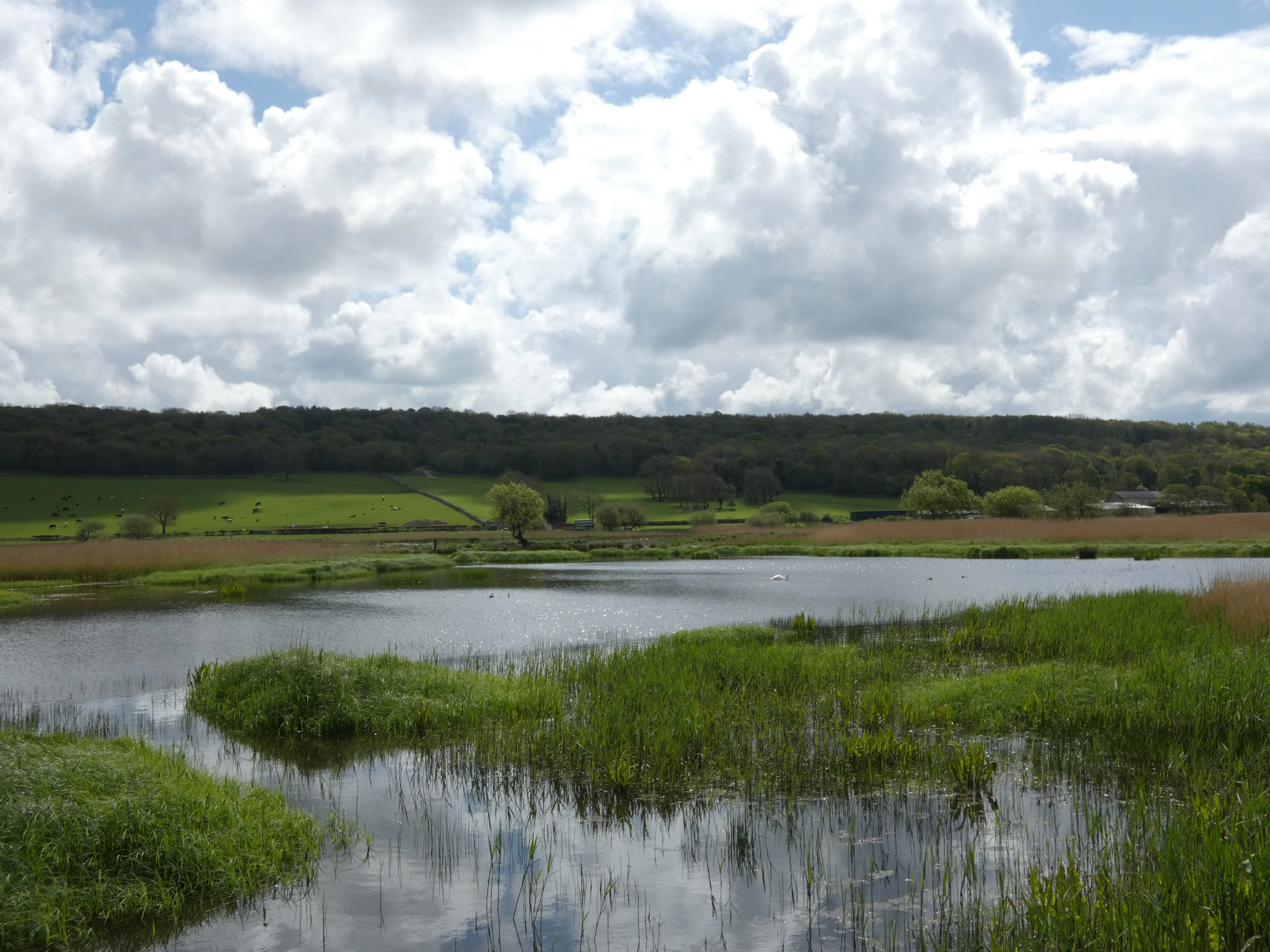
A peaceful landscape view of a reed-fringed pond at Leighton Moss, with green fields and a wooded ridge under a cloudy sky.
A scenic view of the wetlands at Leighton Moss RSPB Reserve, seen from the Grisedale hide.

Leighton Moss RSPB Reserve history and protected-area timeline

The story of Leighton Moss begins in 1822, when the moss passed into the ownership of Richard Gillow, grandson of Lancaster furniture manufacturer Robert Gillow. Using steam-powered drainage technology, Gillow attempted to reclaim the wetland for agriculture, and although the resulting farmland produced good soil, the venture became uneconomic over time. By 1918 the land had largely returned to a flooded state, partly because rising coal prices made continued drainage impractical, and the area was subsequently used for duck shooting.

The modern history of the reserve is closely linked to the Royal Society for the Protection of Birds. The RSPB first leased the moss in 1964 and opened it to visitors in 1965 on a permit-only basis, welcoming 375 people in its first year. In 1974 the charity purchased the site outright from the Leighton Hall estate, although the shooting rights over the land remained with the estate until 1984, when they were finally sold to the RSPB.

In 1985 Leighton Moss was formally designated a Ramsar site, confirming its international wetland significance. Management of the reedbeds has been an ongoing priority, particularly to prevent drying and saline intrusion from the nearby coast. Following declines in the breeding bittern population in the 1990s and 2000s, extensive dynamic habitat management has been undertaken, and numbers have begun to recover. The reserve has also been the focus of public attention through events such as its role in hosting the BBC's Autumnwatch programme in 2013 and 2014.

Leighton Moss RSPB Reserve landscape and geographic character

The landscape of Leighton Moss is shaped by its position on the coastal edge of Morecambe Bay, where low-lying former mossland meets the hills and woodland of the Arnside and Silverdale Area of Outstanding Natural Beauty. The reserve is essentially a wetland mosaic, dominated by extensive reedbeds that fill much of the central area and are bordered by open water, wooded edges, grassy areas, and reed-fringed pools.

Beyond the freshwater reedbeds, the RSPB also manages a substantial area of Morecambe Bay saltmarsh. This tidal landscape is flat, open, and exposed, shaped by the regular rise and fall of the tide and providing a very different setting from the enclosed wetlands of the moss itself. The transition between inland reedbed and coastal mudflat and saltmarsh is one of the defining landscape contrasts of the reserve.

The surrounding terrain offers further variety. Mixed woodland, scrub, and pasture lie around the edges of the wetland, while views across the reserve and out toward Morecambe Bay can be enjoyed from elevated vantage points such as the nine-metre Skytower. The result is a layered landscape in which intimate wetland scenery, woodland paths, and broad coastal panoramas sit in close proximity.
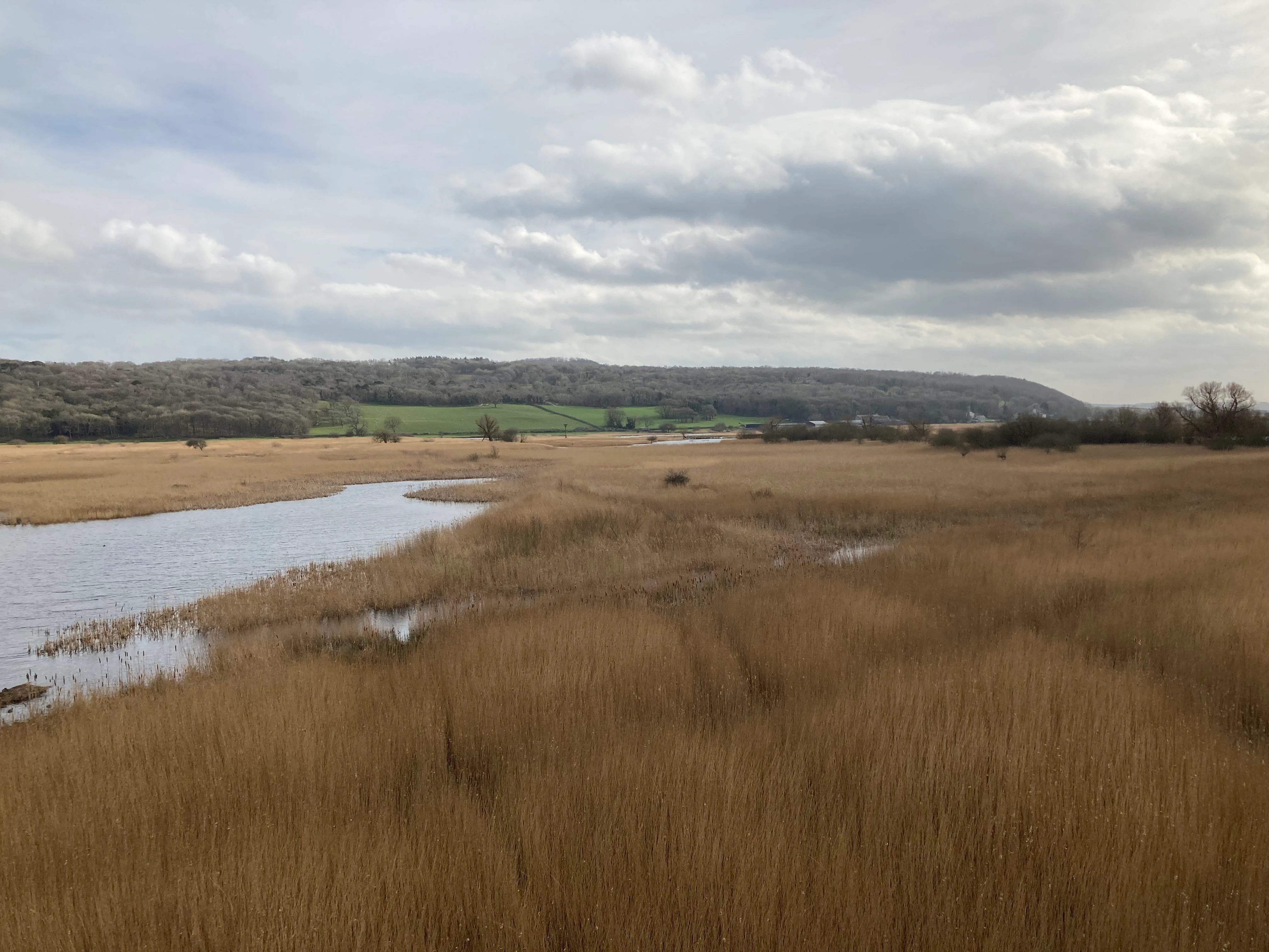
Wide shot of a golden-brown wetland landscape featuring dense reed beds and narrow water channels under a cloudy sky.
A view overlooking the extensive reed beds of Leighton Moss RSPB Reserve.

Leighton Moss RSPB Reserve ecosystems, habitats, and plant life

Leighton Moss is fundamentally a wetland reserve, and its ecological character is defined by its reedbeds and associated freshwater and brackish habitats. The reedbeds are the largest in north-west England and provide the habitat conditions on which much of the reserve's biodiversity depends. They are carefully managed to prevent the reed from drying out and to guard against saline intrusion from the nearby coast, which is one of the most distinctive ecological challenges the site faces.

Around the reedbeds, the reserve offers a range of complementary habitats, including open water for diving and dabbling birds, damp woodland and scrub, meadow areas, and the tidal saltmarsh of Morecambe Bay. Together, these habitats support a particularly varied breeding and wintering bird community. The diversity of habitat types within a relatively small area is one of the key ecological strengths of the site.

Ecological management at Leighton Moss focuses on maintaining the dynamic balance between open water, reedbed, and surrounding vegetation. Without active intervention, reedbeds gradually dry out or become overgrown, which reduces their value for the species that depend on them. The reserve's management approach has evolved to keep these habitats in a productive state, an effort that has been especially important for the recovery of the breeding bittern population.
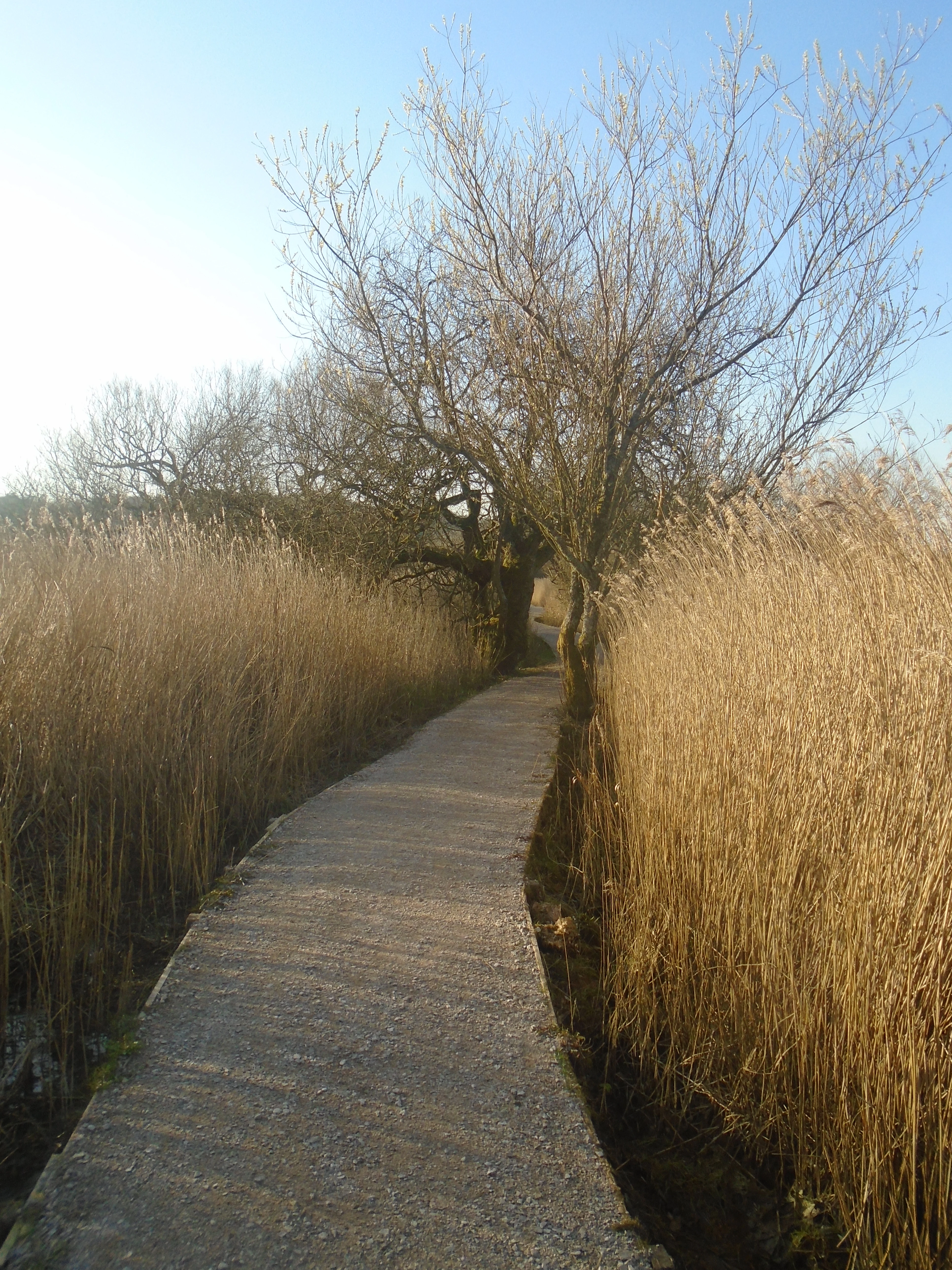
A narrow gravel path leading forward through dense, dry reed beds with a bare tree arching over the center.
A gravel nature trail flanked by tall reeds at Leighton Moss.

Leighton Moss RSPB Reserve wildlife and species highlights

Leighton Moss is best understood through its birdlife. The reserve has long been recognized for its breeding populations of three flagship wetland species: bittern, marsh harrier, and bearded tit. Bitterns in particular have become a symbol of the reserve, with the distinctive booming sound of displaying males audible in spring. Other regularly recorded breeding and resident species include marsh tits, water rails, and a wide variety of wildfowl such as common pochard and Eurasian teal.

The reserve's tidal saltmarsh on Morecambe Bay adds a second wildlife dimension, supporting a breeding colony of avocets that has produced significant numbers of young in some years. Together, the freshwater and coastal habitats give the reserve a particularly rich bird profile across the seasons.

Because of its coastal position, Leighton Moss also attracts a steady flow of rarer visitors. Species such as osprey, Eurasian spoonbill, black tern, and little gull appear fairly regularly, while notable rarities have included red-footed falcon, purple heron, Caspian tern, great reed warbler, Savi's warbler, American wigeon, great grey shrike, green-winged teal, and European honey-buzzard. Beyond the birds, the reserve also supports populations of red deer and otters, adding a further layer of mammal interest to the site.
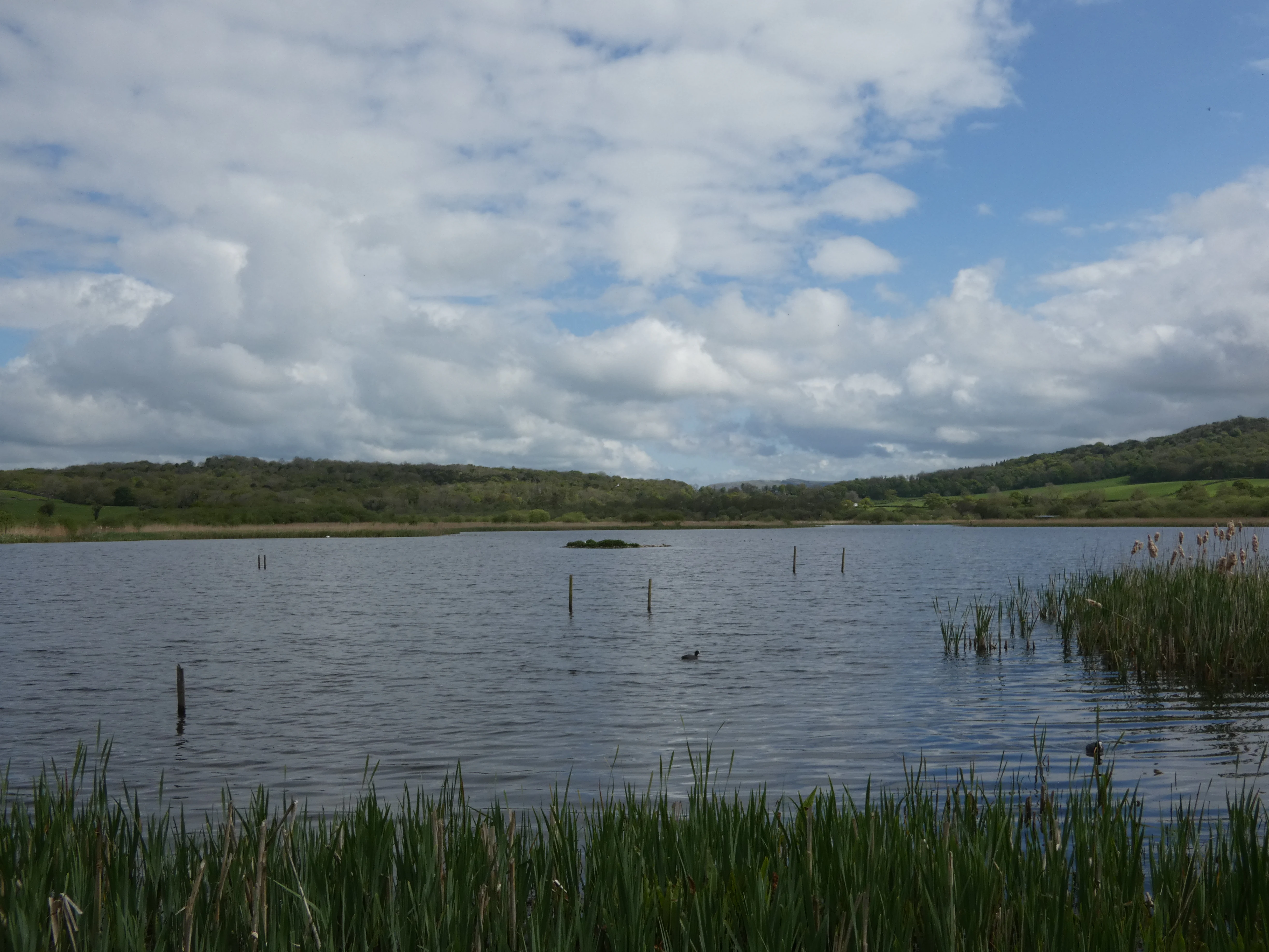
A wide view of a calm lake in Leighton Moss with green reeds in the foreground and low hills in the distance under a cloudy sky.
View across the reed bed and lake from the Causeway Hide at Leighton Moss.

Leighton Moss RSPB Reserve conservation status and protection priorities

Leighton Moss has strong conservation significance at both national and international levels. As a Ramsar site designated in 1985, it is recognized as a wetland of international importance under the Ramsar Convention, which highlights its value for waterbirds, ecological character, and hydrological function. It is also a Site of Special Scientific Interest, a Special Protection Area, and an Important Bird Area, reflecting its importance under UK and European nature conservation frameworks.

The reserve's conservation value lies primarily in its reedbeds and the species they support. Reedbeds are among the most threatened habitats in lowland Britain, and the large, well-managed reedbed complex at Leighton Moss is a significant national resource. Active management to prevent drying and saline intrusion has been central to maintaining this habitat, particularly as climate and coastal processes put pressure on wetland sites around Morecambe Bay.

Bitterns have served as a key indicator of conservation success at the site. After declines in the 1990s and 2000s, the breeding population has been recovering thanks to dynamic habitat management, illustrating how ongoing intervention can restore conditions for highly sensitive species. Beyond bitterns, the reserve's combined freshwater and saltmarsh habitats make it an important refuge for a wider suite of wetland and coastal birds, including breeding marsh harriers, bearded tits, and avocets.

Leighton Moss RSPB Reserve cultural meaning and human context

Leighton Moss has a layered human history that continues to shape the reserve today. The moss was once drained for agriculture by Richard Gillow in the nineteenth century, and the remnants of that land-use history can still be read in the surrounding field patterns and estate boundaries. The later use of the area as a duck shooting ground reflects a long-standing cultural connection between wetland landscapes in this part of Lancashire and traditional country pursuits.

The RSPB's long-term presence, beginning with the initial lease in 1964 and the purchase of the land in 1974, has gradually transformed the reserve into a place where conservation, public access, and local identity come together. The reserve lies within the Arnside and Silverdale Area of Outstanding Natural Beauty, a designation that recognizes the cultural as well as natural value of the surrounding landscape, and Silverdale itself remains a small rural community closely associated with the reserve.

Top sights and standout views in Leighton Moss RSPB Reserve

The single most distinctive feature of Leighton Moss is its status as the largest reedbed in north-west England, a habitat that anchors the reserve's identity and supports many of its most important species. The combination of extensive freshwater reedbed with adjoining Morecambe Bay saltmarsh is unusually rich and gives the site an ecological profile that very few other reserves in the region can match.

The reserve's birdlife stands out as another major highlight. Breeding bitterns, marsh harriers, bearded tits, and avocets provide a continuous seasonal narrative, while rarer visitors add an element of unpredictability that keeps Leighton Moss on the radar of birdwatchers. The combination of strong conservation designations, active habitat management, and accessible facilities makes the reserve a place where ecological importance and visitor experience reinforce one another.

Best time to visit Leighton Moss RSPB Reserve

Leighton Moss offers different experiences at different times of year, and the character of a visit depends largely on what species and landscapes visitors most want to see. Spring is arguably the most distinctive season, when male bitterns boom across the reedbeds and marsh harriers and bearded tits are most active. This is also when the surrounding woodland and scrub come into leaf, giving the reserve a layered appearance of woodland edge and open wetland.

Summer brings breeding activity across the reserve, including the chance to see bearded tit family groups and other wetland species in their full seasonal cycle. Autumn and winter can be rewarding for wildfowl and visiting birds, with colder weather often bringing additional species to the pools and tidal areas. Because the reserve is open year-round, visitors can choose a season that matches the type of wildlife or scenery they want to experience.
Monthly climate preview

Long term temperature ranges and precipitation trends across twelve representative months

Leighton Moss RSPB Reserve Climate Normals and Annual Weather Patterns

Leighton Moss RSPB Reserve exhibits a measured annual cycle of mean temperatures ranging from 3.18 degrees Celsius to 14.85 degrees Celsius alongside daily precipitation variations. Reviewing the complete monthly climate normals provides deeper analytical depth regarding long term meteorological conditions at the sampled coordinate.
Annual mean9 °C
3 °C15 °C
Jan
Feb
Mar
Apr
May10°
Jun13°
Jul15°
Aug15°
Sep12°
Oct
Nov
Dec
Warmest month
July

14.9 °C

Coolest month
January

3.2 °C

Wettest month
December

3.8 mm/day

Driest month
April

2.3 mm/day

Park location guide

Geography guide, regional context, and park location map for Leighton Moss RSPB Reserve

Leighton Moss RSPB Reserve park geography, regions, and map view in United Kingdom

Understand where Leighton Moss RSPB Reserve sits in United Kingdom through a broader geographic reading of the surrounding landscape, nearby location context, and its mapped position within the national park landscape.

How Leighton Moss RSPB Reserve fits into United Kingdom

The United Kingdom is a parliamentary constitutional monarchy located in northwestern Europe, consisting of four constituent countries: England, Scotland, Wales, and Northern Ireland. As a major global power with over 69 million residents, it maintains significant international influence in politics, economics, and culture.

Wider geography shaping Leighton Moss RSPB Reserve in United Kingdom

The United Kingdom is an island nation located in northwestern Europe, surrounded by the Atlantic Ocean, North Sea, English Channel, Celtic Sea, and Irish Sea. It shares a land border with the Republic of Ireland to the west. The territory includes the island of Great Britain, the northeastern portion of Ireland, and most of the smaller British Isles islands.

Map view of Leighton Moss RSPB Reserve

Use this park location map to pinpoint Leighton Moss RSPB Reserve in United Kingdom, understand its exact geographic position, and read its mapped placement within the surrounding landscape more clearly.

Pigeon | © OpenStreetMap contributors

Location context for Leighton Moss RSPB Reserve

EnglandLancashire

Visual reference of wetland habitats, coastal saltmarshes, and reserve terrain.

Leighton Moss RSPB Reserve Photos: Scenery, Reedbeds, and Protected Landscapes

Photographic documentation reveals the intricate mosaic of extensive reedbeds, open water, and coastal saltmarshes that shape the protected environment. Visual exploration of the terrain highlights distinct ecological transitions between inland wetland systems and Morecambe Bay coastal influences.

A peaceful landscape view of a reed-fringed pond at Leighton Moss, with green fields and a wooded ridge under a cloudy sky.

A large flock of geese flying over a calm water body and golden-brown reed beds, with farm buildings and hills in the background.

Wide shot of a golden-brown wetland landscape featuring dense reed beds and narrow water channels under a cloudy sky.

A narrow gravel path leading forward through dense, dry reed beds with a bare tree arching over the center.

A wide view of a calm lake in Leighton Moss with green reeds in the foreground and low hills in the distance under a cloudy sky.

Park atlas

Compare regional wetland habitats, coastal saltmarshes, and nearby protected reserves.

Explore Parks Near Leighton Moss RSPB Reserve and Connected Protected Landscapes

Visitors exploring Leighton Moss RSPB Reserve can expand their geographic comparison across nearby protected areas and regional wetland habitats. Analyzing surrounding conservation landscapes helps reveal broader ecological patterns throughout northern England.
Watercolor painting showing a lake, green hills, and sky
National parkCumbria
About 4.9 km away#1 closest

Northwest

Lake District National Park: Protected Landscape Atlas and Geographic Exploration

Mapped mountain terrain and glacial valleys in Cumbria

Delve into the geography of Lake District National Park, a protected area renowned for its dramatic mountainous terrain, U-shaped glacial valleys, and stunning natural lakes. This atlas perspective highlights the park's unique landscape features, mapped boundaries, and its significance within Cumbria, offering a comprehensive view for geographic discovery.

Area
2,292 km²
Established
1951
IUCN
V
Relief
Mountain
Watercolor painting of green hills, a stream, and grassy areas
National parkNorth Yorkshire
About 13 km away#2 closest

East

Yorkshire Dales National Park: A Protected Landscape in North Yorkshire

Explore mapped boundaries and distinctive limestone terrain.

Yorkshire Dales National Park offers a rich tapestry of mapped natural landscapes, characterized by its iconic limestone valleys, U-shaped glacial formations, and rolling heather-clad moorlands. Situated within North Yorkshire, this protected area showcases a unique karst geology, evident in features like Malham Cove and extensive cave systems. The park's traditional dry-stone walls and working farms contribute to a living cultural landscape, making it a prime destination for atlas-driven geographic discovery and understanding regional terrain.

Area
2,178 km²
Established
1954
IUCN
V
Relief
Mountain
Marine protected areaEngland
About 49 km away#3 closest

West

West of Walney Marine Protected Area: Irish Sea Geographic and Seabed Analysis

Mapped protected landscape in northwest England

West of Walney is a major marine protected area off the Cumbrian coast, notable for its 388 square kilometre coverage of subtidal mud and sand habitats. This site is uniquely shaped by its overlap with offshore wind energy infrastructure, providing a distinct study in regional conservation and seabed management within the Irish Sea.

Area
388 km²
Established
2016
Relief
Lowland
Climate
Temperate
Nature reserveWest Yorkshire
About 72 km away#4 closest

Southeast

Bradford Pennine Gateway: Protected Pennine Fringe Geography in West Yorkshire

A sprawling network of moorland, wetlands, and gritstone valleys.

Spanning over a thousand hectares, this protected nature reserve integrates varied terrain across the Bradford district. From the ancient post-glacial sediments of Bingley North Bog to the sweeping gritstone plateaus, the reserve provides essential habitat for upland bird species and rare reptiles. It stands as a vital corridor of wilderness within the northern landscape, illustrating the geological character of the South Pennines.

Area
12.74 km²
Established
2025
Water
Minor water
Season
Year-round
Watercolor illustration of a coastal bay with green grassy foreground and distant purple hills against a plain white background.
Marine protected areaCumbria
About 79 km away#5 closest

Northwest

Allonby Bay Marine Protected Area: Coastal Landscapes and Roman Archaeology in Cumbria

A vital protected coastal stretch along the Solway Firth.

Discover the unique geography of Allonby Bay, a marine protected zone distinguished by its sweeping dunes, honeycomb worm reefs, and saline marshes. Situated along the Solway coast of Cumbria, the area serves as a critical habitat for marine species while housing significant Roman milefortlets that mark the historic frontier of northern England.

Area
40 km²
Established
2016
Relief
Lowland
Climate
Temperate
National parkUnited Kingdom
About 84 km away#6 closest

Southeast

Peak District National Park: Explore Protected Landscape and Regional Geography

Mapped boundaries and natural terrain context for this UK national park.

Investigate the Peak District National Park, a cornerstone of the United Kingdom's protected natural areas. This MoriAtlas entry provides essential details on its geographic scope, mapped boundaries, and landscape characteristics. Engage with structured data to understand how this national park fits into the atlas of the United Kingdom, supporting detailed geographic and protected-area discovery for researchers and explorers.

Area
1,440 km²
Established
1951
IUCN
V
Visitors
13M annual
Watercolor illustration of Hadrian's Wall stretching across rolling green hills with distant mountains and trees under a sunset sky
National parkNorthumberland
About 93 km away#7 closest

North

Northumberland National Park: England's Northernmost Protected Landscape and Dark Sky Wilderness

Explore its mapped boundaries, Roman heritage, and remote moorland terrain.

Northumberland National Park protects over 1,050 square kilometers of remote and stunning natural beauty in northern England, bordering Scotland. This page provides a structured overview of its protected landscape, focusing on its geographic context within the county of Northumberland, its designation as a National Park, and its renowned status as Europe's largest Dark Sky Park. Users can discover the park's characteristic moorland terrain, the archaeological significance of Hadrian's Wall, and the vast expanses of Kielder Forest, offering an atlas-level understanding of this unique frontier landscape.

Area
1,050 km²
Established
1956
IUCN
V
Relief
Highland
Watercolor illustration showing rolling hills, green vegetation, and a pale sky
National parkNorth Yorkshire
About 114 km away#8 closest

East

North York Moors National Park: Explore its Protected Landscape and Geography

Discover mapped moorland, dales, and coastlines.

The North York Moors National Park is a vital protected landscape in North Yorkshire, celebrated for its extensive heather moorland and distinctive deeply incised dales. This page provides an atlas-style exploration of the park's geography, highlighting its unique terrain, mapped boundaries, and its integral role within the regional landscape context. Understand the diverse natural features that define this iconic national park, from the upland plateau to the dramatic Jurassic coast.

Area
1,430 km²
Established
1952
IUCN
V
Relief
Upland

Common questions about visiting, size, designation, and location context for Leighton Moss RSPB Reserve

Leighton Moss RSPB Reserve FAQs for park facts, access, geography, and protected area context

Find quick answers about Leighton Moss RSPB Reserve, including protected-area facts, park geography, trail and visitor context, and how the park fits into its surrounding country and regional landscape.
MoriAtlas Explorer

Continue Your Protected Areas Search Across the Global Atlas

Deepen your exploration by continuing the structured search for national parks and protected areas worldwide. Utilize the comprehensive filtering capabilities to compare different conservation landscapes and refine your understanding of global park geography. Discover more about the distribution and characteristics of protected natural areas.

Global natural geography