Mori Atlas logo
Nearby park discovery

Geographic atlas and landscape context for protected lands surrounding this wetland habitat

Parks and Protected Areas Located Near Leighton Moss RSPB Reserve in Lancashire

Examine the geographic distribution of protected areas and parks situated near Leighton Moss RSPB Reserve in Lancashire. This data visualization explores regional landscape context, mapping the proximity of surrounding wetlands, woodlands, and coastal reserves to provide a clearer understanding of the local natural terrain.

A flat-style digital illustration depicting a winding river or water channel flowing through a marshy wetland with tall grasses in the foreground and green hills in the background.

North-west England's largest reedbed, managed by the RSPB on the edge of Morecambe Bay.

Leighton Moss RSPB Reserve

Leighton Moss RSPB Reserve is a nature reserve in Lancashire, England, near the village of Silverdale and the town of Carnforth. It sits on the edge of Morecambe Bay within the Arnside and Silverdale Area of Outstanding Natural Beauty, where coastal influences meet inland wetland systems. The reserve has been managed by the Royal Society for the Protection of Birds since 1964 and contains the largest area of reed bed in north-west England. The wetland complex of pools, reedbeds, and woodland supports a rich community of birds, mammals, and other wildlife. Species such as bearded tits, marsh harriers, bitterns, otters, and red deer are all present on the reserve, while the RSPB also protects an adjoining area of saltmarsh on Morecambe Bay that hosts breeding avocets. Because of its ecological value, Leighton Moss has been recognized as a Ramsar site, a Site of Special Scientific Interest, a Special Protection Area, and an Important Bird Area. Beyond its wildlife significance, the reserve is a well-established destination for visitors interested in wetland landscapes, birdwatching, and accessible nature experiences in the north of England. Trails, hides, a visitor centre, and viewing structures such as the Skytower allow close engagement with the reserve's distinctive scenery and birdlife throughout the year.

Location
United Kingdom
Park type
Wildlife reserve
Established
1964
Leighton Moss RSPB Reserve Geography and Map
Regional park map

See the ranked park cluster in its geographic setting

Nearby parks around Leighton Moss RSPB Reserve

This regional map shows the same 20 nearby parks ranked below around Leighton Moss RSPB Reserve. Select a ranked marker to highlight that park’s boundary where boundary data is available.
Reference park: Leighton Moss RSPB ReserveRanked nearby park20 nearby parks shown
20 nearby parks

Distance ranked collection of regional park geography and surrounding protected landscapes

Parks and Protected Areas Geographically Near Leighton Moss RSPB Reserve

Spatial proximity measurements establish a structured ranking of protected areas situated geographically near Leighton Moss RSPB Reserve. Geographic separation and recorded environmental attributes provide comparative baseline metrics for evaluating surrounding regional park topography.
Watercolor painting showing a lake, green hills, and sky
National parkCumbria
About 4.9 km away#1 closest

Northwest

Lake District National Park: Protected Landscape Atlas and Geographic Exploration

Mapped mountain terrain and glacial valleys in Cumbria

Delve into the geography of Lake District National Park, a protected area renowned for its dramatic mountainous terrain, U-shaped glacial valleys, and stunning natural lakes. This atlas perspective highlights the park's unique landscape features, mapped boundaries, and its significance within Cumbria, offering a comprehensive view for geographic discovery.

Area
2,292 km²
Established
1951
IUCN
V
Relief
Mountain
Watercolor painting of green hills, a stream, and grassy areas
National parkNorth Yorkshire
About 13 km away#2 closest

East

Yorkshire Dales National Park: A Protected Landscape in North Yorkshire

Explore mapped boundaries and distinctive limestone terrain.

Yorkshire Dales National Park offers a rich tapestry of mapped natural landscapes, characterized by its iconic limestone valleys, U-shaped glacial formations, and rolling heather-clad moorlands. Situated within North Yorkshire, this protected area showcases a unique karst geology, evident in features like Malham Cove and extensive cave systems. The park's traditional dry-stone walls and working farms contribute to a living cultural landscape, making it a prime destination for atlas-driven geographic discovery and understanding regional terrain.

Area
2,178 km²
Established
1954
IUCN
V
Relief
Mountain
Marine protected areaEngland
About 49 km away#3 closest

West

West of Walney Marine Protected Area: Irish Sea Geographic and Seabed Analysis

Mapped protected landscape in northwest England

West of Walney is a major marine protected area off the Cumbrian coast, notable for its 388 square kilometre coverage of subtidal mud and sand habitats. This site is uniquely shaped by its overlap with offshore wind energy infrastructure, providing a distinct study in regional conservation and seabed management within the Irish Sea.

Area
388 km²
Established
2016
Relief
Lowland
Climate
Temperate
Nature reserveWest Yorkshire
About 72 km away#4 closest

Southeast

Bradford Pennine Gateway: Protected Pennine Fringe Geography in West Yorkshire

A sprawling network of moorland, wetlands, and gritstone valleys.

Spanning over a thousand hectares, this protected nature reserve integrates varied terrain across the Bradford district. From the ancient post-glacial sediments of Bingley North Bog to the sweeping gritstone plateaus, the reserve provides essential habitat for upland bird species and rare reptiles. It stands as a vital corridor of wilderness within the northern landscape, illustrating the geological character of the South Pennines.

Area
12.74 km²
Established
2025
Water
Minor water
Season
Year-round
Watercolor illustration of a coastal bay with green grassy foreground and distant purple hills against a plain white background.
Marine protected areaCumbria
About 79 km away#5 closest

Northwest

Allonby Bay Marine Protected Area: Coastal Landscapes and Roman Archaeology in Cumbria

A vital protected coastal stretch along the Solway Firth.

Discover the unique geography of Allonby Bay, a marine protected zone distinguished by its sweeping dunes, honeycomb worm reefs, and saline marshes. Situated along the Solway coast of Cumbria, the area serves as a critical habitat for marine species while housing significant Roman milefortlets that mark the historic frontier of northern England.

Area
40 km²
Established
2016
Relief
Lowland
Climate
Temperate
National parkUnited Kingdom
About 84 km away#6 closest

Southeast

Peak District National Park: Explore Protected Landscape and Regional Geography

Mapped boundaries and natural terrain context for this UK national park.

Investigate the Peak District National Park, a cornerstone of the United Kingdom's protected natural areas. This MoriAtlas entry provides essential details on its geographic scope, mapped boundaries, and landscape characteristics. Engage with structured data to understand how this national park fits into the atlas of the United Kingdom, supporting detailed geographic and protected-area discovery for researchers and explorers.

Area
1,440 km²
Established
1951
IUCN
V
Visitors
13M annual
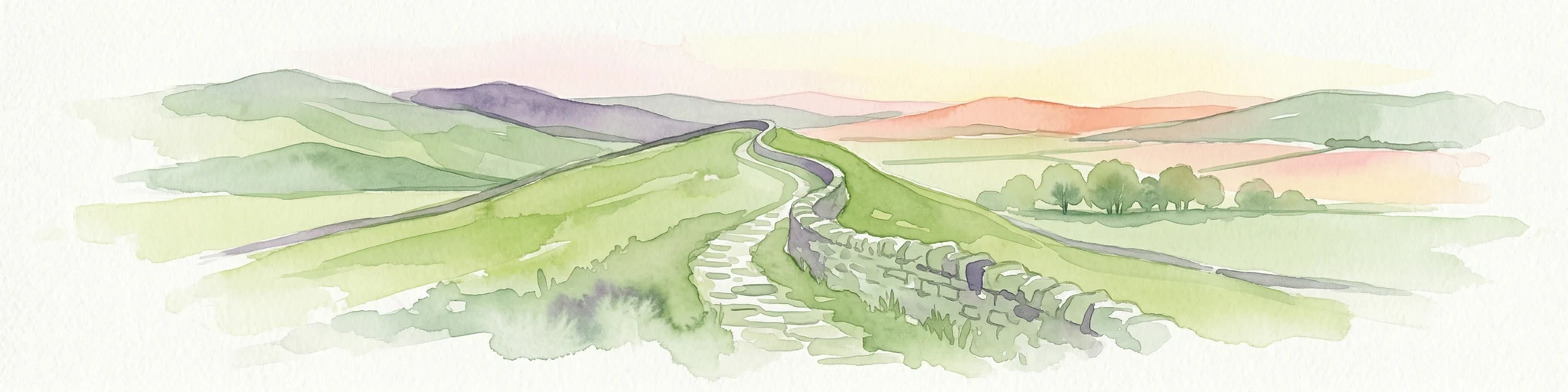
Watercolor illustration of Hadrian's Wall stretching across rolling green hills with distant mountains and trees under a sunset sky
National parkNorthumberland
About 93 km away#7 closest

North

Northumberland National Park: England's Northernmost Protected Landscape and Dark Sky Wilderness

Explore its mapped boundaries, Roman heritage, and remote moorland terrain.

Northumberland National Park protects over 1,050 square kilometers of remote and stunning natural beauty in northern England, bordering Scotland. This page provides a structured overview of its protected landscape, focusing on its geographic context within the county of Northumberland, its designation as a National Park, and its renowned status as Europe's largest Dark Sky Park. Users can discover the park's characteristic moorland terrain, the archaeological significance of Hadrian's Wall, and the vast expanses of Kielder Forest, offering an atlas-level understanding of this unique frontier landscape.

Area
1,050 km²
Established
1956
IUCN
V
Relief
Highland
Watercolor illustration showing rolling hills, green vegetation, and a pale sky
National parkNorth Yorkshire
About 114 km away#8 closest

East

North York Moors National Park: Explore its Protected Landscape and Geography

Discover mapped moorland, dales, and coastlines.

The North York Moors National Park is a vital protected landscape in North Yorkshire, celebrated for its extensive heather moorland and distinctive deeply incised dales. This page provides an atlas-style exploration of the park's geography, highlighting its unique terrain, mapped boundaries, and its integral role within the regional landscape context. Understand the diverse natural features that define this iconic national park, from the upland plateau to the dramatic Jurassic coast.

Area
1,430 km²
Established
1952
IUCN
V
Relief
Upland
Watercolor illustration of rolling mountains and green valleys with distant peaks
National parkWales
About 120 km away#9 closest

Southwest

Snowdonia National Park: Protected Landscape and Map Exploration in North Wales

Mountain terrain, glacial lakes, and regional geography.

Snowdonia National Park offers a profound exploration of mountainous protected landscapes in North Wales. This page details the park's mapped boundaries, revealing a terrain shaped by glaciation, featuring dramatic peaks like Snowdon, steep valleys, and pristine glacial lakes. Understand its geographic identity within the United Kingdom and how its protected status contributes to the regional landscape context, providing a unique focus for atlas-based discovery.

Area
2,142 km²
Established
1951
IUCN
V
Relief
Mountain
Protected landscapeScottish Borders
About 165 km away#10 closest

North

Upper Tweeddale National Scenic Area: Geography and Protected Landscape Atlas Map

Regional landscape profile in the Scottish Borders

Upper Tweeddale National Scenic Area encompasses 12,770 hectares of refined southern Scottish countryside. This atlas entry provides an overview of the area landscape, defined by its narrow river valley, tributary glens, and the significant upland plateau of the Tweedsmuir Hills. Examine the geographic intersection of protected habitats, historic estates, and the winding course of the River Tweed.

Area
128 km²
Established
1981
Relief
Upland
Climate
Temperate
Watercolor painting of soft, rolling green hills and dunes with purple mountain peaks in the distance against a white background.
Nature reserveCounty Down
About 199 km away#11 closest

West

Murlough Nature Reserve: Coastal Dune and Heathland Atlas of County Down

A historic protected peninsula along the shores of Dundrum Bay.

Located in County Down, Murlough Nature Reserve stands as the largest dune heathland in Ireland. This protected landscape encompasses a complex system of sand dunes and open heath, set against the backdrop of the Mourne Mountains. The reserve provides a unique vantage point for understanding coastal geomorphology, invertebrate-rich habitats, and the long-term interaction between shoreline dunes and upland mountainous geography.

Area
2.82 km²
Established
1967
Relief
Lowland
Climate
Temperate
A soft watercolor illustration featuring green rolling hills; pink foliage; and a calm bay under a pale sky.
Marine protected areaScotland
About 214 km away#12 closest

Northwest

Lamlash Marine Protected Area: Coastal Geography and Protected Waters in Scotland

Maritime terrain and conservation landscapes of the Firth of Clyde

Located along the eastern coast of the Isle of Arran, the Lamlash Marine Protected Area serves as a landmark for community-led conservation in Scotland. The site protects a vital marine ecosystem including maerl beds within a sheltered natural harbour, providing a distinct study of coastal boundaries and marine terrain facing Holy Isle across the Firth of Clyde.

Established
2008
Visitors
1.1K annual
Relief
Lowland
Climate
Temperate
A soft-toned watercolor painting of the Dyfi estuary in Wales, showing marshy foreground, water, and distant trees under a pale, minimalist sky.
Biosphere reserveWales
About 220 km away#13 closest

South

Dyfi Biosphere: Mapped Protected Landscapes and Coastal Geography in Western Wales

Discover the estuarine wetlands, raised mires, and Atlantic woodlands of a key Welsh biosphere reserve

The Dyfi Biosphere provides a comprehensive look at the geography of a protected coastal region in Wales. Its boundaries encompass diverse terrain ranging from the Ynyslas sand spit and salt marshes to the primary raised mire of Cors Fochno. This landscape functions as a vital wetland system, offering a clear visual representation of dune succession, peatland growth, and temperate Atlantic woodland ecosystems within a single, interconnected, and carefully monitored geographic area.

Area
15.89 km²
Established
1977
Relief
Mixed relief
Climate
Temperate
Watercolor illustration showing mountains, green forests, a loch, and a river in a landscape
National parkScotland
About 232 km away#14 closest

Northwest

Loch Lomond and The Trossachs National Park: Mapped Landscapes and Terrain

Regional geography and protected Highland boundaries in Scotland

Loch Lomond and The Trossachs National Park covers a vast array of protected habitats, from coastal sea lochs to high-altitude Munros. This geographic profile outlines the park's position across the Highland Boundary Fault, highlighting its role as a core protected area for Caledonian forests and freshwater lake ecosystems within Scotland.

Area
1,865 km²
Established
2002
IUCN
V
Visitors
2.9M annual
Watercolor illustration of a mountainous landscape with lakes and greenery
National parkWales
About 233 km away#15 closest

South

Brecon Beacons National Park: Explore Wales' Iconic Protected Mountain Landscape

Discover mapped terrain, park boundaries, and regional geography.

Brecon Beacons National Park, officially Bannau Brycheiniog, stands as a premier protected area within Wales, covering over 1,344 square kilometers of striking mountainous terrain. This national park is defined by its dramatic Old Red Sandstone ranges, including Pen y Fan, South Wales' highest peak, and features diverse landscapes from heather moorland to extensive river valleys. Its mapped boundaries encompass unique geological features, significant historical sites, and provide context for regional geographic exploration, making it a key destination for understanding protected lands in the UK.

Area
1,344 km²
Established
1957
IUCN
V
Visitors
4.4M annual
Nature reserveNorthern Ireland
About 235 km away#16 closest

West

Oxford Island National Nature Reserve: Protected Wetland Landscapes of Northern Ireland

Lakeshore habitats and woodland geography at Lough Neagh

Oxford Island is a prominent nature reserve where terrestrial woodland meets the expansive waters of Lough Neagh. The site showcases a transition of reed beds and meadows that serve as vital ecological assets within the regional geography of Northern Ireland, offering a dense, accessible look at lowland wetland environments.

Area
1.14 km²
Relief
Lowland
Climate
Temperate
Access
Easy access
A soft watercolor painting of a landscape featuring green rolling hills, a suggestion of a reflective body of water, and layers of purple distant mountains against a light sky.
National parkScotland
About 241 km away#17 closest

Northwest

Loch Lomond and The Trossachs National Park: Geographic and Protected Area Overview

Tracing Highland and Lowland transition zones in Scotland

This protected area captures the contrast between the rugged mountainous terrain of the northern Trossachs and the gentler southern loch basins. By examining the Highland Boundary Fault, users can analyze how glaciers carved the landscape, creating the deep fjord-like trenches and islands that define the region's unique natural geography.

Area
71 km²
Established
2002
Relief
Mountain
Climate
Temperate
Protected areaCounty Antrim
About 241 km away#18 closest

Northwest

Slieveanorra Forest Protected Area: Geography, Maps, and Upland Landscape Context

A comprehensive look at the Antrim forest and glacial landscape.

Slieveanorra Forest serves as a prominent protected area within the County Antrim uplands. Featuring expansive conifer woodlands, the site includes rugged terrain, reservoir edges, and scenic summit views. Understand the geological and environmental composition of this working forest landscape through its mapped boundaries and regional context.

Relief
Upland
Water
Minor water
An illustration of a green meadow in the foreground with forest, steep cliffs, and a narrow waterfall in the background under a pale sky with soft pink clouds.
National parkCounty Meath
About 244 km away#19 closest

West

Boyne Valley National Park: Protected River Floodplains and Neolithic Landscapes

Geographic atlas overview for County Meath, Ireland

Boyne Valley National Park encompasses a significant riparian corridor along the River Boyne, serving as a sanctuary for diverse freshwater species and a guardian of major megalithic monuments. This protected area offers insight into the confluence of Irish ecological preservation and prehistoric archaeological heritage within a managed, low-lying floodplain setting.

Area
2.23 km²
Established
2023
IUCN
II
Relief
Lowland
Nature reserveNorthern Ireland
About 248 km away#20 closest

West

Lough Beg Nature Reserve: Mapping the Wetlands and Floodplains of Northern Ireland

An essential protected landscape within the Lough Neagh basin.

Lough Beg provides a distinct geographic study of freshwater ecosystems and alluvial landscapes. As a designated nature reserve, it forms a crucial link in the Lower Bann catchment, characterized by its shallow waters and seasonal pasture flooding. The area serves as a primary hub for migratory bird species, while the historic Church Island offers a unique convergence of early Christian heritage and natural wetland terrain.

Relief
Lowland
Climate
Temperate
Access
Easy access
Scope
Terrestrial
Distance methodology

Geographic measurements, not driving distances

How nearby park distances are calculated

Distances use park boundaries whenever the available geometry allows it. When one or both boundaries are missing, the mapped park locations provide a clearly labelled estimate. Every value represents straight-line geographic separation and does not use roads or routing.

Boundary distance

Calculated between the nearest points of both park boundaries.

Location-to-boundary estimate

Estimated from one mapped park location to the nearest boundary of the other park.

Mapped-location estimate

Estimated between the mapped locations of both parks.

MoriAtlas Explorer

Trace the Wetland Landscapes of Leighton Moss RSPB Reserve on the MoriAtlas

Investigate the unique terrain of Leighton Moss RSPB Reserve, from its extensive freshwater reedbeds to its coastal saltmarsh boundaries. MoriAtlas provides structured geographic insight into this vital Lancashire protected area, helping you visualize the intersection of inland and tidal ecological systems.