
Mori Atlas logo
Protected landscapeLincoln National Forest

Examining the vertical transition from desert lowlands to sub-alpine forests and mountain ridges

Lincoln National Forest Protected Landscape: A Geographic Analysis of New Mexico Mountain Terrain

Lincoln National Forest preserves a dramatic environmental gradient spanning over one million acres in southeastern New Mexico. This protected landscape stretches from the gypsum scrublands of the Chihuahuan Desert up to the windswept crests of the Sacramento, White, and Capitan Mountains. The terrain offers a unique study in regional geography, documenting the rapid shift from arid basins to dense ponderosa pine, Douglas fir, and aspen woodlands that define the high-elevation zones of the American Southwest.

national forestsouthern New MexicoSacramento MountainsGuadalupe MountainsCapitan MountainsSierra Blanca
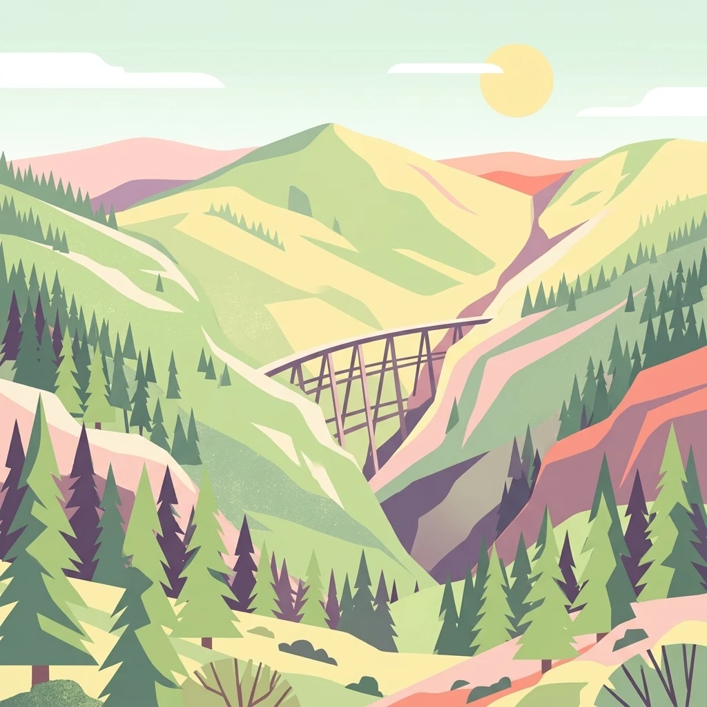
A stylized illustration of a high wooden trestle bridge crossing a steep canyon between two lush green mountain ridges with coniferous trees in the foreground.

Lincoln National Forest

Protected landscape

Park overview

Structured park overview, official facts, and landscape profile for Lincoln National Forest

Lincoln National Forest park facts, protected area profile, and essential visitor context

Review the core facts for Lincoln National Forest, including designation, size, terrain, visitor scale, habitats, and operating context in one park-focused overview.

About Lincoln National Forest

Lincoln National Forest is a 1.1 million acre U.S. National Forest in southern and southeastern New Mexico, occupying parts of Chaves, Eddy, Lincoln, and Otero counties. It begins near the Texas state line in the Guadalupe Mountains and extends northwest across the Sacramento, Capitan, and White Mountains, encompassing desert basins, forested highlands, and sub-alpine ridges. The forest is managed by the U.S. Forest Service from its headquarters in Alamogordo, with district offices in Ruidoso, Cloudcroft, and Carlsbad.

The defining character of the forest is its extraordinary ecological range. Its lowest elevations sit at the floor of the Chihuahuan Desert near Alamogordo and Carlsbad, where creosote, agave, and yucca dominate the landscape, while its high country rises above 11,000 feet on Sierra Blanca Peak, where visitors find cool forests of Douglas fir, ponderosa pine, and aspen, plus open grasslands above the tree line. Mid-elevations are characterized by piñon pine and juniper woodlands, oaks, and mixed conifer stands that have long supported both wildlife and human use.

Three ranger districts divide the modern forest into administratively distinct units. The Smokey Bear Ranger District covers the Capitan Mountains and the White Mountains around Ruidoso and Capitan, including both designated wilderness areas and the Ski Apache winter recreation area. The Sacramento Ranger District rises directly east of Alamogordo in the heavily forested Sacramento Mountains, anchored by the village of Cloudcroft. The Guadalupe Ranger District follows the New Mexico portion of the Guadalupe Mountains from the Texas border northwest along the spine of the range toward the Pecos River valley near Carlsbad.

Lincoln National Forest is also a place of deep human history. Pre-Columbian inhabitants included the Mescalero Apache, and the region gained wider fame through the violent Lincoln County War of 1878 to 1879, whose events took place in and around the village of Lincoln itself. Twentieth-century forestry brought the construction of railroads for timber transport, the establishment of lookout towers under the Civilian Conservation Corps, and the dramatic story of Smokey Bear, all of which contribute to the forest's enduring cultural identity.

Quick facts and research context for Lincoln National Forest

Lincoln National Forest is a federally administered national forest in south-central and southeastern New Mexico, managed by the U.S. Forest Service from its headquarters in Alamogordo. It spans parts of Chaves, Eddy, Lincoln, and Otero counties, beginning near the Texas border and extending northwest into several distinct mountain systems.

The forest contains three major mountain ranges: the Sacramento, Guadalupe, and Capitan Mountains, with a fourth range, the Sierra Blanca or White Mountains, partially included within the Smokey Bear Ranger District. Elevations run from relatively low desert environments to peaks above 11,000 feet, producing a rapid transition between biological zones.

Lincoln National Forest was originally proclaimed the Lincoln Forest Reserve in 1902, later absorbed additional reserves, and today combines the lands once managed as the Alamo and Gallinas national forests. The Capitan Mountains Wilderness and the White Mountain Wilderness are the forest's two federally designated wilderness areas.

Protection and recognition

Documented terrestrial conservation boundaries and international recognition records

Lincoln National Forest Protection Status and Designated Area Framework

Lincoln National Forest maintains a documented terrestrial protection scope within official conservation frameworks. Certified records outline the governing management framework, boundary status, and formal international recognition history.

Protection details

Protection scope
Terrestrial
Transboundary protection
No
Park context

Deeper park guide and search-rich context for Lincoln National Forest

Lincoln National Forest history, landscape, wildlife, and travel context

Explore Lincoln National Forest through its history, landscape character, ecosystems, wildlife, conservation priorities, cultural context, and seasonal travel timing in a structured park guide built for atlas discovery and search intent.

Why Lincoln National Forest stands out

Lincoln National Forest is best known for the dramatic environmental gradient between the Chihuahuan Desert and high sub-alpine forests, all contained within a single national forest. Visitors can move from gypsum sand flats and desert scrub near Alamogordo into dense ponderosa pine, Douglas fir, and aspen forests within a short drive, and then continue up to windswept grasslands above the tree line on Sierra Blanca. The forest is also strongly associated with the real-life story of Smokey Bear, the orphaned cub rescued from the Capitan Gap fire of 1950 in the Capitan Mountains. The Capitan Mountains east-west orientation adds geographic interest, as does the Guadalupe Ranger District, which lies along the ancient Capitan Reef in the northern Guadalupe Mountains. These elements combine to give the forest a distinctive identity within the U.S. National Forest system.
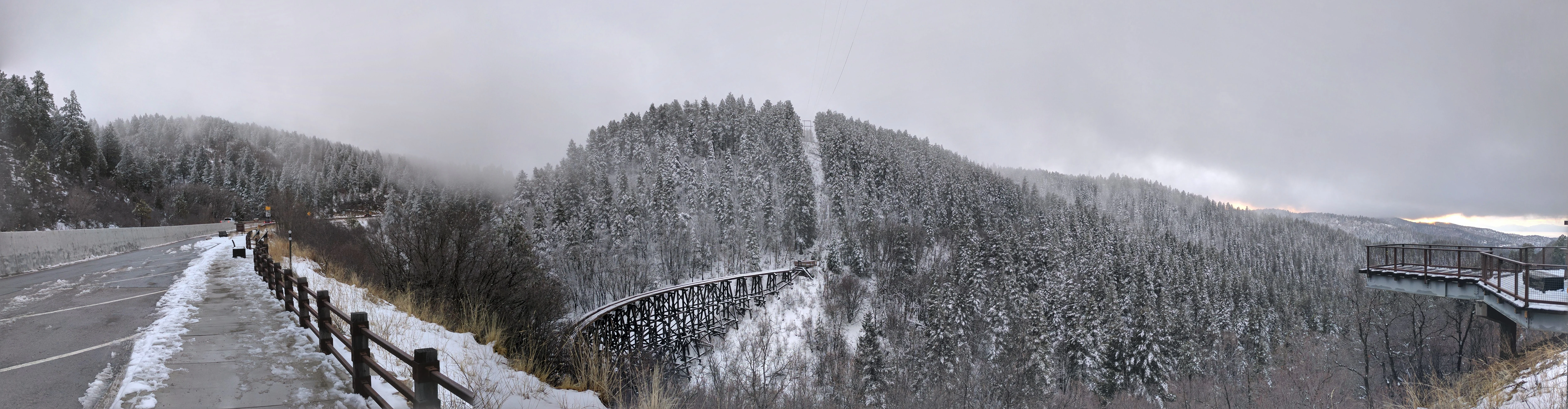
A wide panoramic view of a wooden trestle bridge spanning a deep, snow-covered forest canyon, viewed from a roadside observation area on a cloudy day.
A winter view of the historic Mexican Canyon Trestle, nestled within the snow-covered slopes of Lincoln National Forest.

Lincoln National Forest history and protected-area timeline

The territory of the modern Lincoln National Forest was inhabited long before federal protection, and the Niit'ahi band of the Mescalero Apache occupied these mountain ranges before European-American settlement. By the late nineteenth century, unregulated grazing, timber cutting, and shifting land use prompted early federal efforts to establish formal forest reserves in the southern New Mexico mountains.

The modern forest traces its institutional origins to a series of early-twentieth-century proclamations and executive orders. The Lincoln Forest Reserve was created by presidential proclamation on July 26, 1902, initially covering about 545,256 acres around the towns of Capitan and Lincoln. The Gallinas Forest Reserve, a 78,480 acre unit in the Gallinas Mountains west of Gallinas, was established on November 5, 1906. The Guadalupe National Forest was created on April 19, 1907, to protect the mountains along the Texas border, and the Sacramento National Forest was established on April 24, 1907, to conserve the forested heights of the Sacramento Mountains near Alamogordo. Together these reserves signaled a new federal commitment to managing southwestern forests for sustainability.

A major reorganization came in July 1908, when President Theodore Roosevelt signed Executive Order 908, consolidating several southwestern national forests into larger units. Under this order, the Gallinas National Forest was merged into the Lincoln, while the Guadalupe and Sacramento national forests were combined into the entirely new Alamo National Forest, headquartered in Alamogordo under its first supervisor, Arthur M. Neal. On June 6, 1917, President Woodrow Wilson issued an executive order that dissolved the Alamo National Forest and transferred its lands to the Lincoln, bringing the Sacramento and Guadalupe Mountains into the single, expanded Lincoln National Forest.

The final major boundary change occurred in 1945, when administrative control of the former Gallinas National Forest was transferred from the Lincoln to the Cibola National Forest; the change was officially completed in 1958 and the area was renamed the Mountainair Ranger District. Ranger district boundaries within the Lincoln continued to shift through the twentieth century, eventually settling into the modern Smokey Bear, Sacramento, and Guadalupe districts. Cultural milestones along the way included the 1950 Capitan Gap fire, which led to the rescue of the bear cub who became Smokey Bear, and later wilderness designations under the New Mexico Wilderness Act of 1980 and earlier federal wilderness legislation.

Lincoln National Forest landscape and geographic character

The landscape of Lincoln National Forest is defined by its abrupt vertical change, moving from below 4,000 feet in the desert basins to above 11,500 feet on the crests of the Sacramento and White Mountains. The lowest portions of the forest border the Chihuahuan Desert, with sweeping basins of creosote, ocotillo, agave, and yucca, and dramatic white gypsum dunes visible from the forest edge near White Sands National Park. The Sacramento Mountains rise directly east of Alamogordo, presenting an extraordinary scenic transition from sand flats into deep conifer forest within a few miles of horizontal distance.

The Sacramento Mountains dominate the central portion of the forest. Their heavily forested southern slopes, watered by monsoonal summer rains and winter snowfall, give way to cooler mixed-conifer forests higher up, while the north side descends more gradually. The village of Cloudcroft sits perched along this transition, surrounded by ponderosa pine, Douglas fir, and aspen. To the northwest, the Capitan Mountains form a rare east-west range, rugged, sharply ridged, and rising to Capitan Peak, with the surrounding woodlands supporting dense elk habitat.
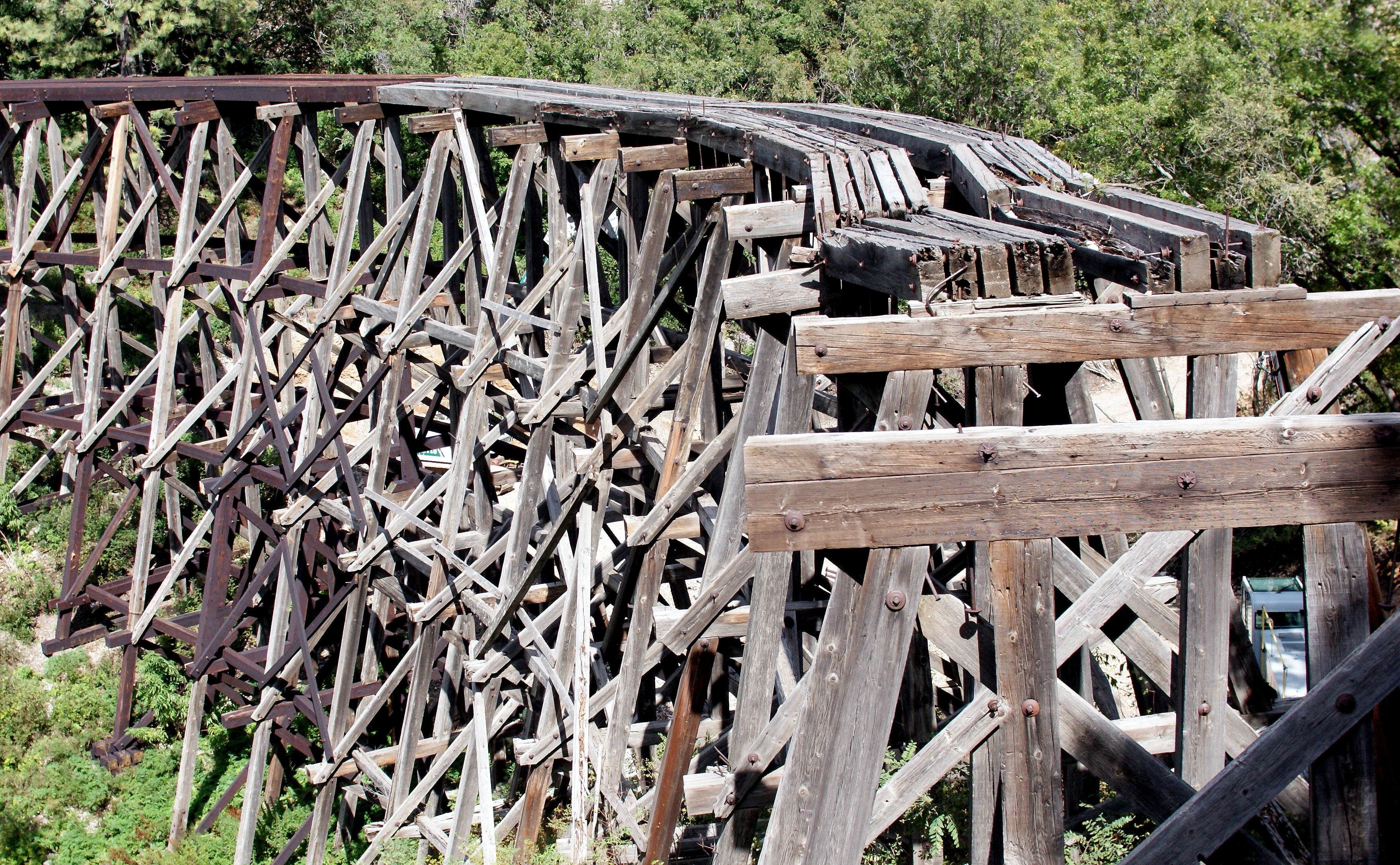
A close up view of the historic wooden Mexican Canyon Trestle railway bridge featuring a complex timber framework set against a backdrop of trees.
The historic Mexican Canyon Trestle in Lincoln National Forest, showing its complex timber support structure.

Lincoln National Forest ecosystems, habitats, and plant life

Lincoln National Forest preserves an unusually compressed ecological gradient for a single administrative unit. At its lower elevations, the forest includes warm desert and grassland environments typical of the northern Chihuahuan Desert, with sparse creosote bush, agave, and yucca. Moving upward, these communities grade into piñon-juniper woodlands that historically fed the local timber economy. Higher still, the forest embraces expansive stands of ponderosa pine, the signature tree of much of the Sacramento Mountains, along with mixed-conifer forest dominated by Douglas fir and white fir, with frequent groves of quaking aspen in cooler, moister pockets.

Above the tree line, the forest opens into sub-alpine grasslands on the summits of Sierra Blanca and the adjacent ridges. This vertical zonation produces dense biodiversity in a small geographic area and supports varied wildlife communities, including Rocky Mountain elk in the high country, mule deer and black bear in the mixed-conifer and oak zones, javelina and a variety of reptiles in the desert margins, and an array of raptors and passerine birds throughout the elevation range. The forest's watersheds, including creeks draining the Sacramento and Capitan ranges into the Pecos River system, are integral to ecological health in the surrounding region.
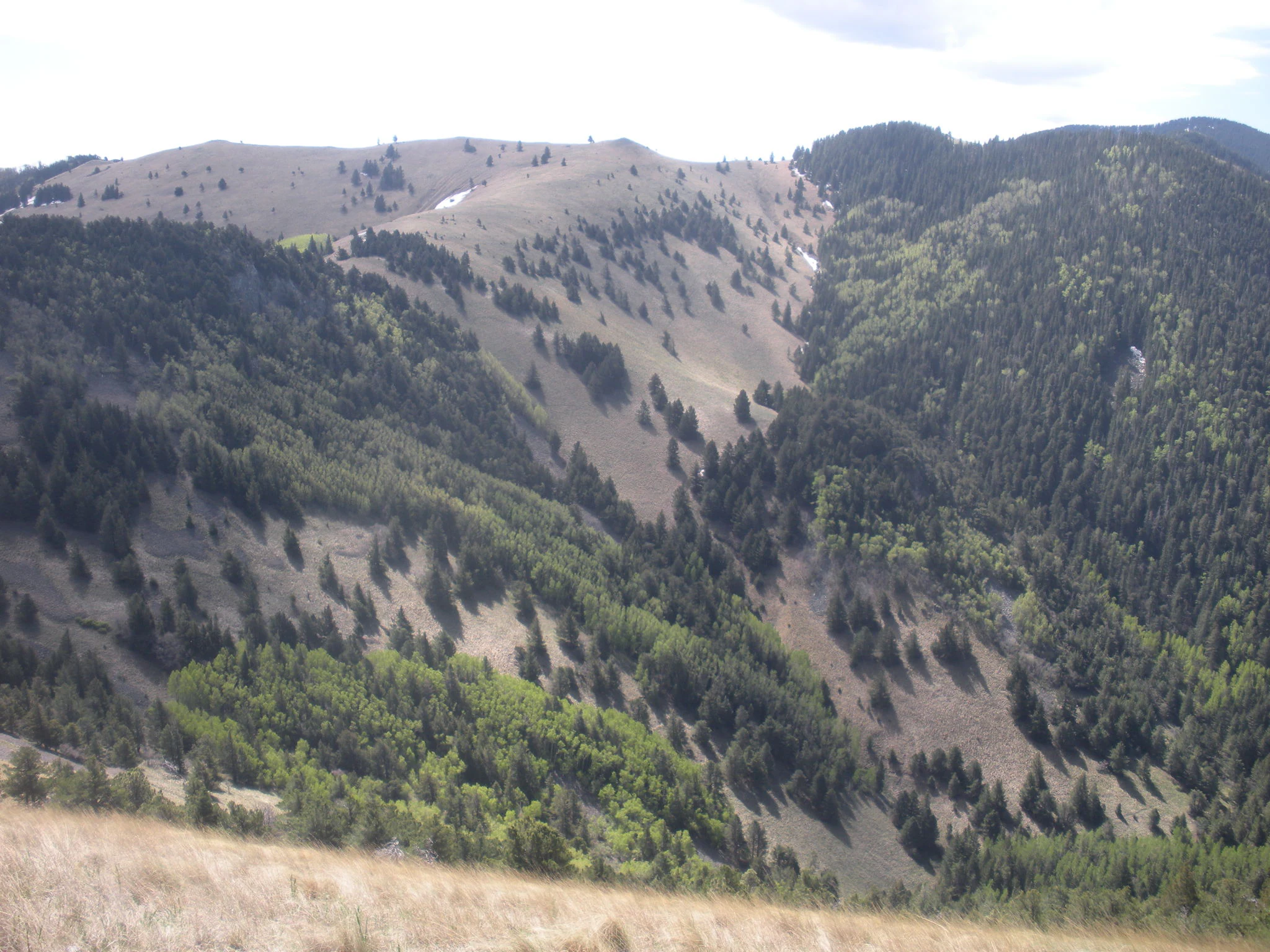
A wide view of a mountain landscape with patches of coniferous trees, deciduous shrubs, and grassy slopes under a bright sky.
A view of the rolling mountain terrain and diverse vegetation within Lincoln National Forest.

Lincoln National Forest wildlife and species highlights

Wildlife in Lincoln National Forest reflects the diversity of the forest's elevation and habitat zones. The high country of the Smokey Bear Ranger District, particularly the Capitan Mountains and the White Mountains around Sierra Blanca, supports an important population of Rocky Mountain elk, along with mule deer that move through oak woodland and mixed-conifer cover. Black bear are present throughout the higher forested districts, while mountain lions and coyotes occupy a similar range of terrain.
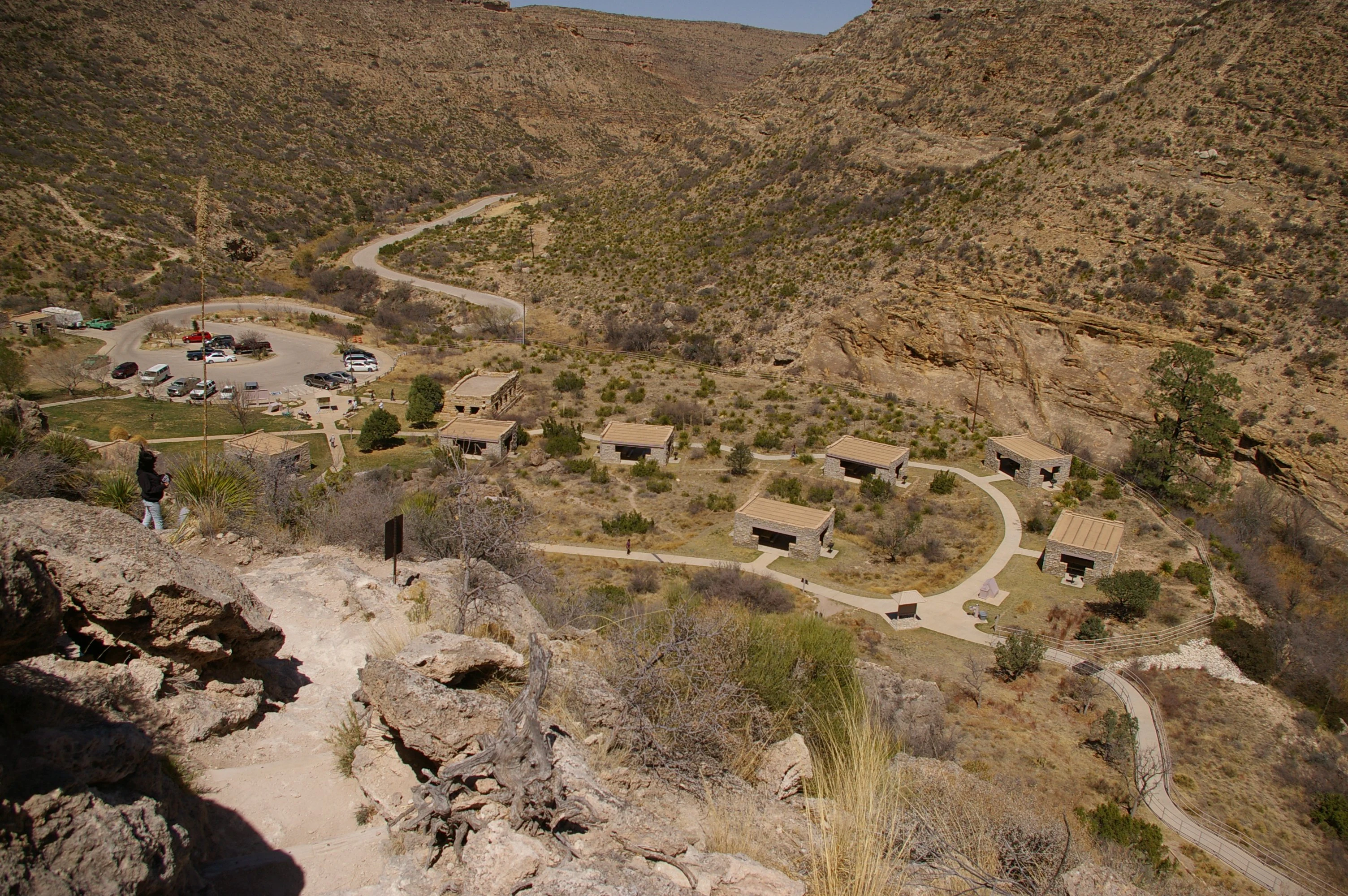
A high angle, wide shot looking down into a desert canyon at a day use area containing several stone picnic shelters, a parking lot with vehicles, and paved walkways, surrounded by arid hills.
A high angle view overlooking the Sitting Bull Falls Day Use Area in Lincoln National Forest, showing picnic shelters, a parking lot, and the surrounding desert canyon landscape.

Lincoln National Forest conservation status and protection priorities

Lincoln National Forest contributes meaningful conservation value within the larger landscape of southern New Mexico and the southwestern United States. It anchors water quality and watershed function for communities stretching from Alamogordo and Cloudcroft down through Carlsbad, and its forested slopes help moderate runoff into the Pecos River system. The forest's two designated federal wilderness areas, the Capitan Mountains Wilderness and the White Mountain Wilderness, represent the highest level of statutory protection available within the National Forest system, safeguarding core tracts of forest and sub-alpine habitat from roads and mechanized use.

The forest is also a working conservation landscape. Its ranger districts include actively managed timber lands, grazing allotments for cattle, and recreation settings that connect local communities to the forest. Fire is a recurring and defining force here, as the spring wind-driven fire season shapes both policy and public awareness. The 1950 Capitan Gap fire, which produced the rescued bear cub later known as Smokey Bear, and later fires including the 2022 McBride Fire, have given the forest a distinctive role in the national conversation about wildfire, prevention, and forest resilience in the American Southwest.

Lincoln National Forest cultural meaning and human context

Lincoln National Forest occupies a landscape with deep and layered human history. The Mescalero Apache, specifically the Niit'ahi band, used these mountain ranges long before federal boundaries were drawn, and their ongoing presence in the region is reflected in the Mescalero Apache Reservation that borders the forest's Sacramento and Smokey Bear districts. The Mescalero Apache today own and operate Ski Apache, the major ski area on Sierra Blanca within the forest.

In the late nineteenth century, the area became nationally famous for the Lincoln County War of 1878 to 1879, a violent conflict over political and economic control of Lincoln County in which the village of Lincoln itself was besieged. The events of the war, including the early involvement of William Bonney, later known as Billy the Kid, took place in and around forest communities. The arrival of the railroad, specifically the Alamogordo and Sacramento Mountain Railway of 1898, marked another cultural turning point, bringing loggers, settlers, and tourists into the high country and leaving behind enduring infrastructure like the Mexican Canyon Trestle near Cloudcroft.
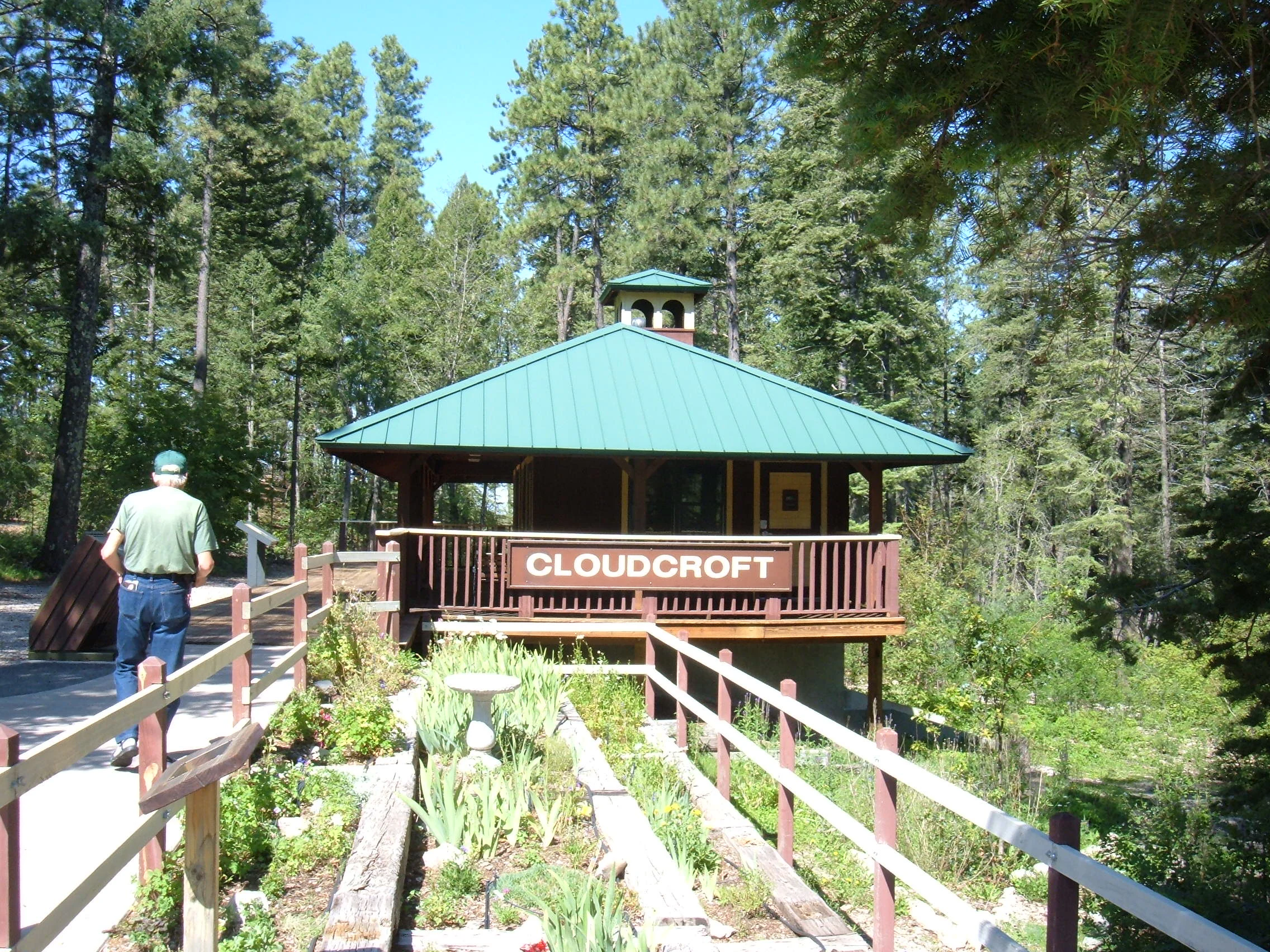
A small wooden building with a green metal roof and a sign reading Cloudcroft, surrounded by a pine forest and wooden railed walkways.
A replica train depot marking the start of the Cloud Climbing Rail Trail in the Trestle Recreation Area.

Top sights and standout views in Lincoln National Forest

Lincoln National Forest spans a remarkable gradient from desert to alpine in a single federally protected unit, encompassing parts of the Sacramento, Guadalupe, Capitan, and White Mountains. Among its standout features are the cool, forested villages of Cloudcroft and Ruidoso, the ancient Capitan Reef geology of the Guadalupe Mountains, and the rugged east-west Capitan Mountains, all connected by more than a hundred developed trails and two federally designated wilderness areas.

Best time to visit Lincoln National Forest

Lincoln National Forest changes dramatically with the seasons, and the best time to visit depends heavily on what kind of experience a visitor is seeking. Summer is the classic high-country season in the Sacramento and Capitan mountains, when cool forests offer relief from desert heat, monsoonal rains feed waterfalls and creeks, and most developed campgrounds are open from May through September. Cloudcroft and the surrounding Sacramento Mountains are especially inviting in summer for hiking, picnicking, and scenic drives.

Winter transforms the forest into a snow recreation destination. Ski Apache, on Sierra Blanca near Ruidoso, provides downhill skiing and snowboarding, the Upper Karr Canyon area near Cloudcroft is set up for sledding and tubing, and cross-country ski trails around Cloudcroft are groomed in season. Snowfall can be substantial at higher elevations, with Cloudcroft receiving around 60 inches annually, while lower desert districts remain mild. Spring is the windiest and most fire-prone period, and visitors should be aware of seasonal fire restrictions. Fall brings cooler temperatures and changing colors in the oaks and aspens, while the desert portions of the Guadalupe Ranger District remain accessible year-round and feature attractions such as Sitting Bull Falls.
Monthly climate preview

Long-term temperature and precipitation patterns recorded across representative coordinates

Lincoln National Forest Climate Normals and Measured Annual Weather by Month

Historical climate normals for Lincoln National Forest outline a measured progression of monthly temperatures and precipitation totals derived from representative monitoring points. Reviewing the complete twelve-month profile provides deeper context on long-term thermal rhythms and moisture distribution across the protected landscape.
Annual mean13 °C
2 °C23 °C
Jan
Feb
Mar
Apr12°
May18°
Jun23°
Jul23°
Aug22°
Sep19°
Oct13°
Nov
Dec
Warmest month
July

23.3 °C

Coolest month
January

2.3 °C

Wettest month
July

2 mm/day

Driest month
April

0.4 mm/day

Park location guide

Geography guide, regional context, and park location map for Lincoln National Forest

Lincoln National Forest park geography, regions, and map view in United States of America

Understand where Lincoln National Forest sits in United States of America through a broader geographic reading of the surrounding landscape, nearby location context, and its mapped position within the national park landscape.

How Lincoln National Forest fits into United States of America

The United States of America is a federal presidential republic and one of the world's largest countries by area and population. It consists of 50 states across a vast territory spanning multiple time zones, with its capital in Washington, D.C. and largest city in New York City. The nation has a diverse economy, influential political system, and significant cultural and military presence globally.

Wider geography shaping Lincoln National Forest in United States of America

The United States occupies a vast territory in North America, bordered by Canada to the north and Mexico to the south. The 48 contiguous states stretch from the Atlantic to the Pacific Ocean, while Alaska occupies the northwestern region and Hawaii is an archipelago in the Pacific. The country encompasses diverse terrain including the Rocky Mountains, Appalachian Mountains, Great Plains, and extensive river systems.

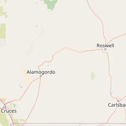
Map view of Lincoln National Forest

Use this park location map to pinpoint Lincoln National Forest in United States of America, understand its exact geographic position, and read its mapped placement within the surrounding landscape more clearly.

Pigeon | © OpenStreetMap contributors

Location context for Lincoln National Forest

New Mexico
Recorded earthquake history

Explore the Documented Earthquake History of Lincoln National Forest

Access a structured collection of historical earthquake records associated with Lincoln National Forest. This catalogue provides key seismic data points, such as magnitude and location, to help you understand the documented geological activity recorded near these protected New Mexico mountain landscapes within the MoriAtlas database.

Lincoln National Forest Earthquake History

Catalogued events

348 events

Strongest magnitude

Magnitude 5.4

Most recent event

Sep 13, 2026

This history includes earthquakes recorded inside the park or within 50 km of its borders

Visual reference of protected environments ranging from desert basins to high alpine ridges

Lincoln National Forest Photos and Scenery: Exploring Mountain Landscapes and Habitats

Visual records capture the dramatic elevation gradient of Lincoln National Forest, showing the sharp transition from Chihuahuan Desert lowlands to dense conifer woodlands. Photographic documentation reveals the diverse habitats, rugged mountain ranges, and distinctive terrain defining this protected ecosystem.

A wide panoramic view of a wooden trestle bridge spanning a deep, snow-covered forest canyon, viewed from a roadside observation area on a cloudy day.

A vintage black and white photograph of a stone fire lookout tower with exterior stone stairs leading up to the structure.

A close up view of the historic wooden Mexican Canyon Trestle railway bridge featuring a complex timber framework set against a backdrop of trees.

A wide view of a mountain landscape with patches of coniferous trees, deciduous shrubs, and grassy slopes under a bright sky.

A high angle, wide shot looking down into a desert canyon at a day use area containing several stone picnic shelters, a parking lot with vehicles, and paved walkways, surrounded by arid hills.

A wide shot looking up a snowy mountain slope at a ski resort with visible ski lifts, pine trees, and a group of people gathering at the base.

A small wooden building with a green metal roof and a sign reading Cloudcroft, surrounded by a pine forest and wooden railed walkways.

Park atlas

Compare adjacent mountain ranges, desert reserves, and regional conservation lands

Explore Parks Near Lincoln National Forest and Surrounding Protected Landscapes

Browsing other protected areas near Lincoln National Forest reveals broader ecological patterns across the surrounding regional terrain. Expanding the geographic comparison connects single mountain reserves to wider desert and alpine habitats.
National parkEddy County
Park boundaries overlap#1 closest

Southeast

Carlsbad Caverns National Park: Detailed Protected Area and Landscape Exploration

View mapped terrain and geographic context for this Eddy County national park.

Gain a deep understanding of Carlsbad Caverns National Park through its specific geographic features and protected landscape identity. This entry provides foundational atlas-level information on the park's mapped boundaries and its role as a designated national park within the broader regional geography of Eddy County. It is designed to offer precise context for users focused on understanding the specific natural terrain and conservation geography of this important protected area, facilitating structured discovery.

Area
189.26 km²
Established
1930
IUCN
II
Visitors
410.8K annual
National parkCulberson County
Park boundaries overlap#2 closest

Southeast

Guadalupe Mountains National Park: Mapped Boundaries and Protected Landscape Identity

Explore the geography and terrain of this Texas national park.

Guadalupe Mountains National Park is a key protected area within Culberson County, West Texas. This national park offers a distinct geographic focus, allowing for detailed exploration of its mapped boundaries and the unique natural landscapes that define its protected status. Understanding its place within the Trans-Pecos region provides valuable context for regional geography and atlas-based discovery of conservation lands in Texas.

Area
349.51 km²
Established
1972
IUCN
II
Visitors
206.4K annual
National parkNew Mexico
19 km away#3 closest

West

White Sands National Park: National Park with Unique Dune Landscape in New Mexico

Explore its protected boundaries and desert geography.

White Sands National Park is a protected national park renowned for its stunning gypsum dunes, offering a unique landscape within New Mexico's geography. This page provides detailed information on its mapped protected area, serving as a valuable resource for understanding the park's specific geographic context and its identity as a significant protected natural landscape.

Area
601.3 km²
Established
2019
IUCN
V
Visitors
729.1K annual
A minimalist watercolor painting depicting soft green rolling hills in the foreground and faded pink mountain ridges in the background on a white paper background.
Protected areaNew Mexico
96 km away#4 closest

North

Manzano Mountain Wilderness: Rugged Protected Landscapes in Central New Mexico

Canyon-scarred mountain geography and forest ecosystems.

Manzano Mountain Wilderness is a significant protected area defined by its deep, radiating canyons and compressed elevational ranges. From pinyon-juniper foothills to the spruce-fir heights of the crest, this landscape offers a detailed look at the varied natural terrain found within the Cibola National Forest in New Mexico.

Area
149.23 km²
Established
1978
IUCN
Ib
Relief
Mountain
Watercolor painting of a gentle, rolling landscape with a small stream, a small waterfall, and scattered trees under a soft, light sky.
Protected landscapeNew Mexico
142 km away#5 closest

North

Santa Fe National Forest: Geographic Atlas and Protected Landscape Overview

New Mexico mountain geography and wilderness mapping

Santa Fe National Forest spans more than 1.5 million acres of Northern New Mexico, featuring a dramatic transition from canyon river systems to the high elevations of the Pecos Wilderness. This protected landscape contains a complex network of forest districts across the Jemez and Sangre de Cristo Mountains, defined by volcanic plateaus, alpine basins, and seasonal aspen forests. Use this resource to understand the park boundaries, regional mountain geography, and the interconnected nature of these protected lands.

Area
6,306.83 km²
Established
1915
Relief
Mountain
Access
Easy access
A horizontal watercolor painting showing distant mountains in shades of purple, soft green rolling hills, a central winding river or stream, and grassy foreground elements on a white background.
Protected landscapeNew Mexico
159 km away#6 closest

West

Gila National Forest: A Geographic Overview of New Mexico's Protected Wilderness Core

Mapped terrain, forest boundaries, and regional wilderness character

Gila National Forest stands as a critical protected landscape in New Mexico, encompassing immense mountain ranges, narrow river gorges, and extensive backcountry basins. This atlas entry details the forest's topographic transition from high-altitude ponderosa stands to desert lowlands, highlighting its status as the foundational site for the global wilderness movement and a stronghold for regional ecological diversity.

Area
10,969.7 km²
Established
1905
Relief
Mountain
Climate
Temperate
A minimalist watercolor painting showing rolling green and yellow hills against a soft, light-colored background.
Wildlife reserveChihuahua
About 190 km away#7 closest

Southwest

Médanos de Samalayuca: Protected Silica Sand Dune Landscapes in Northern Chihuahua

A dynamic desert wildlife reserve and arid natural ecosystem

Located in northern Chihuahua, Médanos de Samalayuca is a protected wildlife reserve centered on a massive, shifting field of fine white silica sand. This desert landscape offers a stark contrast to the surrounding scrublands, providing an essential look at the geological forces and climatic extremes that shape the arid environments of the Chihuahuan Desert.

Area
631.82 km²
Established
2009
Relief
Lowland
Climate
Arid
A horizontal watercolor illustration showing green foreground vegetation, rolling light green hills in the midground, and purple hazy mountains in the background against a white sky.
Wildlife reserveNew Mexico
196 km away#8 closest

West

Gila Wilderness: An In-Depth Look at the Protected Landscape and Geography of New Mexico

Mapped terrain, alpine peaks, and diverse forest ecosystems within the American Southwest

The Gila Wilderness stands as a primary case study in landscape conservation, protecting a massive network of unroaded river canyons and forest-covered mountains in New Mexico. This region serves as a bridge between temperate montane zones and arid desert environments, creating a unique ecological atlas defined by significant altitudinal gradients, volcanic features, and extensive watershed networks across the Mogollon range.

Area
225,820 km²
Established
1924
IUCN
Ib
Relief
Mountain

Common questions about visiting, size, designation, and location context for Lincoln National Forest

Lincoln National Forest FAQs for park facts, access, geography, and protected area context

Find quick answers about Lincoln National Forest, including protected-area facts, park geography, trail and visitor context, and how the park fits into its surrounding country and regional landscape.
MoriAtlas Explorer

Continue Your Protected Areas Search Across the Global Atlas

Deepen your exploration by continuing the structured search for national parks and protected areas worldwide. Utilize the comprehensive filtering capabilities to compare different conservation landscapes and refine your understanding of global park geography. Discover more about the distribution and characteristics of protected natural areas.

Global natural geography