
Mori Atlas logo
Protected landscapeLinkes Bielerseeufer

A detailed map and geographic profile of the vineyard-clad slopes and karst landforms along Lake Biel

Linkes Bielerseeufer Protected Landscape and Jura Lakeshore Geography in the Canton of Bern

(Linkes Bielerseeufer (BLN-Objekt 1001))

Linkes Bielerseeufer represents a significant protected landscape stretching along the steep northwestern shore of Lake Biel. This region features a complex mosaic of south-facing vineyard terraces, dry-stone walls, and dense forests rising toward the Jura range. Our geographic data maps the transition between the lakeshore, the Twannbach gorge, and the rocky outcrops that define this Swiss natural landmark.

BLN protected landscapevineyard terracesdry-stone wallsJura slopelake shore karst and gorge
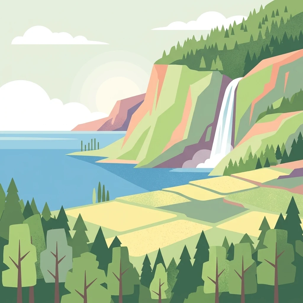
A flat-style vector illustration depicting a lake bordered by steep rocky cliffs and a waterfall, with terraced fields and evergreen forests in the foreground.

Linkes Bielerseeufer

Protected landscape

Park overview

Structured park overview, official facts, and landscape profile for Linkes Bielerseeufer

Linkes Bielerseeufer park facts, protected area profile, and essential visitor context

Review the core facts for Linkes Bielerseeufer, including designation, size, terrain, visitor scale, habitats, and operating context in one park-focused overview.

About Linkes Bielerseeufer

Linkes Bielerseeufer is a defined Swiss landscape of national importance on the northwestern shore of Lake Biel, in the Bernese Jura region of canton Bern. The protected area follows the steep southern face of the Jura anticline, climbing from the narrow lakeshore belt at roughly 429 meters above sea level up toward the Tessenberg plateau several hundred meters above. The BLN-designated core covers about 708 hectares between La Neuveville in the southwest and Tüscherz-Alfermée in the northeast, deliberately excluding the more developed lakeshore sections around La Neuveville itself and around Biel.

The landscape is shaped by both geology and centuries of human use. Jurassic limestone and Cretaceous layers tilted by the Jura folding create the steep, rocky terrain, and exposed rock walls reveal dramatic cross-sections of the bedrock. Karst features are widespread, with caves and the deep Twannbach gorge as prominent examples. Remnants of lateral moraines deposited by the ancient Rhone glacier and scattered erratic boulders further mark the glacial history of the slope.

Land use is strongly conditioned by exposure and slope. The sunny lower flanks have carried vineyards since at least the Middle Ages, supported by extensive dry-stone walls that are themselves a key reason the area was selected for national recognition. Above the vineyards, forests of oak, beech, maple, and lime give way to dry meadows, rocky steppes, and orchards near the villages. Historic traffic routes, including the so-called Pilgerweg along the slope, link the individual lake-edge communities and their terraced fields.

The villages of Schafis, Ligerz, Twann, Wingreis, Tüscherz, and Alfermée, along with the higher hamlet of Schernelz, sit on a narrow coastal strip. They are connected by the main road and the historic Jurasüdfuss railway line, parts of which now run through tunnels that relieve the settlements of through-traffic. The area lies along the Swiss-German and French-speaking linguistic boundary, giving it a distinctive bilingual character reflected in place names and local traditions.

Protection and recognition

Examine documented protection metrics and official designation parameters.

Linkes Bielerseeufer Protection Status and Terrestrial Conservation Scope

Terrestrial conservation frameworks establish the baseline protection status for Linkes Bielerseeufer within regional ecosystems. Structured records compile available management parameters and administrative designations for this protected area.

Protection details

Protection scope
Terrestrial
Transboundary protection
No
Park context

Deeper park guide and search-rich context for Linkes Bielerseeufer

Linkes Bielerseeufer history, landscape, wildlife, and travel context

Explore Linkes Bielerseeufer through its history, landscape character, ecosystems, wildlife, conservation priorities, cultural context, and seasonal travel timing in a structured park guide built for atlas discovery and search intent.

Why Linkes Bielerseeufer stands out

The area is best known for its combination of a steep Jura lakeshore, vineyards on dry-stone-walled terraces, and a richly structured mosaic of forest, dry grassland, and rocky habitats above Lake Biel. It is also recognized for the Twannbach gorge with its karst springs, the prehistoric lakeshore settlement at Twann, and the bilingual cultural identity of villages along the German-French language border.
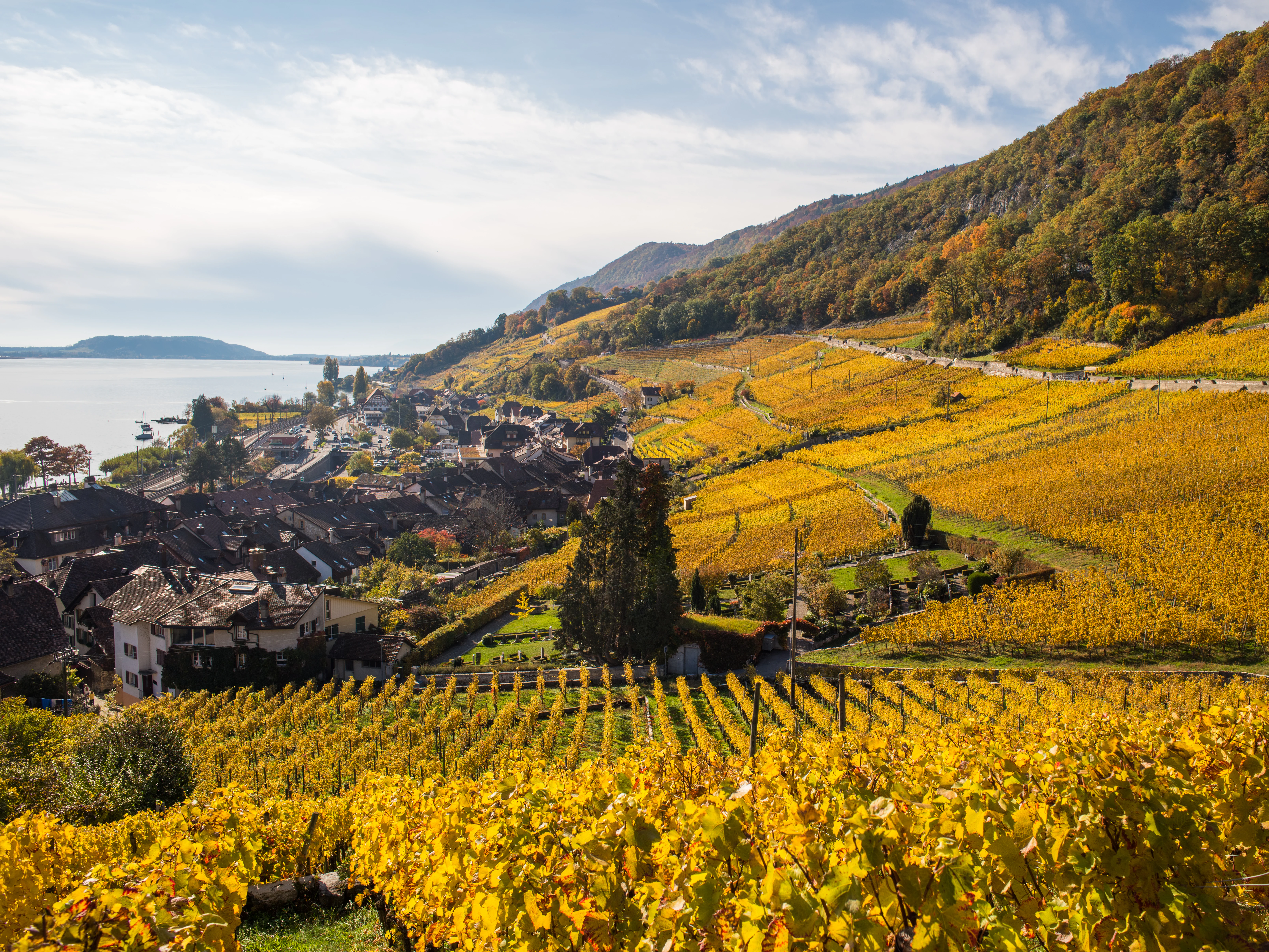
A high-angle view of terraced, golden-yellow vineyards sloping down toward a small village and a large lake under a clear sky.
Autumn vineyards overlooking the village of Twann and Lake Biel.

Linkes Bielerseeufer history and protected-area timeline

Human presence along this shore stretches back to prehistory. Favorable lakeside locations have been occupied since the Neolithic, and Twann became the site of an internationally important lake-dwelling settlement that was archaeologically investigated before the construction of the Twann bypass road.

The Middle Ages brought the foundation of the villages that still shape the area, with documented references to viticulture on the lower slopes from the early medieval period onward. Over time, dry-stone-walled terraces, traditional orchards, mills, churches, and manor houses such as the Hof Ligerz built up a coherent cultural landscape. Several village groups and individual buildings are now listed in the Swiss Inventory of Protected Townscapes.

In the modern era, transport reshaped the lakeshore. The regional road north of Lake Biel was built in 1838, the Suisse Occidentale railway along the Jurageworfuss line opened in 1860, and the Ligerz-Tessenberg railway began operations in 1912. The first Jura Water Correction in the late nineteenth century lowered the level of Lake Biel by roughly two meters, after which the small boat harbors were rebuilt in traditional materials. Later twentieth-century upgrades of the A5 motorway introduced heavy concrete engineering works in places along the shore, even as some sections were redirected into tunnels to relieve the villages.

Linkes Bielerseeufer landscape and geographic character

The defining feature is a steep, sun-oriented slope rising sharply from a narrow lakeshore strip. Below, a thin band of flat shore hosts the villages and the lake-edge infrastructure; above, the terrain climbs through vineyard terraces and forest toward the Tessenberg plateau. The highest points within the BLN perimeter reach just over 800 meters above sea level.

Geology is highly visible. Tilted layers of Jurassic limestone and Cretaceous rocks form the backbone of the slope and appear in numerous bare rock walls. Karst topography is widespread, expressed in caves, rock formations, and the dramatic Twannbach gorge. Landslide debris near Roggete and scattered lateral moraines and erratic boulders from the former Rhone glacier add further texture to the terrain.

At ground level, the gentle coastal strip contrasts with the abrupt climb behind it. Small settlements cluster between La Neuveville and Alfermée, connected by road, railway, ferries on the lake, and older paths. Dry-stone walls, vineyard terraces, orchards, woodland edges, rocky outcrops, and the shaded Twannbach gorge together give the area its strongly varied micro-landscape.

Linkes Bielerseeufer ecosystems, habitats, and plant life

Ecologically, the area is characterized by a sharp gradient between lake, slope, and forest. Forests of oak, beech, maple, and summer lime dominate the higher slopes, with thorn scrub and orchid-rich open patches breaking the canopy. The cooler, shaded Twannbach gorge shelters a relict stand of hart's-tongue fern and maple forest that is otherwise rare in the region.

A second important habitat type is the dry grassland and rocky steppe on the sun-exposed upper slopes and cliffs, where specialized plants of dry, calcareous substrates thrive alongside thorny shrubs. Traditional orchards with tall standard trees near the villages add a managed but ecologically rich layer.

These habitats overlap with sites listed in the Federal Inventory of Dry Meadows and Pastures of National Importance, recognizing their particular value for species adapted to warm, dry conditions and to traditional agricultural mosaics. Since 2006, the Schlossflue forest near Twann has been formally designated as a cantonal forest protection area.

Linkes Bielerseeufer wildlife and species highlights

The mix of cliffs, dry meadows, vineyard walls, and tall orchards supports a rich and unusual insect fauna, with butterflies and crickets being especially conspicuous. These sunny, structured habitats also provide extensive living space for lizards.

The fractured rock faces and shaded crevices of the Twannbach gorge host bat colonies that depend on the gorge's humidity, shelter, and insect supply. Birds associated with woodland edges, orchards, dry grasslands, and lake shores are present throughout the area, though specific inventories focus more on habitat quality than on individual species records.

Together, these communities make the Bielerseeufer a notable area for species that depend on the contact zone between dry, warm slopes and more humid, shaded rock and forest environments.

Linkes Bielerseeufer conservation status and protection priorities

The area is protected primarily through its listing as object 1001 in the Federal Inventory of Landscapes and Natural Monuments of National Importance (BLN), which recognizes both its natural and its cultural landscape values. Additional protection comes from the inclusion of several zones in the Federal Inventory of Dry Meadows and Pastures of National Importance, and from the cantonal forest protection area Schlossflue established near Twann in 2006.

BLN conservation objectives for the site focus on preserving the vineyard landscape with its dry-stone walls; maintaining the contact zone between natural and cultural habitats; protecting geological exposures; managing forest communities and dry sites appropriately; safeguarding the near-natural state of water bodies; protecting the Twannbach gorge and karst springs along with the natural dynamics of the Twannbach; ensuring that forestry and agriculture remain adapted to local conditions; preserving structural elements such as hedgerows and orchards; maintaining the quality of the village townscapes; and keeping historic traffic routes intact.

These objectives reflect a recognition that the area's ecological value is inseparable from its long-standing human management, especially the vineyard terraces that have shaped the slope for centuries.

Linkes Bielerseeufer cultural meaning and human context

The cultural profile of the Bielerseeufer is shaped by a deep historical engagement with the lake and the slope. Neolithic and Bronze Age lake-dwelling cultures left important archaeological traces, of which the Twann lakeshore settlement is the best-known example. Medieval settlement patterns produced the historic core villages, whose tightly grouped houses, churches, mills, and manor houses such as the Hof Ligerz are still recognized as part of Switzerland's protected townscapes.

Viticulture is the single most defining cultural element. The lower slopes have been planted with vines since at least the early Middle Ages, and the network of dry-stone terraces and supporting walls is both an agricultural structure and a piece of living heritage. Historic paths, including the so-called Pilgerweg that runs along the slope above the villages, complement the cultural landscape.

The area also sits directly on the longstanding language frontier between German-speaking Switzerland and French-speaking Romandy, with bilingual place names and a heritage of Franco-Provençal speech in the western communities that gradually gave way to standard French in the modern era. This linguistic borderland identity is part of what the area's cultural-landscape designation seeks to preserve.

Top sights and standout views in Linkes Bielerseeufer

Linkes Bielerseeufer stands out for the unusually tight concentration of vineyard terraces, dry-stone walls, and forested dry slopes along a single stretch of lakeshore, all within a short distance of Bernese Jura villages rich in medieval building stock.

Its gorge at Twannbach, karst geology, lateral moraines left by the ancient Rhone glacier, and relict hart's-tongue maple forest provide distinctive natural features, while the prehistoric lakeshore settlement at Twann and the bilingual cultural tradition linking the German and French language regions give the place a uniquely layered heritage.

Monthly climate preview

Long-term temperature ranges and monthly precipitation averages across the park coordinate

Linkes Bielerseeufer Climate Normals and Measured Annual Weather Patterns

Representative coordinate records show historical temperatures ranging from sub-zero winter minimums to warm summer maximums alongside consistent year-round precipitation values. Examining the complete twelve-month record clarifies multi-seasonal shifts in average temperature and monthly rainfall distribution.
Annual mean8 °C
-1 °C17 °C
Jan-1°
Feb
Mar
Apr
May12°
Jun15°
Jul17°
Aug17°
Sep13°
Oct
Nov
Dec
Warmest month
July

17.4 °C

Coolest month
January

-1.2 °C

Wettest month
May

3.9 mm/day

Driest month
February

2.5 mm/day

Park location guide

Geography guide, regional context, and park location map for Linkes Bielerseeufer

Linkes Bielerseeufer park geography, regions, and map view in Switzerland

Understand where Linkes Bielerseeufer sits in Switzerland through a broader geographic reading of the surrounding landscape, nearby location context, and its mapped position within the national park landscape.

How Linkes Bielerseeufer fits into Switzerland

Switzerland is a landlocked federal republic in Central Europe comprising 26 cantons, with Bern as the federal city and Zurich as the largest city. The country features the Swiss Alps, Swiss Plateau, and Jura Mountains, with German, French, Italian, and Romansh as official languages. It is noted for its political neutrality, direct democracy traditions, and strong economy.

Wider geography shaping Linkes Bielerseeufer in Switzerland

Switzerland is located in Central Europe at the intersection of Western and Southern Europe. It is bordered by Germany to the north, France to the west, Austria and Liechtenstein to the east, and Italy to the south. The country is geographically divided among the Swiss Alps (covering most of the territory), the Swiss Plateau (where most of the population resides), and the Jura Mountains. Switzerland is landlocked.

Map view of Linkes Bielerseeufer

Use this park location map to pinpoint Linkes Bielerseeufer in Switzerland, understand its exact geographic position, and read its mapped placement within the surrounding landscape more clearly.

Pigeon | © OpenStreetMap contributors

Location context for Linkes Bielerseeufer

Canton of Bern

Visualizing steep Jura mountain slopes, dry-stone vineyard terraces, and lake-edge habitats.

Linkes Bielerseeufer Photos and Protected Landscape Scenery

Visual documentation of Linkes Bielerseeufer reveals the steep Jura mountain slopes and dry-stone vineyard terraces rising above Lake Biel. Photographic records capture the protected terrain, mixed forests, and karst geology defining this Swiss natural monument.

A high-angle view of terraced, golden-yellow vineyards sloping down toward a small village and a large lake under a clear sky.

A stone church with a tall steeple stands on a hillside surrounded by lush green vineyard terraces under a clear sky.

Park atlas

Compare regional Jura terrain, lake margins, and protected natural monuments

Exploring Parks Near Linkes Bielerseeufer and Surrounding Protected Landscapes

Browsing protected areas near Linkes Bielerseeufer opens regional comparison across adjacent Jura mountain terrain and lake margin reserves. Expanding the protected-area search helps connect individual lake-edge ecosystems with broader geographic conservation networks.
A pale, abstract watercolor painting showing rolling green hills and distant mountain ridgelines on a white background.
Nature reserveCanton of Bern
About 10 km away#1 closest

Northwest

Combe Grède Nature Reserve: Geological Gorge and Protected Mountain Landscape in Bern

Folded Jura limestone terrain and biodiversity hotspots.

The Combe Grède nature reserve presents a striking half-cluse gorge carved into Cretaceous limestone. This protected area within the Canton of Bern showcases an instructive geological sequence, ancient pine stands, and diverse mountain habitats that span from shaded cliffs to alpine pastures.

Area
12 km²
Established
1932
Relief
Mountain
Climate
Temperate
A watercolor illustration of a river landscape with a gentle bend, shoreline greenery, and distant low hills, rendered with soft, faded edges.
Protected landscapeCanton of Bern
About 12 km away#2 closest

Southeast

Stausee Niederried Protected Landscape: A Geographic Map and Atlas of Swiss Floodplains

Mapped alluvial terrain and sandstone cliffs in the Canton of Bern.

Stausee Niederried functions as a vital protected landscape, blending a historic hydroelectric reservoir with a four-kilometer riverine floodplain. The area is characterized by high geomorphic contrast, ranging from the vast Runtigenfluh molasse cliff to critical riparian marshes and orchid-rich pine forests. This entry provides a structured look at the park boundaries, geological features, and the wider fluvial mosaic found near the confluence of the Aare and the Saane.

Area
2.97 km²
Established
1991
IUCN
V
Relief
Mixed relief
Watercolor painting of a green forested landscape with rolling hills under a soft pink and yellow sunrise sky.
Nature reserveJura
About 19 km away#3 closest

North

Franches-Montagnes Nature Reserve: A Detailed Atlas of Jura Plateau and Peat Bog Geography

Protected karst limestone landscapes and highland pasture geography.

The Franches-Montagnes nature reserve spans a unique high plateau in the Swiss Jura, characterized by its complex karst substrate and iconic raised bog systems like the Etang de la Gruère. This protected area supports a mosaic of traditional wooded pastures and wetlands, serving as a primary site for understanding the intersection of human pastoral heritage and sensitive highland ecology.

Area
39.57 km²
Established
1977
Relief
Upland
Climate
Temperate
A soft watercolor painting depicting a calm river winding through a green, hazy floodplain environment.
Nature reserveSolothurn
About 24 km away#4 closest

Northeast

Naturschutzgebiet Aare bei Altreu: Protecting Aare Valley Floodplains and Alluvial Forest

Riverine meander habitat in the Solothurn canton landscape.

Naturschutzgebiet Aare bei Altreu serves as a vital refuge for floodplain flora and fauna, standing out for its intact meander loops and silver willow gallery forests. Located in the Solothurn region, this protected area preserves a rare stretch of the Aare river ecosystem that contrasts sharply with adjacent canalized banks. Studying its terrain reveals the importance of alluvial corridors in maintaining wetland connectivity within the Swiss Mittelland.

Area
0.205 km²
Established
1992
IUCN
IV
Relief
Lowland
A pale, minimalist watercolor painting depicting rolling hills and mountains in shades of soft green, purple, and yellow against a white background.
Natural monumentNeuchâtel
About 33 km away#5 closest

Southwest

Creux du Van et Gorges de l’Areuse Natural Monument and Regional Protected Landscape

Geological exploration of the Folded Jura and Areuse river valley

Spanning the Cantons of Neuchâtel and Vaud, this protected area unites the dramatic rock bowl of the Creux du Van with the narrow, cascading passages of the Gorges de l’Areuse. The site provides a comprehensive view of Jura mountain landforms, highlighting millions of years of river erosion, glacial activity, and karst weathering in a singular, well-defined geographic corridor.

Area
21.21 km²
Established
1876
Relief
Mountain
Climate
Temperate
A soft watercolor painting of a mountain landscape with rolling hills, pine forests, and a meadow in light green and muted earth tones.
Regional parkCanton of Bern
About 38 km away#6 closest

Southeast

Regionaler Naturpark Gantrisch: Protected Terrain and Map Exploration in Canton of Bern

A diverse transition zone from glacial moraines to high mountain ridges.

Spanning over 400 square kilometers, Regionaler Naturpark Gantrisch offers a unique look at the Swiss landscape. Its boundaries encompass everything from low-lying agricultural valleys and historic castles to the steep, forested gorges of the Sense and Schwarzwasser rivers and the high-altitude vistas of the southern Gantrisch mountain range.

Area
414 km²
Established
2012
Relief
Mountain
Climate
Alpine
A pale, soft-focus watercolor illustration depicting a limestone cliff landscape with gentle rolling hills and light vegetation.
Nature reserveBourgogne-Franche-Comté
About 42 km away#7 closest

Northwest

Réserve naturelle régionale du Crêt des Roches: Protected Landscape and Geography Atlas

Lomont range limestone corniche and regional nature reserve map

Situated southeast of Pont-de-Roide-Vermondans, this regional nature reserve preserves a compact forty-three hectare area of Jurassic limestone cliffs and mesophilic forests. The site provides a critical reference point for studying Mediterranean-margin flora, including rare relict plant populations, and stands as a major topographical observation corridor for autumn bird migrations in eastern France.

Area
0.434 km²
Established
2009
IUCN
IV
Relief
Upland
A soft watercolor painting of a river flowing through a green landscape with rolling hills and trees in the distance.
Protected landscapeKanton Bern
About 42 km away#8 closest

Southeast

Aarelandschaft zwischen Thun und Bern: Protected Landscape and River Corridor Geography

Mapping the floodplain remnants of the Aare river corridor

The Aarelandschaft zwischen Thun und Bern protects a unique corridor of riparian forest, wet meadows, and springs along the Aare river. Situated in the Kanton Bern, this landscape retains evidence of historic river engineering alongside ongoing restoration programs that reconnect vital lowland ecosystems. It stands as a significant natural corridor in a densely populated region, marked by its molasse hills and varied alluvial topography.

Area
10.4 km²
Established
1983
Relief
Lowland
Climate
Temperate

Common questions about visiting, size, designation, and location context for Linkes Bielerseeufer

Linkes Bielerseeufer FAQs for park facts, access, geography, and protected area context

Find quick answers about Linkes Bielerseeufer, including protected-area facts, park geography, trail and visitor context, and how the park fits into its surrounding country and regional landscape.
MoriAtlas Explorer

Continue Your Protected Areas Search Across the Global Atlas

Deepen your exploration by continuing the structured search for national parks and protected areas worldwide. Utilize the comprehensive filtering capabilities to compare different conservation landscapes and refine your understanding of global park geography. Discover more about the distribution and characteristics of protected natural areas.

Global natural geography