Mori Atlas logo
National parkLos Mármoles National Park

Discover the mapped boundaries and regional context of this important protected natural area in Mexico.

Los Mármoles National Park: Mexico's National Park Protected Landscape and Geographic Atlas

Los Mármoles National Park represents a key protected landscape within Mexico's atlas, offering a distinct geographic identity for exploration. This page serves as the definitive entry point for understanding the park's protected-area status, its mapped boundaries, and its contribution to the regional geography. Explore the natural terrain and understand its place within the broader conservation context of Mexico.

National ParkProtected AreaSierra Madre OrientalOak ForestsBat ConservationMountain Landscape

Los Mármoles National Park

National park

Park overview

Structured park overview, official facts, and landscape profile for Los Mármoles National Park

Los Mármoles National Park park facts, protected area profile, and essential visitor context

Review the core facts for Los Mármoles National Park, including designation, size, terrain, visitor scale, habitats, and operating context in one park-focused overview.

About Los Mármoles National Park

Los Mármoles National Park occupies a strategically important position in the Sierra Madre Oriental mountain system of central Mexico. The protected area was established in 1936 with multiple conservation objectives: preventing soil degradation, maintaining regional climate stability through forest preservation, and enabling sustainable tourism development that could benefit local communities. The park's boundaries encompass portions of four municipalities, creating a protected corridor that connects broader ecological systems across the Sierra Madre region. The administrative jurisdiction falls under Mexico's National Commission of Natural Protected Areas, which manages the national park alongside parallel objectives of supporting the traditional livelihoods of the approximately 9,300 residents living within the park's communities. The park's creation reflected early 20th-century Mexican conservation priorities that recognized the importance of preserving representative examples of the nation's diverse ecological regions, particularly those with significance for watershed protection and biodiversity maintenance. Los Mármoles exemplifies the transitional ecological character of the Sierra Madre Oriental, where temperate forest ecosystems meet drier interior basins, creating a complex mosaic of habitats that supports both widespread and endemic species.

Quick facts and research context for Los Mármoles National Park

Los Mármoles National Park covers approximately 231.5 square kilometers in the municipality of Zimapán, Hidalgo, Mexico. The park was established by presidential decree in 1936 under President Lázaro Cárdenas, making it one of Mexico's earliest national park designations. The protected area sits between the Sierra Gorda and Sierra de Pachuca mountain ranges, forming part of a north-south chain of mountains west of the main Sierra Madre Oriental spine. The landscape is dominated by the deep Barranca San Vicente ravine and the prominent Cerro Cangando peak. The park supports significant biodiversity with over 880 documented plant and animal species, including 18 native oak species and 11 bat species. Thirty-nine rural communities with approximately 9,300 inhabitants reside within the park boundaries.

Protection and recognition

Reviewing documented designation records, management categories, and official boundaries.

Los Mármoles National Park Protection Status and Conservation Profile

Geographic records outline the official protection status and documented conservation framework established for Los Mármoles National Park. Understanding verified designation profiles helps researchers and conservation explorers analyze the park's place within regional protected landscapes.

Protection details

Transboundary protection
No
Park context

Deeper park guide and search-rich context for Los Mármoles National Park

Los Mármoles National Park history, landscape, wildlife, and travel context

Explore Los Mármoles National Park through its history, landscape character, ecosystems, wildlife, conservation priorities, cultural context, and seasonal travel timing in a structured park guide built for atlas discovery and search intent.

Why Los Mármoles National Park stands out

Los Mármoles National Park is best known for its exceptional biodiversity concentrated within a relatively compact mountain landscape. The park protects one of the most diverse oak forest ecosystems in Mexico, with 18 native Quercus species documented within its boundaries, representing a significant concentration of global oak diversity. The park also holds particular importance for bat conservation, serving as a critical habitat for 11 species including the common vampire bat, lesser long-nosed bat, and several Myotis species. The dramatic elevation range from 600 to 3,000 meters creates distinct ecological zones that support pine-oak forests, juniper woodlands, and xeric scrub communities in close proximity. The steep Barranca San Vicente, descending 600 meters deep, offers one of the most visually striking canyon landscapes within Hidalgo's protected areas.

Los Mármoles National Park history and protected-area timeline

Los Mármoles National Park was established through a presidential decree issued by General Lázaro Cárdenas del Río on August 12, 1936, with the decree entering formal force on September 8, 1936. This places Los Mármoles among the earliest national parks created in Mexico during a period when the country was systematically establishing its protected area system. The establishment during the Cárdenas administration reflected broader land reform and natural resource management priorities of that era, which emphasized both conservation and sustainable use of natural resources. The original decree articulated three primary objectives: protecting soil resources from degradation while maintaining favorable regional climate conditions through forest conservation; utilizing the natural beauty and picturesque character of surrounding communities as tourism attractions; and improving road access to benefit agricultural communities in the region. These objectives revealed an integrated vision that linked ecological conservation with community development and economic utilization, a relatively progressive approach for park management in that historical period. The park has maintained its national park designation continuously since 1936, though management practices and regulatory frameworks have evolved alongside Mexico's broader environmental policy development.

Los Mármoles National Park landscape and geographic character

The landscape of Los Mármoles National Park is defined by pronounced topographic relief resulting from its position along the western edge of the Sierra Madre Oriental. The terrain is characterized by steep-walled canyons, rounded mountain peaks, and narrow valleys that collectively create a visually dramatic mountain environment. Cerro Cangando, the park's highest point, rises to approximately 3,000 meters above sea level and forms a prominent landmark visible from the surrounding lowlands. In contrast, the Barranca San Vicente descends to approximately 600 meters elevation, creating a vertical span of roughly 2,400 meters within the park's boundaries. This canyon, with its sheer walls and seasonal watercourses, represents one of the most spectacular geomorphological features in the region. The mountains form part of a chain running north-south that lies west of the main Sierra Madre Oriental crest, positioning the park in a transitional zone between higher mountain environments and the interior basins of central Mexico. The underlying geology contributes to the diverse soils and vegetation patterns observed across the elevation gradient, with different rock types influencing drainage patterns and moisture availability at various sites.

Los Mármoles National Park ecosystems, habitats, and plant life

The ecological character of Los Mármoles National Park reflects the complex interplay of elevation, moisture availability, and geographic position within the Sierra Madre Oriental system. The park encompasses several distinct plant communities arranged along the elevation gradient. Oak forests dominate at mid-elevations, with Quercus crassifolia, Quercus laeta, Quercus mexicana, and Quercus affinis among the most common species. This oak diversity is exceptional, with 18 native oak species documented within the park, representing one of the most species-rich oak forest communities in Mexico. Pine forests occur in two principal configurations: a Pinus cembroides-JUNIPERUS deppeana association typical of drier sites, and a more diverse community featuring Pinus greggii, Pinus teocote, Pinus patula, and Pinus pseudostrobus in areas with greater moisture availability. Juniper forests and woodlands occupy transitional areas, while xeric scrub communities dominate the lower canyon floors and ridgetops in rain shadow positions. The vegetation pattern creates a vertically stratified landscape where different forest types can be observed in relatively close proximity as one ascends from the canyon bottoms to the mountain peaks. The climate is primarily temperate subhumid, becoming semiwarm subhumid at the lowest elevations, with annual rainfall ranging from approximately 1,500 millimeters in the wettest areas to around 450 millimeters in the driest rain-shadow locations.

Los Mármoles National Park wildlife and species highlights

Los Mármoles National Park supports a diverse fauna community reflecting the multiple habitat types present within its boundaries. The park holds particular significance for bat populations, with 11 species documented including the common vampire bat (Desmodus rotundus), Aztec fruit-eating bat (Dermanura azteca), lesser long-nosed bat (Leptonycteris yerbabuenae), California myotis (Myotis californicus), southwestern myotis (Myetis auriculus), hoary bat (Aeorestes cinereus), and desert red bat (Lasiurus blossevillii). This bat diversity has led to recognition of Los Mármoles as an important site for bat conservation within Mexico. Mammalian fauna includes the ringtail (Bassariscus astutus), with the Spanish source additionally documenting rabbits, bobcats, skunks, armadillos, squirrels, ocelots, raccoons, badgers, and opossums. The introduced presence of black bears has been noted in the park area. Bird communities include the white-eared hummingbird (Basilinna leucotis), along with hawks, eagles, swallows, doves, falcons, vultures, woodpeckers, and roadrunners as documented in the Spanish source. Reptile diversity includes the spiny lizard (Sceloporus minor), lagarto alicante del Popocatepetl (Barisia imbricata), and various snake species including rattlesnakes. The documented species total exceeds 880, with 35 species classified within some category of risk under Mexico's NOM-059 official species protection standard.

Los Mármoles National Park conservation status and protection priorities

Los Mármoles National Park represents an important conservation legacy in Mexico's protected area system, having been among the earliest national parks established in the country in 1936. The park's conservation significance derives from several factors: its role in protecting representative examples of Sierra Madre Oriental ecosystems; its exceptional oak species diversity, with 18 native Quercus species within a relatively limited geographic area; its importance as bat habitat, supporting 11 species in an area recognized as significant for Mexican bat conservation; and its function as a protective buffer for watersheds serving downstream communities. The original conservation mandate emphasized soil protection and climate regulation through forest maintenance, reflecting understanding of the ecosystem services provided by healthy forest cover. However, the presence of 35 species within risk categories according to Mexican environmental standards indicates ongoing conservation challenges requiring active management attention. The park encompasses multiple municipalities and supports traditional communities whose land use practices interact with conservation objectives, requiring management approaches that balance human settlement with wildlife protection.

Los Mármoles National Park cultural meaning and human context

Los Mármoles National Park contains within its boundaries approximately 39 rural communities with a population of roughly 9,300 inhabitants according to 2000 census data. These communities maintain traditional land use practices including small-scale agriculture, livestock husbandry, and forest resource collection that have shaped the landscape over generations. The park was established with explicit objectives that included benefiting local agricultural communities through improved road access, reflecting an integrated conservation-development approach typical of early Mexican protected area policy. The traditional settlements include villages such as Encarnación, which appears in documentation associated with the park and represents the type of picturesque communities referenced in the original park establishment decree as part of the area's tourism appeal. The indigenous and mestizo communities occupying this portion of Hidalgo maintain cultural connections to the landscape that predate formal protected area designation, creating a complex cultural-ecological context where conservation objectives must be reconciled with resident community needs and traditional resource use patterns.

Top sights and standout views in Los Mármoles National Park

Los Mármoles National Park offers visitors an accessible mountain wilderness experience in central Mexico with remarkable ecological diversity compressed into a relatively compact landscape. The dramatic elevation gradient from 600 to 3,000 meters creates opportunities to traverse multiple distinct ecological zones within a single visit. Oak forest landscapes with exceptional species diversity provide exceptional botanical interest, while the deep Barranca San Vicente canyon offers striking scenery and descending trails into canyon environments. The park's significance for bat conservation makes it particularly interesting for those interested in nocturnal wildlife, though the bats themselves are often more easily observed at dusk than during daylight hours. The proximity to Pachuca de Soto, approximately 126 kilometers, makes Los Mármoles accessible for day trips or longer stays from the state capital while maintaining a sense of wilderness removal from major urban centers. The presence of traditional communities within the park provides opportunities to experience rural Mexican culture and hospitality in conjunction with nature-based recreation.

Best time to visit Los Mármoles National Park

The optimal time to visit Los Mármoles National Park depends on the type of experience sought, but general seasonal patterns guide visit planning. The climate exhibits distinct wet and dry seasons, with summer months from approximately June through September receiving the majority of annual rainfall. This rainy season transforms the landscape with fresh vegetation and flowing water in canyon streams, though afternoon thunderstorms can interrupt outdoor activities. The drier months from November through April typically offer more predictable weather conditions for hiking and wildlife observation, though higher elevation areas may experience colder temperatures during winter nights. The transition seasons of spring and fall offer moderate temperatures and reduced precipitation, though spring may coincide with the start of the dry season's hottest period. The park's subhumid climate means that moisture conditions vary significantly between the wetter upper elevations and the drier canyon floors, potentially offering different visitor experiences depending on which areas of the park one explores.
Monthly climate preview

Long-term temperature and precipitation averages recorded at a representative elevation point

Los Mármoles National Park Climate Normals and Monthly Weather Patterns

Measured coordinates for Los Mármoles National Park show a recorded baseline of monthly mean temperatures ranging from 13.04 degrees Celsius to 21.9 degrees Celsius alongside variable precipitation levels between 0.5 and 6.38 millimeters per day. Examining the complete twelve-month climate profile reveals broader thermal swings and precipitation rhythms across the protected landscape.
Annual mean18 °C
13 °C22 °C
Jan13°
Feb15°
Mar18°
Apr21°
May22°
Jun21°
Jul20°
Aug20°
Sep19°
Oct17°
Nov15°
Dec14°
Warmest month
May

21.9 °C

Coolest month
January

13 °C

Wettest month
September

6.4 mm/day

Driest month
December

0.5 mm/day

Park location guide

Geography guide, regional context, and park location map for Los Mármoles National Park

Los Mármoles National Park park geography, regions, and map view in Mexico

Understand where Los Mármoles National Park sits in Mexico through a broader geographic reading of the surrounding landscape, nearby location context, and its mapped position within the national park landscape.

How Los Mármoles National Park fits into Mexico

Mexico, officially the United Mexican States, is a country in North America spanning the Sierra Madre mountain ranges, coastal plains, and tropical regions. It borders the United States to the north, Guatemala and Belize to the southeast, and has coastlines along the Pacific Ocean, Gulf of Mexico, and Caribbean Sea. With a population exceeding 130 million, Mexico is home to one of the world's most significant concentrations of Indigenous languages alongside Spanish.

Wider geography shaping Los Mármoles National Park in Mexico

Mexico occupies a land area of 1,972,550 km2, making it the thirteenth-largest country in the world. The terrain is highly diverse, featuring the Sierra Madre Occidental and Sierra Madre Oriental mountain ranges, the Mexican Plateau, coastal lowlands along the Pacific and Gulf/Caribbean margins, and the Yucatan Peninsula. The country spans multiple climate zones from desert in the north to tropical rainforest in the south.

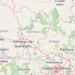
Map view of Los Mármoles National Park

Use this park location map to pinpoint Los Mármoles National Park in Mexico, understand its exact geographic position, and read its mapped placement within the surrounding landscape more clearly.

Pigeon | © OpenStreetMap contributors
Park atlas

Trace the mapped geography and conservation landscapes near Los Mármoles National Park

Explore Nearby National Parks and Protected Areas Beyond Los Mármoles National Park

Continue your exploration of Mexico's protected areas by browsing other national parks and protected landscapes near Los Mármoles National Park. Compare their unique ecological zones and mountainous terrain to understand the broader conservation efforts within the Sierra Madre Oriental region.
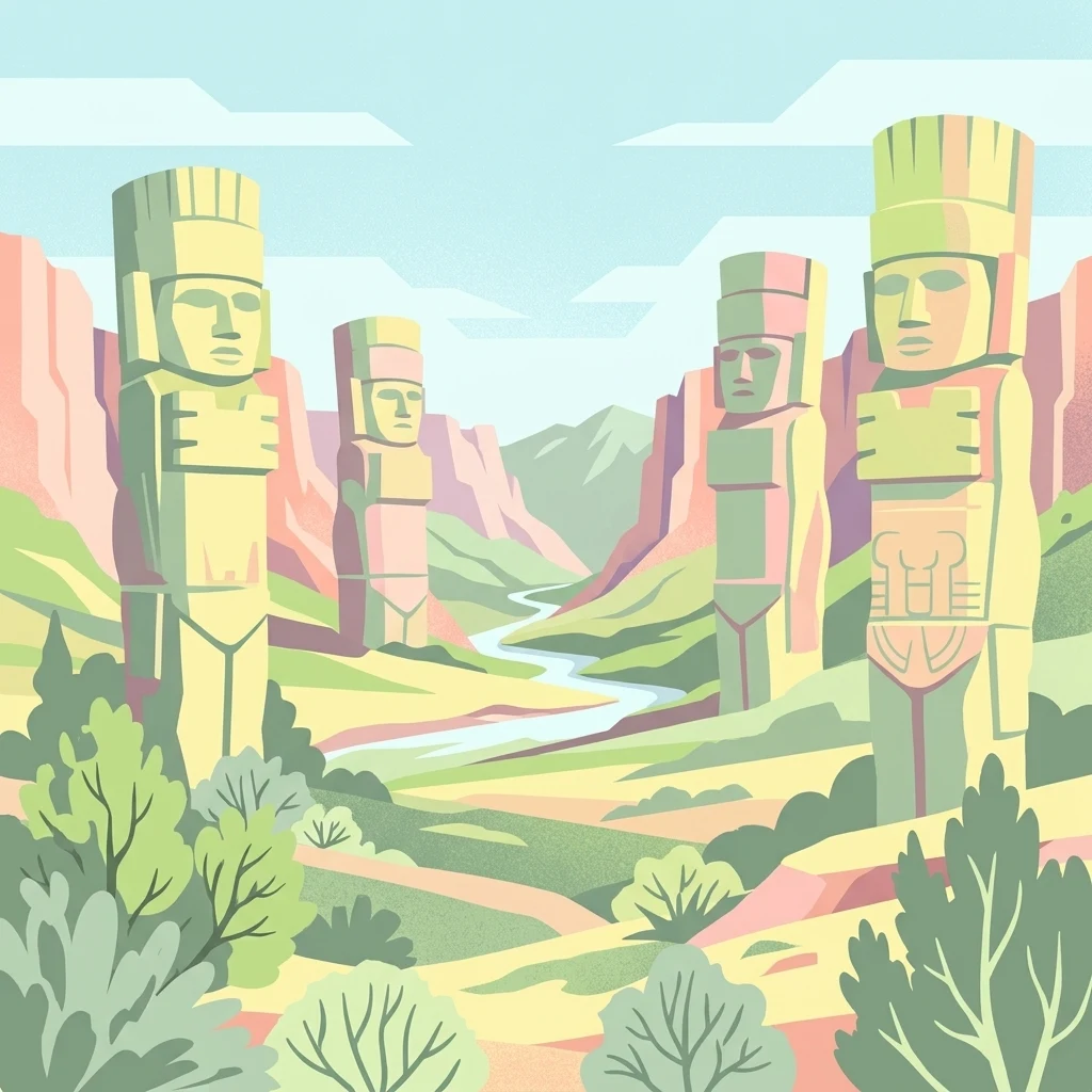
Stylized illustration showing four large stone statues in a valley landscape with a river, hills, and vegetation
Protected areaMexico
About 90 km away#1 closest

South

Tula National Park: Mapped Protected Landscape and Toltec Civilization Atlas

Explore iconic Toltec warrior sculptures and the surrounding geographic terrain.

Tula National Park in Mexico offers a detailed look at the Postclassic Toltec capital, Tollan-Xicocotitlan. As a protected area, its preserved ruins, including the striking Atlantes de Tula warrior columns and the serpent wall, provide crucial insights into Mesoamerican history and architecture. This site's geographic setting in the Tula River Valley, coupled with its architectural parallels to other major sites, makes it a focal point for understanding ancient regional dynamics and landscape utilization.

Area
1 km²
Established
1981
Relief
Upland
Climate
Arid
National parkHidalgo
About 91 km away#2 closest

Southeast

El Chico National Park: National Park Boundaries and Regional Geography in Hidalgo

Explore the mapped protected landscape and terrain of this national park.

El Chico National Park is a distinct protected area offering insight into Mexico's regional geography and conservation landscapes. This page details its specific geographic footprint, the character of its natural terrain, and its place within Hidalgo's broader protected areas atlas. Users can examine mapped boundaries and understand the park's unique environmental context.

Area
27.39 km²
Established
1982
IUCN
II
Relief
Mountain
National parkQuerétaro
About 125 km away#3 closest

West

El Cimatario National Park: National Park Protected Landscape in Querétaro Region

Explore mapped boundaries and regional geography.

Investigate El Cimatario National Park, a protected national park located in Querétaro, Mexico. This entry offers detailed atlas-style insights into the park's protected landscape, its geographic setting within the region, and its clearly mapped boundaries. It serves as a focused point for understanding this specific natural area's place in broader geographic and conservation mapping.

Area
24.48 km²
Established
1982
IUCN
II
Relief
Mountain
National parkMexico
About 128 km away#4 closest

West

Cerro de Las Campanas National Park: Detailed Protected Landscape and Geographic Context

Explore mapped boundaries and regional atlas information for this Mexican national park.

Cerro de Las Campanas National Park is a protected national park in Mexico, offering a specific focus for geographic discovery. Users can investigate its mapped boundaries and understand how this protected area fits into the larger atlas of Mexico's natural landscapes. This page serves as an authoritative entry point for appreciating the park's unique geographic identity and its significance as a protected natural entity within the country's conservation framework.

IUCN
II
Protected areaPuebla
About 145 km away#5 closest

Southeast

Zona Protectora Forestal Vedada Cuenca Hidrográfica del Río Necaxa: Mountain Watershed Atlas

Protected Sierra Madre Oriental mountain landscapes and reservoirs

This protected area safeguards the complex upper watershed of the Necaxa River, where dense cloud forests meet engineered reservoirs. Spanning the mountainous border region, the area serves as a key case study in forest conservation, river basin management, and wetland habitat protection within the broader geographic framework of the Sierra Madre Oriental.

Area
421.29 km²
Established
1938
IUCN
VI
Relief
Mountain
National parkMexico
About 152 km away#6 closest

South

El Tepeyac National Park: Protected National Park Landscape and Regional Geography

Explore mapped boundaries and the park's geographic context.

Gain a detailed understanding of El Tepeyac National Park, a protected national park situated within Mexico. This entry provides essential geographic context, focusing on its mapped boundaries and its role as a protected landscape. It is designed to support users interested in the atlas-level exploration of natural areas, offering foundational information about the park's identity and its position within the broader geographic framework of Mexico.

Area
15 km²
Established
1937
IUCN
VI
Relief
Upland
Protected landscapeEstado de México
About 153 km away#7 closest

South

Parque Ecológico Lago de Texcoco: Mapped Protected Landscape and Regional Geography

A large-scale wetland and ecological restoration project in the Valley of Mexico.

Parque Ecológico Lago de Texcoco stands as a significant protected landscape, transforming a drained lacustrine basin into a vibrant mosaic of saline vegetation and water regulation zones. As an internationally recognized Ramsar wetland and Important Bird Area, the site offers a deep look into the ecological recovery of the Valley of Mexico. The terrain is defined by its flat basin character, ancient archaeological remnants on elevated hill areas, and a expansive network of restored water systems.

Area
140 km²
Established
2024
Relief
Lowland
Climate
Temperate
National parkMexico State
About 154 km away#8 closest

South

Los Remedios National Park: Protected Landscape and Historical Geography of Mexico State

Mapped terrain and cultural heritage within this unique national park.

Delve into the protected landscape of Los Remedios National Park, a national park situated in Mexico State. This page provides detailed geographic context, focusing on its volcanic terrain, mapped boundaries, and the convergence of pre-Hispanic and colonial heritage. Understand its role as a protected area within the western Valley of Mexico and explore the mapped elements that define its cultural and natural identity.

Area
4 km²
Established
1938
IUCN
II
Relief
Mountain

Common questions about visiting, size, designation, and location context for Los Mármoles National Park

Los Mármoles National Park FAQs for park facts, access, geography, and protected area context

Find quick answers about Los Mármoles National Park, including protected-area facts, park geography, trail and visitor context, and how the park fits into its surrounding country and regional landscape.
MoriAtlas Explorer

Continue Your Protected Areas Search Across the Global Atlas

Deepen your exploration by continuing the structured search for national parks and protected areas worldwide. Utilize the comprehensive filtering capabilities to compare different conservation landscapes and refine your understanding of global park geography. Discover more about the distribution and characteristics of protected natural areas.

Global natural geography