Mori Atlas logo
Wildlife reserveLusk Creek Wilderness

Mapping the dramatic sandstone cliffs and recovered hardwood forests of a major Midwestern wilderness area.

Lusk Creek Wilderness in Illinois: A Detailed Atlas of Protected Canyon Landscapes and Terrain

Lusk Creek Wilderness represents the largest federally designated wilderness area within Illinois, protecting over 6,000 acres of rugged, deeply dissected terrain. This protected landscape is defined by the erosional force of the Lusk Creek drainage, which has carved significant sandstone canyons and sheer bluffs through the forest. Beyond the canyon walls, mature second-growth hardwood forests, including oak and hickory, blanket the ridges and slopes, providing an essential example of regional ecological recovery in the Shawnee hills.

wilderness areasandstone canyonhardwood forestnational forestriver corridornational natural landmark

Lusk Creek Wilderness

Wildlife reserve

Park overview

Structured park overview, official facts, and landscape profile for Lusk Creek Wilderness

Lusk Creek Wilderness park facts, protected area profile, and essential visitor context

Review the core facts for Lusk Creek Wilderness, including designation, size, terrain, visitor scale, habitats, and operating context in one park-focused overview.

About Lusk Creek Wilderness

Lusk Creek Wilderness occupies a stretch of the Shawnee hills in extreme southern Illinois, where the relatively flat agricultural reputation of the state gives way to a surprising landscape of canyons, bluffs, ridges, and densely wooded stream valleys. Although only a few thousand acres in size, it is large enough by Illinois wilderness standards, and rugged enough in terrain, to feel much more expansive to a visitor on the ground. The area is essentially a roadless interior tract within the larger Shawnee National Forest, accessible on foot through an informal network of trails, including the famous River to River Trail that traverses the region.

The defining feature of the wilderness is Lusk Creek Canyon itself, a deeply eroded sandstone gorge that has been recognized as a National Natural Landmark. The rock is gray Carboniferous sandstone, the same geological foundation that produces the spectacular formations at the better-known Garden of the Gods Wilderness nearby. Over millions of years, the creek and its small tributaries have cut downward into this sandstone, producing sheer cliffs, narrow hollows, exposed rock faces, and terraces where finer material has accumulated. The result is a landscape that resembles, in miniature, the canyon country typically associated with the American West, dropped into the wooded hills of the lower Midwest.

Vegetation throughout the wilderness reflects the area's land-use history. For much of the nineteenth and early twentieth centuries, the hills here were used as pasture for cattle and other livestock. Federal land condemnations in the 1930s ended that grazing, and abandoned pastures gradually returned to forest. Today the wilderness consists of mature second-growth woodland dominated by hardwood species: sugar maple and beech on the cooler, sheltered terraces, and hickory and white oak on the drier slopes and ridges. This combination of canyon topography and recovering hardwood forest gives the area both visual interest and ecological importance, and it is one of the few places in Illinois where true wilderness conditions have been formally recognized at a substantial scale.

Quick facts and research context for Lusk Creek Wilderness

Lusk Creek Wilderness is a 6,293-acre Wilderness Area located in Pope County, Illinois, and is the largest designated wilderness in the state. It lies within the Shawnee National Forest and is administered by the U.S. Forest Service.

The area was designated as wilderness through the Illinois Wilderness Act of 1990, which set aside seven parcels within Shawnee National Forest, and it encompasses the Lusk Creek Canyon National Natural Landmark. The wilderness is roadless, undeveloped, and used primarily for hiking, wildlife observation, and solitude, with the River to River Trail providing a key route through its terrain.

Protection and recognition

Documented terrestrial protected area status and management scope

Lusk Creek Wilderness Protection Status and Recognition Details

Lusk Creek Wilderness maintains a defined terrestrial protection scope within its designated natural landscape. Documented conservation records outline the official protected area designation and management framework governing the terrain.

Protection details

Protection scope
Terrestrial
Transboundary protection
No
Park context

Deeper park guide and search-rich context for Lusk Creek Wilderness

Lusk Creek Wilderness history, landscape, wildlife, and travel context

Explore Lusk Creek Wilderness through its history, landscape character, ecosystems, wildlife, conservation priorities, cultural context, and seasonal travel timing in a structured park guide built for atlas discovery and search intent.

Why Lusk Creek Wilderness stands out

Lusk Creek Wilderness is best known for its deep sandstone canyons and dramatic bluffs, particularly the Lusk Creek Canyon National Natural Landmark, which forms the geological centerpiece of the area. The wilderness also stands out as the single largest wilderness designation in the state of Illinois, an unusual distinction given how small and fragmented such designations tend to be in the region. Beyond its canyon scenery, the area is recognized for the ecological recovery of its hardwood forests: former pasture land purchased through federal condemnations in the 1930s has reverted to mature second-growth woodland, with sugar maple and beech on sheltered terraces and hickory and white oak on the slopes. The wilderness is also associated with one especially notable overlook, Indian Kitchen, a scenic bluff whose top remains in private hands and is not open to public access.

Lusk Creek Wilderness history and protected-area timeline

The landscape of Lusk Creek Wilderness carries the imprint of two very different eras of land use.

For much of the nineteenth and early twentieth centuries, the forested hills of southern Pope County were used as pasture land. Settlers cleared portions of the slopes and ridges, allowing livestock to graze among the remaining trees. By the late 1920s and into the 1930s, the federal government began acquiring large tracts of eroded and damaged farmland in southern Illinois through land condemnation purchases, eventually assembling land that would become the Shawnee National Forest, formally established in 1939. The end of grazing within the Lusk Creek area allowed pasture openings to revert to forest, gradually producing the dense second-growth woodland that defines the wilderness today.

The area was protected in a second wave of action in 1990, when the Illinois Wilderness Act designated seven separate parcels within Shawnee National Forest as Wilderness Areas under the National Wilderness Preservation System. Lusk Creek Wilderness was among them and was the largest of the seven, giving it the distinction of being the single largest Wilderness Area in Illinois. It has since been managed as a roadless area with no motorized access, intended to preserve its wilderness character for future generations and to protect its unique geological and ecological resources.

Lusk Creek Wilderness landscape and geographic character

Lusk Creek Wilderness is defined by the erosional history of a single drainage system: Lusk Creek and its small tributaries have cut downward into the local bedrock, producing a landscape of deep canyons, narrow hollows, exposed cliffs, and forested terraces. The bedrock throughout the area is gray Carboniferous sandstone, the same rock type that underlies the better-known formations of the Garden of the Gods Wilderness to the west. Because the layers of sandstone weather unevenly, the canyons feature a mixture of sheer vertical cliffs, rounded overhangs, slumping slopes, and exposed rock shelves.

The terrain within the wilderness is strongly dissected. Steep-walled ridges drop abruptly to creek bottoms, and the elevation changes within short distances can be pronounced. The eroded landscape culminates in the Lusk Creek Canyon National Natural Landmark, a particularly dramatic section of the drainagethat anchors the area's scenic identity. From certain overlook points along the canyon rim, visitors can look down into the gorge and along the forested slopes on the far side. One especially famous viewpoint, known as Indian Kitchen, sits on a bluff whose summit is technically outside the wilderness boundary because it remains in private hands, even though its dramatic face lies within the protected area.

Away from the canyon itself, the wilderness contains undulating hills and ridges covered in closed-canopy hardwood forest, broken intermittently by small drainages and rocky outcrops. Although the area is not mountainous in any conventional sense, the combination of cliffs, ravines, and densely wooded slopes produces a sense of relief and isolation unusual for southern Illinois.

Lusk Creek Wilderness ecosystems, habitats, and plant life

The ecological character of Lusk Creek Wilderness is shaped by the combination of sandstone canyon topography, a humid temperate climate, and a relatively recent history of forest recovery. After livestock grazing ended in the 1930s, former pasture openings grew back into forest, so the modern vegetation is almost entirely second-growth hardwood, with individual trees that can nonetheless reach large size on favorable sites.

The dominant forest community of the area is mixed mesophytic hardwood. On sheltered terraces and cooler lower slopes, where moisture collects and soil depth is greater, the canopy is dominated by sugar maple and American beech, species typical of richer, more protected sites. On the drier slopes and ridges, the forest shifts toward hickory, white oak, and other oaks, which are better adapted to thinner soils and more exposure. This pattern of terrace communities versus slope and ridge communities is characteristic throughout the Shawnee hills and gives the wilderness a layered botanical character.

Beneath the canopy, the steep terrain and rocky soils limit most human disturbance, and shaded sandstone walls contribute microhabitats for mosses, ferns, and other moisture-loving plants. The watershed itself, draining through Lusk Creek, supports a small but ecologically important riparian corridor, where vegetation is lusher and the canopy is more continuous. Although the area is small, its combination of canyon topography, recovering hardwood forest, and protected status makes it ecologically meaningful within the broader context of southern Illinois.

Lusk Creek Wilderness wildlife and species highlights

Wildlife in Lusk Creek Wilderness reflects the broader patterns of the Shawnee hills rather than any unique assemblage of its own. The dense second-growth hardwood forest, the dissected canyon topography, and the roadless nature of the protected area together support healthy populations of forest-interior species that require both cover and relative freedom from human disturbance.

White-tailed deer are among the most commonly observed mammals, using the forest understory and the steep slopes for browse and bedding cover. Smaller mammals such as gray fox, raccoon, opossum, and various squirrel species, including fox squirrel and gray squirrel, are present throughout the area. The cliffs and rocky outcrops along the canyon walls also provide denning and roosting habitat for raptors such as red-tailed hawks and great horned owls.

Songbirds associated with eastern deciduous forest are abundant, with breeding populations of wood thrush, ovenbird, scarlet tanager, summer tanager, and various warbler species typically present in the mature hardwood stands. Reptiles and amphibians find refuge in the cool, damp conditions of the canyon bottoms and along Lusk Creek itself, where salamanders, frogs, and a variety of snake species are part of the local fauna. Because the wilderness is roadless and largely free of intensive human activity, it functions as a quiet refuge for wildlife in a region otherwise dominated by agriculture.

Lusk Creek Wilderness conservation status and protection priorities

Lusk Creek Wilderness is significant as the largest federally designated Wilderness Area in Illinois, a state in which Wilderness Areas are both small in total acreage and few in number. Its 1990 designation through the Illinois Wilderness Act recognized not only the area's ecological and geological values but also the need to preserve a roadless, undeveloped tract within a national forest that has otherwise been shaped by generations of agricultural and grazing land use.

Conservation value here is closely tied to the recovery of the forest itself. The transition from heavily grazed pasture land to mature second-growth hardwood forest is a textbook case of land sparing followed by natural recovery, and the wilderness now protects that recovering forest from future disturbance. By keeping the area roadless and free of motorized access, the U.S. Forest Service management approach ensures that the watershed, the canyon features, and the interior forest environment remain intact.

The Lusk Creek Canyon National Natural Landmark, embedded within the wilderness, adds an additional layer of recognition: the canyon is formally acknowledged at the national level as a significant natural feature, and the surrounding wilderness buffer is one of the primary mechanisms by which that landmark is protected. Together, the wilderness designation, the natural landmark status, and the area's role within the broader Shawnee National Forest make Lusk Creek Wilderness an important piece of the conservation fabric of southern Illinois.

Lusk Creek Wilderness cultural meaning and human context

Although the Lusk Creek Wilderness itself has no major built cultural features, the surrounding region of Pope County carries a strong rural and agricultural cultural identity, with scattered small communities such as Eddyville serving as gateways to the wilderness. The names applied to features within the area, including the overlook known as Indian Kitchen, hint at a longer cultural association with Indigenous peoples of the Ohio and Mississippi river valleys, who traveled through and used these forested hills long before European-American settlement.

The land-use history of the area, including the period of grazing and the later federal condemnations that removed that land from agriculture, is itself a key part of the local cultural story. The transition of this land from private pasture to public forest, and eventually to formally protected wilderness, reflects broader twentieth-century shifts in how southern Illinois landscapes have been valued and managed. Trails such as the River to River Trail also serve cultural purposes, connecting wilderness areas across county lines and providing shared recreational traditions for residents and visitors of the region.

Top sights and standout views in Lusk Creek Wilderness

Lusk Creek Wilderness stands out for combining the largest Wilderness Area designation in Illinois with one of the state's more striking canyon landscapes. Its defining highlights include the Lusk Creek Canyon National Natural Landmark, the dramatic gray sandstone cliffs and bluffs carved by the creek system, and the well-known but privately held Indian Kitchen overlook.

The wilderness also offers excellent examples of recovering second-growth hardwood forest, with classic terrace communities of sugar maple and beech alongside slope forests of hickory and white oak. The presence of the River to River Trail through the area extends its value beyond the wilderness itself, making it a key segment of a broader long-distance hiking experience across the Shawnee hills.

Best time to visit Lusk Creek Wilderness

Lusk Creek Wilderness is best experienced in spring and fall, when mild temperatures combine with active scenery and comfortable hiking conditions. Spring brings leaf-out across the hardwood canopy, wildflowers along the forest floor, and usually higher water in Lusk Creek, which enhances the canyon experience. Fall is the most visually striking season, as the mix of sugar maple, beech, hickory, and oak produces strong autumn color across the hills and ridges.

Summer visits are possible but can be hot and humid, and the shaded conditions within the canyons, while pleasant in terms of temperature, also make for heavy insect activity. Winter visits are quieter and offer clear views from the canyon overlooks because of the leafless canopy, but trail conditions can be slippery on cold rock and frozen leaf litter. In all seasons, comfortable hiking footwear, attention to weather, and a willingness to manage moderate elevation change along the canyon slopes are more important than any specific calendar window.

Monthly climate preview

Long-term representative monthly averages for temperature and precipitation

Lusk Creek Wilderness Climate Normals and Annual Temperature Patterns

Lusk Creek Wilderness exhibits a measured annual temperature and precipitation rhythm across representative coordinates based on historical NASA climatology. Examining the complete monthly climate normals reveals deeper variations in temperature ranges and precipitation rates throughout the year.
Annual mean14 °C
0 °C26 °C
Jan
Feb
Mar
Apr14°
May19°
Jun24°
Jul26°
Aug25°
Sep22°
Oct15°
Nov
Dec
Warmest month
July

25.7 °C

Coolest month
January

0.2 °C

Wettest month
April

4.3 mm/day

Driest month
August

2.5 mm/day

Park location guide

Geography guide, regional context, and park location map for Lusk Creek Wilderness

Lusk Creek Wilderness park geography, regions, and map view in United States of America

Understand where Lusk Creek Wilderness sits in United States of America through a broader geographic reading of the surrounding landscape, nearby location context, and its mapped position within the national park landscape.

How Lusk Creek Wilderness fits into United States of America

The United States of America is a federal presidential republic and one of the world's largest countries by area and population. It consists of 50 states across a vast territory spanning multiple time zones, with its capital in Washington, D.C. and largest city in New York City. The nation has a diverse economy, influential political system, and significant cultural and military presence globally.

Wider geography shaping Lusk Creek Wilderness in United States of America

The United States occupies a vast territory in North America, bordered by Canada to the north and Mexico to the south. The 48 contiguous states stretch from the Atlantic to the Pacific Ocean, while Alaska occupies the northwestern region and Hawaii is an archipelago in the Pacific. The country encompasses diverse terrain including the Rocky Mountains, Appalachian Mountains, Great Plains, and extensive river systems.

Map view of Lusk Creek Wilderness

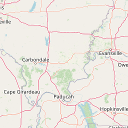
Use this park location map to pinpoint Lusk Creek Wilderness in United States of America, understand its exact geographic position, and read its mapped placement within the surrounding landscape more clearly.

Pigeon | © OpenStreetMap contributors

Location context for Lusk Creek Wilderness

Illinois
Recorded earthquake history

Examine Recorded Earthquake History Near Lusk Creek Wilderness

Review a comprehensive catalogue of seismic events documented in the proximity of Lusk Creek Wilderness. This MoriAtlas dataset offers a transparent look at recorded earthquake history, providing geographic context and event details for the surrounding protected Illinois landscape.

Lusk Creek Wilderness Earthquake History

Catalogued events

8 events

Strongest magnitude

Magnitude 3.8

Most recent event

May 1, 2016

This history includes earthquakes recorded inside the park or within 50 km of its borders

Park atlas

Explore surrounding regional geography and connected protected landscapes across the local terrain.

Parks Near Lusk Creek Wilderness and Related Protected Areas to Compare Next

Compare other parks near Lusk Creek Wilderness to examine similar sandstone canyons, mature hardwood forests, and protected regional landscapes. Continuing into nearby protected areas reveals the broader geographic spread of conservation lands throughout the surrounding region.
Watercolor painting of a wide, rolling landscape featuring layered sandstone bluffs and green forested hills against a light background.
Protected landscapeIllinois
Park boundaries overlap#1 closest

West

Shawnee National Forest: Exploring the Protected Landscapes of the Illinois Shawnee Hills

Mapped sandstone formations and glacial terrain in southern Illinois

Spanning nearly 289,000 hectares, Shawnee National Forest is the largest body of public land in Illinois. The area is defined by its dramatic sandstone bluffs, deep canyons, and seven designated wilderness areas that provide a rare rugged topography within the American Midwest. Explore the complex geography of this forest, from its glacial-sculpted river watersheds to its diverse hardwood habitats and historic reforestation sites.

Area
2,017.83 km²
Established
1933
Relief
Upland
Climate
Temperate
Watercolor painting of rock formations and surrounding green trees on a plain white background.
Wildlife reserveIllinois
7.1 km away#2 closest

Northeast

Garden of the Gods Wilderness: A Protected Sandstone Plateau in Southern Illinois

Explore geologic boundaries, sandstone hoodoos, and forested wilderness terrain

Garden of the Gods Wilderness represents a critical protected area within the Shawnee National Forest, notable for its unglaciated sandstone geography. This 3,318-acre wilderness offers an intimate view of ancient carboniferous rock formations, including prominent hoodoos and clifftop overlooks that provide expansive sightlines across the southern Illinois landscape.

Area
13.43 km²
Established
1990
Relief
Upland
Climate
Temperate
A watercolor painting showing a stylized landscape with rolling green hills, a band of trees, and a pale pink lake surface under a soft morning sky.
Protected landscapeUnited States of America
61 km away#3 closest

Southeast

Land Between the Lakes National Recreation Area: Mapped Geography and Protected Landscapes

An inland peninsula preserved between two major river reservoirs.

Land Between the Lakes National Recreation Area occupies a distinct narrow land bridge between Kentucky Lake and Lake Barkley. This protected landscape contains a dense mix of forested ridges, stream valleys, and managed wildlife prairies. The area is integral to the lower Ohio River Valley geography, showcasing the results of long-term watershed management and large-scale ecological restoration within the United States.

Area
693.1 km²
Established
1963
Visitors
2M annual
Relief
Lowland
National parkMissouri
136 km away#4 closest

West

Mark Twain National Forest: Geography and Protected Area Atlas of Southern Missouri

Mapping the karst terrain and ancient ridges of the Ozark Highlands

Mark Twain National Forest represents a sprawling conservation area within the Missouri Ozark Highlands. Its geography is defined by volcanic mountain remnants, rocky glades, and significant river corridors like the Eleven Point National Scenic River. This record provides insight into the forest's complex mapped boundaries, seven designated wilderness areas, and the distinctive karst geology that characterizes this unique American landscape.

Area
6,037.3 km²
Established
1939
Relief
Upland
Climate
Temperate
Wildlife reserveMissouri
About 158 km away#5 closest

West

Mingo Wilderness: Missouri Protected Wildlife Reserve and Wetland Geography

Primitive bottomland forest and swamp landscape

Mingo Wilderness encompasses 8,000 acres of protected bottomland hardwood forest and cypress-tupelo swamp in southeastern Missouri. As a federally designated wilderness area embedded within a national wildlife refuge, it provides a quiet, primitive habitat characterized by slow-moving creek corridors and varied seasonal wetlands.

Area
32 km²
Established
1976
IUCN
Ib
Relief
Lowland
Watercolor painting of a soft, hazy forest landscape with rolling hills in the background and soft green trees in the foreground.
Protected landscapeIndiana
159 km away#6 closest

Northeast

Hoosier National Forest: Geographic Overview of Indiana Protected Wilderness and Woodlands

Mapping the karst terrain and forest corridors of southern Indiana.

Hoosier National Forest defines the landscape of southern Indiana with its rolling unglaciated hills and ridge systems. Discover the mapped geography of this protected area, including its rare prairie-like barrens, sandstone cliff formations, and the designated Charles C. Deam Wilderness. This overview focuses on the spatial extent and diverse topographic features that distinguish this forest from the surrounding Midwest plains.

Area
826.78 km²
Established
1961
Relief
Upland
Climate
Temperate
Wildlife reserveMissouri
162 km away#7 closest

West

Rockpile Mountain Wilderness: Mapping the Rugged Ridge Landscapes of the Southeastern Ozarks

A federally protected wilderness within Missouri's Mark Twain National Forest

Explore the distinct geography of Rockpile Mountain Wilderness, where a steep granite ridge runs from Little Grass Mountain toward the national forest boundary. This protected area features unique cultural history in the form of an Indigenous stone cairn and showcases the eroded, rocky character of the eastern Ozark highlands. Use this resource to understand the boundary and terrain of this significant wilderness tract.

Area
17.15 km²
Established
1980
IUCN
Ib
Relief
Mountain
National parkMissouri
185 km away#8 closest

Northwest

Gateway Arch National Park: National Park Geographic Atlas and Map Boundaries

Explore protected landscape context and regional setting.

Gateway Arch National Park represents a unique protected landscape within Missouri, contributing to the broader national park atlas. This entry focuses on its specific geographic identity and mapped boundaries, offering structured data for understanding its role. Discover the factual landscape context and regional importance of Gateway Arch National Park for informed geographic exploration.

Area
0.78 km²
Established
2018
IUCN
II
Visitors
1.2M annual

Common questions about visiting, size, designation, and location context for Lusk Creek Wilderness

Lusk Creek Wilderness FAQs for park facts, access, geography, and protected area context

Find quick answers about Lusk Creek Wilderness, including protected-area facts, park geography, trail and visitor context, and how the park fits into its surrounding country and regional landscape.
MoriAtlas Explorer

Continue Your Protected Areas Search Across the Global Atlas

Deepen your exploration by continuing the structured search for national parks and protected areas worldwide. Utilize the comprehensive filtering capabilities to compare different conservation landscapes and refine your understanding of global park geography. Discover more about the distribution and characteristics of protected natural areas.

Global natural geography