
Mori Atlas logo
Wildlife reserveLye Brook Wilderness

Mapping the natural terrain, brook valleys, and ridgelines of this historic Vermont wilderness reserve

Lye Brook Wilderness: A Protected High Plateau Landscape in the Southern Green Mountains of Vermont

Lye Brook Wilderness serves as a significant protected unit within the Green Mountain National Forest, encompassing nearly 18,000 acres of high plateau forest. Defined by its northern hardwood canopy and deep glacial drainages, the area hosts unique geography including Lye Brook Falls and the winding paths of the Long Trail. This space preserves a crucial backcountry environment across Bennington and Windham counties, offering a distinct look at the southern Vermont wilderness through its interconnected ridgelines, quiet ponds, and expansive brook valleys.

wilderness areanational forestGreen Mountain National Forestnorthern hardwood forestmaple birch beech forestwaterfalls
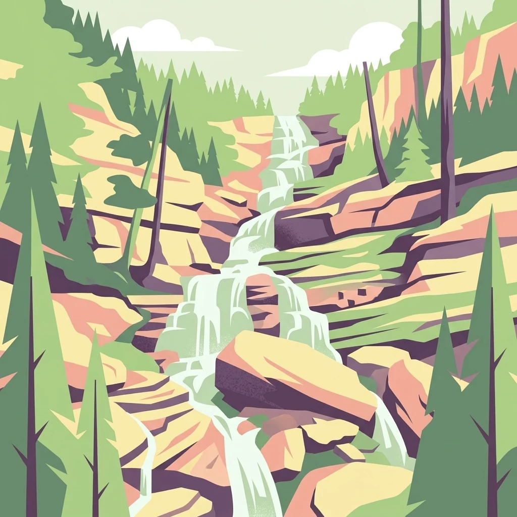
A stylized vector illustration of a multi-tiered waterfall flowing over layered rock formations, surrounded by pine trees under a simple sky.

Lye Brook Wilderness

Wildlife reserve

Park overview

Structured park overview, official facts, and landscape profile for Lye Brook Wilderness

Lye Brook Wilderness park facts, protected area profile, and essential visitor context

Review the core facts for Lye Brook Wilderness, including designation, size, terrain, visitor scale, habitats, and operating context in one park-focused overview.

About Lye Brook Wilderness

Lye Brook Wilderness is a substantial protected backcountry area in southern Vermont, set within the broader landscape of the Green Mountain National Forest. It sits northwest of Stratton, Vermont, and stretches across portions of Bennington County and Windham County. Although not the largest wilderness unit in the state, it is one of the most historically significant, having been established through the Eastern Wilderness Areas Act of 1975 and later reinforced through additional wilderness designations.

The wilderness is defined by a high forested plateau that defines much of the southern Green Mountains. Elevation within Lye Brook runs from roughly 900 feet along its lower brooks to nearly 2,900 feet along its highest ridges, with most of the protected land lying above 2,500 feet. This elevated, relatively even terrain gives the wilderness its characteristic feeling: broad wooded ridges, slow changing views through the trees, and intermittent openings where rocky outcrops or wetlands break the canopy. The plateau character distinguishes it from more sharply alpine areas further north in Vermont.

Lye Brook itself is the area's namesake and central hydrological feature. The brook flows through the western half of the wilderness and has carved a steep valley that culminates in Lye Brook Falls, a roughly 125 foot waterfall considered one of the highest in the state. The falls have become one of the area's most recognizable landmarks and are a frequent destination for hikers entering the wilderness from the south.

The Long Trail, Vermont's historic long-distance footpath, passes through the wilderness along its eastern flank, entering near Stratton Pond and continuing north. Combined with the Lye Brook Trail and the Branch Pond Trail, this trail network makes the wilderness accessible for day hikes, overnight backpacking, and quiet backcountry travel. Its forested setting, relatively undisturbed character, and proximity to southern New England population centers make Lye Brook Wilderness a meaningful example of the older generation of eastern U.S. wilderness areas.

Quick facts and research context for Lye Brook Wilderness

Lye Brook Wilderness is a federally protected wilderness area in southern Vermont, managed by the United States Forest Service as part of the Green Mountain National Forest.

The wilderness spans roughly 18,122 acres across Bennington County and Windham County and ranges in elevation from about 900 feet to roughly 2,900 feet above sea level. Most of the protected area sits on a forested plateau above 2,500 feet. Established in 1975 through the Eastern Wilderness Areas Act, Lye Brook is one of the oldest wilderness areas in Vermont and has been enlarged by the Vermont Wilderness Act of 1984 and the New England Wilderness Act of 2006. It is crossed by the Long Trail and contains Lye Brook Falls, one of the highest waterfalls in the state.

Park context

Deeper park guide and search-rich context for Lye Brook Wilderness

Lye Brook Wilderness history, landscape, wildlife, and travel context

Explore Lye Brook Wilderness through its history, landscape character, ecosystems, wildlife, conservation priorities, cultural context, and seasonal travel timing in a structured park guide built for atlas discovery and search intent.

Why Lye Brook Wilderness stands out

Lye Brook Wilderness is best known for its untouched northern hardwood forests, its position on the Long Trail, and its dramatic waterfall scenery, especially Lye Brook Falls, one of the tallest waterfalls in Vermont. The wilderness also stands out for its high plateau landscape in the southern Green Mountains. Rather than dramatic alpine peaks, the area offers sweeping ridgelines, quiet ponds such as Stratton Pond, deep brook valleys, and broken terrain shaped by glacial and water erosion. Its combination of an established long-distance trail corridor, dense forest cover, and accessible wilderness character near the small town of Stratton makes it a signature Vermont backcountry experience.
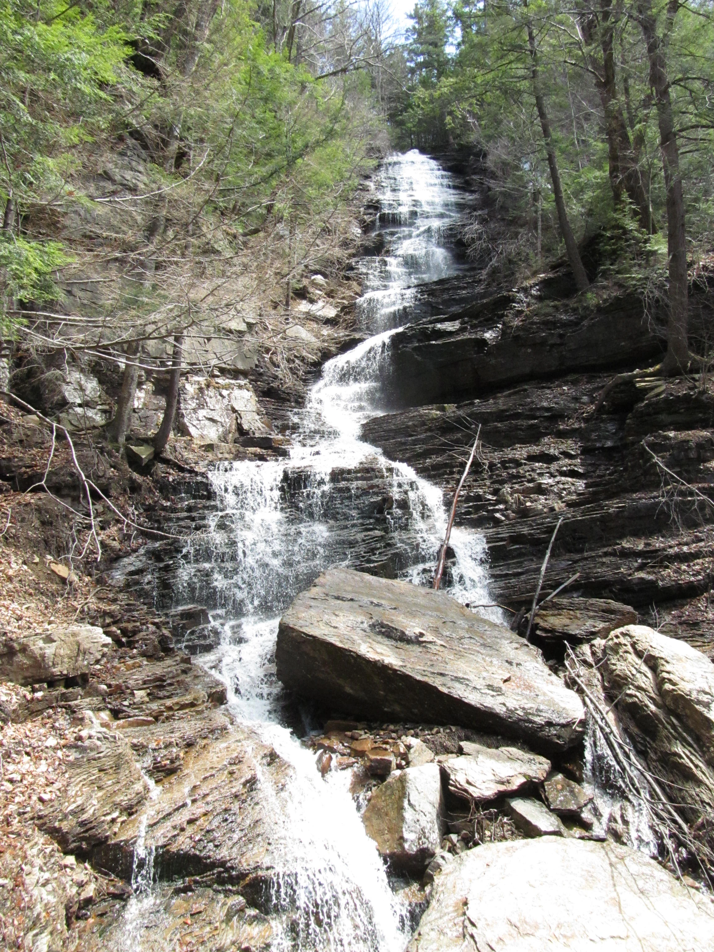
A multi-tiered waterfall cascading down a steep, rocky cliff face surrounded by a dense forest.
Lye Brook Falls flowing over rocky ledges within the Lye Brook Wilderness.

Lye Brook Wilderness history and protected-area timeline

Lye Brook Wilderness was established in 1975 through the Eastern Wilderness Areas Act, federal legislation that designated a series of newly protected wilderness areas across the eastern United States. This early designation makes Lye Brook one of the oldest wilderness areas in Vermont and a product of the expanding national wilderness system of the 1970s.

In 1984, the Vermont Wilderness Act enlarged the area, reflecting growing recognition of its backcountry values and the desire to incorporate additional connected forestland into the protected boundary. A second expansion occurred in 2006 with the passage of the New England Wilderness Act, which further increased the wilderness's footprint and bolstered its conservation status.

Across these three legislative milestones, Lye Brook has grown from its original 1975 boundaries into its present extent of roughly 18,122 acres, all managed today by the United States Forest Service as part of the Green Mountain National Forest. The repeated expansions indicate that the area has been viewed, over several decades, as a high-priority piece of Vermont's wilderness network.

Lye Brook Wilderness landscape and geographic character

The landscape of Lye Brook Wilderness is defined by a high forested plateau typical of the southern Green Mountains. Rather than featuring a single dramatic peak, the wilderness has a broad, elevated interior, with much of the land sitting above 2,500 feet in elevation. From this plateau, terrain drops down into brook valleys and ravines along the area's edges. The transition from high open forest to lower, steeper drainages shapes much of the visual experience of the wilderness.

Lye Brook is the central watercourse, flowing through the western half of the area and producing one of the area's defining landforms: Lye Brook Falls, a roughly 125 foot waterfall that ranks among the tallest in Vermont. Beyond Lye Brook itself, smaller tributaries, ponds such as Stratton Pond, and scattered wetlands add to the diversity of the terrain. Glacial history has left its mark on the area in the form of rounded ridge profiles, scattered boulders, and undulating ground that breaks up what could otherwise be very uniform forest.

Lye Brook Wilderness ecosystems, habitats, and plant life

Approximately eighty percent of Lye Brook Wilderness is forested, with northern hardwoods forming the backbone of the ecological character. Sugar maple, beech, and yellow birch dominate the canopy across much of the wilderness, reflecting the broader forest composition of the Green Mountain National Forest. These hardwoods give the area a rich seasonal cycle, from bright green spring and summer foliage to vibrant fall color and bare winter slopes.

Mixed into the hardwood matrix are small stands and thickets of spruce, which add coniferous character to parts of the forest and contribute to the structural diversity of the canopy. Wetland pockets, stream corridors, and areas near ponds break the continuity of the forest and create habitat edges that support a wider range of plant species and ecological niches. Together, these forest types give the wilderness a quiet, mature woodland identity typical of long-protected Vermont backcountry.

Lye Brook Wilderness wildlife and species highlights

Lye Brook Wilderness supports a typical suite of northern New England forest wildlife. Mammals documented or regularly observed in the area include black bear, moose, white-tailed deer, pine marten, and bobcat, indicating that the wilderness provides habitat large enough and undisturbed enough to sustain both common and more elusive species.

Birdlife in the wilderness reflects the broader Green Mountain National Forest bird community, with mixed northern hardwood and conifer forest habitat supporting a variety of songbirds, woodpeckers, and raptors. Hikers and visitors have logged observations of more than 80 species of animals, plants, and fungi within the area, illustrating the diversity of life supported by the wilderness beyond obvious large mammals. The combination of forest cover, elevation, water features, and limited development makes Lye Brook a meaningful refuge for wildlife within southern Vermont.

Lye Brook Wilderness conservation status and protection priorities

Lye Brook Wilderness is significant from a conservation perspective as one of the earliest formally designated wilderness areas in Vermont, established to preserve the backcountry character of the southern Green Mountains in their natural state. As a designated wilderness under the National Wilderness Preservation System, the area is managed with a deliberate emphasis on minimal human impact, with restrictions on structures, motorized use, and development designed to maintain its wilderness character.

The repeated expansion of the area, first in 1984 and again in 2006, reflects an ongoing recognition of the ecological value of linking additional forestland into the protected core. Managed by the United States Forest Service within the Green Mountain National Forest, the wilderness contributes to habitat connectivity in a region where working forests and developed land dominate the broader landscape. Its high elevation forest cover, intact watercourses, and wildlife habitat give it disproportionate conservation value relative to its size, serving as a refuge for species that require large, contiguous tracts of relatively undisturbed northern hardwood and mixed forest.

Lye Brook Wilderness cultural meaning and human context

Lye Brook Wilderness is closely tied to Vermont's long-standing outdoor recreation and trail culture. The Long Trail, which passes through the wilderness near Stratton Pond, is among the oldest long-distance hiking trails in the United States, and its presence in the area gives the wilderness a layered cultural identity rooted in early 20th century trail-building traditions in Vermont.

The town of Stratton, Vermont, located southeast of the wilderness, has long served as a gateway community for hikers, hunters, and backcountry travelers. Local use of the forest for hunting, fishing, and hiking predates the formal wilderness designation, and the protection of the land under federal wilderness law formalized an existing relationship between nearby communities and these mountains. The wilderness now occupies a place in the regional identity as a quiet, accessible stretch of preserved backcountry in southern Vermont.

Top sights and standout views in Lye Brook Wilderness

Lye Brook Wilderness stands out for its Lye Brook Falls, one of the tallest waterfalls in Vermont, and for the passage of the Long Trail through its eastern side near Stratton Pond. The wilderness's high plateau forest, dominated by northern hardwoods with scattered spruce, gives it a distinct character among Vermont wilderness areas.

Additional highlights include the area's status as one of Vermont's oldest wilderness designations, set aside in 1975, and the diversity of wildlife supported within its forests, from black bear and moose to pine marten and bobcat. Its combination of mature hardwood canopy, accessible trail network, and quiet backcountry atmosphere makes Lye Brook a representative example of southern Green Mountain wilderness.

Best time to visit Lye Brook Wilderness

Summer and early fall are generally the most favorable seasons for experiencing Lye Brook Wilderness, when trail conditions are reliable, brook crossings are manageable, and the northern hardwood forest is fully leafed out. Late September through early October can be especially rewarding for visitors interested in fall foliage, when maples, birches, and beeches across the high plateau turn vivid shades of orange, red, and gold.

Late spring can also be a good period for visitors comfortable with wetter and sometimes muddy trails, as wildflowers emerge and water levels on brooks and at Lye Brook Falls are typically at their highest. Winter brings snow-covered forest and a quieter, more remote character, though deep snow, exposure on ridgelines, and reduced daylight make winter travel significantly more demanding and generally suited to experienced backcountry users.

Monthly climate preview

Long term temperature and precipitation records measured across representative regional coordinates

Lye Brook Wilderness Climate Normals and Annual Weather Patterns

Historical climatology data details the measured annual temperature spread and daily precipitation rates recorded across representative Lye Brook Wilderness coordinates. Reviewing the complete monthly profile provides clear reference values for long term meteorological monitoring and geographic research.
Annual mean6 °C
-8 °C19 °C
Jan-8°
Feb-7°
Mar-2°
Apr
May12°
Jun17°
Jul19°
Aug19°
Sep15°
Oct
Nov
Dec-4°
Warmest month
July

19.5 °C

Coolest month
January

-7.6 °C

Wettest month
June

3.7 mm/day

Driest month
February

2.4 mm/day

Park location guide

Geography guide, regional context, and park location map for Lye Brook Wilderness

Lye Brook Wilderness park geography, regions, and map view in United States of America

Understand where Lye Brook Wilderness sits in United States of America through a broader geographic reading of the surrounding landscape, nearby location context, and its mapped position within the national park landscape.

How Lye Brook Wilderness fits into United States of America

The United States of America is a federal presidential republic and one of the world's largest countries by area and population. It consists of 50 states across a vast territory spanning multiple time zones, with its capital in Washington, D.C. and largest city in New York City. The nation has a diverse economy, influential political system, and significant cultural and military presence globally.

Wider geography shaping Lye Brook Wilderness in United States of America

The United States occupies a vast territory in North America, bordered by Canada to the north and Mexico to the south. The 48 contiguous states stretch from the Atlantic to the Pacific Ocean, while Alaska occupies the northwestern region and Hawaii is an archipelago in the Pacific. The country encompasses diverse terrain including the Rocky Mountains, Appalachian Mountains, Great Plains, and extensive river systems.

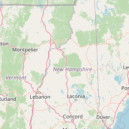
Map view of Lye Brook Wilderness

Use this park location map to pinpoint Lye Brook Wilderness in United States of America, understand its exact geographic position, and read its mapped placement within the surrounding landscape more clearly.

Pigeon | © OpenStreetMap contributors

Location context for Lye Brook Wilderness

Bennington CountyVermontWindham County
Recorded earthquake history

Explore the Lye Brook Wilderness Historical Earthquake Catalogue

Review the recorded history of seismic activity associated with the Lye Brook Wilderness landscape. This MoriAtlas catalogue provides structured data on past earthquake events, allowing for informed geographic analysis of documented epicentres in the surrounding region.

Lye Brook Wilderness Earthquake History

Catalogued events

1 event

Strongest magnitude

Magnitude 3.1

Most recent event

Mar 11, 2020

This history includes earthquakes recorded inside the park or within 50 km of its borders

Visualizing northern hardwood forests, high plateau terrain, and waterfall environments.

Lye Brook Wilderness Photos and Protected Landscape Scenery

Examine authentic Lye Brook Wilderness photos to understand the rugged terrain, dense hardwood canopies, and hidden aquatic environments of southern Vermont. Visual documentation provides direct insight into protected forest ecosystems, remote ridgelines, and high-altitude plateau geography.

A multi-tiered waterfall cascading down a steep, rocky cliff face surrounded by a dense forest.

Park atlas

Compare adjacent forest reserves, ridgelines, and regional protected natural areas.

Explore Parks Near Lye Brook Wilderness and Surrounding Protected Landscapes

Browsing other parks near Lye Brook Wilderness reveals connected regional forest ecosystems and upland protected landscapes across southern Vermont. Comparing these nearby natural areas provides valuable geographic context for understanding the wider Green Mountain mountain terrain.
Watercolor painting of a lush green landscape featuring rolling hills in the distance, a meandering stream in the midground, and wetlands with cattails in the foreground.
Protected landscapeVermont
Park boundaries overlap#1 closest

North

Green Mountain National Forest: Mapped Geography and Protected Landscape Analysis

Examining the wilderness backbone of Vermont's mountainous terrain

Gain insight into the expansive boundaries of Green Mountain National Forest, an essential protected area spanning the Green Mountains of Vermont. This profile details the forest's composition, ranging from high-elevation spruce-fir zones to mixed hardwood slopes and extensive federal wilderness corridors, providing a foundational geographic understanding of this vital northeastern landscape.

Area
1,615.31 km²
Established
1932
Relief
Mountain
Climate
Temperate
Wildlife reserveBennington County
18 km away#2 closest

South

George D. Aiken Wilderness: Protected Forest Landscapes and Ridgelines in Vermont

Detailed geographic overview of a Green Mountain wilderness reserve

Spanning over 4,800 acres in Bennington County, the George D. Aiken Wilderness stands as a significant protected area within the southern Green Mountains. The terrain features narrow ridgelines, steep valleys, and a dense canopy of northern hardwoods that remain unmanaged to maintain wilderness standards. This area serves as a primary geographic anchor for Eastern wilderness preservation efforts in the United States.

Area
19 km²
Established
1984
IUCN
Ib
Relief
Mountain
Protected landscapeVermont
About 25 km away#3 closest

North

Robert T. Stafford White Rocks National Recreation Area: Protected Landscape and Regional Geography

Southern Vermont wilderness, quartzite formations, and Appalachian Trail corridors.

Robert T. Stafford White Rocks National Recreation Area represents a unique fusion of protected forest and rugged geological character in southern Vermont. Known for the quartzite rockslides of Chaos Canyon and its inclusion of two distinct wilderness areas, this territory offers a complex terrain profile. Spanning over 36,000 acres, it serves as a central hub for regional backcountry exploration, blending dense hardwood ecosystems with the prominent rocky outcrops that define its distinct mountainous identity.

Area
147 km²
Established
1984
Water
Major water bodies
Protected areaAddison County
About 82 km away#4 closest

North

Joseph Battell Wilderness: Mapping Protected Ridges in the Green Mountain National Forest

A high-elevation Appalachian landscape in Addison County, Vermont.

Spanning over twelve thousand acres, the Joseph Battell Wilderness preserves a critical core of the Green Mountains. This protected area features dramatic cliff faces like Mount Horrid and a continuous sequence of summits exceeding three thousand feet. The region provides a deep look at northern hardwood habitats and the geographic influence of the Long Trail within the broader Vermont mountain landscape.

Area
49.92 km²
Established
2006
Relief
Mountain
Climate
Temperate
Protected landscapeNew Hampshire
99 km away#5 closest

Northeast

White Mountain National Forest: Protected Landscape Atlas and Geographic Boundary Context

Mapping the alpine ridges and river valleys of New Hampshire

Delve into the geography of White Mountain National Forest, a primary federal protected landscape in the eastern United States. This overview details the mountainous terrain, including the Presidential Range and Pemigewasset Wilderness, providing a clear window into its spatial scale, watershed boundaries, and regional prominence within the New England landscape.

Area
3,038.59 km²
Established
1918
Relief
Mountain
Climate
Temperate
A horizontal watercolor painting showing a wide coastal estuary with gentle hills in the background, a winding body of water in the middle ground, and soft green trees and shrubs in the foreground.
Nature reserveNew Hampshire
About 166 km away#6 closest

East

Great Bay National Estuarine Research Reserve: Protected Coastal and Estuarine Geography

Regional tidal habitat and protected watershed in New Hampshire

Great Bay National Estuarine Research Reserve protects a vital coastal landscape characterized by broad tidal basins, fringing salt marshes, and inland woodlands. Located in southeastern New Hampshire, this nature reserve serves as an essential site for studying the intersection of freshwater and saltwater ecosystems, preserving a mosaic of land and water that illustrates the complex geography of the Atlantic coast.

Area
41.42 km²
Established
1989
Relief
Lowland
Climate
Temperate
A watercolor painting of a green, rolling coastal landscape with gentle hills and trees under a white background.
Protected landscapeMassachusetts
About 185 km away#7 closest

Southeast

Boston Harbor Islands National and State Park: Mapping Coastal Protected Landscapes

A diverse archipelago of islands and tidal harbors in Massachusetts

Boston Harbor Islands National and State Park offers an expansive look at coastal geography within the Massachusetts Bay. Spanning dozens of islands and peninsulas, this protected landscape captures a blend of drumlin terrain, tidal salt marshes, and historic maritime structures set directly against the urban skyline of Boston.

Area
6 km²
Established
1996
Visitors
28.2K annual
Relief
Lowland
Marine protected areaRhode Island
About 212 km away#8 closest

Southeast

Narragansett Bay National Estuarine Research Reserve: Island and Marine Protected Area Overview

A coastal research landscape in Rhode Island

Discover the geographic composition of the Narragansett Bay National Estuarine Research Reserve. This marine protected area spans the terrestrial and aquatic zones of three major islands within the Narragansett Bay system, providing a deep look at estuarine habitat conservation and regional island geography.

Area
15.9 km²
Established
1980
Relief
Lowland
Climate
Temperate

Common questions about visiting, size, designation, and location context for Lye Brook Wilderness

Lye Brook Wilderness FAQs for park facts, access, geography, and protected area context

Find quick answers about Lye Brook Wilderness, including protected-area facts, park geography, trail and visitor context, and how the park fits into its surrounding country and regional landscape.
MoriAtlas Explorer

Continue Your Protected Areas Search Across the Global Atlas

Deepen your exploration by continuing the structured search for national parks and protected areas worldwide. Utilize the comprehensive filtering capabilities to compare different conservation landscapes and refine your understanding of global park geography. Discover more about the distribution and characteristics of protected natural areas.

Global natural geography