
Mori Atlas logo
Nature reserveMali me Gropa-Bizë-Martanesh Nature Park

Tracing the karst plateaus, glacial valleys, and forested mountain ridges of this protected reserve

Mali me Gropa-Bizë-Martanesh Nature Park: An Extensive Protected Landscape in Central Albania

(Parku Natyror Mali me Gropa-Bizë-Martanesh)

Mali me Gropa-Bizë-Martanesh Nature Park stands as a significant protected area in central Albania, defined by its complex vertical zonation from Mediterranean shrubland to alpine grasslands. The geography is characterized by the Mali me Gropa karst massif, deep river canyons, and isolated glacial lakes that anchor a diverse ecosystem. Spanning across diverse terrain in the interior, this nature reserve serves as a critical corridor for large carnivores and a sanctuary for high-altitude plant species in the Dinaric mountain chain.

mountain landscapekarst plateauprotected landscapemixed forestconiferous forestdeciduous forest
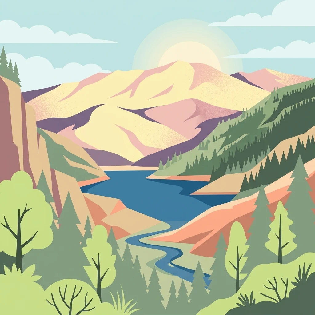
A flat-style vector illustration of a mountain range surrounding a blue river flowing through a valley with pine trees in the foreground.

Mali me Gropa-Bizë-Martanesh Nature Park

Nature reserve

Park overview

Structured park overview, official facts, and landscape profile for Mali me Gropa-Bizë-Martanesh Nature Park

Mali me Gropa-Bizë-Martanesh Nature Park park facts, protected area profile, and essential visitor context

Review the core facts for Mali me Gropa-Bizë-Martanesh Nature Park, including designation, size, terrain, visitor scale, habitats, and operating context in one park-focused overview.

About Mali me Gropa-Bizë-Martanesh Nature Park

Mali me Gropa-Bizë-Martanesh Nature Park is one of the more recently declared protected areas in Albania, formally established in early 2007. It is administered by the Ministry of Environment and managed as a Category IV habitat and species management area under Albanian law, while the International Union for Conservation of Nature recognizes the broader landscape as Category V. The park stretches across Bulqizë, Mat, and Tirana districts in central Albania and lies at a critical geographic junction: it adjoins the expanded Dajti National Park to the northwest, and forms a natural ecological continuum with the Bovilla basin and Qafështama National Park further north. Together, these protected areas represent a sizable swath of relatively continuous mountainous habitat in the center of the country.

The park's topography is shaped by major mountain massifs, river valleys, and karst plateaus. The Mali me Gropa massif itself is considered one of the most typical karst landscapes in Albania; its ridges are filled with sinkholes, dolines, and karst pits from which the area takes its name, often clothed with highland meadows and pastures. Other notable landscapes within the park include the Martanesh Canyon and glacial features such as Liqeni i Zi, a dark mountain lake, as well as panoramic high passes such as Priska Pass. Forests, dominated by coniferous and deciduous species, dominate the area, with agricultural land, pastures, meadows, and small settlements filling the rest of the mosaic.

Five official nature monuments fall within the park's boundaries, among them the caves of Xixelles, Valit, and Shutrese, and a glacial valley and lake, and a rock formation called Malit me Gropa. These monuments add a strong geological dimension to the park's ecological value. Culturally, the territory still hosts traditional highland villages with long histories of pastoral and agricultural land use, and the Albanian-language management concept for the park explicitly provides for a traditional-use zone, a sustainable-use zone, a core conservation zone, and a recreational zone that includes the Valit valley and the area around the Martanesh teqe (Bektashi lodge).

Quick facts and research context for Mali me Gropa-Bizë-Martanesh Nature Park

Mali me Gropa-Bizë-Martanesh Nature Park is a protected landscape in central Albania, established in 2007 under the authority of the Albanian Ministry of Environment. It covers approximately 25,000 to 26,000 hectares across parts of Bulqizë, Mat, and Tirana districts, dominated by roughly 70% forest cover. The park borders Dajti National Park to the northwest and is linked ecologically to the Bovilla basin and Qafështama National Park, forming part of a broader central Albanian natural corridor. It has been designated a Category IV nature park by Albania and recognized by the IUCN, and is listed by Plantlife as an Important Plant Area.

Protection and recognition

Terrestrial conservation scope, designation records, and administrative framework.

Mali me Gropa-Bizë-Martanesh Nature Park Protection Status and Recognition

Mali me Gropa-Bizë-Martanesh Nature Park maintains a designated terrestrial conservation status within regional boundaries. Documented records outline the administrative framework, protection scope, and official designation parameters for the protected area.

Protection details

Protection scope
Terrestrial
Transboundary protection
No
Core area
137.53 km²
Park context

Deeper park guide and search-rich context for Mali me Gropa-Bizë-Martanesh Nature Park

Mali me Gropa-Bizë-Martanesh Nature Park history, landscape, wildlife, and travel context

Explore Mali me Gropa-Bizë-Martanesh Nature Park through its history, landscape character, ecosystems, wildlife, conservation priorities, cultural context, and seasonal travel timing in a structured park guide built for atlas discovery and search intent.

Why Mali me Gropa-Bizë-Martanesh Nature Park stands out

The park is best known for its richly forested mountain terrain in central Albania, which encompasses some of the country's most characteristic karst landscapes, including the heavily pitted plateau of Mali me Gropa itself. Its combination of Dinaric and Mediterranean floral elements, vertical vegetation zonation from Mediterranean shrubland up to alpine grasslands, and its role as a refuge for large carnivores such as brown bear, wolf, and lynx set it apart. The inclusion of multiple nature monuments, ranging from caves to a glacial valley and lake, alongside traditional highland villages also gives it a strong cultural-natural identity.
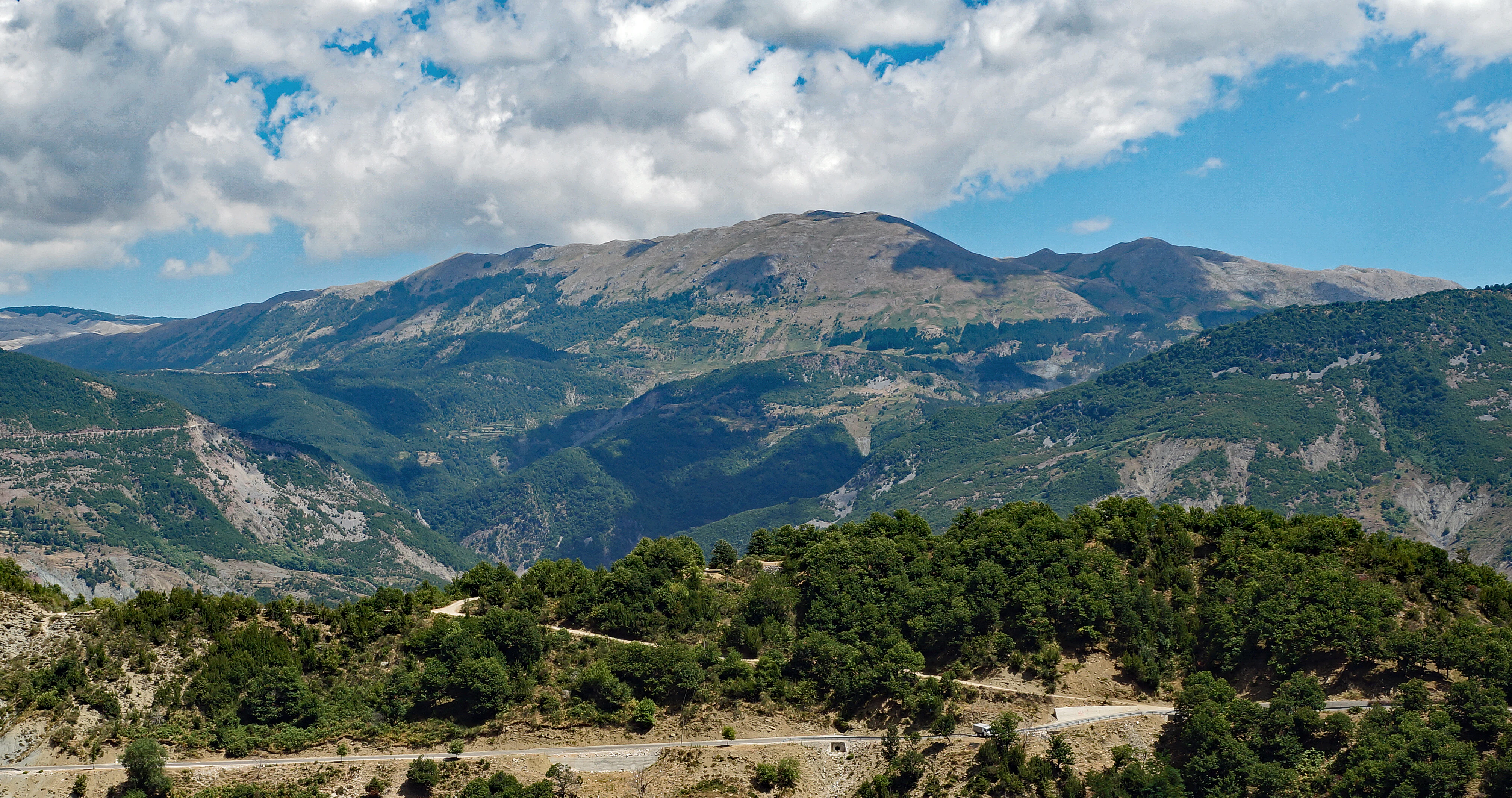
Panoramic view of rugged mountains and forested slopes in Mali me Gropa under a blue sky with scattered white clouds.
A wide view of the mountainous landscape of Mali me Gropa, featuring forested slopes and rugged peaks.

Mali me Gropa-Bizë-Martanesh Nature Park history and protected-area timeline

Mali me Gropa-Bizë-Martanesh is among the most recently declared protected areas in Albania, formally established by the Albanian government in early 2007 through a decision designated VKM 49, 2007. Its establishment reflected an increasing national and international recognition of the value of central Albania's forested mountain landscapes for biodiversity conservation, watershed protection, and the preservation of traditional highland land use. Administrative responsibility was placed with the Ministry of Environment.

Since its declaration, the park's profile has been reinforced through international recognition: the IUCN has listed the broader landscape as Category V (protected landscape/seascape), and the region has been included by Plantlife among Important Plant Areas of international significance. The park was also designed from the start with a zoning system that distinguishes a strict core conservation zone, a sustainable-use zone, a traditional-use zone accommodating continued rural livelihoods, and a recreational zone that highlights prominent natural and cultural features such as the Valit valley and the Martanesh teqe. Together, these designations create a relatively modern framework that blends biodiversity protection with the recognition of long-standing human presence in the landscape.

Mali me Gropa-Bizë-Martanesh Nature Park landscape and geographic character

The landscape of Mali me Gropa-Bizë-Martanesh is dominated by central Albanian mountain country, with rounded highland massifs, deep river-cut valleys, canyons, and broad karst plateaus. The most visually distinctive terrain is the Mali me Gropa massif itself, regarded as one of the most typical karst landscapes in Albania. Its ridges and interior are scored by sinkholes, dolines, and karst pits, often softened by alpine meadows and highland pastures, while the broader park includes the dramatic Martanesh Canyon and the glacial features associated with valleys like Liqeni i Zi.

Among the park's named landscape features, Mali me Gropa stands out as a wide karst plateau, Liqeni i Zi is a dark mountain lake of glacial origin, and viewpoints such as Priska Pass offer sweeping vistas across the surrounding ridges and neighboring valleys. The varied topography, river systems, and microclimatic conditions, combined with relatively limited modern disturbance, are widely cited as the primary reasons the area supports such a wide diversity of habitats within a compact geographic footprint.
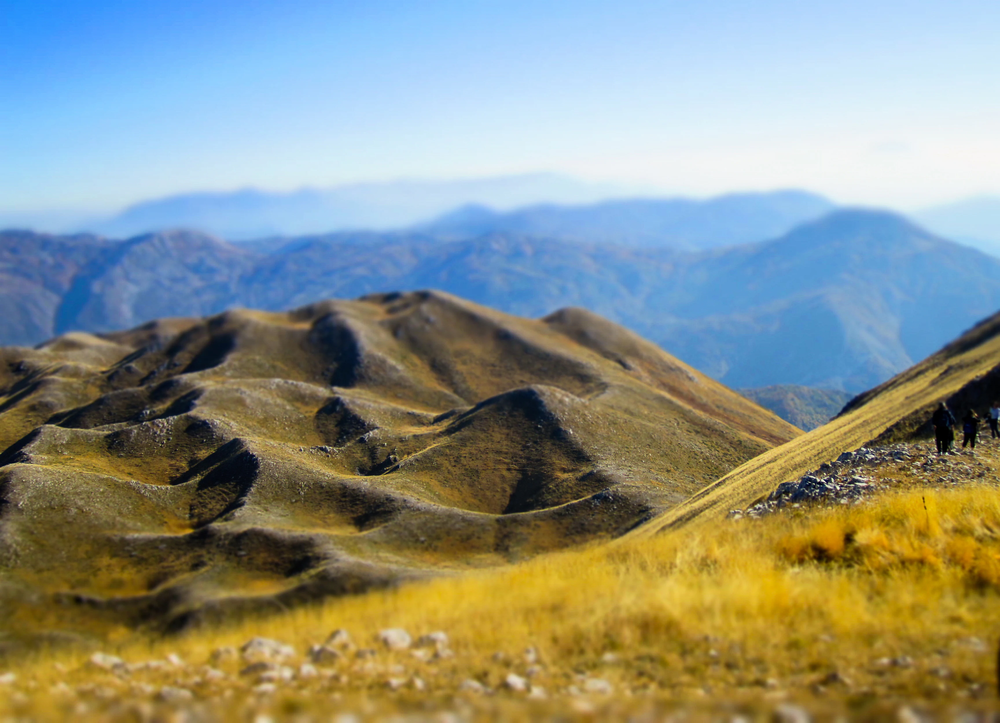
Wide view of rugged, undulating mountain terrain with golden grasses in the foreground and blue ridgelines fading into the distance under a clear sky.
The distinctive rolling landscape of the Mali me Gropa mountain range in Albania.

Mali me Gropa-Bizë-Martanesh Nature Park ecosystems, habitats, and plant life

Biogeographically, Mali me Gropa-Bizë-Martanesh falls within the Dinaric alpine mixed forests terrestrial ecoregion of the Palearctic temperate broadleaf and mixed forests biome. Roughly 68% of the park's area is forested, with the remainder made up of agricultural land, orchards, pastures, sparse alpine vegetation, and small areas of urban settlement. Because the landscape runs from Mediterranean altitudes up into the alpine zone, vegetation is vertically layered.

In the Mediterranean zone, forests are dominated by black pine, European beech, silver fir, Austrian oak, Hungarian oak, and European smoketree, with deciduous woodland dominated by European box, cade juniper, and Jerusalem thorn. The alpine zone is largely open, with grass, moss, lichen, and abundant bilberry stands, supporting uncommon flowering plants such as spring gentian, rock rose, alpine aster, catsfoot, European blueberry, and primrose. About 450 vascular plant species have been recorded in the park, representing roughly 12% of Albania's total vascular flora, and the area has been formally designated by Plantlife as an Important Plant Area of international significance.
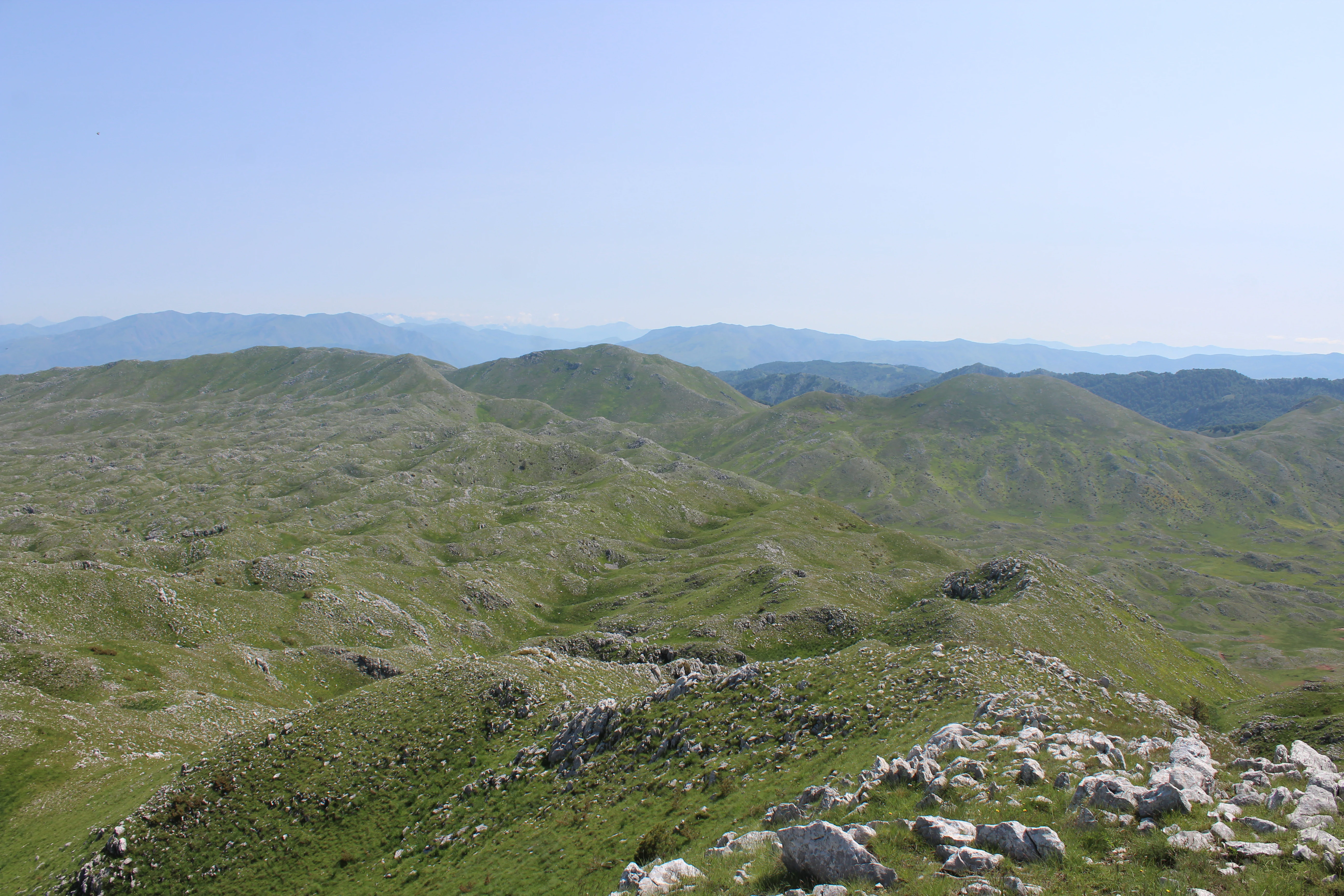
A wide, elevated view of undulating green hills and rocky, karst-like terrain under a clear blue sky, characteristic of the Albanian mountains.
View of the rolling karst landscape in Mali me Gropa-Bizë-Martanesh Nature Park.

Mali me Gropa-Bizë-Martanesh Nature Park wildlife and species highlights

The park's vertebrate fauna includes 209 recorded species, with 44 mammals, 130 birds, 23 reptiles, and 12 amphibians. The forested tracts still support large carnivores: brown bear, grey wolf, and Eurasian lynx remain present in the remoter forest regions, while smaller predatory and omnivorous mammals such as red fox, European otter, and the Mediterranean horseshoe bat are also recorded, alongside widespread ungulates and small mammals like roe deer, wild boar, red squirrel, and hazel dormouse.

The area has been associated by some secondary sources with the northern goshawk as a breeding species, and birdlife is otherwise rich, including golden eagle, sparrowhawk, Egyptian vulture, common buzzard, European honey buzzard, alpine swift, and alpine chough among many other species, with the high pastures and cliff environments providing habitat for raptors and alpine specialists. Reptile and amphibian communities are likewise varied; commonly documented species include the alpine newt, European ratsnake, and Hermann's tortoise, with the European pond turtle present in suitable wetland and riverine settings. The combination of large carnivores, raptors, and a diverse herpetofauna gives the park a particularly broad vertebrate profile for a relatively compact protected area.
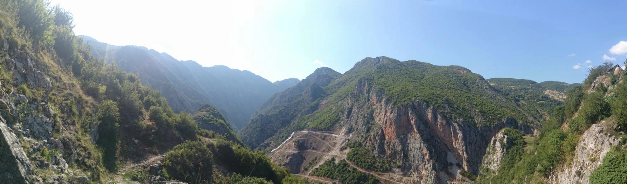
Panoramic view of a mountainous canyon with steep rocky slopes covered in sparse green forest vegetation under a clear sky.
A wide view of the canyon landscape near Peshk village in the Martanesh region.

Mali me Gropa-Bizë-Martanesh Nature Park conservation status and protection priorities

Mali me Gropa-Bizë-Martanesh sits at the heart of a growing network of protected landscapes in central Albania and is one of the country's declared Important Plant Areas of international importance as recognized by Plantlife. Its classification as a national nature park (Category IV under Albanian law) reflects an emphasis on habitat and species management, while its parallel recognition as Category V by the IUCN acknowledges its broader value as a harmonious cultural-natural landscape. Roughly seventy percent forest cover, limited modern anthropogenic pressure, and a vertical mosaic of habitats from Mediterranean woodland to alpine meadow give the park significant biodiversity value.

The park is also ecologically linked to the expanded Dajti National Park and the Qafështama National Park further north, forming part of a continuous corridor of relatively intact mountain habitat that is critical for wide-ranging species such as brown bear, wolf, and lynx. Provincial-level planning has reinforced this role through a zonation system that combines a core conservation area of natural forest habitats across Brozh-Bardhetit, Snoit i Madh and i Vogël, Biza, Ballenja, Martanesh, Panjeti, and parts of Kostenja forests with sustainable-use, traditional-use, and recreational zones, ensuring both biodiversity protection and continuity of traditional rural livelihoods.

Mali me Gropa-Bizë-Martanesh Nature Park cultural meaning and human context

Although primarily valued for its natural and ecological character, Mali me Gropa-Bizë-Martanesh encompasses a long-inhabited highland region of central Albania. Several traditional villages including those of Martanesh, Bizë, and Mali me Gropa lie within or alongside the protected area, and their agricultural and pastoral land use is explicitly recognized within the park's zoning framework through a dedicated traditional-use zone. The Martanesh region is also notable for its Bektashi religious heritage, and the area around the Martanesh teqe has been included within the park's proposed recreational zone, reflecting a recognition of cultural landscape values alongside natural ones.

Top sights and standout views in Mali me Gropa-Bizë-Martanesh Nature Park

Among the park's strongest points of distinction are Mali me Gropa itself, regarded as one of the most typical karst landscapes in Albania, the glacial Liqeni i Zi, and the Martanesh Canyon with its dramatic rock formations. Five designated nature monuments anchor the park's geological and ecological identity, including the caves of Xixelles, Valit, and Shutrese as well as a glacial valley and lake. Ecologically, the park stands out for its extensive mixed forests, its 450 vascular plant species, and the continued presence of large carnivores including brown bear, wolf, and lynx, all set within a vertical vegetation gradient that links Mediterranean woodland directly to alpine grassland.

Best time to visit Mali me Gropa-Bizë-Martanesh Nature Park

Visits during late spring and summer provide the most favorable conditions for appreciating the park's full ecological gradient, with alpine meadows and high pastures in bloom and easier access to upland areas such as Mali me Gropa and Priska Pass. Birdwatching and raptor observations are typically rewarding in these months, when alpine and Mediterranean species are most active. Autumn brings forest color changes across nearly seventy percent of the protected landscape and quieter conditions, while the cold winters at altitude can render higher elevations difficult to access, making shoulder seasons the broader sweet spot for landscape-focused visits.
Monthly climate preview

Long-term temperature ranges and monthly precipitation patterns for Dibër County

Mali me Gropa-Bizë-Martanesh Nature Park Climate Normals and Weather by Month

Representative coordinate measurements reveal the annual temperature progression and monthly precipitation rhythm across Mali me Gropa-Bizë-Martanesh Nature Park. Analyzing the full twelve-month climate profile provides detailed long-term averages for thermal variations and precipitation totals.
Annual mean12 °C
2 °C24 °C
Jan
Feb
Mar
Apr10°
May15°
Jun20°
Jul23°
Aug24°
Sep18°
Oct13°
Nov
Dec
Warmest month
August

23.6 °C

Coolest month
January

1.9 °C

Wettest month
November

3.8 mm/day

Driest month
August

1 mm/day

Park location guide

Geography guide, regional context, and park location map for Mali me Gropa-Bizë-Martanesh Nature Park

Mali me Gropa-Bizë-Martanesh Nature Park park geography, regions, and map view in Albania

Understand where Mali me Gropa-Bizë-Martanesh Nature Park sits in Albania through a broader geographic reading of the surrounding landscape, nearby location context, and its mapped position within the national park landscape.

How Mali me Gropa-Bizë-Martanesh Nature Park fits into Albania

Albania is a unitary parliamentary republic in Southeast Europe, situated on the Balkan Peninsula along the Adriatic and Ionian coastal regions. With a population of approximately 2.4 million people, it borders Montenegro, Kosovo, North Macedonia, and Greece. The country features varied landscapes ranging from the Albanian Alps to fertile coastal plains, with Tirana as its capital and largest city.

Wider geography shaping Mali me Gropa-Bizë-Martanesh Nature Park in Albania

Albania occupies the western part of the Balkan Peninsula in Southeast Europe. The country features a varied terrain with rugged mountain ranges including the Albanian Alps (Accursed Mountains), Korab, Skanderbeg Mountains, Pindus, and Ceraunian Mountains. Fertile lowland plains extend along the Adriatic and Ionian coastal regions. The country borders Montenegro to the northwest, Kosovo to the northeast, North Macedonia to the east, and Greece to the south.

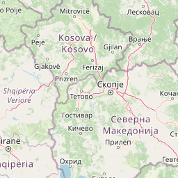
Map view of Mali me Gropa-Bizë-Martanesh Nature Park

Use this park location map to pinpoint Mali me Gropa-Bizë-Martanesh Nature Park in Albania, understand its exact geographic position, and read its mapped placement within the surrounding landscape more clearly.

Pigeon | © OpenStreetMap contributors

Location context for Mali me Gropa-Bizë-Martanesh Nature Park

Dibër CountyTirana County

Visual exploration of karst plateaus, canyons, and alpine forests in central Albania

Mali me Gropa-Bizë-Martanesh Nature Park Photos and Landscapes

Examine verified park photography to understand the rugged topography, vertical vegetation zonation, and remote habitat character of Mali me Gropa-Bizë-Martanesh Nature Park. Visual documentation reveals the distinct geological formations and expansive mountain terrain that define this protected landscape.

Panoramic view of rugged mountains and forested slopes in Mali me Gropa under a blue sky with scattered white clouds.

A high-angle view of a deep blue lake nestled within forested mountain slopes, showing clear water and rocky, grassy shorelines under a bright sky.

Wide view of rugged, undulating mountain terrain with golden grasses in the foreground and blue ridgelines fading into the distance under a clear sky.

A wide, elevated view of undulating green hills and rocky, karst-like terrain under a clear blue sky, characteristic of the Albanian mountains.

Panoramic view of a mountainous canyon with steep rocky slopes covered in sparse green forest vegetation under a clear sky.

A high-angle view over undulating green mountains and karst topography under a hazy blue sky.

Park atlas

Compare adjacent mountain terrain and connected regional protected landscapes

Parks Near Mali me Gropa-Bizë-Martanesh Nature Park and Surrounding Protected Areas

Browse nearby national parks and connected protected areas sharing the same central Albanian mountain terrain and forest ecoregions. Expanding the geographic comparison reveals broader ecological patterns across neighboring karst plateaus and glacial valleys.
National parkAlbania
About 8.3 km away#1 closest

West

Dajti Mountain National Park: Albania's Accessible Protected Mountain Landscape for Geographic Discovery

Explore the mapped terrain and diverse ecosystems of this significant national park.

Dajti Mountain National Park is a prime example of a protected mountain landscape central to Albania's geography. Situated near Tirana, its rugged karst topography, steep limestone ridges, and varied elevation create distinct ecological zones. This atlas-focused entry details the park's terrain, notable geological features like Pellumbas Cave, and its role as a significant protected area offering rich mapped landscape context.

Area
293.84 km²
Established
1966
IUCN
II
Relief
Mountain
Nature reserveAlbania
About 21 km away#2 closest

Northwest

Shtamë Pass Nature Park: Geographic Overview and Protected Mountain Landscape Map

Highland pine forests and freshwater corridors in Albania

Shtamë Pass Nature Park sits within the central Albanian mountains, providing a critical ecological link between coastal-inland gateway regions. The area protects a complex mosaic of alpine terrain, including clear mountain lakes, cold freshwater springs, and dense black pine forests that shelter brown bears and wolves. This protected zone offers a comprehensive view of regional highland geography and topography through its distinct mountain pass corridor.

Area
68.64 km²
Established
1996
IUCN
IV
A minimalist watercolor painting showing a tranquil lake surrounded by gentle hills and trees against a soft, pale sky.
Nature reserveDibër County
About 36 km away#3 closest

North

Lake Ulza Nature Park: Mapped Geography and Protected Area Overview in Dibër County

Analyzing the reservoir and river valley landscapes of central Albania

Lake Ulza Nature Park represents a significant protected mosaic where the Mat River creates a corridor of reservoirs, oak forests, and stony uplands. This overview examines the park geography, offering a structured look at how water bodies and mountainous terrain converge to form a unique inland habitat in Dibër County. Explore the physical relief and environmental boundaries that define this essential Albanian natural landmark.

Area
42.06 km²
Established
2013
IUCN
IV
Relief
Mixed relief
Watercolor illustration of mountains, a lake, and rolling hills with grassy vegetation.
National parkElbasan County
About 46 km away#4 closest

Southeast

Shebenik National Park: Mapped Protected Landscape and Glacial Terrain Atlas

Explore Elbasan County's significant mountain wilderness and protected natural features.

Shebenik National Park is a protected national park in Elbasan County, Albania, notable for its dramatic glacial terrain and extensive ancient forests. This park offers a deep dive into Albania's natural landscape, featuring 14 glacial lakes and serving as vital habitat. Its position within the Balkan Peninsula's geography makes it a key point of reference for understanding protected areas and mountain wilderness within a structured atlas.

Area
345.079 km²
Established
2008
IUCN
II
Relief
Mountain
National parkNorth Macedonia
About 49 km away#5 closest

Northeast

Mavrovo National Park: North Macedonia's Extensive Protected Alpine Terrain and Wildlife

Mapped geography of Alpine peaks, gorges, and unique endemic species.

Mavrovo National Park, North Macedonia's largest protected area, offers a deep dive into a complex Alpine geography. Dominated by the Šar, Korab, and Bistra mountain systems, the park features towering peaks and the dramatic Radika River gorge. This protected landscape is globally significant for its role in conserving the rare Balkan lynx and harbors endemic tertiary relic plant species like Macedonian pine. Explore the mapped boundaries, glacial lakes, and distinct terrain that define this vital conservation area.

Area
730.88 km²
Established
1949
IUCN
II
Relief
Mountain
Watercolor illustration of rolling green hills and distant mountains under a soft sky
National parkDibër County
About 50 km away#6 closest

North

Lurë-Dejë Mountain National Park: Mapped Protected Landscape and Glacial Lake Geography

Dibër County's alpine protected area with unique glacial lakes.

Delve into the detailed geographic context and mapped protected area of Lurë-Dejë Mountain National Park, an essential natural landscape in Albania's Dibër County. This park is renowned for its rare chain of twelve glacial lakes, situated at high elevations amidst dramatic alpine terrain. Its protected status ensures the preservation of significant old-growth forest ecosystems, including the critically endangered Balkan pine, contributing to its recognition as an Important Bird and Plant Area. Explore the park's distinctive terrain, from its soaring mountain peaks to its unique alpine meadows, all within a comprehensive geographic atlas framework.

Area
202.42 km²
Established
1966
IUCN
II
Relief
Mountain
Watercolor painting showing hills, green fields, a body of water, and vegetation under a soft sky
National parkAlbania
About 54 km away#7 closest

Southwest

Divjakë-Karavasta National Park: Albania's Expansive Coastal Wetland and Pelican Breeding Site

Mapping Albania's largest Mediterranean lagoon and its vital bird sanctuaries.

Divjakë-Karavasta National Park is a key protected coastal wetland in western Albania, centered around Karavasta Lagoon, one of the largest in the Mediterranean. This Ramsar site provides critical habitats for numerous bird species, including a globally significant population of the endangered Dalmatian pelican, making it a premier destination for understanding regional wetland geography and protected area dynamics.

Area
222.3 km²
Established
2007
IUCN
II
Relief
Lowland
A minimalist watercolor painting depicting a soft-focus landscape with green marshes, pale yellow flats, and light pink rolling hills in the background.
Nature reserveLezhë County
About 55 km away#8 closest

Northwest

Kunë-Vain-Talë-Patok-Fushëkuqe-Ishëm Nature Park: Mapped Geography and Coastal Wetlands

Protected lagoon and forest landscapes in Lezhë County, Albania

Examine the protected territory of Kunë-Vain-Talë-Patok-Fushëkuqe-Ishëm Nature Park, defined by its dynamic lagoon systems, alluvial forests, and coastal dunes along the Adriatic shore. This area provides deep insight into deltaic hydrology and the preservation of Mediterranean woodland habitats within a regional geographic context.

Area
43.93 km²
Established
2010
IUCN
IV
Relief
Lowland

Common questions about visiting, size, designation, and location context for Mali me Gropa-Bizë-Martanesh Nature Park

Mali me Gropa-Bizë-Martanesh Nature Park FAQs for park facts, access, geography, and protected area context

Find quick answers about Mali me Gropa-Bizë-Martanesh Nature Park, including protected-area facts, park geography, trail and visitor context, and how the park fits into its surrounding country and regional landscape.
MoriAtlas Explorer

Continue Your Protected Areas Search Across the Global Atlas

Deepen your exploration by continuing the structured search for national parks and protected areas worldwide. Utilize the comprehensive filtering capabilities to compare different conservation landscapes and refine your understanding of global park geography. Discover more about the distribution and characteristics of protected natural areas.

Global natural geography