Mori Atlas logo
Marine protected areaMalindi-Watamu

A complex protected seascape of fringing coral reefs, tidal inlets, and mangrove forests

Malindi-Watamu Marine Protected Area and Coastal Landscape Geography in Kenya

Malindi-Watamu serves as a critical marine protected area along the northern coast of Kenya, where the Indian Ocean meets a diverse transition of intertidal ecosystems. This protected framework spans the junction between offshore coral reef systems and the sheltered, mangrove-lined channels of Mida Creek. The terrain reveals a layered coastal environment, linking open sandy beaches and tidal mudflats with inland scrub and forested margins.

marine reservecoral reefsmangrove foreststidal flatscoastal biosphere reserveseabird breeding

Malindi-Watamu

Marine protected area

Park overview

Structured park overview, official facts, and landscape profile for Malindi-Watamu

Malindi-Watamu park facts, protected area profile, and essential visitor context

Review the core facts for Malindi-Watamu, including designation, size, terrain, visitor scale, habitats, and operating context in one park-focused overview.

About Malindi-Watamu

Malindi-Watamu represents a connected system of marine and coastal protected areas on the northern Kenyan shoreline of the Indian Ocean. Rather than functioning as a single contiguous park boundary, it operates as an umbrella designation that brings together the Malindi National Marine Park and Reserve in the north, the Watamu National Marine Park and Reserve in the south, and the biosphere zone that surrounds them. Together, these units form one of the most ecologically varied coastal conservation landscapes in Kenya, integrating coral reef ecosystems with mangrove wetlands, tidal flats, and sandy shoreline.

The reserve is positioned along the East African coastal corridor about 100 km north of Mombasa, where the warm tropical waters of the western Indian Ocean support diverse reef communities. Its coral reefs are part of the broader fringing reef systems that hug the Kenyan and Tanzanian coasts, and within Malindi-Watamu these reefs extend into both the Malindi and Watamu marine park zones, each of which allows managed recreation while excluding extractive activity from the more protected cores.

Mida Creek, located in the southern portion of the reserve near Watamu, is one of the reserve's defining landscape elements. This tidal inlet is fringed by extensive mangrove forests, and its intertidal flats expand and contract with the rhythm of the tides, creating ephemeral habitats for invertebrates, fish, and shorebirds. To the west of Mida Creek lies Arabuko-Sokoke Forest Reserve, a key terrestrial protected area; together, the forest, the mangroves, the tidal flats, and the offshore reefs establish a rare land-to-sea continuum of protected habitat. Beyond the reef and mangrove zones, the wide white-sand beaches of the Kenyan coast form a recognizable physical backdrop that ties the reserve together visually and sets the stage for most visitor activity.

As a UNESCO Biosphere Reserve since 1979, Malindi-Watamu occupies a notable place in the history of marine conservation in East Africa. The biosphere designation reflects the site's value not only for its marine ecosystems but also for the broader coastal zone in which traditional fishing, tourism, and habitat protection intersect. The reserve therefore stands as both an ecological stronghold and a long-running experiment in balancing conservation with human use along a heavily visited coastline.

Quick facts and research context for Malindi-Watamu

Malindi-Watamu is a national marine reserve located on the northern Kenyan coast, roughly 100 km north of Mombasa, between Malindi in the north and the Mida Creek area near Watamu to the south. The reserve combines the Malindi and Watamu National Marine Parks with their surrounding marine reserves, covering a combined protected area of about 245 km², with the biosphere reserve designation itself covering roughly 196 km².

The seascape is defined by fringing coral reefs along the open coast, intertidal flats that are submerged by tidal cycles, and Mida Creek's mangrove forests in the southern portion. The reserve has been part of the UNESCO World Network of Biosphere Reserves since 1979, giving it long-standing international recognition for its coastal and marine biodiversity.

Adjacent terrestrial forest protection, including the Arabuko-Sokoke Forest Reserve adjoining the western side of Mida Creek, extends habitat conservation inland and reinforces the ecological corridor between marine and coastal forest ecosystems of southeastern Kenya.

Protection and recognition

Documented marine conservation scope and established 1979 designation timeline

Malindi-Watamu Protection Status and Marine Reserve Designation History

Malindi-Watamu features documented marine protection status alongside an established designation history dating to 1979. Designated boundaries outline the marine conservation scope for analytical review and protected-area reference.

Protection details

Protection scope
Marine
Designated year
1979
Transboundary protection
No
Park context

Deeper park guide and search-rich context for Malindi-Watamu

Malindi-Watamu history, landscape, wildlife, and travel context

Explore Malindi-Watamu through its history, landscape character, ecosystems, wildlife, conservation priorities, cultural context, and seasonal travel timing in a structured park guide built for atlas discovery and search intent.

Why Malindi-Watamu stands out

Malindi-Watamu is best known for its exceptional concentration of marine and coastal habitats along a short stretch of Kenya's Indian Ocean coast, where coral reefs, mangrove forests, and tidal sandflats exist side by side. The reserve is recognized for the ecological richness of Mida Creek, a major tidal inlet lined with mangroves and bordered by intertidal flats that support large numbers of shorebirds and migratory waterbirds. It is also well known as a UNESCO Biosphere Reserve, designated in 1979, which placed it among the earliest formally recognized marine-coastal biosphere reserves in East Africa. The coral reef system within the area has long made it a focal point for reef tourism, snorkeling, glass-bottom boat outings, and deep-sea fishing, while also making it a high-priority site for reef conservation in the region. The reserve is further distinguished by its role as a wintering and stopover site for migratory birds along the East African coast, including seabirds that nest on offshore islets during the southeast monsoon season between June and October.

Malindi-Watamu history and protected-area timeline

The modern conservation identity of Malindi-Watamu was formally established in 1979 when the area was inscribed into the UNESCO World Network of Biosphere Reserves, making it one of the earliest formally designated coastal biosphere zones in East Africa. This international recognition built on earlier national designation of the Malindi and Watamu marine parks and reserves, which had already established a framework of zoned marine protection along this stretch of Kenya's northern coast.

The Malindi and Watamu National Marine Parks, together with their surrounding marine reserves, were created as distinct but adjacent units so that reef ecosystems could be protected in their core zones while broader seascapes and resource use were managed in surrounding reserve areas. This zoned approach set a template that has shaped coastal marine management along the Kenyan coast.

Over time, the prominence of the area as a tourism destination, particularly for reef-based recreation and beach holidays, became inseparable from its conservation story. Visitor pressure, combined with industrial pollution from nearby shipping lanes and inland urban areas, including Nairobi's industrial zones, has placed ongoing stress on the reef systems. The history of the reserve is therefore also a record of how one of Kenya's flagship marine protected areas has had to adapt to the dual pressures of popular tourism and regional industrial development.

Malindi-Watamu landscape and geographic character

The Malindi-Watamu landscape is dominated by the meeting point between ocean and a deeply indented tropical coastline. Fringing coral reefs run parallel to the shore, separated from the sandy beaches by shallow lagoons; beyond the reefs, the seabed descends gradually into deeper Indian Ocean waters. The beaches themselves are broad, light-colored, and characteristic of the East African coast, providing both natural scenery and the physical setting for most visitor activity in the reserve.

The most distinctive physical feature of the southern portion of the reserve is Mida Creek, a tidal inlet whose basin alternately fills and empties with the tides. The creek is bordered by mangrove forests that occupy the upper intertidal zone, while lower mudflats and sandflats emerge at low tide to create large expanses of open sediment. This combination of a sheltered tidal basin, mangrove channels, and expansive flats gives Mida Creek a strong sense of enclosure and ecological complexity compared to the open coastline further north.

Towards the inland edge of the reserve, the coastal plain rises gently into scrubby vegetation and dry coastal forest, which transitions into the larger Arabuko-Sokoke Forest Reserve west of Mida Creek. The wider landscape therefore reads as a layered system: offshore reefs, nearshore lagoons, sandy beaches, mangrove-fringed creeks, intertidal flats, and finally a forested inland margin that links the marine reserve to a broader network of protected habitats.

Malindi-Watamu ecosystems, habitats, and plant life

The ecological identity of Malindi-Watamu is shaped by the close coexistence of marine, estuarine, and coastal forest habitats within a relatively small geographic footprint. Coral reefs form the foundation of the marine ecosystem, supporting algae, invertebrates, and the fish communities that depend on reef structure. The diversity of reef habitats is complemented by seagrass beds in shallower sandy areas, which act as nursery and feeding grounds for a wide range of marine species.

Equally important to the reserve is the estuarine and mangrove ecosystem of Mida Creek. The mangroves are characterized by species typical of the Indo-Pacific mangrove flora, with several dominant tree species occupying different zones according to tidal flooding tolerance. Algal communities colonize the rocky intertidal surfaces, while seagrass species root into the sandy areas of the creek, anchoring soft sediment and providing habitat for grazing marine life.

Inland, the reserve borders dry coastal forest ecosystems that connect the marine protected area to the larger Arabuko-Sokoke landscape, creating a transition zone between saltwater and terrestrial forest that is rare on the East African coast. This ecological gradient, from offshore reef through lagoon and mangrove to dry forest, gives Malindi-Watamu a layered habitat structure that helps explain both its biodiversity and its conservation significance.

Malindi-Watamu wildlife and species highlights

Wildlife within Malindi-Watamu spans marine, intertidal, and bird communities, with the avifauna being particularly well documented. Mida Creek and the adjacent coastline serve as a wintering and stopover site for numerous migratory shorebirds, and the offshore islets host breeding colonies of seabirds during the warmer months. Between June and October, tern species nest on islands within the reserve, taking advantage of the relatively undisturbed conditions during the southeast monsoon season.

Along the shoreline, waders and other coastal birds forage across the tidal flats, with species commonly associated with sandy beaches, mudflats, and rocky edges all represented in the reserve. Resident coastal species share habitat with Palearctic migrants, producing seasonal shifts in bird abundance and composition. The mangroves themselves provide nesting and roosting habitat for herons, egrets, and other water-associated birds that depend on the sheltered conditions created by the forest canopy.

Below the waterline, the reefs and seagrass beds support a diverse community of reef fish, invertebrates, and other marine fauna typical of the western Indian Ocean. Although much of the marine wildlife is less conspicuous to casual visitors than the birdlife, the reef communities underpin the entire ecosystem by sustaining both ecological function and the tourism experiences for which the reserve is best known.

Malindi-Watamu conservation status and protection priorities

Malindi-Watamu has been a focal point of marine and coastal conservation in East Africa since its inscription as a UNESCO Biosphere Reserve in 1979, an early international endorsement of the area's ecological value. The biosphere designation frames the reserve as more than a single park; it positions Malindi-Watamu as part of a wider coastal zone in which conservation, research, and human activity are coordinated across park, reserve, and surrounding landscapes.

The primary conservation concerns in the reserve revolve around the health of the coral reef systems. Tourism, while economically important, contributes localized pressure on reefs through direct contact and souvenir collection, and broader regional pressures arise from industrial pollution, including discharges linked to oil tanker traffic and inland industrial activity around Nairobi. Both threats have been recognized as significant drivers of reef degradation in the area.

Management of the reserve employs a zoned approach, with marine parks providing the strictest protection and surrounding marine reserves permitting regulated fishing under license. This zoning is intended to protect the most sensitive reef cores while maintaining the livelihoods of local fishing communities. The reserve also plays an important role in coastal bird conservation, as Mida Creek and the offshore islands are recognized sites for migratory and seabird populations along the East African flyway.

Malindi-Watamu cultural meaning and human context

The coast on which Malindi-Watamu lies has a long history of human settlement shaped by Indian Ocean trade, Swahili coastal culture, and a continuing tradition of small-scale fishing. Communities along this stretch of shoreline have, for generations, drawn on the reef and nearshore fisheries that the reserve now regulates, and the contemporary zoning system reflects an attempt to accommodate these traditional uses alongside tourism and ecological protection.

The area's identity is also strongly tied to tourism culture, with Malindi and Watamu together forming one of Kenya's principal beach and reef destinations. Visitor activity, including boat-based reef excursions and diving, is integral to the local economy, and the reserve has become a defining feature of how tourists experience the Kenyan coast.

There is no specific indigenous cultural narrative documented in the available sources that would justify a separate cultural section; instead, the cultural significance of the area lies in the everyday interaction between coastal communities, the reef fisheries, and the destination tourism economy.

Top sights and standout views in Malindi-Watamu

Among the standout qualities of Malindi-Watamu are the unusually tight integration of coral reefs, mangrove forests, tidal flats, and dry coastal forest within a single protected framework, and its status as one of the earliest designated marine biosphere reserves in East Africa following its 1979 UNESCO inscription.

Mida Creek stands out as a defining feature of the reserve, combining mangrove-lined channels, productive intertidal flats, and rich birdlife that includes both resident and migratory species. The offshore islets and their seasonal seabird colonies add a further distinctive element that elevates the reserve beyond typical reef-and-beach destinations.

Best time to visit Malindi-Watamu

Visitor experience at Malindi-Watamu is shaped by the alternating monsoon seasons of the East African coast. The southeast monsoon period, roughly June through October, coincides with the seabird breeding season on the offshore islands within the reserve, when tern colonies are active and ornithological interest is especially high. This period tends to bring cooler, drier conditions with stronger onshore winds, which can affect water clarity and the calmness of nearshore reefs.

The northeast monsoon period, broadly November through March, often brings warmer and more humid conditions with calmer seas, which are typically considered more favorable for reef-based recreation such as snorkeling, glass-bottom boat outings, and diving. Migratory shorebird presence is also pronounced during parts of this window, given the importance of Mida Creek and the broader coastline as wintering habitat.

Because seasonality influences birdwatching, sea conditions, and general reef visibility differently, the best time to visit depends primarily on whether a visitor prioritizes reef recreation or bird-based wildlife viewing; in practice, both seasons can yield strong experiences if matched to the relevant activity.
Monthly climate preview

Track monthly temperature averages and precipitation rhythms across the protected area

Malindi-Watamu Climate Normals, Long-Term Temperature and Precipitation Patterns

Historical data records the annual temperature progression and monthly precipitation fluctuations measured at a representative point within Malindi-Watamu. Analyzing the complete twelve-month climate profile provides detailed insight into long-term averages across the protected landscape.
Annual mean27 °C
25 °C29 °C
Jan28°
Feb28°
Mar29°
Apr28°
May27°
Jun26°
Jul25°
Aug25°
Sep26°
Oct26°
Nov27°
Dec27°
Warmest month
March

28.5 °C

Coolest month
July

25 °C

Wettest month
May

5.9 mm/day

Driest month
February

0.5 mm/day

Park location guide

Geography guide, regional context, and park location map for Malindi-Watamu

Malindi-Watamu park geography, regions, and map view in Kenya

Understand where Malindi-Watamu sits in Kenya through a broader geographic reading of the surrounding landscape, nearby location context, and its mapped position within the national park landscape.

How Malindi-Watamu fits into Kenya

Kenya is a presidential republic in East Africa and the seventh-most populous country on the continent. Its capital is Nairobi, and it borders five countries and the Indian Ocean. The country features significant geographic diversity including Mount Kenya, the Rift Valley, and coastal regions.

Wider geography shaping Malindi-Watamu in Kenya

Kenya is located in East Africa, bordering South Sudan to the northwest, Ethiopia to the north, Somalia to the east, Tanzania to the southwest, and Uganda and Lake Victoria to the west. The southeastern border meets the Indian Ocean. The geography includes the Rift Valley highlands with Mount Kenya, coastal plains, and northern arid regions.

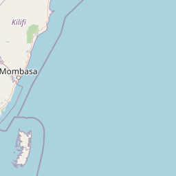
Map view of Malindi-Watamu

Use this park location map to pinpoint Malindi-Watamu in Kenya, understand its exact geographic position, and read its mapped placement within the surrounding landscape more clearly.

Pigeon | © OpenStreetMap contributors
Park atlas

Compare regional park geography and connected coastal ecosystems across East Africa.

Parks Near Malindi-Watamu: Explore Other Protected Areas and Coastal Reserves

Continue browsing other national parks and protected areas near Malindi-Watamu to evaluate adjacent marine reserves, tidal wetlands, and coastal habitats. Comparing regional park geography provides deeper context into the diverse protected landscapes spanning the coastline.
National parkCoast Province
About 8.9 km away#1 closest

South

Arabuko Sokoke National Park: National Park Atlas and Geographic Identity in Coast Province

Mapped protected area within Kenya's coastal region.

Arabuko Sokoke National Park is identified as a protected national park situated within the historical Coast Province of Kenya. This entry offers a focused examination of its protected landscape and geographic significance, contributing to a structured atlas of protected areas. Users can explore the park's mapped boundaries and its positioning within the regional geography, providing essential context for understanding this natural landscape.

Area
6 km²
Established
1990
IUCN
II
Relief
Lowland
Marine protected areaKenya
About 28 km away#2 closest

Southeast

Watamu Marine National Park: Coastal Protected Marine Landscape in Kenya

Explore mapped boundaries and regional geography.

Watamu Marine National Park represents a crucial marine protected area situated on Kenya's coastline, contributing significantly to the country's conservation landscape. This designation underscores its role in preserving coastal and underwater geography, making it a key entity for atlas exploration of protected marine environments. Understanding its specific geographic scope and mapped protected boundaries is essential for comprehending Kenya's broader environmental atlas.

Established
1968
Relief
Lowland
Climate
Tropical
Access
Moderate access
Watercolor painting showing a landscape with mountains in the background, green hills in the midground, and water or wetland in the foreground
National parkKenya
About 34 km away#3 closest

East

Malindi Marine National Park: Kenya's National Park Atlas of Coastal Protected Lands

Explore mapped marine geography and protected landscape context.

Malindi Marine National Park is a protected national park situated along Kenya's coast, contributing to the nation's atlas of conservation landscapes. This entry details the park's specific geographic identity, its mapped boundaries, and its role as a protected marine environment. Engage with its regional context and understand how its protected status shapes its unique landscape for a deeper geographic appreciation.

Relief
Lowland
Climate
Tropical
Access
Access unknown
Scope
Marine
National parkKenya
About 68 km away#4 closest

West

Tsavo East National Park: Kenya's Protected Natural Landscape for Geographic Exploration

Explore mapped boundaries and regional park geography.

Tsavo East National Park in Kenya offers a rich entry point for understanding protected landscapes and regional geography. As a designated national park, its mapped boundaries and natural terrain provide essential context for geographic exploration within East Africa. This page serves as a focused discovery point for the park's specific environmental attributes and its role in the broader atlas of protected areas.

Area
13,747 km²
Established
1948
IUCN
II
Relief
Lowland
National parkKenya
About 97 km away#5 closest

South

Mombasa Marine Park National Park: Kenya's Coastal Protected Landscape

Mapped protected area within the East African regional geography.

This detail page offers an in-depth look at Mombasa Marine Park, a designated national park in Kenya. It focuses on its protected landscape identity, mapped boundaries, and its place within the regional geography of East Africa. Users seeking structured atlas information and context for protected natural areas will find detailed geographic data here.

National parkTaita-Taveta County
About 149 km away#6 closest

West

Tsavo West National Park: Kenya's Protected National Park and Regional Geography

Explore mapped boundaries and natural landscapes in Taita-Taveta County.

Tsavo West National Park offers a focused exploration of protected landscape and regional geography within Kenya. Discover the mapped extent of this national park, understanding its role as a conservation area in Taita-Taveta County. This entry provides key geographic context and atlas-style information, highlighting the natural terrain and protected boundaries for detailed discovery.

Area
9,065 km²
Established
1948
IUCN
II
Relief
Mixed relief
Watercolor illustration of a hilly landscape with green and pink hues, showing trees, distant hills, and a light sky
National parkKenya
About 172 km away#7 closest

South

Kisite-Mpunguti Marine National Park: Kenya's Coastal Protected Marine Landscape

Mapped coral reefs and diverse marine ecosystems.

As Kenya's foremost marine national park, Kisite-Mpunguti Marine National Park presents an unparalleled opportunity to explore a thriving underwater world. Its protected boundaries encompass remarkable coral formations and a rich tapestry of marine species, including diverse fish populations, sea turtles, and dolphins. This park is a cornerstone of coastal conservation, offering valuable insights into marine geography and ecosystem health for those seeking detailed landscape context.

Area
39 km²
Established
1973
IUCN
II
Relief
Lowland
National parkTanzania
About 176 km away#8 closest

Southwest

Mkomazi National Park: Tanzania's Vast Protected Savanna Landscape and Wildlife Geography

Explore its mapped terrain and conservation significance within East Africa.

Mkomazi National Park is a critical protected landscape in Tanzania, spanning over 3,200 square kilometers of classic East African semi-arid savanna woodland. This national park offers a unique atlas-style view into conservation success, particularly for its black rhinoceros sanctuary and African wild dog programs. Its landscape is characterized by rolling terrain and Acacia-Commiphora vegetation, forming a vital transboundary conservation area with Kenya that supports significant wildlife migration corridors and provides a distinct geographic context within the broader regional atlas.

Area
3,234 km²
Established
2006
IUCN
II
Visitors
1.6K annual

Common questions about visiting, size, designation, and location context for Malindi-Watamu

Malindi-Watamu FAQs for park facts, access, geography, and protected area context

Find quick answers about Malindi-Watamu, including protected-area facts, park geography, trail and visitor context, and how the park fits into its surrounding country and regional landscape.
MoriAtlas Explorer

Continue Your Protected Areas Search Across the Global Atlas

Deepen your exploration by continuing the structured search for national parks and protected areas worldwide. Utilize the comprehensive filtering capabilities to compare different conservation landscapes and refine your understanding of global park geography. Discover more about the distribution and characteristics of protected natural areas.

Global natural geography