Why Mercury Islands stands out
The Mercury Islands are particularly known for their volcanic origins, with the largest island being a remnant of a Pliocene rhyolitic volcano, and for the dramatic reddish cliffs that surround Red Mercury Island. The group is also recognised for the early Māori presence on Ahuahu, where extensive pā sites and an important toki, or adze, quarry developed across the centuries. The smaller islands of the group are internationally recognised as an Important Bird Area, especially for nesting seabirds such as the Pycroft's petrel, with several thousand breeding pairs recorded. The Mercury Islands are additionally associated with successful conservation efforts that have eliminated introduced mammalian pests across the group.
Mercury Islands history and protected-area timeline
The human history of the Mercury Islands begins early in the Māori settlement of Aotearoa. Great Mercury Island, Ahuahu, was used from an early period as a quarrying site for toki, or stone adzes, and this industry supported a semi-permanent population on the island. Across the pre-colonial period, at least twenty pā are recorded on Ahuahu, including Matakawau on the western side, where extensive archaeological excavations took place in the 1950s and where ongoing research by the University of Auckland has continued after coastal storms further exposed sites.
In wider oral tradition, the islands appear in the stories of Ngāti Porou, which recall that the ancestor Paikea first arrived on Ahuahu after travelling from Hawaiki. The islands today lie within the acknowledged rohe of Ngāti Hei and of the Ngāti Whanaunga hapū Ngāti Karaua.
European observation of the islands began with James Cook's 1769 voyage, during which the transit of Mercury was observed near both the islands and the nearby mainland coast, leading to the European name Mercury Islands and to the naming of Mercury Bay on the Coromandel Peninsula. By 1827, the French explorer Dumont d'Urville had also sighted the group, recording the alternate name Iles d'Haussez during his charting of the New Zealand coast.
The nineteenth century brought European settlement and colonial land changes. A settler claimed to have purchased Great Mercury Island in 1839, and between 1858 and 1865, Great Mercury, Kawhitu or Stanley Island, and Double Island, including the smaller blocks Whakakapua and Kowhaka, were taken as Crown land, a process that did not include consultation with Ngāti Hei despite their continuing habitation. Uuder private ownership, the islands were later developed as isolated sheep and cattle farms, and kauri gum digging took place on Ahuahu during the later nineteenth century. In 2017, a settlement formally recognised Ngāti Hei's legitimate claim to Great Mercury Island.
In more recent times, a major turning point came in 2014, when the private owners of Great Mercury Island, in partnership with the Department of Conservation, began a programme to eradicate kiore, ship rats, and cats; by 2016 the entire Mercury Island Group was declared free of introduced mammalian pests.
Mercury Islands landscape and geographic character
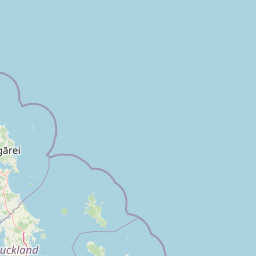
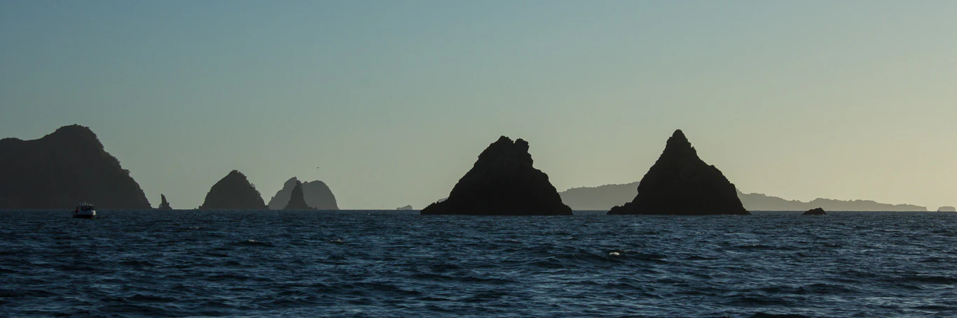
The Mercury Islands present a varied and visually striking seascape of volcanic rocky islands, plunging cliffs, and sheltered coves, all rising from the deeper South Pacific waters east of the Coromandel Peninsula. The main chain has a clearly defined structure: the much larger Great Mercury Island, Ahuahu, anchoring the western end of the group, and the smaller Red Mercury Island, Whakau, rising sharply at the eastern end, with five intermediate islands filling the gap between them.
Red Mercury Island is particularly notable for its coastal geomorphology. Its entire perimeter is ringed by reddish cliffs rising to roughly one hundred metres above the sea, a feature that gave the island its European name during Cook's 1769 exploration. These dramatic cliff faces, together with the broader island relief, reveal the volcanic foundations shared across the group.
The surrounding waters reflect a comparable geological story. During the Last Glacial Maximum, sea levels were more than one hundred metres lower than today, exposing a large coastal plain across the present-day Hauraki Gulf; the islands were then hills rising above this plain. As sea levels rose over thousands of years, the islands became progressively isolated. In that earlier lower-sea landscape, what is now the Opitonui River flowed east through the gap between Cuvier Island and Great Mercury Island before reaching the ocean.
Mercury Islands ecosystems, habitats, and plant life
Ecologically, the Mercury Islands form one of New Zealand's most carefully managed offshore island ecosystems. Apart from the privately owned Great Mercury Island, every island in the main chain carries full Nature Reserve protection under the Department of Conservation, and public access to them is generally prohibited. This statutory status, combined with the islands' offshore isolation, has allowed highly sensitive habitats and species communities to persist with very low levels of disturbance.
A defining ecological feature of the group is the success of its pest eradication history. Through cooperative work between private landowners and the conservation authorities, introduced mammalian predators including kiore, ship rats, and cats have been removed from the islands, and the entire Mercury Island Group was declared free of introduced mammalian pests by 2016. This restored environment provides exceptionally clean refuges for native invertebrates, forest communities, and seabird colonies, where ground-nesting and burrow-nesting birds can breed without the predation pressures that affect the mainland.
The islands' vegetation and broader habitats reflect their volcanic substrate, their long isolation from the mainland, and their exposure to oceanic weather. The relatively undisturbed forest remnants, coastal scrub, and cliff communities across the smaller Nature Reserves support a restricted but ecologically significant suite of native species, including endemics that exist almost exclusively within the Mercury Island Group.
Mercury Islands wildlife and species highlights
Wildlife is one of the central reasons the Mercury Islands are so highly valued in conservation terms. The smaller islands of the group have been identified by BirdLife International as an Important Bird Area, primarily because they provide nesting habitat for a substantial population of Pycroft's petrels, with recorded breeding reaching up to around three thousand pairs across the group.
Beyond the petrel colonies, the islands are also recognised for their invertebrate fauna. Both Double Island (Moturehu) and Red Mercury Island (Whakau) support the critically endangered Mercury Islands tusked wētā, a species whose restricted range makes these reserves essential to its continued survival. The wider pest-free status of the group further enhances the conditions under which native fauna, including reptiles and other ground-dwelling species, can recover and persist.
The seabird and wētā importance of the islands, combined with their protected status, helps explain why the smaller islands of the Mercury group are managed so strictly, with public access tightly controlled to maintain the conditions these threatened species require.
Mercury Islands conservation status and protection priorities
The Mercury Islands represent one of New Zealand's clearest examples of island-based conservation in action. Apart from Great Mercury Island, every island of the main chain is held as a Nature Reserve, and public access to those reserves is prohibited in order to protect highly sensitive ecological values. The management of these reserves falls to the Department of Conservation, which oversees ecological monitoring, biosecurity preparedness, and habitat protection across the group.
A pivotal conservation achievement was the eradication programme coordinated with the private owners of Great Mercury Island. Beginning in 2014, the operation targeted kiore, ship rats, and cats across the island. By 2016, the entire Mercury Island Group was declared free of introduced mammalian pests, restoring an ecological baseline that had been lost across much of the mainland for centuries.
The conservation profile of the group is reinforced by international recognition of the smaller islands as an Important Bird Area for seabird breeding, and by the presence of critically endangered invertebrate species such as the Mercury Islands tusked wētā. Because the islands host multiple threatened taxa and form a pest-free refuge cluster, they contribute meaningfully to New Zealand's wider predator-free landscape strategy.
Mercury Islands cultural meaning and human context
The Mercury Islands carry a deep and continuous cultural heritage for Māori. Great Mercury Island, Ahuahu, was used from an early period in Māori settlement as a major toki, or adze, quarry and manufacturing centre, supporting a semi-permanent resident community and a number of fortified pā across the island. In Ngāti Porou tradition, the ancestor Paikea is said to have first arrived on Ahuahu after voyaging from Hawaiki, linking the islands to some of the foundational stories of iwi identity.
In the modern legal and cultural framework, the islands fall within the rohe of Ngāti Hei and of the hapū Ngāti Karaua of Ngāti Whanaunga. A significant 2017 settlement acknowledged Ngāti Hei's legitimate historical claim to Great Mercury Island, recognising that earlier nineteenth-century Crown purchases had taken place without meaningful consultation despite Māori habitation.
The European naming of the islands is itself a cultural marker. Captain James Cook's 1769 observation of the transit of Mercury near both the islands and the adjacent coast gave rise to the names Mercury Islands and Mercury Bay, while the French explorer Dumont d'Urville's 1827 sighting produced the alternate name Iles d'Haussez, both of which continue to appear in cartographic and historical sources.
Top sights and standout views in Mercury Islands
The Mercury Islands combine a tight cluster of protected volcanic islands with strong cultural and ecological significance. Their clearest highlights include the dramatic reddish cliffs of Whakau, the ancient toki quarrying and pā landscapes of Ahuahu, and the internationally recognised seabird colonies that have helped designate the smaller islands as an Important Bird Area.
Alongside these natural and cultural strengths, the islands stand out as one of the more complete pest-free island groups around New Zealand's coastline. The successful removal of introduced mammals from Great Mercury Island in the 2010s means that visitors, researchers, and conservation programmes can look at the Mercury Islands as a working example of what restored island ecosystems can achieve in the Hauraki Gulf region.
Best time to visit Mercury Islands
The Mercury Islands lie in a mild oceanic climate on the edge of the South Pacific, and their general character changes relatively gently across the seasons compared with more continental destinations. Warmer months, generally spanning the southern hemisphere summer and early autumn, tend to produce calmer seas, clearer visibility in surrounding waters, and the kind of settled conditions that make offshore experiences and coastal scenery most accessible. Cooler months are typically characterised by stronger winds, more variable weather, and rougher seas around the islands.
For visitors interested in the natural history of the group, the seabird breeding season on the smaller islands is a particularly significant period, when colonies of petrels and other seabirds are most active across the protected reserves. Travellers interested in the cultural and archaeological landscape of Ahuahu will generally find that accessible conditions favour the warmer half of the year, when the island's open landscape is easier to explore.