
Mori Atlas logo
Protected landscapeMidewin National Tallgrass Prairie

Mapping the restoration of tallgrass prairie ecosystems and native forest transitions

Midewin National Tallgrass Prairie: An Essential Protected Landscape in Will County Illinois

Midewin National Tallgrass Prairie stands as a landmark protected landscape in Will County, representing the first federal tallgrass prairie preserve established in the United States. Situated in a critical transition ecoregion, this expansive territory features a complex mosaic of open grasslands, sedge meadows, and forested corridors along the Kankakee River. The site serves as a vital focal point for large-scale ecological research and restoration, mapping the path toward resilient tallgrass ecosystems east of the Mississippi River.

tallgrass prairieprairie restorationgrassland conservationbison reintroductionnative grasslandswoodland patches
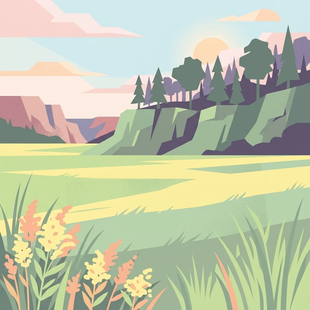
A flat-design, vector-style illustration of a tallgrass prairie with yellow wildflowers in the foreground, rolling green hills with scattered pine and deciduous trees in the midground, and soft cliffs under a setting sun in the background.

Midewin National Tallgrass Prairie

Protected landscape

Park overview

Structured park overview, official facts, and landscape profile for Midewin National Tallgrass Prairie

Midewin National Tallgrass Prairie park facts, protected area profile, and essential visitor context

Review the core facts for Midewin National Tallgrass Prairie, including designation, size, terrain, visitor scale, habitats, and operating context in one park-focused overview.

About Midewin National Tallgrass Prairie

The Midewin National Tallgrass Prairie sits in the central forest-grasslands transition ecoregion of the temperate grasslands, savannas, and shrublands biome. Before European settlement, the area was overwhelmingly prairie, with forest limited to the Jackson Creek corridor in the northwest corner and a small wooded patch in the southwest along the Kankakee River and Prairie Creek. The site's modern identity is built around recovering that lost mosaic of grassland, savanna, wet meadow, and woodland communities on a landscape that was heavily industrialized during the twentieth century.

The reserve was created in 1996 through the Illinois Land Conservation Act, which transferred former U.S. Army land to the U.S. Forest Service. Its management mandate is unusually broad: restoring native fish, wildlife, and plant populations and habitats; supporting scientific, environmental, and land-use education and research; maintaining compatible agricultural or resource management uses; and providing compatible public recreation. This framework reflects an intent to balance recovery of natural systems with human learning and use.

Ecologically, Midewin is distinctive for the unusual density of restoration partnerships concentrated there. Not-for-profit organizations including the Wetlands Initiative, Openlands, The Nature Conservancy's Illinois chapter, and other members of the Chicago Wilderness collaborative have collectively driven work on high-quality tallgrass prairie, dolomite prairie, sedge meadows, swales, and related communities. With neighboring state and federal sites such as the Des Plaines Fish and Wildlife Area, Midewin anchors one of the largest grassland-focused conservation complexes in the Chicago region.

The 2015 bison introduction marked a turning point in the reserve's identity. Roughly 1,200 acres were designated for a conservation herd, and the project has become a flagship study of how a once-near-extinct megagrazer shapes prairie recovery. Visitors encounter a place that is simultaneously a working federal land unit, a restoration showcase, and a research site for grassland ecology.

Quick facts and research context for Midewin National Tallgrass Prairie

Midewin National Tallgrass Prairie is located in Will County in northeastern Illinois, between the towns of Elwood, Manhattan, and Wilmington, with its headquarters along Illinois Route 53. It is the first federal tallgrass prairie preserve east of the Mississippi River and is recognized as the largest tallgrass prairie restoration area in the United States.

The reserve encompasses roughly 18,000 acres of grasslands, woodlands, and associated habitats, with about 7,000 acres open to public access along non-motorized trails. It is managed by the U.S. Forest Service under the Illinois Land Conservation Act of 1996 and forms the core of a larger multi-partner conservation landscape of more than 40,000 acres.

Protection and recognition

Examine the documented terrestrial protection scope and international recognition details

Midewin National Tallgrass Prairie Protection Status and Recognition Data

Midewin National Tallgrass Prairie maintains a documented terrestrial protection scope within the national conservation framework. Structured records compile available designation data and management governance parameters for analytical evaluation.

Protection details

Protection scope
Terrestrial
Transboundary protection
No
Park context

Deeper park guide and search-rich context for Midewin National Tallgrass Prairie

Midewin National Tallgrass Prairie history, landscape, wildlife, and travel context

Explore Midewin National Tallgrass Prairie through its history, landscape character, ecosystems, wildlife, conservation priorities, cultural context, and seasonal travel timing in a structured park guide built for atlas discovery and search intent.

Why Midewin National Tallgrass Prairie stands out

Midewin is best known for being the first national tallgrass prairie in the United States and for the ongoing effort to reconstruct a functioning tallgrass ecosystem on land that was once a military production complex. The 2015 introduction of bison as part of a long-term prairie restoration experiment draws particular attention and frames the site as a working laboratory for large-grazer ecology. Beyond restoration, Midewin is recognized for preserving a rare transitional landscape where prairie, savanna, sedge meadow, and woodland communities coexist. This diversity, combined with partnerships with organizations such as the Wetlands Initiative, Openlands, The Nature Conservancy, and the broader Chicago Wilderness collaborative, makes the prairie a focal point for prairie conservation in the Midwest.
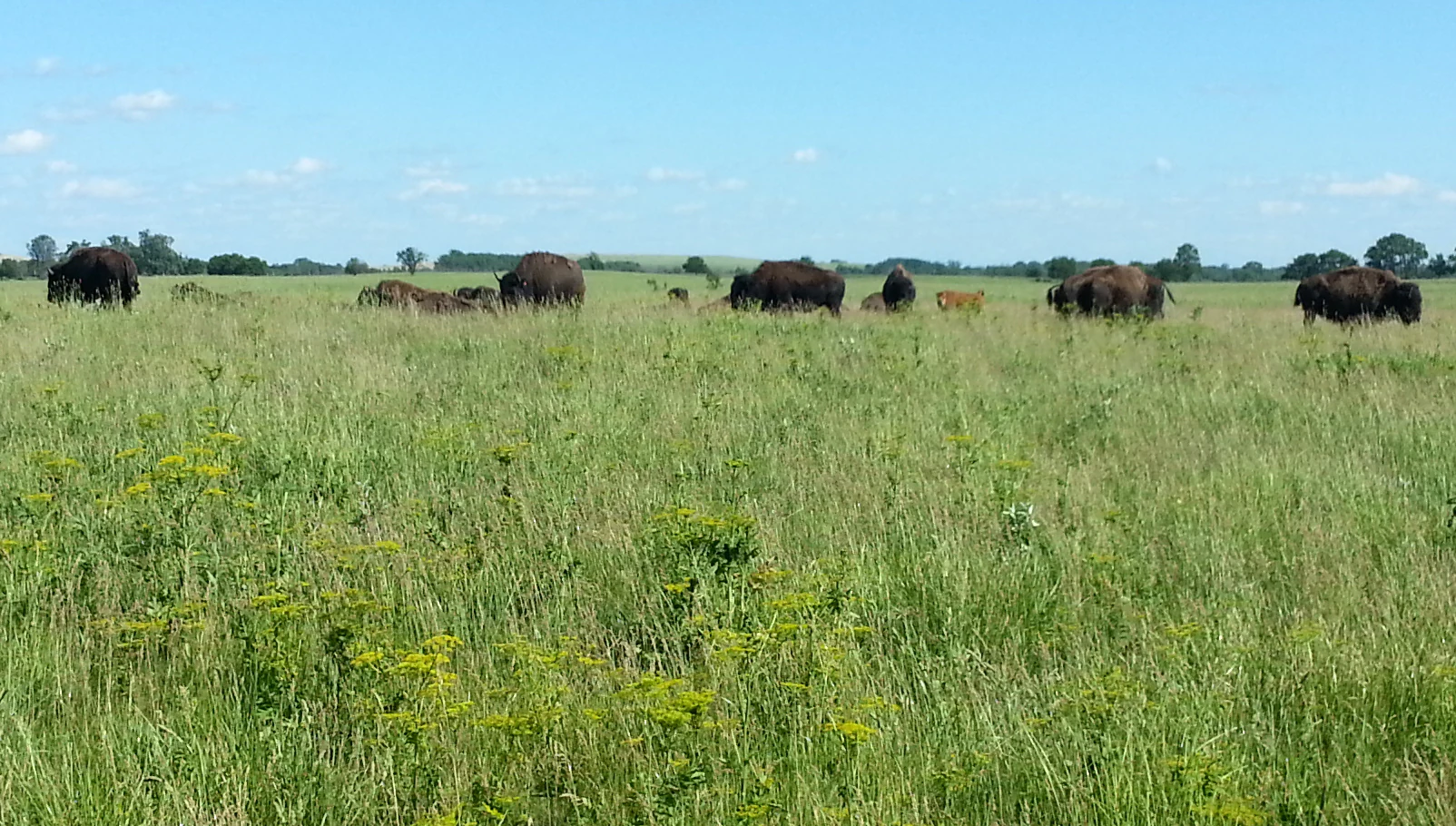
A group of dark-furred American bison grazing in a wide, grassy, open field under a clear blue sky.
A small herd of American bison grazing in the tallgrass prairie at Midewin.

Midewin National Tallgrass Prairie history and protected-area timeline

The land that is now Midewin National Tallgrass Prairie carries a longer human history than its modern restoration role suggests. Archaeological work since the establishment of the park has documented a pre-European-contact Oneota culture village site, dated to roughly 1600, in an area of the property called Middle Creek. The prairie's name itself comes from the Potawatomi word Midewin, a term for the tribe's healers, who were believed to also keep their society in balance. This word was selected to reflect a sense of cultural reconnection and stewardship for the restored landscape.

The site was dramatically transformed during the twentieth century by the establishment of the Joliet Army Ammunition Plant, which drove large-scale land disturbance and the conversion of prairie to industrial use. After the plant's military mission ended, advocacy including prominent support from World War II flying ace William J. Cullerton helped build momentum for a new conservation future on the same ground.

The federal Illinois Land Conservation Act (Public Law 104-106) of 1996 created Midewin National Tallgrass Prairie and authorized the transfer of more than 19,000 acres from the U.S. Army to the U.S. Forest Service. The first land transfer occurred on March 10, 1997, beginning with about 15,000 acres believed to be free from contamination, and subsequent land acquisitions have grown the reserve to roughly 20,000 acres.

In 2004, after years of active ecological restoration, part of the prairie opened to public visitors. The most ambitious recent chapter began in 2015, when the reserve authorized 1,200 acres for a conservation herd of American bison. Twenty-seven animals were brought in from Fort Collins, Colorado, and Gann Valley, South Dakota, marking the first U.S. Forest Service project of its kind and embedding Midewin into nationwide discussions about bison restoration and prairie ecology.

Midewin National Tallgrass Prairie landscape and geographic character

The Midewin landscape is defined by its position along the historic boundary between central U.S. forests and the tallgrass prairies of the Great Plains. The terrain is a mosaic of gentle uplands and lowlands rather than a continuous sweep of open grassland. Prairies, both mesic and dolomite, dominate the land cover, but they are interrupted by sedge meadows, swales, and two important wooded corridors along Jackson Creek in the northwest and along the Kankakee River and Prairie Creek in the far southwest.

These woodland ribbons are not incidental. They are ecological reference points that hint at the forest-grasslands transition character of the ecoregion, and they give Midewin a more varied scenery than a strictly open prairie. Wet features, including swales and sedge meadows, contribute to subtle changes in elevation and moisture that translate into a patchwork of plant communities.

The site has also been shaped by its industrial past. Former ammunition plant infrastructure, disturbed soils, and regraded surfaces have added complexity to the restoration landscape. Over time, the physical setting reads less as a single habitat and more as a layered land mosaic, where recovered prairie now occupies much of the original footprint while former industrial areas continue to evolve back into ecological systems.
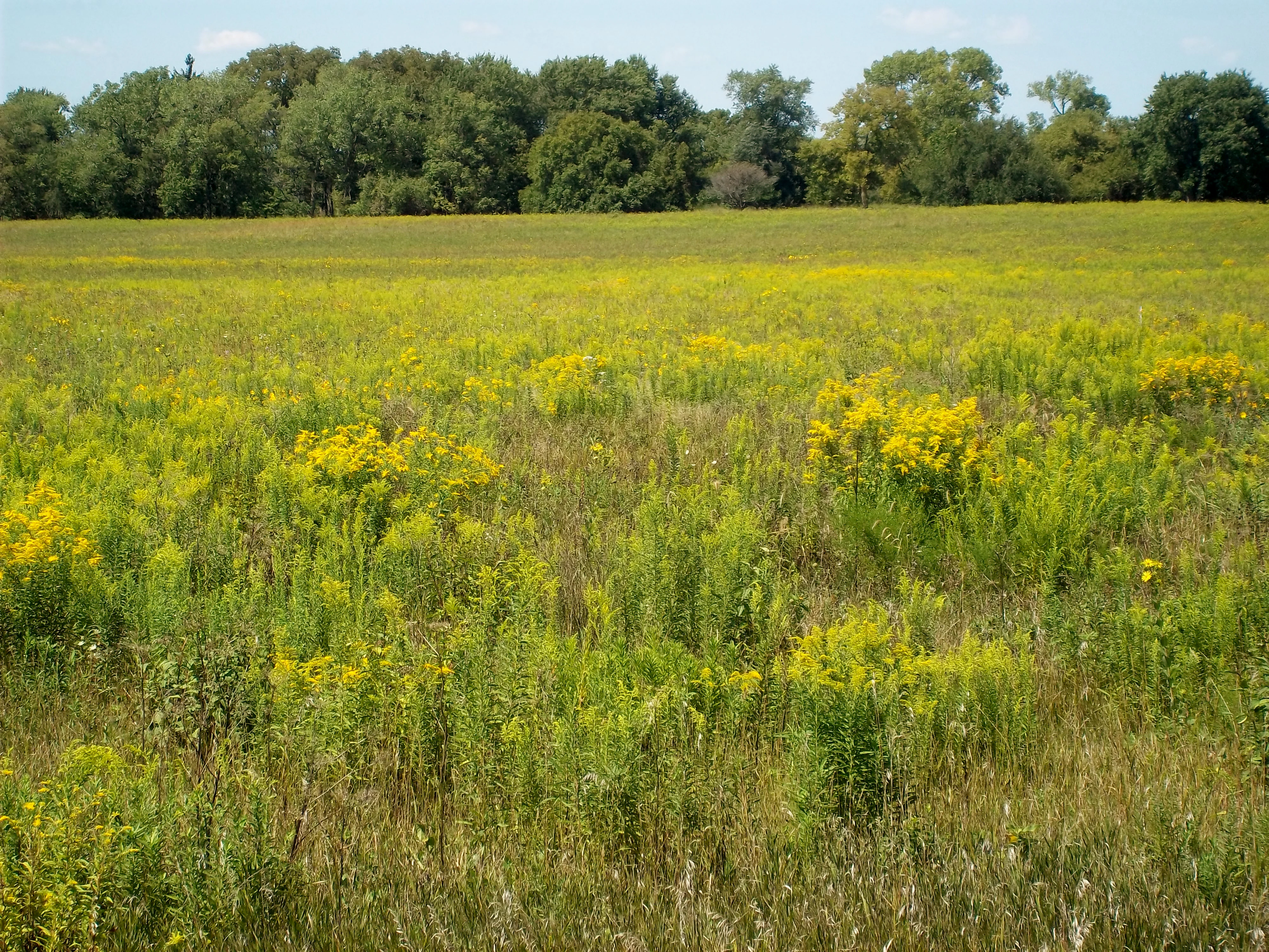
A vast field of green grasses and yellow wildflowers stretching toward a line of green deciduous trees under a clear sky.
A wide view of the restored tallgrass prairie at Midewin National Tallgrass Prairie.

Midewin National Tallgrass Prairie ecosystems, habitats, and plant life

Ecologically, Midewin is positioned within the central forest-grasslands transition ecoregion, a transitional zone where tallgrass prairie, oak savanna, and woodland historically interlocked. The reserve is one of the best examples of an active attempt to reconstruct this kind of mosaic ecosystem, and it houses a notable range of plant community types side by side: high-quality tallgrass prairie, dolomite prairie, sedge meadows, swales, and remnants of woodland.

The site's vegetation recovery integrates multiple grassland and wetland habitats, with management efforts aimed at re-establishing native plant populations and the ecological processes that historically maintained them. Because the reserve lies in a region where surviving tallgrass habitat is exceptionally rare, particularly east of the Mississippi River, Midewin's restored communities carry disproportionate conservation value.

The broader Chicago Wilderness landscape context amplifies this value. Midewin sits at the heart of a conservation macrosite of more than 40,000 acres, supported by organizations including the Wetlands Initiative, Openlands, The Nature Conservancy, and other Chicago Wilderness members, which have contributed to restoring and linking native habitats across the region.

Midewin National Tallgrass Prairie wildlife and species highlights

Midewin's wildlife story is closely tied to its status as a tallgrass prairie restoration flagship. While species populations have been reshaped by habitat loss and the site's industrial history, the reserve is designed to recover native fish, wildlife, and plant communities. The landscape supports species associated with tallgrass prairie, sedge meadow, swale, and woodland edge habitats, including grassland birds and other fauna tied to open-country environments.

The most prominent wildlife development at Midewin is its conservation herd of American bison, introduced in 2015 on a designated 1,200-acre area. The introduction reflects a deliberate scientific effort to study how a large native grazer interacts with prairie restoration and influences habitat structure, plant diversity, and ecological dynamics. As of late spring 2017, the herd had grown to roughly 50 animals through natural births.

Wider significance extends to avian life and the prairie's role in addressing grassland bird declines in the Midwest. Restoration work at Midewin contributes to broader efforts to rebuild habitat for ground-nesting birds and other tallgrass-dependent species, even though the site's industrial history means that wildlife recovery is an ongoing rather than completed process.

Midewin National Tallgrass Prairie conservation status and protection priorities

Midewin National Tallgrass Prairie is one of the highest-profile grassland conservation projects in the eastern United States. It is the only federal tallgrass prairie preserve east of the Mississippi River, and it is the first national tallgrass prairie ever designated in the United States. These distinctions give the site an outsized role in efforts to restore an ecosystem that has largely vanished from the region.

The reserve is governed by an unusually explicit conservation mandate laid out in the Illinois Land Conservation Act of 1996, which directs the U.S. Forest Service to conserve, restore, and enhance native populations and habitats of fish, wildlife, and plants; to support scientific and environmental education and research; to allow compatible agricultural or resource management uses; and to provide compatible public recreation. This statutory framework links ecological recovery directly to research and public benefit.

In regional conservation terms, Midewin is the anchor of a macrosite of more than 40,000 acres of protected land when combined with the Des Plaines Fish and Wildlife Area and surrounding state and county reserves. A network of not-for-profit partners, including the Wetlands Initiative, Openlands, The Nature Conservancy, and the broader Chicago Wilderness collaborative, has invested heavily in restoring native communities at the site. The 2015 bison reintroduction extends this conservation mission into active research on how native megafauna shape tallgrass ecosystems.

Midewin National Tallgrass Prairie cultural meaning and human context

The cultural framing of Midewin National Tallgrass Prairie begins with its name, which comes from the Potawatomi word for tribal healers believed to also keep the community in balance. This naming choice is part of an effort to acknowledge Indigenous presence and to align the reserve's modern restoration work with a longer Native American relationship to the land. Archaeological research has revealed a Oneota culture village site, dated to around 1600, along what is now called Middle Creek within the preserve, adding a tangible pre-contact layer to that relationship.

The site's more recent cultural memory is shaped by its identity as a former military industrial complex. The conversion of the Joliet Army Ammunition Plant into a tallgrass prairie is itself a significant cultural shift: a landscape used for wartime production is now dedicated to ecological recovery, scientific study, and public recreation. The advocacy that made this transition possible, including prominent figures such as World War II flying ace William J. Cullerton, is part of the park's institutional history.

The reserve also functions as a regional educational resource. Its explicit mandate to support scientific, environmental, and land-use education and research means that Midewin is a working setting where schools, universities, volunteer groups, and conservation organizations engage directly with prairie restoration, making it a cultural hub as well as an ecological one.

Top sights and standout views in Midewin National Tallgrass Prairie

Midewin's distinguishing highlights include its standing as the first national tallgrass prairie in the United States and the largest tallgrass prairie restoration area in the country. The reserve's location east of the Mississippi River makes it a reference point for grassland conservation in the eastern U.S., where surviving tallgrass habitat is rare.

Equally important are the partnerships and the experimental work taking place at the site. The 2015 bison reintroduction stands out as a flagship initiative and the first U.S. Forest Service project of its kind, while the broader conservation macrosite of more than 40,000 acres links Midewin to a network of state, federal, and nonprofit protected areas across the Chicago region.

Best time to visit Midewin National Tallgrass Prairie

Midewin is a prairie landscape, so seasonal timing strongly shapes what visitors experience. Late spring and summer bring the most visible flowering display, with warm-season grasses and forbs reaching their full height and creating the open, sweeping character that defines tallgrass prairie. These are also the seasons when grassland-associated wildlife is most active across the reserve.

Early autumn typically offers a different mood: cooler temperatures, lower humidity, and active restoration work in the field. Visitors in this period may encounter habitat management activities and the bison herd under more comfortable conditions.

Winter brings a quieter but still distinctive prairie experience. Tallgrasses dry to tan and gold, and the broad open landscape takes on a stark, atmospheric quality. Cooler months can be excellent for hiking, though visitors should be prepared for cold exposure typical of northeastern Illinois.
Monthly climate preview

Track monthly precipitation averages and long-term temperature ranges across the representative coordinate

Midewin National Tallgrass Prairie Climate Normals and Annual Temperature Rhythm

Midewin National Tallgrass Prairie exhibits a measured annual temperature range from sub-zero winter lows to warm summer maximums alongside consistent monthly precipitation patterns. Reviewing the complete twelve-month climatology dataset reveals deeper variations in temperature and precipitation across the protected landscape.
Annual mean10 °C
-5 °C23 °C
Jan-5°
Feb-3°
Mar
Apr
May16°
Jun21°
Jul23°
Aug22°
Sep18°
Oct11°
Nov
Dec-2°
Warmest month
July

23.2 °C

Coolest month
January

-5.2 °C

Wettest month
June

3.8 mm/day

Driest month
January

1.6 mm/day

Park location guide

Geography guide, regional context, and park location map for Midewin National Tallgrass Prairie

Midewin National Tallgrass Prairie park geography, regions, and map view in United States of America

Understand where Midewin National Tallgrass Prairie sits in United States of America through a broader geographic reading of the surrounding landscape, nearby location context, and its mapped position within the national park landscape.

How Midewin National Tallgrass Prairie fits into United States of America

The United States of America is a federal presidential republic and one of the world's largest countries by area and population. It consists of 50 states across a vast territory spanning multiple time zones, with its capital in Washington, D.C. and largest city in New York City. The nation has a diverse economy, influential political system, and significant cultural and military presence globally.

Wider geography shaping Midewin National Tallgrass Prairie in United States of America

The United States occupies a vast territory in North America, bordered by Canada to the north and Mexico to the south. The 48 contiguous states stretch from the Atlantic to the Pacific Ocean, while Alaska occupies the northwestern region and Hawaii is an archipelago in the Pacific. The country encompasses diverse terrain including the Rocky Mountains, Appalachian Mountains, Great Plains, and extensive river systems.

Map view of Midewin National Tallgrass Prairie

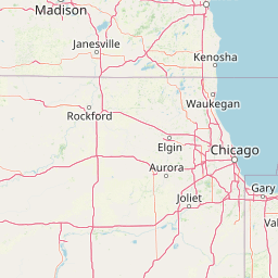
Use this park location map to pinpoint Midewin National Tallgrass Prairie in United States of America, understand its exact geographic position, and read its mapped placement within the surrounding landscape more clearly.

Pigeon | © OpenStreetMap contributors

Location context for Midewin National Tallgrass Prairie

IllinoisWill County
Recorded earthquake history

Explore Recorded Earthquake History for Midewin National Tallgrass Prairie

Investigate the seismic history of the region surrounding Midewin National Tallgrass Prairie through our curated catalogue. This MoriAtlas resource allows for the detailed review of documented earthquake events by date, magnitude, and proximity to the prairie landscape.

Midewin National Tallgrass Prairie Earthquakes

Catalogued events

3 events

Strongest magnitude

Magnitude 3.2

Most recent event

Jul 15, 2024

This history includes earthquakes recorded inside the park or within 50 km of its borders

Visual reference guide to the habitats, terrain, and restored ecosystems of Midewin National Tallgrass Prairie

Midewin National Tallgrass Prairie Photos, Landscapes, and Scenery

Visual documentation captures the evolving landscape, tallgrass plant communities, and rare transitional habitats found across Midewin National Tallgrass Prairie. Photographic coverage reveals the terrain, restoration zones, and protected environment that define the largest tallgrass restoration area east of the Mississippi River.

A group of dark-furred American bison grazing in a wide, grassy, open field under a clear blue sky.

A field filled with green stalks and yellow wildflowers, likely goldenrod, with a tree line in the background.

A vast field of green grasses and yellow wildflowers stretching toward a line of green deciduous trees under a clear sky.

Park atlas

Compare surrounding Midwestern conservation landscapes and connected natural habitats

Parks Near Midewin National Tallgrass Prairie and Related Regional Protected Areas

Browse other protected areas near Midewin National Tallgrass Prairie to examine adjacent grassland reserves and regional conservation networks. Continuing across these nearby locations reveals broader ecological patterns within the central forest-grasslands transition ecoregion.
National parkUnited States of America
59 km away#1 closest

East

Indiana Dunes National Park: Protected Landscape Geography and Map Exploration

Explore the National Park's geographic boundaries and regional context.

Indiana Dunes National Park represents a distinct protected area within the United States of America, characterized by its unique landscape setting. This entry provides a detailed atlas-style view, highlighting the park's mapped boundaries and its contribution to the regional geography. Understanding this National Park means appreciating its specific natural terrain and its place within the conservation landscape of North America.

Area
62.12 km²
Established
1966
IUCN
II
Visitors
2.8M annual
Watercolor painting of a soft, hazy forest landscape with rolling hills in the background and soft green trees in the foreground.
Protected landscapeIndiana
282 km away#2 closest

Southeast

Hoosier National Forest: Geographic Overview of Indiana Protected Wilderness and Woodlands

Mapping the karst terrain and forest corridors of southern Indiana.

Hoosier National Forest defines the landscape of southern Indiana with its rolling unglaciated hills and ridge systems. Discover the mapped geography of this protected area, including its rare prairie-like barrens, sandstone cliff formations, and the designated Charles C. Deam Wilderness. This overview focuses on the spatial extent and diverse topographic features that distinguish this forest from the surrounding Midwest plains.

Area
826.78 km²
Established
1961
Relief
Upland
Climate
Temperate
Marine protected areaWisconsin
About 291 km away#3 closest

North

Wisconsin Shipwreck Coast National Marine Sanctuary: Mapping Underwater Protected Cultural Landscapes

Underwater maritime archaeology and Lake Michigan basin geography.

Spanning 82 miles along the Wisconsin coastline, the Wisconsin Shipwreck Coast National Marine Sanctuary protects a unique underwater archaeological landscape. Cold, fresh water ensures the remarkable preservation of dozens of historic schooners and steamships, providing a deep look into the maritime economy of the upper Midwest. The sanctuary area offers insights into glacial lakebed terrain, bathymetric mapping, and the complex underwater geography of Lake Michigan.

Area
2,490 km²
Established
2021
Relief
Lowland
Climate
Temperate
National parkMissouri
346 km away#4 closest

Southwest

Gateway Arch National Park: National Park Geographic Atlas and Map Boundaries

Explore protected landscape context and regional setting.

Gateway Arch National Park represents a unique protected landscape within Missouri, contributing to the broader national park atlas. This entry focuses on its specific geographic identity and mapped boundaries, offering structured data for understanding its role. Discover the factual landscape context and regional importance of Gateway Arch National Park for informed geographic exploration.

Area
0.78 km²
Established
2018
IUCN
II
Visitors
1.2M annual
A soft watercolor painting showing green rolling hills, a calm body of water, and small clusters of pink flowers against a light, hazy background.
National parkMichigan
394 km away#5 closest

Northeast

Sleeping Bear Dunes National Lakeshore: Atlas, Maps, and Protected Landscape Geography

Great Lakes freshwater coast and glacial dune systems

Sleeping Bear Dunes National Lakeshore showcases the unique intersection of glacial geology and freshwater ecology. This protected area features massive dunes resting on ancient glacial deposits, backed by beech and maple forests. The geographic scope includes the vast shoreline of Lake Michigan, inland waters such as Glen Lake, and the distinct maritime history found across the remote North and South Manitou Islands.

Area
288.13 km²
Established
1970
IUCN
III
Visitors
1.5M annual
Watercolor painting of a wide, rolling landscape featuring layered sandstone bluffs and green forested hills against a light background.
Protected landscapeIllinois
402 km away#6 closest

South

Shawnee National Forest: Exploring the Protected Landscapes of the Illinois Shawnee Hills

Mapped sandstone formations and glacial terrain in southern Illinois

Spanning nearly 289,000 hectares, Shawnee National Forest is the largest body of public land in Illinois. The area is defined by its dramatic sandstone bluffs, deep canyons, and seven designated wilderness areas that provide a rare rugged topography within the American Midwest. Explore the complex geography of this forest, from its glacial-sculpted river watersheds to its diverse hardwood habitats and historic reforestation sites.

Area
2,017.83 km²
Established
1933
Relief
Upland
Climate
Temperate
Watercolor painting of rock formations and surrounding green trees on a plain white background.
Wildlife reserveIllinois
411 km away#7 closest

South

Garden of the Gods Wilderness: A Protected Sandstone Plateau in Southern Illinois

Explore geologic boundaries, sandstone hoodoos, and forested wilderness terrain

Garden of the Gods Wilderness represents a critical protected area within the Shawnee National Forest, notable for its unglaciated sandstone geography. This 3,318-acre wilderness offers an intimate view of ancient carboniferous rock formations, including prominent hoodoos and clifftop overlooks that provide expansive sightlines across the southern Illinois landscape.

Area
13.43 km²
Established
1990
Relief
Upland
Climate
Temperate
Wildlife reserveIllinois
419 km away#8 closest

South

Lusk Creek Wilderness: An Atlas of Protected Sandstone Canyons and Forests in Southern Illinois

Mapping rugged wilderness terrain and forest ecological recovery.

Lusk Creek Wilderness serves as a key protected landscape in southern Illinois, featuring extensive sandstone canyon systems and dense hardwood woodland. This area offers a unique look at the geological and forested character of the Shawnee region, documented through its boundaries, elevation changes, and natural landmarks. Use this geographic entry to examine the rugged, roadless character of the state largest wilderness designation and its place within the wider regional drainage system.

Area
25.47 km²
Established
1990
IUCN
Ib
Relief
Upland

Common questions about visiting, size, designation, and location context for Midewin National Tallgrass Prairie

Midewin National Tallgrass Prairie FAQs for park facts, access, geography, and protected area context

Find quick answers about Midewin National Tallgrass Prairie, including protected-area facts, park geography, trail and visitor context, and how the park fits into its surrounding country and regional landscape.
MoriAtlas Explorer

Continue Your Protected Areas Search Across the Global Atlas

Deepen your exploration by continuing the structured search for national parks and protected areas worldwide. Utilize the comprehensive filtering capabilities to compare different conservation landscapes and refine your understanding of global park geography. Discover more about the distribution and characteristics of protected natural areas.

Global natural geography