Mori Atlas logo
Nature reserveMierzeja Sarbska Nature Reserve

Mapping the parabolic dune systems and rare interdunal vegetation on the Baltic Sea coast

Mierzeja Sarbska Nature Reserve: Coastal Barrier Geography and Protected Dune Landscapes

(Rezerwat przyrody Mierzeja Sarbska)

Mierzeja Sarbska Nature Reserve sits along the northern Polish coast as a distinct sandy barrier between the Baltic Sea and Lake Sarbsko. This protected area showcases a complex coastal mosaic defined by active parabolic dunes reaching 24 meters, alongside specialized crowberry pine forests and bog habitats. The geographic boundaries preserve a rare sequence of landforms that anchor the ecological character of the Pomeranian Voivodeship shoreline.

coastal reservesand barrierparabolic dunesBaltic coastcrowberry pine forestinterdunal wetlands

Mierzeja Sarbska Nature Reserve

Nature reserve

Park overview

Structured park overview, official facts, and landscape profile for Mierzeja Sarbska Nature Reserve

Mierzeja Sarbska Nature Reserve park facts, protected area profile, and essential visitor context

Review the core facts for Mierzeja Sarbska Nature Reserve, including designation, size, terrain, visitor scale, habitats, and operating context in one park-focused overview.

About Mierzeja Sarbska Nature Reserve

The Mierzeja Sarbska Nature Reserve occupies a stretch of sandy coastal barrier on Poland's northern Baltic shore, where it safeguards a dynamic dune landscape and its associated forest and wetland ecosystems. The reserve sits within the broader Wybrzeże Słowińskie mesoregion, in the transitional zone between the Słowińskie and Kashubian coastal belts, which gives it strong regional geographical character and places it near some of the most iconic Baltic landscapes in Poland.

At its core, the reserve is built around a series of parabolic dunes, including features reaching about 24 meters above sea level, that still display signs of active movement. These dunes shape every other element of the protected landscape: the dry ridges are colonized by distinctive crowberry pine forests, while the sheltered interdunal hollows harbor relict bog and mire plant communities that have persisted in this otherwise sandy setting.

Beyond the dunes, the reserve encompasses well-preserved patches of birch forest and bog pine woodland (bór bagienny), as well as alder carrs (olsyny) that mark the wetter margins of the barrier. Around 340 vascular plant species have been recorded, with many protected species represented, underscoring both the botanical richness and the conservation importance of the site. The reserve's location on the mierzeja between Lake Sarbsko and the open Baltic also gives it a clear landscape identity, framed by water on both sides and bordered to the south by the lower course of the Chełst River.

Administratively and ecologically, the reserve extends across the gminas of Choczewo, Łeba, and Wicko, making it a notable shared protected-area asset in the Pomorskie Voivodeship. Together, its dune dynamics, pine-dominated forest mosaic, and unusual interdunal habitats make Mierzeja Sarbska a key reference site for understanding sandy-barrier ecosystems along the southern Baltic Sea.

Quick facts and research context for Mierzeja Sarbska Nature Reserve

Mierzeja Sarbska is a Polish landscape nature reserve (rezerwat krajobrazowy) located in the Pomorskie Voivodeship, at roughly 54.78°N, 17.66°E. It was created in 1976 under Polish legal gazette Monitor Polski No. 42, item 206, and covers approximately 546.95 hectares on the barrier between Lake Sarbsko and the Baltic Sea.

The reserve lies in the Wybrzeże Słowińskie mesoregion, near the border between the Słowińskie and Kashubian coastal belts, and spans three gminas: Choczewo, Łeba, and Wicko. The nearest towns are Łeba and Osetnik. The Chełst River runs along the southern edge of the reserve in its lower course toward the sea.

Ecologically, the area combines mobile parabolic dunes, crowberry pine forest, birch woodland, bog pine communities, and alder swamps, and supports around 340 vascular plant species, including several strictly protected taxa.

Park context

Deeper park guide and search-rich context for Mierzeja Sarbska Nature Reserve

Mierzeja Sarbska Nature Reserve history, landscape, wildlife, and travel context

Explore Mierzeja Sarbska Nature Reserve through its history, landscape character, ecosystems, wildlife, conservation priorities, cultural context, and seasonal travel timing in a structured park guide built for atlas discovery and search intent.

Why Mierzeja Sarbska Nature Reserve stands out

Mierzeja Sarbska is best known for its combination of active parabolic dune systems and exceptionally intact interdunal vegetation communities, which are considered unusual for the Polish Baltic coast. The reserve's crowberry pine forests and relict wetland plant stands occupy the hollows between the dunes, creating a habitat mosaic that is rare in this part of the southern Baltic. The protected vascular flora, including species such as royal fern, bog violet, long-leaved sundew, marsh sedge, and European waxflower, gives the reserve additional botanical significance. The setting on a narrow sandy barrier between Lake Sarbsko and the sea further reinforces its identity as a classic Polish coastal mierzeja reserve.
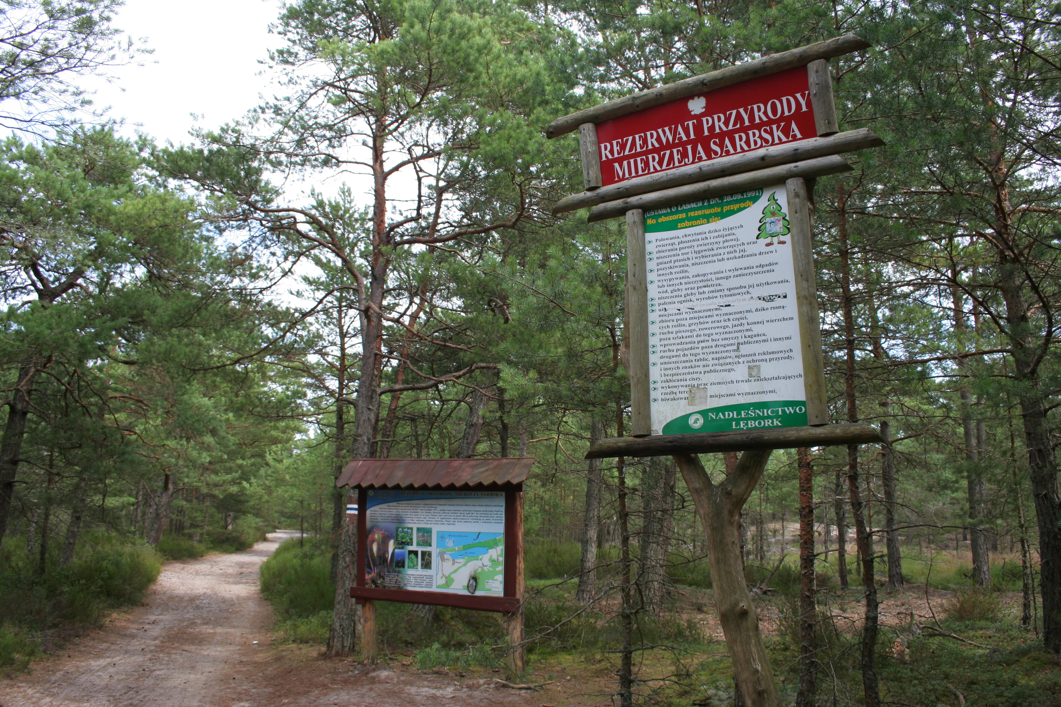
A wooden sign identifying Rezerwat Przyrody Mierzeja Sarbska stands on a dirt path entering a coastal forest.
Information signs at the entrance to Mierzeja Sarbska Nature Reserve in Poland.

Mierzeja Sarbska Nature Reserve history and protected-area timeline

The Mierzeja Sarbska Nature Reserve was formally established in 1976, when Polish authorities designated the area as a landscape-level nature reserve (rezerwat krajobrazowy). Its legal foundation is recorded in the official Polish gazette Monitor Polski (1976, No. 42, item 206), which set the framework for protection of the dune and forest mosaic on the barrier between Lake Sarbsko and the Baltic.

The reserve's creation reflected the broader 1970s emphasis in Poland on protecting representative coastal landscapes, particularly dune systems and their associated forest stands, before such habitats faced stronger pressure from tourism and infrastructure development along the Baltic shore. By placing the mobile parabolic dunes and their interdunal plant communities under formal protection, the state aimed to secure both the geomorphological dynamics of the barrier and the unusually rich botanical assemblages documented there.

Since its designation, the reserve has remained a recognized component of the regional network of protected areas in the Pomorskie Voivodeship, situated near the well-known coastal town of Łeba and not far from the larger Słowiński National Park, reinforcing its role within the broader Baltic coastal conservation landscape.

Mierzeja Sarbska Nature Reserve landscape and geographic character

The defining landscape of Mierzeja Sarbska is a narrow, sandy coastal barrier shaped by wind and sea. The reserve's terrain is dominated by parabolic dunes, including formations that rise to about 24 meters above sea level and remain sufficiently active to qualify as 'ruchy' (mobile) dunes. Between these dunes sit deflation hollows where finer material has been removed by wind, leaving behind wetter, more sheltered basins that sustain distinctive vegetation.

To the north, the Baltic Sea frames the barrier; to the south lies Lake Sarbsko, a large coastal lagoon that parallels the dune belt. The southern edge of the reserve is also traced by the lower Chełst River as it flows toward its mouth. The result is a landscape strongly bounded by water on both sides, with the dunes, their intervening wetlands, and the bordering forests all compressed into a relatively narrow coastal strip.

Beyond the open dunes, the landscape becomes more forested, with crowberry pine stands on the drier ridges and birch woodland, bog pine communities, and alder carrs occupying the wetter depressions. Together, these elements form a compact, layered coastal scene typical of the southern Baltic mierzeja systems, while the proximity to Łeba and Osetnik ties the reserve firmly into the lived-in coastal geography of the region.

Mierzeja Sarbska Nature Reserve ecosystems, habitats, and plant life

Ecologically, Mierzeja Sarbska is defined by the interplay between active dune processes, coniferous and birch-dominated forest stands, and relict wetland patches. On the drier, shifting sands, the reserve protects crowberry pine forest (bór bażynowy), a distinctive vegetation type tied closely to the nutrient-poor, acidic dune substrates of the southern Baltic coast.

In the more sheltered interdunal depressions, the reserve harbors plant communities that are unusual for the Polish coast. These deflation hollows support bog and mire vegetation with relict character, including birch woodland, bog pine communities, and alder carr (ols) clusters. The combination of such wetland patches within an otherwise dry, sandy dune belt is ecologically unusual along the Baltic and is one of the main reasons the site was given protected status.

Surveys have documented approximately 340 vascular plant species within the reserve, a high figure for such a limited area and one that reflects the strong habitat contrasts across the dune and forest mosaic. These include protected and regionally rare taxa such as royal fern (długosz królewski), bog violet (fiołek torfowy), long-leaved sundew (rosiczka długolistna), intermediate sundew (rosiczka pośrednia), marsh sedge (turzyca bagienna), bog grooveburreed (wątlik błotny, long unrecorded), turf-like cottongrass (wełnianeczka darniowa), and European waxflower (woskownica europejska).

Mierzeja Sarbska Nature Reserve wildlife and species highlights

The wildlife profile of Mierzeja Sarbska is tightly linked to its dune, pine forest, and bog habitat mosaic, characteristic of Poland's Baltic coastal barriers. The reserve's vegetation layers, from open mobile sand to dense pine and birch stands and wetter alder carrs, support a range of invertebrates, amphibians, and breeding birds typical of this kind of mosaic.

The presence of sundews, sedges, and other bog plants indicates a thriving community of moisture-loving insects, while the surrounding pine forests and dune hollows provide nesting and shelter for typical Baltic woodland and dune-breeding bird species. Reptiles and amphibians associated with damp dune slacks and boggy pools are also part of the expected fauna, although detailed species inventories are not central to the public record of the reserve.

Beyond species lists, the wildlife significance of Mierzeja Sarbska lies in its role as a protected refuge within a larger coastal landscape near Łeba and the Słowiński National Park area, helping maintain ecological continuity along a stretch of Polish Baltic shoreline that is otherwise heavily used for tourism and settlement.

Mierzeja Sarbska Nature Reserve conservation status and protection priorities

From a conservation perspective, Mierzeja Sarbska is significant because it protects an integrated dune-forest-wetland system rather than an isolated habitat type. Active parabolic dunes, crowberry pine communities, birch woodland, and alder carrs all occur within the same protected block, which is rare on the Polish coast and gives the reserve strong ecological coherence.

The interdunal deflation hollows are particularly important: they host plant communities described in the scientific literature as unique to the Polish seashore, including relict bog and mire species with protected status. Safeguarding these species in situ is a key conservation goal, since such communities are highly sensitive to changes in groundwater, dune movement, and human pressure.

The reserve's formal status as a landscape nature reserve under the 1976 Monitor Polski designation places it within Poland's national system of protected areas. Combined with its location within the Pomorskie Voivodeship and adjacent to other major coastal protected landscapes, including the well-known dunes near Łeba, Mierzeja Sarbska is a meaningful component of regional conservation planning for the southern Baltic coast.

Mierzeja Sarbska Nature Reserve cultural meaning and human context

The protected area sits within the broader cultural-geographical framework of the Pomeranian Baltic coast, near the town of Łeba and the small locality of Osetnik. These settlements form part of the wider landscape of the former Słowińskie and Kashubian coastal communities, whose traditional relationships with the dunes, fishing, and coastal lagoons shaped the human geography of the area long before modern tourism arrived.

The reserve itself is named after the regional mierzeja (sand barrier) and Lake Sarbsko, both of which carry local toponyms rooted in the coastal communities of this part of northern Poland. While the reserve is managed primarily for natural values, its position next to historically important coastal settlements gives it a clear place within the regional identity of the Pomorskie coast.

Top sights and standout views in Mierzeja Sarbska Nature Reserve

The reserve's most notable features are its active parabolic dunes and the unusual interdunal plant communities that have developed in the deflation hollows between them. Crowberry pine forest on the dune ridges and bog woodland with relict plant species in the depressions create a compact, easily readable ecological story that is relatively rare along the Polish Baltic coast.

Additional highlights include the documented presence of around 340 vascular plant species, the protected relict species such as royal fern, sundews, and European waxflower, and the reserve's position on the barrier between Lake Sarbsko and the Baltic Sea, near the coastal town of Łeba and along the lower Chełst River corridor.

Best time to visit Mierzeja Sarbska Nature Reserve

The most rewarding time to visit Mierzeja Sarbska depends on what a visitor hopes to experience along the Baltic coast. Late spring and early summer are broadly favorable for observing the dune flora and the characteristic interdunal wetland vegetation, when protected plants such as royal fern, sundews, and bog violet are most visible and the dune pines and birch stands are in full leaf.

Autumn brings softer light across the dune belt and quieter conditions along the barrier, useful for appreciating the broader landscape between Lake Sarbsko and the Baltic. Winter, though harsher, can reveal the structure of the dunes and the openness of the coastal pine forest more clearly, while the surrounding foregrounds of Lake Sarbsko and the sea create strong scenic contrast throughout the year.
Monthly climate preview

Long-term representative monthly averages for temperature and precipitation patterns

Mierzeja Sarbska Nature Reserve Climate Normals and Annual Temperature Rhythm

Measured NASA POWER climatology records track monthly temperature variations and precipitation rates across a representative coordinate within Mierzeja Sarbska Nature Reserve. Examining twelve-month averages reveals the long-term annual climate rhythm mapped for this protected area.
Annual mean9 °C
1 °C18 °C
Jan
Feb
Mar
Apr
May10°
Jun14°
Jul17°
Aug18°
Sep15°
Oct11°
Nov
Dec
Warmest month
August

18.2 °C

Coolest month
February

1.4 °C

Wettest month
August

2.4 mm/day

Driest month
April

1.2 mm/day

Park location guide

Geography guide, regional context, and park location map for Mierzeja Sarbska Nature Reserve

Mierzeja Sarbska Nature Reserve park geography, regions, and map view in Poland

Understand where Mierzeja Sarbska Nature Reserve sits in Poland through a broader geographic reading of the surrounding landscape, nearby location context, and its mapped position within the national park landscape.

How Mierzeja Sarbska Nature Reserve fits into Poland

Poland, officially the Republic of Poland, is a Central European country spanning from the Baltic Sea in the north to the Carpathian Mountains in the south. It borders Germany, Czech Republic, Slovakia, Ukraine, Belarus, Lithuania, and Kaliningrad Oblast. The country has a temperate climate, diverse landscapes, and is known for its rich history, cultural heritage, and strong economic position within the EU.

Wider geography shaping Mierzeja Sarbska Nature Reserve in Poland

Poland occupies 312,696 km2 in Central Europe, extending from the Baltic Sea coast in the north to the Sudetes and Carpathian Mountains in the south. It borders Germany to the west, Czech Republic and Slovakia to the south, Ukraine and Belarus to the east, and Lithuania and Kaliningrad Oblast to the northeast. The landscape includes lowland plains, uplands, and mountain ranges.

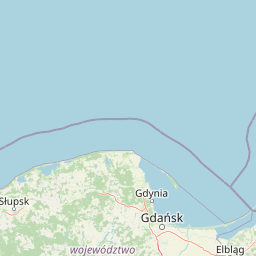
Map view of Mierzeja Sarbska Nature Reserve

Use this park location map to pinpoint Mierzeja Sarbska Nature Reserve in Poland, understand its exact geographic position, and read its mapped placement within the surrounding landscape more clearly.

Pigeon | © OpenStreetMap contributors

Location context for Mierzeja Sarbska Nature Reserve

Pomeranian Voivodeship

Visual exploration of coastal sand dunes, pine forests, and wetland habitats

Mierzeja Sarbska Nature Reserve Photos and Landscape Scenery

Visual documentation captures the active parabolic dunes, crowberry pine forests, and sheltered interdunal wetlands that define the terrain of Mierzeja Sarbska Nature Reserve. Examining these coastal landforms and rare plant communities provides a deeper understanding of the protected Baltic barrier landscape.

A wooden sign identifying Rezerwat Przyrody Mierzeja Sarbska stands on a dirt path entering a coastal forest.

Park atlas

Compare nearby coastal reserves and regional habitats across the southern Baltic shoreline.

Parks Near Mierzeja Sarbska Nature Reserve and Surrounding Protected Landscapes

Browse other protected areas and coastal habitats located near Mierzeja Sarbska Nature Reserve to compare regional landforms. Examining adjacent parks provides broader geographic context for coastal dune ecosystems and lowland forest formations.
Watercolor illustration of sand dunes, tall grasses, pine trees, and distant mountains under a soft sky
National parkPomeranian Voivodeship
About 8.4 km away#1 closest

West

Slovincian National Park: Moving Dunes and Baltic Coast Protected Landscape Exploration

Discover its unique geography and mapped terrain.

Slovincian National Park is a protected area in Pomeranian Voivodeship, Poland, celebrated for its impressive moving sand dunes and coastal wetland ecosystems. These dynamic dunes, some reaching 30 meters high, migrate inland, creating an ever-changing landscape. The park also features large shallow lakes like Łebsko and Gardno, vital for migratory birds. Explore the mapped boundaries and geographic context of this significant protected area, a Ramsar site and UNESCO biosphere reserve.

Area
186.18 km²
Established
1967
IUCN
II
Visitors
319K annual
A horizontal watercolor illustration depicting rolling green hills, patches of tall grass, a small cluster of pine trees, and dunes under a soft, light-filled sky.
National parkPomorskie Voivodeship
About 8.4 km away#2 closest

West

Słowiński Park Narodowy: Mapping the Baltic Sand Dunes and Wetland Geography

Coastal landscapes of the Polish Pomorskie region

Słowiński Park Narodowy protects a vital mosaic of moving sand dunes, raised bogs, and coastal lakes along the Baltic shoreline. This atlas entry focuses on the physical landscape dynamics of the Gardno-Łeba lowland, highlighting the interaction between dune belts, water bodies, and coastal forest habitats within the Pomorskie Voivodeship.

Area
327.44 km²
Established
1967
Visitors
319K annual
Relief
Lowland
Nature reservePomeranian Voivodeship
About 24 km away#3 closest

East

Długosz Królewski w Wierzchucinie: Mapping a Protected Floristic Peatland Reserve in Pomerania

Floristic nature reserve and bog ecosystem in northern Poland

This protected area in Gmina Krokowa preserves critical peatland habitats, including rare stands of royal fern and interrupted clubmoss. Its geography captures the history of the Wierzchucińska Forest, showcasing a complex environment of moist woodlands and bog mosaics characteristic of the Baltic coastal landscape in Poland.

Area
1.482 km²
Established
2003
Relief
Lowland
Climate
Temperate
Nature reservePomeranian Voivodeship
About 24 km away#4 closest

Southeast

Rezerwat przyrody Długosz Królewski w Łęczynie: Botanical Protected Area in Pomerania

Floristic nature reserve focused on royal fern conservation

Located in the heart of the Puszcza Wierzchucińska, this nature reserve is a critical site for the study and conservation of Osmunda regalis. The surrounding terrain of damp, peat-influenced woodland defines the unique character of this small, specialized protected area in northern Poland.

Area
0.02 km²
Established
1977
Scope
Terrestrial
Water
Minor water
Nature reservePomeranian Voivodeship
About 48 km away#5 closest

Southeast

Rezerwat przyrody Jezioro Turzycowe: Wetland Protected Area in Pomeranian Voivodeship

Kashubian Lake District bog forest and dystrophic lake atlas

Rezerwat przyrody Jezioro Turzycowe protects a concentrated mosaic of post-glacial wetland environments, including a dystrophic lake and raised bog habitats. This nature reserve offers deep insight into the specific hydrological and botanical conditions defining northern Polish wilderness corridors.

Area
0.114 km²
Established
1959
Relief
Upland
Climate
Temperate
Nature reservePomeranian Voivodeship
About 57 km away#6 closest

East

Mechelińskie Łąki Nature Reserve: Coastal Geography and Protected Baltic Wetland Atlas

Pomeranian Voivodeship coastal dune and marsh landscape exploration

Investigate the protected topography of Mechelińskie Łąki Nature Reserve, where saline meadows meet the Baltic shoreline of Puck Bay. This faunistic reserve preserves an essential mosaic of dunes, marshes, and reedbeds in northern Poland, serving as a significant habitat for nesting shorebirds and rare amphibian species within the Pomeranian Voivodeship.

Area
1.135 km²
Established
2000
Relief
Lowland
Climate
Temperate
Nature reservePomeranian Voivodeship
About 62 km away#7 closest

South

Rezerwat przyrody Mechowiska Sulęczyńskie: Geography and Protected Area Landscape Analysis

Alkaline fen and peatland habitat in Pomeranian Voivodeship

Study the geographic distribution and protected status of Rezerwat przyrody Mechowiska Sulęczyńskie, an essential alkaline fen ecosystem in northern Poland. This reserve highlights the role of groundwater-fed landscapes in maintaining orchid populations and bryophyte-rich mires within a post-glacial region. The site serves as a reference point for peatland conservation and structural landscape integrity.

Area
0.252 km²
Established
2014
Relief
Lowland
Climate
Temperate
Nature reservePomeranian Voivodeship
About 62 km away#8 closest

Southwest

Rezerwat przyrody Jezioro Modła: Wetland Geography and Protected Coastal Habitat

Nature reserve mapping in Pomeranian Voivodeship, Poland

Focusing on a shallow coastal lake and its surrounding marshland ecosystem, Rezerwat przyrody Jezioro Modła provides vital breeding habitats for waterbirds. The reserve represents a core component of the Pomeranian shoreline, where shifting lake boundaries and dense vegetation define the terrain, highlighting the ecological significance of this protected region.

Area
1.948 km²
Established
1982
Relief
Lowland
Climate
Temperate

Common questions about visiting, size, designation, and location context for Mierzeja Sarbska Nature Reserve

Mierzeja Sarbska Nature Reserve FAQs for park facts, access, geography, and protected area context

Find quick answers about Mierzeja Sarbska Nature Reserve, including protected-area facts, park geography, trail and visitor context, and how the park fits into its surrounding country and regional landscape.
MoriAtlas Explorer

Continue Your Protected Areas Search Across the Global Atlas

Deepen your exploration by continuing the structured search for national parks and protected areas worldwide. Utilize the comprehensive filtering capabilities to compare different conservation landscapes and refine your understanding of global park geography. Discover more about the distribution and characteristics of protected natural areas.

Global natural geography