Mori Atlas logo
Nearby park discovery

Mapping the geographic distribution of protected terrain within the Neckar valley context

Protected Areas and Surrounding Regional Landscapes Near Mittleres Neckartal

This geographic overview examines the network of protected areas surrounding Mittleres Neckartal in the Baden-Württemberg region. By analyzing the proximity of adjacent landscapes and river corridors, users can compare regional land designations. The analysis focuses on the spatial arrangement of protected floodplains and valley terrain within this densely settled river corridor.

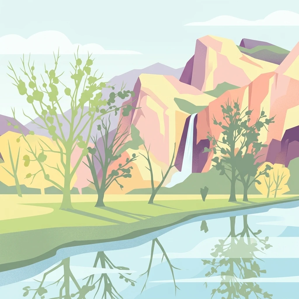
A graphic illustration showing a river in the foreground with trees on its bank, and a tall waterfall cascading from pink and orange cliffs in the background.

A protected river-valley landscape along the Neckar between Tübingen and Reutlingen.

Mittleres Neckartal

Mittleres Neckartal is a designated landscape protection area (Landschaftsschutzgebiet) covering a stretch of the Neckar River valley in the state of Baden-Württemberg in southern Germany. The protected landscape runs from Tübingen-Lustnau in the west to Reutlingen-Mittelstadt in the east, crossing parts of the Reutlingen and Tübingen districts. The area is administered under Germany's IUCN Category V framework, recognizing it as a protected landscape rather than a strictly regulated nature reserve. The designation aims to preserve the visual and ecological character of the Neckar valley, including its floodplain features and agricultural surroundings, within a region heavily shaped by human settlement. Although the valley landscape has long been modified by river straightening, agriculture, and transport corridors such as the busy Bundesstraße 27, the protection status is intended to guide how this working landscape continues to evolve, balancing land use with the conservation of the valley's distinct character.

Location
Germany
Park type
Protected landscape
Area
5.3 km²
Mittleres Neckartal Protected Landscape Geography
Regional park map

See the ranked park cluster in its geographic setting

Nearby parks around Mittleres Neckartal

This regional map shows the same 20 nearby parks ranked below around Mittleres Neckartal. Select a ranked marker to highlight that park’s boundary where boundary data is available.
Reference park: Mittleres NeckartalRanked nearby park20 nearby parks shown
20 nearby parks

Distance-ranked regional park geography and surrounding protected landscapes

Parks and Protected Areas Geographically Near Mittleres Neckartal

Geographic proximity measurements establish a structured ranking of protected areas surrounding Mittleres Neckartal across adjacent regional territory. Comparing these neighboring locations reveals diverse environmental characteristics and broader landscape patterns within the surrounding protected network.
Protected landscapeBaden-Württemberg
About 10 km away#1 closest

West

Unteres Ammertal Protected Landscape: Regional Geography and Valley Maps

A structured cultural valley in Baden-Württemberg

Unteres Ammertal serves as a critical example of a managed agricultural landscape near Tübingen. This protected area preserves a rich variety of wet meadows, hedgerows, and river channels, offering insights into the complex land-use patterns of the Swabian foothills and the broader ecology of the Neckar basin.

Area
3.479 km²
Established
1999
IUCN
V
Relief
Lowland
Watercolor painting of a green, rolling landscape with forested hills and a soft, hazy background.
Protected landscapeBaden-Württemberg
About 14 km away#2 closest

West

Pfaffenberg Landscape Protection Area: Geography and Mapped Natural Features

Examining geological formations and cultural land use in Baden-Württemberg

Pfaffenberg is a significant protected landscape in Germany, recognized for its identity as an isolated Keuper-stage Zeugenberg. The area preserves a unique mosaic of mixed forest and historic orchard meadows, revealing the complex geological and agricultural heritage of the upper Neckar region within the Baden-Württemberg state boundaries.

Area
3.168 km²
Established
1967
IUCN
V
Protected landscapeBaden-Württemberg
About 15 km away#3 closest

West

Oberes Ammertal mit dem Seitental Merkental Protected Landscape and Regional Map Context

Baden-Württemberg protected valley and limestone terrain

Situated in the Schönbuch and Glemswald region, this protected area safeguards the upper Ammer valley's meadow floodplains and botanical limestone slopes. It represents a significant mosaic of habitat types; including dry grassland and small quarry-fed water bodies; that maintain the ecological integrity of the local southwestern German geography.

Area
0.202 km²
Established
1982
IUCN
V
Protected landscapeBaden-Württemberg
About 15 km away#4 closest

Northwest

Ghägnet östlich dem Waldteil Häselhau mit Umgebung: Landscape and Geography Overview

Protected orchard meadows in the Böblingen district of Germany.

This protected landscape in Baden-Württemberg spans 3.1 hectares of Jurassic slope loam soils. It is recognized for its traditional Swabian orchard meadows and wet grassland vegetation, functioning as an ecological corridor adjacent to the Hochberg protected area within the greater Schönbuch forest zone.

Area
0.031 km²
Established
1974
IUCN
V
Protected landscapeBaden-Wuerttemberg
About 16 km away#5 closest

Northwest

Hangflächen um die Pfefferburg: A Protected Landscape in Baden-Württemberg

Orchard meadows, hillside terrain, and local geography.

Hangflächen um die Pfefferburg forms a compact protected landscape defined by its southern-facing orchard meadows and moisture-rich spring zones. Located near Schönaich, the area preserves traditional land-use patterns on a diverse hillside, connecting regional protected zones within the broader geography of the Böblingen district.

Area
0.252 km²
Established
1974
IUCN
V
Relief
Upland
Protected landscapeBaden-Württemberg
About 17 km away#6 closest

East

Neuffen auf Gemarkungen Neuffen und Kappishäusern Protected Area and Regional Landscape

Geography of the Swabian Alb escarpment and riparian zones

This protected landscape defines the visual and ecological character of the area surrounding the Hohenneuffen and Jusi hills. The terrain spans limestone slopes, fruit-bearing orchards, and the Steinach river valley. By integrating local habitat protection with regional biosphere networks, the region serves as a vital transition point between the plateau and the Neckar basin.

Area
13.41 km²
Established
1993
IUCN
V
Relief
Mountain
Protected landscapeBaden-Württemberg
About 21 km away#7 closest

East

Tiefenbachtal Protected Landscape: Geographic Boundaries and Regional Terrain Map

Swabian Alb foothill mosaic in the Esslingen district

Investigate the protected landscape of Tiefenbachtal, where gently rolling terrain and stream-cut valleys form a continuous ecological corridor. This record covers the physical geography, meadow and woodland composition, and the broader context of this site within the Baden-Württemberg pre-Alb landscape.

Area
0.35 km²
Established
1958
IUCN
V
Relief
Upland
Watercolor painting of a green valley with a winding river and a small group of trees under a light sky.
Protected landscapeZollernalbkreis
About 23 km away#8 closest

Southwest

Mittleres Starzeltal Protected Landscape: Mapping the Geography of the Zollernalbkreis District

A detailed look at the Starzel river valley and forest mosaic.

The Mittleres Starzeltal protected landscape represents a significant river corridor in the Zollernalbkreis district. This area spans through Hechingen and Bisingen, characterized by its traditional orchard meadows and dense forest slopes that frame the middle Starzel valley. Explore the boundaries and topographic features that define this protected territory within the Swabian Alb conservation network.

Area
12.454 km²
Established
1963
IUCN
V
Relief
Upland
A watercolor painting showing a wide view of a winding river flowing through a lush green valley with distant purple hills and forested ridges.
Protected landscapeLandkreis Tübingen
About 23 km away#9 closest

Southwest

Oberes Neckartal mit den Seitentälern Rommelstal, Starzeltal und Eyachtal Protected Landscape

Geographic landscape analysis of the upper Neckar river valley and its forested tributaries.

Situated within Landkreis Tübingen, this protected landscape is defined by its distinct Muschelkalk geology and the interplay between deep valley slopes and open orchard meadows. The area encompasses the upper Neckar river valley along with the side valleys of Rommelstal, Starzeltal, and Eyachtal. This detailed landscape profile provides insight into the structured natural environment, forest coverage, and fluvial terrain that characterize this region of southwestern Germany.

Area
23.364 km²
Established
1981
IUCN
V
Relief
Upland
A pale watercolor landscape illustration showing rolling green hills and meadows under a soft yellow sky.
Protected landscapeBaden-Württemberg
About 23 km away#10 closest

East

Owen Protected Landscape: A Geographic Analysis of Orchard Meadows and Teckberg Terrain

Baden-Württemberg protected area and regional landscape map

Examine the detailed landscape composition of the Owen protected area, a vital reserve in the Mittleres Albvorland. This atlas entry focuses on the interaction between traditional orchard meadow mosaics, hedgerows, and the abrupt topographical shift toward the Teckberg peak, providing a clear geographic context for this protected natural region.

Area
5.67 km²
Established
1974
IUCN
V
Protected landscapeBaden-Württemberg
About 24 km away#11 closest

East

Wolfsschlucht Protected Landscape: Swabian Alb Gorge Geography and Regional Mapping

A key geotope within the central Swabian Alb mountain terrain.

Wolfsschlucht preserves a distinctive limestone gorge and ravine forest system within a compact 1.4 hectare area. Its geography highlights the intersection of karst landforms, steep valley relief, and layered conservation status, serving as a representative model of the central Swabian Alb's geological and ecological character in Baden-Württemberg.

Area
0.014 km²
Established
1955
IUCN
V
Protected landscapeBaden-Württemberg
About 24 km away#12 closest

Northeast

Wendlingen am Neckar Protected Landscape: Regional Geography and Habitat Connectivity

A structured Swabian countryside mosaic in Baden-Württemberg

This protected area safeguards a unique, fragmented landscape comprising traditional orchard meadows and brookside woodland corridors. Located on the Filder plateau, it acts as a critical ecological refuge, maintaining the transition between settled zones and the natural terrain of the Mittleres Albvorland through long-standing landscape conservation measures.

Area
2.27 km²
Established
1992
IUCN
V
Watercolor painting of a rolling rural landscape with forested hills and open fields in muted green, yellow, and soft pink tones.
Protected landscapeBaden-Württemberg
About 24 km away#13 closest

South

Oberes Starzeltal und Zollerberg Protected Landscape: Regional Geography and Terrain

Swabian Alb limestone topography and river valley systems.

Oberes Starzeltal und Zollerberg represents a core landscape protection area on the western Swabian Alb, defined by its distinct Middle Jurassic limestone geology. The area connects critical habitats across the Zollernalbkreis district, featuring steep wooded slopes and open sheep-grazed grasslands. Through this atlas entry, visualize the environmental continuity between the Starzel river valley and the surrounding agricultural plateau, which together form a essential component of the regional protected-area network.

Area
79 km²
Established
1972
IUCN
V
Relief
Mountain
Protected landscapeBaden-Württemberg
About 25 km away#14 closest

Northeast

Unteres Körschtal Protected Landscape: Geography and Mapped Boundaries in Baden-Württemberg

An ecological green corridor within the Swabian Keuper-Lias landscape

Unteres Körschtal protects the natural valley floor and adjacent slopes of the lower Körsch river. This landscape conservation area provides essential habitat and recreational space between the Filder plateau and the Neckar valley, standing as a primary example of regional geography in Germany.

Area
4.729 km²
Established
1978
IUCN
V
Watercolor painting of a rolling landscape featuring light green hills, patches of trees, and white rock outcrops against a soft, light-colored background.
Protected landscapeBaden-Württemberg
About 26 km away#15 closest

East

Öde im Hartberg Protected Landscape and Geological Features of the Middle Swabian Alb

Juniper heathland and limestone outcrops in Baden-Württemberg

Situated at the mouth of the Fischburgtal, Öde im Hartberg is a significant protected area on the Middle Swabian Alb. The site preserves a unique mosaic of open heath and successional woodland, anchored by the Hartbergfels and Seeburger Nägelesfels limestone monuments. It offers a clear look at the geological and conservation landscape of this southwestern German region.

Area
0.101 km²
Established
1955
IUCN
V
Protected landscapeLandkreis Esslingen
About 28 km away#16 closest

Northeast

Wernau (Neckar) Protected Landscape: Geographic Overview and Mapped Cultural Terrain

Landscape protection area within the Landkreis Esslingen region

Trace the boundaries of the Wernau (Neckar) protected landscape, an ecologically significant mosaic of meadow orchards, riparian vegetation, and small woodlands. Situated in the Landkreis Esslingen of Baden-Württemberg, this area functions as a critical buffer zone that maintains the continuity of local habitats between the Filder plain and the Swabian Alb foothills.

Area
2.27 km²
Established
1995
IUCN
V
Protected landscapeBaden-Württemberg
About 29 km away#17 closest

Northwest

Heckengäu-Weil der Stadt Protected Landscape: Mapping the Cultural Scenery of Baden-Württemberg

A regional mosaic of orchard meadows and river valleys

Heckengäu-Weil der Stadt defines a complex protected area composed of fourteen distinct sub-sections circling the town of Weil der Stadt. This geography preserves an intact cultural landscape of small-scale fields, hedgerows, and the Würm river floodplain, standing as a critical transition zone between the Gäu plateau and the rising foothills of the Black Forest.

Area
17.7 km²
Established
1986
IUCN
V
Relief
Upland
Protected landscapeBaden-Württemberg
About 31 km away#18 closest

Northeast

Notzingen Protected Landscape: Mapping the Voralb Foothills and Swabian Alb Terrain

Regional protected area analysis in Landkreis Esslingen

Notzingen represents a coherent protected landscape composed of three parcels near the Swabian Alb foothills. The area is defined by a delicate intersection of stream-side riparian habitats and traditional Streuobstwiesen orchard meadows. This atlas-focused entry provides spatial context for understanding how these protected lands maintain the character of the southern German countryside.

Area
3.15 km²
Established
1989
IUCN
V
Relief
Upland
A minimalist watercolor illustration showing a winding river flowing through a soft green landscape with rolling hills in the background and clusters of trees.
Nature reserveBaden-Württemberg
About 31 km away#19 closest

Southwest

Gebiete zwischen Bisingen, Haigerloch und Rosenfeld Nature Reserve and Geographic Context

Fragmented protected terrain in the Swabian Alb foothills

Gain insight into the fifteen separate fragments that constitute this protected nature reserve in Baden-Württemberg. From open limestone meadows to narrow floodplain strips, the area represents a critical mosaic of EU-protected habitat types that demand careful geographic consideration and mapping.

Area
7.53 km²
Established
2019
Protected areaBaden-Württemberg
About 32 km away#20 closest

North

Penal Substitution: Protected Area Mapping and Regional Geography in Baden-Württemberg

Cultural landscape and habitat mosaic overview

Penal Substitution represents a preserved cultural landscape in the German state of Baden-Württemberg, featuring a structured mix of orchard meadows, farmland, and riparian habitats. This area serves as a critical regional green link, where mapped boundaries reveal a complex interplay of agricultural history and active environmental conservation just outside the urban core.

Area
2.586 km²
Established
2004
Relief
Upland
Climate
Temperate
Distance methodology

Geographic measurements, not driving distances

How nearby park distances are calculated

Distances use park boundaries whenever the available geometry allows it. When one or both boundaries are missing, the mapped park locations provide a clearly labelled estimate. Every value represents straight-line geographic separation and does not use roads or routing.

Boundary distance

Calculated between the nearest points of both park boundaries.

Location-to-boundary estimate

Estimated from one mapped park location to the nearest boundary of the other park.

Mapped-location estimate

Estimated between the mapped locations of both parks.

MoriAtlas Explorer

Explore the Mittleres Neckartal Protected Landscape and River Geography

Trace the mapped boundaries and natural features of the Mittleres Neckartal valley. Use MoriAtlas to understand how this protected corridor functions as a vital open space within the dense settlement geography of Baden-Württemberg.