Mori Atlas logo
National parkMont Péko National Park

Discover the mapped protected area boundaries and natural terrain of this national park.

Mont Péko National Park: Ivory Coast National Park Landscape and Geography

Mont Péko National Park represents a key protected area within the geography of Ivory Coast. This national park serves as a significant entity for atlas exploration, offering insight into its specific landscape and geographic context. Users can investigate its mapped boundaries and understand its role within the regional natural terrain.

national parkforest reservechimpanzee habitatImportant Bird Areamountain landscapeWest Africa

Mont Péko National Park

National park

Park overview

Structured park overview, official facts, and landscape profile for Mont Péko National Park

Mont Péko National Park park facts, protected area profile, and essential visitor context
Review the core facts for Mont Péko National Park, including designation, size, terrain, visitor scale, habitats, and operating context in one park-focused overview.

About Mont Péko National Park

Mont Péko National Park occupies a significant position in Ivory Coast's protected area network as one of the nation's oldest national parks, established in 1968. The park is situated in the central region of the country within the savanna-forest transition zone, where the combination of relatively intact forest cover and mountainous terrain creates a distinctive ecological character. The park's approximately 340 square kilometer extent encompasses two main hills, with Mont Péko rising to 997 meters as the dominant geographic feature. Forest dominates the landscape, covering approximately 80% of the park's area and providing critical habitat for both resident and migratory species. The park's establishment reflected early recognition of the need to preserve West African forest ecosystems and the biodiversity they support, particularly in the context ofIvory Coast's position as one of the more heavily forested nations in the region.

Quick facts and research context for Mont Péko National Park

Mont Péko National Park is located in central Ivory Coast, approximately 340 square kilometers in size, with Mont Péko peak reaching 997 meters elevation. The park was established in 1968 and receives IUCN category II protection status as a national park. Approximately 80% of the park is covered by forest, and it has been designated an Important Bird Area by BirdLife International due to its significant bird populations. The park also supports a substantial chimpanzee population, with recent surveys indicating a density of roughly 1.6 individuals per square kilometer.

Park context

Deeper park guide and search-rich context for Mont Péko National Park

Mont Péko National Park history, landscape, wildlife, and travel context
Explore Mont Péko National Park through its history, landscape character, ecosystems, wildlife, conservation priorities, cultural context, and seasonal travel timing in a structured park guide built for atlas discovery and search intent.

Why Mont Péko National Park stands out

Mont Péko National Park is best known for its significant chimpanzee population, representing one of the more important primate conservation areas in Ivory Coast. The park is also recognized for its Important Bird Area status, supporting approximately 240 bird species in its forest habitats. The mountainous terrain around Mont Péko peak provides a distinctive landscape within the park, while the connected forest corridor through the classified forest of Haut Sassandra extends the conservation value beyond the park's official boundaries.

Mont Péko National Park history and protected-area timeline

Mont Péko National Park was established in 1968, representing one of the earliest national parks created in Ivory Coast during a period when the country was developing its national parks system. The park's creation came at a time when Ivory Coast was experiencing significant economic growth driven by agricultural expansion, particularly coffee and cocoa production, which placed increasing pressure on forest habitats across the country. The establishment of Mont Péko reflected a growing recognition among Ivorian authorities and conservation advocates that protecting representative samples of the nation's forest ecosystems was essential for long-term environmental sustainability. Over the subsequent decades, the park has faced various conservation challenges typical of West African protected areas, including pressure from surrounding agricultural activities and the need to balance local community interests with conservation objectives. Scientific surveys, particularly those conducted in 2001, have helped document the park's ongoing ecological value and guided management approaches.

Mont Péko National Park landscape and geographic character

The landscape of Mont Péko National Park is characterized by a hilly terrain dominated by two main mountains, with Mont Péko at 997 meters serving as the highest and most prominent peak. The park sits within the forest zone of central Ivory Coast, where the underlying geology supports a landscape of rolling hills and elevated terrain that rises above the surrounding plain. Forest vegetation covers approximately 80% of the park area, creating a relatively dense and contiguous canopy in the more mature sections, while the remaining areas include more open habitats and transitional zones. The park is connected ecologically to the classified forest of Haut Sassandra through forest corridors, extending the functional habitat beyond the formal park boundaries and facilitating wildlife movement across a broader forested landscape.

Mont Péko National Park ecosystems, habitats, and plant life

The nature of Mont Péko National Park is defined by its tropical forest ecosystem, which supports remarkable biodiversity despite the surrounding agricultural landscape. The dominant tree species include Triplochiton scleroxylon, various Celtis species, Pterygota macrocarpa, and Mansonia altissima, which together form the characteristic canopy of the forest. These species represent typical West African forest vegetation adapted to the seasonal climate of the region. The forest ecosystem supports a rich community of organisms, from invertebrates and insects to larger mammals and birds, creating a complex ecological community that depends on the integrity of the forest habitat.

Mont Péko National Park wildlife and species highlights

The wildlife of Mont Péko National Park is highlighted by a significant population of chimpanzees, with recent surveys indicating a density of approximately 1.6 individuals per square kilometer and an estimated total population of around 320 weaned chimpanzees within the park. This chimpanzee population represents an important conservation resource for Ivory Coast, where primate populations have faced significant pressure from habitat loss and hunting. The park also supports an impressive avian community with approximately 240 bird species recorded, earning it designation as an Important Bird Area by BirdLife International. This designation reflects the park's significance for bird conservation, particularly for species that depend on forest habitats and those that use the area during migratory cycles.

Mont Péko National Park conservation status and protection priorities

Mont Péko National Park holds significant conservation value as a protected forest area in a region where forest habitat has been substantially reduced by agricultural expansion. The park's designation as an Important Bird Area recognizes its international significance for bird conservation, while the documented chimpanzee population underscores its importance for primate protection. The ecological connectivity to the broader classified forest of Haut Sassandra through forest corridors extends the conservation network beyond the park's boundaries, creating a more resilient landscape for wildlife movement and population maintenance. The park represents a remaining stronghold of forest biodiversity in central Ivory Coast and serves as a reference point for understanding the region's ecological heritage.

Mont Péko National Park cultural meaning and human context

Mont Péko National Park is situated within the traditional territory of the Ivorian forest zone, where rural communities have historically practiced shifting agriculture and forest resource use. The park's establishment created a protected zone within a landscape where human settlement and agricultural activities have shaped the surrounding environment over generations. While the park itself is now protected, surrounding communities continue to maintain connections to the land through traditional land use practices that influence the park's boundary areas and edge effects.

Top sights and standout views in Mont Péko National Park

The standout features of Mont Péko National Park include its significant chimpanzee population representing one of the more important primate conservation sites in Ivory Coast, its designation as an Important Bird Area supporting approximately 240 bird species, its distinctive mountain landscape centered on Mont Péko peak at 997 meters, and its functional connectivity to the broader Haut Sassandra forest corridor. The park's age since 1968 makes it one of the nation's established protected areas, providing long-term conservation continuity for West African forest ecosystems.

Best time to visit Mont Péko National Park

The optimal period to visit Mont Péko National Park falls during the dry season from November to March, when precipitation is minimal and wildlife viewing conditions are most favorable. During this season, reduced vegetation density improves sightlines through the forest, while water scarcity concentrates animals around remaining water sources, facilitating wildlife observation. The wet season from April to October brings heavier rainfall that can make some trails less accessible and wildlife more dispersed, though the landscape becomes lusher and bird activity increases with migrating species present.
Park location guide

Geography guide, regional context, and park location map for Mont Péko National Park

Mont Péko National Park park geography, regions, and map view in Ivory Coast
Understand where Mont Péko National Park sits in Ivory Coast through a broader geographic reading of the surrounding landscape, nearby location context, and its mapped position within the national park landscape.

How Mont Péko National Park fits into Ivory Coast

Ivory Coast, officially the Republic of Côte d'Ivoire, is a West African country with a coastline on the Gulf of Guinea. It gained independence from France in 1960 and is now a presidential republic. The country is a major producer of cocoa and coffee, with Abidjan serving as its largest city and economic hub, while Yamoussoukro is the official capital.

Wider geography shaping Mont Péko National Park in Ivory Coast

Ivory Coast is situated on the southern coast of West Africa along the Gulf of Guinea. It borders Guinea to the northwest, Liberia to the west, Mali to the northwest, Burkina Faso to the northeast, Ghana to the east, and the Atlantic Ocean to the south. The terrain includes coastal plains, interior highlands, and forested regions.

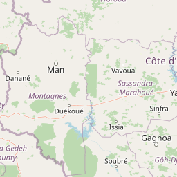
Map view of Mont Péko National Park

Use this park location map to pinpoint Mont Péko National Park in Ivory Coast, understand its exact geographic position, and read its mapped placement within the surrounding landscape more clearly.

Pigeon | © OpenStreetMap contributors
Park atlas

Explore more West African forest reserves and mountain landscapes, comparing their protected status and geographic spread around Mont Péko.

Discover Other Protected Areas and National Parks Near Mont Péko National Park
Browse national parks and protected areas ecologically connected to Mont Péko National Park, extending the geographic scope of your discovery across Ivory Coast's diverse forest and mountain terrain. Compare different protected landscapes and conservation efforts in West Africa, tracing their boundaries, habitat types, and significance for primate and bird populations within a broader regional context.
National parkSassandra-Marahoué District

Marahoué National Park: Protected Landscape and Geographic Setting in Ivory Coast

Mapped protected area boundaries and regional context.

Marahoué National Park represents a significant protected landscape within the Sassandra-Marahoué District, offering detailed geographic insights for atlas exploration. This entry focuses on the park's mapped boundaries and its identity as a national park, providing essential context for understanding its place in Ivory Coast's protected areas network. Discover the mapped terrain and regional landscape elements relevant to this protected natural site.

Area
1,000 km²
Established
1968
IUCN
II
Relief
Upland
National parkIvory Coast

Taï National Park: A Primary Rainforest Protected Area in Ivory Coast

Explore mapped boundaries and critical primate habitats in West Africa.

Taï National Park in Ivory Coast stands as a monumental protected landscape, comprising the largest contiguous area of primary rainforest remaining in West Africa. Its designation as a national park highlights its critical role in preserving biodiversity and unique geographic features. Users exploring this destination can delve into its mapped terrain, understand its regional landscape context within Ivory Coast, and appreciate its significance as a vital habitat for endangered species and an integral part of the Upper Guinean forest ecosystem.

Area
3,300 km²
Established
1972
IUCN
II
Relief
Upland
Protected areaNimba County

Nimba National Forest: Protected Mountain Landscape & Bird Area in Nimba County

Explore mapped boundaries and regional geographic context.

Nimba National Forest, a protected area of approximately 187 square kilometers, is defined by its mountainous terrain in Nimba County, Liberia. Situated at the tri-border region with Guinea and Ivory Coast, this forest is recognized for its importance as a habitat for diverse bird species and its role in regional conservation efforts. Discover its mapped landscape, its position within the Nimba Range, and its ecological significance within West Africa's protected natural areas.

Area
187 km²
IUCN
VI
Access
Access unknown
Scope
Terrestrial
National parkNimba County

Gio National Forest National Park: A Protected Landscape in Nimba County

Mapping the geographic boundaries and regional context of Gio National Forest.

Gio National Forest National Park serves as a key protected area within Liberia's Nimba County. This destination facilitates detailed exploration of its specific geographic footprint and its contribution to the regional atlas. Users can investigate the park's natural landscape context, mapped terrain, and its role as a protected conservation zone. Understand where this significant natural area fits within the broader geographic framework of West Africa.

Area
327 km²
Established
1960
IUCN
IV
Relief
Upland
Protected areaNimba County

Gibi National Forest: Protected Tropical Forest in Nimba County, Liberia

Mapped landscape and regional geography of this key conservation area.

Gibi National Forest, a protected tropical forest spanning 607 square kilometers in Nimba County, Liberia, plays a crucial role in the preservation of the Upper Guinea forest ecosystem. Established in 1960, its landscape features tropical forest terrain near the mountainous Nimba Range. This protected area contributes significantly to regional conservation strategies, offering a vital habitat within a biodiversity hotspot that faces considerable pressure.

Area
607 km²
Established
1960
IUCN
VI
Climate
Tropical
National parkSinoe County

Sapo National Park: Explore Its Protected Landscape and Geographic Identity in Sinoe County

Discover mapped park boundaries and regional context.

Delve into the protected landscape of Sapo National Park, a key national park located in Sinoe County, Liberia. This page provides essential context for understanding its geographic setting, mapped park boundaries, and its significance as a protected natural area. It serves as a foundational entry for exploring Liberia's protected lands within the broader atlas, focusing on landscape identity and regional geographic features.

Area
1,804 km²
Established
1983
IUCN
II
Relief
Mixed relief
National parkIvory Coast

Assagny National Park: Ivory Coast's Protected Natural Landscape and Park Boundaries

Explore the mapped terrain and regional geography.

Assagny National Park is a significant protected area in Ivory Coast, functioning as a national park. This entry provides detailed information on its geographic setting, mapping its protected boundaries and surrounding natural landscapes. It serves as a resource for understanding the park's specific landscape character and its contribution to the regional geography of West Africa, offering an atlas-style exploration of its conservation significance.

Area
170 km²
Established
1981
IUCN
II
Protected areaGbarpolu County

Kpelle National Forest: Protected Area Identity and Geographic Exploration

Explore Gbarpolu County's protected landscape.

Kpelle National Forest is a key protected area offering a unique glimpse into Liberia's natural geography. This atlas-driven exploration focuses on understanding its specific boundaries, regional placement within Gbarpolu County, and the broader landscape context. Discover the protected area's identity and its significance for geographic comprehension, enabling detailed map-based exploration and regional comparison.

Area
1,748 km²
Established
1961
Relief
Mountain
Climate
Tropical

Common questions about visiting, size, designation, and location context for Mont Péko National Park

Mont Péko National Park FAQs for park facts, access, geography, and protected area context
Find quick answers about Mont Péko National Park, including protected-area facts, park geography, trail and visitor context, and how the park fits into its surrounding country and regional landscape.
MoriAtlas Explorer

Continue Your Protected Areas Search Across the Global Atlas

Deepen your exploration by continuing the structured search for national parks and protected areas worldwide. Utilize the comprehensive filtering capabilities to compare different conservation landscapes and refine your understanding of global park geography. Discover more about the distribution and characteristics of protected natural areas.

Global natural geography