Mori Atlas logo
National parkMount Revelstoke National Park

Trace the mapped boundaries and regional geography of this significant national park in British Columbia.

Mount Revelstoke National Park: Protected Area Identity and Geographic Landscape Context

Mount Revelstoke National Park stands as a distinct protected landscape within British Columbia, offering a focal point for geographic discovery. This page serves as an atlas entry, detailing the park's specific location and its role as a national park. Users can explore its mapped boundaries and understand its place within the broader regional geography, providing essential context for comprehending protected natural areas.

Inland Temperate RainforestOld-Growth ForestMountain National ParkCaribou HabitatSelkirk MountainsInterpretive Trails

Mount Revelstoke National Park

National park

Park overview

Structured park overview, official facts, and landscape profile for Mount Revelstoke National Park

Mount Revelstoke National Park park facts, protected area profile, and essential visitor context
Review the core facts for Mount Revelstoke National Park, including designation, size, terrain, visitor scale, habitats, and operating context in one park-focused overview.

About Mount Revelstoke National Park

Mount Revelstoke National Park occupies a distinctive place within Canada's national park system as a compact mountain park with exceptional ecological richness. Located in the Selkirk Mountains of southeastern British Columbia, the park rises directly from the doorstep of Revelstoke, one of the few Canadian national parks with an urban interface of this nature. The park's 260 square kilometres encompass a vertical span of over 1,500 metres, transitioning from valley-bottom rainforest through sub-alpine forest to open subalpine meadows that bloom with wildflowers during the summer months.

The park's founding in 1914 came later than the major mountain parks of Banff, Yoho, and Glacier, which were established in the 1880s along the Canadian Pacific Railway corridor. Local residents of Revelstoke, organized through mountaineering and skiing clubs and the municipal Progress Club, drove the initiative to protect the mountain, building the first trail to the summit in 1910. The park boundaries were extended southward toward the Revelstoke townsite in 1920, solidifying the park's relationship with the community.

What distinguishes Mount Revelstoke from larger mountain parks is its remarkable ecological compression. Within a relatively small footprint, visitors encounter globally rare inland temperate rainforest, significant caribou habitat, and diverse mountain terrain. The park's climate is characterized by warm, moist conditions that support the rainforest ecosystem, creating conditions more typical of coastal British Columbia than of the continental interior.

Quick facts and research context for Mount Revelstoke National Park

Mount Revelstoke National Park is situated in the Selkirk Mountains of British Columbia, immediately east of the city of Revelstoke. The park covers 260 square kilometres and was established in 1914, making it one of the earlier Canadian national parks though created after the pioneering parks of the 1880s. The park features a remarkable ecological transition, ascending from valley-bottom inland temperate rainforest through sub-alpine forest to open subalpine meadows carpeted with wildflowers. A herd of threatened boreal woodland caribou persists within the park, while the rainforest supports an isolated population of banana slugs at the easternmost extent of their British Columbia range. The park receives approximately 775,000 visitors annually and is administered by Parks Canada.

Park context

Deeper park guide and search-rich context for Mount Revelstoke National Park

Mount Revelstoke National Park history, landscape, wildlife, and travel context
Explore Mount Revelstoke National Park through its history, landscape character, ecosystems, wildlife, conservation priorities, cultural context, and seasonal travel timing in a structured park guide built for atlas discovery and search intent.

Why Mount Revelstoke National Park stands out

Mount Revelstoke National Park is best known for its extraordinary ecological diversity compressed into a relatively small area. The park contains one of the world's few inland temperate rainforests, a globally rare ecosystem type characterized by old-growth western red cedar and western hemlock forest in a continental climate setting. The Giant Cedars Boardwalk provides accessible immersion in this ancient forest, with some trees exceeding 800 years in age. The park is also renowned for its historic ski-jumping legacy, once hosting international competitions on North America's longest natural ski jump. The Meadows in the Sky Parkway ascends 26 kilometres from rainforest to subalpine meadows, creating a scenic mountain drive through dramatically changing ecosystems.

Mount Revelstoke National Park history and protected-area timeline

Mount Revelstoke National Park emerged from a groundswell of local enthusiasm in the early twentieth century. The initiative to establish a park was led by residents of Revelstoke, including members of the local mountaineering and skiing clubs, who worked with municipal officials and the Progress Club to advocate for protection of Mount Revelstoke. The first trail to the summit was constructed in 1910, establishing the mountain as a recreational destination and building community investment in its preservation. The park was formally established in 1914, with boundaries expanded southward toward the Revelstoke townsite in 1920.

The Meadows in the Sky Parkway, the 26-kilometre summit road that remains the park's primary access route, was begun in 1911 and completed in 1927. This construction project holds a significant historical dimension: during the First World War, Parks Commissioner J.B. Harkin authorized the use of interned "enemy aliens," predominantly men from the Austro-Hungarian Empire, on construction projects within Canada's national parks. An internment camp was established on the slopes of Mount Revelstoke in 1915, and over 200 interned men laboured on the road to the summit before the camp was abandoned when cold weather halted progress in the fall.

The park also developed a significant skiing heritage. By the early twentieth century, Revelstoke had emerged as one of the first ski destinations in North America. A ski-jumping facility was established on Mount Revelstoke in 1915 and expanded to Olympic specifications in 1933. The jump became the longest natural jump in Canada, and international records were set there during competitions in the first half of the century. Nels Nelsen was a prominent figure in developing these facilities and setting jumping records. The last competitive event was held in 1971, after which the ski area was converted to a trail system for hiking and downhill mountain biking.

Mount Revelstoke National Park landscape and geographic character

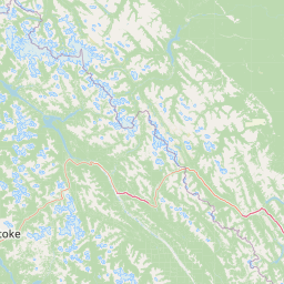
Mount Revelstoke National Park occupies the Selkirk Mountains, a subrange of the Columbia Mountains that runs parallel to the Rocky Mountains through southeastern British Columbia. The terrain is characterized by steep, rugged mountains that rise dramatically from the valley bottom, creating a landscape of sharp ridges, deep valleys, and alpine summits. The park's proximity to Revelstoke means that the mountain rises immediately behind the city, giving the landscape an intimate quality uncommon among Canadian national parks.

The park's elevational gradient drives dramatic changes in landscape character. The lower elevations feature valley bottoms and gentle slopes cloaked in dense temperate rainforest, dominated by western red cedar and western hemlock. As elevation increases, the forest transitions through sub-alpine zones characterized by different conifer species. The upper elevations open into rolling subalpine meadows, where wildflowers bloom during the brief growing season and the landscape takes on a more open, pastoral character. The Meadows in the Sky Parkway traverses this entire gradient, ascending from the rainforest through the forest to the meadows over its 26-kilometre length.

To the west, the Monashee Mountains rise in the distance, while the Selkirk range forms the park's eastern boundary. This positioning places the park within a larger mountain context that contributes to its ecological significance and scenic beauty.

Mount Revelstoke National Park ecosystems, habitats, and plant life

Mount Revelstoke National Park protects one of the world's rare inland temperate rainforests, an ecosystem type found in only a few locations globally. This remarkable environment exists in the rain shadow of the Coast Mountains yet retains sufficient moisture from Pacific weather systems to support the classic temperate rainforest vegetation of western red cedar and western hemlock. These old-growth stands represent forest that has developed without significant disturbance for centuries, with some individual trees exceeding 800 years in age.

The rainforest ecosystem supports an ecological community that is unusual in its continental setting. The park contains an isolated population of banana slugs, marking the easternmost boundary of their distribution in British Columbia. This presence is significant because banana slugs are typically associated with coastal rainforest environments, and their occurrence here demonstrates the unique nature of the inland rainforest. The ecosystem also supports diverse mosses, lichens, and fungi that characterize mature rainforest environments.

The wetland areas within the park, particularly in the valley bottom, support distinctive plant communities including skunk cabbage, duckweed, and horsetail. These wetlands provide important habitat for wildlife and contribute to the overall ecological diversity of the park.

Mount Revelstoke National Park wildlife and species highlights

Mount Revelstoke National Park protects significant wildlife populations within its mountainous and forested terrain. The park is home to a small herd of threatened boreal woodland caribou, a species at risk in British Columbia whose protection within the park represents an important conservation priority. The diverse habitats within the park support a range of mammalian predators and prey species.

Large mammals present in the park include cougars, grizzly bears, black bears, and the smaller Canada lynx. Moose inhabit the wetland areas and forest edges, while mountain goats occupy the higher rocky terrain. Smaller predators include red foxes, coyotes, timber wolves, martens, and wolverines. The park also supports populations of shrews, voles, and mice, which form important prey base for the predator species.

The wetland and forest environments provide habitat for diverse small mammals, while the overall ecological diversity of the park supports bird populations and seasonal migrations. The combination of old-growth forest, wetlands, and alpine meadows creates a mosaic of habitats that supports the broader wildlife community.

Mount Revelstoke National Park conservation status and protection priorities

Mount Revelstoke National Park represents an important conservation unit within British Columbia's protected areas system. The park's protection of the inland temperate rainforest ecosystem is globally significant, as this ecosystem type exists in only a handful of locations worldwide. The old-growth forests within the park, dominated by western red cedar and western hemlock, represent a forest type that is rapidly declining outside of protected areas due to logging and development pressures.

The presence of a herd of threatened boreal woodland caribou adds to the park's conservation significance. Caribou populations throughout British Columbia have declined significantly due to habitat fragmentation and human disturbance, and protected areas like Mount Revelstoke play a crucial role in maintaining viable populations. The park's diverse habitats, from valley-bottom wetlands to subalpine meadows, create ecological connectivity that supports broader biodiversity.

The conversion of the former ski area to a trail system for hiking and downhill mountain biking reflects the park's evolving management priorities, emphasizing non-motorized recreational use that is compatible with conservation objectives. The interpretive trails, including the Giant Cedars Boardwalk and Skunk Cabbage Boardwalk, provide opportunities for visitors to understand and appreciate the park's ecological values.

Mount Revelstoke National Park cultural meaning and human context

Mount Revelstoke National Park's relationship with the city of Revelstoke represents a distinctive aspect of its cultural context. Unlike most Canadian national parks, which are situated at considerable distance from urban centres, Mount Revelstoke rises directly behind Revelstoke, creating an intimate connection between the community and the protected landscape. This proximity has shaped both the park's history and its contemporary character.

The park's establishment in 1914 was driven by local residents who recognized the mountain's recreational and scenic value. The early development of ski facilities reflected Revelstoke's emergence as a ski destination in the early twentieth century, with the community building facilities that attracted international competitions. The historical use of interned workers during the First World War, while a challenging chapter in Canadian history, reflects the broader social context of the period and the role of national parks in the era.

The park continues to serve as a backdrop for Revelstoke's community identity, with the Meadows in the Sky Parkway providing residents and visitors with access to mountain wilderness without requiring significant travel. This accessibility distinguishes the park from more remote protected areas and reinforces its role as a community resource.

Top sights and standout views in Mount Revelstoke National Park

The Giant Cedars Boardwalk offers visitors an accessible gateway into the ancient inland rainforest, a 500-metre interpretive trail winding through old-growth western red cedar and hemlock forest with trees exceeding 800 years in age. The Skunk Cabbage Boardwalk extends 1.2 kilometres through valley-bottom rainforest and fragile wetlands, providing wildlife viewing opportunities and exploring the migration patterns of birds from Central and South America. The Meadows in the Sky Parkway itself, rising 26 kilometres from rainforest through sub-alpine forest to wildflower meadows, represents a scenic journey through dramatically different ecosystems. The former ski-jumping site, now converted to trail use, provides a tangible connection to the park's competitive skiing heritage and the era when Revelstoke hosted international ski-jumping competitions.

Best time to visit Mount Revelstoke National Park

The Meadows in the Sky Parkway is open during the snow-free months, typically from late spring through autumn, making the summer months of July and August the most accessible period for experiencing the full elevational gradient of the park. During this time, the subalpine meadows are in bloom with wildflowers including Arctic lupine, glacier lily, and pink mountain heather, creating vibrant displays across the alpine zone. The valley-bottom rainforest is accessible throughout the warmer months, with the Giant Cedars Boardwalk and Skunk Cabbage Boardwalk providing year-round opportunities to experience the park's distinctive forest environments. Autumn can offer spectacular fall colour in the sub-alpine zones and fewer crowds, while the shoulder seasons may have variable weather and potential road closures due to early snowfall at higher elevations.

Park location guide

Geography guide, regional context, and park location map for Mount Revelstoke National Park

Mount Revelstoke National Park park geography, regions, and map view in Canada
Understand where Mount Revelstoke National Park sits in Canada through a broader geographic reading of the surrounding landscape, nearby location context, and its mapped position within the national park landscape.

How Mount Revelstoke National Park fits into Canada

Canada is a federal parliamentary constitutional monarchy spanning North America from the Atlantic to the Pacific and Arctic Oceans. With a population of over 41 million, it is officially bilingual in English and French at the federal level. The country gained independence from the United Kingdom through a gradual process culminating in 1982.

Wider geography shaping Mount Revelstoke National Park in Canada

Canada occupies the northern portion of North America, sharing its longest international border with the United States. The country extends from the Atlantic Ocean to the Pacific Ocean and northward into the Arctic Ocean, giving it the longest coastline of any nation.

Map view of Mount Revelstoke National Park

Use this park location map to pinpoint Mount Revelstoke National Park in Canada, understand its exact geographic position, and read its mapped placement within the surrounding landscape more clearly.

Pigeon | © OpenStreetMap contributors

Location context for Mount Revelstoke National Park

British Columbia
Park atlas

Trace nearby mountain parks and protected landscapes across British Columbia, expanding your atlas exploration from Mount Revelstoke.

Compare National Parks and Protected Areas Near Mount Revelstoke National Park and the Selkirk Mountains
Continue your park discovery after exploring Mount Revelstoke National Park by browsing other national parks and protected areas in the surrounding Selkirk and Columbia Mountains. Map these diverse protected landscapes to understand their regional spread, compare distinct ecosystems, and trace Canada's significant conservation geography.
National parkColumbia-Shuswap Regional District

Glacier National Park: A National Park within Canada's Protected Landscape Atlas

Explore its mapped boundaries and regional geography.

Glacier National Park represents a significant protected area entity within the broader Canadian geography. This page offers an atlas-oriented perspective on its identity as a national park, focusing on its mapped geographic spread and role as a conservation landscape. Users can explore the park's place within the Columbia-Shuswap Regional District and understand its distinct contribution to the national protected area framework.

Area
1,349 km²
Established
1886
IUCN
II
Visitors
4M annual
National parkBritish Columbia

Kootenay National Park: National Park Protected Landscape and Geographic Context

Explore Kootenay National Park's mapped terrain and regional geography.

Kootenay National Park is a protected national park located in British Columbia, Canada. This dedicated detail page provides an atlas-style exploration of its geographic identity, focusing on its mapped boundaries and the surrounding natural terrain. Understand how Kootenay National Park fits into the larger regional geography, offering rich context for protected landscape discovery and analysis.

Area
1,406 km²
Established
1920
IUCN
II
Visitors
574.1K annual
National parkCanada

Banff National Park: Exploring Canada's Iconic National Park Protected Landscape and Geography

Mapped park boundaries and regional geographic context for Banff National Park.

Gain a structured understanding of Banff National Park as a key protected area within Canada. This resource details its identity as a national park, providing insights into its geographic setting and mapped landscape. It serves as a vital point for atlas-based discovery, helping to contextualize Banff National Park's significance within Canada's protected lands and natural terrain.

Area
6,641 km²
Established
1885
IUCN
II
Visitors
4.1M annual
National parkAlberta

Jasper National Park National Park: Mapped Protected Landscape and Alberta Geography

Explore Alberta's regional park context and natural terrain.

Jasper National Park is a key protected national park in Alberta, Canada, offering extensive natural landscapes. This park page details its precise geographic location, outlines its protected boundaries, and provides context within the regional geography of Western Canada. Discover the mapped terrain and the park's significance as a protected area within a broader atlas perspective.

Area
10,878 km²
Established
1907
IUCN
II
Visitors
2.4M annual
National parkWashington

North Cascades National Park: US National Park Protected Landscape and Geographic Context

Explore mapped boundaries and regional Washington geography.

Gain insight into North Cascades National Park, a vital US National Park located in Washington. This entry focuses on its protected land status, mapped geographic extent, and its role within the regional atlas. Users seeking to understand the park's landscape character, natural terrain, and its specific location in Washington will find this an essential point for detailed park geography exploration and protected area discovery.

Area
2,042.26 km²
Established
1968
IUCN
II
Visitors
16.5K annual
National parkAlberta

Waterton Lakes National Park: Alberta's Protected Landscape and Geographic Atlas

Explore mapped boundaries and regional terrain context.

Waterton Lakes National Park represents a vital protected area situated within the province of Alberta. This atlas view focuses on its mapped boundaries and the characteristic natural terrain, providing essential geographic context for understanding its significance. Discover its role as a national park and its placement within the regional geography of Western Canada, ideal for users seeking structured data on protected lands and landscape features.

Area
505 km²
Established
1895
IUCN
II
Visitors
475.8K annual
National parkMontana

Glacier National Park: A Montana National Park with Distinct Protected Landscape Geography

Explore its mapped boundaries and regional natural terrain.

Glacier National Park represents a significant national park entity within Montana, providing a unique lens for understanding protected landscapes and regional geography. As a key component of the US protected areas network, it offers valuable insights into mapped park boundaries and the surrounding natural terrain. This page serves as a gateway to exploring the specific geographic context and landscape identity of Glacier National Park.

Area
4,100.77 km²
Established
1910
IUCN
II
Visitors
2.9M annual
National parkAlberta

Elk Island National Park: National Park Protected Landscape and Alberta Geography

Discover the mapped terrain and protected boundaries.

Elk Island National Park, a designated national park in Alberta, Canada, offers a distinct protected landscape for geographic exploration. This detail page focuses on its mapped boundaries, regional setting within Western Canada, and the specific natural terrain that constitutes its protected area. Users can gain a structured understanding of Elk Island National Park's role as a conserved natural entity, ideal for atlas-based discovery and geographic context.

Area
194 km²
Established
1913
IUCN
II
Visitors
401.9K annual

Common questions about visiting, size, designation, and location context for Mount Revelstoke National Park

Mount Revelstoke National Park FAQs for park facts, access, geography, and protected area context
Find quick answers about Mount Revelstoke National Park, including protected-area facts, park geography, trail and visitor context, and how the park fits into its surrounding country and regional landscape.
MoriAtlas Explorer

Continue Your Protected Areas Search Across the Global Atlas

Deepen your exploration by continuing the structured search for national parks and protected areas worldwide. Utilize the comprehensive filtering capabilities to compare different conservation landscapes and refine your understanding of global park geography. Discover more about the distribution and characteristics of protected natural areas.

Global natural geography