
Mori Atlas logo
Wildlife reserveMount Washington Wilderness

Mapping the geological terrain of lava flows, cinder cones, and alpine lake basins.

Mount Washington Wilderness: A Volcanic Landscape within the Oregon Cascade Range

Spanning over 54,000 acres in the central Oregon Cascade Range, Mount Washington Wilderness preserves an extreme volcanic landscape defined by expansive basaltic lava flows, cinder cones like Belknap Crater, and rubble fields. This protected territory transitions between dense lodgepole and hemlock forests to sparse alpine vegetation across a rugged, high-elevation plateau. Our mapping data details the complex interaction between its unique geological formations and the twenty-eight secluded lakes clustered within this remote wilderness.

wilderness areashield volcanoCascade Rangevolcanic landscapelodgepole pine forestmountain hemlock
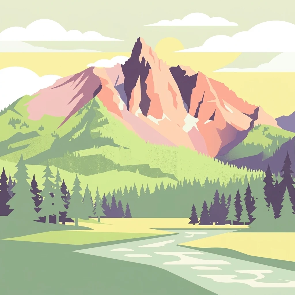
Vector-style illustration of a dramatic, angular mountain peak in the background, a forest of evergreen trees in the midground, and a stream flowing through a grassy meadow in the foreground.

Mount Washington Wilderness

Wildlife reserve

Park overview

Structured park overview, official facts, and landscape profile for Mount Washington Wilderness

Mount Washington Wilderness park facts, protected area profile, and essential visitor context

Review the core facts for Mount Washington Wilderness, including designation, size, terrain, visitor scale, habitats, and operating context in one park-focused overview.

About Mount Washington Wilderness

Mount Washington Wilderness is a forested and volcanic protected landscape in the central Oregon Cascades. Centered on the shield volcano Mount Washington and extending outward across portions of the Willamette and Deschutes National Forests, it covers about 54,278 acres and straddles Linn, Deschutes, and Lane Counties. The wilderness lies within a heavily forested region of the Cascades but is unusual for the extent to which barren lava flows, cinder deposits, and exposed rock define its terrain.

Geologically, Mount Washington itself is a broad shield volcano that rises above tens of square miles of lava-strewn plain. The bedrock story is dominated by late Cenozoic volcanism: layered Eocene-to-Pliocene volcanic rocks underlie the modern vents, and surface features include the cinder and ash cone of Belknap Crater at 6,873 feet, along with numerous older flows that give the wilderness its rugged, broken appearance. This volcanic inheritance shapes nearly every other aspect of the area, from soils and vegetation to the network of lakes that occupy glacially and volcanically modified basins.

Vegetation closely tracks the volcanic substrate. Lodgepole pine, often growing on raw lava, is the most widespread forest type, while mountain hemlock occupies higher and rougher sites. On the eastern side, ponderosa pine stands at the volcano's base, with Douglas fir dominating the moister western flank. In forested pockets, an understory of beargrass, huckleberry, and rhododendron develops. The wilderness contains 28 lakes, whose margins support additional plant communities and provide habitat for amphibians as well as stocked and native trout.

A defining feature for hikers is the 16.6-mile section of the Pacific Crest National Scenic Trail that crosses the wilderness from a northern entry near Big Lake to a southern exit at the Dee Wright Observatory. Side trails lead to Patjens Lakes, Hand Lake, and Benson Lake, providing shorter, family-friendly routes through lodgepole pine forest and meadows. While the area is less visited than some neighboring Cascade wildernesses, it remains an important refuge for large mammals, alpine specialists, and intact volcanic terrain close to the Willamette Valley, and it has been a designated wilderness under the U.S. Forest Service since 1964.

Quick facts and research context for Mount Washington Wilderness

Mount Washington Wilderness is located in the central Cascade Range of Oregon, within Linn, Deschutes, and Lane Counties, with Sisters, Oregon as the nearest community. It was established in 1964 and is administered by the U.S. Forest Service as part of the National Wilderness Preservation System.

The wilderness covers roughly 54,000 acres across portions of the Willamette and Deschutes National Forests. Its dominant landform is the shield volcano Mount Washington, accompanied by Belknap Crater, almost thirty lakes, and a 16.6-mile segment of the Pacific Crest National Scenic Trail.

Protection and recognition

Examine documented terrestrial conservation frameworks and official area boundaries.

Mount Washington Wilderness Protection Status and Territorial Designation Facts

Mount Washington Wilderness maintains documented terrestrial protection status within a managed regional landscape framework. Detailed administrative records track designated conservation parameters and official area recognition sources.

Protection details

Protection scope
Terrestrial
Transboundary protection
No
Park context

Deeper park guide and search-rich context for Mount Washington Wilderness

Mount Washington Wilderness history, landscape, wildlife, and travel context

Explore Mount Washington Wilderness through its history, landscape character, ecosystems, wildlife, conservation priorities, cultural context, and seasonal travel timing in a structured park guide built for atlas discovery and search intent.

Why Mount Washington Wilderness stands out

Mount Washington Wilderness is best known for its volcanic geological character, specifically the broad, lava-strewn flanks of the Mount Washington shield volcano and the cinder cone Belknap Crater. Large expanses of basaltic rubble, young lava flows, and pumice- and ash-derived terrain define much of its surface, giving the area a stark, sparsely vegetated appearance unusual among Oregon's Cascade wildernesses. Equally defining is the contrast between these raw volcanic surfaces and the conifer forests that anchor the wilderness. Lodgepole pine dominates much of the higher ground, with ponderosa pine at the drier eastern base and Douglas fir on the moister western slopes, while mountain hemlock colonizes lava flows and whitebark pine appears at higher elevations. The presence of nearly thirty lakes and a major segment of the Pacific Crest Trail reinforces the wilderness's character as a place where geologic activity and Cascade forest ecology are tightly interlocked.
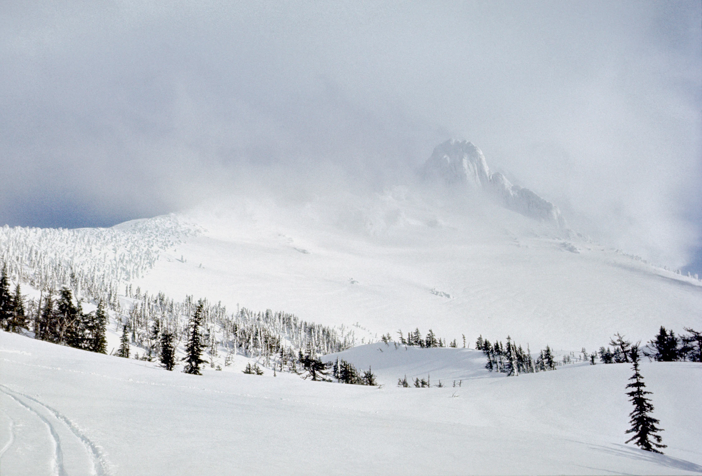
A snowy, misty mountain landscape in the Cascade Range with a foreground of snow-dusted coniferous trees and ski tracks.
A snow covered mountain peak rising above a forest in the Mount Washington Wilderness.

Mount Washington Wilderness history and protected-area timeline

Mount Washington Wilderness was formally designated in 1964 as part of the National Wilderness Preservation System, placing its volcanic terrain and conifer forests under the higher level of protection afforded to wilderness areas rather than to ordinary national forest land. The designation followed broader early-1960s efforts to identify and shield distinctive wild landscapes in the Cascade Range from increasing recreational and resource development pressures.

Since its establishment, the wilderness has been administered by the U.S. Forest Service, drawing on land within both the Willamette National Forest and the Deschutes National Forest. A visitor permit system for overnight use was instituted in 1991, and the area has been managed to maintain its primitive, undeveloped character, including restrictions on motorized and mechanical equipment such as bicycles and drones.

In more recent decades, the wilderness has been affected by regional wildfire events. The B&B Complex fires of 2003 burned within and around the area, leaving lasting impacts on forest structure, trail conditions, and vegetation in some drainages. Visitation declined from the mid-1990s through the early 2000s, then leveled off. Surveys of visitor behavior have shown that a comparatively high share of visitors to Mount Washington Wilderness do not build campfires, and that a large majority of campers choose sites near lakes, patterns that continue to shape management decisions for the wilderness.

Mount Washington Wilderness landscape and geographic character

The defining landscape of Mount Washington Wilderness is volcanic. Mount Washington is a shield volcano whose flanks spread across roughly 75 square miles of lava-strewn plains, and the wilderness preserves a large share of this terrain in a relatively undisturbed state. Cinders, ash, basaltic rubble, and a patchwork of lava flows of different ages produce a surface that ranges from sharp, jagged rock fields to older, soil-mantled flows that now support forest.

Within this broader terrain, several features stand out. Belknap Crater, a 6,873-foot cinder and ash cone, is one of the most prominent landmarks, illustrating the explosive eruptive style that punctuates the more effusive activity of the main shield. Forest roads reach only the base of the mountain, leaving the higher slopes and interior open to foot travel.

Hydrologically, the wilderness is dotted with 28 lakes, clustered mainly in the northern and southwestern portions of the area. These basins, along with meadows and smaller wetlands, create patches of softer ground within an otherwise rocky setting and offer focal points for both ecological communities and recreation. Elevations on common routes range roughly from about 4,700 to 6,100 feet, traversing transitions between lodgepole forest, lava flows, and open alpine-style terrain near the summit.

Mount Washington Wilderness ecosystems, habitats, and plant life

The ecological identity of Mount Washington Wilderness is closely tied to volcanic substrates and to the Cascade Range's strong east-to-west climate gradient. Because lava flows of different ages dominate the surface, vegetation tends to reflect both elevation and substrate age: young flows remain sparsely vegetated, while older flows have been colonized by conifers that survive in shallow, rocky soils.

At lower and middle elevations, lodgepole pine is the most characteristic forest-forming species across the wilderness. Mountain hemlock grows on rougher surfaces, including lava flows, and forms a montane-to-subalpine component on harder terrain. At the drier eastern base of Mount Washington, ponderosa pine becomes the dominant tree, while the moister western slopes support stands of Douglas fir. Whitebark pine occurs in higher, harsher settings, often on cold, exposed sites.

Beneath the canopy, an understory of broadleaved shrubs and herbaceous plants thrives in places, including beargrass, huckleberry species, and rhododendron, contributing to seasonal displays of flowers and berries. The numerous lakes scattered through the wilderness add an aquatic component to the habitat mosaic, supporting wetland vegetation along their margins as well as amphibian and fish populations, and creating the wetter microhabitats that contrast with the otherwise dry volcanic terrain.

Mount Washington Wilderness wildlife and species highlights

Wildlife in Mount Washington Wilderness reflects the broader Cascade Range fauna, with a mix of large ungulates, mid-sized carnivores, and smaller alpine-adapted mammals. Deer and elk are among the most visible large mammals, frequenting forested areas and meadows, while American black bears and the occasional cougar roam the more remote terrain, though sightings are infrequent. These larger species benefit from the wilderness's size, its restricted access, and the relatively contiguous forest cover that surrounds it.

Smaller mammals are particularly associated with the rock and rubble fields that make up so much of the volcanic landscape. Pikas inhabit talus and broken lava, marmots occupy open rocky habitats, and martens, snowshoe hares, and ground squirrels occupy various niches in forest and edge environments. This mix of small mammals is typical of high-elevation Cascades habitats but is especially prominent here because of the extensive bare-rock terrain.

The wilderness's 28 lakes support freshwater fauna as well, including populations of brook trout, cutthroat trout, and rainbow trout, which draw anglers as well as the aquatic insect and amphibian communities on which they depend. Frogs can be observed around many of the lakes during the warmer months. While birdlife is not as prominently documented in the available source material, the combination of forested cover, lakes, and open lava flows provides nesting and foraging habitat for typical Cascade forest and subalpine species throughout the year.

Mount Washington Wilderness conservation status and protection priorities

Mount Washington Wilderness has conservation significance primarily because of its combination of relatively intact volcanic landforms, conifer forests, and lake systems within a single protected boundary. As a designated wilderness under the National Wilderness Preservation System, it receives a higher level of protection than surrounding national forest lands, which is intended to preserve its primitive and unconfined character and to limit the influence of human activity on ecological processes.

The wilderness plays a notable role in preserving Cascade Range ecosystems that are increasingly affected by fragmentation, development, and fire. Its stands of lodgepole pine, mountain hemlock, ponderosa pine, Douglas fir, and whitebark pine represent a range of forest types conditioned by elevation, aspect, and substrate, and the large areas of bare and sparsely vegetated lava provide reference landscapes for understanding how vegetation reclaims volcanic terrain over time. The 28 lakes and their associated riparian zones add to the ecological value by sustaining aquatic and wetland habitats that would otherwise be scarce on the volcanic substrate.

Fire is a recurring influence, as illustrated by the B&B Complex fires of 2003, which burned within and around the wilderness and altered forest structure in parts of the area. These events create both challenges for management and opportunities to study post-fire succession on volcanic soils, and they have shaped trail conditions and vegetation patterns in affected drainages. Mineral and geothermal surveys conducted in the 1980s found limited potential for metallic minerals, fossil fuels, or commercial geothermal development within the wilderness boundaries, which has helped keep the area free from extractive industries and supported its long-term conservation profile.

Mount Washington Wilderness cultural meaning and human context

Mount Washington Wilderness lies within the traditional homeland of Indigenous peoples of the central Cascade Range, whose long presence in the mountains shaped seasonal use of the area's lakes, meadows, and passes. While the principal historical focus of the available source material is on the area's formal establishment as a wilderness in 1964, the broader cultural framing of the Cascades as a landscape with deep Indigenous history is part of how the wilderness is understood regionally.

In the modern era, the wilderness has come to function as a nearby but relatively quiet escape for residents of the heavily populated Willamette Valley. Visitor surveys have documented patterns such as frequent lakeside camping and a comparatively low rate of campfires, reflecting a regional backcountry culture that emphasizes low-impact use. The wilderness is also crossed by the Pacific Crest National Scenic Trail, a long-distance route of cultural as well as recreational significance that links the area to the wider trail culture of the western United States.

Top sights and standout views in Mount Washington Wilderness

Mount Washington Wilderness stands out for the sheer prominence of volcanic landforms in a compact Cascade setting: the shield volcano Mount Washington, the cinder cone Belknap Crater, and broad fields of young and old lava flows dominate the viewscape and set the wilderness apart from more heavily forested Oregon Cascade preserves.

Equally notable is the mosaic of vegetation adapted to that geology, from ponderosa pine on the dry eastern flank through lodgepole pine and mountain hemlock to whitebark pine near the higher elevations, and from sparse colonizers on raw lava to beargrass, huckleberry, and rhododendron beneath the canopy. The presence of 28 lakes in the northern and southwestern portions of the wilderness, combined with a 16.6-mile segment of the Pacific Crest Trail, adds concentrated points of interest within a relatively quiet, less-visited area, giving the wilderness a strong sense of geological identity coupled with accessible backcountry recreation.

Best time to visit Mount Washington Wilderness

Mount Washington Wilderness is broadly appealing across a relatively compressed summer-to-early-autumn window. From late May through October, when overnight permits are typically available, snow has generally melted from most trails and the lakes and forest are accessible without specialized winter gear, while the volcanic terrain remains visible rather than buried under deep snowpack.

Late summer and early autumn often bring more stable weather, drier trail conditions, and clearer access to alpine viewpoints, although afternoon thunderstorms can develop over the Cascades in any summer month. Winter and early spring transform the wilderness into a snow-covered and more technically demanding landscape, suitable mainly for experienced snow travelers and climbers attempting Mount Washington itself. Visitors attracted to wildflowers, beargrass blooms, and the greener forest understory typically find midsummer to early fall the most rewarding period.
Monthly climate preview

Long-term representative temperature and precipitation averages across the protected landscape

Mount Washington Wilderness Climate Normals and Monthly Weather Patterns

Historical monitoring data from the representative coordinate reveals measured annual variations in average temperature and daily precipitation rates for Mount Washington Wilderness. Reviewing the complete twelve-month climatology profile provides deeper analytical context for long-term regional weather patterns.
Annual mean7 °C
-1 °C16 °C
Jan
Feb
Mar
Apr
May
Jun12°
Jul16°
Aug16°
Sep13°
Oct
Nov
Dec-1°
Warmest month
August

16.3 °C

Coolest month
December

-0.7 °C

Wettest month
December

6.3 mm/day

Driest month
July

0.5 mm/day

Park location guide

Geography guide, regional context, and park location map for Mount Washington Wilderness

Mount Washington Wilderness park geography, regions, and map view in United States of America

Understand where Mount Washington Wilderness sits in United States of America through a broader geographic reading of the surrounding landscape, nearby location context, and its mapped position within the national park landscape.

How Mount Washington Wilderness fits into United States of America

The United States of America is a federal presidential republic and one of the world's largest countries by area and population. It consists of 50 states across a vast territory spanning multiple time zones, with its capital in Washington, D.C. and largest city in New York City. The nation has a diverse economy, influential political system, and significant cultural and military presence globally.

Wider geography shaping Mount Washington Wilderness in United States of America

The United States occupies a vast territory in North America, bordered by Canada to the north and Mexico to the south. The 48 contiguous states stretch from the Atlantic to the Pacific Ocean, while Alaska occupies the northwestern region and Hawaii is an archipelago in the Pacific. The country encompasses diverse terrain including the Rocky Mountains, Appalachian Mountains, Great Plains, and extensive river systems.

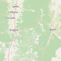
Map view of Mount Washington Wilderness

Use this park location map to pinpoint Mount Washington Wilderness in United States of America, understand its exact geographic position, and read its mapped placement within the surrounding landscape more clearly.

Pigeon | © OpenStreetMap contributors

Location context for Mount Washington Wilderness

Oregon
Natural feature types

Browse the Full Index of Natural Features in Mount Washington Wilderness

Examine the volcanic landforms and alpine habitats of the Mount Washington Wilderness. This structured geographic atlas provides a deeper understanding of the area's complex physical environment, connecting users with the unique terrain that defines this significant Oregon protected landscape.
Recorded earthquake history

Explore Historical Earthquake Records for Mount Washington Wilderness

Review documented seismic events associated with this Oregon wilderness through a structured catalogue. MoriAtlas provides accessible records including event dates, magnitudes, and depth measurements for the area, allowing for a clearer understanding of local seismic history.

Mount Washington Wilderness Earthquake History

Catalogued events

1 event

Strongest magnitude

Magnitude 4.4

Most recent event

Oct 7, 2022

This history includes earthquakes recorded inside the park or within 50 km of its borders

Explore visual records of basaltic lava fields, cinder cones, and subalpine conifer forests in Oregon.

Mount Washington Wilderness Photos, Volcanic Landscapes, and Scenic Views

Photographic collections reveal the stark volcanic terrain and forested lake basins defining the protected wilderness environment. Visual records capture the contrast between raw basaltic lava flows and dense stands of lodgepole pine across the high Cascades.

A snowy, misty mountain landscape in the Cascade Range with a foreground of snow-dusted coniferous trees and ski tracks.

A wide-angle, eye-level photograph of Mount Washington in Oregon against a clear blue sky, showing a jagged, rocky peak with patches of snow and a base covered in dense coniferous forest.

Park atlas

Compare adjacent Cascade volcanic landscapes and regional wilderness reserves.

Parks Near Mount Washington Wilderness And Surrounding Protected Area Comparisons

Browse other parks near Mount Washington Wilderness to examine connected volcanic terrain and surrounding Cascade forest reserves. Extending your geographic comparison reveals how neighboring protected landscapes share similar shield volcano geology and subalpine lake basins.
Protected landscapeOregon
Park boundaries overlap#1 closest

Southwest

Willamette National Forest: Geography and Protected Landscapes of the Central Oregon Cascades

Mapped terrain, old-growth forests, and protected wilderness boundaries.

Explore the expansive territory of Willamette National Forest, a primary protected area extending over 100 miles along Oregon's Cascade Range. This region features volcanic peaks exceeding 10,000 feet, extensive old-growth Douglas-fir stands, and a dense network of Wild and Scenic rivers, providing a detailed look at the geographic character and ecological heritage of the Pacific Northwest.

Area
6,790.75 km²
Established
1933
Visitors
1.7M annual
Relief
Mountain
Wildlife reserveOregon
22 km away#2 closest

Northwest

Middle Santiam Wilderness: Geographic Atlas and Protected Landscape Overview of the Oregon Cascades

Old-growth forest basins and volcanic landmarks in the Willamette National Forest.

Middle Santiam Wilderness represents a distinct segment of the central Oregon Cascades. The area is defined by its substantial old-growth coniferous forests, including 450-year-old Douglas-fir and western hemlock stands, alongside the striking 4,965-foot volcanic plug known as Chimney Peak. This map-focused record traces the river-cut valleys and high-ridge topography that shape this protected habitat.

Area
34.57 km²
Established
1984
IUCN
Ib
Relief
Mountain
Watercolor painting of a rolling mountain landscape with coniferous trees in the foreground and a hazy range of hills in the background.
Wildlife reserveOregon
About 27 km away#3 closest

West

Menagerie Wilderness Wildlife Reserve: Oregon Cascade Range Geography and Rock Pinnacles

Protected Cascade mountain terrain and unique crag clusters

Situated in the central Cascade Range of Oregon, Menagerie Wilderness provides a compact, highly defined landscape of rising rock pinnacles and lush coniferous forest. This resource traces the unique topography and protected boundaries of this specialized wilderness area, offering insight into the geological features and forest ecosystems that distinguish it from surrounding mountainous terrain.

Area
20.37 km²
Established
1984
IUCN
Ib
Relief
Mountain
A watercolor painting showing a snowy mountain peak in the background rising above rolling green hills and pine forests in the foreground.
Protected landscapeOregon
39 km away#4 closest

North

Mount Hood National Forest: Atlas of Protected Landscapes and Volcanic Geography

Exploring the Cascade Range terrain and wilderness boundaries in Oregon.

Mount Hood National Forest encompasses a vast, rugged expanse of the Oregon Cascades, anchored by the iconic, glacier-clad Mount Hood. This protected landscape contains extensive old-growth forests, high-alpine lakes, and deep river canyons. Discover the geographic extent of these wilderness areas and mountain terrain within the MoriAtlas database of protected lands.

Area
4,318.17 km²
Established
1908
Visitors
4.4M annual
Relief
Mountain
Protected areaOregon
70 km away#5 closest

East

Ochoco National Forest: Mapping the Rugged Canyons and High Desert of Central Oregon

A vast protected area defined by rimrock plateaus and pine-forest watersheds.

Located in the heart of the Ochoco Mountains, this protected landscape offers a study in ecological contrast. From its dense ponderosa pine groves to the exposed volcanic ridges of the high desert, the forest acts as a critical habitat corridor for mule deer and elk, while protecting the headwaters of the North Fork Crooked River within a diverse, multi-terrain framework.

Area
3,444.01 km²
Established
1911
Visitors
575K annual
Relief
Mountain
Wildlife reserveOregon
About 91 km away#6 closest

North

Roaring River Wilderness: Geography and Protected Area Atlas of Oregon

Ancient forest corridors and alpine lake landscapes

Roaring River Wilderness is a federally protected landscape in Oregon, defined by steep, tree-covered ridges and the vigorous Roaring River. This wilderness preserves a dense mosaic of old-growth conifers, high-elevation alpine lakes like Serene and Shellrock, and important salmon-spawning waters within the broader Mount Hood National Forest geography.

Area
148 km²
Established
2009
IUCN
Ib
Relief
Mountain
Protected landscapeOregon
92 km away#7 closest

North

Mount Hood National Recreation Area: Oregon Protected Landscape and Regional Geography

A three-unit recreational forest landscape in the Cascade Range.

Spanning over 34,000 acres, this protected landscape frames the lower volcanic slopes and forested drainages around Mount Hood. The area integrates river corridors, wilderness boundaries, and subalpine terrain, offering a clear view of the complex topography that defines the Cascade Range in northern Oregon.

Area
139.8 km²
Established
2009
Relief
Mountain
Climate
Temperate
A watercolor painting showing a wide, panoramic view of a mountain range in the background, rolling green hills in the midground, and a small cluster of evergreen trees in the foreground against a white background.
Wildlife reserveOregon
92 km away#8 closest

North

Mount Hood Wilderness: Atlas of Volcanic Peaks and Glacial Geography in Oregon

High-altitude protected landscapes and forest ecosystems

This protected area captures the dramatic character of the Cascade Range through its signature volcanic terrain, ancient forests, and high-alpine ridges. Covering a vast vertical range, the wilderness offers a study in geologic forces, featuring active glaciers, deep basaltic canyons, and meadows that define the mountain's northern and western slopes.

Area
262 km²
Established
1964
IUCN
Ib
Visitors
10K annual

Common questions about visiting, size, designation, and location context for Mount Washington Wilderness

Mount Washington Wilderness FAQs for park facts, access, geography, and protected area context

Find quick answers about Mount Washington Wilderness, including protected-area facts, park geography, trail and visitor context, and how the park fits into its surrounding country and regional landscape.
MoriAtlas Explorer

Continue Your Protected Areas Search Across the Global Atlas

Deepen your exploration by continuing the structured search for national parks and protected areas worldwide. Utilize the comprehensive filtering capabilities to compare different conservation landscapes and refine your understanding of global park geography. Discover more about the distribution and characteristics of protected natural areas.

Global natural geography