

Mori Atlas logo
Nature reserveMpofu Nature Reserve

Analyzing the biome transitions and terrain complexity of this South African conservation area

Mpofu Nature Reserve: Protected Mountain Landscapes and Escarpment Geography in the Eastern Cape

Mpofu Nature Reserve represents a critical protected area within the Eastern Cape, where the rugged topography of the Katberg and Amatole mountain ranges converges. This landscape is defined by the convergence of Grassland, Forest, and Albany Thicket biomes, creating high botanical density and varied habitat structures across steep valleys and high plateaus. The reserve functions as an essential part of the regional conservation network, preserving representative plains game and endangered white rhino populations within a malaria-free mountain environment.

nature reserveEastern CapeAmatole MountainsKatbergescarpment landscapeGrassland biome

Mpofu Nature Reserve

Nature reserve

Park overview

Structured park overview, official facts, and landscape profile for Mpofu Nature Reserve

Mpofu Nature Reserve park facts, protected area profile, and essential visitor context

Review the core facts for Mpofu Nature Reserve, including designation, size, terrain, visitor scale, habitats, and operating context in one park-focused overview.

About Mpofu Nature Reserve

Mpofu Nature Reserve is one of the more ecologically layered protected areas in the Eastern Cape Province of South Africa. Set in the Amatole district, it stretches across the valleys and escarpments between the Katberg and Amatole mountain ranges, producing a landscape that shifts rapidly between deep valleys, wooded slopes, open grassland plateaus, and rugged mountain edges. The terrain is at times steep, with altitudes rising from about 550 metres in the low valleys to nearly 1,400 metres along the higher escarpment sections, giving the reserve a noticeable vertical range that contributes to its ecological variety.

The reserve was established in 1985 from land that had been held by farming families descended from the 1820 settlers, an important historical community in the Eastern Cape. The transition from privately managed farmland to a formal conservation area under Eastern Cape Parks reshaped the land's role, moving its emphasis toward biodiversity protection, ecological research, and public access through activities such as hiking, game drives, and educational tours.

What distinguishes Mpofu ecologically is the convergence of three major biomes within its boundaries: Grassland, Forest, and Albany Thicket. Each biome contributes a distinctive plant assemblage, and many of the species present are endemic to South Africa. This biotic overlap, combined with varied topography and a malaria-free climate, gives the reserve a strong scientific and conservation profile. It also positions Mpofu as a useful complement to neighbouring protected areas, including Fort Fordyce Nature Reserve, with which it shares a network of historic mountain passes.

Quick facts and research context for Mpofu Nature Reserve

Mpofu Nature Reserve lies in the Amatole district of the Eastern Cape Province, South Africa, roughly between Fort Beaufort and Balfour, and is administered by Eastern Cape Parks. It covers several thousand hectares spanning altitudes from roughly 550 to about 1,400 metres, extending from lower valleys up to the escarpments of the Katberg and Amatole mountains.

The reserve was established in the mid-1980s from land purchased from farming families with roots in the 1820 settler history of the region. Its vegetation represents the uncommon convergence of Grassland, Forest, and Albany Thicket biomes, which supports a high proportion of South African endemic flora. The reserve is also a malaria-free conservation area, an important practical feature that broadens its appeal for year-round wildlife viewing and educational visits.

Protection and recognition

Documented terrestrial protection scope and conservation designation records

Mpofu Nature Reserve Protection Status and International Recognition Data

Mpofu Nature Reserve maintains a documented terrestrial protection scope without imported international recognition sources or transboundary status. Structured conservation records outline the official protected area classification and management framework.

Protection details

Protection scope
Terrestrial
Transboundary protection
No
Park context

Deeper park guide and search-rich context for Mpofu Nature Reserve

Mpofu Nature Reserve history, landscape, wildlife, and travel context

Explore Mpofu Nature Reserve through its history, landscape character, ecosystems, wildlife, conservation priorities, cultural context, and seasonal travel timing in a structured park guide built for atlas discovery and search intent.

Why Mpofu Nature Reserve stands out

Mpofu is best known for being a meeting point of three distinct South African biomes: Grassland, Forest, and Albany Thicket. This ecological overlap, set against the steep topography of the Katberg and Amatole escarpments, gives the reserve unusually high botanical and habitat diversity for its size. The reserve is also recognized for its conservation of endangered white rhino and a representative range of typical Eastern Cape and southern African mammals, including Burchell's zebra, giraffe, Cape buffalo, eland, bushbuck, and black-backed jackal. Its location in a malaria-free region further enhances its standing as a credible wildlife destination within the Eastern Cape protected-area network.
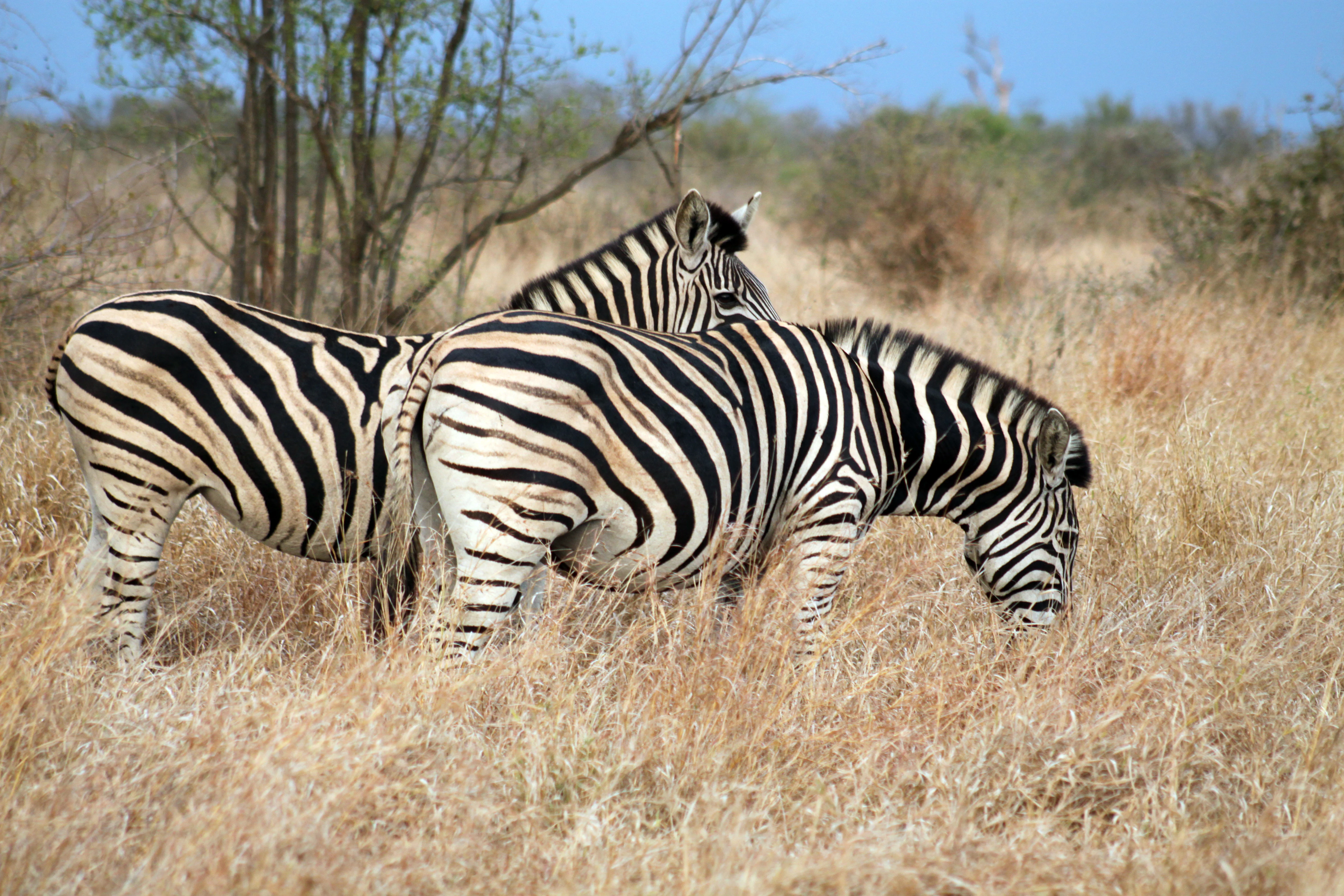
Two Burchell's zebras standing in tall, dry golden grass, viewed from the side while grazing.
Two Burchell's zebras grazing in the dry grasslands of Mpofu Nature Reserve.

Mpofu Nature Reserve history and protected-area timeline

Mpofu Nature Reserve was formally established in 1985 when land previously held by farming families was purchased for conservation purposes. These families traced their roots to the 1820 settlers, British colonial-era immigrants whose legacy remains a significant part of the Eastern Cape's social and cultural fabric. The conversion of their agricultural land into a managed reserve marked a deliberate shift in land use, prioritizing ecological protection, biodiversity conservation, and controlled public access over farming.

The management of the reserve was placed under Eastern Cape Parks, the regional conservation authority responsible for a network of protected natural areas across the province. Under this administration, Mpofu became integrated into broader conservation planning for the Amatole region, a landscape already significant for its mountain catchments, endemic flora, and wildlife populations.

The reserve's history also extends into deeper geological and paleontological time. The surrounding region is known for fossils discovered by Andrew Gedges Bain, a pioneering geologist and paleontologist who described the mammal-like reptile Pareiasaurus serridens, a species associated locally with the mythical 'Blinkwater Monster'. Bain received recognition from the British government in 1845 for his research, underscoring the long scientific significance of the area around Mpofu. Local mountain passes that link Mpofu to Fort Fordyce Nature Reserve have themselves become a kind of heritage corridor, embedding the reserve within a landscape shaped by both natural history and human movement.

Mpofu Nature Reserve landscape and geographic character

Mpofu's landscape is defined by the dynamic topography of the Katberg and Amatole mountains. The reserve occupies both the lower-lying valleys and the higher, more rugged sections where the mountains meet the upper escarpment. This vertical variation is visible in the sharp transitions between sheltered valleys and exposed slopes, creating a terrain that ranges from gently undulating grassland to steep, rocky escarpment edges.

The southern boundary is marked by the Katberg range, while the broader landscape ties into the Amatole Mountains to the north. Several mountain passes traverse the reserve, connecting it to Fort Fordyce Nature Reserve and shaping both its human and ecological access. The Blinkwater Pass runs north for about 19 kilometres across the Amathola escarpment, the Fuller's Hoek Pass winds for around 8 kilometres through afromontane forest on a curve-filled route, and the Bosnek Pass ascends steeply with significant altitude gain and a sharp one-in-eight gradient.

The reserve's elevation generally runs from roughly 550 metres along valley floors up to nearly 1,400 metres on higher ground. This altitudinal range produces a layered scenery where vegetation changes with altitude and aspect, alternating between dense woody cover on shaded slopes and open grassland on the plateaus. Snow is occasional in the surrounding mountains during winter, adding dramatic seasonal contrasts to an already varied terrain.
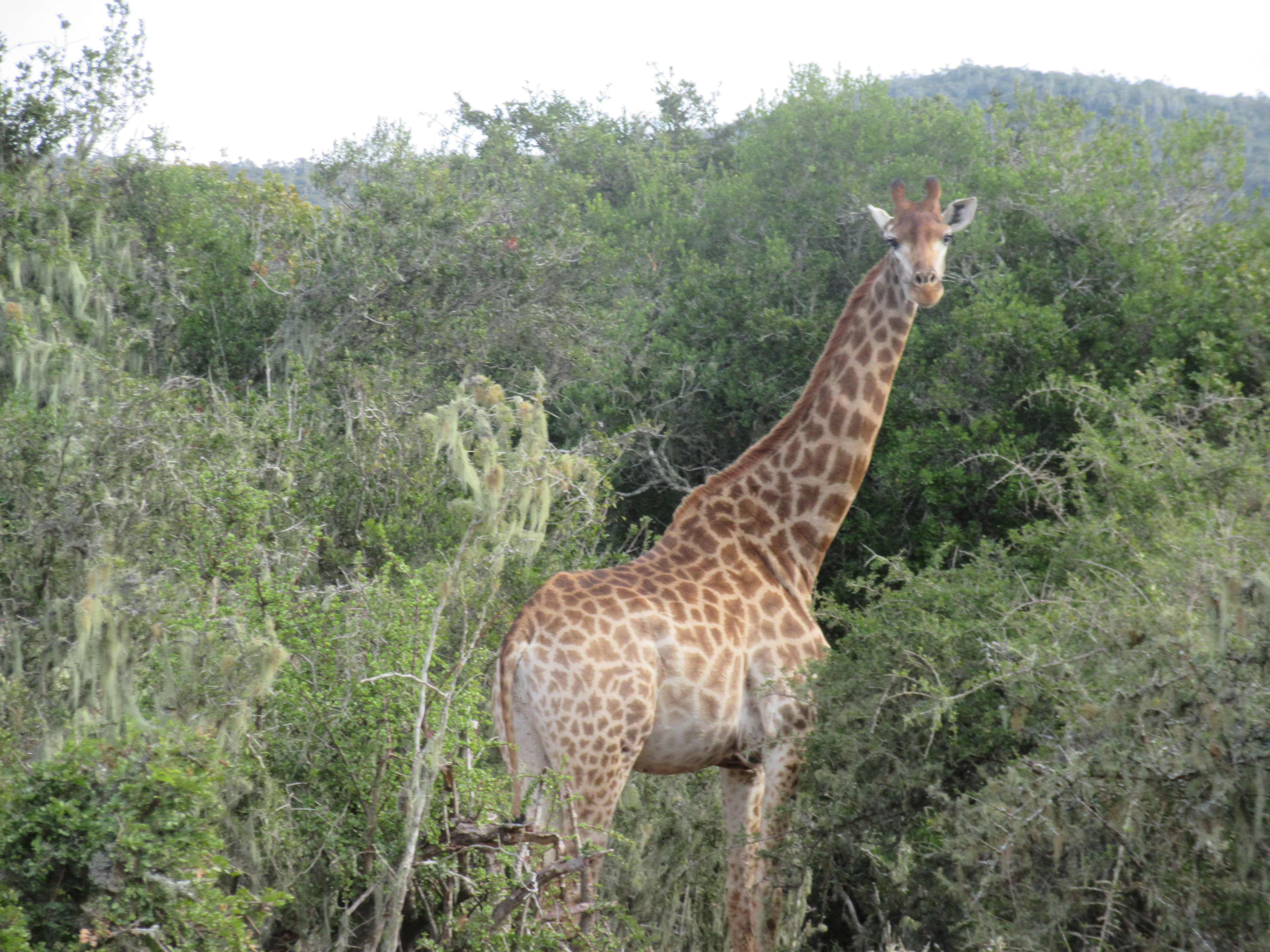
A giraffe standing in dense, green bushveld with a hilly landscape in the background.
A Cape giraffe standing among the dense shrubbery and vegetation of the Mpofu Nature Reserve.

Mpofu Nature Reserve ecosystems, habitats, and plant life

The ecological identity of Mpofu rests on the unusual coincidence of three major biomes within a single protected area: Grassland, Forest, and Albany Thicket. This biome overlap is one of the defining features of the reserve and is a major reason for its botanical richness. Grassland dominates the open plateaus and upper slopes, while Forest appears in the more sheltered, moister valleys and along particular mountain slopes, and Albany Thicket contributes dense, woody vegetation typical of the Eastern Cape's lower-lying interior.

A high proportion of plant species found in Mpofu are endemic to South Africa, reflecting both the reserve's geographic position and the protection its altitudinal range provides for specialised habitats. The diversity of vegetation types also creates structural complexity across the landscape, with open grassland patches, closed-canopy forest strips, and woody thicket mosaics all present in close proximity.

Climate interacts clearly with this ecological structure. The reserve's rainy season runs roughly from November to March, supporting peak growing conditions and greener plant cover, while the cooler, drier months from autumn into winter shift the mood of the reserve. The combination of varied terrain, three biomes, and seasonal rainfall patterns produces a dynamic vegetation cycle and contributes to the reserve's role as a botanically important site within the Eastern Cape's conservation network.
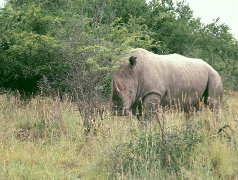
A white rhinoceros standing in tall grassy savanna vegetation with shrubs and trees in the background.
A white rhinoceros in the Mpofu Nature Reserve.

Mpofu Nature Reserve wildlife and species highlights

Mpofu supports a notably diverse mammal community for a reserve of its type, anchored by the presence of endangered white rhino. This species gives Mpofu particular conservation weight, as the reserve provides secure habitat within a managed Eastern Cape protected-area system.

Alongside white rhino, the reserve hosts species typical of mixed savanna, grassland, and thicket environments in southern Africa. Burchell's zebra graze the open areas, giraffe browse from taller trees and shrubs, Cape buffalo move through the wetter valley systems, and eland, one of the largest antelope species in the region, roam the grasslands. Bushbuck occupy denser thicket and forest-edge habitats, while black-backed jackal range across the reserve as a common smaller predator. The presence of these species together suggests a habitat mosaic capable of supporting both grazers and browsers.

The bird life within Mpofu is reported to be diverse, supported by the combination of grassland, forest, and thicket habitats. Reptile and insect populations are also described as varied, contributing to the overall richness of the reserve's fauna. While Mpofu is not primarily known as a single-species flagship site, its assemblage of plains game, large mammals, and habitat-sensitive species gives it a credible wildlife profile within the broader Eastern Cape conservation landscape.

Mpofu Nature Reserve conservation status and protection priorities

Conservation is central to the identity of Mpofu Nature Reserve. As a protected area managed by Eastern Cape Parks, it forms part of a regional network of reserves that collectively safeguard representative samples of the Eastern Cape's ecosystems. Mpofu's particular contribution lies in its rare convergence of Grassland, Forest, and Albany Thicket, all within a single managed area, and its high representation of South African endemic flora.

The reserve's role in conserving endangered white rhino stands out as a defining conservation feature. By maintaining secure habitat for this species alongside other representative mammals, the reserve contributes to regional efforts to sustain viable populations of large herbivores and at-risk species in the Eastern Cape. Its location in a malaria-free zone also supports conservation-linked activities such as educational tours, which broaden public engagement with biodiversity protection.

A pressing ecological concern within Mpofu is bush encroachment by Acacia karoo, which is recognised as a current threat to the reserve's biodiversity. This form of woody-plant invasion, common in parts of the Eastern Cape, can alter grassland structure, reduce forage availability, and shift habitat conditions for small mammals, birds, and reptiles. Managing this encroachment is an ongoing ecological task for the reserve, alongside broader efforts to maintain the balance between its three biomes.

Mpofu Nature Reserve cultural meaning and human context

Mpofu carries meaningful cultural and historical context rooted in the 1820 settlers, the British colonial-era community whose farming descendants once owned the land that would become the reserve. The conversion of these farms into a conservation area in 1985 represents a tangible shift in land use and identity for the region, embedding the reserve within a story of settler heritage, agricultural history, and modern conservation policy.

The broader cultural landscape around Mpofu enhances this context. The nearby mountain village of Hogsback is a well-known regional destination associated with natural beauty, folklore, and creative communities, while Khoisan rock art at Waylands connects the area to a much older human presence in the Eastern Cape. Together, these neighbouring sites place Mpofu within a cultural corridor where colonial-era history, indigenous heritage, and contemporary conservation intersect.

The reserve also carries a scientific-cultural thread through the legacy of Andrew Geddes Bain. His 19th-century paleontological discoveries in the terrain around Mpofu, including Pareiasaurus serridens, contribute to a long tradition of natural-science research in the region. The folkloric framing of these fossils as the 'Blinkwater Monster' shows how deep geological time and local imagination have intertwined in the cultural memory of the area.

Top sights and standout views in Mpofu Nature Reserve

Three overlapping biomes, Grassland, Forest, and Albany Thicket, give Mpofu an unusually high botanical and ecological density for a single Eastern Cape reserve, with many South African endemic plant species present.

The reserve's protected populations of endangered white rhino, alongside representative plains game such as Burchell's zebra, giraffe, Cape buffalo, and eland, anchor its wildlife significance, while its malaria-free status makes it broadly accessible for year-round conservation-focused visits.

Mpofu also stands out for its integration of landscape, history, and culture: an escarpment terrain shaped by the Katberg and Amatole mountains, a network of heritage mountain passes, and a setting closely tied to the legacy of 1820 settlers, regional Khoisan rock art, and 19th-century paleontological research.

Best time to visit Mpofu Nature Reserve

Seasonal character at Mpofu tracks the Eastern Cape's broader climatic rhythms. The rainy season, running roughly from November through March, brings hotter, more humid conditions and lush vegetation, which can make hiking more demanding but rewarding for observers interested in green landscapes, active birdlife, and full watercourses.

The cooler, drier months from autumn into winter offer a different atmosphere: clearer skies, more comfortable walking conditions, and the occasional possibility of snow on the surrounding mountains. This period can be particularly atmospheric for visitors drawn to dramatic scenery, quieter trails, and crisp visibility across the escarpment. Because the reserve is malaria-free year-round, these seasonal contrasts matter more for landscape mood and hiking comfort than for health-related timing.

Visitors with broad interests in wildlife, botany, or scenery will find meaningful character at Mpofu across much of the year. Choosing between the green, humid summer months and the cooler, occasionally snowy winter season is largely a question of personal preference and which aspects of the reserve's identity one most wants to experience.
Monthly climate preview

Long-term representative temperature and precipitation averages for Mpofu Nature Reserve

Mpofu Nature Reserve Climate Normals and Annual Weather Patterns

Historical data compiled from NASA Power tracks monthly temperature ranges and precipitation averages across the protected terrain of Mpofu Nature Reserve. Reviewing the complete twelve-month profile provides detailed insight into long-term climate variations and seasonal precipitation rhythms.
Annual mean15 °C
9 °C20 °C
Jan20°
Feb20°
Mar18°
Apr15°
May12°
Jun
Jul
Aug11°
Sep14°
Oct16°
Nov17°
Dec19°
Warmest month
January

20 °C

Coolest month
July

9.3 °C

Wettest month
January

4.4 mm/day

Driest month
June

0.8 mm/day

Park location guide

Geography guide, regional context, and park location map for Mpofu Nature Reserve

Mpofu Nature Reserve park geography, regions, and map view in South Africa

Understand where Mpofu Nature Reserve sits in South Africa through a broader geographic reading of the surrounding landscape, nearby location context, and its mapped position within the national park landscape.

How Mpofu Nature Reserve fits into South Africa

South Africa is the southernmost country in Africa, spanning 1.22 million km² with a population of over 63 million. The country operates with three capital cities, Pretoria (executive), Cape Town (legislative), and Bloemfontein (judicial), and is renowned for its biodiversity, national parks, and multicultural society.

Wider geography shaping Mpofu Nature Reserve in South Africa

South Africa occupies the southernmost region of Africa, with coastline along both the Atlantic Ocean to the west and the Indian Ocean to the east. The interior features elevated plateaus including the Highveld, with the Drakensberg escarpment marking the eastern highlands. The country shares borders with Namibia, Botswana, Zimbabwe, Mozambique, Eswatini, and Lesotho.

Map view of Mpofu Nature Reserve

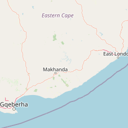
Use this park location map to pinpoint Mpofu Nature Reserve in South Africa, understand its exact geographic position, and read its mapped placement within the surrounding landscape more clearly.

Pigeon | © OpenStreetMap contributors

Location context for Mpofu Nature Reserve

Eastern Cape Province

Visual reference for the biomes, mountain escarpments, and wildlife habitats of Mpofu

Mpofu Nature Reserve Photos, Landscapes, and Protected Area Scenery

Visual records illustrate the rugged escarpment terrain and meeting points of distinct biomes across Mpofu Nature Reserve. Protected area photography captures the vertical variation of deep valleys, steep mountain slopes, and high plateaus that define the local habitat character.

Two Burchell's zebras standing in tall, dry golden grass, viewed from the side while grazing.

Two dark-colored Cape buffalo lying down in a green meadow with a wire fence visible in the background.

A giraffe standing in dense, green bushveld with a hilly landscape in the background.

A white rhinoceros standing in tall grassy savanna vegetation with shrubs and trees in the background.

Park atlas

Compare regional mountain terrain, escarpment reserves, and connected conservation areas

Exploring Parks Near Mpofu Nature Reserve and Surrounding Protected Landscapes

Browse other parks near Mpofu Nature Reserve to examine similar escarpment topography and overlapping biomes across the Eastern Cape region. Expanding the search helps compare regional protected areas, mountain passes, and diverse wildlife habitats within the broader landscape.
Nature reserveEastern Cape
About 45 km away#1 closest

Southeast

Great Fish River Nature Reserve: Mapping Protected Areas in the Eastern Cape of South Africa

A consolidated network of river-valley terrain and subtropical thicket ecosystems.

Spanning over 45,000 hectares, this reserve captures the essence of the Eastern Cape's dissected landscape. The protected area is defined by the Great Fish River and a series of steep, dramatic cliffs that separate distinct ecological basins. This atlas entry focuses on the reserve's unique combination of historical boundaries and its role in maintaining habitat continuity along the region's main river valley.

Area
450 km²
Established
1994
Relief
Upland
Climate
Subtropical
Nature reserveEastern Cape
About 51 km away#2 closest

North

Tsolwana Nature Reserve: Geographic Profile and Protected Landscape Boundaries

Eastern Cape, South Africa Mountain and Karoo Transition

Tsolwana Nature Reserve protects a 8,500 hectare landscape on the Winterberg slopes. This region serves as a vital ecological bridge, blending semi-arid Karoo vegetation with high-altitude grasslands. Explore the map to understand the intersection of river corridors, mountain ridgelines, and plains habitat that define this South African reserve.

Area
85 km²
Established
1979
National parkEastern Cape
About 104 km away#3 closest

Southwest

Addo Elephant National Park: South African National Park with Diverse Protected Landscapes

Explore its geographic context and unique Big Seven megafauna habitats.

Addo Elephant National Park is a crucial protected landscape within South Africa's Eastern Cape, covering approximately 1,640 square kilometers of varied terrain including karoo plains, coastal dunes, and marine protected areas. Its identity is deeply tied to the successful recovery of elephant populations and its distinction as the only African national park where all Big Seven megafauna can be observed in their natural surroundings. Discover the park's geographic spread, landscape diversity, and its role as a premier conservation area.

Area
1,640 km²
Established
1931
IUCN
II
Visitors
305.5K annual
Wildlife reserveEastern Cape
About 108 km away#4 closest

Southwest

Shamwari Game Reserve: An Atlas View of Restored Bushveld and Conservation Landscapes

Examining protected terrain within South Africa's Eastern Cape

Shamwari Game Reserve occupies approximately 250 square kilometers of restored Eastern Cape terrain. As a focal point of the Indalo Protected Environment, the reserve provides a structured habitat for diverse wildlife species and represents a significant case study in regional land reclamation and conservation mapping.

Area
250 km²
Established
1992
Relief
Upland
Scope
Terrestrial
National parkEastern Cape
About 110 km away#5 closest

Northwest

Mountain Zebra National Park: A National Park within Eastern Cape's Geography

Explore its mapped protected boundaries and regional landscape context.

Mountain Zebra National Park serves as a key protected area within South Africa's Eastern Cape region. This page offers an atlas-driven perspective, detailing the park's geographic scope and mapped boundaries. Understand its role as a national park and its contribution to the regional landscape context, providing structured data for those interested in protected land distribution and natural terrain.

Area
284 km²
Established
1937
IUCN
II
Visitors
31.2K annual
Wildlife reserveEastern Cape
About 142 km away#6 closest

East

Inkwenkwezi Private Game Reserve: Wildlife Reserve and Regional Landscape Geography

A protected multi-biome territory in South Africa's Eastern Cape region

Inkwenkwezi Private Game Reserve represents a critical study in compressed ecological diversity. Within its 4,500-hectare boundary, the property demonstrates the transition between coastal Wild Coast influences and inland forests. This overview details the reserve's unique biome convergence and its place within the broader protected geography of the Eastern Cape, providing insight into the land use and wildlife habitat structure.

Area
45 km²
Established
1983
Access
Access unknown
Scope
Terrestrial
National parkEastern Cape
About 184 km away#7 closest

West

Camdeboo National Park: Protected Landscape Atlas and Eastern Cape Geographic Context

Discover the mapped geography and protected area identity of this Eastern Cape national park.

Camdeboo National Park represents a key protected landscape within the Eastern Cape province of South Africa. This entry provides essential details for understanding its protected-area status, geographic footprint, and its role within the regional atlas. Examine its mapped boundaries and explore the unique natural terrain it encompasses, gaining specific insight into its protected landscape characteristics.

Area
194.05 km²
Established
2005
Relief
Mountain
Climate
Arid
National parkEastern Cape
About 206 km away#8 closest

Northeast

Grassland National Park National Park: Exploring Protected Landscapes and Regional Geography

Mapped boundaries and natural terrain context for an Eastern Cape protected area.

Grassland National Park represents a crucial protected area within South Africa's Eastern Cape province. As a national park, it offers significant insights into the region's natural landscapes and geographic character. This atlas perspective focuses on understanding the park's mapped scope, its terrain features, and its place within the broader provincial geography. Discover the unique protected landscape identity of Grassland National Park and how it contributes to the mapped natural heritage of the Eastern Cape.

Area
102.25 km²
Established
2025
IUCN
II
Relief
Mountain

Common questions about visiting, size, designation, and location context for Mpofu Nature Reserve

Mpofu Nature Reserve FAQs for park facts, access, geography, and protected area context

Find quick answers about Mpofu Nature Reserve, including protected-area facts, park geography, trail and visitor context, and how the park fits into its surrounding country and regional landscape.
MoriAtlas Explorer

Continue Your Protected Areas Search Across the Global Atlas

Deepen your exploration by continuing the structured search for national parks and protected areas worldwide. Utilize the comprehensive filtering capabilities to compare different conservation landscapes and refine your understanding of global park geography. Discover more about the distribution and characteristics of protected natural areas.

Global natural geography