
Mori Atlas logo
Nature reserveMurlough Nature Reserve

An iconic protected landscape where ancient sand dunes meet the dramatic Mourne Mountains backdrop.

Murlough Nature Reserve: Mapping the Largest Coastal Dune Heathland in County Down, Ireland

Murlough Nature Reserve represents a critical protected coastal habitat on the County Down peninsula, serving as a landmark dune heathland system that has developed over 6,000 years. This site provides significant geographic interest through its interplay of shifting sand dunes, low heathland vegetation, and the immediate proximity of the Mourne Mountains. The area serves as a vital case study for coastal conservation, mapping the intersection of shoreline ecosystems and elevated granite terrain along the Dundrum Bay coast.

dune heathlandsand dunescoastal reserveNorthern IrelandCounty Downheathland
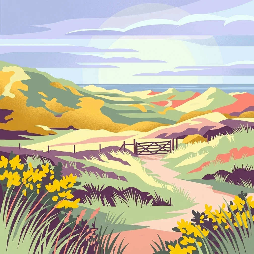
A colorful digital illustration of a coastal sand dune landscape featuring a walking path leading toward a gate, surrounded by grasses and yellow wildflowers, with a glimpse of the ocean in the distance.

Murlough Nature Reserve

Nature reserve

Park overview

Structured park overview, official facts, and landscape profile for Murlough Nature Reserve

Murlough Nature Reserve park facts, protected area profile, and essential visitor context

Review the core facts for Murlough Nature Reserve, including designation, size, terrain, visitor scale, habitats, and operating context in one park-focused overview.

About Murlough Nature Reserve

Murlough Nature Reserve sits on a low coastal peninsula in County Down, Northern Ireland, framed by the sea on two sides and backed by views toward the Mourne Mountains. The reserve is fundamentally a dune heathland: an active sand dune system that has been accreting along this stretch of the County Down coast for thousands of years, colonised and stabilised by a heathland community in which gorse, heather, and a suite of dune-loving wildflowers are central.

The protection of Murlough in 1967 was a landmark moment for conservation in Ireland, as it was the first site in the country to be formally designated as a nature reserve. From the outset it was placed under the stewardship of the National Trust, which has continued to manage it as both a working conservation site and an accessible coastal landscape. A network of paths and boardwalks runs through the dunes, opening up a habitat that would otherwise be difficult or damaging to visit, and balancing ecological sensitivity with public access.

Ecologically, the reserve's defining feature is the combination of dunes and heath on a single site. Sandy substrates support specialised dune plants, while more stable dune surfaces and inland transitions develop into heather, gorse, and grassland communities. This mosaic draws a wide variety of breeding birds, supports rare plant species such as pyramidal orchid and carline thistle, and is exceptionally rich in moths and butterflies, including species of European conservation importance such as the marsh fritillary.

Along the Dundrum Bay shoreline, Murlough Beach extends for several miles as a shingle and sand beach recognised by the Blue Flag programme. Together with the dune interior, it forms a continuous coastal landscape running from the beach up into the heath and on toward the granite uplands visible inland. The result is a reserve whose identity is shaped as much by scenery and shoreline as by its formal conservation role.

Quick facts and research context for Murlough Nature Reserve

Murlough Nature Reserve covers 697 acres of dune heathland along the County Down coast, on a peninsula between Dundrum Bay and Murlough Bay near Newcastle. It was designated in 1967 as the first nature reserve in Ireland and has been managed by the National Trust ever since. The reserve was established to protect a sand dune system estimated to be around 6,000 years old, and it currently supports one of the richest Lepidoptera faunas in the region, with 23 butterfly species and around 810 moth and butterfly species recorded on site.

Protection and recognition

Examine terrestrial conservation records and designated protected area frameworks.

Murlough Nature Reserve Protection Status and International Recognition

Terrestrial protection status and documented conservation frameworks outline the administrative scope of Murlough Nature Reserve. Official designation records detail management classifications and recognized boundaries for the protected landscape.

Protection details

Protection scope
Terrestrial
Transboundary protection
No
Park context

Deeper park guide and search-rich context for Murlough Nature Reserve

Murlough Nature Reserve history, landscape, wildlife, and travel context

Explore Murlough Nature Reserve through its history, landscape character, ecosystems, wildlife, conservation priorities, cultural context, and seasonal travel timing in a structured park guide built for atlas discovery and search intent.

Why Murlough Nature Reserve stands out

Murlough is best known as Ireland's first nature reserve and as the largest dune heathland in Ireland, a coastal habitat where ancient sand dunes are overlaid with low, heather-dominated heath. It is also recognised for the exceptional richness of its moths and butterflies, which has made the site a long-standing reference location for invertebrate recording in Ireland. The reserve is closely associated with the sweeping dune and heath landscape of the Dundrum Bay coast, the Murlough Beach frontage, and the working relationship between conservation management and the surrounding Mourne Mountains scenery, particularly views toward Slieve Donard.
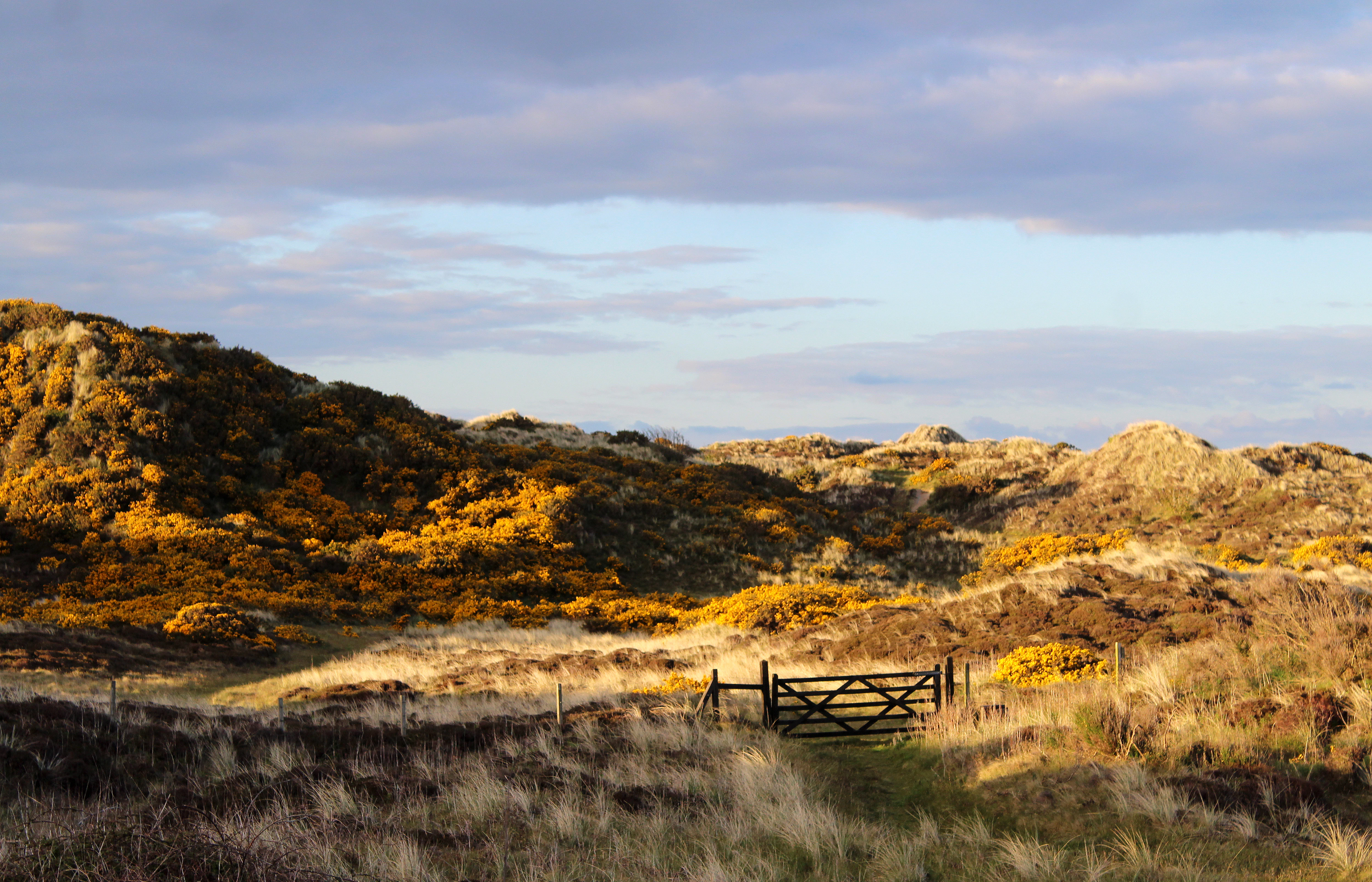
A wide, eye-level shot of undulating sand dunes covered in patches of golden gorse and brown grasses under a soft, overcast sky, with a wooden gate visible in the midground.
Autumnal view over the sand dunes at Murlough Nature Reserve.

Murlough Nature Reserve history and protected-area timeline

The modern history of Murlough begins with the construction of Murlough House in 1857, when Arthur Hill, 4th Marquess of Downshire, built a summer residence on the peninsula. A wooden bridge originally connected the site across to Keel Point, and this was replaced in 1893 by the granite bridge that still stands today. The house and the surrounding sand dunes were extensively used by the United States Army during the Second World War; the US 1st Battalion of the 13th Armored Regiment (1st Division) arrived in 1942, followed by the 818th Tank Destroyer Battalion (XV Corps) in April 1944.

The defining moment in the reserve's history came in 1967, when the National Trust acquired and designated the site as a nature reserve. This designation made Murlough Ireland's first nature reserve, establishing a precedent for formal conservation management in the country. Management since then has combined habitat work such as grazing, gorse control, and careful visitor routing with ongoing biological recording, and the reserve has built up an unusually detailed long-term record of its invertebrate, plant, and bird life.

Murlough Nature Reserve landscape and geographic character

The landscape of Murlough is shaped by a long, low peninsula where sand dunes meet the sea on both sides. To the west lies Dundrum Bay, fronted by the shingle beach of Murlough Beach, which runs for several miles along the coast. To the east, the dunes face Murlough Bay, the 'sea inlet' that gives the reserve its Irish name, Murlach.

Inland from the shoreline, the dunes rise into a plateau of dune heath, where low vegetation takes over from bare sand. Scattered paths and boardwalks thread through this terrain, and active conservation measures, including controlled gorse burning and grazing by hardy hardy pony breeds such as Exmoor ponies, help to keep the heath open and varied.

Beyond the reserve itself, the Mourne Mountains form a dramatic backdrop, and on clear days the slopes and summit of Slieve Donard, the highest peak in the range, are clearly visible to the south. The interplay between flat coastal dunes, textured heathland, and looming granite uplands gives Murlough a distinctive setting on the County Down coast.
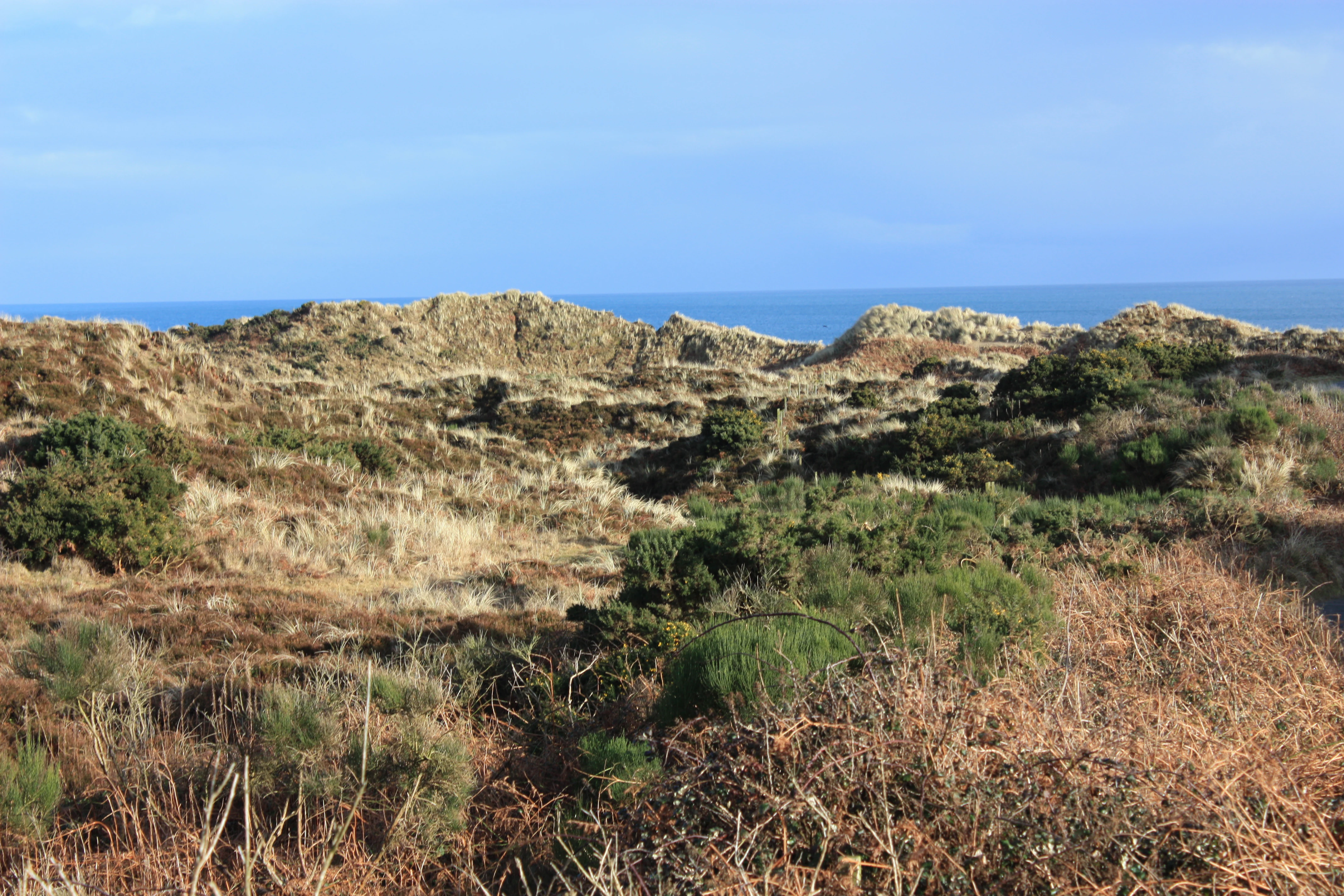
A coastal landscape featuring rolling sand dunes covered in low-lying green and brown heath vegetation under a clear blue sky, with a glimpse of the ocean on the horizon.
Sand dune heathland landscape at Murlough Nature Reserve.

Murlough Nature Reserve ecosystems, habitats, and plant life

Murlough's ecological character is dominated by the dune heathland habitat mosaic. Active and fixed dunes give way to dune slacks and more stabilised surfaces where heath vegetation develops. Gorse, heather, and associated dwarf shrubs create the low, shrubby structure typical of coastal heath, while sandy pockets maintain populations of specialised dune plants.

Among the rare plants locally associated with the reserve are pyramidal orchid and carline thistle, both characteristic of calcareous or sandy dune-edge communities. The vegetation structure is deliberately kept open and uneven through active management, including traditional practices such as rotational gorse burning and grazing with hardy hardy pony breeds, which helps to maintain the variety of microhabitats that the reserve's wildlife depends on.

The mosaic of open sand, low heath, flowering plants, and sheltered dune slacks creates conditions favourable to a wide range of invertebrates, which in turn supports breeding birds and forms the backbone of Murlough's ecological identity.
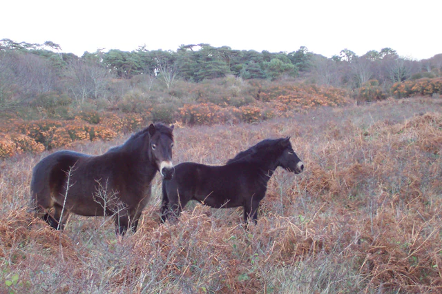
Two dark ponies standing in a brown, brushy field with a background of trees and dune vegetation.
Ponies grazing within the dune heathland of Murlough Nature Reserve.

Murlough Nature Reserve wildlife and species highlights

The Murlough dunes support a rich bird community, with breeding species typical of open heath and dune-edge habitats. Meadow pipit, Eurasian skylark, common cuckoo, European stonechat, common linnet, and common reed bunting are recorded as regular breeders, taking advantage of the mix of short vegetation, shrub patches, and damp slacks.

The surrounding waters are used by both grey seals and common seals, with between roughly 50 and 130 individuals regularly using the area for moulting, resting, and feeding. Seals can therefore be a notable feature of the coastal experience, particularly around haul-out sites in Dundrum Bay and Murlough Bay.

The reserve's most distinctive wildlife claim, however, lies in its invertebrates. Twenty-three butterfly species have been recorded, including the marsh fritillary, a species of European conservation importance, along with dark-green fritillary, grayling, and cryptic wood white. The marsh fritillary's presence in particular gives the site weight beyond its national boundaries, as the species is protected under European nature conservation frameworks.

Murlough Nature Reserve conservation status and protection priorities

Murlough's conservation significance rests on its combination of habitat rarity, historical precedence, and ecological richness. As the dune heathland covering around 700 acres of coastal County Down, it represents both the largest example of that habitat in Ireland and one of the longest studied coastal dune systems in the region.

Its designation in 1967 as Ireland's first nature reserve gives it a foundational role in the country's conservation history. Long-running National Trust management has kept the site in continuous conservation use for decades, providing the long-term stability that rare species such as the marsh fritillary require. The reserve's invertebrate fauna, in particular, has made it a reference site for monitoring the fortunes of dune and heath-dependent species in Ireland.

Management practices on site reflect a deliberate balance between ecological function, cultural landscape, and public access. Grazing by Exmoor ponies, controlled gorse burning, a network of boardwalks through sensitive dune areas, and ongoing biological recording together maintain the open heath mosaic. The presence of Murlough Beach along the Dundrum Bay shore, recognised as a Blue Flag beach, adds a further layer of conservation and recreation interest.

Murlough Nature Reserve cultural meaning and human context

Although Murlough is principally known ecologically, the peninsula has a documented built heritage. Murlough House was constructed in 1857 as a summer residence for the Marquess of Downshire, and the surviving granite bridge, which replaced an earlier wooden structure in 1893, remains a visible reminder of this 19th-century estate landscape.

The site's 20th-century history is tied to the Second World War presence of the United States Army, which made extensive use of both the house and the surrounding dunes from 1942 onwards. Today, Murlough is part of the broader cultural geography of the County Down coast, sitting beside the seaside town of Newcastle and acting as a green threshold between the beach, town, and the Mourne Mountains beyond.

Top sights and standout views in Murlough Nature Reserve

Murlough stands out as Ireland's first nature reserve and home to the country's largest dune heathland, a habitat that combines active sand dunes with low shrubby heath on a coastal peninsula at Dundrum Bay. The reserve's moth and butterfly fauna is exceptional, with around 810 Lepidoptera species recorded, including the European-protected marsh fritillary. Its location near Newcastle places the dune and heath landscape immediately against the backdrop of the Mourne Mountains and Slieve Donard, while Murlough Beach itself has been recognised as a Blue Flag beach along the Dundrum Bay shore.

Best time to visit Murlough Nature Reserve

Murlough's character shifts meaningfully with the seasons. Late spring and early summer are typically the richest time for the dune heath, when flowering plants such as pyramidal orchid are at their peak, breeding birds are active across the heath, and many of the reserve's butterfly species are on the wing. Summer evenings can also be productive for moths in suitable conditions, reflecting the site's importance for invertebrate recording.

Autumn and winter bring a more open, windswept feel, when storm activity reshapes the dunes and seal activity along the shore can be more visible. Whatever the season, the reserve's exposed coastal setting means weather can change quickly; visitors should expect the cooler, brighter conditions typical of the Irish Sea coastline rather than a sheltered inland experience.
Monthly climate preview

Long-term representative temperature and precipitation averages for County Down

Murlough Nature Reserve Climate Normals and Monthly Weather Patterns

Historical climatology records outline the measured annual temperature progression and daily precipitation rates across twelve distinct monthly intervals for Murlough Nature Reserve. Comprehensive monthly climate statistics provide deeper insight into long-term averages beyond this initial summary.
Annual mean10 °C
7 °C15 °C
Jan
Feb
Mar
Apr
May11°
Jun13°
Jul15°
Aug15°
Sep14°
Oct12°
Nov10°
Dec
Warmest month
August

15 °C

Coolest month
February

6.6 °C

Wettest month
November

3.8 mm/day

Driest month
May

2.1 mm/day

Park location guide

Geography guide, regional context, and park location map for Murlough Nature Reserve

Murlough Nature Reserve park geography, regions, and map view in United Kingdom

Understand where Murlough Nature Reserve sits in United Kingdom through a broader geographic reading of the surrounding landscape, nearby location context, and its mapped position within the national park landscape.

How Murlough Nature Reserve fits into United Kingdom

The United Kingdom is a parliamentary constitutional monarchy located in northwestern Europe, consisting of four constituent countries: England, Scotland, Wales, and Northern Ireland. As a major global power with over 69 million residents, it maintains significant international influence in politics, economics, and culture.

Wider geography shaping Murlough Nature Reserve in United Kingdom

The United Kingdom is an island nation located in northwestern Europe, surrounded by the Atlantic Ocean, North Sea, English Channel, Celtic Sea, and Irish Sea. It shares a land border with the Republic of Ireland to the west. The territory includes the island of Great Britain, the northeastern portion of Ireland, and most of the smaller British Isles islands.

Map view of Murlough Nature Reserve

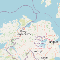
Use this park location map to pinpoint Murlough Nature Reserve in United Kingdom, understand its exact geographic position, and read its mapped placement within the surrounding landscape more clearly.

Pigeon | © OpenStreetMap contributors

Location context for Murlough Nature Reserve

County Down

Visual reference of coastal sand dunes, heathland habitats, and mountain backdrops

Murlough Nature Reserve Photos and Landscape Scenery Exploration

Examine detailed photography of Murlough Nature Reserve to understand its expansive dune heath mosaic and coastal peninsula terrain. Visual archives reveal the distinct environmental character of Ireland's pioneering protected area against the Mourne Mountains.

A wide, eye-level shot of undulating sand dunes covered in patches of golden gorse and brown grasses under a soft, overcast sky, with a wooden gate visible in the midground.

A group of people walking on a gravel path through grassy sand dunes under a dark, cloudy sky.

A coastal landscape featuring rolling sand dunes covered in low-lying green and brown heath vegetation under a clear blue sky, with a glimpse of the ocean on the horizon.

Two dark ponies standing in a brown, brushy field with a background of trees and dune vegetation.

Park atlas

Compare adjacent coastal habitats, dune systems, and regional mountain landscapes

Explore Other Parks and Protected Areas Near Murlough Nature Reserve

Visitors exploring Murlough Nature Reserve can continue browsing other protected areas throughout the surrounding County Down region and nearby coastal territories. Expanding the geographic comparison reveals connected regional ecosystems, alternative coastal reserves, and related mountain landscapes.
Nature reserveNorthern Ireland
About 44 km away#1 closest

Northwest

Oxford Island National Nature Reserve: Protected Wetland Landscapes of Northern Ireland

Lakeshore habitats and woodland geography at Lough Neagh

Oxford Island is a prominent nature reserve where terrestrial woodland meets the expansive waters of Lough Neagh. The site showcases a transition of reed beds and meadows that serve as vital ecological assets within the regional geography of Northern Ireland, offering a dense, accessible look at lowland wetland environments.

Area
1.14 km²
Relief
Lowland
Climate
Temperate
Access
Easy access
An illustration of a green meadow in the foreground with forest, steep cliffs, and a narrow waterfall in the background under a pale sky with soft pink clouds.
National parkCounty Meath
About 70 km away#2 closest

Southwest

Boyne Valley National Park: Protected River Floodplains and Neolithic Landscapes

Geographic atlas overview for County Meath, Ireland

Boyne Valley National Park encompasses a significant riparian corridor along the River Boyne, serving as a sanctuary for diverse freshwater species and a guardian of major megalithic monuments. This protected area offers insight into the confluence of Irish ecological preservation and prehistoric archaeological heritage within a managed, low-lying floodplain setting.

Area
2.23 km²
Established
2023
IUCN
II
Relief
Lowland
Nature reserveNorthern Ireland
About 75 km away#3 closest

Northwest

Lough Beg Nature Reserve: Mapping the Wetlands and Floodplains of Northern Ireland

An essential protected landscape within the Lough Neagh basin.

Lough Beg provides a distinct geographic study of freshwater ecosystems and alluvial landscapes. As a designated nature reserve, it forms a crucial link in the Lower Bann catchment, characterized by its shallow waters and seasonal pasture flooding. The area serves as a primary hub for migratory bird species, while the historic Church Island offers a unique convergence of early Christian heritage and natural wetland terrain.

Relief
Lowland
Climate
Temperate
Access
Easy access
Scope
Terrestrial
Nature reserveNorthern Ireland
About 83 km away#4 closest

Northwest

Ballynahone Bog: Northern Ireland Lowland Raised Peatland and Wetland Geography

Intact active bog dome and protected wetland landscape

Examine the geography of Ballynahone Bog, one of the largest remaining lowland raised bogs in Northern Ireland. This protected landscape preserves an active peat-forming surface, intricate hummock and pool complexes, and marginal fen habitats, offering insight into the ecological history and hydrological patterns of the Lough Neagh lowland region.

Area
2.432 km²
Established
1995
Relief
Lowland
Climate
Temperate
Protected areaCounty Antrim
About 93 km away#5 closest

North

Slieveanorra Forest Protected Area: Geography, Maps, and Upland Landscape Context

A comprehensive look at the Antrim forest and glacial landscape.

Slieveanorra Forest serves as a prominent protected area within the County Antrim uplands. Featuring expansive conifer woodlands, the site includes rugged terrain, reservoir edges, and scenic summit views. Understand the geological and environmental composition of this working forest landscape through its mapped boundaries and regional context.

Relief
Upland
Water
Minor water
Nature reserveCounty Fermanagh
About 104 km away#6 closest

West

Crom Estate Nature Reserve and Upper Lough Erne Geographic Landscape Overview

Riparian forest and island geography in County Fermanagh

Deeply connected to the shores of Upper Lough Erne, Crom Estate is a sprawling nature reserve defined by its ancient riparian woodlands and intricate maze of bays and islands. The terrain preserves a distinct mix of old-growth forest, open grassland, and historic castle ruins, providing a valuable case study in the regional geography of County Fermanagh and the conservation of water-influenced ecosystems.

Area
5.5 km²
Established
1987
Relief
Lowland
Climate
Temperate
Watercolor illustration of a landscape with mountains, a lake, and trees
National parkCounty Wicklow
About 114 km away#7 closest

South

Wicklow Mountains National Park: Protected Landscape and Geographic Atlas Mapping

Explore County Wicklow's mapped natural terrain and park boundaries.

Understand the geographic scope and protected landscape identity of Wicklow Mountains National Park. This page offers detailed information on its mapped boundaries and its context within County Wicklow, providing a foundation for atlas-based discovery of Ireland's natural areas. Explore how this national park contributes to the region's mapped geography and conservation landscapes.

Area
205 km²
Established
1991
IUCN
II
Relief
Mountain
Protected areaCounty Antrim
About 120 km away#8 closest

North

Benbane Head Protected Area: Geographic Profile and Regional Landscape Mapping

Coastal terrain and protected boundaries in County Antrim

Examine the geographic characteristics of Benbane Head, a significant protected area located in County Antrim. This profile highlights the site's physical boundaries and its place within the regional landscape, providing essential mapping context for understanding Northern Ireland's diverse natural terrain and conservation geography.

Area
0.052 km²
Established
1953
Relief
Lowland
Climate
Temperate

Common questions about visiting, size, designation, and location context for Murlough Nature Reserve

Murlough Nature Reserve FAQs for park facts, access, geography, and protected area context

Find quick answers about Murlough Nature Reserve, including protected-area facts, park geography, trail and visitor context, and how the park fits into its surrounding country and regional landscape.
MoriAtlas Explorer

Continue Your Protected Areas Search Across the Global Atlas

Deepen your exploration by continuing the structured search for national parks and protected areas worldwide. Utilize the comprehensive filtering capabilities to compare different conservation landscapes and refine your understanding of global park geography. Discover more about the distribution and characteristics of protected natural areas.

Global natural geography