

Mori Atlas logo
Protected landscapeNantahala National Forest

Tracing the mountain ridges, temperate rainforests, and river gorge networks of western North Carolina

Nantahala National Forest: A Comprehensive Geographic Atlas of Protected Appalachian Landscapes

Spanning a vast, rugged expanse of the southern Appalachian Mountains, Nantahala National Forest serves as a premier protected landscape in western North Carolina. This atlas entry details the forest's complex topography, ranging from high-elevation balds to deeply incised river gorges. Users can analyze the forest boundaries, ancient old-growth groves, and interconnected water networks that define one of the wettest and most lush temperate rainforest regions in the eastern United States.

national forestsouthern AppalachiansAppalachian temperate rainforestold-growth forestwilderness areaswaterfalls
An artistic, stylized illustration of a mountain stream flowing through a dense forest with trees, ferns, and rocky terrain under soft light.

Nantahala National Forest

Protected landscape

Park overview

Structured park overview, official facts, and landscape profile for Nantahala National Forest

Nantahala National Forest park facts, protected area profile, and essential visitor context

Review the core facts for Nantahala National Forest, including designation, size, terrain, visitor scale, habitats, and operating context in one park-focused overview.

About Nantahala National Forest

Nantahala National Forest spans a vast and varied landscape in the mountains and valleys of western North Carolina, encompassing portions of Macon, Graham, Cherokee, Jackson, Clay, Swain, and Transylvania counties. As the largest of North Carolina's four national forests, it covers hundreds of thousands of acres of rugged Appalachian terrain, from ridges exceeding 5,800 feet to the deep river gorges that drop toward 1,200 feet in the southern part of the state.

The forest's identity is shaped by its climate. Because it lies within the Appalachian temperate rainforest and ranks as the second wettest area in the continental United States after the Pacific Northwest, Nantahala supports exceptionally lush vegetation, dense hardwood and evergreen forests, and an extensive network of streams. The combination of high rainfall, varied elevation, and sheltered valleys produces a rich mosaic of habitats, dramatic waterfalls, and some of the most reliable trout waters in the eastern United States.

Rivers define much of the forest's character. The Nantahala River runs through the heart of the forest and gives it its name, while the Tuckasegee, Hiwassee, and Little Tennessee systems also flow through or around its boundaries. Mountain reservoirs such as Lake Chatuge, Hiwassee Lake, and Lake Appalachia add to the region's hydrological complexity and create recreational opportunities along the forest's edges.

The forest is also a major outdoor recreation destination. Portions of the Appalachian Trail, Bartram Trail, Foothills Trail, and Mountains-to-Sea Trail cross the forest, and three designated wilderness areas anchor some of its most rugged scenery. The Joyce Kilmer Memorial Forest preserves one of the most remarkable stands of ancient tulip poplars in the eastern United States. Together with adjacent national forests and the Great Smoky Mountains National Park, Nantahala forms a critical part of the southern Appalachian conservation landscape.

Quick facts and research context for Nantahala National Forest

Nantahala National Forest is located in the mountains of western North Carolina and is the largest of the state's four national forests. It falls within the Appalachian temperate rainforest and is officially managed by the United States Forest Service. Stretching across multiple counties, the forest spans from the high ridges of the southern Appalachians down to deep river gorges, encompassing notable wilderness areas, old-growth forest stands, and segments of famous long-distance trails.

Protection and recognition

Examine documented terrestrial protection records and international recognition scopes

Nantahala National Forest Protection Status and Terrestrial Conservation Scope

Nantahala National Forest maintains a documented terrestrial protection scope within the wider regional forest landscape. Review verified designation data, management classifications, and international recognition parameters associated with the protected area.

Protection details

Protection scope
Terrestrial
Transboundary protection
No
Park context

Deeper park guide and search-rich context for Nantahala National Forest

Nantahala National Forest history, landscape, wildlife, and travel context

Explore Nantahala National Forest through its history, landscape character, ecosystems, wildlife, conservation priorities, cultural context, and seasonal travel timing in a structured park guide built for atlas discovery and search intent.

Why Nantahala National Forest stands out

The forest is best known for the deep, forested gorges of the Nantahala River and the surrounding mountains in the southern Appalachians. It is associated with the Appalachian temperate rainforest, abundant rainfall, and prolific waterfalls, including towering cascades in the Cowee and Nantahala mountains. The forest is also recognized for its rich old-growth stands and three designated wilderness areas, including Joyce Kilmer-Slickrock Wilderness.
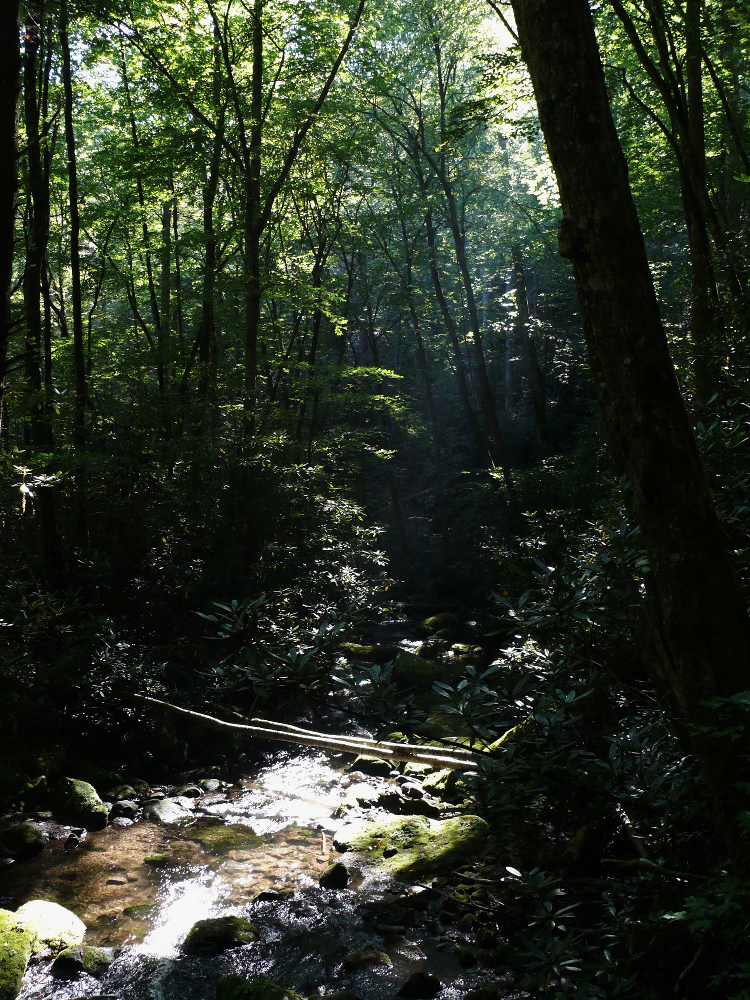
A small, rocky mountain stream flows through a dense, sun-dappled hardwood forest with light rays piercing the canopy.
Sunlight filters through the old growth hardwood canopy of Joyce Kilmer Memorial Forest.

Nantahala National Forest history and protected-area timeline

The landscape now protected as Nantahala National Forest has been home to the Cherokee and their indigenous ancestors for thousands of years. The name "Nantahala" itself comes from the Cherokee language and refers to the deep gorges where sunlight only reaches the valley floor near noon. European colonization brought traditional deer hide trade and a long series of treaties between 1721 and 1777 that gradually reduced Cherokee territory, followed by further losses such as the Treaty of Hopewell in 1785. The Cherokee were eventually forced westward along routes such as the Trail of Tears between 1830 and 1850, although a pronounced Cherokee population remains in present-day North Carolina.

European exploration included the Spanish expedition led by Hernando de Soto in 1540 and the naturalist William Bartram in the eighteenth century. Bartram's extensive botanical and cultural documentation, particularly his multi-year journey across southeastern America, helped inspire later appreciation for the region's natural heritage. The Bartram Trail, which passes through the forest today, was later established in his honor.

Large-scale commercial logging in the nineteenth century stripped many slopes of timber before companies sold off cutover lands. The conservation movement that followed sought to reverse that damage. Dr. Chase P. Ambler helped lead early calls to protect the western North Carolina mountains, while the Forest Reserve Act of 189 and the Weeks Act created legal mechanisms for the federal government to purchase and protect private lands.

On January 29, 1920, President Woodrow Wilson combined purchased lands in Georgia, North Carolina, and South Carolina to formally establish the Nantahala National Forest. Cherokee, Graham, and Swain counties were initially excluded and became part of the Pisgah National Forest in 1921. President Herbert Hoover later transferred additional lands to expand the forest in 1929, and a 1936 reorganization brought Nantahala within the borders of North Carolina alone.

Nantahala National Forest landscape and geographic character

Nantahala National Forest covers a broad and physically diverse portion of the southern Appalachian Mountains. Elevations range roughly from 5,800 feet at Lone Bald in Jackson County down to about 1,200 feet along the Hiwassee River in Cherokee County below the Appalachia Dam. Within these ranges, the landscape shifts from high, exposed balds and ridges such as Wayah Bald to deeply incised river gorges and sheltered valleys.

Mountain waters shape the scenery throughout the forest. The Nantahala River cuts through a narrow gorge that gives the forest its name, while the Tuckasegee Gorge in the Roy Taylor Forest adds steep, scenic terrain. Standing Indian Mountain, at 5,499 feet in the Nantahala Ranger District, anchors the region's high country, and the Trimont Ridge and Fishhawk Mountains create some of the most scenic sections of the Bartram Trail. Reservoir-fed lakes along the southern and western edges give the terrain a softer character where TVA-managed waters meet forested slopes.

Waterfalls are a defining visual feature of the forest. Western North Carolina as a whole is known for its cascades, and Nantahala contains scattered examples across its districts, including exceptionally tall falls such as Whitewater Falls, which is the highest waterfall east of the Rockies. Streams, creeks, and trout waters thread through the forest, contributing to its lush, mossy character in combination with the area's high rainfall. The Mountain Waters Scenic Byway provides one of the most direct scenic routes through this varied landscape.

A black and white photograph showing a man in a suit and fedora standing next to a weathered wooden sign labeled Snowbird Picnic Area, Developed and maintained by Nantahala National Forest, featuring a US Forest Service shield logo.
A vintage photograph of a man standing beside a wooden entrance sign for the Snowbird Picnic Area in Nantahala National Forest.

Nantahala National Forest ecosystems, habitats, and plant life

Nantahala National Forest falls within the Appalachian temperate rainforest, an ecological region distinguished by high rainfall, frequent fog, and dense forest cover. The widespread precipitation supports an unusually lush mix of hardwoods such as tulip poplar, oak, hickory, and maple, along with rhododendron, hemlock, and other understory species that thrive in moist conditions. Combined with elevation differences of more than 4,000 feet, this moisture produces a layered forest environment with multiple microclimates.

Several pockets of old-growth forest remain within the forest. Joyce Kilmer Memorial Forest, dedicated in 1936, holds tulip poplars and other trees that are more than 450 years old and represents one of the most celebrated ancient hardwood groves in the eastern United States. The broader Joyce Kilmer-Slickrock Wilderness protects nearly 6,000 acres of old growth within the forest. Across the Nantahala, more than 30,000 acres of intact older forest have been identified, contributing to habitat continuity for species that require mature forest conditions.

Rivers, streams, and reservoirs shape the aquatic environment. The forest's many miles of trout water, supported by cool mountain streams such as the Nantahala, the Tuckasegee, the Hiwassee, and Fires Creek, are a defining ecological feature. Mountain lakes along the southern edge, including Lake Chatuge, Hiwassee Lake, and Lake Appalachia, add to wetland and riparian habitat diversity. Together forest, gorge, stream, and reservoir create an unusually rich temperate rainforest ecosystem in the eastern United States.
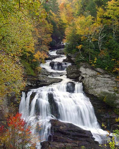
A multi-tiered waterfall cascading down dark rocky ledges, surrounded by dense trees with autumn foliage in shades of gold, orange, and red.
Cullasaja Falls cascading through a vibrant autumn forest in Nantahala National Forest.

Nantahala National Forest wildlife and species highlights

The combination of mature forest, high rainfall, and varied elevation supports a diverse wildlife community typical of the southern Appalachians. Cool, well-forested streams and rivers sustain thriving populations of trout, making the forest one of the most notable freshwater fishing destinations in the region. The extensive deciduous and mixed forest cover supports songbirds, raptors, and resident Appalachian wildlife patterns, and the deep gorges and old-growth stands provide nesting cover and refuge for species that depend on undisturbed habitat.

The forest's linkage with the broader southern Appalachian landscape, including its connections to the Great Smoky Mountains National Park and adjoining national forests, allows wildlife to move across a wider ecological network than any single tract could provide on its own. Adjacency to the Cherokee Indian Reservation and other forested lands further extends this habitat continuity.
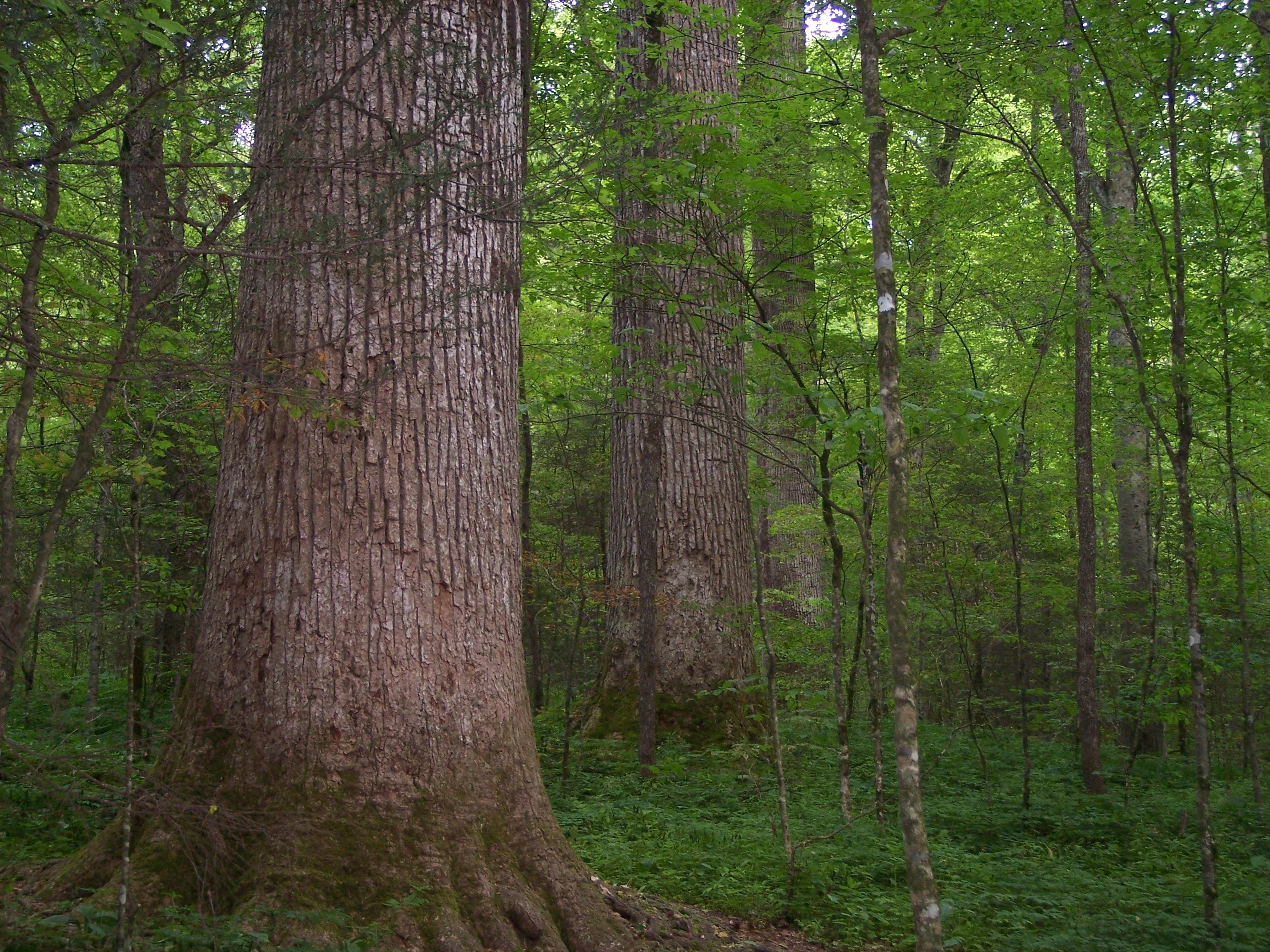
Close-up view of the thick, textured trunks of massive old-growth trees in a lush, green deciduous forest.
An ancient grove of large hardwood trees in the Joyce Kilmer Memorial Forest.

Nantahala National Forest conservation status and protection priorities

Nantahala National Forest represents a major conservation success story for eastern forests. The land that makes up the forest was once heavily logged and depleted by industrial timber operations in the nineteenth century, leaving many slopes stripped and abandoned. The early twentieth century conservation movement, including the Forest Reserve Act of 1891 and the Weeks Act, provided the legal framework for the federal government to purchase these damaged lands and restore them under federal stewardship. The Weeks Act in particular is regarded as one of the most successful conservation laws in American history, protecting more than twenty million acres nationwide.

The formal establishment of Nantahala in 1920 marked the practical application of that framework in the southern Appalachians. Today the forest protects significant stands of old-growth trees, large wilderness areas that limit development and road-building, and substantial stretches of cool, clean trout water. Designated wilderness areas within the forest, including Joyce Kilmer-Slickrock, Southern Nantahala, and Ellicott Rock, anchor this protection by setting aside some of the most rugged and ecologically sensitive terrain in a strictly managed condition.

The forest is also part of a broader Appalachian conservation network that extends into neighboring national forests and across the Blue Ridge Parkway. Its proximity to Joyce Kilmer Memorial Forest, the Bartram Trail, and segments of the Appalachian Trail has helped foster public awareness of eastern forest preservation, drawing on the legacy of early naturalists like William Bartram. By managing lands in coordination with the Pisgah, Croatan, and Uwharrie National Forests under common headquarters in Asheville, Nantahala contributes to a coordinated federal approach to southern Appalachian conservation.

Nantahala National Forest cultural meaning and human context

The cultural identity of the Nantahala region is deeply tied to the Cherokee, for whom these lands have been home for thousands of years and from whom the forest's name originates. Cherokee place names persist across the forest's three ranger districts, with names such as Cheoah, meaning "otter," Nantahala, "Land of the Noonday Sun," and Tusquitee, "where the waterdogs laughed," connecting the modern administrative landscape to the region's indigenous heritage. Cherokee communities remained in North Carolina throughout the removals of the nineteenth century and continue to shape the cultural landscape adjacent to the forest.

European exploration and documentation added another layer of cultural memory. Hernando de Soto's 1540 expedition passed through the area, and William Bartram's eighteenth century botanical and ethnographic writings helped shape American natural history. The Bartram Trail commemorates that legacy of exploration and conservation-minded observation. Names such as Standing Indian Mountain also reflect the region's long history of indigenous presence and the encounter between cultures in the southern Appalachians.

Top sights and standout views in Nantahala National Forest

Three designated wilderness areas, Joyce Kilmer-Slickrock, Southern Nantahala, and Ellicott Rock, anchor the forest's most rugged terrain. Joyce Kilmer Memorial Forest preserves ancient tulip poplars over four centuries old in one of the most celebrated old-growth groves in the eastern United States. Major long-distance trails, including the Appalachian, Bartram, Foothills, and Mountains-to-Sea trails, cross the forest, linking it to a wider Appalachian recreation network. The high rainfall of the Appalachian temperate rainforest shapes the forest's dense vegetation, abundant waterfalls, and miles of trout streams that define the experience of visiting Nantahala.

Best time to visit Nantahala National Forest

Seasonal conditions strongly shape the experience of the forest. Spring brings heavy rainfall, fresh green growth, and roaring waterfalls, while also producing dense mist that hangs in the deep gorges where the forest earned its "land of the noonday sun" name. Summer offers warmer temperatures, full foliage, and reliable conditions for hiking and trout fishing, though afternoon storms are common.

Fall is widely regarded as one of the most striking seasons, when hardwood ridges and high balds turn vivid autumn colors and cooler weather makes long-distance trails such as the Appalachian and Bartram trails especially rewarding. Winter brings the clearest views from high points such as Wayah Bald and Standing Indian Mountain, but also colder temperatures and occasional snow at elevation. Because the forest spans from low gorges to high ridges, conditions can vary significantly across the trail system in any given season.

Monthly climate preview

Long term average temperature and precipitation measurements sampled at a representative coordinate

Nantahala National Forest Climate Normals and Monthly Weather Patterns

Historical climate records for Nantahala National Forest show sustained monthly variations in average temperature and precipitation across a representative coordinate at 730 meters elevation. Detailed monthly comparisons illustrate the full twelve month cycle of thermal minimums, maximums, and daily precipitation averages for the protected area.
Annual mean13 °C
2 °C23 °C
Jan
Feb
Mar
Apr13°
May17°
Jun21°
Jul23°
Aug23°
Sep20°
Oct14°
Nov
Dec
Warmest month
July

23.2 °C

Coolest month
January

1.9 °C

Wettest month
February

4.6 mm/day

Driest month
October

3.2 mm/day

Park location guide

Geography guide, regional context, and park location map for Nantahala National Forest

Nantahala National Forest park geography, regions, and map view in United States of America

Understand where Nantahala National Forest sits in United States of America through a broader geographic reading of the surrounding landscape, nearby location context, and its mapped position within the national park landscape.

How Nantahala National Forest fits into United States of America

The United States of America is a federal presidential republic and one of the world's largest countries by area and population. It consists of 50 states across a vast territory spanning multiple time zones, with its capital in Washington, D.C. and largest city in New York City. The nation has a diverse economy, influential political system, and significant cultural and military presence globally.

Wider geography shaping Nantahala National Forest in United States of America

The United States occupies a vast territory in North America, bordered by Canada to the north and Mexico to the south. The 48 contiguous states stretch from the Atlantic to the Pacific Ocean, while Alaska occupies the northwestern region and Hawaii is an archipelago in the Pacific. The country encompasses diverse terrain including the Rocky Mountains, Appalachian Mountains, Great Plains, and extensive river systems.

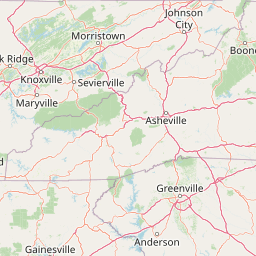
Map view of Nantahala National Forest

Use this park location map to pinpoint Nantahala National Forest in United States of America, understand its exact geographic position, and read its mapped placement within the surrounding landscape more clearly.

Pigeon | © OpenStreetMap contributors

Location context for Nantahala National Forest

North Carolina
Natural feature types

Explore the Topographic and Natural Features of Nantahala National Forest

Access the MoriAtlas index of named mountains, river systems, and geological features within Nantahala National Forest. Use this collection to map the diverse terrain of the southern Appalachians and gain a deeper understanding of the region's complex natural landscape boundaries.
Recorded earthquake history

Explore Historical Earthquake Records for Nantahala National Forest

Browse the documented seismic history associated with Nantahala National Forest through this curated record of past events. Provided by MoriAtlas, this data collection offers insights into regional earthquake occurrences, magnitudes, and epicentre locations for the mountains and valleys of western North Carolina.

Nantahala National Forest Earthquake History

Catalogued events

42 events

Strongest magnitude

Magnitude 4.7

Most recent event

May 10, 2025

This history includes earthquakes recorded inside the park or within 50 km of its borders

Explore protected area views, river gorges, and temperate rainforest habitats.

Nantahala National Forest Photos and Scenery: Visualizing Mountain Landscapes

Visual documentation captures the rugged mountain terrain, deep river gorges, and temperate rainforest habitats spanning Nantahala National Forest. Studying these protected area views reveals the distinct ecological character and forested topography defining the southern Appalachian landscape.

A small, rocky mountain stream flows through a dense, sun-dappled hardwood forest with light rays piercing the canopy.

A brown wooden entrance sign with yellow lettering reading Nantahala National Forest, mounted on a stone base, situated in a forested area.

A black and white photograph showing a man in a suit and fedora standing next to a weathered wooden sign labeled Snowbird Picnic Area, Developed and maintained by Nantahala National Forest, featuring a US Forest Service shield logo.

A multi-tiered waterfall cascading down dark rocky ledges, surrounded by dense trees with autumn foliage in shades of gold, orange, and red.

Close-up view of the thick, textured trunks of massive old-growth trees in a lush, green deciduous forest.

Park atlas

Compare adjacent southern Appalachian wilderness areas and regional mountain terrain.

Other Parks Near Nantahala National Forest and Surrounding Protected Areas

Browse nearby national forests and protected landscapes sharing the rugged topography of Nantahala National Forest. This regional comparison connects visitors to surrounding mountain reserves and river gorge ecosystems across the southern Appalachians.
A soft watercolor illustration depicting a winding river, a small waterfall over layered rocks, and distant rolling mountains in muted green, blue, and brown tones.
Wildlife reserveUnited States of America
Park boundaries overlap#1 closest

Southeast

Ellicott Rock Wilderness: Geographic and Historic Protected Landscape Overview

A rare tri-state wilderness in the Southern Appalachian Mountains

Discover the mapped terrain of Ellicott Rock Wilderness, a protected area defined by its steep river gorges, dense cove forests, and unique position at the tripoint of three U.S. states. This wilderness area preserves the Chattooga River corridor and historic survey landmarks within the southern Blue Ridge Mountains, offering deep insight into the regional geography of the American southeast.

Area
33.48 km²
Established
1975
IUCN
Ib
Relief
Mountain
A horizontal watercolor painting showing a soft, impressionistic landscape with mature trees in the foreground, rolling green hills in the midground, and faded purple mountain silhouettes in the distance against a white background.
Wildlife reserveNorth Carolina
Park boundaries overlap#2 closest

West

Joyce Kilmer-Slickrock Wilderness: Mapped Topography and Protected Forest Boundaries

Old-growth Appalachian wilderness in North Carolina

Analyze the dramatic valley-and-ridge geography of the Joyce Kilmer-Slickrock Wilderness. This protected area, encompassing the rare Joyce Kilmer Memorial Forest, serves as a vital reference for eastern forest conservation, featuring ancient hardwood groves and sweeping mountain vistas across the Unicoi range.

Area
70 km²
Established
1975
IUCN
Ib
Relief
Mountain
Watercolor painting of a winding trail through grassy hills with mountains in the background, using a soft pastel color palette of greens, purples, and yellows.
Protected landscapeNorth Carolina
Park boundaries overlap#3 closest

East

Pisgah National Forest: Protected Appalachian Mountain Geography and Regional Mapping

An extensive mountain forest in western North Carolina

Pisgah National Forest represents a major protected landscape in the southern Appalachian Mountains of North Carolina. Its diverse terrain includes high peaks above 6,000 feet, dense hardwood forests, and deep river gorges. Recognized as a historic center for professional forestry, the area protects extensive watersheds and wilderness zones, offering a detailed case study in Appalachian geography, conservation science, and rugged mountain topography.

Area
2,075.06 km²
Established
1916
Relief
Mountain
Climate
Temperate
Protected landscapeSouth Carolina
Park boundaries overlap#4 closest

East

Sumter National Forest: Mapping Protected Landscapes and Terrain in South Carolina

Bridging Piedmont forests and Appalachian mountain foothills

Sumter National Forest offers a study in geographic contrast, as its three districts span the transition from South Carolina Piedmont ridges to the rugged spurs of the Blue Ridge Mountains. This protected area features the Chattooga Wild and Scenic River corridor, expansive hardwood-conifer mosaics, and complex mountain watersheds. The forest provides a window into regional land restoration, where reclaimed farmland and mountain ridges now form a continuous network of protected natural terrain.

Area
1,500.98 km²
Established
1936
Relief
Mixed relief
Climate
Temperate
National parkTennessee
0.1 km away#5 closest

North

Great Smoky Mountains National Park: Exploring Its Protected Landscape and Regional Geography

Tennessee's premier national park, mapped for landscape discovery.

Delve into the protected area identity of Great Smoky Mountains National Park, a significant natural landmark within Tennessee. This page provides detailed context on its mountainous terrain, mapped ecological zones, and its foundational role in the broader geography of eastern North America. Understanding the park's specific protected landscape features and its geographic setting is essential for appreciating its unique conservation value.

Area
2,114.15 km²
Established
1934
IUCN
II
Visitors
12.2M annual
A pale, abstract watercolor painting depicting gentle, tree-covered mountain ridges against a white background.
Wildlife reserveNorth Carolina
0.2 km away#6 closest

East

Middle Prong Wilderness: High-Elevation Appalachian Forest and Watershed Geography

Rugged ridges and headwaters in the Pisgah National Forest

Middle Prong Wilderness encompasses nearly 7,900 acres of protected southern Appalachian terrain. This rugged landscape, ranging from deep valley floors to wind-swept high-elevation ridges, serves as a vital protected corridor adjacent to Shining Rock Wilderness, showcasing a complex mosaic of hardwood and spruce-fir forest ecosystems within the Blue Ridge Mountains.

Area
32 km²
Established
1984
IUCN
Ib
Relief
Mountain
Wildlife reserveTennessee
18 km away#7 closest

West

Gee Creek Wilderness: Geographic Atlas of an Appalachian Forested Wildlife Reserve

Protected mountain terrain in the Tennessee foothills

Gee Creek Wilderness is a federally protected area in southeastern Tennessee characterized by its small, roadless footprint and rich Appalachian forest composition. The reserve showcases the dramatic intersection of forested ridgelines and stream-carved valleys, providing a concentrated look at the ecological character of the Cherokee National Forest's lower Appalachian zone.

Area
10.09 km²
Established
1975
IUCN
Ib
Relief
Upland
A pale, minimalist watercolor painting showing layers of soft green hills and a gentle stream against a white background.
Wildlife reserveGeorgia
29 km away#8 closest

Southwest

Raven Cliffs Wilderness: Exploring the Appalachian Ridges and Protected Forest Landscapes

High-elevation wilderness area in northern Georgia.

Spanning steep ridges and narrow valleys, Raven Cliffs Wilderness represents a significant protected area within the Chattahoochee National Forest. The landscape transitions from high, exposed ridgelines to dense hardwood forest, offering a compact yet varied study in Appalachian mountain geography.

Area
36.89 km²
Established
1986
IUCN
Ib
Relief
Mountain

Common questions about visiting, size, designation, and location context for Nantahala National Forest

Nantahala National Forest FAQs for park facts, access, geography, and protected area context

Find quick answers about Nantahala National Forest, including protected-area facts, park geography, trail and visitor context, and how the park fits into its surrounding country and regional landscape.
MoriAtlas Explorer

Continue Your Protected Areas Search Across the Global Atlas

Deepen your exploration by continuing the structured search for national parks and protected areas worldwide. Utilize the comprehensive filtering capabilities to compare different conservation landscapes and refine your understanding of global park geography. Discover more about the distribution and characteristics of protected natural areas.

Global natural geography