Mori Atlas logo
Marine protected areaNational Marine Sanctuary of American Samoa

Discover the mapped marine protected landscape of this key protected area within American Samoa.

National Marine Sanctuary of American Samoa: Marine Protected Area Geography and Boundaries

The National Marine Sanctuary of American Samoa represents a vital marine protected area, offering a unique lens through which to explore the geography and protected natural landscapes of American Samoa. Situated within the Polynesian subregion of Oceania, this sanctuary's mapped boundaries define a significant marine territory vital for understanding regional conservation and landscape context. Delve into its specific geographic setting and protected-area identity within the South Pacific.

Marine Protected AreaCoral ReefsTropical Marine EcosystemWhale MigrationSea Turtle HabitatDeep Water Reef

National Marine Sanctuary of American Samoa

Marine protected area

Park overview

Structured park overview, official facts, and landscape profile for National Marine Sanctuary of American Samoa

National Marine Sanctuary of American Samoa park facts, protected area profile, and essential visitor context
Review the core facts for National Marine Sanctuary of American Samoa, including designation, size, terrain, visitor scale, habitats, and operating context in one park-focused overview.

About National Marine Sanctuary of American Samoa

The National Marine Sanctuary of American Samoa represents a unique ecological and cultural treasure within the U.S. protected areas network. As the largest and most remote marine sanctuary in the National Marine Sanctuary system, it stretches across a vast expanse of the South Pacific, encompassing multiple islands and marine environments that together form one of the world's most biodiverse marine regions. The sanctuary was originally established in 1986 at Fagatele Bay on Tutuila Island in response to devastating coral reef damage caused by a crown-of-thorns starfish outbreak in the late 1970s. This event, which destroyed more than 90 percent of living corals on Tutuila's reefs, prompted the American Samoa Government to propose formal protection of the area. The sanctuary was significantly expanded in 2012 to include additional protected zones at Fagalua/Fogama'a, Aunu'u Island, Ta'ū Island, Swains Island, Rose Atoll, and the Vailulu'u Seamount, transforming it into a comprehensive archipelago-wide marine protected area.

Quick facts and research context for National Marine Sanctuary of American Samoa

The sanctuary covers roughly 13,581 square miles across six distinct protected areas in American Samoa, making it the largest marine sanctuary in the U.S. system. It was originally designated as Fagatele Bay National Marine Sanctuary in 1986 and expanded to its current configuration in 2012. The territory lies midway between Hawaii and New Zealand in the South Pacific. The sanctuary is notable for containing the world's largest known coral, nicknamed Big Momma, a Porites lobata colony estimated at over 500 years old.

Park context

Deeper park guide and search-rich context for National Marine Sanctuary of American Samoa

National Marine Sanctuary of American Samoa history, landscape, wildlife, and travel context
Explore National Marine Sanctuary of American Samoa through its history, landscape character, ecosystems, wildlife, conservation priorities, cultural context, and seasonal travel timing in a structured park guide built for atlas discovery and search intent.

Why National Marine Sanctuary of American Samoa stands out

The National Marine Sanctuary of American Samoa is distinguished by its exceptional marine biodiversity, representing the greatest concentration of aquatic species of all marine sanctuaries in the U.S. system. It protects some of the world's oldest Porites coral heads, including the famous Big Momma coral, which stands 21 feet tall and spans 134 feet in circumference at over 500 years old. The sanctuary encompasses diverse marine environments including fringing coral reefs, deep-water reefs, and hydrothermal vent communities. During the humpback whale migration season from June to September, southern humpback whales travel from Antarctica to calve and court in Samoan waters, offering visitors the rare opportunity to hear the distinctive whale songs of courting males.

National Marine Sanctuary of American Samoa history and protected-area timeline

The National Marine Sanctuary of American Samoa traces its origins to the devastating crown-of-thorns starfish (alamea) outbreak of the late 1970s, when millions of these coral-eating starfish consumed their way through Tutuila's reefs, destroying more than 90 percent of all living corals. This ecological catastrophe prompted the American Samoa Government to propose the establishment of a marine sanctuary to the National Marine Sanctuary Program. On April 29, 1986, Fagatele Bay National Marine Sanctuary was officially designated as the first tropical marine sanctuary in the U.S. system. The original protected area encompassed just the Fagatele Bay portion, a 0.25-square-mile zone formed within an eroded volcanic crater on Tutuila. In 2012, the sanctuary was significantly expanded to include additional areas across the American Samoa archipelago, and its name was changed to reflect its broader geographic scope. The expansion added protection for Rose Atoll, Ta'ū Island, Swains Island, and the Vailulu'u Seamount, establishing the sanctuary as the largest in the National Marine Sanctuary system.

National Marine Sanctuary of American Samoa landscape and geographic character

The National Marine Sanctuary of American Samoa encompasses a remarkable variety of marine landscapes across the American Samoa archipelago. The Fagatele Bay portion sits within a collapsed volcanic crater, creating a naturally enclosed marine environment with dramatic surrounding terrain. The surrounding watershed remains largely undeveloped, with local families having inhabited these slopes for thousands of years. The sanctuary includes coastal fringing reef systems, deep-water reef environments, and the submerged volcanic formation of Vailulu'u Seamount. Rose Atoll represents a distinct coral atoll environment, while the outer islands feature diverse coastal and reef formations. The landscape transitions from the steep volcanic peaks of the main islands to the relatively flat coral formations of the atolls, creating a mosaic of marine habitats that support exceptional biodiversity.

National Marine Sanctuary of American Samoa ecosystems, habitats, and plant life

The sanctuary protects a remarkable range of tropical marine ecosystems and habitats. The fringing coral reef ecosystem within Fagatele Bay represents a vibrant tropical marine environment teeming with biodiversity. Beyond the shallow reef systems, the sanctuary encompasses deep-water reefs and unique hydrothermal vent communities that support specialized organisms. The marine environment includes diverse habitats from coastal reef zones to open ocean waters surrounding the islands. The sanctuary is distinguished as the only true tropical reef ecosystem within the National Marine Sanctuary program, and it is considered the most biodiverse of all U.S. marine sanctuaries. The waters support extensive coral communities, including some of the oldest Porites coral heads on Earth, representing centuries of continuous reef growth.

National Marine Sanctuary of American Samoa wildlife and species highlights

The National Marine Sanctuary of American Samoa supports an extraordinary diversity of marine species. The coral reef ecosystems host numerous fish species including parrot fish, damselfish, and butterfly fish, alongside invertebrates such as lobster, crabs, and octopus. Sharks patrol the reef environments, while larger marine mammals frequent the waters during seasonal migrations. From June through September, southern humpback whales migrate from Antarctica to Samoan waters to calve and court, with males producing distinctive whale songs thought to attract mates. Several dolphin species including common dolphins, bottlenose dolphins, and spinner dolphins inhabit the sanctuary waters. Endangered sea turtles, particularly hawksbill and green sea turtles, are commonly seen throughout the sanctuary. The reef systems also support various starfish species, including the crown-of-thorns starfish that previously caused significant coral damage.

National Marine Sanctuary of American Samoa conservation status and protection priorities

The sanctuary faces significant conservation challenges from climate change impacts. Ocean acidification, which has increased ocean acidity by 30 percent since 1750, threatens reef consolidation by impacting crustose coralline algae that cement reefs together. Rising water temperatures, with American Samoa waters having warmed 1.8 degrees Fahrenheit over the past 30 years, have triggered multiple coral bleaching events, with six mass bleaching events occurring between 1994 and 2020. Projections indicate yearly bleaching events could occur by 2040. The NOAA Ocean Acidification Program installed a monitoring buoy in Fagatele Bay in 2019 to track real-time environmental parameters. Conservation measures include crown-of-thorns sea star population control through ox bile injections, and a coral nursery project initiated in 2020 to support potential reef restoration efforts.

National Marine Sanctuary of American Samoa cultural meaning and human context

The National Marine Sanctuary of American Samoa exists within a region of deep cultural significance to the Samoan people. The land surrounding Fagatele Bay has been held by local families for thousands of years, and traditional stewardship practices have helped maintain relatively undeveloped watershed conditions. The sanctuary operates through a cooperative agreement between NOAA and the American Samoa Government's Economic Development Planning Office, with staff based in Pago Pago. The sanctuary emphasizes integration of traditional Samoan cultural knowledge with scientific education, incorporating cultural events and community outreach into its programming. Traditional fishing methods remain permitted within the inner bay, reflecting the ongoing relationship between the local community and the marine environment.

Top sights and standout views in National Marine Sanctuary of American Samoa

The sanctuary's most famous feature is Big Momma, the world's largest known coral, a Porites lobata colony in the Valley of Giants measuring 21 feet tall with a 134-foot circumference and estimated at over 500 years old. The sanctuary represents the only tropical reef in the National Marine Sanctuary program and contains the greatest biodiversity of aquatic species of all U.S. marine sanctuaries. Visitors can experience world-class diving and snorkeling amid pristine coral reefs, observe seasonal humpback whale migrations, and encounter endangered sea turtles. The Tauese P.F. Sunia Ocean Center on Tutuila provides educational exhibits and serves as the sanctuary's visitor center, offering programs for all ages including the EnviroDiscoveries Camp for children.

Best time to visit National Marine Sanctuary of American Samoa

The National Marine Sanctuary of American Samoa can be visited year-round, though certain seasons offer distinctive experiences. The period from June to September brings the southern humpback whale migration, when pregnant females and courting males arrive in Samoan waters, creating exceptional opportunities for whale watching and underwater listening to whale songs. This season also offers generally favorable weather conditions for water activities. The summer months support the sanctuary's environmental education programs, including camps for children. Water visibility for diving and snorkeling is typically best during the calmer dry season, though conditions can vary. Visitors interested in experiencing the full range of marine life should consider the whale migration season, while those prioritizing reef exploration may find the transitional periods between seasons equally rewarding.

Park location guide

Geography guide, regional context, and park location map for National Marine Sanctuary of American Samoa

National Marine Sanctuary of American Samoa park geography, regions, and map view in American Samoa
Understand where National Marine Sanctuary of American Samoa sits in American Samoa through a broader geographic reading of the surrounding landscape, nearby location context, and its mapped position within the national park landscape.

How National Marine Sanctuary of American Samoa fits into American Samoa

American Samoa is an unincorporated U.S. territory in the South Pacific, positioned in the Polynesian subregion of Oceania. The territory comprises the eastern part of the Samoan archipelago, including the main island of Tutuila, the Manu'a islands (Ofu, Olosega, Ta'ū), Rose Atoll, and Swains Island. Pago Pago serves as the capital, with Fagatogo as the government seat. The territory is the southernmost U.S. territory and one of only two U.S. territories south of the Equator.

Wider geography shaping National Marine Sanctuary of American Samoa in American Samoa

American Samoa is located at approximately 14.3°S, 170.7°W in the South Pacific Ocean. It sits about 40 miles southeast of the independent nation of Samoa, east of the International Date Line, north of Tonga, and west of the Cook Islands. The territory is approximately 2,200 miles southwest of Hawaii. The main island is Tutuila, with the Manu'a islands (Ofu, Olosega, Ta'ū) located to the east.

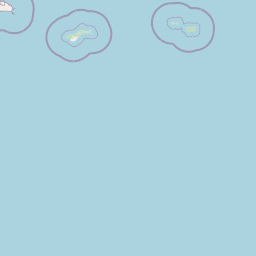
Map view of National Marine Sanctuary of American Samoa

Use this park location map to pinpoint National Marine Sanctuary of American Samoa in American Samoa, understand its exact geographic position, and read its mapped placement within the surrounding landscape more clearly.

Pigeon | © OpenStreetMap contributors
Park atlas

Map marine and island protected areas, comparing their geographic spread across the American Samoa archipelago.

Discover Related Protected Areas Near National Marine Sanctuary of American Samoa
After exploring National Marine Sanctuary of American Samoa, continue discovering other national parks and protected areas with similar marine or island landscapes across the Pacific. Compare these distinct conservation regions to understand the broader geographic context and the varied protected ecosystems surrounding American Samoa.
National parkUnited States of America

National Park of American Samoa: A Mapped Protected Landscape within the USA

Discover its island geography and protected area context.

National Park of American Samoa stands as a significant protected natural area, offering unique insights into island geography and conservation landscapes. Explore its detailed mapped boundaries and understand its placement within the broader atlas of United States of America protected lands. This entity provides a focal point for understanding distinct geographic features and the territorial spread of protected natural resources.

Area
33.414 km²
Established
1988
IUCN
V
Visitors
12.1K annual
National parkSamoa

O Le Pupu-Puʿe National Park: Explore Samoa's Protected National Park Geography and Boundaries

Mapped terrain and protected landscape context for this Samoan national park.

Understand O Le Pupu-Puʿe National Park as a significant protected area within Samoa's archipelago. This detail entry provides essential geographic context, mapping its boundaries and situating it within the nation's protected lands. Explore the park's role as a national park and its contribution to the mapped natural landscape of Samoa.

Area
50.2 km²
Established
1978
IUCN
II
Relief
Mixed relief
National parkUpolu

Lake Lanoto'o National Park: Discover Its Protected Landscape and Geographic Setting on Upolu

Explore park boundaries and regional natural terrain.

Lake Lanoto'o National Park represents a crucial protected area on the island of Upolu, Samoa. This page provides detailed geographic information, focusing on the park's mapped boundaries and its contribution to the natural landscape of the region. Understand its role as a national park and its position within the broader atlas of protected lands, offering insight into the island's unique geography.

Area
4.7 km²
Established
2003
IUCN
II
Relief
Highland
National parkAustralia

Norfolk Island National Park: Australian National Park Protected Landscape and Geography

Mapped Boundaries and Natural Terrain Exploration

Delve into the specifics of Norfolk Island National Park, a key protected area contributing to Australia's national park geography. This resource focuses on its mapped boundaries and the distinct natural landscape it encompasses, offering valuable context for understanding its place within a broader geographic atlas. Investigate the terrain and conservation context of this unique Australian national park.

Area
6.5 km²
Established
1984
IUCN
II
Relief
Mountain
National parkNew Zealand

Tongariro National Park: New Zealand's Premier Volcanic National Park Atlas

Explore mapped terrain, active volcanoes, and unique dual World Heritage values.

Tongariro National Park, situated in New Zealand's North Island, is a globally significant protected area celebrated for its dramatic volcanic landscapes and profound cultural heritage. As the nation's oldest national park, it features three active volcanoes: Mount Ruapehu, Mount Ngauruhoe, and Mount Tongariro, set within a diverse terrain that includes forests, alpine zones, and the Rangipo Desert. Its dual World Heritage status underscores its importance for both natural attributes and its sacred cultural landscape, offering rich opportunities for geographic and atlas exploration.

Area
795.96 km²
Established
1887
IUCN
II
Relief
Mountain
National park

Whanganui National Park: Protected Wilderness Landscape and Geographic Context

Explore the mapped boundaries and natural terrain of this national park.

Whanganui National Park offers a unique blend of natural wilderness and significant cultural history, centered on the Whanganui River valley. This protected area safeguards one of New Zealand's most extensive lowland forest ecosystems, providing vital habitat and showcasing a landscape deeply intertwined with Māori traditions and historical settlement. Understanding its geographical setting and mapped protected boundaries reveals its importance as a distinct national park.

Area
742 km²
Established
1986
IUCN
II
Relief
Lowland
National parkNew Zealand

Egmont National Park: New Zealand's Distinctive Volcanic National Park

Explore the mapped volcanic terrain and protected landscape of Mount Taranaki.

Egmont National Park represents a significant protected area within New Zealand's North Island, dominated by the iconic stratovolcano, Mount Taranaki. This national park is celebrated for its distinct circular protected boundary, a unique feature against the surrounding pastoral farmlands, and its dramatic volcanic landscape. Visitors can explore a range of natural habitats from dense temperate rainforests to alpine environments, all mapped within this significant conservation landmark.

Area
341.7 km²
Established
1900
IUCN
II
Visitors
400K annual
National parkTasman District

Abel Tasman National Park: Coastal Protected Landscape and Mapped Geography in Tasman District

New Zealand's smallest national park offering iconic coastal hiking and wildlife.

Delve into the mapped boundaries and unique geography of Abel Tasman National Park, New Zealand's smallest national park located in the Tasman District. This protected landscape features renowned golden beaches, forested hills, and vital island ecosystems. Explore its coastal trails, understand its ecological restoration context, and appreciate its historical significance as a site of early European and Māori interaction, making it a key destination for atlas-driven geographic discovery.

Area
237.1 km²
Established
1942
IUCN
II
Relief
Upland

Common questions about visiting, size, designation, and location context for National Marine Sanctuary of American Samoa

National Marine Sanctuary of American Samoa FAQs for park facts, access, geography, and protected area context
Find quick answers about National Marine Sanctuary of American Samoa, including protected-area facts, park geography, trail and visitor context, and how the park fits into its surrounding country and regional landscape.
MoriAtlas Explorer

Continue Your Protected Areas Search Across the Global Atlas

Deepen your exploration by continuing the structured search for national parks and protected areas worldwide. Utilize the comprehensive filtering capabilities to compare different conservation landscapes and refine your understanding of global park geography. Discover more about the distribution and characteristics of protected natural areas.

Global natural geography