
Mori Atlas logo
Protected landscapeNaturpark Maas-Schwalm-Nette

Analyzing the geographic character of river valleys, peat lakes, and border forest ecosystems

Naturpark Maas-Schwalm-Nette: A Mapped Exploration of Transboundary Protected Landscapes

Naturpark Maas-Schwalm-Nette functions as a vast transboundary protected landscape reaching across Germany and the Netherlands. This regional geography is defined by the converging river valleys of the Maas, Schwalm, and Nette, which collectively shape the low-lying terrain into a complex mosaic of wetlands, heath, and woodland. Beyond these primary waterways, the landscape features historical peat-cut lakes and expansive border forests that support diverse natural habitats. The area serves as a significant conservation network, linking unique environmental zones such as the Krickenbecker Seen and the Kaldenkirchener Grenzwald.

cross-border nature parkLower Rhineriver valleyswetlandspeat lakesjuniper heath
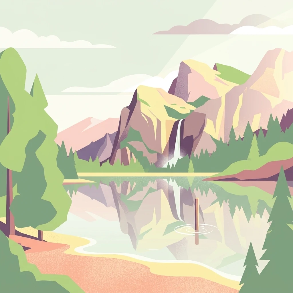
A minimalist flat illustration showing a calm lake reflecting rugged mountains and a small waterfall, with pine trees in the foreground and light clouds in the sky.

Naturpark Maas-Schwalm-Nette

Protected landscape

Park overview

Structured park overview, official facts, and landscape profile for Naturpark Maas-Schwalm-Nette

Naturpark Maas-Schwalm-Nette park facts, protected area profile, and essential visitor context

Review the core facts for Naturpark Maas-Schwalm-Nette, including designation, size, terrain, visitor scale, habitats, and operating context in one park-focused overview.

About Naturpark Maas-Schwalm-Nette

Naturpark Maas-Schwalm-Nette is one of the larger cross-border nature parks in northwestern Europe, stretching across a broad swathe of the Lower Rhine region in Germany and the southern Dutch province of Limburg. It was established in 2002 as a joint initiative that also absorbed the older German Naturpark Schwalm-Nette, founded in 1965, giving the new park a foundation of several decades of regional conservation work and landscape planning. Today the park covers roughly 870 square kilometers and functions as both a protected landscape and a regional recreation area.

Geographically, the park unites three river systems, the Maas, the Schwalm, and the Nette, whose valleys provide much of the structural and visual identity of the area. The German side of the park falls within the districts of Kleve, Viersen, and Heinsberg, along with the city of Mönchengladbach, while the Dutch side includes the municipalities of Roermond, Roerdalen, Venlo, Echt-Susteren, Leudal, and Maasgouw. This makes the park a genuinely transboundary landscape where natural and cultural features of the Lower Rhine meet those of the Dutch Maasland.

Ecologically, the park contains a striking variety of habitats for what is essentially a lowland region. The Krickenbecker Seen are a cluster of lakes formed by historical peat cutting, and the surrounding wetlands form one of its most distinctive conservation zones. In the municipality of Niederkrüchten lies the only juniper heath (Wacholderheide) of the Lower Rhine area, set within the Elmpter Schwalmbruch, while the Kaldenkirchener Grenzwald on the German side hosts the Sequoiafarm arboretum and a geo-hydrological water garden. On the Dutch side, the well-known Meinweg area connects the park with adjacent protected landscapes.

Culturally and educationally, the park has developed an extensive network of visitor and information centers: twenty-one in total, spread across both countries. These centers interpret the local landscape, art, nature, cultural history, and traditional crafts, and they coordinate a program of excursions and activities that serves both local residents and visitors. Museums such as the Lower Rhine Open-Air Museum at Grefrath, the textile museum in Nettetal-Hombergen, the Jagd- und Naturkundemuseum at Burg Brüggen, the flax museum at Beeck, and various Dutch institutions like the ceramic center at Tegelen and the regional museum at Roermond add a strong cultural layer to the natural park.

Quick facts and research context for Naturpark Maas-Schwalm-Nette

Naturpark Maas-Schwalm-Nette is a cross-border nature park located in the Lower Rhine region of Germany and the adjacent Limburg area of the Netherlands. Established in 2002, it covers approximately 870 square kilometers, incorporating the earlier German Naturpark Schwalm-Nette founded in 1965. The park is named after the Maas, Schwalm, and Nette rivers and stretches across several districts and municipalities on both sides of the border.

Protection and recognition

Examining terrestrial protection metrics and administrative recognition scope

Naturpark Maas-Schwalm-Nette Protection Status and Transboundary Geography

Documented protection status and transboundary characteristics define the conservation profile of Naturpark Maas-Schwalm-Nette across its regional landscape. Structured records outline the territorial scope and designation framework supporting this protected area.

Protection details

Protection scope
Terrestrial
Transboundary protection
Yes
Park context

Deeper park guide and search-rich context for Naturpark Maas-Schwalm-Nette

Naturpark Maas-Schwalm-Nette history, landscape, wildlife, and travel context

Explore Naturpark Maas-Schwalm-Nette through its history, landscape character, ecosystems, wildlife, conservation priorities, cultural context, and seasonal travel timing in a structured park guide built for atlas discovery and search intent.

Why Naturpark Maas-Schwalm-Nette stands out

The park is best known for its combination of three river landscapes, including the Maas, Schwalm, and Nette, and for its distinctive ecological features such as the Krickenbecker Seen peat lakes, the juniper heath in the Elmpter Schwalmbruch area, and the Kaldenkirchener Grenzwald with the Sequoiafarm arboretum. It is also recognized for its cross-border character, linking protected landscapes, cultural heritage sites, and a dense network of visitor centers across Germany and the Netherlands.
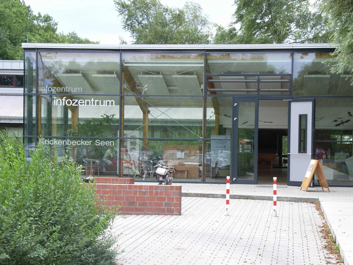
Modern glass-fronted visitor information center building with white text on windows and a red brick wall in the foreground.
The visitor information center for the Krickenbecker Seen area within the Naturpark Maas-Schwalm-Nette.

Naturpark Maas-Schwalm-Nette history and protected-area timeline

The Naturpark Maas-Schwalm-Nette traces its institutional origins to 2002, when it was founded as a cross-border nature park linking areas of western Germany and the southeastern Netherlands. Importantly, it did not start from scratch: its German portion was built on the earlier Naturpark Schwalm-Nette, which had been established in 1965 and over decades had developed its own network of protected sites, visitor facilities, and conservation programs. Through the 2002 foundation, that older park was integrated into the new larger, transboundary entity, and the Naturpark Schwalm-Nette effectively became part of the Maas-Schwalm-Nette landscape.

The choice of the new name reflects the geographic ambition of the project, drawing together the Maas, Schwalm, and Nette river systems into a single regional identity. From the beginning, the park was designed to function as a recreation area as well as a conservation framework, and the development of a network of visitor and information centers formed a central part of its mission. Over time, the park has also had to respond to external pressures on its environment, particularly the influence of open-cast lignite mining south of Mönchengladbach on the regional water balance, an issue that became more pressing as the Garzweiler II mining area gradually expanded toward the city and the park's territory.

Naturpark Maas-Schwalm-Nette landscape and geographic character

The landscape of Naturpark Maas-Schwalm-Nette is shaped by three converging river systems, the Maas, the Schwalm, and the Nette, whose valleys and floodplains provide the structural framework of the park. The terrain is generally lowland in character, lying within the Lower Rhine region in Germany and the Maasland area in the Netherlands, but it contains a surprising variety of landforms including wetlands, heathland, deciduous and mixed forests, and historically managed peat landscapes.

Notable landscape features include the Krickenbecker Seen, a group of lakes formed by centuries of peat cutting, and the Elmpter Schwalmbruch, a wetland area that surrounds the only juniper heath of the Lower Rhine, near Niederkrüchten. Along the German-Dutch border, the Kaldenkirchener Grenzwald forms a quiet forested zone that includes the Sequoiafarm arboretum, a remarkable plantation of giant sequoias and other exotic tree species. On the Dutch side, the park connects with the rolling, partly elevated terrain around the Meinweg, providing additional scenic variety. The mosaic of rivers, lakes, heath, and forest makes the park visually diverse despite its predominantly gentle topography.
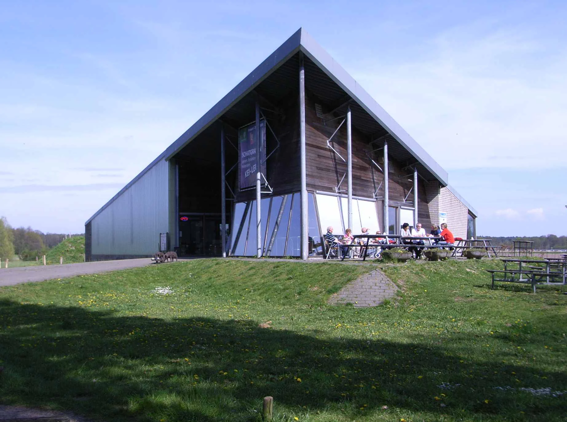
A modern visitor center building with a large triangular roof and glass facade situated in a grassy park setting, with people sitting at outdoor picnic tables.
The De Meinweg visitor center, a modern facility serving the Naturpark Maas-Schwalm-Nette.

Naturpark Maas-Schwalm-Nette ecosystems, habitats, and plant life

Naturpark Maas-Schwalm-Nette preserves a varied mosaic of lowland habitats typical of the border region between the Lower Rhine and the southern Netherlands. Wetland complexes, including the Krickenbecker Seen and the Elmpter Schwalmbruch, anchor the park ecologically, combining open water, reed beds, wet grasslands, and peat-influenced soils. These areas support distinctive plant communities and provide important refuges for wetland-dependent species.

Dry open habitats are represented by the juniper heath near Niederkrüchten, a rare habitat type within the Lower Rhine, while forests range from native deciduous and mixed woodland to the more unusual Sequoiafarm arboretum at Kaldenkirchen, where introduced conifers such as giant sequoia grow alongside native tree species. The Dutch portion contributes additional heath, woodland, and Maas valley landscapes, linking the park ecologically with the broader Dutch nature network, including the Meinweg area. The combination of rivers, lakes, heath, woodland, and small-scale agricultural land creates transitional habitats that are often richer in biodiversity than any single habitat type alone.
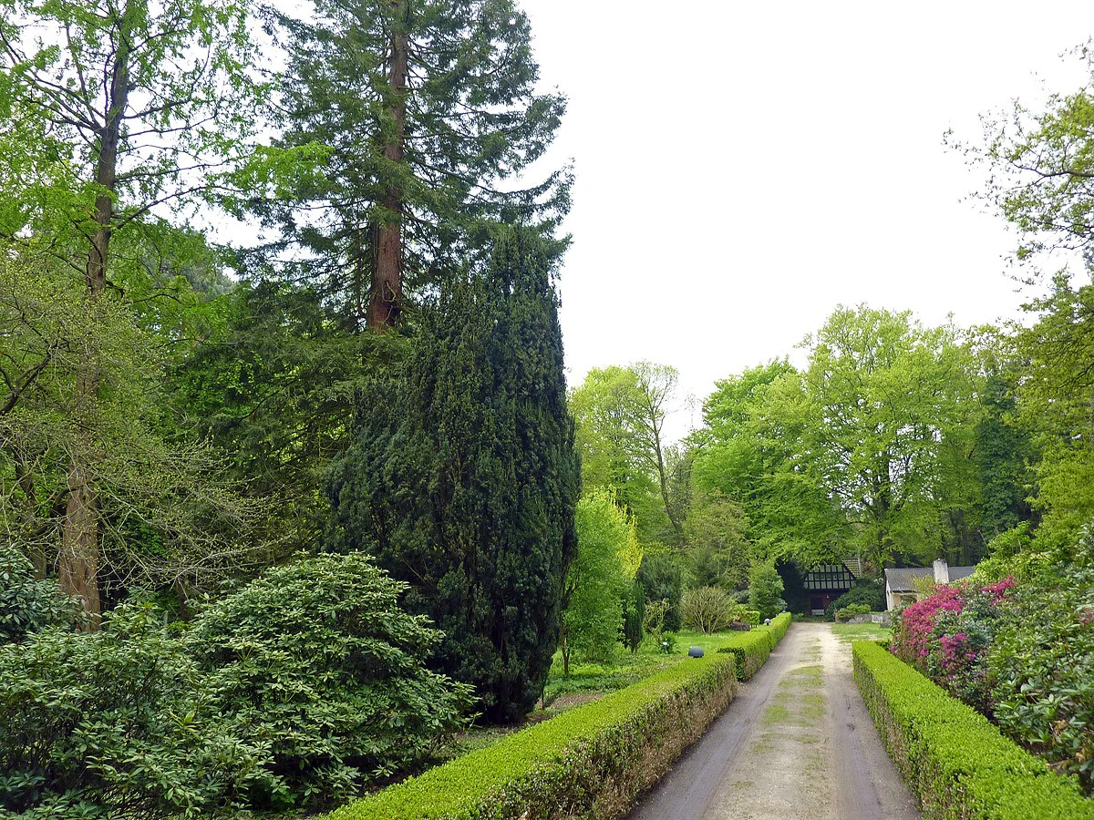
A gravel path leads into a lush, green arboretum lined with manicured hedges, mature coniferous trees, and flowering shrubs.
The entrance area of Sequoiafarm Kaldenkirchen within Naturpark Maas-Schwalm-Nette.

Naturpark Maas-Schwalm-Nette wildlife and species highlights

The park's combination of wetlands, heathland, forests, and river valleys supports a wide range of typical Lower Rhine and southern Dutch fauna. Wetland complexes such as the Krickenbecker Seen and the Elmpter Schwalmbruch are particularly important for waterbirds, amphibians, and insects associated with open water and reed environments. The juniper heath near Niederkrüchten provides habitat for species adapted to dry, open conditions, including specialized invertebrates and ground-nesting birds.

Forests such as the Kaldenkirchener Grenzwald and the wooded Dutch portions of the park offer habitat for typical woodland birds, small mammals, and bats, while the river valleys of the Maas, Schwalm, and Nette contribute freshwater aquatic life and riparian species. Although specific large mammal populations are not the focus of the park, the mosaic of habitats supports the kind of ecological diversity that characterizes well-connected cross-border nature parks in this part of Europe.
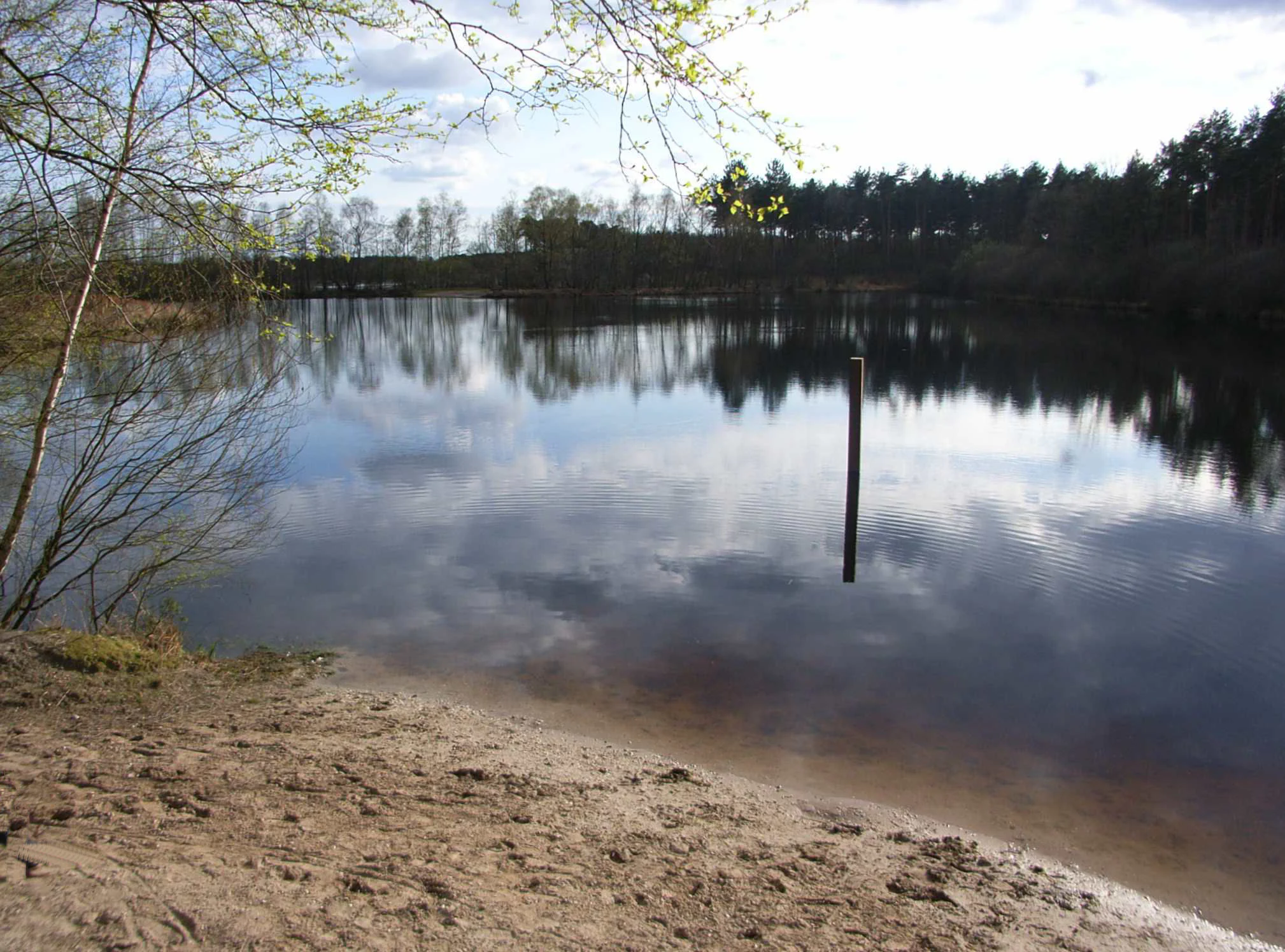
A calm lake reflecting the sky and surrounding trees, with a sandy shoreline in the foreground and a single post sticking out of the water.
The quiet waters of Melickerven lake, surrounded by forest in the Elmpter Wald area.

Naturpark Maas-Schwalm-Nette conservation status and protection priorities

Naturpark Maas-Schwalm-Nette plays an important conservation role by coordinating landscape protection across administrative boundaries in Germany and the Netherlands. Through its integrated network of protected sites, including nature reserves such as the Krickenbecker Seen, the juniper heath at Elmpter Schwalmbruch, and the Kaldenkirchener Grenzwald, the park helps maintain habitat connectivity in a region where land use pressures are significant. The cross-border structure itself is a conservation asset, allowing coordinated management of habitats that do not respect national boundaries.

A particular conservation concern is the influence of open-cast lignite mining south of Mönchengladbach on the regional water balance. As the Garzweiler II mining area continues to expand toward the city and the park, the management of water resources and the protection of sensitive wetland and heath habitats have become central issues for the park's long-term ecological integrity. The park's institutional framework, its visitor centers, and its partnerships with conservation groups such as NABU at Nettetal and Wildenrath are key elements in monitoring and responding to these pressures.

Naturpark Maas-Schwalm-Nette cultural meaning and human context

Naturpark Maas-Schwalm-Nette reflects a long history of human interaction with the landscape, from peat cutting that created the Krickenbecker Seen to traditional agriculture, linen production, and hunting. Museums embedded in the park, including the Lower Rhine Open-Air Museum at Grefrath, the textile museum at Nettetal-Hombergen, the flax museum at Beeck near Wegberg, and the hunting and natural history museum at Burg Brüggen, help preserve and interpret this rural and craft heritage on the German side.

On the Dutch side, the cultural fabric is equally distinctive, with traditional crafts such as Tegelen ceramics highlighted at the Towana visitor and ceramic center, regional history explored at the Roerstreekmuseum in Roermond, and heritage sites such as St. Elisabethshof in Haelen anchoring local memory. The cross-border character of the park means that visitors experience a blend of Lower Rhine and Limburg cultural traditions, expressed through architecture, language patterns, foods, and local festivals, all set within a shared natural landscape.

Top sights and standout views in Naturpark Maas-Schwalm-Nette

Highlights of Naturpark Maas-Schwalm-Nette include the Krickenbecker Seen peat lakes, the juniper heath in the Elmpter Schwalmbruch, the Sequoiafarm arboretum in the Kaldenkirchener Grenzwald, and the cross-border river valleys of the Maas, Schwalm, and Nette. The park also stands out for its twenty-one visitor centers, its dense network of small museums, and its integration of the older Naturpark Schwalm-Nette into a single transboundary landscape.

Best time to visit Naturpark Maas-Schwalm-Nette

The park's lowland character means that seasonal variation is more about vegetation cycles and atmospheric conditions than about dramatic weather shifts. Spring brings lively wetland bird activity around the Krickenbecker Seen and fresh growth across forests and heath, while summer offers long days suitable for hikes, cycling routes, and visits to arboretum sites such as the Sequoiafarm. Autumn highlights the heath and forest landscapes in warmer colors and quieter trails, and winter periods can provide peaceful conditions for walking and observation, though visitors should plan according to local conditions and seasonal center opening hours.

Monthly climate preview

Long-term temperature ranges and monthly precipitation averages for Germany

Naturpark Maas-Schwalm-Nette Climate Normals and Annual Weather Patterns

Naturpark Maas-Schwalm-Nette records multi-year climate measurements showing progressive temperature shifts alongside steady precipitation distribution across the representative coordinate. Examining the full monthly breakdown reveals detailed baseline records for long-term temperature trends and monthly precipitation totals.
Annual mean10 °C
2 °C19 °C
Jan
Feb
Mar
Apr10°
May14°
Jun17°
Jul19°
Aug18°
Sep15°
Oct10°
Nov
Dec
Warmest month
July

18.7 °C

Coolest month
January

1.9 °C

Wettest month
December

2.6 mm/day

Driest month
April

1.5 mm/day

Park location guide

Geography guide, regional context, and park location map for Naturpark Maas-Schwalm-Nette

Naturpark Maas-Schwalm-Nette park geography, regions, and map view in Germany

Understand where Naturpark Maas-Schwalm-Nette sits in Germany through a broader geographic reading of the surrounding landscape, nearby location context, and its mapped position within the national park landscape.

How Naturpark Maas-Schwalm-Nette fits into Germany

Germany is a federal republic in Western and Central Europe with a population of over 83 million across sixteen constituent states. It is Europe's largest economy by nominal GDP and a major global exporter and importer. The capital is Berlin, and the country borders Denmark, Poland, Czech Republic, Austria, Switzerland, France, Luxembourg, Belgium, and the Netherlands.

Wider geography shaping Naturpark Maas-Schwalm-Nette in Germany

Germany is located in Western and Central Europe, spanning 357,022 km². It borders Denmark to the north, Poland and the Czech Republic to the east, Austria and Switzerland to the south, and France, Luxembourg, Belgium, and the Netherlands to the west. The country has coastlines on the Baltic Sea and North Sea to the north, with the Alps located in the southern region.

Map view of Naturpark Maas-Schwalm-Nette

Use this park location map to pinpoint Naturpark Maas-Schwalm-Nette in Germany, understand its exact geographic position, and read its mapped placement within the surrounding landscape more clearly.

Pigeon | © OpenStreetMap contributors

Visual exploration of river valleys, wetlands, and border forests

Naturpark Maas-Schwalm-Nette Landscape Photography and Scenery

Visual records capture the distinctive river valleys, peat lakes, and protected habitats that define Naturpark Maas-Schwalm-Nette across Germany and the Netherlands. Examining terrain photography helps visitors understand the regional ecology, lowland topography, and woodland environments more clearly.

Modern glass-fronted visitor information center building with white text on windows and a red brick wall in the foreground.

A group of tall, mature giant sequoia trees with reddish-brown bark and dense green needle foliage standing in a wooded park area.

A modern visitor center building with a large triangular roof and glass facade situated in a grassy park setting, with people sitting at outdoor picnic tables.

A gravel path leads into a lush, green arboretum lined with manicured hedges, mature coniferous trees, and flowering shrubs.

A calm lake reflecting the sky and surrounding trees, with a sandy shoreline in the foreground and a single post sticking out of the water.

Park atlas

Compare cross-border river valleys, peat lakes, and neighboring lowland nature reserves.

Explore Parks Near Naturpark Maas-Schwalm-Nette and Surrounding Protected Landscapes

Browse other parks near Naturpark Maas-Schwalm-Nette to compare adjacent river valleys, border forests, and wetland reserves across the Lower Rhine region. Extending the geographic review reveals connected protected landscapes and regional conservation networks.
Watercolor painting of a soft, hazy forest landscape with a pond in the foreground.
Nature reserveNorth Rhine-Westphalia
About 1.7 km away#1 closest

Southwest

Kaldenkirchener Grenzwald Nature Reserve in North Rhine-Westphalia

Regional border forest with heath moors and rare arboretum stands

Explore the geographic character of the Kaldenkirchener Grenzwald, a significant nature reserve located in the Nettetal region. This area showcases the interplay between native sandy pine forests and protected heath moor remnants, while incorporating the unique Sequoiafarm arboretum. Gain insights into the border landscape of the Lower Rhine and the historical ecological restoration that defines this protected area within Germany.

Established
1949
Relief
Lowland
Climate
Temperate
Access
Easy access
A soft watercolor painting of a winding river surrounded by grassy plains and distant hills, rendered in pale greens and neutral tones.
Protected areaNorth Rhine-Westphalia
About 4.4 km away#2 closest

Northeast

Schwalm-Nette-Platte mit Grenzwald und Meinweg Protected Area Map and Landscape Analysis

Regional bird sanctuary and habitat mosaic in North Rhine-Westphalia

Schwalm-Nette-Platte mit Grenzwald und Meinweg encompasses roughly 77 square kilometers of varied lowland terrain, featuring pine and oak forests, dry heaths, and wetlands. This geographic overview highlights the unique arrangement of habitats that sustain significant migratory and breeding bird species across the Lower Rhine plain, providing a clear perspective on its role as a cross-border ecological site.

Area
77.22 km²
Established
1983
Watercolor painting of a landscape featuring a stream, trees, and rolling hills
National parkLimburg
About 13 km away#3 closest

South

De Meinweg National Park: Unique Terraced Landscape and Protected Area in Limburg

National Park with exceptional reptile and amphibian biodiversity.

De Meinweg National Park is a remarkable protected landscape located in the Dutch province of Limburg, distinguished by its rare terraced topography unlike any other in the Netherlands. This national park, covering 1,800 hectares, is a key component of the transboundary Grenspark Maas-Swalm-Nette, bordering Germany. Its ecological significance is underscored by its status as a Natura 2000 site, with notable biodiversity, particularly among reptiles and amphibians, and regenerating raised bogs. MoriAtlas offers a map-centric view of this unique protected area, detailing its geographic context and landscape features for structured discovery.

Area
18 km²
Established
1995
IUCN
II
Relief
Upland
Watercolor painting of a soft-focus landscape featuring gentle green hills, sparse trees, and a calm, watery foreground.
Nature reserveNorth Rhine-Westphalia
About 20 km away#4 closest

South

Helpensteiner Bachtal, oberes Schaagbachtal und Petersholz Nature Reserve Atlas

Protected lowland stream valleys and sandy heathland mosaic

Located in the town of Wegberg, this nature reserve protects a variety of habitats including swamp forests and brook-side meanders. The reserve functions as a critical protected landscape, where dry sandy ridges meet moist lowland valleys, supporting rare flora and fauna near the border. This entity provides a structured look at the terrain, ecological character, and regional importance of one of Germany's key protected land areas.

Area
6.929 km²
Established
1985
Water
Major water bodies
Watercolor painting of a lake, grassy shoreline, distant hills, and trees
National parkLimburg
About 21 km away#5 closest

North

De Maasduinen National Park: Mapping the Longest River Dune System in the Netherlands

Protected Landscape and Dune Terrain in Limburg

Delve into the geographic identity of De Maasduinen National Park, a vital protected area in Limburg. This page offers detailed insights into its remarkable dune landscape, heathlands, and forests, emphasizing its role within the Dutch natural atlas and its connections to surrounding conservation areas.

Area
45 km²
Established
1996
IUCN
II
Relief
Lowland
Watercolor painting of a peat bog ecosystem featuring green trees, pink and yellow vegetation, a body of water, and distant mountains
National parkNetherlands
About 23 km away#6 closest

West

De Groote Peel National Park: Mapped Boundaries of a Unique Raised Bog & Wetland

Protected area with exceptional birdlife and peat landscape.

De Groote Peel National Park represents a crucial protected landscape in the Netherlands, renowned as one of the last substantial raised bogs in Western Europe. Its terrain is characterized by a distinct blend of open lakes formed by historical peat extraction, heathland expanses, and sensitive peat swamps. This Ramsar-designated wetland is a vital habitat for numerous bird species, offering unique opportunities for landscape context and atlas exploration of its ecological significance and mapped geographic features.

Area
13.4 km²
Established
1993
IUCN
II
Relief
Lowland
Nature reserveKrefeld
About 25 km away#7 closest

East

Hülser Bruch Nature Reserve: Geographic Atlas and Protected Landscape Mapping for Krefeld

A historic glacial plain and protected wetland habitat in the Lower Rhine region.

Hülser Bruch represents a vital protected area in Krefeld, characterized by clay rich soils, high groundwater levels, and ancient brook channels. The reserve preserves a distinct mosaic of coppice woodland and earthen embankments that reveal the geomorphological influence of Pleistocene ice sheets on this lowland territory.

Area
4.3 km²
Established
2002
Relief
Lowland
Climate
Temperate
A soft watercolor painting of a winding stream through a grassy meadow with gentle hills in the background.
Nature reserveNordrhein-Westfalen
About 33 km away#8 closest

East

Latumer Bruch Nature Reserve and Protected Wetland Geography in Nordrhein-Westfalen

A mapped overview of floodplain forests and Rhine channel landscapes

Latumer Bruch protects a unique lowland mosaic of alder swamp forest and dry grassland ridges near Krefeld. This nature reserve functions as a vital wetland refuge and floodwater retention basin, offering deep insight into the complex hydrologic character and ecological connectivity of the Lower Rhine region.

Area
1.85 km²
Established
1982
IUCN
IV
Relief
Lowland

Common questions about visiting, size, designation, and location context for Naturpark Maas-Schwalm-Nette

Naturpark Maas-Schwalm-Nette FAQs for park facts, access, geography, and protected area context

Find quick answers about Naturpark Maas-Schwalm-Nette, including protected-area facts, park geography, trail and visitor context, and how the park fits into its surrounding country and regional landscape.
MoriAtlas Explorer

Continue Your Protected Areas Search Across the Global Atlas

Deepen your exploration by continuing the structured search for national parks and protected areas worldwide. Utilize the comprehensive filtering capabilities to compare different conservation landscapes and refine your understanding of global park geography. Discover more about the distribution and characteristics of protected natural areas.

Global natural geography