
Mori Atlas logo
Nature reserveN'Dhala Gorge Nature Park

Examining the ancient sandstone gorge, cultural heritage sites, and arid valley geography

N'Dhala Gorge Nature Park: A Protected Landscape in the Eastern MacDonnell Ranges

N'Dhala Gorge Nature Park preserves a critical intersection of cultural and natural history in the eastern MacDonnell Ranges of the Northern Territory. This protected area features an ancient, narrow sandstone gorge that shelters rare plant species and serves as a significant archive for thousands of Aboriginal petroglyphs. Its geography encompasses a distinct transition from wind-sculpted sand dunes to rugged rocky outcrops, offering insight into the arid environment of Central Australia.

Aboriginal rock artpetroglyphsMacDonnell RangesNorthern Territorysandstone gorgeIndigenous sacred sites
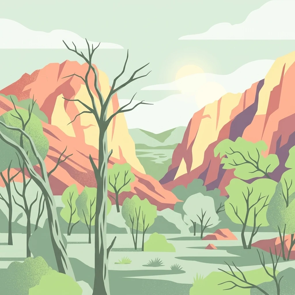
A vector-style illustration showing a valley with green trees and tall bare trees in the foreground, flanked by steep reddish-orange rocky cliffs under a pale sky.

N'Dhala Gorge Nature Park

Nature reserve

Park overview

Structured park overview, official facts, and landscape profile for N'Dhala Gorge Nature Park

N'Dhala Gorge Nature Park park facts, protected area profile, and essential visitor context

Review the core facts for N'Dhala Gorge Nature Park, including designation, size, terrain, visitor scale, habitats, and operating context in one park-focused overview.

About N'Dhala Gorge Nature Park

N'Dhala Gorge Nature Park is a compact but exceptionally layered protected landscape in Australia's Northern Territory. Located approximately 90 kilometres east of Alice Springs, near the small community of Hale, the park sits within the eastern reaches of the MacDonnell Ranges, the long chain of folded and eroded ridges that frames Central Australia's famous red centre. Covering a modest area of just over 5 square kilometres, the park protects not only a distinctive rocky environment but one of inland Australia's most significant concentrations of Indigenous rock art.

The terrain at N'Dhala is shaped by the slow geological forces that define the MacDonnell Ranges. Sharp rocky outcrops rise from a base of low sand dunes, and the gorge itself cuts through ancient sandstone to form sheltered walls that have recorded human activity over an extraordinary span of time. More than 6,000 petroglyphs have been recorded here, created in two separate stylistic periods: an earlier tradition dating back roughly ten thousand years, and a later phase around three thousand years old. The carvings were produced through deliberate pounding of stone surfaces and through finer pecking techniques, leaving behind an unbroken visual archive of Aboriginal cultural expression in the same landscape.

For the Eastern Arrernte people, who refer to the area as Ilwentje, the gorge is far more than an archaeological curiosity. It contains men's sacred sites, occupation shelters, and art sites that remain culturally significant today, and the park's governance reflects that ongoing relationship through shared management with the traditional owners alongside the Parks and Wildlife Commission of the Northern Territory. Surrounding these cultural features is a botanical environment of unusual interest for such an arid setting, with rare species such as the undoolya wattle and the peach-leafed poison bush persisting in the sheltered conditions of the gorge. The result is a park whose value lies as much in cultural depth and ecological specificity as in its dramatic landforms.

Quick facts and research context for N'Dhala Gorge Nature Park

N'Dhala Gorge Nature Park is a small protected landscape covering roughly 5 square kilometres in the Northern Territory of Australia, situated in the eastern MacDonnell Ranges near the settlement of Hale and about 90 kilometres east of Alice Springs.

Established in 1962 and classified under IUCN Category V, the park is jointly governed by the Parks and Wildlife Commission of the Northern Territory and the area's traditional owners. It combines an arid sandstone gorge environment with an unusually rich collection of Aboriginal rock art and pockets of rare native plant life.

Protection and recognition

Examine terrestrial protection details and documented recognition frameworks for N'Dhala Gorge Nature Park.

N'Dhala Gorge Nature Park Protection Status and Conservation Records

N'Dhala Gorge Nature Park holds a documented terrestrial protection status with structured conservation records. Systematic database entries provide verified management scope and official designation details for conservation analysis.

Protection details

Protection scope
Terrestrial
Transboundary protection
No
Park context

Deeper park guide and search-rich context for N'Dhala Gorge Nature Park

N'Dhala Gorge Nature Park history, landscape, wildlife, and travel context

Explore N'Dhala Gorge Nature Park through its history, landscape character, ecosystems, wildlife, conservation priorities, cultural context, and seasonal travel timing in a structured park guide built for atlas discovery and search intent.

Why N'Dhala Gorge Nature Park stands out

N'Dhala Gorge is best known for hosting one of the larger concentrations of Aboriginal petroglyphs in Central Australia, with around 6,000 stone carvings distributed across the gorge walls and surrounding rock surfaces. Equally distinctive is the cultural depth of the site for the Eastern Arrernte people, whose men's sacred sites, occupation shelters, and art sites give the gorge a continuous record of human presence. Added to this is a botanical interest: the gorge supports rare and localised plant species such as the undoolya wattle and the peach-leafed poison bush, making the park a place where cultural heritage and natural heritage intersect in a single narrow valley.
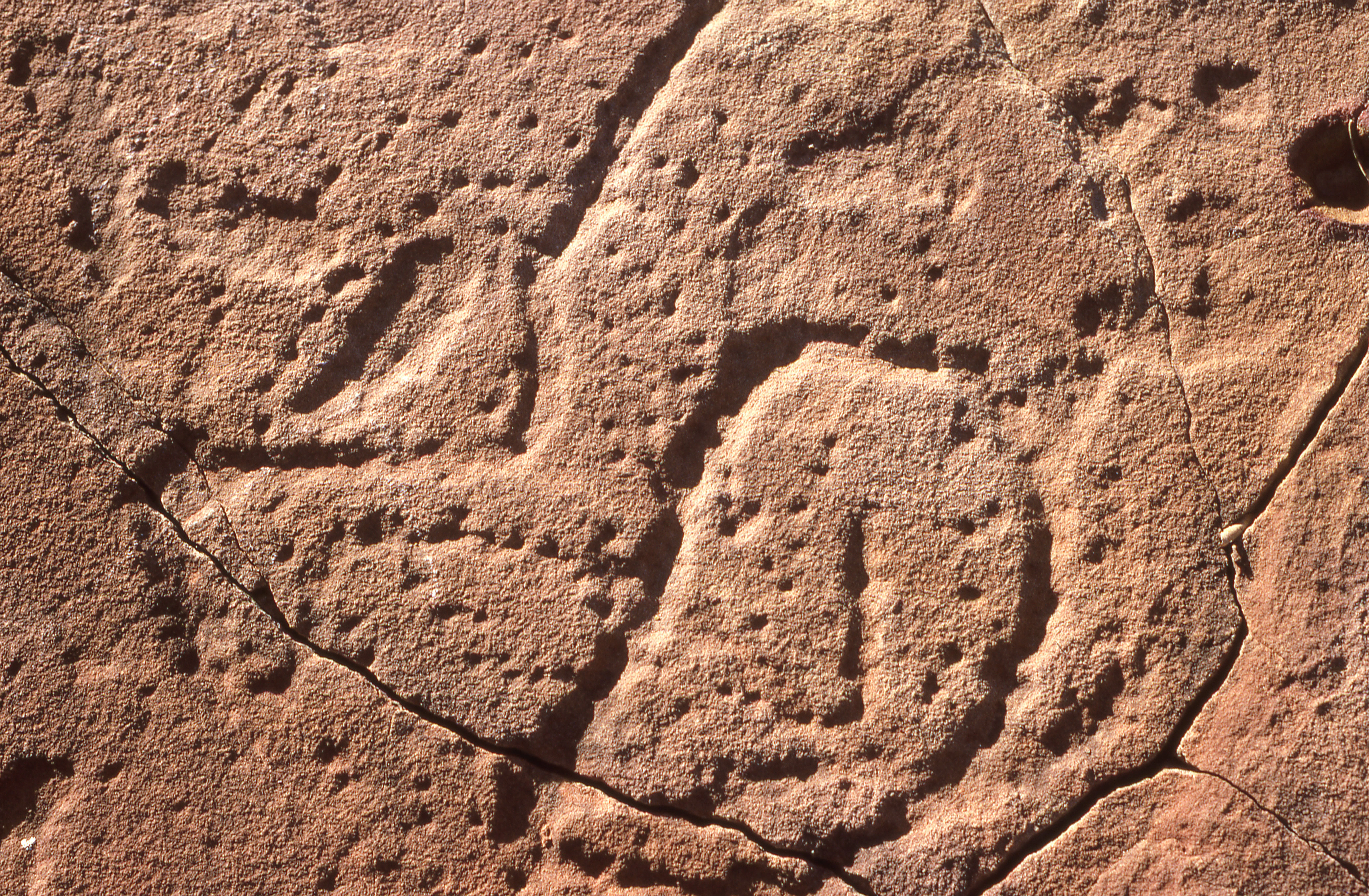
Close up view of ancient Aboriginal rock carvings on a reddish brown rock surface, featuring dotted outlines of figures.
Aboriginal rock carving at N'Dhala Gorge, Northern Territory, 1987.

N'Dhala Gorge Nature Park history and protected-area timeline

N'Dhala Gorge has been a significant place for the Eastern Arrernte people for many thousands of years. During that long span, successive cultural traditions produced the two main phases of rock art visible in the gorge, with the earliest carvings believed to have been created around ten thousand years ago and a later stylistic phase some three thousand years later.

The gorge was formally protected as a nature park on 21 December 1962, securing the landscape and its remarkable rock art under official management. Today it is administered under an IUCN Category V protected landscape designation, with governance shared between the Parks and Wildlife Commission of the Northern Territory and the area's traditional owners, reflecting the continuing cultural importance of the site.

N'Dhala Gorge Nature Park landscape and geographic character

N'Dhala Gorge occupies a small but visually striking section of the eastern MacDonnell Ranges. The terrain is built from low, wind-shaped sand dunes giving way to rocky outcrops and the steep, sheltered walls of the gorge itself, which cuts through the ancient sandstone ridges that characterise this part of Central Australia.

The gorge's narrow confines produce shaded pockets and protected microhabitats within an otherwise arid landscape. Its rock walls, sculpted over geological time, also serve as the canvas for the thousands of petroglyphs that make the site culturally important, blurring the line between natural scenery and human heritage. The surrounding sand dunes and outcrops complete a tightly framed landscape that feels distinctly different from the open spinifex plains further east.
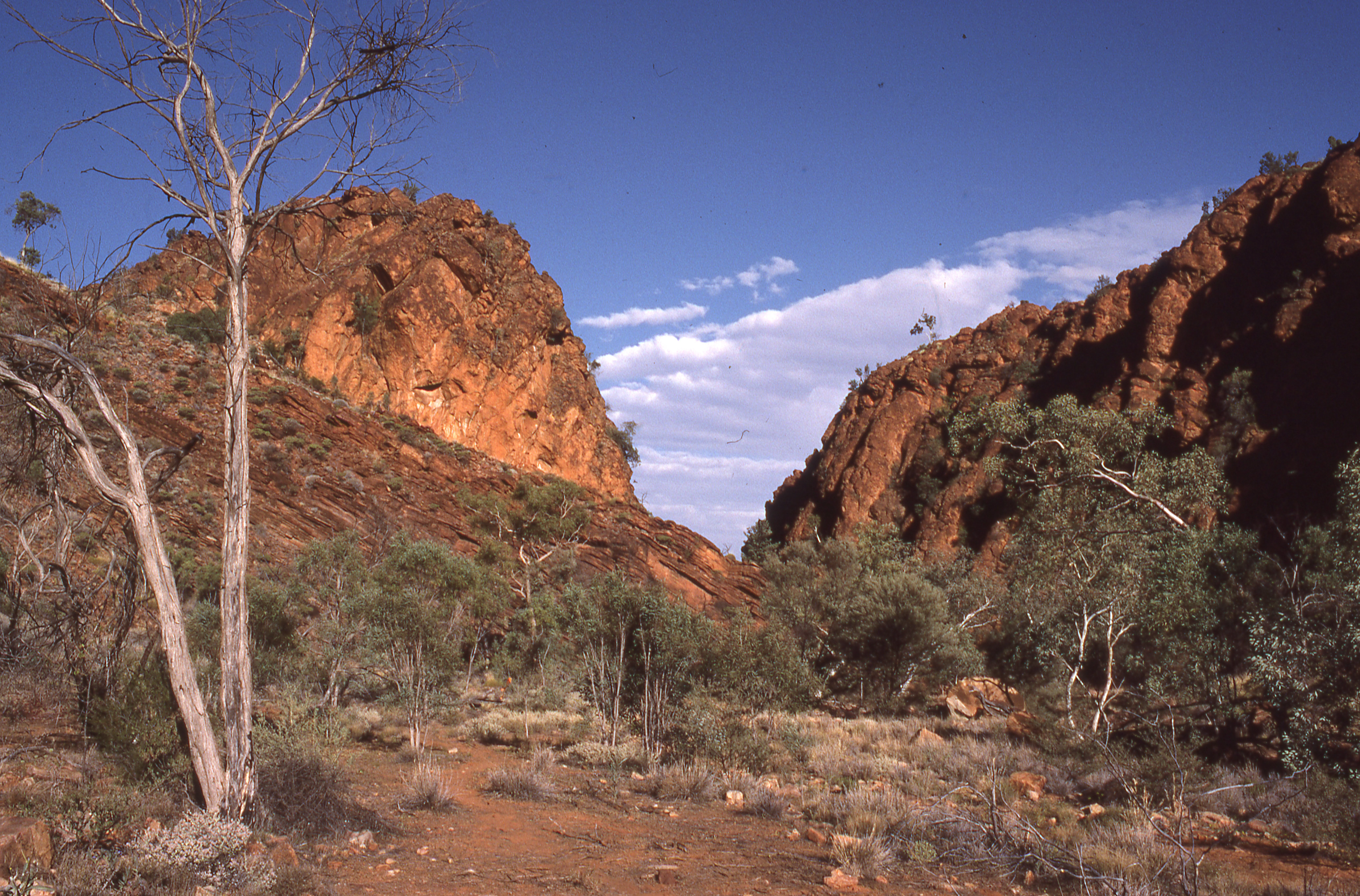
A landscape view of a dry gorge with reddish rocky cliffs on either side, sparse green vegetation, and a dead tree in the foreground under a blue sky with clouds.
A view of the rocky cliffs and dry vegetation within N'Dhala Gorge.

N'Dhala Gorge Nature Park ecosystems, habitats, and plant life

Despite its arid Central Australian setting, N'Dhala Gorge supports a notable botanical environment. The sheltered conditions of the gorge create microhabitats where several rare Australian plant species have persisted, including the undoolya wattle and the peach-leafed poison bush.

These localised populations sit within the broader ecological context of the eastern MacDonnell Ranges, where rocky ridges, sandy flats, and drainage channels each support their own plant communities. The combination of rare plant occurrences and the protected status of the landscape gives the park's nature value a clear conservation dimension.
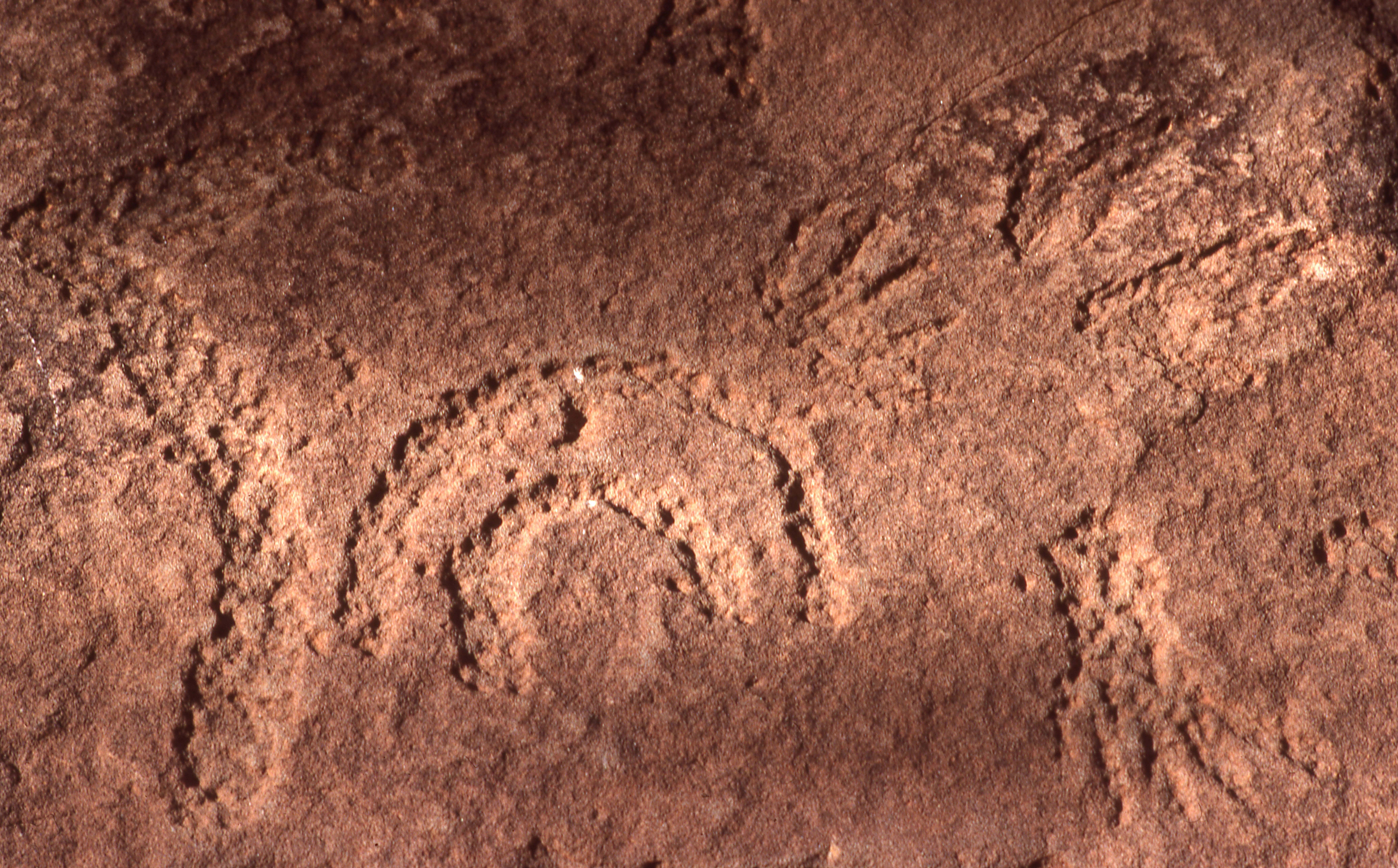
Close-up view of Aboriginal rock carvings showing circular and arc-shaped patterns etched into a reddish-brown rock surface
Aboriginal rock carving at N'Dhala Gorge

N'Dhala Gorge Nature Park conservation status and protection priorities

N'Dhala Gorge Nature Park is recognised for its combination of cultural and natural values, with conservation significance stemming from three linked factors: the protection of an estimated 6,000 Aboriginal petroglyphs, the preservation of rare plant species such as the undoolya wattle and the peach-leafed poison bush, and the formal safeguarding of a distinctive gorge landscape within the MacDonnell Ranges.

Its IUCN Category V status places it among protected landscapes maintained through traditional land use alongside broader conservation objectives. Shared governance with the area's traditional owners reinforces the conservation framework by aligning formal protection with the continuing custodial relationship of the Eastern Arrernte people.

N'Dhala Gorge Nature Park cultural meaning and human context

N'Dhala Gorge holds deep cultural importance for the Eastern Arrernte people, who call the area Ilwentje. The gorge contains men's sacred sites as well as art sites, shelter sites, and occupation sites, indicating long-term use of the area by Aboriginal communities.

The petroglyphs, produced in two distinct stylistic traditions reaching back many thousands of years, form not just a tourist attraction but a living cultural landscape. The involvement of traditional owners in the park's management reflects the ongoing significance of these places, where contemporary Aboriginal custodianship sits alongside formal nature park protection.

Top sights and standout views in N'Dhala Gorge Nature Park

The park's standout feature is the extraordinary assemblage of around 6,000 pre-existing Aboriginal petroglyphs, made across two stylistic periods stretching back perhaps ten thousand years, set into the walls of an ancient sandstone gorge in the eastern MacDonnell Ranges.

Equally compelling is the combination of sacred cultural sites for the Eastern Arrernte, the unusual botanical riches of the sheltered gorge environment, and the park's role as a small but meaningful window into both deep Aboriginal heritage and the Australian arid interior.

Best time to visit N'Dhala Gorge Nature Park

Like much of Central Australia, N'Dhala Gorge experiences a climate dominated by hot, dry summers and cooler, drier winters. Winter and the shoulder seasons around it tend to offer milder daytime temperatures and clearer conditions, which can make exploring the gorge and its many rock art panels more comfortable.

Summer brings extreme heat typical of the MacDonnell Ranges, which can make extended time in the rocky terrain demanding. Cooler months are generally more conducive to appreciating both the landscape and the petroglyphs, though visitors should always weigh current seasonal conditions before travelling in this part of the Northern Territory.
Monthly climate preview

Long-term monthly temperature and precipitation rhythm for N'Dhala Gorge Nature Park

N'Dhala Gorge Nature Park Climate Normals and Annual Temperature Patterns

Representative coordinates record long-term temperature ranges and precipitation rates across twelve distinct months at N'Dhala Gorge Nature Park. Examining the complete monthly climate normals reveals full seasonal shifts in average temperatures and daily precipitation levels.
Annual mean22 °C
12 °C30 °C
Jan30°
Feb28°
Mar26°
Apr22°
May16°
Jun13°
Jul12°
Aug15°
Sep20°
Oct24°
Nov27°
Dec29°
Warmest month
January

29.8 °C

Coolest month
July

12.4 °C

Wettest month
January

1.8 mm/day

Driest month
August

0.1 mm/day

Park location guide

Geography guide, regional context, and park location map for N'Dhala Gorge Nature Park

N'Dhala Gorge Nature Park park geography, regions, and map view in Australia

Understand where N'Dhala Gorge Nature Park sits in Australia through a broader geographic reading of the surrounding landscape, nearby location context, and its mapped position within the national park landscape.

How N'Dhala Gorge Nature Park fits into Australia

Australia is a constitutional monarchy and federal parliamentary democracy comprising six states and ten territories. With a population of nearly 28 million, it is one of the world's most urbanised countries, with most people concentrated on the eastern seaboard. The country has a high Human Development Index and is known for its cultural diversity, ancient Aboriginal heritage, and unique wildlife.

Wider geography shaping N'Dhala Gorge Nature Park in Australia

Australia occupies the entire Australian continent, the island of Tasmania, and numerous smaller islands. It is the world's flattest and driest inhabited continent, featuring vast deserts in the interior (the Outback), tropical rainforests along the eastern coast, and a coastline bordering the Indian and Pacific Oceans.

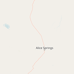
Map view of N'Dhala Gorge Nature Park

Use this park location map to pinpoint N'Dhala Gorge Nature Park in Australia, understand its exact geographic position, and read its mapped placement within the surrounding landscape more clearly.

Pigeon | © OpenStreetMap contributors

Location context for N'Dhala Gorge Nature Park

Northern Territory

Explore photographic records of sandstone gorge terrain, arid habitats, and ancient rock art

Visualizing N'Dhala Gorge Nature Park: Landscape Scenery and Protected Area Photography

Visual documentation captures the rugged sandstone walls, low sand dunes, and sheltered microhabitats that define the remote terrain of N'Dhala Gorge Nature Park. Photographic records provide clear visual context for the ancient petroglyphs and localized botanical species embedded within the surrounding arid ranges.

Close up view of ancient Aboriginal rock carvings on a reddish brown rock surface, featuring dotted outlines of figures.

Close-up view of ancient Aboriginal rock carvings etched into a textured, reddish-brown sandstone surface.

A landscape view of a dry gorge with reddish rocky cliffs on either side, sparse green vegetation, and a dead tree in the foreground under a blue sky with clouds.

Close-up view of Aboriginal rock carvings showing circular and arc-shaped patterns etched into a reddish-brown rock surface

Close-up view of two Aboriginal rock carvings etched into a purplish-brown rock surface, each showing a radiating pattern of pecked lines extending outward from a central point

Park atlas

Continue comparing regional desert terrain and protected landscapes across Central Australia

Explore Parks Near N'Dhala Gorge Nature Park and Surrounding Protected Areas

Discover related protected areas and neighboring reserves situated throughout the rugged ranges of Central Australia. Comparing adjacent park geography provides deeper context for regional arid landscapes and cultural heritage sites.
Protected landscapeNorthern Territory
About 13 km away#1 closest

Northwest

Trephina Gorge Nature Park: Mapped Geography and Protected Landscape Context

East MacDonnell Ranges, Northern Territory Australia

Trephina Gorge Nature Park represents a central feature of the arid MacDonnell Ranges, characterized by its deep gorge, white ghost gums against red rock, and expansive spinifex ridges. This record outlines the park boundaries, its role as a jointly managed conservation area, and its position within the broader geography of central Australia.

Established
1965
Relief
Mountain
Climate
Arid
Access
Access unknown
Protected landscapeNorthern Territory
About 25 km away#2 closest

West

Corroboree Rock Conservation Reserve: Geological and Cultural Protected Area in Central Australia

Mapped protected landscape within the East MacDonnell Ranges

Corroboree Rock Conservation Reserve features a striking dolomite rock formation tied to ancient Precambrian salt lake sediments. Located east of Alice Springs, the reserve provides a protected glimpse into central Australian arid range geography and holds profound cultural importance for the Eastern Arrernte Traditional Owners within the surrounding pastoral landscape.

Area
0.07 km²
Established
1962
IUCN
V
Visitors
15K annual
Protected areaNorthern Territory
About 34 km away#3 closest

Northeast

Arltunga Historical Reserve: A Heritage Protected Area in Northern Territory Australia

Mapping nineteenth century mining ruins and arid terrain

Arltunga Historical Reserve offers a distinct window into the outback mining era through its well-preserved stone structures and desolate desert setting. This protected area within the Northern Territory highlights the intersection of European settlement history and the traditional cultural heritage of the Eastern Arrernte people.

Area
50 km²
Established
1975
Relief
Upland
Climate
Arid
National parkNorthern Territory
About 59 km away#4 closest

West

Tjoritja / West MacDonnell National Park: National Park Atlas and Protected Landscape

Explore the dramatic MacDonnell Ranges terrain and geography.

Delve into the protected geography of Tjoritja / West MacDonnell National Park, a significant national park in Australia's Northern Territory. This landscape features striking mountain formations, deep gorges like Standley Chasm and Glen Helen, and is intrinsically linked to the famous Larapinta Trail and the Arrernte people's cultural heritage. Understanding its mapped boundaries and regional context provides essential insight into this iconic Central Australian protected area.

Area
2,568.61 km²
Established
1992
IUCN
II
Relief
Mountain
A wide, panoramic watercolor painting showing a soft landscape with rolling hills in the background, green trees and bushes in the midground, and a pinkish path or river in the foreground.
Protected areaNorthern Territory
About 60 km away#5 closest

East

Ruby Gap Nature Park: Geography and Protected Wilderness in the Northern Territory

Gorge-carved arid landscapes and historical mining heritage

Ruby Gap Nature Park stands as a remote protected area in the heart of Australia's Northern Territory. Defined by the Hale River gorge, the terrain showcases dramatic cliff lines, expansive rocky flats, and rich geological sites that reveal a layered story of Indigenous heritage and 19th-century boom-and-bust mining history. Explore the park boundary and the surrounding East MacDonnell Ranges through this focused geographic overview.

Area
92.57 km²
Relief
Upland
Climate
Arid
Access
Remote access
Watercolor painting of a soft, abstract landscape with a line of trees against rolling hills and light, hazy colors.
Nature reserveNorthern Territory
About 67 km away#6 closest

Southwest

Napwerte / Ewaninga Rock Carvings Conservation Reserve: Protected Desert Landscape Map

Cultural heritage and arid basin geography in the Northern Territory

Napwerte / Ewaninga Rock Carvings Conservation Reserve protects a unique desert site defined by its extensive collection of prehistoric Arrernte rock engravings. The landscape encompasses rocky outcrops, red sand dunes, and a seasonal claypan that captures rare rainfall, creating a significant intersection of archaeological history and arid-zone ecology in central Australia.

Area
0.06 km²
Established
1970
IUCN
V
Relief
Lowland
Wildlife reserveNorthern Territory
About 72 km away#7 closest

West

Kuyunba Conservation Reserve: Wildlife Protected Landscape in Central Australia

Mapped geography and rocky habitat near Alice Springs

Kuyunba Conservation Reserve represents a focused approach to habitat protection in the Northern Territory. The terrain is defined by its rocky hills and boulder-filled escarpments, offering critical shelter for wildlife in an arid, drought-adapted desert region. This site provides a clear view of how targeted land management supports specialized ecological niches in inland Australia.

Area
6.29 km²
Established
1970
IUCN
V
Relief
Upland
A horizontal watercolor painting showing stylized soft green, orange, and pale yellow hills under a white sky.
Nature reserveNorthern Territory
About 113 km away#8 closest

Southwest

Rainbow Valley Conservation Reserve: Geological Atlas and Protected Landscape Mapping

Examining the arid-zone terrain of Northern Territory, Australia.

The Rainbow Valley Conservation Reserve is a significant protected landscape known for its 350-million-year-old banded sandstone bluffs and diverse arid-zone habitats. This overview provides a focused look at the park's geological structure, claypan terrain, and its status as a vital site for Aboriginal heritage, offering a clear understanding of its place within the broader Northern Territory geographic context.

Area
24.83 km²
Established
1990
IUCN
V
Visitors
6.8K annual

Common questions about visiting, size, designation, and location context for N'Dhala Gorge Nature Park

N'Dhala Gorge Nature Park FAQs for park facts, access, geography, and protected area context

Find quick answers about N'Dhala Gorge Nature Park, including protected-area facts, park geography, trail and visitor context, and how the park fits into its surrounding country and regional landscape.
MoriAtlas Explorer

Continue Your Protected Areas Search Across the Global Atlas

Deepen your exploration by continuing the structured search for national parks and protected areas worldwide. Utilize the comprehensive filtering capabilities to compare different conservation landscapes and refine your understanding of global park geography. Discover more about the distribution and characteristics of protected natural areas.

Global natural geography