
Mori Atlas logo
Regional parkNemunas Delta Regional Park

Trace the intricate river distributaries, polder meadows, and coastal islands of this protected delta terrain

Nemunas Delta Regional Park: A Comprehensive Atlas of Lithuania Coastal Wetland Landscapes

(Nemuno deltos regioninis parkas)

Nemunas Delta Regional Park encompasses a low lying mosaic of channels, floodplains, and islands where the Nemunas River meets the Curonian Lagoon. This protected landscape is defined by its hydrological complexity, featuring a dense network of oxbows, canals, and reed beds that serve as a critical staging area for migratory bird species within the Baltic coastal lowland. As a designated Ramsar site, the area provides essential habitat for diverse waterbirds and includes Lake Krokų Lanka, the only lake of marine origin in Lithuania.

wetlandsriver deltaRamsar sitebirdwatchingmigratory birdsreed beds
A vector-style illustration of a winding river flowing through a valley between cliffs with waterfalls, framed by evergreen trees in the foreground, under a sunrise sky.

Nemunas Delta Regional Park

Regional park

Park overview

Structured park overview, official facts, and landscape profile for Nemunas Delta Regional Park

Nemunas Delta Regional Park park facts, protected area profile, and essential visitor context

Review the core facts for Nemunas Delta Regional Park, including designation, size, terrain, visitor scale, habitats, and operating context in one park-focused overview.

About Nemunas Delta Regional Park

Nemunas Delta Regional Park encompasses the broad, gently sloping wetlands of the Nemunas River as it nears the Curonian Lagoon and the Baltic Sea. The landscape is overwhelmingly flat and water-shaped, with most of the territory only a few meters above sea level. The river's main current splits into a network of distributaries, with the Rusnė channel carrying the majority of the flow and smaller branches such as Atmata, Pakalnė, and Skirvytė threading through islands, polder meadows, reed beds, and shallow embayments.

At the heart of the delta lies Rusnė Island, Lithuania's largest island in the region, with the small town of Rusnė as its main settlement. Despite being the principal human community in the delta, Rusnė has a population of only about 2,500. The wider region is sparsely populated, and the character of the park is dominated by open water channels, seasonally flooded grasslands, peat-forming wetland, and a near-constant background of marsh, reed, and water.

Beyond its scenic and recreational value, the park is internationally significant for biodiversity. The Nemunas Delta wetlands have been part of the Ramsar list of globally important wetlands since 1993, and bird research here has a notably long history. The Ventė Cape ornithological station, one of Europe's earliest bird ringing centers, opened in 1929 and has contributed to long-term monitoring of European migration routes, with ringed birds later recovered as far away as Iran, Egypt, and South Africa.

The park offers a combination of ecological importance, scientific heritage, and accessible wetland scenery that is unusual within the Baltic region. It draws visitors interested in birdwatching, nature photography, and the experience of traveling through Europe's largest lowland river delta on the southeastern Baltic coast.

Quick facts and research context for Nemunas Delta Regional Park

Nemunas Delta Regional Park was established in 1992 to safeguard one of Lithuania's most ecologically important wetland systems. It covers roughly 239 square kilometers and includes 14 nature reserves and a water reservoir, with about one-fifth of the area made up of open water. The delta portion defined by the park is also recognized under the Ramsar Convention as a wetland of international importance, designated in 1993.

The park sits in western Lithuania, in the Šilutė district, and extends partly into the Russian Kaliningrad Oblast. Its defining geography is the branching mouth of the Nemunas River, where channels such as Atmata, Pakalnė, Skirvytė, and Gilija split around islands including Rusnė, Lithuania's largest island in the delta. The region is shallow, flat, and heavily shaped by annual spring flooding.

Protection and recognition

Examine documented protection parameters and governance frameworks for Nemunas Delta Regional Park

Nemunas Delta Regional Park Protection Status and Transboundary Scope

Nemunas Delta Regional Park maintains a documented mixed protection status with established transboundary connectivity across its wetland terrain. Official conservation records outline management parameters and designated geographic boundaries for this protected area.

Protection details

Protection scope
Mixed
Transboundary protection
Yes
Park context

Deeper park guide and search-rich context for Nemunas Delta Regional Park

Nemunas Delta Regional Park history, landscape, wildlife, and travel context

Explore Nemunas Delta Regional Park through its history, landscape character, ecosystems, wildlife, conservation priorities, cultural context, and seasonal travel timing in a structured park guide built for atlas discovery and search intent.

Why Nemunas Delta Regional Park stands out

The Nemunas Delta is best known as Lithuania's premier birdwatching and migratory bird refuge, a Ramsar-listed wetland of global importance, and a historic center of European ornithological research. The Ventė Cape bird ringing station, established in 1929 by zoologist Tadas Ivanauskas, is one of the oldest on the continent and continues to operate as a major monitoring and ringing site. Visitors and researchers come for the sheer density and diversity of birdlife: hundreds of species pass through each year, and tens of thousands of birds can be counted at the cape in a single day during peak migration. The delta also provides breeding habitat for several globally threatened species, including the aquatic warbler, white-tailed eagle, and barnacle goose, making it exceptionally important for European conservation.
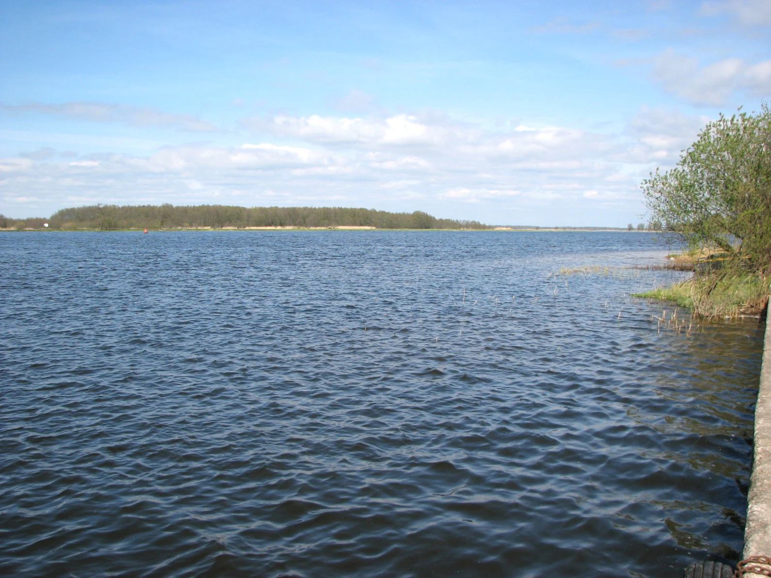
A wide, calm river scene with a tree-lined bank in the distance and a concrete edge in the foreground.
A view across the Atmata River in the Nemunas Delta Regional Park.

Nemunas Delta Regional Park history and protected-area timeline

The Nemunas Delta Regional Park was created in 1992, in the years following Lithuania's independence, as a way to formally protect the delta's wetland ecosystems and to coordinate conservation work, research, and ecological monitoring across the region. Its establishment reflected growing recognition of the delta's value both as wildlife habitat and as a functioning hydrological landscape.

A major early conservation milestone came in 1993, when the Nemunas Delta was inscribed on the Ramsar list of wetlands of international importance. This designation formalized the delta's status as a globally significant site and helped anchor subsequent efforts in habitat protection and waterbird monitoring. A botanical-zoological reserve, the Nemuno deltos botaninis-zoologinis draustinis, was also established within the broader delta.

The park's ornithological heritage, however, extends much further back. The Ventė Cape bird ringing station, located on a peninsula near the mouth of the Nemunas, was founded in 1929 by the Lithuanian zoologist Tadas Ivanauskas, making it one of the oldest bird ringing stations in Europe. That station's history predates the modern park by more than six decades and continues to operate as a key scientific landmark within the protected landscape.

Since 1999, the Lithuanian Society of Ornithologists and the park administration have organized an annual international bird counting rally each October. Open to non-professional birders, the rally combines citizen science with formal environmental monitoring and has become an established tradition, contributing to long-term datasets on bird populations and habitat health.

Nemunas Delta Regional Park landscape and geographic character

The Nemunas Delta is a classic lowland river delta, the lowest part of Lithuania's Baltic coastal lowland. The elevation throughout the region is minimal, often only a few meters above sea level, and the topography is best understood as a wet mosaic rather than as defined landforms. Annual spring floods reshape the surface, and sediments carried by the river gradually extend the delta westward into the Curonian Lagoon.

The hydrological structure is complex. Below the town of Tilžė, the Nemunas splits into the Gilija and Rusnė branches. Gilija carries a smaller share of the flow, around 16 to 29 percent, while the Rusnė and its subbranches carry the majority, including Skirvytė and Atmata. Between the main channels lies the true body of the delta, a labyrinth of islands, oxbows, abandoned channels, canals, and embayments. Names like Vorusnė, Pakalnė, Skatulė, Naikupė, Rusnaitė, Vytinė, Ūstraginė, Ulmas, Vilkinė, and Tovė reflect the intricate branching of the system.

One of the defining inland waterbodies is Lake Krokų Lanka, located near where the Nemunas enters the lagoon. It was cut off from the Curonian Lagoon by river outwash sediments and is now the largest lake within the delta region, with an area of roughly 7.93 square kilometers. It is also Lithuania's only lake of marine origin, giving it a distinctive character within the freshwater-dominated wetland system. Larger islands such as Rusnė, Kiemo, Briedžių, Kubilių, Ragininkų, and others rise slightly above the surrounding marsh and floodplain, providing the principal dry ground in a landscape otherwise shaped by water and reed.
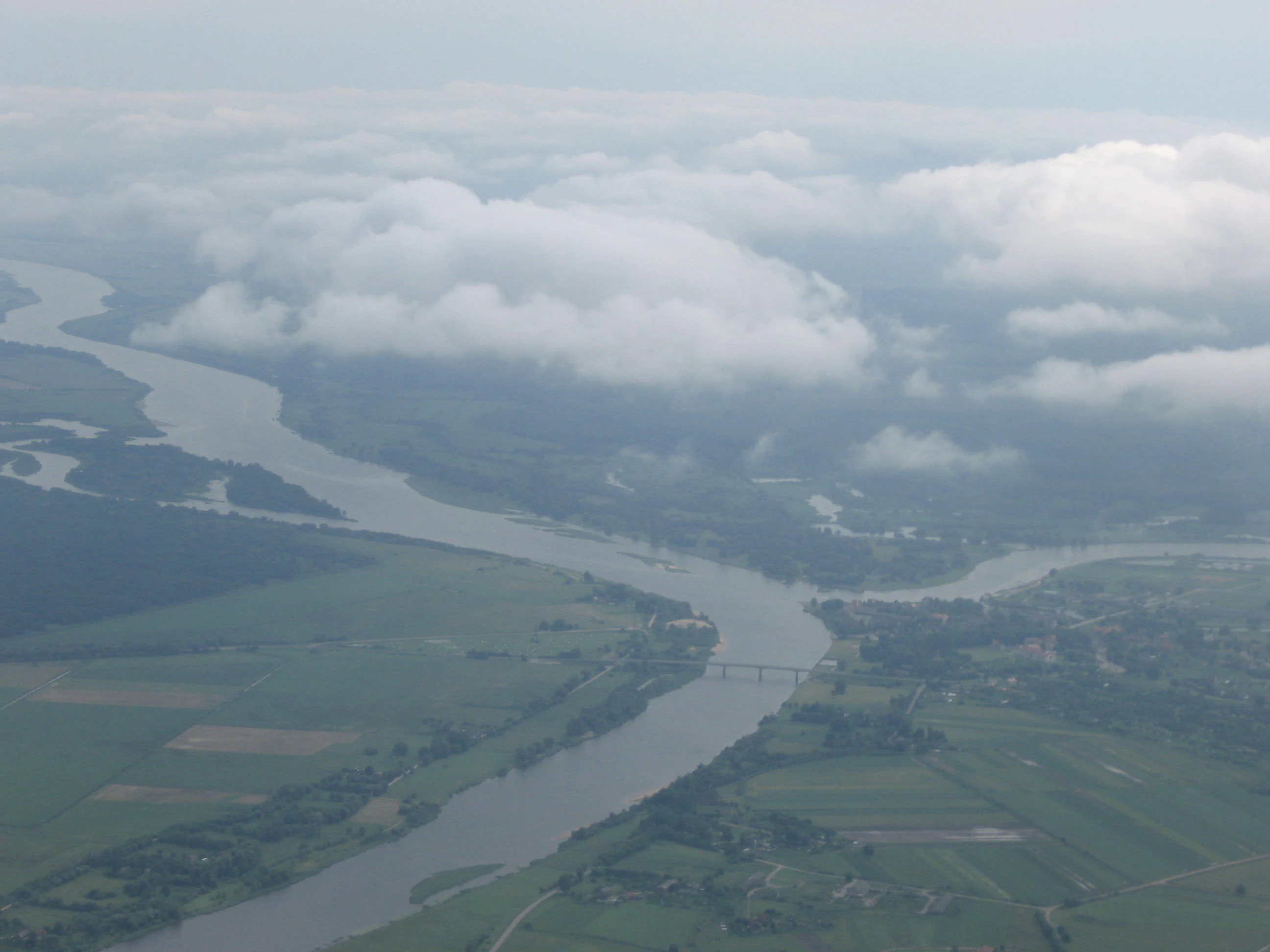
An aerial shot of a wide, winding river flowing through a flat, green landscape with distant patches of trees, partially obscured by low-hanging clouds.
An aerial view of the Nemunas River delta, showcasing the expansive wetlands and water networks characteristic of the region.

Nemunas Delta Regional Park ecosystems, habitats, and plant life

The Nemunas Delta's ecological identity is built around wetland habitats: reedbeds, flooded meadows, shallow embayments, peat-influenced marsh, riparian woodland fringes, and open water. Roughly one-fifth of the park area is water, and the proportion that becomes temporarily flooded during spring is much larger, making the system fundamentally a hydrological rather than a terrestrial environment.

The delta is a critical node on the Baltic and East Atlantic flyways. Its combination of food-rich shallow waters, safe roosting sites, and extensive reed cover supports both large breeding populations and very high densities of migrating waterfowl, waders, and passerines. The reed beds are particularly important for species tied to marsh-edge nesting habitat.

Beyond birdlife, the system provides habitat for mammals adapted to wetland edges, including beaver, fox, wild boar, elk, and otter. The overall ecological character of the delta is one of dynamic balance between flooding, sedimentation, and biological productivity: the very processes that build the delta also sustain the habitats on which its wildlife depends.

A wide panoramic view showing a low-lying, tree-covered cape extending into calm water, with a long pier or jetty stretching out from the shore toward the horizon.
A panoramic view of Cape Vente, a landmark point extending into the water within Nemunas Delta Regional Park.

Nemunas Delta Regional Park wildlife and species highlights

The Nemunas Delta ranks as Lithuania's most important site for migratory birds and supports one of the country's richest breeding bird communities. Around 200 bird species have been recorded here, with roughly 40 listed in the Lithuanian Red Book of Endangered Species. The delta's value is both passage and resident: millions of birds representing hundreds of species pass through annually, and substantial breeding populations remain through spring and summer.

The park supports several internationally protected and globally rare species. The aquatic warbler, a globally threatened passerine tied to marsh habitats, breeds in the delta's reedbeds. The white-tailed eagle, a large raptor of conservation concern, is also present, along with barnacle goose, various crane species, and dunlins. Large flocks of ducks and geese gather in spring, sometimes numbering in the thousands during peak migration.

The historic Ventė Cape ringing station remains a core scientific infrastructure. On busy days during migration season, hundreds of thousands of birds may pass the cape, and tens of thousands of individuals are ringed there each year. Ringing recoveries from the station have documented movements reaching Iran, Egypt, and South Africa, illustrating the international reach of the delta's ecological connections.

Among mammals, the wetland mosaic supports beaver, otter, elk, wild boar, and fox. Their presence reflects the broader pattern of the delta as a working wetland landscape, where human-modified polders and channels sit alongside rich wildlife habitat.
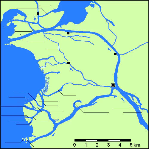
A simple flat-colored map illustrating the river delta of the Nemunas River, depicting blue water channels against a pale green landmass with a scale bar at the bottom.
Cartographic map of the Nemunas River Delta showing the river channels and coastal layout.

Nemunas Delta Regional Park conservation status and protection priorities

Conservation significance is the central reason for the park's existence. The Nemunas Delta is recognized internationally through its 1993 designation as a Ramsar Wetland of International Importance, placing it among the most ecologically significant wetland sites in the Baltic region. The regional park, together with the Nemuno deltos botaninis-zoologinis draustinis botanical-zoological reserve and a network of 14 internal reserves, provides a layered framework of habitat protection.

The delta is ecologically significant for several reasons. It is Lithuania's most important migratory bird staging area, a key breeding ground for threatened marshland species such as the aquatic warbler, and a major hydrological system with high natural productivity. Its combination of high biodiversity, intact wetland processes, and long-standing research infrastructure gives it disproportionate conservation value relative to its size.

However, the system faces ongoing pressures. Annual flooding is a natural and defining feature of the delta, but the principal threats identified for the region are pollution, agricultural runoff and land use change, fisheries-related impacts, and unmanaged tourism. Annual October bird counts conducted jointly by the Lithuanian Society of Ornithologists and the park administration serve both as a public engagement tool and as a long-term environmental monitoring mechanism, helping detect shifts in bird populations that may indicate broader habitat change.

Nemunas Delta Regional Park cultural meaning and human context

The Nemunas Delta carries a layered cultural geography. The river itself has long had multiple names: in German it was historically called the Memel, and the delta was known as Memel Niederung, a name that survives in older European maps and references. Rusnė, the principal island settlement and the delta's only real town, has a small but distinct identity shaped by its dependence on fishing, river transport, and seasonal flooding.

Before the post-World War II border changes that reshaped this part of the Baltic, the delta formed part of a wider German-speaking and East Prussian cultural landscape, traces of which persist in place names and historical features such as the former name Windenburg for Ventė Cape. Today, the delta region straddles Lithuania and the Russian Kaliningrad Oblast, giving it a cross-border character that is unusual among European protected wetlands and that lends additional political and cultural interest to its conservation role.

Top sights and standout views in Nemunas Delta Regional Park

The Nemunas Delta's most defining feature is the combination of a Ramsar-recognized wetland ecosystem with one of Europe's oldest and most active bird ringing stations. The park supports around 200 recorded bird species and roughly 40 Red Book species, making it Lithuania's foremost site for both seasonal migration and breeding birdlife.

Its landscape is a true water landscape: branching distributaries, polder meadows, reedbeds, and low islands create a habitat mosaic that hosts globally threatened species such as the aquatic warbler, white-tailed eagle, and barnacle goose. Inland features such as Lake Krokų Lanka, Lithuania's only lake of marine origin, and Rusnė Island add distinctiveness to the system. The ongoing October international bird counting rally further reinforces the delta's identity as both a scientific site and a place of public engagement with wetland nature.

Best time to visit Nemunas Delta Regional Park

Spring is the most ecologically dramatic season in the Nemunas Delta. Snowmelt and seasonal flooding fill the channels and floodplains, bringing the delta into its most active hydrological state, and it is the key period for breeding birds and large gatherings of waterfowl and geese. Migration peaks also bring some of the year's highest concentrations of visible birdlife.

Autumn, particularly October, is the heart of public birdwatching in the delta. It is the time of the long-running international bird counting rally organized by the Lithuanian Society of Ornithologists and the park administration, and the period when large numbers of birds are on the move and visible from observation points such as Ventė Cape. Summer offers quieter conditions, lush wetland vegetation, and generally milder weather, though it tends to bring fewer dramatic bird events than spring or autumn. Winter is the least active season for visitors but reflects the lowest-flow state of the delta's hydrological cycle.
Monthly climate preview

Long-term monthly temperature averages and precipitation patterns for Lithuania

Nemunas Delta Regional Park Climate Normals and Annual Weather Rhythm

Representative coordinate records show measured monthly temperature variations and precipitation totals from 1991 to 2020. Detailed twelve-month climatology data provides complete monthly tracking for comprehensive geographic analysis.
Annual mean8 °C
-2 °C18 °C
Jan-2°
Feb-2°
Mar
Apr
May11°
Jun15°
Jul18°
Aug18°
Sep14°
Oct
Nov
Dec
Warmest month
August

17.9 °C

Coolest month
February

-1.6 °C

Wettest month
October

2.8 mm/day

Driest month
April

1.4 mm/day

Park location guide

Geography guide, regional context, and park location map for Nemunas Delta Regional Park

Nemunas Delta Regional Park park geography, regions, and map view in Lithuania

Understand where Nemunas Delta Regional Park sits in Lithuania through a broader geographic reading of the surrounding landscape, nearby location context, and its mapped position within the national park landscape.

How Nemunas Delta Regional Park fits into Lithuania

Lithuania is a unitary semi-presidential republic and one of three Baltic states in Northern Europe. It lies on the eastern coast of the Baltic Sea, with Vilnius as its capital and largest city. The country regained independence in 1990 after Soviet occupation and joined the European Union in 2004. Lithuania has a population of about 2.9 million and covers an area of 65,300 km².

Wider geography shaping Nemunas Delta Regional Park in Lithuania

Lithuania is situated on the eastern shore of the Baltic Sea in Northern Europe. It borders Latvia to the north, Belarus to the east and south, Poland to the south, and Russia's Kaliningrad Oblast to the southwest. The country also has a maritime border with Sweden to the west. The terrain is largely flat with rolling hills, numerous lakes, and rivers. The Nemunas River is the longest river in the country.

Map view of Nemunas Delta Regional Park

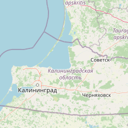
Use this park location map to pinpoint Nemunas Delta Regional Park in Lithuania, understand its exact geographic position, and read its mapped placement within the surrounding landscape more clearly.

Pigeon | © OpenStreetMap contributors

Explore protected habitats, low-lying river channels, and coastal lowland terrain.

Nemunas Delta Regional Park Photos and Scenery: Visualizing the Wetland Landscape

Visual documentation captures the intricate network of flooded meadows, branching distributaries, and island habitats defining the protected delta ecosystem. Photographic records reveal the low-lying terrain and expansive wetlands that support major bird migration corridors.

A wide, calm river scene with a tree-lined bank in the distance and a concrete edge in the foreground.

Aerial view looking over flat, green wetlands and river channels as they flow into a large, bright body of water under a cloudy sky.

An aerial shot of a wide, winding river flowing through a flat, green landscape with distant patches of trees, partially obscured by low-hanging clouds.

A wide panoramic view showing a low-lying, tree-covered cape extending into calm water, with a long pier or jetty stretching out from the shore toward the horizon.

A simple flat-colored map illustrating the river delta of the Nemunas River, depicting blue water channels against a pale green landmass with a scale bar at the bottom.

Park atlas

Compare surrounding regional landscapes and connected wetland reserves in western Lithuania

Explore Other Parks Near Nemunas Delta Regional Park And Related Protected Areas

Browsing other parks near Nemunas Delta Regional Park helps connect regional wetland habitats to broader coastal lowland ecosystems. Comparing adjacent protected landscapes reveals the full geographic scale of the Baltic river delta.
Watercolor painting of a landscape with a river flowing through grassy fields, trees, and mountains in the background
National parkLithuania
Mapped location lies within the park boundary#1 closest

North

Curonian Spit National Park: Atlas of Baltic Sand Dunes and Coastal Protected Areas

Exploring the narrow peninsula landscape of Lithuania

Curonian Spit National Park is a protected coastal terrain featuring massive sand dunes and coniferous forests situated along the Baltic Sea. This detailed map-based overview examines the geomorphology of the spit, the stabilization of the Nagliai reserve, and the regional geography that defines this unique ecological corridor within Lithuania.

Area
264.74 km²
Established
1991
IUCN
II
Visitors
400K annual
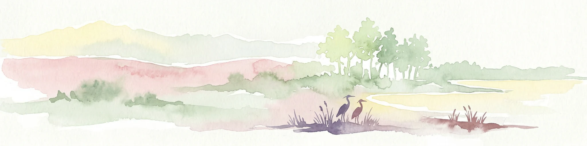
Watercolor painting of a coastal landscape featuring trees, birds, and soft pastel-colored hills
National parkKaliningrad Oblast
About 2.7 km away#2 closest

Southwest

Curonian Spit National Park: Coastal Dunes and Baltic Protected Landscape

Explore a UNESCO World Heritage sand spit with unique terrain.

Curonian Spit National Park offers a remarkable study in coastal geography and protected landscapes, situated on one of the longest sand spits globally. This protected area within Russia's Kaliningrad Oblast features dynamic dune systems, distinctive forest formations, and serves as a vital corridor for migratory birds. Its UNESCO status underscores its international significance for natural heritage and landscape exploration, providing rich context for regional geography within the MoriAtlas platform.

Area
66 km²
Established
1987
IUCN
II
Relief
Lowland
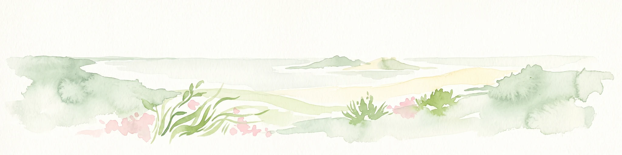
A panoramic watercolor illustration showing a minimalist landscape with light green dunes, tufts of grass, and small pink flowers in the foreground against a white background.
National parkKaliningrad Oblast
About 22 km away#3 closest

Southwest

Curonian Spit National Park: Mapped Geography of Russia's Baltic Coastal Peninsula

Exploring the dune systems and coastal lagoon terrain

Curonian Spit National Park serves as a critical protected landscape located in Kaliningrad Oblast. Its geography includes active aeolian dune formations, ancient forest stands, and wetlands flanking the Curonian Lagoon. The park represents a vital intersection of geological history and international bird migration research within a narrow, fragile Baltic coastal environment.

Area
66.21 km²
Established
1987
IUCN
II
Visitors
1M annual
Watercolor painting showing rolling hills, a lake, and green forests under a soft sky
National parkLithuania
About 90 km away#4 closest

Northeast

Žemaitija National Park: Mapped Glacial Terrain and Samogitian Protected Landscape

Explore protected areas and natural geography in Northwestern Lithuania.

Žemaitija National Park is a protected natural reserve in Lithuania, defined by its distinctive glacially sculpted landscape. This park preserves over 217 square kilometers of hilly terrain, featuring significant lake systems like Lake Plateliai and substantial forest cover interspersed with wetlands. Users can explore the park's unique topographic character, its mapped geographic features, and its role as a vital protected area within the Samogitian region, offering a rich context for atlas-based discovery.

Area
217.54 km²
Established
1991
IUCN
II
Relief
Highland
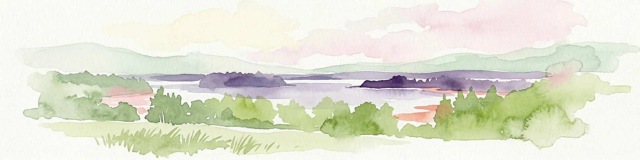
A horizontal watercolor illustration of a lake landscape, featuring soft greens and pinks, showing marshy foreground vegetation, calm water, islands, and a distant treeline.
Nature reserveWarmian-Masurian Voivodeship
About 117 km away#5 closest

South

Rezerwat przyrody Jezioro Siedmiu Wysp: Protected Wetland Geography and Map Overview

Wetland ecosystems in the Warmian-Masurian Voivodeship

Examine the geographic layout of Rezerwat przyrody Jezioro Siedmiu Wysp, encompassing Lake Oświn, the Oświnka River corridor, and extensive peat-forming marshes. This protected area offers insight into Masurian wetland dynamics, including the interplay between open water, meadow grazing by konik polski horses, and critical habitats for diverse waterfowl populations across the Polish border region.

Area
17.63 km²
Established
1956
Relief
Lowland
Climate
Temperate
Protected landscapeWarmian-Masurian Voivodeship
About 139 km away#6 closest

Southwest

Park Krajobrazowy Wysoczyzny Elbląskiej: Mapping Upland Terrain and Protected Forest Zones

Geography of a distinctive morainic plateau in northern Poland

Investigate the natural landscape of Park Krajobrazowy Wysoczyzny Elbląskiej, a protected area in the Warmian-Masurian Voivodeship. Focus on the interplay between stream valleys, morainic ridges, and rare plant communities. This mapping resource details the ecological significance of the upland terrain and its transition toward coastal lowland borders.

Area
137.32 km²
Established
1985
Relief
Upland
Climate
Temperate
Nature reserveWarmian-Masurian Voivodeship
About 141 km away#7 closest

South

Rezerwat przyrody Mokradła Żegockie: Nature Reserve Map and Protected Landscape Overview

Lowland marshland habitat in the Warmian-Masurian Voivodeship of Poland

This nature reserve preserves a shallow, boggy depression surrounded by agricultural plains. It is recognized for its bird-rich ecosystem, containing open water, reedbeds, and willow shrubs that returned after the collapse of historic drainage works. Use this atlas resource to understand the park's terrain, mapped boundaries, and environmental role within the local geography.

Area
0.336 km²
Established
1991
Relief
Lowland
Scope
Terrestrial
Nature reserveWarmian-Masurian Voivodeship
About 142 km away#8 closest

Southeast

Mechacz Wielki Nature Reserve: Geographic Records of Protected Peatlands in Northeastern Poland

Mapping the raised bog and forest ecosystems of the Romincka Forest.

Mechacz Wielki Nature Reserve represents a critical example of raised bog geography and peat-forming processes in Poland. This record details the reserve as a core feature of the Romincka Forest, focusing on its transition from open moss-dominated surfaces to complex boggy pine forests and wetland habitats. Gain insight into the regional landscape characteristics that shape this unique northeastern protected area.

Area
1.467 km²
Established
1974
Relief
Lowland
Scope
Terrestrial

Common questions about visiting, size, designation, and location context for Nemunas Delta Regional Park

Nemunas Delta Regional Park FAQs for park facts, access, geography, and protected area context

Find quick answers about Nemunas Delta Regional Park, including protected-area facts, park geography, trail and visitor context, and how the park fits into its surrounding country and regional landscape.
MoriAtlas Explorer

Continue Your Protected Areas Search Across the Global Atlas

Deepen your exploration by continuing the structured search for national parks and protected areas worldwide. Utilize the comprehensive filtering capabilities to compare different conservation landscapes and refine your understanding of global park geography. Discover more about the distribution and characteristics of protected natural areas.

Global natural geography