

Mori Atlas logo
Wildlife reserveÁrea de protección de flora y fauna Nevado de Toluca

Mapping the high-elevation ecological transition zones of the Nevado de Toluca massif

Área de protección de flora y fauna Nevado de Toluca: A Volcanic Landscape and Wildlife Reserve

The Área de protección de flora y fauna Nevado de Toluca protects the slopes of a dormant stratovolcano in the State of Mexico, ranging from dense oak and conifer forests to high-alpine volcanic ridges. This reserve marks a critical biogeographic convergence zone, safeguarding essential watersheds that feed the Toluca Valley aquifer while supporting diverse high-altitude ecosystems across its vertical terrain.

volcanic landscapeprotected areahighland forestsconiferous forestoak woodlandalpine zone
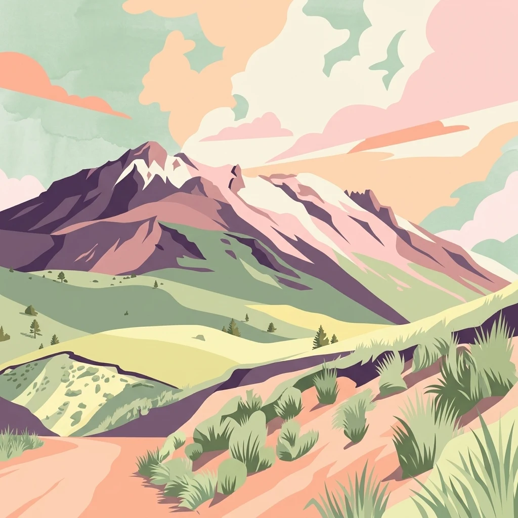
A digital illustration of a mountainous volcanic landscape featuring rolling green hills, a prominent peak with snow patches, and desert-like vegetation in the foreground under a sunset-colored sky.

Área de protección de flora y fauna Nevado de Toluca

Wildlife reserve

Park overview

Structured park overview, official facts, and landscape profile for Nevado de Toluca Flora and Fauna Protection Area

Nevado de Toluca Flora and Fauna Protection Area park facts, protected area profile, and essential visitor context

Review the core facts for Nevado de Toluca Flora and Fauna Protection Area, including designation, size, terrain, visitor scale, habitats, and operating context in one park-focused overview.

About Nevado de Toluca Flora and Fauna Protection Area

The Nevado de Toluca Flora and Fauna Protection Area is a federally administered natural reserve managed by Mexico's Comisión Nacional de Áreas Naturales Protegidas. It protects a substantial portion of the Nevado de Toluca massif, the fourth-tallest peak in Mexico, and the surrounding highland ecosystems in the western State of Mexico. The reserve's identity is defined by its dramatic volcanic profile, its elevation-driven ecological gradients, and its role as a biogeographic transition zone.

At its core, the protected area preserves temperate and high-elevation forests dominated by coniferous species and oak woodlands, alongside the subalpine and alpine zones found on the volcano's upper slopes. The convergence of Nearctic and Neotropical biogeographic realms gives the area an unusually rich ecological profile for central Mexico. More than 1,380 species of plants and animals have been documented within its boundaries, and 62 of these fall within a category of risk under Mexican conservation regulations, underscoring the reserve's biodiversity importance.

The area also has substantial hydrological significance. By protecting the upper slopes of the Nevado de Toluca, the reserve safeguards the headwaters and infiltration zones that supply the Toluca Valley aquifer and maintain flow in several ecologically and economically important streams. This combination of volcanic landscape, transitional forests, and watershed function gives the protected area a multi-dimensional importance that extends well beyond its scenic value.

Quick facts and research context for Nevado de Toluca Flora and Fauna Protection Area

The Nevado de Toluca reserve occupies approximately 46,784 hectares in the State of Mexico, distributed across eleven municipalities surrounding the volcanic massif. It lies about 22 kilometers southwest of the city of Toluca and stretches across an elevational gradient from roughly 2,200 to 4,680 meters above sea level, making it one of the highest-protected areas in Mexico. Annual mean temperatures around 3.9 degrees Celsius rank among the coldest recorded within Mexico's federal protected-area network.

Protection and recognition

Documented terrestrial protection history and designation records

Área de Protección de Flora y Fauna Nevado de Toluca Protection Status

Terrestrial protection status for Área de protección de flora y fauna Nevado de Toluca details the official 2013 designation timeline. Structured conservation records provide clear insight into the management scope and recognized natural boundaries.

Protection details

Protection scope
Terrestrial
Designated year
2013
Park context

Deeper park guide and search-rich context for Nevado de Toluca Flora and Fauna Protection Area

Nevado de Toluca Flora and Fauna Protection Area history, landscape, wildlife, and travel context

Explore Nevado de Toluca Flora and Fauna Protection Area through its history, landscape character, ecosystems, wildlife, conservation priorities, cultural context, and seasonal travel timing in a structured park guide built for atlas discovery and search intent.

Why Nevado de Toluca Flora and Fauna Protection Area stands out

The area is best known for protecting the ecological slopes of the Nevado de Toluca, a dormant stratovolcano that anchors one of Mexico's most distinctive high-elevation landscapes. It stands out as a meeting point between Nearctic and Neotropical biogeographic influences, producing a transitional ecological character visible in its mixed conifer and oak forests. The reserve also has significant recognition for safeguarding the upper watersheds that feed the Toluca Valley aquifer and several important streams.
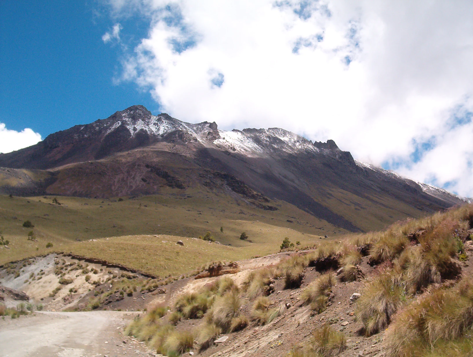
A wide-angle mountain landscape shows a large volcanic peak under a partially cloudy blue sky; the upper slopes are dusted with snow, while the foreground consists of dry, grassy volcanic terrain.
A view of the Nevado de Toluca volcano showing its characteristic volcanic slopes and light snow cover.

Nevado de Toluca Flora and Fauna Protection Area history and protected-area timeline

The protected area's history is marked by a long period as one of Mexico's earliest national parks, followed by a more recent managerial reclassification. The area was first established as Parque Nacional Nevado de Toluca on January 25, 1936, through a federal decree issued by Mexican President Lázaro Cárdenas. This made it one of the early entries in Mexico's national-park system during a period of significant expansion of the country's protected-area framework.

For decades the area operated as a national park focused on protecting the volcano and its surrounding ecosystems. On September 26, 2013, President Enrique Peña Nieto published a decree that formally changed the status of the area from a national park to a flora and fauna protection area, a category that emphasizes the integrated management of biological resources and ecological services rather than purely scenic conservation.

Although the designation changed, the federal administered status and the threats motivating protection persisted. The reclassification reflected an evolving understanding of the area's ecological and hydrological functions, particularly its role in supporting the Toluca Valley aquifer and the broader set of biodiversity values identified through national biodiversity inventories.

Nevado de Toluca Flora and Fauna Protection Area landscape and geographic character

The landscape of the Nevado de Toluca reserve is defined by the striking volcanic massif that gives the area its name. The Nevado de Toluca is a large stratovolcano in central Mexico with two prominent crater lakes near its summit and extensive eroded flanks shaped by past eruptions and glacial activity. Within the protected area, elevations range from roughly 2,200 meters to 4,680 meters above sea level, producing sharp vertical zonation in vegetation and climate.

The terrain moves from gentler highland slopes in the lower portions of the reserve up through dense forested ridges, exposed volcanic rock fields, and barren alpine surfaces near the volcano's rim. The summit area includes recognizable crater lakes, broad open slopes, and panoramic viewpoints that shape the visual identity of the reserve. Cold air settles into the higher elevations, and the surface geology carries the unmistakable textures of a high volcanic system: dark rocky ground, ash-influenced soils, and contrasting vegetated slopes.

The surrounding valleys, including the Toluca Valley, frame the massif and influence how the landscape reads from below. Even within relatively limited horizontal distance, the visitor moves through clearly distinct elevation zones, each contributing its own character of light, soil, vegetation cover, and weather exposure.

Nevado de Toluca Flora and Fauna Protection Area ecosystems, habitats, and plant life

Ecologically, the reserve sits at a notable biogeographic crossroads where Nearctic and Neotropical influences meet, generating a transitional ecological profile that supports a broad mix of species. The dominant vegetation cover is a mosaic of coniferous forests and oak woodlands, characteristic of Mexico's higher-elevation temperate zones, interspersed with subalpine and alpine environments near the summit.

This combination produces layered habitat zones: pine and fir-dominated forests on the mid slopes, oak-rich woodland communities in transitional elevations, and lower-stature high-mountain vegetation as the terrain rises toward the volcano's barren upper cone. The reserve's ecological significance derives in part from this altitudinal compression, which packs substantial ecological diversity into a relatively compact area.

Beyond its forests, the area also contributes critical environmental services. Its upper slopes act as a key water catchment area, feeding both the Toluca Valley aquifer and a network of streams with regional hydrological importance. This dual role: as habitat for terrestrial biodiversity and as a regulator of regional water resources, gives the protected area a strong conservation identity rooted in functioning ecosystems rather than purely scenic conservation.

Nevado de Toluca Flora and Fauna Protection Area wildlife and species highlights

Wildlife within the protected area reflects its location at the convergence of Nearctic and Neotropical biogeographic realms. Among the mammal groups documented are squirrels, rabbits, coyotes, rodents, opossums, and the endangered romerolagus or teporingo, a small rabbit species endemic to Mexican high-elevation habitats. Reptiles and a diverse bird community round out much of the recorded fauna, supported by the reserve's varied forest types and elevational zones.

The high-elevation forests provide habitat for many bird species associated with Mexico's montane and pine-oak woodland environments, while the open alpine zones and rocky slopes create conditions favored by certain reptile and small-mammal species. Although specific population-level data are limited, the documented presence of more than 1,380 species across plants and animals signals that the area supports a recognizable and diverse wildlife community.

Of particular conservation interest is the inclusion of 62 species that are listed under a category of risk within Mexico's official ecological norm NOM-059, alongside 29 introduced species. The persistence of these diverse fauna groups within a single contiguous protected landscape reinforces the reserve's role as a meaningful refuge for central Mexican wildlife.

Nevado de Toluca Flora and Fauna Protection Area conservation status and protection priorities

Conservation significance in the reserve stems from its combined biodiversity, watershed, and high-elevation ecological values. Because the Nevado de Toluca straddles Nearctic and Neotropical biogeographic regions, the area captures ecological transitions that are not duplicated elsewhere in central Mexico. The presence of 62 species in categories of risk under NOM-059 gives the area concrete, measurable weight as a refuge for vulnerable flora and fauna.

The reserve's hydrological function is equally central to its conservation profile. The upper slopes of the volcano act as a key recharge zone for the Toluca Valley aquifer and contribute flows to ecologically important streams, meaning that degradation of vegetation cover or soils within the reserve would propagate well beyond its borders. Protecting the forest cover, soils, and ecological communities of the volcano's slopes is therefore treated as a regional water-security issue as well as a biodiversity issue.

Management by the Comisión Nacional de Áreas Naturales Protegidas places the area within a coordinated national conservation framework, and its status under the IUCN's protected-area categories reflects its recognized ecological importance. The shift from national-park status to flora and fauna protection status in 2013 also reframed the protection philosophy to emphasize ecological function and habitat management, while preserving federal protection.

Nevado de Toluca Flora and Fauna Protection Area cultural meaning and human context

The Nevado de Toluca has deep cultural resonance in central Mexico that extends well beyond its formal protected status. As one of the most prominent peaks visible from the Toluca Valley, the volcano features in regional identity and traditional landscape perception for communities in surrounding municipalities. The area crosses eleven municipal boundaries, and many of the municipalities within and around the reserve, including Toluca, Tenango del Valle, and Calimaya, carry historical weight in the valley's cultural geography.

The volcano itself has historical and symbolic associations reaching back long before the area received formal protection, and the surrounding highland communities maintain traditional relationships with the land, including agricultural and pastoral land use patterns shaped by elevation and soil conditions. The reserve's modern protected status sits within this longer history of human presence and landscape management in the Toluca Valley region.

Top sights and standout views in Nevado de Toluca Flora and Fauna Protection Area

The reserve's standout qualities include the dramatic high-elevation volcanic landscape of the Nevado de Toluca massif itself, the convergence of Nearctic and Neotropical ecological influences, and a documented biodiversity of more than 1,380 species across plants and animals. Equally notable is the area's role as a critical watershed feeding the Toluca Valley aquifer.

Its long institutional history as one of Mexico's earlier national parks, followed by its 2013 reclassification as a flora and fauna protection area, gives it a distinctive place in the country's protected-area system. The combination of summit crater lakes, deep conifer and oak forests, cold-climate alpine zones, and regional water-supply importance makes the reserve unusually multi-dimensional in its conservation profile.

Best time to visit Nevado de Toluca Flora and Fauna Protection Area

Given the reserve's high elevation and cold microclimate, with annual mean temperatures around 3.9 degrees Celsius, weather conditions vary significantly across the year. Cooler months bring firmer ground and clearer visibility along the upper slopes and crater-lake viewpoints, making them attractive for visitors focused on landscape scenery and high-elevation photography. Warmer months soften conditions in the lower forested portions of the reserve, where wildlife observation and forest exploration can be more comfortable.

Because the area sits among the coldest protected regions in Mexico, visitors should generally expect cold conditions at higher elevations regardless of season, and should plan around the environmental character of the specific zone they intend to explore. Clear days tend to reward visits to the summit area, while overcast or storm-prone periods can obscure views and complicate access across the rocky alpine terrain.

Monthly climate preview

Long-term representative temperature ranges and monthly precipitation distributions across the protected landscape

Área de protección de flora y fauna Nevado de Toluca Climate Normals and Annual Weather Patterns

Historical monitoring data records the measured annual temperature rhythm and monthly precipitation variations across a representative coordinate within Área de protección de flora y fauna Nevado de Toluca. Detailed monthly breakdowns and multi-year climate normals provide comprehensive context for analyzing long-term environmental trends.
Annual mean18 °C
15 °C21 °C
Jan15°
Feb17°
Mar19°
Apr21°
May21°
Jun20°
Jul19°
Aug18°
Sep18°
Oct17°
Nov16°
Dec15°
Warmest month
May

21.4 °C

Coolest month
January

15.1 °C

Wettest month
August

6 mm/day

Driest month
December

0.2 mm/day

Park location guide

Geography guide, regional context, and park location map for Nevado de Toluca Flora and Fauna Protection Area

Nevado de Toluca Flora and Fauna Protection Area park geography, regions, and map view in Mexico

Understand where Nevado de Toluca Flora and Fauna Protection Area sits in Mexico through a broader geographic reading of the surrounding landscape, nearby location context, and its mapped position within the national park landscape.

How Nevado de Toluca Flora and Fauna Protection Area fits into Mexico

Mexico, officially the United Mexican States, is a country in North America spanning the Sierra Madre mountain ranges, coastal plains, and tropical regions. It borders the United States to the north, Guatemala and Belize to the southeast, and has coastlines along the Pacific Ocean, Gulf of Mexico, and Caribbean Sea. With a population exceeding 130 million, Mexico is home to one of the world's most significant concentrations of Indigenous languages alongside Spanish.

Wider geography shaping Nevado de Toluca Flora and Fauna Protection Area in Mexico

Mexico occupies a land area of 1,972,550 km2, making it the thirteenth-largest country in the world. The terrain is highly diverse, featuring the Sierra Madre Occidental and Sierra Madre Oriental mountain ranges, the Mexican Plateau, coastal lowlands along the Pacific and Gulf/Caribbean margins, and the Yucatan Peninsula. The country spans multiple climate zones from desert in the north to tropical rainforest in the south.

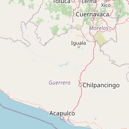
Map view of Nevado de Toluca Flora and Fauna Protection Area

Use this park location map to pinpoint Nevado de Toluca Flora and Fauna Protection Area in Mexico, understand its exact geographic position, and read its mapped placement within the surrounding landscape more clearly.

Pigeon | © OpenStreetMap contributors

Location context for Nevado de Toluca Flora and Fauna Protection Area

Estado de México

Visual exploration of high-elevation terrain, alpine crater lakes, and protected highland forests.

Área de protección de flora y fauna Nevado de Toluca Photos and Volcanic Landscapes

Visual documentation captures the dramatic volcanic terrain, summit crater lakes, and dense conifer forests defining the protected area. Photographic records provide essential reference material for examining elevational zonation, ecological habitats, and high-altitude scenery across the reserve.

A wide-angle mountain landscape shows a large volcanic peak under a partially cloudy blue sky; the upper slopes are dusted with snow, while the foreground consists of dry, grassy volcanic terrain.

Park atlas

Compare nearby high-elevation volcanic landscapes and regional conservation zones

Parks Near Área de protección de flora y fauna Nevado de Toluca and Surrounding Protected Areas

Browsing other protected areas near Área de protección de flora y fauna Nevado de Toluca reveals connected highland ecosystems across central Mexico. Comparing adjacent regional parks provides deeper context on local volcanic terrain, high-altitude forests, and watershed geography.
National parkMexico State
Mapped park locations coincide#1 closest

Southeast

Nevado de Toluca National Park: Protected Landscape Atlas and Geographic Context

Explore mapped boundaries and regional terrain within Mexico State.

Nevado de Toluca National Park serves as a key protected landscape for understanding the natural geography of Mexico State. This destination facilitates detailed exploration of its mapped territory, protected area identity, and the surrounding regional context. Discover how this national park fits into the larger geographic atlas through its distinct terrain and documented boundaries, offering a factual foundation for landscape research.

Area
510 km²
Established
1936
IUCN
VI
Relief
Mountain
Protected landscapeEstado de México
About 30 km away#2 closest

Northeast

Ciénegas del Lerma: Protected Highland Wetland Landscape in the State of Mexico

Mapping the upper Lerma River basin and remnant marsh ecosystems.

Ciénegas del Lerma serves as a significant protected landscape in central Mexico, encompassing three main lakes and extensive marshland corridors. This atlas entry details the site's hydrological structure, encompassing open-water zones and alluvial soils that support diverse aquatic vegetation and endemic species within a human-influenced highland setting.

Area
30.23 km²
Established
2002
IUCN
VI
Relief
Upland
Protected areaState of Mexico
About 34 km away#3 closest

West

Zona Protectora Forestal los terrenos constitutivos de las cuencas de los ríos Valle de Bravo, Malacatepec, Tilostoc y Temascaltepec

Highland watershed and mountain forest reserve in the State of Mexico

Examine the expansive forested catchment area defined by the Trans-Mexican Volcanic Belt. This protected landscape is fundamental for regional hydrology and provides critical winter habitat within the mountainous geography of the State of Mexico.

Area
1,402.34 km²
Established
1941
IUCN
VI
Relief
Mountain
National parkState of Mexico
About 44 km away#4 closest

East

Lagunas de Zempoala National Park: Protected Landscape and Geographic Atlas Entry

Explore mapped boundaries and natural terrain context.

Lagunas de Zempoala National Park is a dedicated protected area within the State of Mexico, serving as a vital point for understanding national park geography and landscape mapping. This entry provides foundational atlas data on its protected boundaries and its specific natural terrain. It is designed for users seeking structured information on the park's geographic scope and its importance as a mapped natural landscape for regional context.

Area
47.9 km²
Established
1936
IUCN
II
Relief
Mountain
National parkMexico
About 47 km away#5 closest

Northeast

La Marquesa National Park: Atlas of Protected Highland Forests in Mexico's Sierra de las Cruces

Explore its mapped boundaries and regional geographic context.

La Marquesa National Park represents a critical protected natural zone in Mexico's central highlands, specifically within the Sierra de las Cruces mountain range. Its landscape is defined by rugged volcanic terrain, featuring steep slopes and deep ravines densely covered by pine and oak woodlands. Designated as an early national park, it plays a crucial role in watershed protection for the surrounding region, preserving unique highland forest ecosystems and their associated biodiversity. This park offers a tangible example of protected landscape within Mexico's atlas, highlighting its ecological significance and geographic positioning.

IUCN
II
National parkState of Mexico
About 50 km away#6 closest

Northwest

Bosencheve National Park: National Park Protected Landscape within State of Mexico

Explore mapped boundaries and regional geographic context.

Bosencheve National Park, a key national park designation, offers a focused area for understanding protected landscapes and their geographic distribution. This entry provides detailed insights into its mapped boundaries and how it fits within the regional geography of the State of Mexico. It serves as a vital point for exploring Mexico's protected natural areas from a structured, atlas-driven perspective.

Area
146 km²
Established
1940
IUCN
II
Scope
Terrestrial
National parkMexico City
About 53 km away#7 closest

Northeast

Desierto de los Leones National Park: Protected National Park and its Geographic Setting

Explore mapped boundaries and regional landscape context near Mexico City.

Delve into the specifics of Desierto de los Leones National Park, a designated national park recognized for its protected landscape. This MoriAtlas entry focuses on its geographic presence within the Mexico City region, providing clear insights into its mapped boundaries and the surrounding natural terrain. Understand the park's importance as a conservation area and its contribution to the regional geography through dedicated atlas data.

Area
18.67 km²
Established
1917
IUCN
II
Visitors
205K annual
National parkMexico
About 54 km away#8 closest

East

Cumbres del Ajusco National Park: Exploring Mexico's National Park Protected Landscape

Discover mapped boundaries and regional geography.

Cumbres del Ajusco National Park is an important national park offering rich opportunities for geographic exploration. This detailed profile focuses on its identity as a protected landscape within Mexico, providing essential context for map-based discovery. Understand the park's specific location, its mapped territory, and its role within the nation's network of conservation areas, facilitating a structured atlas view.

Area
9.2 km²
Established
1936
IUCN
II
Relief
Mountain

Common questions about visiting, size, designation, and location context for Nevado de Toluca Flora and Fauna Protection Area

Nevado de Toluca Flora and Fauna Protection Area FAQs for park facts, access, geography, and protected area context

Find quick answers about Nevado de Toluca Flora and Fauna Protection Area, including protected-area facts, park geography, trail and visitor context, and how the park fits into its surrounding country and regional landscape.
MoriAtlas Explorer

Continue Your Protected Areas Search Across the Global Atlas

Deepen your exploration by continuing the structured search for national parks and protected areas worldwide. Utilize the comprehensive filtering capabilities to compare different conservation landscapes and refine your understanding of global park geography. Discover more about the distribution and characteristics of protected natural areas.

Global natural geography