

Mori Atlas logo
Marine protected areaNinety Mile Beach Marine National Park

Discover the mapped boundaries and coastal landscape of this significant marine protected area in Victoria, Australia.

Ninety Mile Beach Marine National Park: Protected Marine Area and Coastal Geography

Ninety Mile Beach Marine National Park, located along the renowned Gippsland coast in eastern Victoria, Australia, preserves the vital underwater ecosystems adjacent to one of Victoria's most iconic sandy shorelines. This marine protected area, established in 2002, covers approximately 2,750 hectares of coastal waters and seabed. The park's geographic identity is intrinsically linked to the nearly 100-kilometer straight, unbroken sandy beach that defines this section of the Australian coastline, offering a unique perspective on temperate marine environments and coastal conservation.

marine protected areacoastal parkVictoria national parkGippsland regionsandy beach ecosystemtemperate marine environment

Ninety Mile Beach Marine National Park

Marine protected area

Park overview

Structured park overview, official facts, and landscape profile for Ninety Mile Beach Marine National Park

Ninety Mile Beach Marine National Park park facts, protected area profile, and essential visitor context
Review the core facts for Ninety Mile Beach Marine National Park, including designation, size, terrain, visitor scale, habitats, and operating context in one park-focused overview.

About Ninety Mile Beach Marine National Park

Ninety Mile Beach Marine National Park represents Victoria's marine protected area network along its eastern coastline. The park extends along the waters adjacent to the well-known Ninety Mile Beach, which runs approximately 100 kilometres along the Gippsland coast from Port Albert to the town of Lakes Entrance. The marine national park was established in 2002 as part of Victoria's marine protected area expansion, bringing formal conservation status to the coastal waters that hug this extensive sandy shoreline. The park's waters encompass a range of marine and near-shore environments, contributing to biodiversity protection in a region that includes both the beach system and the extensive Gippsland Lakes behind it. As a marine national park, it sits within a broader context of coastal protection that includes adjacent terrestrial and coastal park designations, creating a conservation corridor from the shoreline into inland wetland systems.

Quick facts and research context for Ninety Mile Beach Marine National Park

The marine national park is located off the Gippsland coast in eastern Victoria, approximately 30 kilometres south of the city of Sale. It was established in November 2002 and covers an area of 27.5 square kilometres (2,750 hectares). The park protects marine waters adjacent to Ninety Mile Beach, one of Victoria's longest continuous sandy beaches. The protected area lies alongside the Gippsland Lakes Coastal Park, creating a connected coastal conservation landscape. The park falls under IUCN category II classification as a national park and is managed by Parks Victoria.

Park context

Deeper park guide and search-rich context for Ninety Mile Beach Marine National Park

Ninety Mile Beach Marine National Park history, landscape, wildlife, and travel context
Explore Ninety Mile Beach Marine National Park through its history, landscape character, ecosystems, wildlife, conservation priorities, cultural context, and seasonal travel timing in a structured park guide built for atlas discovery and search intent.

Why Ninety Mile Beach Marine National Park stands out

Ninety Mile Beach Marine National Park is best known for protecting the marine environment along one of Victoria's most celebrated coastal stretches. The park safeguards the underwater ecosystems that exist parallel to the famous Ninety Mile Beach, a straight, unbroken sandy shoreline that defines much of the eastern Victorian coast. The marine national park preserves coastal waters that support diverse marine life and habitats, contributing to the broader ecological integrity of the Gippsland coastal region. What makes this park distinctive is its role in protecting the submerged portion of a landscape that is visually prominent in the region's geography.

Ninety Mile Beach Marine National Park history and protected-area timeline

The Ninety Mile Beach Marine National Park was formally established through government gazettal on 16 November 2002. This designation represented a significant expansion of Victoria's marine protected area network during the early 2000s, when the state committed to comprehensive marine conservation planning. The establishment of the marine national park came as part of broader coastal management initiatives in the Gippsland region, where the relationship between the coastal beach system, the Gippsland Lakes, and surrounding lands had been increasingly recognized for its ecological significance. The park's creation built upon existing conservation frameworks and placed formal protection over waters that had previously lacked specific marine park status. Parks Victoria assumed management responsibility for the protected area, integrating it into the state's system of marine and coastal park management.

Ninety Mile Beach Marine National Park landscape and geographic character

The marine national park encompasses the waters along a coastline characterized by long, straight sandy beaches formed by wave and current processes along the Gippsland coast. The shoreline of Ninety Mile Beach is remarkably linear, stretching for nearly 100 kilometres and representing one of Victoria's most continuous beach formations. The marine park extends offshore into waters that gradually deepen along this section of the Victorian coast. Behind the beach, the landscape transitions to the Gippsland Lakes system, a series of coastal lagoons and wetlands that run parallel to the shoreline. This combination of exposed ocean beach, nearshore waters, and adjacent lagoon systems creates a distinctive coastal landscape. The region sits within a broader coastal plain that extends along eastern Victoria, with the beach forming a clear boundary between the Tasman Sea and the inland wetland systems.

Ninety Mile Beach Marine National Park ecosystems, habitats, and plant life

The marine national park protects coastal and nearshore marine environments along a section of the Gippsland coast. The waters adjacent to Ninety Mile Beach support marine ecosystems that include seafloor habitats, open water environments, and the productive zones where freshwater from the Gippsland Lakes mixes with coastal waters. The region's marine environment is influenced by the nearby lake system, which creates specific conditions where fresh and salt water interact. This coastal zone supports biodiversity associated with temperate Australian marine environments, including species adapted to sandy-bottom habitats and near-shore waters. The marine park exists as part of a connected environmental system that includes the adjacent Gippsland Lakes Coastal Park, creating protection for both the aquatic and terrestrial components of this coastal landscape.

Ninety Mile Beach Marine National Park wildlife and species highlights

The coastal waters of the marine national park provide habitat for various marine species that inhabit the temperate waters of eastern Victoria. The nearshore and shallow waters along Ninety Mile Beach support fish species and invertebrates that are characteristic of this section of the Victorian coast. The broader Gippsland region is known for its birdlife, particularly waterfowl and waders that utilize the coastal wetlands and lagoon systems. While the marine park specifically protects the waters themselves, the interconnected nature of the coastal system means that marine species benefit from the overall protection of this coastal corridor. The region's position along the East Australian coast places it within migratory pathways for various marine and coastal species.

Ninety Mile Beach Marine National Park conservation status and protection priorities

Ninety Mile Beach Marine National Park contributes to Victoria's marine conservation framework by protecting a significant section of the state's eastern coastline. The park's establishment in 2002 added to Victoria's network of marine national parks, which collectively aim to represent the diversity of marine environments found in Victorian waters. The protected area serves conservation purposes by maintaining habitat for marine species and preserving the ecological character of a distinctive coastal section. The park's location adjacent to the Gippsland Lakes Coastal Park creates a complementary conservation approach that protects both marine and coastal terrestrial environments. This integrated approach acknowledges the ecological connections between beach, nearshore waters, lagoons, and wetlands that characterize the Gippsland coast.

Ninety Mile Beach Marine National Park cultural meaning and human context

The Gippsland region has a human history extending back thousands of years, with Indigenous peoples having associations with the coastal environments that now fall within and adjacent to the marine national park. The beach and surrounding lands hold significance in the cultural history of the region. European settlement of the Gippsland coast occurred from the mid-nineteenth century, with the establishment of towns along this section of coastline and the development of fishing and coastal industries. The naming of Ninety Mile Beach reflects historical measurement conventions rather than precise distance, demonstrating how colonial naming practices shaped the way this landscape is identified.

Top sights and standout views in Ninety Mile Beach Marine National Park

The marine national park protects an extensive section of Victoria's coastal waters along one of the state's most recognizable beaches. The protected area forms part of a connected coastal conservation landscape that includes the Gippsland Lakes Coastal Park, creating meaningful protection for both marine and terrestrial environments. The park preserves the underwater ecosystems associated with a long, straight sandy coastline that is visually distinctive in the Victorian landscape. The establishment of this marine protected area in 2002 represents Victoria's commitment to comprehensive marine conservation along its eastern coast.

Best time to visit Ninety Mile Beach Marine National Park

The marine environment can be experienced year-round, though conditions vary with Victoria's temperate seasonal patterns. Summer months bring warmer water temperatures and more stable weather, making this time popular for coastal activities in the region. Winter brings cooler conditions but still offers opportunities to experience the coast. The Gippsland coast experiences the variability typical of southern Australian coastlines, with weather systems moving through periodically. Visitors interested in the broader Gippsland coastal experience often combine exploration of the marine national park area with visits to the adjacent coastal park and the Gippsland Lakes system, as these destinations are located in close proximity to one another.
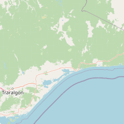
Park location guide

Geography guide, regional context, and park location map for Ninety Mile Beach Marine National Park

Ninety Mile Beach Marine National Park park geography, regions, and map view in Australia
Understand where Ninety Mile Beach Marine National Park sits in Australia through a broader geographic reading of the surrounding landscape, nearby location context, and its mapped position within the national park landscape.

How Ninety Mile Beach Marine National Park fits into Australia

Australia is a constitutional monarchy and federal parliamentary democracy comprising six states and ten territories. With a population of nearly 28 million, it is one of the world's most urbanised countries, with most people concentrated on the eastern seaboard. The country has a high Human Development Index and is known for its cultural diversity, ancient Aboriginal heritage, and unique wildlife.

Wider geography shaping Ninety Mile Beach Marine National Park in Australia

Australia occupies the entire Australian continent, the island of Tasmania, and numerous smaller islands. It is the world's flattest and driest inhabited continent, featuring vast deserts in the interior (the Outback), tropical rainforests along the eastern coast, and a coastline bordering the Indian and Pacific Oceans.

Map view of Ninety Mile Beach Marine National Park

Use this park location map to pinpoint Ninety Mile Beach Marine National Park in Australia, understand its exact geographic position, and read its mapped placement within the surrounding landscape more clearly.

Pigeon | © OpenStreetMap contributors
Park atlas

Trace the protected landscape geography, comparing marine parks and coastal reserves across Victoria's Gippsland region.

Compare Other National Parks and Protected Areas Near Ninety Mile Beach Marine National Park
Browse other protected marine and coastal areas within Victoria, extending your park discovery beyond Ninety Mile Beach Marine National Park. Compare diverse protected landscapes in the Gippsland region and surrounding Victorian coast, tracing the network of conservation efforts and unique ecosystems.
National park

Tarra-Bulga National Park: Ancient Mountain Ash Forest Protected Landscape in Victoria

Explore mapped fern gullies and temperate rainforest ecosystems.

Tarra-Bulga National Park is a protected national park in Victoria, Australia, renowned for its spectacular old-growth mountain ash forests and lush fern gullies. This significant fragment of temperate rainforest offers a unique window into the region's natural heritage and geographic past. Discover the mapped landscape character, including towering trees and vibrant undergrowth, making it a key destination for protected-area exploration.

Area
15.22 km²
Established
1986
IUCN
II
Visitors
80K annual
National park

The Lakes National Park: Coastal Wetland Protected Area in Gippsland

Discover unique island habitats and mapped paperbark forests.

The Lakes National Park offers a unique exploration of coastal wetlands and their mapped geographic features. Situated within the Gippsland Lakes, this protected area showcases diverse island habitats and fringing paperbark forests. As a designated national park, its conservation legacy is evident in the preserved wetland systems and the ecological significance of areas like Rotamah Island, providing a distinct regional landscape for atlas discovery.

Area
23.9 km²
Established
1956
IUCN
II
Relief
Lowland
National park

Morwell National Park: Protected Landscape Diversity in Victoria's Strzelecki Ranges

Explore the mapped terrain and unique forest ecosystems.

Morwell National Park, an Australian national park in the Strzelecki Ranges, is celebrated for its extraordinary plant and animal diversity within a concentrated area. The park preserves critical wet sclerophyll forests and delicate temperate rainforest pockets within deep gullies, offering a distinct landscape character. Its establishment reflects a significant community-driven conservation effort, making it a valuable site for understanding regional protected-area geography and landscape richness.

Area
5.65 km²
Established
1966
IUCN
III
Relief
Highland
Marine protected area

Corner Inlet Marine National Park: Australian Protected Marine Landscape Atlas

Explore tidal wetlands and marine protected area geography.

Corner Inlet Marine National Park is a designated marine protected area in South Gippsland, Victoria, renowned for its ecological importance as part of a Ramsar-listed wetland. This park encompasses the waters and extensive intertidal zones of Corner Inlet, featuring vital seagrass beds and tidal marshes. Its protected status highlights its significance within Australia's marine park network, offering a clear example of coastal inlet conservation and regional landscape context for map-based exploration.

Area
15.5 km²
Established
2002
IUCN
II
Relief
Lowland
National park

Wilsons Promontory National Park: Southernmost Australian National Park with Granite Landscapes and Rainforests

Mapped geography of a dramatic coastal and wilderness park.

Wilsons Promontory National Park, situated at Australia's southern mainland extremity, represents a significant protected landscape. The park's geography is defined by ancient granite formations, creating dramatic peaks and headlands that meet the Bass Strait. Within its boundaries, diverse ecosystems flourish, including rare temperate rainforests and heathy woodlands. This page provides detailed geographic context and atlas-style discovery for this iconic protected area.

Area
505 km²
Established
1898
IUCN
II
Relief
Mixed relief
National park

Baw Baw National Park: Subalpine Granite Landscapes and Protected Area Geography

Discover Victoria's southernmost alpine wilderness.

Baw Baw National Park offers a rare glimpse into Australia's subalpine environment, characterized by striking granite boulder formations and iconic snow gum forests. As a protected national park, it safeguards unique ecosystems and habitats, including those for critically endangered species. This atlas entry details the park's distinctive landscape, its mapped boundaries, and its geographic significance as the southern edge of mainland alpine terrain.

Area
135.3 km²
Established
1979
IUCN
II
Relief
Mountain
Marine protected area

Wilsons Promontory Marine National Park: Australia's Southern Marine Protected Landscape

Explore mapped boundaries and island ecosystems at the edge of Bass Strait.

Wilsons Promontory Marine National Park, a 15,500-hectare marine protected area in Victoria, Australia, offers unique atlas exploration of its coastal and island geography. The park's waters surround the Glennie and Anser island groups, showcasing a complex marine terrain where Bass Strait transitions into the Southern Ocean. It complements the adjacent terrestrial national park, creating a comprehensive protected landscape vital for marine biodiversity and regional geographic context. Discover its mapped marine environment and ecologically significant island habitats.

Area
155 km²
Established
2003
IUCN
II
Scope
Marine
National parkTasmania

Kent Group National Park: Protected Landscape in Tasmania, Australia

National Park mapping and geographic context.

Kent Group National Park is an essential protected natural area situated within Tasmania, Australia. This national park offers a clear example of a mapped protected landscape, contributing to the understanding of regional geography and conservation efforts in Tasmania. MoriAtlas provides structured data to explore its boundaries and geographic significance, aiding in a comprehensive atlas-style discovery of its protected natural identity.

Area
312.83 km²
Established
1971
IUCN
II
Scope
Mixed

Common questions about visiting, size, designation, and location context for Ninety Mile Beach Marine National Park

Ninety Mile Beach Marine National Park FAQs for park facts, access, geography, and protected area context
Find quick answers about Ninety Mile Beach Marine National Park, including protected-area facts, park geography, trail and visitor context, and how the park fits into its surrounding country and regional landscape.
MoriAtlas Explorer

Continue Your Protected Areas Search Across the Global Atlas

Deepen your exploration by continuing the structured search for national parks and protected areas worldwide. Utilize the comprehensive filtering capabilities to compare different conservation landscapes and refine your understanding of global park geography. Discover more about the distribution and characteristics of protected natural areas.

Global natural geography