
Mori Atlas logo
Protected areaNordby Bakker

Mapping the dry grasslands, coastal cliffs, and terminal moraine ridges of northern Samsø

Nordby Bakker Protected Area: A Glacial Moraine Landscape in Region Midtjylland

(Natura 2000-område nr. 58 Nordby Bakker)

Nordby Bakker represents a significant protected area within Region Midtjylland, characterized by its expansive dry calcareous grasslands and complex glacial terrain. This terminal moraine, formed by the Great Belt glacier, rises to Ballebjerg and encompasses a diverse coastal fringe of dunes and beach ridges. The area offers a detailed look at island ecology where rare flora and insect populations thrive within a mosaic of open hillsides and nutrient-rich lowland lakes.

dry grasslandcalcareous grasslandmorainecoastal cliffsdunesbeach ridges
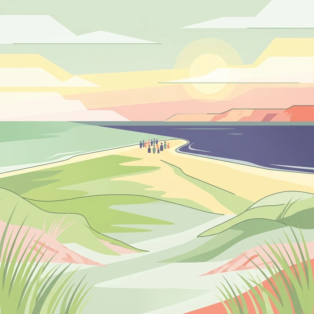
A minimalist, flat-style illustration depicting a coastal landscape with green, rolling dunes in the foreground leading toward a sandy point between two bodies of water. A small group of people is visible standing on the sandy point. The background features a soft sunset sky.

Nordby Bakker

Protected area

Park overview

Structured park overview, official facts, and landscape profile for Nordby Bakker

Nordby Bakker park facts, protected area profile, and essential visitor context

Review the core facts for Nordby Bakker, including designation, size, terrain, visitor scale, habitats, and operating context in one park-focused overview.

About Nordby Bakker

Nordby Bakker represents a remarkable convergence of glacial history, coastal landscape, and dry grassland ecology on the northern tip of Samsø. The protected area covers the entire northwestern corner of the island, running from the headland of Issehoved down along the coast to Asmindør Hage. Its backbone is a terminal moraine, a ridge-like deposit left where the Great Belt glacier paused at the close of the last ice age, which gives the area its characteristic rolling hills and sweeping skylines that face out over the Kattegat.

Although modest in elevation, with Ballebjerg reaching about 64 meters above sea level, the relief is striking by Danish standards and deeply influences the ecology. The moraine slopes transition into a varied coastal fringe of active and stabilized dunes, lime-rich beach ridges, and clay or chalk coastal cliffs, while small freshwater lakes occupy hollows in the landscape. Eight smaller lakes of the nutrient-rich lake type lie within the site, several of them created or restored in recent decades to support amphibians tied to the Habitats Directive.

The site's ecological significance is closely linked to Samsø's distinctive local climate, which is drier and warmer than most of Denmark, with annual precipitation below 500 millimeters compared to a national average of around 660 millimeters. Under these conditions, the dry, sun-exposed slopes maintain an unusually rich calcareous grassland flora, including notable populations of nationally rare plants and several red-listed insect species associated with undisturbed, open dry grassland. Nordby Bakker is therefore both a defining scenic feature of northern Samsø and one of the country's most important inland dry grassland refuges.

Quick facts and research context for Nordby Bakker

Nordby Bakker is a 628 hectare EU Habitat Directive site on northern Samsø, of which the Danish Nature Agency owns around 281 hectares. Its core landscape is a terminal moraine from the Great Belt glacier, with rolling hills, coastal cliffs, dunes, beach ridges, and a small mosaic of inland lakes. About 500 hectares of connected dry calcareous and acid grassland make it one of Denmark's largest continuous overdry grassland areas, and around 480 hectares are covered by long-standing conservation easements originating from 1949 and later decades.

Protection and recognition

Documented protection history and official Natura 2000 recognition details

Nordby Bakker Protection Status and International Recognition Records

Nordby Bakker holds mixed protection status alongside official Natura 2000 recognition established in 2011. Structured records outline the designated management scope and administrative recognition history for the protected area.

International recognition

Protection details

Protection scope
Mixed
Designated year
2011
Transboundary protection
No
Park context

Deeper park guide and search-rich context for Nordby Bakker

Nordby Bakker history, landscape, wildlife, and travel context

Explore Nordby Bakker through its history, landscape character, ecosystems, wildlife, conservation priorities, cultural context, and seasonal travel timing in a structured park guide built for atlas discovery and search intent.

Why Nordby Bakker stands out

Nordby Bakker is best known for hosting one of Denmark's largest coherent tracts of dry calcareous and sand grassland, set on a glacial moraine that rises to about 64 meters at Ballebjerg. The combination of a dry island microclimate, lime-rich soils, and coastal exposure produces a flora unusually rich in nationally rare plant species, alongside red-listed beetles and butterflies that depend on the open, sun-warmed slopes. The landscape is also distinguished by the way its terminal moraine, eroded coastal cliffs, dunes, and inland lakes appear together within a single protected area.
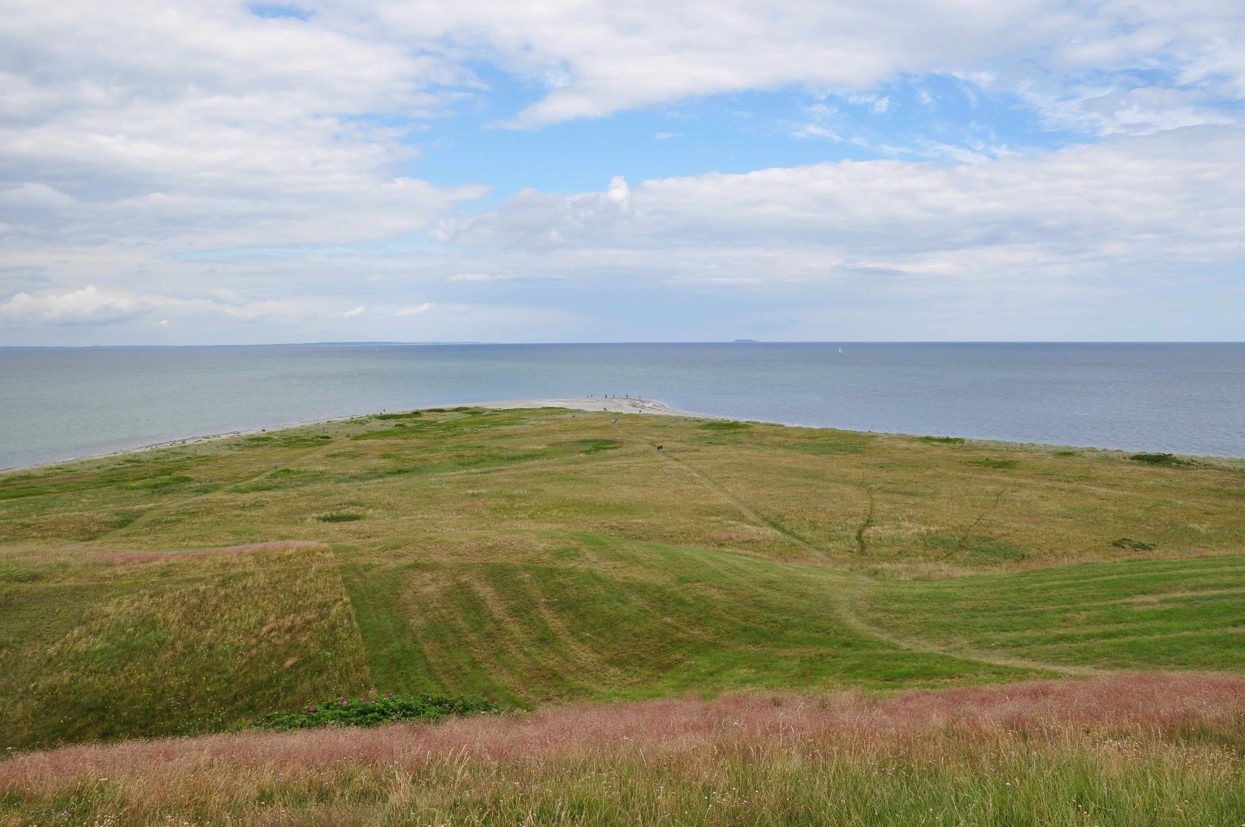
A wide coastal landscape showing a grassy peninsula extending into the sea, viewed from an elevated grassy hill under a partly cloudy sky.
The northern point of Samso, known as Issehoved, viewed from the elevated terrain of Nordby Bakker.

Nordby Bakker history and protected-area timeline

The protection history of Nordby Bakker stretches back to the mid-twentieth century. The first formal conservation easement over the area was established in 1949, marking early recognition of the site's landscape and ecological value. A series of further easements followed during the 1960s and again in 1980, gradually building up the layered protection framework that today covers around 480 hectares of the protected area, including a continuous easement running from Issehoved south to Ballebjerg and the adjacent Kragemose wetland.

In the modern era, Nordby Bakker was designated as Natura 2000 site number 58 and classified as an EU Habitat Directive site, designated H182, with a total area of approximately 628 hectares. A Natura 2000 plan was adopted in 2011, after which the Nature Agency and Samsø Municipality prepared binding action plans for its implementation, and the plan has been carried forward into later planning periods. The terrestrial natural plan is coordinated with the water plan for the Aarhus Bay catchment area, reflecting the integration of freshwater, terrestrial, and coastal management. State ownership through the Danish Nature Agency extends to roughly 281 hectares within the site.

Nordby Bakker landscape and geographic character

The landscape of Nordby Bakker is shaped above all by its terminal moraine, the ridge-like accumulation of glacial debris deposited where the Great Belt glacier halted near the end of the last ice age. This produces a gently undulating terrain that rises inland to its highest point at Ballebjerg, about 64 meters above sea level, before dropping again toward the coast. The moraine creates the open, hilly stage on which the area's ecological value is set.

Along the northwestern and northern coastline, the moraine meets the sea in a varied coastal landscape. Active dunes, older gray and white dune systems, and lime-rich beach ridges fringe the shore, while in places the land ends in coastal cliffs and erosion gullies worn into the moraine and underlying deposits. Inland, the open terrain is broken by scattered thorn scrub, small plantations of conifers, and a mosaic of fields and grazed grassland. Several small lowland lakes lie within the protected area, creating pockets of still water within the predominantly dry landscape.

Nordby Bakker ecosystems, habitats, and plant life

Nordby Bakker is fundamentally a dry grassland landscape, framed by dune and coastal habitats on one side and by inland freshwater features on the other. The principal ecological asset is the extensive complex of dry grassland, including both calcareous sandy dry grassland and true calcareous grassland, which together account for the majority of the protected area. These grasslands support a species-rich flora and a specialized insect fauna that depend on open, warm, and sun-exposed conditions.

Around the coast, the site protects shifting beach ridges with both annual and perennial vegetation, active white dunes, older gray-green dune heath, and coastal cliff habitats, as well as small patches of coastal grassland. Inland, a handful of nutrient-rich lakes, some created or restored in recent decades, provide freshwater habitat. The varied mosaic of dry grassland, dune, cliff, scrub, and small wetland creates a habitat patchwork that supports unusually high botanical diversity for Denmark.

Nordby Bakker wildlife and species highlights

The wildlife significance of Nordby Bakker lies less in charismatic large mammals than in its specialized invertebrate fauna and amphibians. The dry, warm calcareous grasslands shelter several red-listed insect species, including the dung beetle known as the moon scarab and butterflies such as the pale orange-tip and the pearl-bordered fritillary. These insects depend on the persistence of large, undisturbed open grassland with their associated wildflowers.

Amphibians are represented by the great crested newt, which is listed in the site's official designation, while the green toad is relatively common throughout the area and has been a focus of recent pond management. The mosaic of dry grassland, scrub, dune, and freshwater provides a setting in which even small wildlife communities can be unusually rich, contributing to the site's broader value as a habitat island within an intensively used agricultural region.

Nordby Bakker conservation status and protection priorities

Nordby Bakker is one of the most important dry grassland reserves in Denmark and is recognized at the European level through its Natura 2000 and Habitats Directive status. It holds a nationally significant share of the country's dry calcareous sand grassland and a substantial proportion of the calcareous grassland found within Danish habitat sites, which gives it an outsized role in the national conservation strategy for these habitat types.

Conservation management on the site combines long-standing legal protection with active restoration. Roughly 480 hectares are covered by conservation easements, the first of which dates from 1949, providing a stable baseline of legal protection. Active management includes grazing to maintain open dry grassland, restoration and creation of small lakes for amphibians, and coordination with broader Natura 2000 planning, water planning for the Aarhus Bay catchment, and municipal action plans led by Samsø Municipality and the Danish Nature Agency.

Nordby Bakker cultural meaning and human context

Nordby Bakker is closely tied to the identity of northern Samsø and its long history as an island shaped by farming, grazing, and coastal life. The open hills and coastal cliffs have long served as common landscape for grazing and seasonal land use, and the persistence of large areas of never- or long-uncultivated grassland reflects centuries of low-intensity land management rather than deliberate rewilding. Today, the area is part of how residents and visitors experience the natural character of Samsø, marking the transition between the island's cultivated interior and its exposed northern coastline.

Top sights and standout views in Nordby Bakker

Nordby Bakker combines several features in a single protected area: a clear glacial landform in the form of the Great Belt glacier's terminal moraine, one of Denmark's largest connected dry calcareous grassland complexes, and a varied coastal fringe of dunes, beach ridges, and cliffs. The site stands out nationally for its rare dry grassland flora and red-listed insect fauna, and regionally as the signature natural landscape of northern Samsø.

Best time to visit Nordby Bakker

The dry grasslands, dunes, and coastal scenery of Nordby Bakker are most expressive in late spring and summer, when warm weather brings out the wildflower displays on the calcareous slopes and supports the most active period for butterflies and other insects. Cooler seasons still offer clear views across the open moraine landscape and along the coast, but the combination of flowering grassland and insect activity that gives the area its distinctive character is concentrated in the warmer months of the year.

Monthly climate preview

Long-term temperature and precipitation records across twelve months

Nordby Bakker Climate Normals and Average Temperature Patterns

Historical climate data for Nordby Bakker establishes a measured annual rhythm of monthly average temperatures and daily precipitation rates based on representative coordinates. Examining the complete twelve-month normals reveals detailed long-term variations in regional weather patterns.
Annual mean9 °C
2 °C17 °C
Jan
Feb
Mar
Apr
May11°
Jun15°
Jul17°
Aug17°
Sep14°
Oct10°
Nov
Dec
Warmest month
August

17.5 °C

Coolest month
February

1.5 °C

Wettest month
August

2.5 mm/day

Driest month
April

1.3 mm/day

Park location guide

Geography guide, regional context, and park location map for Nordby Bakker

Nordby Bakker park geography, regions, and map view in Denmark

Understand where Nordby Bakker sits in Denmark through a broader geographic reading of the surrounding landscape, nearby location context, and its mapped position within the national park landscape.

How Nordby Bakker fits into Denmark

Denmark is a constitutional monarchy and Nordic country in Northern Europe. It is the southernmost of the Scandinavian countries, bordering Germany to the south, Norway to the north, and Sweden to the southwest. The country consists of the Jutland peninsula and an archipelago of islands, with Copenhagen as its capital and largest city. Denmark has a population of over 6 million and is characterized by flat, arable land, sandy coasts, and a temperate climate.

Wider geography shaping Nordby Bakker in Denmark

Denmark occupies the Jutland peninsula and roughly 406 islands in Northern Europe. It is situated between the North Sea to the west and the Baltic Sea to the east. The country borders Germany to the south and is connected to Sweden via the Øresund Bridge. Denmark is predominantly flat terrain with low elevation, the highest point being Møllehøj at 170.86 meters.

Map view of Nordby Bakker

Use this park location map to pinpoint Nordby Bakker in Denmark, understand its exact geographic position, and read its mapped placement within the surrounding landscape more clearly.

Pigeon | © OpenStreetMap contributors

Location context for Nordby Bakker

Region Midtjylland
Recorded earthquake history

Explore Historical Earthquake Records Associated with Nordby Bakker

Access a structured archive of seismic data associated by location with the Nordby Bakker landscape. This resource provides a clear view of recorded historical events, including magnitudes and proximity metrics, to support geographic exploration of the region using data from official monitoring sources.

Nordby Bakker Earthquake Records

Catalogued events

2 events

Strongest magnitude

Magnitude 3.2

Most recent event

Feb 3, 2005

This history includes earthquakes recorded inside the park or within 50 km of its borders

Explore photographic records of terminal moraine formations and dry grassland habitats across Samsø.

Nordby Bakker Photos and Landscape Scenery: Visualizing Protected Terrain

Visual documentation of Nordby Bakker reveals the intricate topography of coastal cliffs, glacial moraines, and rare calcareous grasslands. Examining these protected area environments offers a clearer understanding of island habitats and regional terrain structures.

A wide coastal landscape showing a grassy peninsula extending into the sea, viewed from an elevated grassy hill under a partly cloudy sky.

Park atlas

Compare surrounding regional geography and connected protected areas

Parks Near Nordby Bakker and Related Protected Landscapes to Explore Next

Browse nearby national parks and protected areas sharing similar glacial terrain and coastal grassland ecosystems. Continuing the comparison helps place the distinctive landscape features of Nordby Bakker within broader regional geography.
A minimalist watercolor painting showing a horizontal landscape of green islands and shoreline against a white background.
Protected areaDenmark
2.1 km away#1 closest

Southeast

Stavns Fjord Protected Area: An Atlas of Danish Coastal Landscapes

Mapping the islands and tidal flats of Samsø

Stavns Fjord offers a rare glimpse into a sheltered coastal landscape set entirely within the island of Samsø. Characterized by its calm waters, shallow tidal flats, and the curving spit of Besser Rev, this protected site is a critical Ramsar wetland habitat for coastal bird populations. Explore the unique geography and layered history, from Viking canals to medieval fortifications, that define this essential Danish protected area.

Area
20 km²
Established
1926
Relief
Lowland
Access
Moderate access
Nature reserveRegion Midtjylland
About 8 km away#2 closest

Southeast

Natura 2000-område nr. 55 Stavns Fjord, Samsø Østerflak og Nordby Hede Protected Landscapes

Coastal lagoons and glacial islands in Region Midtjylland

Gain insight into the expansive marine and terrestrial geography of this protected site. The area spans a diverse mosaic of salt meadows, dunes, and shallow reefs while supporting critical habitats for waterbirds and seals within the Kattegat sea.

Area
156.63 km²
Established
1981
Relief
Lowland
Climate
Temperate
A horizontal watercolor painting depicting a soft, rolling landscape with green grassy fields, small clusters of trees, and tall grasses in the foreground.
Protected areaCentral Denmark Region
8.1 km away#3 closest

Southwest

Horsens Fjord, havet øst for og Endelave: Protected Coastal Landscape and Map Context

Mapping island habitats, reefs, and fjord geography in Denmark

Examine the geographic composition of Horsens Fjord, havet øst for og Endelave, a significant Natura 2000 site. This protected area connects inland fjord waters to open Kattegat coastlines, featuring a chain of islands, tidal sand flats, and submerged stone reefs that define this distinct ecological region.

Area
458.23 km²
Established
2011
Relief
Lowland
Climate
Temperate
Watercolor illustration showing rolling hills, a lake, pink flowering trees, and distant mountains
National parkDenmark
16 km away#4 closest

North

Mols Bjerge National Park: Glacial Geography and Protected Terrain in Central Jutland

Mapping the coastal cliffs and rolling heathland of Denmark

Mols Bjerge National Park protects a sweeping mosaic of glacial hills, woodlands, and coastal zones on the Djursland peninsula. With a landscape shaped by ancient ice sheets, the park offers a detailed view into Denmark's geological history, preserved ancient barrows, and rich botanical diversity along the Kattegat sea.

Area
180 km²
Established
2009
IUCN
II
Relief
Upland
A horizontal watercolor illustration showing a calm coastal bay with grassy banks, winding water channels, and rolling hills in the background under a soft yellow sky.
Protected areaRegion Midtjylland
About 17 km away#5 closest

North

Natura 2000-område nr. 51 Begtrup Vig og kystområder ved Helgenæs Geography and Maps

Coastal grasslands and marine habitats in Region Midtjylland

Examine the complex terrain of Natura 2000-område nr. 51 Begtrup Vig og kystområder ved Helgenæs, an expansive protected area characterized by its diverse coastal cliff systems and large calcareous grasslands. This site documents the evolution of the Kattegat shoreline through its unique recurved spits and lifted seabed formations, providing a window into the natural landscape history of the Helgenæs peninsula.

Area
17.71 km²
Established
2011
Relief
Lowland
Climate
Temperate
Protected areaRegion Midtjylland
17 km away#6 closest

West

Kysing Fjord Protected Area: Coastal Lagoon and Saltmarsh Geography in Region Midtjylland

Mapped coastal lagoon and wetland protected area

Kysing Fjord serves as a significant coastal lagoon system on the eastern Jutland coast. This protected area in Region Midtjylland integrates shallow lagoon waters, saltmarsh meadows, and riverine terrain, offering a precise look at managed coastal landscapes and their ecological importance for wintering bird populations.

Area
3.7 km²
Established
1942
Relief
Lowland
Climate
Temperate
Watercolor painting of a calm coastal bay with soft, layered green hills in the distance and a pale shoreline in the foreground.
Protected areaDenmark
About 17 km away#7 closest

North

Begtrup Vig Protected Area: Glacial Terrain and Coastal Geography in Denmark

Coastal landscape and regional protected area mapping

Begtrup Vig is a distinct coastal bay defined by its glacial history, stretching across the southern Djursland peninsula in Denmark. Within the broader Mols Bjerge national park framework, the area features varied topography including stony shores, sandy coves, and pastoral meadows. This record provides a focused look at the environmental boundaries and geographic significance of this protected habitat, bridging natural terrain with the regional landscape context.

Relief
Upland
Scope
Mixed
Water
Water-dominated
Season
Year-round
Nature reserveRegion Midtjylland
23 km away#8 closest

North

Tved Kær Nature Reserve: Protected Coastal Habitat Geography in Region Midtjylland

Exploring lime-rich fens and coastal cliff terrain.

Tved Kær represents a compact but ecologically dense protected area in Denmark, known for its rare calcareous fen and seepage vegetation. Situated near the village of Tved, this nature reserve integrates coastal cliffs and raised seabed to form a distinct habitat mosaic within the Mols peninsula, serving as a vital site for rare orchid species and lime-rich soil preservation.

Area
0.06 km²
Established
1981
Relief
Lowland
Climate
Temperate

Common questions about visiting, size, designation, and location context for Nordby Bakker

Nordby Bakker FAQs for park facts, access, geography, and protected area context

Find quick answers about Nordby Bakker, including protected-area facts, park geography, trail and visitor context, and how the park fits into its surrounding country and regional landscape.
MoriAtlas Explorer

Continue Your Protected Areas Search Across the Global Atlas

Deepen your exploration by continuing the structured search for national parks and protected areas worldwide. Utilize the comprehensive filtering capabilities to compare different conservation landscapes and refine your understanding of global park geography. Discover more about the distribution and characteristics of protected natural areas.

Global natural geography