Why Northumberland National Park stands out
Northumberland National Park is best known for its exceptional dark sky quality, being the largest Dark Sky Park in Europe, and for encompassing the most complete surviving section of Hadrian's Wall, a Roman fortification that represents one of Britain's most significant historical landscapes. The park also protects the Cheviot Hills, England's northernmost mountainous terrain, and contains the expansive Kielder Forest, a major European afforestation project. The combination of Roman archaeological significance, remote moorland wilderness, and world-class astronomy designation makes this park uniquely distinguished among England's protected landscapes.
Northumberland National Park history and protected-area timeline
Northumberland National Park was established in 1956, making it the last of England's original ten national parks to be designated. The creation of the park represented the culmination of post-war conservation efforts in Britain, reflecting a growing recognition that the distinctive landscapes of Britain's upland and frontier regions warranted formal protection from the pressures of agricultural intensification, industrial forestry, and development. The park's designation in 1956 placed it within a sequence of English national park creations that began with the Peak District, Lake District, and Dartmoor in 1951.
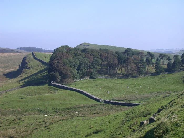
The landscape that became the national park has been shaped by at least 10,000 years of continuous human habitation, with archaeological evidence spanning the prehistoric period through the Roman occupation, the medieval era, and the early modern period of Border Reivers and pele tower construction. The Roman presence is most dramatically evidenced by Hadrian's Wall, constructed under Emperor Hadrian around AD 122 as a defensive fortification marking the northern limit of Roman Britain. The wall's construction involved massive earthworks and stone architecture that still define the landscape today, with the national park protecting the most visually impressive central section.
Following the Roman withdrawal, the Anglo-Saxon kingdom of Northumbria established control over the region, and the name Northumberland itself derives from this period—meaning the land north of the River Humber and related to the ancient kingdom of Northumbria. The medieval and early modern periods saw the frontier region become characterized by conflict and raiding between English and Scottish forces, with the distinctive pele towers—fortified farmhouses—constructed as defensive adaptations to this persistent insecurity. Many of these structures remain visible elements in the farmed valleys of the park.
The twentieth century brought new land uses to the area, notably extensive afforestation programmes that created Kielder Forest beginning in the 1920s and continuing through the mid-century. The Ministry of Defence's acquisition of land for the Otterburn Training Area also occurred during this period, creating the unusual situation where nearly a quarter of the modern national park remains under military use. The park's dark sky designation in 2013 represents the most recent significant recognition of the area's special qualities.
Northumberland National Park landscape and geographic character
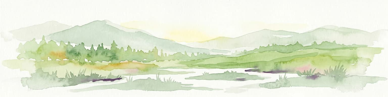
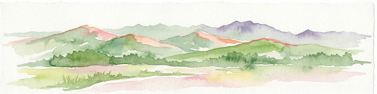
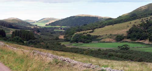
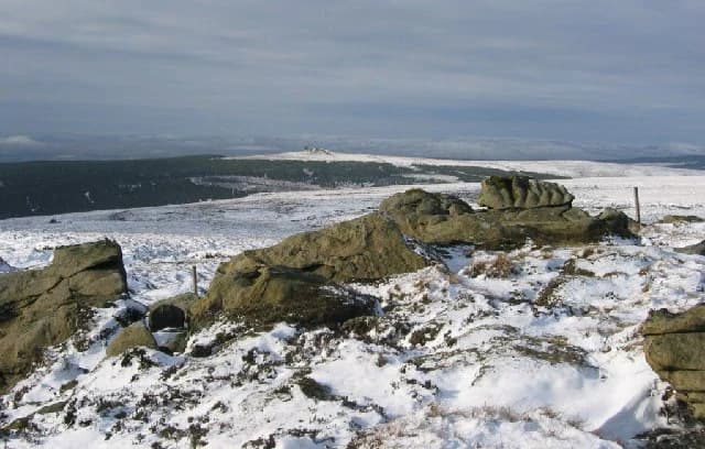
The landscape of Northumberland National Park encompasses a remarkable variety of terrain within a relatively compact area, creating a diversity that defies expectations for Britain's most northerly national park. The Cheviot Hills form the structural backbone of the northern park, a series of rounded, grass-covered summits that rise to 815 metres at The Cheviot itself. These hills are characterized by broad, smooth ridges, steep-sided valleys, and extensive areas of heather moorland that turn purple with bloom in late summer. The underlying geology of the Southern Uplands contributes weathered sandstone and shale to the soils, creating the characteristic acid grasslands and wet heaths that dominate the hill slopes.
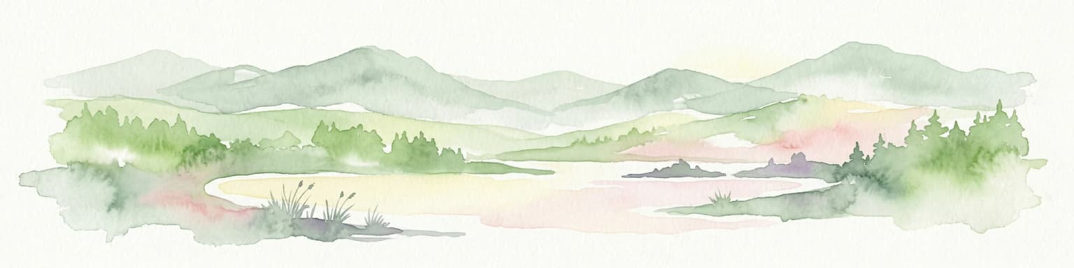
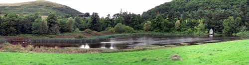
Moving south from the hills, the terrain gradually descends into the broader valley systems that dissect the park, notably the College Valley, the River Coquet valley, and the tributaries of the River Tyne that flow through the southern reaches. These valleys contain the majority of the park's farmland, with mediaeval field patterns and traditional stone farmsteads providing the human-scaled element of the landscape. The contrast between the open, windswept tops and the sheltered, enclosed valleys creates a landscape of considerable visual variety.
The southern part of the park introduces the dramatic limestone terrain associated with Hadrian's Wall, where thewall crests the Whin Sill geological formation to create a distinctive feature running east-west across the landscape. This geological band produces crags, cliffs, and dramatic drops that the Roman engineers utilized for defensive positioning. The Whin Sill also creates the waterfalls and rocky gorges that characterize the wall country, most notably at Cuddy's Gap and the stream crossings that became the basis for Roman fort positions.
Kielder Forest dominates the south-western park, an extensive plantation of coniferous trees that represents one of Europe's largest afforestation projects. The forest's geometric block plantings create a landscape very different from the semi-natural environments elsewhere in the park, though recent phases of felling and replanting have introduced more variety and structural diversity. The forest surrounds Kielder Water, a reservoir created in the 1980s that provides recreational facilities while also serving as a habitat for wildlife.
Northumberland National Park ecosystems, habitats, and plant life
The ecological character of Northumberland National Park is defined by extensive semi-natural habitats that have survived the modifications affecting much of lowland Britain. The upland heaths and blanket bogs represent some of the most important such habitats in England, with the park supporting large areas of heather-dominated heath, acid grassland, and peat-accumulating bog communities that have developed over centuries of relatively low-intensity land use. These habitats are particularly significant because they represent a decreasing resource across Britain, as similar areas elsewhere have been drained, ploughed, or afforested.
The Cheviot Hills support a specialized upland bird community that includes species such as the golden plover, dunlin, and red grouse, with the curlew—chosen as the park's official symbol—being particularly characteristic of the damp grasslands and moorlands. The park's populations of breeding waders represent a significant national resource, though like many upland bird communities they have faced pressures from habitat change and predation. The open hills also support merlin and peregrine falcon as breeding species, while the mix of coniferous plantation and native woodland in the lower valleys provides habitat for species such as goosander and otter along the watercourses.
Kielder Forest has developed an ecological significance that was not anticipated at its creation, with the extensive coniferous plantation and the reservoir of Kielder Water creating new habitats that have been colonized by species expanding their British ranges. The forest now supports populations of species such as the capercaillie, which has established a significant breeding population in the plantation, though this population faces conservation challenges. The reservoir and its margins provide habitat for wintering wildfowl and osprey, which have colonized the area as breeding species in recent decades.
The designation of much of the park as a Dark Sky Park emphasizes the park's value not only for daytime ecology but also for nocturnal nature, with the dark skies supporting insects such as moths that are dependent on natural light cycles and astronomical predators such as barn owls that hunt in low-light conditions. The combination of upland, wetland, plantation, and farmland habitats within the park creates an ecological diversity that supports a range of species across taxonomic groups.
Northumberland National Park wildlife and species highlights
Northumberland National Park supports a wildlife community characteristic of Britain's northern uplands, with several species particularly emblematic of the park's ecological identity. The Eurasian curlew, with its distinctive long curved bill and evocative breeding call, has been adopted as the park's official symbol and remains a common breeding species across the moorland areas. The sight and sound of curlew on the open hills in spring represents one of the park's most characteristic wildlife experiences, though like many upland wader populations the species faces ongoing conservation challenges related to habitat change and nest predation.
The upland bird community also includes significant populations of golden plover and dunlin breeding on the higher ground, with these species occupying the most exposed and boggy areas of the Cheviot Hills. Red grouse are abundant across the heather moorlands, maintaining populations that support traditional grouse shooting interests while also serving as prey for raptors such as the hen harrier and peregrine falcon that hunt the open ground. The park's raptors include merlin as a breeding species and occasional visits from species such as the short-eared owl that hunt the open areas in winter.
The watercourses and wetlands of the park support their own distinctive wildlife, with the rivers and streams providing habitat for otter and goosander, the latter being a species that has expanded its British range northward in recent decades. The reservoir of Kielder Water has become a significant site for wintering wildfowl and has been colonized by osprey as a breeding species, with these fishing raptors now raising young in the forest surrounding the reservoir each summer. The coniferous plantation of Kielder Forest supports a distinct community that includes capercaillie, crossbill, and siskin among the tree-dependent species.
The mammalian fauna includes species such as roe deer that are common across the farmed valleys, with the park's extensive areas of semi-natural habitat also supporting smaller mammals including hare, rabbit, and the various vole species that form prey bases for the raptor populations. Foxes and badgers occur across the park, though the more remote upland areas support lower densities of these more adaptable species compared to areas closer to human settlement.
Northumberland National Park conservation status and protection priorities
Northumberland National Park represents one of Britain's most significant protected landscapes, combining extensive semi-natural habitats with archaeological heritage of national and international importance. The designation as a national park provides statutory protection that guides land use and development within its boundaries, while the IUCN Category V classification emphasizes the landscape's character as a protected seascape or landscape where the interaction of people and nature has produced distinct ecological, cultural, and aesthetic values.
The park's Dark Sky Park status, awarded by the International Dark Sky Association in 2013, represents a relatively new form of conservation recognition that protects the nocturnal environment rather than daytime habitats. This designation, covering both Northumberland National Park and the adjoining Kielder area, creates the largest such protected area in Europe and acknowledges that dark skies represent a natural resource worthy of protection alongside more traditional ecological values. The achievement of dark sky status required action to reduce light pollution from settlements and infrastructure across the region.
The management of the park involves balancing multiple interests, including agriculture, forestry, military training, and public access, within the framework of national park purposes that include conservation, enjoyment, and sustainable economic and community development. The Otterburn Training Area, which occupies roughly 23 percent of the park, represents a particular management challenge, with military activities permitted in certain areas while public access restrictions apply in others. This unusual integration of defence uses within a national park has generated ongoing discussion about the appropriate balance between military and conservation interests.
The ecological conservation of upland habitats, particularly the heather moorlands and blanket bogs, represents a major focus for park management, with initiatives aimed at maintaining the traditional low-intensity grazing and burning regimes that preserve these semi-natural communities. The control of muirburn and the management of grazing levels are key tools in maintaining the characteristic moorland landscape and the bird communities it supports. The forest management within Kielder also involves balancing timber production with biodiversity considerations, with the expansion of native woodland and the creation of more diverse habitat structures representing conservation priorities.
Northumberland National Park cultural meaning and human context
The cultural landscape of Northumberland National Park reflects millennia of human occupation and use, creating an archaeological record of remarkable depth and variety. The prehistoric period is represented by burial monuments, stone circles, and field systems that demonstrate continuous occupation from the Neolithic period through the Bronze Age and Iron Age, with the hilltops and valley sides containing evidence of settlement and ritual activity spanning thousands of years. The density of prehistoric monuments in some areas, particularly around the Cheviot Hills, indicates that these uplands supported significant communities in the earlier prehistoric period.
The Roman occupation left the most dramatic physical legacy in the form of Hadrian's Wall, constructed around AD 122 to mark and defend the northern frontier of the Roman Empire. The wall and its associated fortifications—forts, milecastles, and turrets—create a linear archaeological monument of international significance that forms a core element of the park's identity. The UNESCO World Heritage status of the wall reflects its outstanding universal value as a physical demonstration of the Roman Empire's frontier systems and its subsequent influence on the cultural development of northern Britain.
The post-Roman and medieval periods saw the region become a contested frontier between English and Scottish kingdoms, with the landscape shaped by this persistent conflict. The distinctive pele towers—fortified farmhouses with thick walls and small windows—represent a architectural response to the threat of raiding, with many surviving examples visible in the park's valleys. The Border Reivers, raiders who operated across the frontier from the late medieval period through the seventeenth century, gave this frontier its particular character of violence and adaptability, with the place names and folk traditions of the region still carrying echoes of this turbulent history.
The more recent cultural landscape includes the designed estates and farms that characterize the valley bottoms, the industrial archaeology of nineteenth-century lead mining in some areas, and the twentieth-century forest plantations that have created the contemporary character of Kielder. This layered cultural history, from prehistoric monument to Cold War military training, makes the park an archaeological landscape of exceptional complexity and interest.
Top sights and standout views in Northumberland National Park
Northumberland National Park offers a combination of qualities that distinguish it among England's national parks, beginning with its exceptional dark sky quality—the largest Dark Sky Park in Europe provides celestial views that have become increasingly rare across the continent. The park's embrace of Hadrian's Wall, the most complete and visually dramatic section of this Roman frontier, integrates ancient heritage with landscape conservation in a way unique among British national parks. The Cheviot Hills provide the most northerly mountain terrain in England, offering remote walking and wildlife experiences far from the crowds that visit more accessible parks.
The park's relative remoteness and low visitor numbers create an atmosphere of wilderness that distinguishes it from more heavily used national parks, with vast areas where visitors can walk for hours without encountering other people. Kielder Forest and Kielder Water represent one of Britain's most significant afforestation projects, with the reservoir providing recreational opportunities and the forest supporting wildlife populations of conservation concern. The park's extensive moorlands, representing some of the most intact examples of this habitat in Britain, provide the characteristic purple heather display in late summer and support specialized bird communities including the emblematic curlew.
The integration of active military training within the national park boundary creates a distinctive management scenario, with restricted areas and the presence of military activity adding an unusual dimension to the protected landscape. The archaeological richness of the park, spanning from prehistoric burial monuments through Roman fortifications to medieval pele towers, provides historical interest across an extraordinary time depth. The park's position at the northern edge of England, bordering Scotland, gives it a frontier character that is both geographic and cultural, representing a meeting point of landscapes, histories, and identities.
Best time to visit Northumberland National Park
Northumberland National Park can be visited throughout the year, with each season bringing distinct qualities to the landscape and visitor experience. Spring and early summer, from April through June, bring the breeding bird activity that makes the park particularly rewarding for wildlife observation, with curlew displaying across the moorlands and the first flowers appearing in the meadows and woodlands. The longer days of late spring also provide more time for exploration, though this is also a period when military training activity may restrict access to some areas.
Autumn, from September through November, offers the characteristic purple heather bloom that colours the moorlands in late August and September, creating one of the park's most visually striking seasonal displays. The autumn months also bring the possibility of clear skies and the onset of the dark sky season, with the longer nights of October and November providing excellent conditions for stargazing. This period can also involve more changeable weather, with the first autumn storms bringing the characteristic windswept quality to the open hills.
Winter, while offering short days, provides a different character to the park, with the high hills potentially covered in snow and the empty landscapes offering a particular solitude. The dark winter nights, particularly in December and January, provide the best conditions for dark sky observation, with the Milky Way and winter constellations displayed with exceptional clarity in the park's unpolluted skies. Summer, while providing the longest days for walking, is also the period when the park is at its busiest, though visitor numbers remain far lower than in more accessible national parks.