
Mori Atlas logo
Protected areaØ Bakker

Geographic profile of a prominent hill ridge rising above the flat Nørreå river valley

Ø Bakker Protected Area: Mapping the Glacial Heath Ridge of Central Jutland, Denmark

Rising like an island from the expansive meadows of the Nørreå valley, Ø Bakker represents a significant protected landscape in central Jutland, Denmark. This site encompasses a long, narrow glacial ridge characterized by rugged heath vegetation and stony ground, serving as a remnant of the ancient fjord landscapes that once dominated the region. Through detailed mapping of the ridge and its surrounding valley floor, this site allows for a deeper understanding of the geological history and ecological preservation of Danish heathlands.

heathlanddry heathglacial landscapeNørreå valleynature reserveNatura 2000
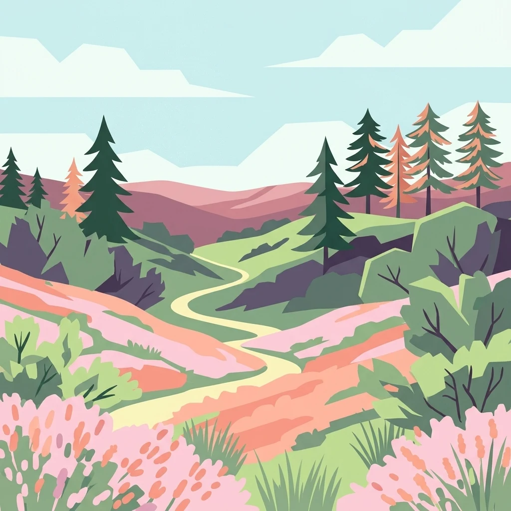
A stylized digital illustration of a winding trail leading through rolling hills covered in pink heather and scattered coniferous trees under a light blue sky.

Ø Bakker

Protected area

Park overview

Structured park overview, official facts, and landscape profile for Ø Bakker

Ø Bakker park facts, protected area profile, and essential visitor context

Review the core facts for Ø Bakker, including designation, size, terrain, visitor scale, habitats, and operating context in one park-focused overview.

About Ø Bakker

Ø Bakker is a protected natural area in the Nørreå valley between Viborg and Randers, in the central part of the Jutland peninsula. The site is named after the small village of Ø and after the elongated hill ridge that defines the reserve. Although it lies in a region of gentle terrain, the ridge rises sharply enough above the surrounding meadows to create a strongly defined sense of place, with sweeping views across the valley from its highest point of roughly fifty-three meters above sea level.

The protected area consists of about 285 hectares, designated in 1975. The eastern portion of the broader land parcel remains in agricultural use, but the western, more rugged portion has been set aside as a nature reserve. This reserve is the focus of public attention, marked by nature trails that lead through the heath and a number of parking areas that allow visitors to enter from surrounding roads.

Ecologically, Ø Bakker is defined by its dry heath vegetation. The landscape carries a typical mix of heath plants including birch, bog myrtle, juniper, bilberry, bog bilberry, cowberry, crowberry, wolf's claw, and golden bog-rhubarb, creating a mosaic of low shrubs and grasses that recolonizes the open ground. To maintain this open character, sheep grazing is used to keep the heath from being overgrown by trees and bushes, a management practice that reflects the long-running Danish tradition of preserving heath landscapes through active stewardship.

Geologically, the ridge is a fragment of the post-glacial landscape. During the Stone Age, the lower ground here was submerged by a long fjord that reached almost to Viborg, connected to Randers Fjord. The hill ridge remained above water as a long, narrow island and was not eroded away by the meltwater rivers of the retreating ice sheet as many similar ridges in the region were. The result is a surviving piece of terrain that preserves both its geological form and its ecological character, anchored in the modern landscape by the meandering course of the Nørreå river.

The area also carries human and cultural associations. Folk tradition places the legendary King Dan, sometimes identified with the early Danish ruler Halfdan the Old, as having been buried at Ø Bakker in full armor. A large glacial erratic boulder in the middle of the reserve is one of the geological curiosities of the site, while the village of Ø itself notes that the name Ø is the shortest registered place name in Denmark.

Quick facts and research context for Ø Bakker

Ø Bakker is located in the Nørreådalen in central Jutland, roughly twelve kilometers east of Viborg. It sits as an elongated, isolated hill ridge rising above flat meadowland on both sides of the Nørreå river.

The nature reserve covers about 285 hectares and was designated as a protected area in 1975. The landscape is dominated by dry heath, glacial soils, and scattered birch and juniper growth, with a large glacial erratic boulder in the central part of the protected zone.

The site forms part of the larger Natura 2000 area that continues along the valley toward Fussing Sø and Rindsholm, linking Ø Bakker into a broader network of protected valley landscapes in central Jutland.

Protection and recognition

Examining official terrestrial boundaries and designation history

Ø Bakker Protection Status and Documented Conservation Scope

Terrestrial protection records define the conservation scope and regulatory framework established for Ø Bakker. Factual designation parameters provide reliable context for exploring the protected landscape.

Protection details

Protection scope
Terrestrial
Transboundary protection
No
Park context

Deeper park guide and search-rich context for Ø Bakker

Ø Bakker history, landscape, wildlife, and travel context

Explore Ø Bakker through its history, landscape character, ecosystems, wildlife, conservation priorities, cultural context, and seasonal travel timing in a structured park guide built for atlas discovery and search intent.

Why Ø Bakker stands out

Ø Bakker is best known for its striking visual profile as a heath-topped hill ridge rising like an island from the flat Nørreå valley meadows. The combination of glacial geology, surviving dry heath vegetation, and broad panoramic views across the valley makes it a recognizable landmark in the central Jutland landscape. It is also notable as one of the more clearly defined examples of a protected Danish heath area that combines active conservation grazing with public access via marked nature trails, and as a place where geological history, cultural legend, and ecological preservation intersect in a single compact site.
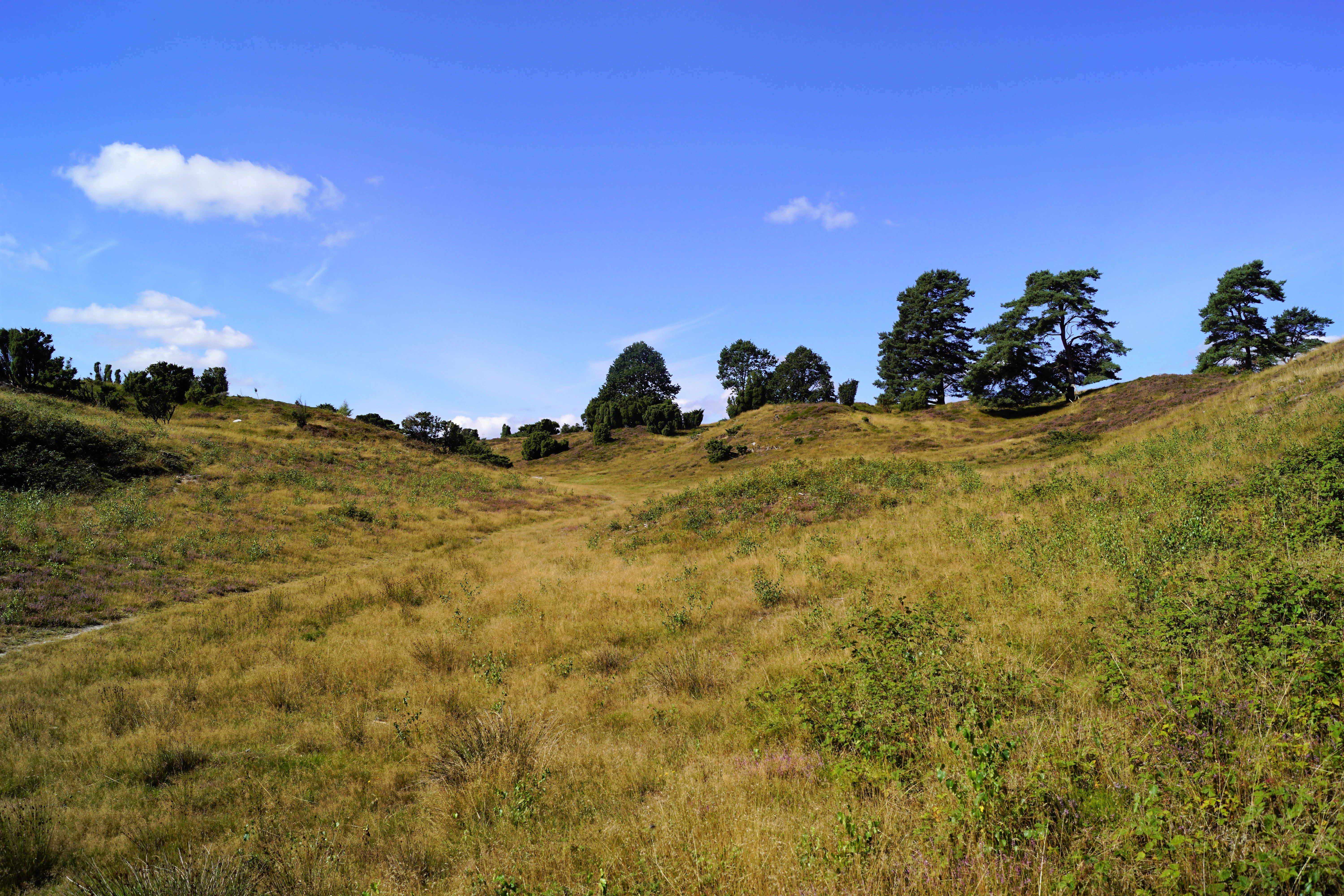
A wide, outdoor shot of a hilly, grassy landscape under a bright blue sky, with scattered trees along the ridges.
A view of the rolling hills and heather landscape of Ø Bakker.

Ø Bakker history and protected-area timeline

The landscape of Ø Bakker has its origins in the closing stages of the last ice age, when the surrounding lowlands were shaped by meltwater and later flooded by a long fjord connected to Randers Fjord, reaching almost to Viborg. The hill ridge survived as an island in that water body and was not eroded away as nearby ridges were, leaving the dramatic isolated form that defines the area today.

During the Stone Age, people likely encountered Ø as a true island surrounded by water rather than as part of a continuous land surface. The site's later cultural memory is preserved in Danish legend, which holds that the semi-legendary King Dan, sometimes identified with the early ruler Halfdan the Old, was buried at Ø Bakker in full armor.

The modern protected status of the area dates to 1975, when approximately 285 hectares were designated under Danish nature conservation law. The designation formalized the protection of the heath landscape and established the framework for public access and conservation grazing that continues to shape the site today. Over time, the area has also been recognized as part of the European Natura 2000 network, connecting it to a broader complex of protected valley landscapes in central Jutland.

Ø Bakker landscape and geographic character

Ø Bakker rises as a long, narrow hill ridge out of the flat meadows of the Nørreå valley, giving the site an unusually distinct silhouette for a lowland Danish landscape. The ridge runs roughly east-west and stands high enough above the surrounding terrain to create a clear sense of separation between the sloping hill and the broad meadowlands on either side.

From the highest point at around fifty-three meters above sea level, the visitor looks southward across the valley toward the wooded ridges beyond Viskum Skov, with the broader Nørreådal opening out below. The slopes of the ridge are uneven and rugged, marked by glacial deposits, small hollows, and stony ground that contributes to the variety of microhabitats across the site.

The valley floor around Ø Bakker is shaped by the natural meanders of the Nørreå, which winds between the meadows and the base of the hill. In the eastern portion of the area, the landscape is more open and agricultural, while the western reserve feels more enclosed, with low heath vegetation, scattered bushes, and stony clearings creating a varied, undulating terrain.
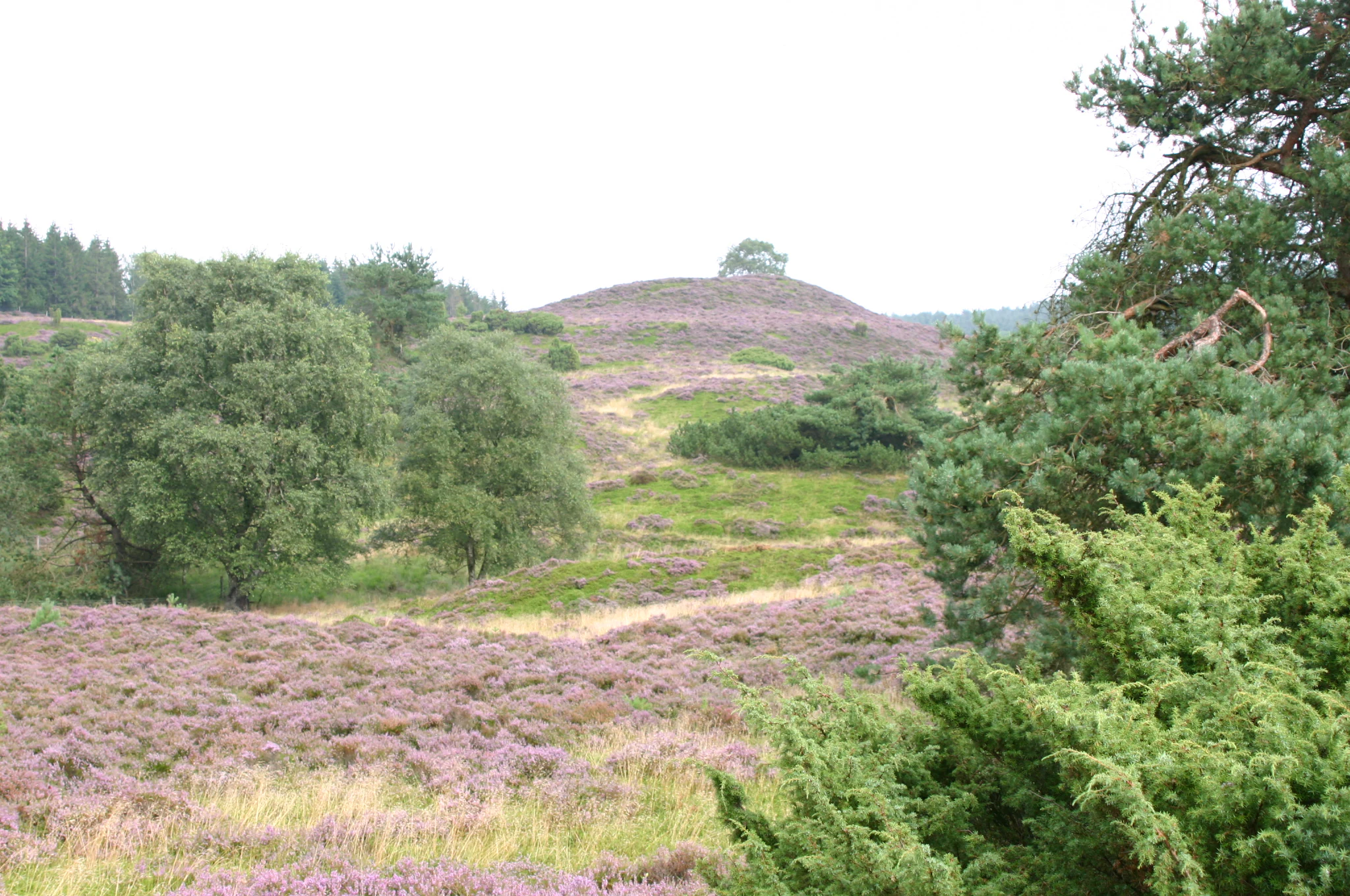
A scenic view of a rolling, grassy, and heather-covered hillside with patches of small trees and shrubs under an overcast sky.
The rolling, heather-covered hills of Ø Bakker, a glacial landscape in Denmark.

Ø Bakker ecosystems, habitats, and plant life

The ecological character of Ø Bakker is closely tied to dry heath. The protected area preserves a classic Danish heath mosaic dominated by low shrubs and herbaceous plants adapted to acidic, sandy, and nutrient-poor soils. These conditions support typical heath species such as birch, bog myrtle, juniper, bilberry, bog bilberry, cowberry, crowberry, wolf's claw, and golden bog-rhubarb, which together create the layered ground cover that defines the reserve.

The combination of exposed slopes, glacial soils, and a managed grazing regime keeps the heath landscape open. Without grazing, succession would gradually convert the open heath into scrub and woodland, so the continued use of sheep grazing is central to maintaining the site's ecological identity.

In addition to its plant life, Ø Bakker is recognized as a habitat for a wide variety of insects, particularly butterflies and dragonflies, which benefit from the mix of open heath, scattered shrubs, and small wetland patches nearby. This insect diversity, in turn, supports a richer food web across the protected area and contributes to the site's broader ecological value within the surrounding valley.

Ø Bakker wildlife and species highlights

Wildlife interest at Ø Bakker centers on its invertebrate fauna, particularly butterflies and dragonflies, which find favorable habitat in the open heath, heath margins, and adjacent wetland edges. The diversity of these insect groups is often cited as one of the defining ecological features of the reserve.

The mix of dry heath, scattered birch and juniper, and small sheltered clearings creates conditions for a varied insect community that, in turn, supports the broader food web of the protected area. Grazing by sheep shapes the vegetation structure and indirectly influences the distribution of insects and other small fauna across the ridge.

While the area is not primarily characterized as a mammalian or large-bird reserve, its role as a surviving patch of dry heath in an otherwise agricultural landscape gives it value for any species, including various birds, that depends on open lowland heath habitats in Denmark.

Ø Bakker conservation status and protection priorities

Ø Bakker has been protected under Danish nature conservation law since 1975, when approximately 285 hectares were designated as a nature reserve. The designation reflects the long-standing Danish tradition of preserving heath landscapes, which once covered much larger portions of Jutland but have been reduced by agriculture and afforestation.

A central element of the conservation approach is the use of sheep grazing to keep the heath open. As traditional grazing declined, trees and shrubs began to colonize the area, threatening both the heath vegetation and the open character of the landscape. Fencing and managed grazing have been introduced to reverse this trend and to preserve the distinctive open heath profile that defines the site.

The area is also part of the European Natura 2000 network via Natura 2000 site number 30, which links Ø Bakker through a narrow connection near Fussing Sø to a much larger protected complex that extends along the Nørreådalen and Skals Ådal toward Rindsholm. This integration into a broader network strengthens the conservation significance of Ø Bakker beyond its own boundaries, providing continuity with other protected valley landscapes in central Jutland.

Ø Bakker cultural meaning and human context

Ø Bakker sits at the meeting point of geological history, local folklore, and modern nature conservation. The site's most distinctive cultural marker is the legend of King Dan, a semi-legendary figure sometimes identified with Halfdan the Old, an early Danish ruler associated with the origin of the name Denmark. According to local tradition, King Dan was buried at Ø Bakker in full armor, a story that ties the landscape to broader narratives of Danish national origin.

The small village of Ø, after which the area is named, also holds a place in Danish cultural curiosity as the holder of the shortest registered place name in the country. The combination of unusual naming, dramatic landscape, and ancient burial legend gives Ø Bakker a cultural resonance that goes beyond its ecological and geological significance.

Top sights and standout views in Ø Bakker

The most distinctive feature of Ø Bakker is the visual contrast between the isolated, heath-covered ridge and the flat meadows of the Nørreå valley, a contrast that is unusually sharp for the gentle terrain of central Jutland.

Equally memorable are the protected dry heath communities and the management tradition that sustains them through grazing, the long-distance views from the high point toward the forested valley slopes, and the large glacial erratic boulder at the heart of the reserve. The site's connection to the Natura 2000 network and its embedded place in Danish legend about King Dan add further layers of interest.

Best time to visit Ø Bakker

The character of Ø Bakker changes with the seasons, and timing can shape both the visual and ecological experience of a visit.

In late summer, the heath plants often come into flower, producing the warm purples and golds that are typical of Danish heath landscapes. Spring brings fresh green growth across the slopes and high insect activity, which can make the area particularly rewarding for visitors interested in butterflies and dragonflies. Cooler seasons offer sharper views and quieter conditions, with the broad panoramic views across the Nørreå valley often clearer in cooler, drier weather. The marked nature trails and multiple parking areas make the site accessible across the year, while grazing animals are likely to be present in the open heath during the grazing season.

Monthly climate preview

Track representative annual temperature ranges and precipitation patterns across the protected landscape

Ø Bakker Climate Normals and Long-Term Monthly Weather Statistics

Long-term data records document measured temperature fluctuations and monthly precipitation averages across representative coordinates in Denmark. Examining the full twelve-month profile provides complete historical climate statistics for the protected area.
Annual mean8 °C
1 °C17 °C
Jan
Feb
Mar
Apr
May11°
Jun14°
Jul17°
Aug16°
Sep13°
Oct
Nov
Dec
Warmest month
July

16.5 °C

Coolest month
January

0.6 °C

Wettest month
October

2.8 mm/day

Driest month
April

1.6 mm/day

Park location guide

Geography guide, regional context, and park location map for Ø Bakker

Ø Bakker park geography, regions, and map view in Denmark

Understand where Ø Bakker sits in Denmark through a broader geographic reading of the surrounding landscape, nearby location context, and its mapped position within the national park landscape.

How Ø Bakker fits into Denmark

Denmark is a constitutional monarchy and Nordic country in Northern Europe. It is the southernmost of the Scandinavian countries, bordering Germany to the south, Norway to the north, and Sweden to the southwest. The country consists of the Jutland peninsula and an archipelago of islands, with Copenhagen as its capital and largest city. Denmark has a population of over 6 million and is characterized by flat, arable land, sandy coasts, and a temperate climate.

Wider geography shaping Ø Bakker in Denmark

Denmark occupies the Jutland peninsula and roughly 406 islands in Northern Europe. It is situated between the North Sea to the west and the Baltic Sea to the east. The country borders Germany to the south and is connected to Sweden via the Øresund Bridge. Denmark is predominantly flat terrain with low elevation, the highest point being Møllehøj at 170.86 meters.

Map view of Ø Bakker

Use this park location map to pinpoint Ø Bakker in Denmark, understand its exact geographic position, and read its mapped placement within the surrounding landscape more clearly.

Pigeon | © OpenStreetMap contributors

Explore protected heathland views, glacial topography, and valley habitats.

Ø Bakker Photos and Landscape Scenery: Visualizing the Central Jutland Ridge

Visual records reveal the distinctive topography of Ø Bakker, showcasing the heath-covered ridge rising abruptly above the flat meadows of the Nørreå valley. Protected area photography captures the rugged terrain, dry vegetation, and broad vistas that define this central Jutland natural reserve.

A wide, outdoor shot of a hilly, grassy landscape under a bright blue sky, with scattered trees along the ridges.

A wide landscape view of rolling, green, hilly terrain covered in low-lying vegetation and scattered trees under a blue sky with scattered white clouds.

A scenic view of a rolling, grassy, and heather-covered hillside with patches of small trees and shrubs under an overcast sky.

Park atlas

Compare surrounding valley terrain and regional conservation areas in central Jutland

Exploring Other Parks Near Ø Bakker and Connected Protected Landscapes

Browsing other parks near Ø Bakker reveals connected protected landscapes and similar glacial valley formations across the region. Extending the geographic comparison helps trace broader ecological corridors and regional terrain patterns beyond the central Jutland ridge.
Protected areaCentral Denmark Region
About 21 km away#1 closest

West

Fiskbæk Å Protected Area: Geographic Context and Mapped Valley Features in Central Denmark

Restored freshwater corridors and heathland mosaic geography.

Fiskbæk Å functions as a vital protected landscape in the Central Denmark Region, spanning a complex valley system that includes former lake basins and spring-fed wetlands. This detailed view captures the stream's transition from high-ground heath to the Hjarbæk Fjord, highlighting its role as a formally recognized Natura 2000 habitat area.

Area
1.71 km²
Established
1984
Relief
Lowland
Climate
Temperate
Nature reserveCentral Denmark Region
About 24 km away#2 closest

West

Natura 2000-område nr. 39 Mønsted og Daugbjerg Kalkgruber og Mønsted Ådal Geography and Map

Subterranean chalk mines and river valley ecosystems in Central Denmark

This protected area offers a look at a varied mosaic of habitats in central Jutland, spanning steep valley slopes, heath plateaus, and historic subterranean chalk mine complexes. The region acts as a vital habitat for bat species and rare moss flora, defined by its groundwater-fed spring mires and the pristine waters of Birkesø lake.

Area
7.4 km²
Established
2011
Relief
Lowland
Scope
Terrestrial
Protected areaDenmark
About 24 km away#3 closest

West

Natura 2000-område nr. 38 Bredsgård Sø: Protected Area Geography and Landscape Mapping

An examination of valley ecosystems and spring-fed fens in Denmark.

Navigate the geographic boundaries and terrain features of Natura 2000-område nr. 38 Bredsgård Sø. This protected area in central Jutland represents a significant study of wetland restoration, showcasing complex groundwater spring lines, rich fen habitats, and the transition from dry upland heaths to moist valley floors within the Fiskbæk system.

Area
1.72 km²
Established
1984
Relief
Upland
Scope
Terrestrial
A soft watercolor painting depicting a scenic landscape with distant purple hills, green forests, and a body of water in the foreground, set against a plain white background.
Nature reserveRegion Midtjylland
About 32 km away#4 closest

South

Silkeborgskovene Nature Reserve: Mapping the Forest and Lake Highlands of Central Jutland

Protected woodlands and freshwater mosaic in Denmark

Silkeborgskovene represents a profound example of Denmark's inland natural heritage, spanning a wide array of mature beech forests and clear lakes across the Søhøjland. This structured record provides geographic and habitat context for the reserve, detailing its role as a vital Natura 2000 protected area that preserves diverse ecosystems ranging from dry heathland to calcareous fens and unique brown-water aquatic environments.

Area
14.55 km²
Established
2011
Relief
Upland
Climate
Temperate
A minimalist watercolor painting showing rolling green hills and pink heather under a white sky.
Protected landscapeSilkeborg Municipality
About 35 km away#5 closest

South

Sindbjerg og Stovbjerg: Protected Heath and Glacial Landscape near Silkeborg Municipality

Twin heather summits overlooking the central Danish lake district

Sindbjerg og Stovbjerg features two prominent summits that have remained open heathland since early conservation efforts in 1919. This protected landscape offers a rare perspective on the Gudenå tunnel valley, providing panoramic vantage points across Borre Sø and the surrounding forested ridges of Jutland.

Area
0.22 km²
Established
1910
Relief
Upland
Climate
Temperate
A stylized digital illustration of a valley featuring a cascading waterfall between two mountains, with a winding river in the foreground and pine trees.
Protected areaDenmark
About 35 km away#6 closest

East

Randers Fjord Protected Area: Mapping the Reed-Dominated Estuaries of Eastern Denmark

Coastal river mouth geography and tidal wetland terrain

Randers Fjord represents a significant protected area in eastern Jutland, Denmark, characterized by its winding water corridor and tall stands of common reed. This geographic survey details the transition from the Gudenå river channel to the Kattegat, highlighting the marsh-like atmosphere and conservation-focused wetlands that define the regional coastline.

Established
2018
Relief
Lowland
Climate
Temperate
Access
Easy access
Protected landscapeRanders Kommune
About 37 km away#7 closest

East

Naturpark Randers Fjord: Estuarine Geography and Protected Coastal Landscape in Denmark

Regional landscape profile and wetland ecosystem mapping

Naturpark Randers Fjord preserves a notable concentration of diverse ecosystems, from the unique east-facing tidal flats at Udbyhøj to the inland mosaic of bogs and dry grasslands. This protected area offers insight into the complex water-based topography where the Gudenå river meets the fjord. Explore the geographic composition, mapped boundaries, and varied terrain that define this protected landscape in the Randers Kommune area.

Area
292.5 km²
Established
2018
Relief
Lowland
Climate
Temperate
Protected areaCentral Denmark Region
About 38 km away#8 closest

Southwest

Natura 2000-område nr. 40 Karup Å, Kongenshus og Hessellund Heder Landscape and Maps

Central Denmark Region protected heath and river corridors

Investigate the natural terrain of this expansive Natura 2000 protected area. Analyze the distinct combination of the unregulated Karup Å river valley, rich fen systems, and the vast inland heathlands of Kongenshus and Hessellund that characterize this vital Central Denmark geographic feature.

Area
38.01 km²
Established
2011
Relief
Lowland
Climate
Temperate

Common questions about visiting, size, designation, and location context for Ø Bakker

Ø Bakker FAQs for park facts, access, geography, and protected area context

Find quick answers about Ø Bakker, including protected-area facts, park geography, trail and visitor context, and how the park fits into its surrounding country and regional landscape.
MoriAtlas Explorer

Continue Your Protected Areas Search Across the Global Atlas

Deepen your exploration by continuing the structured search for national parks and protected areas worldwide. Utilize the comprehensive filtering capabilities to compare different conservation landscapes and refine your understanding of global park geography. Discover more about the distribution and characteristics of protected natural areas.

Global natural geography