Mori Atlas logo
National parkO Le Pupu-Puʿe National Park

Mapping the protected area boundaries and regional terrain of this national park in Samoa.

O Le Pupu-Puʿe National Park: Discover Samoa's Protected Landscape Identity and Geographic Context

O Le Pupu-Puʿe National Park stands as a distinct protected entity within the island geography of Samoa. This page offers an atlas-style exploration of its mapped boundaries and its role as a national park. Understand the park's place within the broader regional context of Samoa, focusing on its contribution to the nation's network of protected landscapes and natural terrain.

Volcanic LandscapeCloud ForestCoastal CliffsRamsar WetlandMountain ParksIsland Conservation

O Le Pupu-Puʿe National Park

National park

Park overview

Structured park overview, official facts, and landscape profile for O Le Pupu-Puʿe National Park

O Le Pupu-Puʿe National Park park facts, protected area profile, and essential visitor context
Review the core facts for O Le Pupu-Puʿe National Park, including designation, size, terrain, visitor scale, habitats, and operating context in one park-focused overview.

About O Le Pupu-Puʿe National Park

O Le Pupu-Puʿe National Park represents Samoa's flagship protected area and the cornerstone of the nation's conservation estate. The park's establishment in 1978 marked a pivotal moment in Samoan environmental policy, creating the first national park under the National Parks and Reserves Act 1974. The park's dramatic topography reflects the volcanic origins of Upolu, with the central ridge forming a backbone of mountainous terrain that descends steeply to the sea. The O Le Pupu lava field stands as a testament to the island's geological activity, creating a distinctive landscape of rugged volcanic rock amid tropical forest. The park's extent from mountain to coast creates a protected corridor that safeguards watersheds, prevents soil erosion, and maintains the ecological connectivity that Samoan forests require for healthy function. The management of the park has evolved since its creation, moving from the Forestry Division to the Lands, Surveys and Environment Department, and finally to the Ministry of Natural Resources and Environment, reflecting the growing sophistication of Samoan environmental governance.

Quick facts and research context for O Le Pupu-Puʿe National Park

O Le Pupu-Puʿe National Park is located on the island of Upolu in Samoa, approximately 20 kilometers east of the capital Apia. The park covers 5,019 hectares and was established in 1978 under Samoa's National Parks and Reserves Act of 1974. It was originally smaller at 2,800 hectares and expanded over time to its current size, with the most recent expansion in 2008 incorporating the Togitogiga Recreational Reserve. The park encompasses Mount Fito at 1,100 meters elevation, the highest point on Upolu, and descends through forested valleys and marshes to dramatic coastal cliffs. The Ministry of Natural Resources and Environment currently manages the park.

Park context

Deeper park guide and search-rich context for O Le Pupu-Puʿe National Park

O Le Pupu-Puʿe National Park history, landscape, wildlife, and travel context
Explore O Le Pupu-Puʿe National Park through its history, landscape character, ecosystems, wildlife, conservation priorities, cultural context, and seasonal travel timing in a structured park guide built for atlas discovery and search intent.

Why O Le Pupu-Puʿe National Park stands out

O Le Pupu-Puʿe National Park is best known for its dramatic transition from volcanic mountain to coastline, encompassing the O Le Pupu lava field as a defining geological feature. The park protects half of Samoa's native plant species within its boundaries, a remarkable concentration of biodiversity for its size. Its designation as a Ramsar wetland in 2016 recognizes the importance of its marshes and coastal ecosystems. The park's accessibility from Apia makes it a primary destination for visitors seeking to experience Samoa's natural heritage, with the aerial view of the lava cliffs against the Pacific Ocean being particularly striking.

O Le Pupu-Puʿe National Park history and protected-area timeline

The establishment of O Le Pupu-Puʿe National Park in 1978 represented Samoa's first major step toward formalizing protection of its natural landscapes. The park was created under the authority of the National Parks and Reserves Act 1974, which provided the legal framework for identifying and designating areas of national ecological significance. Initially the park covered 2,800 hectares, a substantial area but smaller than its current extent. Through subsequent expansions the park grew to 4,234 hectares before reaching its present size of 5,019 hectares in 2008, when an adjoining forestry project and the Togitogiga Recreational Reserve were incorporated into the park's boundaries. The management of the park shifted over time: it was originally administered by the Forestry Division of the Ministry of Agriculture, Forestry, Fisheries and Meteorology, then transferred in 1989 to the Lands, Surveys and Environment Department, and again in 2005 to the Ministry of Natural Resources and Environment. This evolution in management reflects the broader institutional development of environmental protection in Samoa.

O Le Pupu-Puʿe National Park landscape and geographic character

The landscape of O Le Pupu-Puʿe National Park encompasses a remarkable diversity of terrain within its 50 square kilometers. The park rises from sea level at the Pacific coastline to the summit of Mount Fito at approximately 1,100 meters, the highest elevation on Upolu island. The coastal section features dramatic cliffs that drop sharply into the ocean, creating a rugged shoreline characteristic of volcanic Pacific islands. Inland, the terrain becomes increasingly mountainous as the central ridge of Upolu runs through the park, with deep valleys carving through the slopes. The O Le Pupu lava field occupies a significant portion of the park's mid-elevation zone, characterized by volcanic rock formations and sparse vegetation where the lava flows have not yet been fully colonized by forest. Marshland areas exist in the lower elevations, creating wetland habitat that contributes to the park's Ramsar designation. The combination of coastal cliffs, mountain slopes, volcanic terrain, and wetland areas creates a visually dramatic and ecologically varied landscape.

O Le Pupu-Puʿe National Park ecosystems, habitats, and plant life

The ecological significance of O Le Pupu-Puʿe National Park is extraordinary for its size, with the park protecting half of Samoa's native plant species within its boundaries. This concentration of biodiversity reflects the park's role in preserving multiple forest types across an elevational gradient from sea level to 1,100 meters. Montane forest clothing the upper slopes features species adapted to cooler, cloudier conditions, while lowland forest below supports the more typical tropical flora expected at these latitudes. Littoral vegetation along the coast provides specialized habitat adapted to salt spray and sandy conditions. The park's marshes represent an important wetland ecosystem, supporting both aquatic and terrestrial species and contributing to water regulation within the watershed. The 352 native plant species recorded in the park represent an important conservation asset for Samoa, a small island nation where habitat loss pressures are significant. The park's protection of these species across multiple forest types makes it a critical repository of Samoan botanical heritage.

O Le Pupu-Puʿe National Park wildlife and species highlights

The fauna of O Le Pupu-Puʿe National Park includes at least 51 recorded animal species, with bats representing a particularly significant component of the park's wildlife. Three species of flying fox occur within the park: the Samoa flying fox, the Insular flying fox, and the Pacific sheath-tailed bat. These fruit bats play important roles in seed dispersal and forest ecology across the island. The Pacific boa, a non-venomous snake species, is believed to be present in the park, with remains found in 2018 confirming its continued existence in the area. The park's diverse habitats, from forest canopy to marshland to coastal areas, support a range of ecological niches for different species. However, the park has faced ecological challenges, with Cyclones Ofa and Val causing significant disturbance that allowed the invasive Merremia plant to colonize approximately 10% of the park area, demonstrating the vulnerability of island ecosystems to both natural and introduced pressures.

O Le Pupu-Puʿe National Park conservation status and protection priorities

O Le Pupu-Puʿe National Park holds particular conservation importance for Samoa as the nation's first and oldest protected national park. Its designation as a Ramsar wetland of international importance in 2016 elevated its conservation profile internationally, recognizing the significance of its marshland and coastal ecosystems beyond just terrestrial values. The park's protection of half of Samoa's native plant species within its boundaries makes it a critical anchor for national biodiversity conservation. The elevation gradient from mountain to coast creates a protected corridor that allows species to migrate and adapt to changing conditions, maintaining genetic connectivity across the island's forest ecosystems. The park also serves important watershed protection functions, safeguarding water resources that communities downstream depend upon. Challenges remain, including the invasive Merremia plant that has spread following cyclone damage, requiring ongoing management attention.

O Le Pupu-Puʿe National Park cultural meaning and human context

O Le Pupu-Puʿe National Park occupies traditional Samoan lands that have been part of the island's cultural landscape for generations. The park's name, translating roughly as "The Cliffs-Mountain," reflects the prominent physical features that have shaped local understanding of this landscape. The relationship between Samoan communities and the forested mountains of Upolu extends beyond simple resource use to encompass traditional land management practices and cultural values tied to the natural environment. While the formal protection framework follows modern conservation models, the park's existence depends on the willingness of traditional landholders to participate in the protected area system. The continued ecological health of the park connects to broader questions of Samoan identity and the preservation of the natural heritage that forms part of the nation's self-understanding.

Top sights and standout views in O Le Pupu-Puʿe National Park

O Le Pupu-Puʿe National Park offers visitors the opportunity to experience the full ecological and scenic range of Upolu in a single protected area. The dramatic coastal cliffs provide stunning ocean views, particularly striking in aerial perspective. The ascent from sea level to Mount Fito traverses multiple forest types, demonstrating the ecological diversity that Samoa supports. The O Le Pupu lava field represents a geological highlight where volcanic origins remain visible amid the recovering forest. The park's status as Samoa's oldest national park gives it historical significance, while its Ramsar designation acknowledges modern conservation standards. The relative accessibility from Apia makes the park a practical destination for visitors seeking to understand Samoa's natural heritage.

Best time to visit O Le Pupu-Puʿe National Park

The optimal time to visit O Le Pupu-Puʿe National Park corresponds to Samoa's dry season, typically from May to October, when rainfall is reduced and trail conditions are more favorable for hiking. The cooler, drier months offer more comfortable conditions for exploring the park's mountain trails and coastal areas. Visiting during the wet season from November to April brings increased rainfall, potentially making trails slippery and views less clear, though the lush green vegetation during this period has its own appeal. The park can be visited year-round, but those seeking the most reliable conditions for hiking and sightseeing should plan for the mid-year dry period. Cyclone season overlaps with the wet months, and major storms like Cyclones Ofa and Val have historically affected the park, so visitors should be aware of weather patterns when planning trips.

Park location guide

Geography guide, regional context, and park location map for O Le Pupu-Puʿe National Park

O Le Pupu-Puʿe National Park park geography, regions, and map view in Samoa
Understand where O Le Pupu-Puʿe National Park sits in Samoa through a broader geographic reading of the surrounding landscape, nearby location context, and its mapped position within the national park landscape.

How O Le Pupu-Puʿe National Park fits into Samoa

Samoa, officially the Independent State of Samoa, is a Pacific island nation located in Polynesia. It gained independence from New Zealand on January 1, 1962. The country is known for its Polynesian culture, volcanic landscapes, and traditional village governance system.

Wider geography shaping O Le Pupu-Puʿe National Park in Samoa

Samoa is located in the South Pacific Ocean, approximately 64 km west of American Samoa. The country consists of two main islands (Savai'i and Upolu), two smaller inhabited islands (Manono and Apolima), and several smaller uninhabited islands. The islands are volcanic in origin.

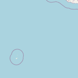
Map view of O Le Pupu-Puʿe National Park

Use this park location map to pinpoint O Le Pupu-Puʿe National Park in Samoa, understand its exact geographic position, and read its mapped placement within the surrounding landscape more clearly.

Pigeon | © OpenStreetMap contributors

Location context for O Le Pupu-Puʿe National Park

Upolu
Park atlas

Trace the broader regional geography and compare protected landscapes surrounding O Le Pupu-Puʿe National Park on Upolu island.

Continue Your Park Discovery: Explore Other Protected Areas Near O Le Pupu-Puʿe National Park
Explore a curated selection of national parks and protected areas geographically connected to O Le Pupu-Puʿe National Park and the surrounding island landscapes. Compare diverse protected areas, including volcanic terrains, coastal ecosystems, and high-elevation cloud forests, to enhance your regional atlas perspective and conservation insight.
National parkUpolu

Lake Lanoto'o National Park: Discover Its Protected Landscape and Geographic Setting on Upolu

Explore park boundaries and regional natural terrain.

Lake Lanoto'o National Park represents a crucial protected area on the island of Upolu, Samoa. This page provides detailed geographic information, focusing on the park's mapped boundaries and its contribution to the natural landscape of the region. Understand its role as a national park and its position within the broader atlas of protected lands, offering insight into the island's unique geography.

Area
4.7 km²
Established
2003
IUCN
II
Relief
Highland
Marine protected areaAmerican Samoa

National Marine Sanctuary of American Samoa: Mapped Marine Protected Area Geography

Discover protected marine landscapes across American Samoa's region.

Investigate the National Marine Sanctuary of American Samoa, a protected marine area with distinct geographic relevance. This detailed view focuses on its mapped boundaries and its role as a protected landscape within the broader atlas of American Samoa. Understand the unique environmental context and protected-area significance that shapes this marine sanctuary.

Area
35,170 km²
Established
1986
Climate
Tropical
Access
Easy access
National parkUnited States of America

National Park of American Samoa: A Mapped Protected Landscape within the USA

Discover its island geography and protected area context.

National Park of American Samoa stands as a significant protected natural area, offering unique insights into island geography and conservation landscapes. Explore its detailed mapped boundaries and understand its placement within the broader atlas of United States of America protected lands. This entity provides a focal point for understanding distinct geographic features and the territorial spread of protected natural resources.

Area
33.414 km²
Established
1988
IUCN
V
Visitors
12.1K annual
National parkAustralia

Norfolk Island National Park: Australian National Park Protected Landscape and Geography

Mapped Boundaries and Natural Terrain Exploration

Delve into the specifics of Norfolk Island National Park, a key protected area contributing to Australia's national park geography. This resource focuses on its mapped boundaries and the distinct natural landscape it encompasses, offering valuable context for understanding its place within a broader geographic atlas. Investigate the terrain and conservation context of this unique Australian national park.

Area
6.5 km²
Established
1984
IUCN
II
Relief
Mountain
National parkNew Zealand

Tongariro National Park: New Zealand's Premier Volcanic National Park Atlas

Explore mapped terrain, active volcanoes, and unique dual World Heritage values.

Tongariro National Park, situated in New Zealand's North Island, is a globally significant protected area celebrated for its dramatic volcanic landscapes and profound cultural heritage. As the nation's oldest national park, it features three active volcanoes: Mount Ruapehu, Mount Ngauruhoe, and Mount Tongariro, set within a diverse terrain that includes forests, alpine zones, and the Rangipo Desert. Its dual World Heritage status underscores its importance for both natural attributes and its sacred cultural landscape, offering rich opportunities for geographic and atlas exploration.

Area
795.96 km²
Established
1887
IUCN
II
Relief
Mountain
National park

Whanganui National Park: Protected Wilderness Landscape and Geographic Context

Explore the mapped boundaries and natural terrain of this national park.

Whanganui National Park offers a unique blend of natural wilderness and significant cultural history, centered on the Whanganui River valley. This protected area safeguards one of New Zealand's most extensive lowland forest ecosystems, providing vital habitat and showcasing a landscape deeply intertwined with Māori traditions and historical settlement. Understanding its geographical setting and mapped protected boundaries reveals its importance as a distinct national park.

Area
742 km²
Established
1986
IUCN
II
Relief
Lowland
National parkNew Zealand

Egmont National Park: New Zealand's Distinctive Volcanic National Park

Explore the mapped volcanic terrain and protected landscape of Mount Taranaki.

Egmont National Park represents a significant protected area within New Zealand's North Island, dominated by the iconic stratovolcano, Mount Taranaki. This national park is celebrated for its distinct circular protected boundary, a unique feature against the surrounding pastoral farmlands, and its dramatic volcanic landscape. Visitors can explore a range of natural habitats from dense temperate rainforests to alpine environments, all mapped within this significant conservation landmark.

Area
341.7 km²
Established
1900
IUCN
II
Visitors
400K annual
National parkTasman District

Abel Tasman National Park: Coastal Protected Landscape and Mapped Geography in Tasman District

New Zealand's smallest national park offering iconic coastal hiking and wildlife.

Delve into the mapped boundaries and unique geography of Abel Tasman National Park, New Zealand's smallest national park located in the Tasman District. This protected landscape features renowned golden beaches, forested hills, and vital island ecosystems. Explore its coastal trails, understand its ecological restoration context, and appreciate its historical significance as a site of early European and Māori interaction, making it a key destination for atlas-driven geographic discovery.

Area
237.1 km²
Established
1942
IUCN
II
Relief
Upland

Common questions about visiting, size, designation, and location context for O Le Pupu-Puʿe National Park

O Le Pupu-Puʿe National Park FAQs for park facts, access, geography, and protected area context
Find quick answers about O Le Pupu-Puʿe National Park, including protected-area facts, park geography, trail and visitor context, and how the park fits into its surrounding country and regional landscape.
MoriAtlas Explorer

Continue Your Protected Areas Search Across the Global Atlas

Deepen your exploration by continuing the structured search for national parks and protected areas worldwide. Utilize the comprehensive filtering capabilities to compare different conservation landscapes and refine your understanding of global park geography. Discover more about the distribution and characteristics of protected natural areas.

Global natural geography