
Mori Atlas logo
Protected landscapeOsceola National Forest

Tracing the pine flatwoods, cypress-hardwood swamps, and historic terrain of this Florida wilderness

Osceola National Forest: A Comprehensive Protected Landscape and Geographic Atlas Map

Osceola National Forest comprises a significant protected landscape within northeastern Florida, characterized by vast pine flatwoods and interconnected cypress-hardwood swamp systems. This geographic entity offers insight into the coastal plain's natural mosaic, featuring the Big Gum Swamp Wilderness and varied wetland habitats. The area supports ecological research and preserves historical sites, including the Olustee Battlefield, within a low-lying terrain that stretches across multiple counties.

pine flatwoodscypress swamphardwood swamplongleaf pine ecosystemfire ecologywildlife refuge
A graphic illustration showing tall pine trees in the foreground with a waterfall cascading down rocky cliffs in the background.

Osceola National Forest

Protected landscape

Park overview

Structured park overview, official facts, and landscape profile for Osceola National Forest

Osceola National Forest park facts, protected area profile, and essential visitor context

Review the core facts for Osceola National Forest, including designation, size, terrain, visitor scale, habitats, and operating context in one park-focused overview.

About Osceola National Forest

Osceola National Forest is one of three national forests in Florida and a defining landscape of the state's northeastern interior. Stretching across roughly 190,000 acres of Columbia, Baker, Bradford, and Hamilton counties, the forest lies west of Jacksonville and south of the Georgia border, occupying a transitional zone where the southeastern coastal plain gives way to a landscape of low, flat pine country punctuated by cypress-lined swamps and broad hardwood bays.

The forest's identity is shaped first and foremost by its fire-adapted ecosystems. Pine flatwoods cover much of the terrain, while cypress-hardwood swamps, including the protected Big Gum Swamp Wilderness, harbor old-growth trees and important wildlife habitat. The Osceola Research Natural Area, designated a National Natural Landmark in 1974, preserves particularly representative examples of these communities for scientific study and long-term ecological reference.

Osceola is also a working cultural landscape. It memorializes the Seminole leader Osceola and the broader Indigenous presence that ranged across this region long before the forest was proclaimed in 1931 by President Herbert Hoover. Within its boundaries lies the Olustee Battlefield, a preserved American Civil War site, and a 28-mile stretch of the Florida National Scenic Trail connects visitors to the wider long-distance hiking network of the state. Recreation, from camping at Ocean Pond to hunting, horseback riding, and wildlife observation, is woven into how the forest is managed and experienced.

Quick facts and research context for Osceola National Forest

Osceola National Forest was proclaimed by President Herbert Hoover on July 10, 1931, and is administered by the U.S. Forest Service as part of Florida's three national forests. It covers about 190,000 acres of pine flatwoods and cypress-hardwood swamp in northeast Florida, spanning Columbia, Baker, Bradford, and Hamilton counties.

A 28-mile section of the Florida National Scenic Trail crosses the forest, and the Olustee Battlefield, site of a significant American Civil War engagement, lies within its boundaries. The Osceola Research Natural Area was designated a National Natural Landmark in December 1974, and the Big Gum Swamp Wilderness protects 13,660 acres of old-growth swamp habitat.

Protection and recognition

Documented terrestrial protection history and management framework

Osceola National Forest Protection Status and Designation History

Osceola National Forest maintains a documented terrestrial protection status established in nineteen thirty-one. Structured records outline the official designation timeline and management scope for this protected area.

Protection details

Protection scope
Terrestrial
Designated year
1931
Transboundary protection
No
Park context

Deeper park guide and search-rich context for Osceola National Forest

Osceola National Forest history, landscape, wildlife, and travel context

Explore Osceola National Forest through its history, landscape character, ecosystems, wildlife, conservation priorities, cultural context, and seasonal travel timing in a structured park guide built for atlas discovery and search intent.

Why Osceola National Forest stands out

Osceola National Forest is best known for its extensive pine flatwoods and cypress-hardwood swamp ecosystems, which together define the character of northeast Florida's pinelands. It is also recognized for harboring the endangered red-cockaded woodpecker, the Florida black bear, and a mosaic of wetland-dependent species that thrive in its swamp and bay systems. The forest carries additional distinction through its Civil War history at the Olustee Battlefield and through a long heritage of prescribed fire management. These layers, ecological, historical, and cultural, give the forest an unusually layered identity among Florida's protected natural areas.
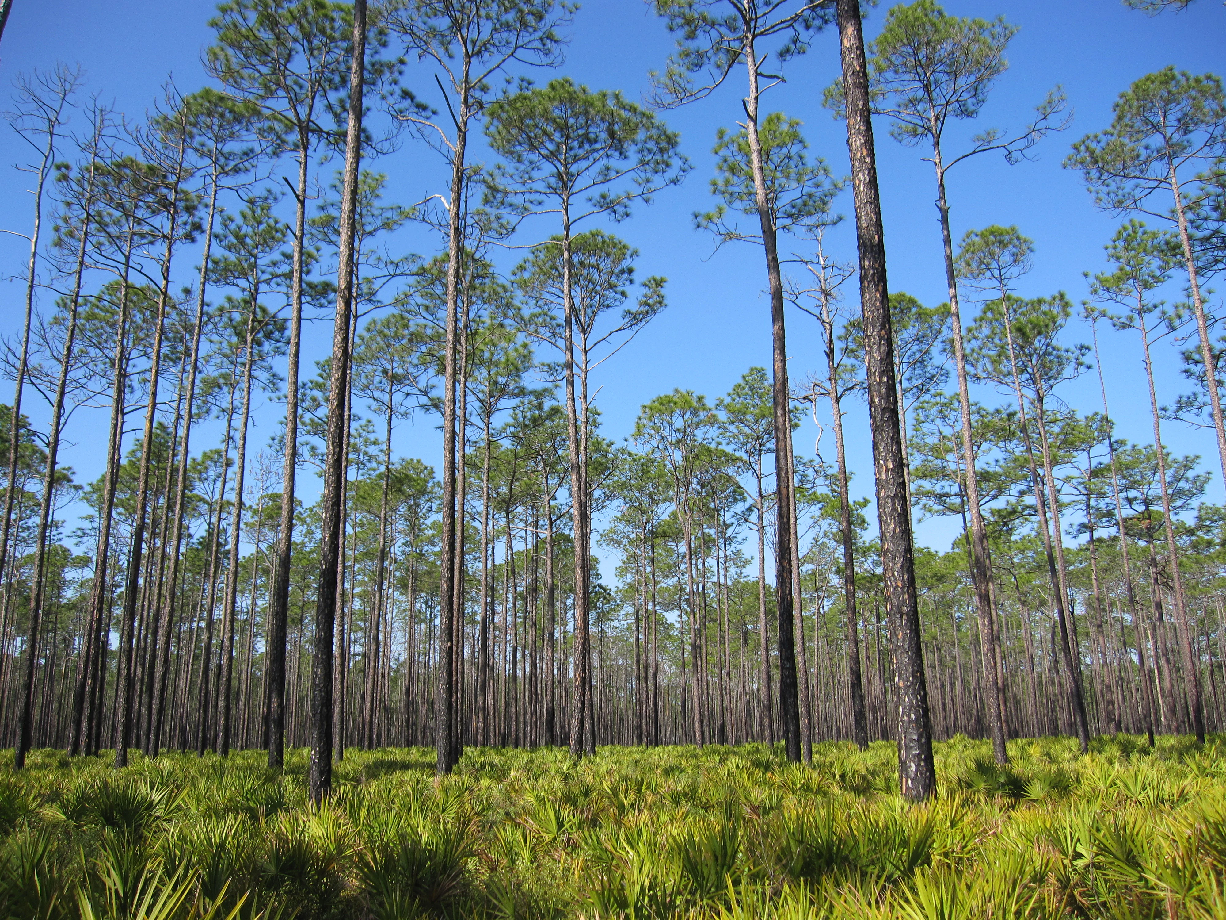
A stand of tall, slender slash pine trees in Osceola National Forest rising above a bright green understory of saw palmetto under a clear blue sky.
Slash pine flatwoods in Osceola National Forest, characterized by open canopy and a lush understory of saw palmetto.

Osceola National Forest history and protected-area timeline

Osceola National Forest has a longer human history than its 1931 designation suggests. Indigenous peoples inhabited and traveled through the area long before it became a federally protected forest, and the landscape itself reflects generations of interaction between people, fire, and the natural systems of the North Florida pinelands.

The modern history of the forest began on July 10, 1931, when President Herbert Hoover issued a proclamation establishing the area as a national forest, naming it after the prominent Seminole warrior Osceola. Since then, the U.S. Forest Service has managed the land for conservation, forestry, recreation, and ecological health, while also incorporating fire management practices that have shaped the forest for much of its existence.

Major fires have been part of that story. In June 1941, a fire that spread across roughly 15 miles required about 600 firefighters to bring under control, an event that underscored both the flammability of the pine flatwoods and the importance of prescribed burning as a management tool. The cultural history of the area is preserved, in part, through the Olustee Battlefield within the forest, a site associated with one of the larger engagements of the American Civil War in Florida. In 1974, the Osceola Research Natural Area was recognized as a National Natural Landmark, further anchoring the forest's ecological and scientific significance.

Osceola National Forest landscape and geographic character

The landscape of Osceola National Forest reads as a vast, low, and subtly varied mosaic typical of the North Florida coastal plain. Pine flatwoods make up much of the terrain, where open stands of pines rise over an understory of wiregrass and other fire-adapted groundcover, creating wide, sunlit vistas under high canopies.

Interspersed among the flatwoods are cypress-hardwood swamps and broader boggy lows, where cypress trees stand in dark, still water and hardwood bays shelter oaks, bays, and other moisture-loving species. The Big Gum Swamp Wilderness area, with its 13,660 acres of relatively undisturbed swamp, preserves some of the forest's most ecologically striking scenery, while natural lakes and ponds, including the 1,760-acre Ocean Pond, add open-water elements to the otherwise forested landscape.

The forest's elevations are modest, with the land generally lying near 200 feet above sea level, which contributes to its flat, expansive character and to the ease with which water collects in shallow depressions and drains slowly across the countryside. This combination of pines, cypress, hardwoods, ponds, and slow-moving water creates a landscape that is at once quiet and visually varied across seasonal and weather conditions.

Osceola National Forest ecosystems, habitats, and plant life

Ecologically, Osceola National Forest is defined by the interplay between fire-maintained pine flatwoods and waterlogged swamp systems, a combination that produces high habitat diversity across a relatively uniform topography. The flatwoods support a wide array of fire-dependent plant communities, while the swamps and bays create permanently moist refuges where different species assemblages can flourish.

The result is one of the most biodiverse national forests in Florida. Longleaf and other pine communities overlap with cypress, tupelo, red maple, bay trees, and a dense understory of shrubs and graminoids. The Osceola Research Natural Area, designated a National Natural Landmark in 1974, is recognized specifically for preserving representative examples of these natural communities and for supporting scientific study of the ecological patterns that sustain them.

Osceola National Forest wildlife and species highlights

Osceola National Forest supports a rich and varied wildlife community that reflects the patchwork of habitats across its flatwoods and swamps. The American alligator is among the most iconic residents, inhabiting the swamps, ponds, and slow-moving waters, while wading birds and other waterbirds make use of the wetland edges and open wet areas.

Among mammals, the forest is home to the Florida black bear, an important symbol of the region's wildlife heritage and a recurring presence on roads crossing the forest; highway signs specifically warn drivers of bear crossings on Interstate 10. Other mammals include the Virginia opossum, raccoon, bobcat, coyote, muskrat, fox squirrels, red fox and gray fox, and two species of skunk. Reports over the years have also raised the possibility of cougar, or Florida panther, presence in the area.

Reptiles and amphibians thrive in the moist landscape as well. The eastern indigo snake, a species of conservation concern, ranges through the forest alongside the gopher tortoise and other reptiles. Amphibians, including the pine woods tree frog, are closely tied to both the wet flatwoods and the swamp systems, while the endangered red-cockaded woodpecker is one of the most significant bird species in the forest, nesting in older pines and serving as a key indicator of longleaf pine ecosystem health.

Osceola National Forest conservation status and protection priorities

As a national forest, Osceola plays a central role in conserving representative examples of Florida's pine flatwoods and cypress-hardwood swamp ecosystems. Its large, connected blocks of habitat support rare, threatened, and endangered species and serve as one of the more important refuges for pine-dependent wildlife in the region.

Wildfire has long shaped the forest, and management of that fire regime is itself a major conservation issue. The forest has experienced significant wildfires, including a 1941 blaze that spread across about 15 miles and required hundreds of firefighters, and prescribed burning remains a central tool used to reduce the risk of catastrophic fires, maintain open pine habitat, and support species that depend on fire-maintained landscapes. Recognition of the forest's ecological importance is reflected in the designation of the Osceola Research Natural Area as a National Natural Landmark in December 1974 and the protection of the Big Gum Swamp Wilderness, which safeguards 13,660 acres of old-growth swamp habitat.

Osceola National Forest cultural meaning and human context

The cultural identity of Osceola National Forest is layered. The forest itself is named after Osceola, a prominent Seminole leader who became a lasting symbol of Indigenous resistance in Florida, and the broader area has a documented history of Native American presence and travel stretching back well before the forest's formal establishment in 1931.

Within the forest's boundaries, the Olustee Battlefield preserves the memory of one of the more significant American Civil War engagements in Florida and offers visitors a tangible link to that period of regional history. Local ranger district operations are based in Olustee, a small community whose identity remains tied to the forest and to the battlefield nearby. Together, these elements give Osceola a cultural profile that extends beyond natural areas management into regional memory and place-based heritage.

Top sights and standout views in Osceola National Forest

Osceola National Forest stands out for its large, contiguous blocks of pine flatwoods and cypress-hardwood swamp, its protected wilderness at Big Gum Swamp, and its nationally recognized research natural area. The endangered red-cockaded woodpecker and the Florida black bear are two of the most distinctive wildlife signatures of the forest, while the Olustee Battlefield and the forest's named connection to Osceola give the landscape a strong cultural footprint.

The 28-mile section of the Florida National Scenic Trail, the variety of developed and primitive camping around Ocean Pond and the hunt camps, and the network of horseback riding, hiking, and historic trails round out a forest that blends ecological conservation, recreation, and regional history into a single protected landscape in northeast Florida.

Best time to visit Osceola National Forest

Osceola National Forest is shaped strongly by its fire ecology and seasonal water patterns, both of which influence when the forest is most rewarding to visit. Cooler and drier months, roughly from late fall through early spring, tend to bring more comfortable temperatures for hiking, horseback riding, and outdoor exploration, and wildlife observation can be strong as animals concentrate around remaining water sources.

Spring and early summer bring vibrant growth in the flatwoods and a high point for amphibian and reptile activity around swamps and ponds, while birds are most active across the warm months. Summer is also the period when prescribed burning and wildfire risk are most pronounced, and conditions in the forest can be hot, humid, and smoky after burns. Visitors who come in cooler seasons typically encounter the most accessible trails and the widest range of comfortable conditions across the forest's different habitats.
Monthly climate preview

Examine long-term representative temperature ranges and monthly precipitation records.

Osceola National Forest Climate Normals and Annual Weather Patterns

Representative coordinate measurements reveal the annual rhythm of average temperatures and precipitation totals across Osceola National Forest from 1991 to 2020. Reviewing the complete twelve-month climatology dataset clarifies long-term environmental trends without relying on short-term forecasts.
Annual mean20 °C
11 °C28 °C
Jan11°
Feb13°
Mar16°
Apr20°
May24°
Jun27°
Jul28°
Aug27°
Sep25°
Oct21°
Nov16°
Dec12°
Warmest month
July

27.5 °C

Coolest month
January

10.8 °C

Wettest month
June

6 mm/day

Driest month
November

1.9 mm/day

Park location guide

Geography guide, regional context, and park location map for Osceola National Forest

Osceola National Forest park geography, regions, and map view in United States of America

Understand where Osceola National Forest sits in United States of America through a broader geographic reading of the surrounding landscape, nearby location context, and its mapped position within the national park landscape.

How Osceola National Forest fits into United States of America

The United States of America is a federal presidential republic and one of the world's largest countries by area and population. It consists of 50 states across a vast territory spanning multiple time zones, with its capital in Washington, D.C. and largest city in New York City. The nation has a diverse economy, influential political system, and significant cultural and military presence globally.

Wider geography shaping Osceola National Forest in United States of America

The United States occupies a vast territory in North America, bordered by Canada to the north and Mexico to the south. The 48 contiguous states stretch from the Atlantic to the Pacific Ocean, while Alaska occupies the northwestern region and Hawaii is an archipelago in the Pacific. The country encompasses diverse terrain including the Rocky Mountains, Appalachian Mountains, Great Plains, and extensive river systems.

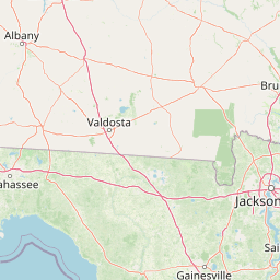
Map view of Osceola National Forest

Use this park location map to pinpoint Osceola National Forest in United States of America, understand its exact geographic position, and read its mapped placement within the surrounding landscape more clearly.

Pigeon | © OpenStreetMap contributors

Location context for Osceola National Forest

Florida

Explore the terrain, pine flatwoods, and cypress swamps of northeast Florida through photography.

Osceola National Forest Photos and Scenery: Visualizing Florida Pinelands

Visual documentation captures the vast pine flatwoods, dark cypress swamps, and open water bodies that define the protected landscape. Examining these photographs helps reveal the underlying terrain, habitat diversity, and unique visual identity of the forest.

A stand of tall, slender slash pine trees in Osceola National Forest rising above a bright green understory of saw palmetto under a clear blue sky.

A small grey and brown mottled treefrog perched on a green leaf.

Park atlas

Compare adjacent pinelands, swamp ecosystems, and regional conservation areas.

Parks Near Osceola National Forest and Surrounding Protected Landscapes

Browsing nearby national forests and protected areas provides deeper geographic context for the North Florida coastal plain. Comparing these adjacent conservation landscapes reveals shared pineland habitats and regional watershed patterns.
A horizontal watercolor painting depicting a soft-toned, light-filled forest landscape with a calm body of water in the foreground and rolling treed hills in the background.
Protected landscapeFlorida
39 km away#1 closest

South

Ocala National Forest: A Comprehensive Look at Florida's Largest National Forest Landscape

Protected scrub ecosystems and hydric river networks

Explore the geographic expanse of Ocala National Forest, the oldest national forest east of the Mississippi. This protected area features the vast Big Scrub, a unique sand pine ecosystem that anchors a diverse terrain of longleaf pine, blackwater rivers, and crystal-clear springs across multiple Florida counties.

Area
1,741.96 km²
Established
1908
Relief
Lowland
Climate
Subtropical
Nature reserveFlorida
About 71 km away#2 closest

East

Guana Tolomato Matanzas National Estuarine Research Reserve: Florida Nature Reserve Atlas

Protected estuarine geography and coastal river convergence

Discover the geographic complexity of this research-driven protected area, where freshwater and saltwater environments converge along the Florida coastline. The reserve features an intricate network of tidal creeks, pine flatwoods, and coastal dunes, providing a unique look into the regional ecology of the Carolinian marine bioregion and its significant role in maritime conservation science.

Area
296.46 km²
Established
1999
IUCN
IV
Relief
Lowland
A pale watercolor landscape painting featuring silhouetted dead trees against a soft, light-colored prairie background.
Wildlife reserveMarion County
72 km away#3 closest

Southeast

Juniper Prairie Wilderness: Wildlife Reserve Geography and Mapped Protected Landscapes

Central Florida ecological preserve in Marion County

Covering over 13,000 acres, Juniper Prairie Wilderness preserves a transition of ecosystems from dry pine scrub to wet sawgrass flats. This wildlife reserve in Marion County provides essential protection for the Juniper River drainage basin and its first-magnitude springs, offering a dense study of central Florida natural history and terrain.

Area
54 km²
Established
1984
IUCN
Ib
Relief
Lowland
A soft watercolor painting of a coastal scene with sandy dunes, pine trees, and palmetto bushes against a pale, warm-toned sky.
Protected areaGeorgia
75 km away#4 closest

Northeast

Cumberland Island National Seashore: Protected Barrier Island Geography and Mapping

A wild coastal landscape on the southeastern Georgia shoreline

Cumberland Island National Seashore stands as a significant protected area on the Atlantic coast, defined by its lack of paved roads and vehicle-free status. The geography spans a complex array of habitats, including maritime forests, tidal creeks, and salt marshes, anchored by historic estates. This protected landscape represents an essential case study in coastal barrier island ecology and preserved historic environments.

Area
147.368 km²
Established
1972
IUCN
II
Visitors
60.3K annual
Marine protected areaGeorgia
163 km away#5 closest

Northeast

Gray's Reef National Marine Sanctuary: Continental Shelf Geography and Reef Mapping

Submerged sandstone ridges and Atlantic marine habitat

Gray's Reef National Marine Sanctuary protects one of the largest near-shore live-bottom reefs in the southeastern United States. This submerged landscape consists of sandstone ledges rising above the sandy seafloor, fostering a unique three-dimensional habitat that supports a diverse range of marine invertebrates and fish species across its 22-square-mile protected boundary.

Area
57 km²
Established
1981
IUCN
IV
Relief
Lowland
A minimalist watercolor illustration showing green rolling hills and a shoreline against a pale background, representing the natural coastal landscape.
Protected landscapeFlorida
About 171 km away#6 closest

Southeast

Canaveral National Seashore Protected Landscape and Barrier Island Geography

Coastal ecosystems of the Florida Atlantic shore

Canaveral National Seashore stands as a significant protected landscape on the Florida coast, offering a cross section of barrier island geography. This protected area connects the dynamic Atlantic oceanfront with the calm, biodiverse waters of the Mosquito Lagoon, forming a vital refuge of dunes, maritime hammocks, and estuarine wetlands.

Area
233.35 km²
Established
1975
IUCN
V
Visitors
2.5M annual
Watercolor painting of a meandering river flowing through a green marshland with rolling hills in the background under a pale sky.
Nature reserveFlorida
About 194 km away#7 closest

West

Apalachicola National Estuarine Research Reserve: Florida Protected Estuary and Coastal Geography

Exploring the tidal marshes and benthic habitats of Florida's Gulf Coast.

Apalachicola National Estuarine Research Reserve offers a deep look into the coastal geography of the Florida panhandle. As a protected area, it manages the complex intersection of estuarine food chains, commercial fishing zones, and vital wetland habitats, utilizing advanced GIS capabilities to map the bay's submerged reefs and tidal channels.

Relief
Lowland
Climate
Subtropical
Scope
Marine
Water
Water-dominated
A minimalist watercolor painting showing a vast coastal marshland with meandering tidal creeks and green islands under a bright, open sky.
Nature reserveSouth Carolina
About 280 km away#8 closest

Northeast

Ashepoo Combahee Edisto Basin National Estuarine Research Reserve: Mapped Protected Area

Coastal river convergence and tidal marsh geography

Spanning 140,000 acres of the South Carolina Lowcountry, this estuarine reserve protects a unique intersection of blackwater river systems and Atlantic coastal marshlands. The area provides a vital habitat for various species, where historic plantation lands, cypress swamps, and productive salt marshes form one of the largest undeveloped estuarine complexes on the United States eastern seaboard.

Area
570 km²
Relief
Lowland
Climate
Subtropical
Access
Access unknown

Common questions about visiting, size, designation, and location context for Osceola National Forest

Osceola National Forest FAQs for park facts, access, geography, and protected area context

Find quick answers about Osceola National Forest, including protected-area facts, park geography, trail and visitor context, and how the park fits into its surrounding country and regional landscape.
MoriAtlas Explorer

Continue Your Protected Areas Search Across the Global Atlas

Deepen your exploration by continuing the structured search for national parks and protected areas worldwide. Utilize the comprehensive filtering capabilities to compare different conservation landscapes and refine your understanding of global park geography. Discover more about the distribution and characteristics of protected natural areas.

Global natural geography