
Mori Atlas logo
National parkPaanajärvi National Park

Examining the boreal wilderness, mountain fells, and river systems of the Karelian borderlands

Paanajärvi National Park: A Deep Analysis of Protected Taiga Landscapes and Glacial Terrain

(National Park Paanajärvi)

Paanajärvi National Park occupies a significant portion of the northern Republic of Karelia, bordering the Finnish wilderness to create a continuous cross-border conservation landscape. The geography is characterized by the extreme depth of Lake Paanajärvi, dramatic white-water rapids along the Olanga River, and the high forested fells that include Mount Nuorunen, the highest point in the region. Scientific interest centers on ancient geological intrusions and hanging mires that define this sub-Arctic taiga environment.

taigaboreal forestglacial lakefellswaterfallsmires

Paanajärvi National Park

National park

Park overview

Structured park overview, official facts, and landscape profile for Paanajärvi National Park

Paanajärvi National Park park facts, protected area profile, and essential visitor context

Review the core facts for Paanajärvi National Park, including designation, size, terrain, visitor scale, habitats, and operating context in one park-focused overview.

About Paanajärvi National Park

Paanajärvi National Park is one of the largest and most remote protected areas in European Russia, occupying a substantial tract of taiga in the far north of Karelia. The reserve lies only a short distance south of the Arctic Circle, and its entire western boundary runs along the international border with Finland, where it meets Oulanka National Park to form a continuous cross-border wilderness. This position gives Paanajärvi a notably continental character; the surrounding mountain valleys produce strongly inverted winter temperatures, while summer conditions remain comparatively warm, creating one of the most climatically extreme environments in Fennoscandia.

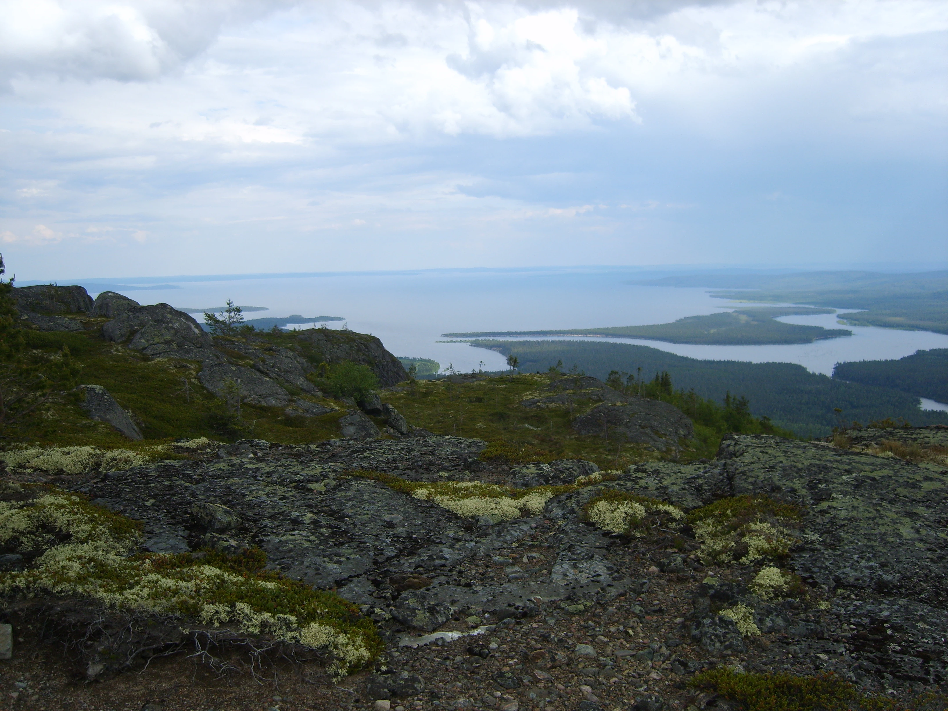
The landscape of the park is shaped by ancient geology. The bedrock includes layered igneous intrusions, granite massifs, and major fault structures of global scientific significance, while the surface is carved into fells, rapids, deep glacial valleys, and a network of lakes and mires. Boreal forest dominates the land cover, interspersed with bogs and small wetlands, and the steep slopes of several fells host unusual so-called hanging mires. Mount Nuorunen, the highest peak in Karelia, and the Kivakka and Tsipringa intrusions are particularly prominent features.

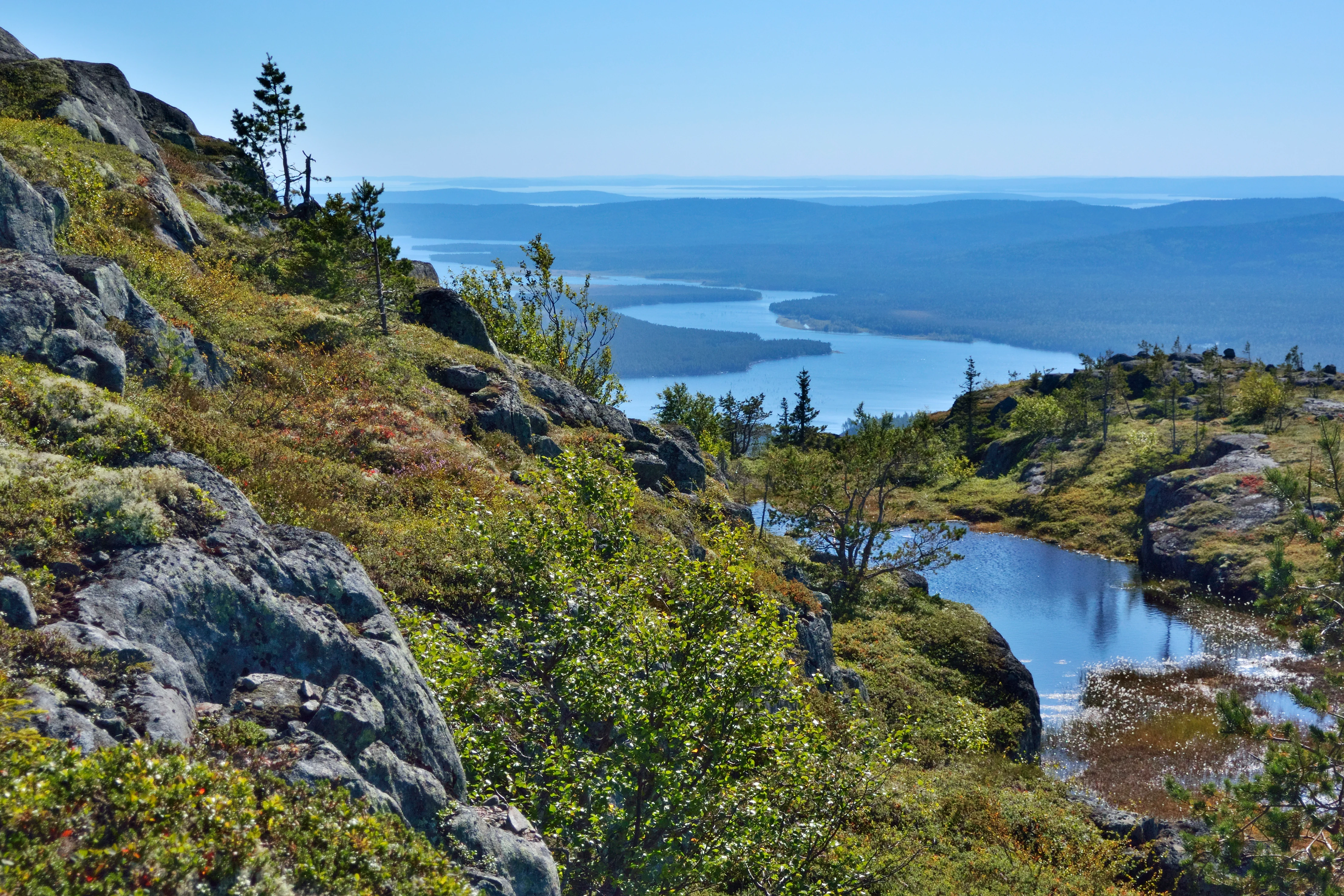
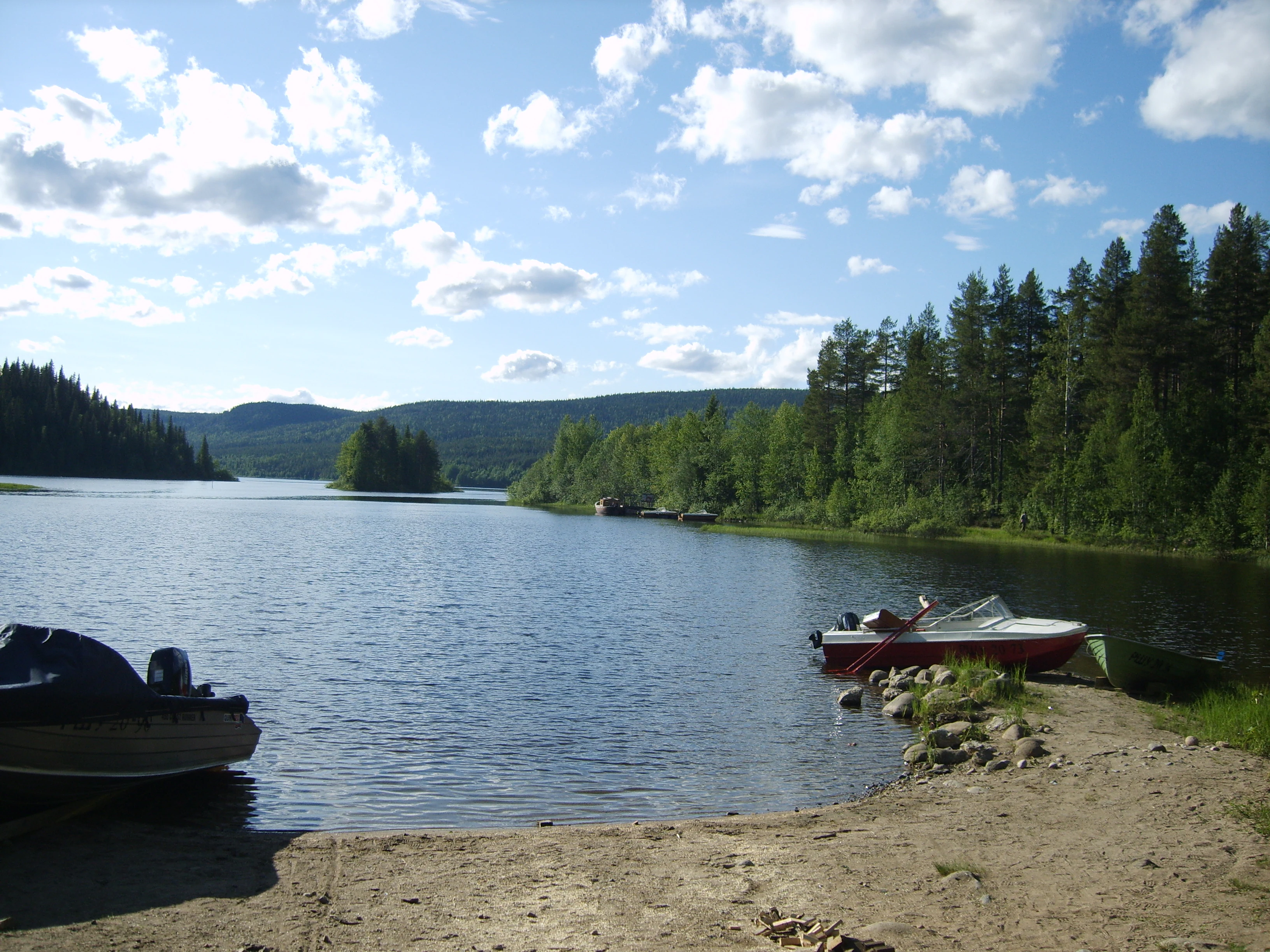
Lake Paanajärvi defines the central axis of the park. Its elongated basin extends roughly 24 kilometers in length but remains extremely narrow, plunging to depths of more than 100 meters. The surrounding fells shelter the valley from weather systems and produce sharp temperature inversions; in severe winters, near-record low temperatures have been recorded in the basin. The combination of deep water, dark forests, mirrored fells, and exceptionally long summer daylight gives the lake a strong visual and ecological identity within the park.

From an ecological perspective, Paanajärvi protects a representative sample of north Karelian taiga, with boreal forest vegetation, mire complexes, and relatively undisturbed predator populations. The park has been used as a baseline reference area for long-term studies of Fennoscandian flora and vegetation history. Its accessibility, low visitor density, and undeveloped character also make it a key destination for those exploring the wild taiga landscapes of Europe's far north.

Quick facts and research context for Paanajärvi National Park

Paanajärvi National Park is a federal specially protected natural area in the Loukhsky District of the Republic of Karelia, in northwestern Russia, established in 1992 under a decree of the Government of the Russian Federation. The park covers roughly 1,045 square kilometers of largely uninhabited taiga, with forests dominating the landscape and significant areas of mires, rivers, and lakes.

Its western border coincides with the Russia-Finland state boundary, where it adjoins Finland's Oulanka National Park, creating a shared international conservation area near the Arctic Circle. The park is administered as a federal budgetary institution under the Russian Ministry of Natural Resources and Ecology and is divided into several functional zones, ranging from a strict protected regime to zones for regulated recreation and visitor services.

Protection and recognition

Examine documented terrestrial protection parameters and official recognition records.

Paanajärvi National Park Protection Status and Mapped Conservation Scope

Paanajärvi National Park maintains a defined terrestrial protection scope within its regional landscape. Structured records detail the official designation history and administrative management framework governing the natural area.

Protection details

Protection scope
Terrestrial
Transboundary protection
No
Park context

Deeper park guide and search-rich context for Paanajärvi National Park

Paanajärvi National Park history, landscape, wildlife, and travel context

Explore Paanajärvi National Park through its history, landscape character, ecosystems, wildlife, conservation priorities, cultural context, and seasonal travel timing in a structured park guide built for atlas discovery and search intent.

Why Paanajärvi National Park stands out

Paanajärvi is best known for its dramatic sub-Arctic taiga scenery, where boreal forests, mires, white-water rivers, and fells rise above deep glacial lakes. Lake Paanajärvi itself is one of the park's defining features: a narrow, extraordinarily deep lake in a steep mountain valley, celebrated for the clarity of its waters and the unusual continentality of its local climate. The park is also recognized for Mount Nuorunen, the highest point in the Republic of Karelia, and for a concentration of internationally important geological formations such as the layered intrusions of Kivakka and Tsipringa. These landforms, combined with the park's position near the polar circle, give the area its distinctive profile among European protected landscapes.
Paanajärvi National Park history and protected-area timeline

The Paanajärvi region has been inhabited since ancient times. Archaeological evidence shows that the earliest inhabitants of the area lived from gathering, hunting, and fishing, leaving behind stone tools and pottery along the shores of lakes Paanajärvi and Pyaozero. Material dated to the 5th through 6th millennia BCE marks some of the earliest traces of human presence in the area, and a number of later prehistoric sites were identified after the Second World War along the Pyaozero shoreline.

During the 12th through 14th centuries the region was part of the lands controlled by Novgorod, in what is traditionally considered Russian Lapland. After the devastation of Novgorod by Ivan IV, much of the area became effectively ungoverned, and in 1595 it was incorporated into the Kingdom of Sweden. In 1673, King Charles XI of Sweden opened Lapland to new settlement, offering settlers tax exemptions for fifteen years, and the first Finnish settlement at Paanajärvi dates to 1769.

In 1809, following the peace treaty between Russia and Sweden, Paanajärvi became part of the Russian Empire as part of the autonomous Grand Duchy of Finland. A boundary clarification in 1849 placed the lake entirely on Finnish territory, and by the late 19th century the local village had several hundred inhabitants. The late 19th century also brought industrial-scale logging by the Russian company Rusanov, with timber floated down the Olanga River, and the area became a popular tourist destination around the turn of the century.

Following Finnish independence in 1917, the border with White Sea Karelia was closed and traditional trade links were severed, although the community persisted, even constructing a church in 1937. After the Soviet-Finnish Winter War, the surrounding territory was transferred to the USSR, temporarily reoccupied by Finnish and German forces during the Second World War, and finally returned to Soviet control in 1944. The area remained part of Soviet Karelia until, on 20 May 1992, the Government of the Russian Federation formally established Paanajärvi National Park to protect the unique natural complexes of the lake and the Olanga River basin for conservation, recreation, education, and scientific purposes.

Paanajärvi National Park landscape and geographic character

The landscape of Paanajärvi National Park is defined by the meeting of boreal forest with rugged sub-Arctic mountain terrain. The park lies in a transitional zone where Karelian taiga meets the Maanselkä uplands, producing a varied topography of fells, river valleys, and forested lowlands. Several of the tallest peaks in the Republic of Karelia rise within or near the park's boundaries, including Mount Kivakka, Mount Lunar, Mount Mäntötunturi, and Mount Nuorunen, the highest point in all of Karelia. These summits are rounded and forested rather than alpine, but their relief creates sharp local contrasts.

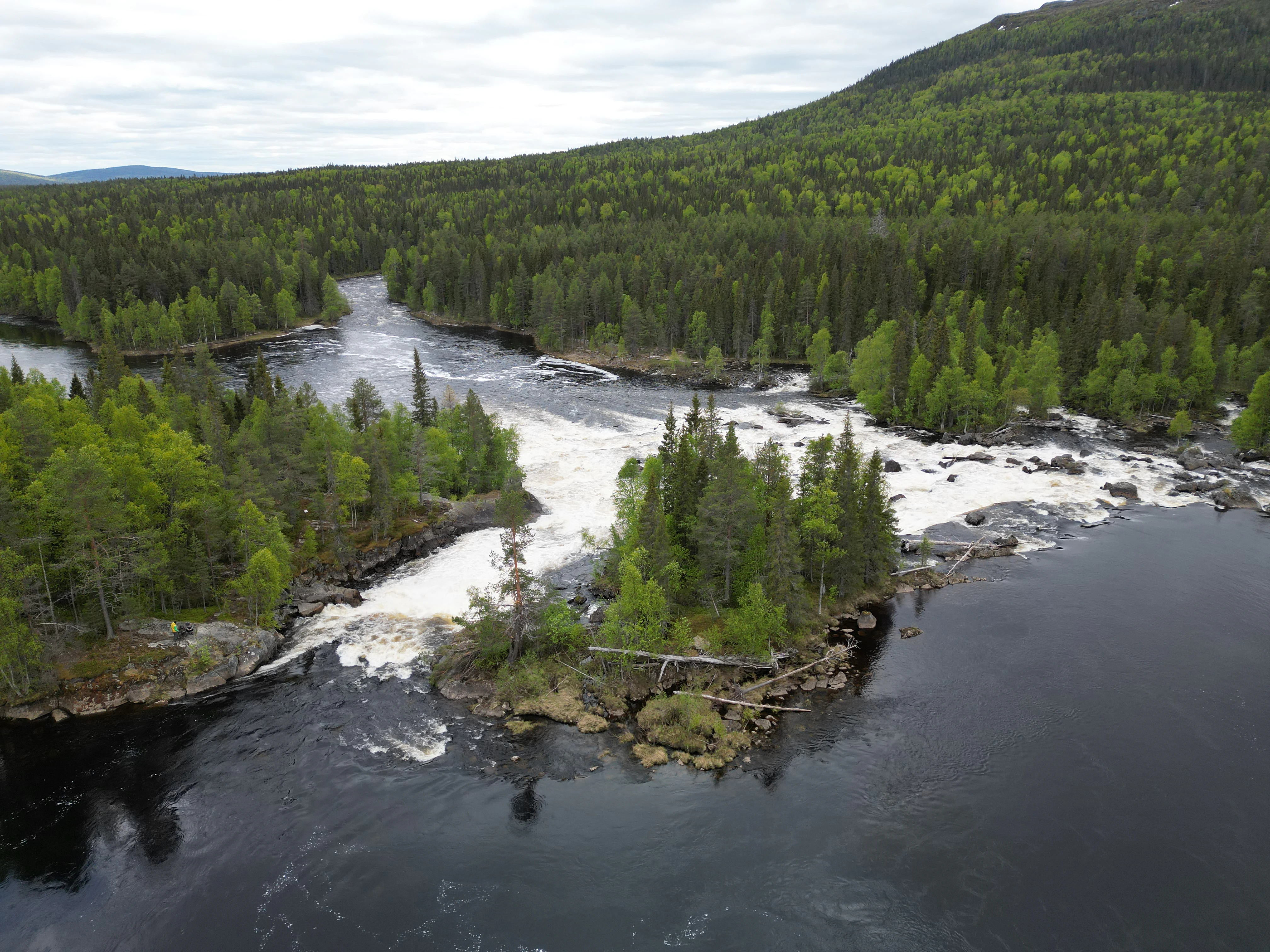
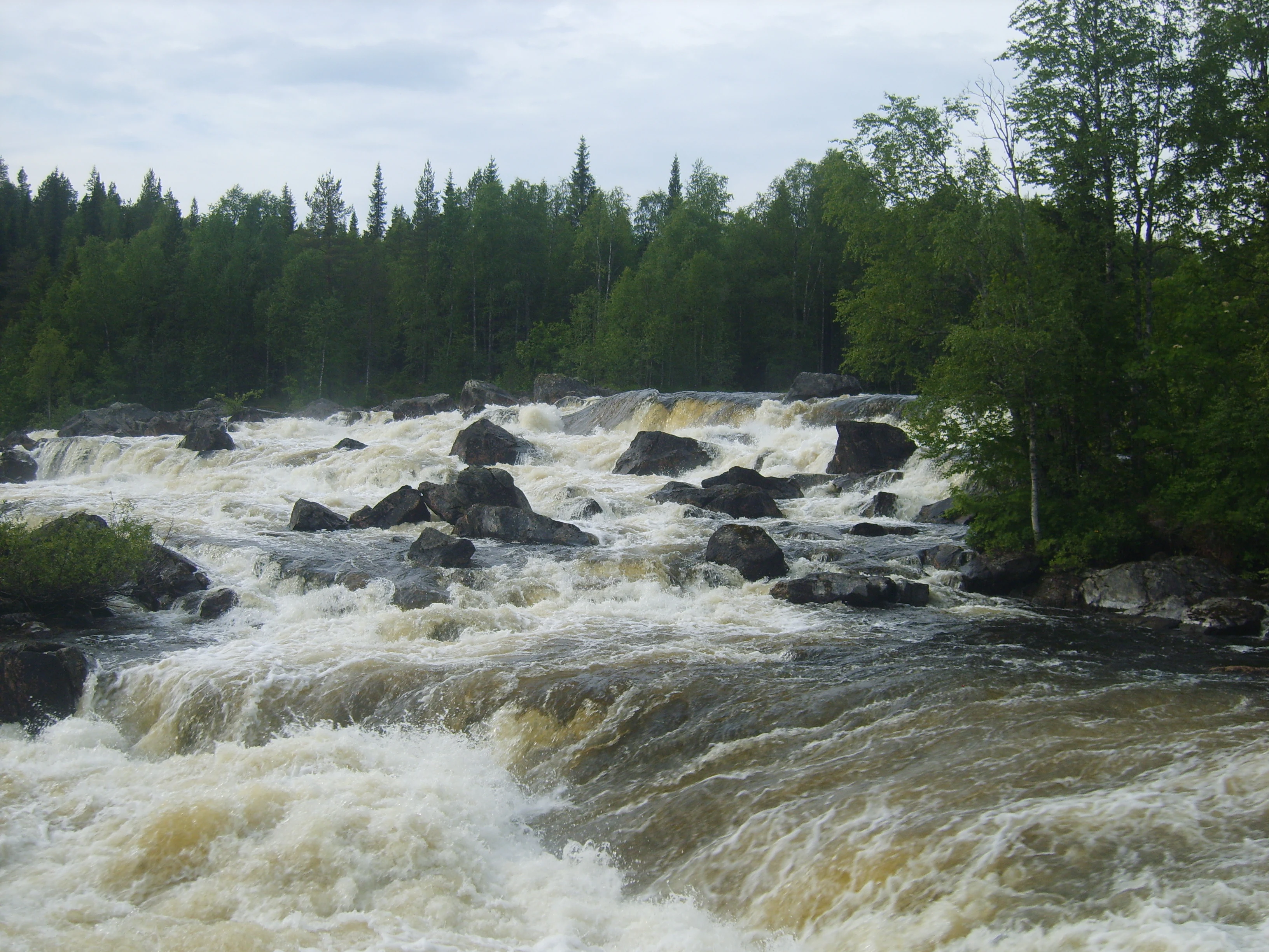
Rivers and rapids are central to the park's visual identity. The Olanga and its tributaries cut through the terrain in a series of cascades and waterfalls, of which Kivakkakoski, visible from Mount Kivakka, is among the most celebrated. Steep slopes are dotted with unusual hanging mires, peatlands that cling to the sides of fells, which are considered a particular scenic and scientific attraction of the reserve. The park contains a dense network of small lakes and streams, marshland, and ancient glacial landforms, including an extensive system of glaciofluvial deltas along the rivers Olanga and Tsipringa.

Geologically, the park is of international significance. It includes the layered intrusions of Kivakka and Tsipringa, the Nuorunen granite massif, the Paanajärvi rift with its Ruskeakallio cliff, a segment of the deep Paanajärvi-Kandalaksha fault, and glacial delta complexes that together comprise dozens of nationally and globally important geological monuments.
Paanajärvi National Park ecosystems, habitats, and plant life

Ecologically, Paanajärvi National Park captures a representative profile of north Karelian taiga near the Arctic Circle. Boreal forests dominate the landscape, with extensive stands of spruce, pine, and birch on the better-drained sites, and widespread mires in flatter areas and on poorly drained slopes. The variation in elevation, exposure, and soil conditions creates a patchwork of forest types, mire complexes, and upland habitats, giving the park strong ecological diversity despite its northern latitude.

The park's flora is notable for both richness and conservation value. Surveys have documented 623 species of higher vascular plants, including more than 70 species listed in the Red Data Books of Fennoscandia, Finland, and the Republic of Karelia. Vegetation studies of the park have become important references for understanding Holocene landscape development across Fennoscandia, given the relatively undisturbed state of many plant communities.

Mire habitats are a defining ecological feature. Beyond the extensive lowland bogs, the unusual hanging mires on the slopes of certain fells represent a distinctive microhabitat. Wetland systems support characteristic northern birdlife, and the clean, cold rivers, rapids, and deep lakes create conditions favorable for sensitive aquatic and riparian species. The forests are largely composed of mature and old-growth stands, and the overall absence of permanent settlements within the park boundaries has helped maintain ecological continuity across the reserve.
Paanajärvi National Park wildlife and species highlights

Paanajärvi National Park supports a full assembly of taiga fauna typical of northwestern Russia, including both resident boreal species and animals whose ranges extend across the Russian-Finnish border. The park is home to 42 mammal species and 171 bird species, and its relative remoteness and low human density make it a stronghold for large predators and other sensitive wildlife.

Among mammals, characteristic species include moose, brown bear, lynx, wolverine, and wolf, alongside smaller fur-bearers such as red fox, pine marten, stoat and weasel, as well as mountain hare, red squirrel, American mink, voles, and shrews. The presence of wolverine, lynx, and wolf gives the park particular ecological value, as these predators are indicators of intact, well-connected wilderness. Avian diversity reflects the park's position near the Arctic Circle, with communities shaped by extensive forest cover, mires, rivers, and lake shorelines, and there is potential for northern species whose ranges reach into Fennoscandia.

Aquatic habitats also contribute significantly to the park's wildlife character. The cold, oxygen-rich waters of Lake Paanajärvi and the network of clear mountain rivers and rapids support native fish communities adapted to oligotrophic conditions. Combined, the terrestrial and aquatic fauna make the park an important reference site for understanding intact northern taiga ecosystems in Europe.
Paanajärvi National Park conservation status and protection priorities

Paanajärvi National Park was established in 1992 specifically to protect the unique natural complexes of Lake Paanajärvi and the Olanga River basin, recognizing the area's outstanding geological, hydrological, and ecological values. It is administered as a federal specially protected natural area under the Russian Ministry of Natural Resources and Ecology, with a management structure designed to combine conservation, scientific research, environmental education, and limited recreation.

The park's layered functional zoning reflects a conservation strategy that balances strict protection with appropriate use. A special regime zone along the border and a strict reserve zone together cover a substantial share of the territory, while zones for educational tourism, regulated recreation, and visitor services allow controlled public access. This zoning, combined with the absence of permanent settlements within park boundaries, supports long-term ecological integrity and minimizes fragmentation of forest and mire habitats.

At the broader scale, Paanajärvi forms the Russian counterpart to Finland's Oulanka National Park across the international border, creating a cross-border conservation area of considerable size. The presence of internationally significant geological monuments, red-listed plant species, and populations of large predators gives the park substantial conservation importance beyond its national context, and it has been used as a reference site for scientific studies of taiga ecology and Holocene vegetation history.

Paanajärvi National Park cultural meaning and human context

The Paanajärvi region carries a layered cultural history shaped by its position between Russian, Karelian, and Finnish traditions. Archaeological traces show human use of the area stretching back thousands of years, with Stone Age and later prehistoric sites along the lakes indicating long-standing traditions of hunting, fishing, and gathering. The region historically lay at the intersection of Novgorod Russian, Swedish, and Finnish spheres of influence, and these shifts left their mark on settlement patterns and local identity.

The village that developed around the lake on the Finnish side of the border became a small but established community by the late 19th century, complete with a church built in 1937. The displacement of the regional border as a result of the Second World War severed ties between communities on either side, and the eventual protection of the area as a national park shifted its identity decisively toward wilderness and ecological values. Today the park is valued both as a natural landscape and as a place that preserves traces of this complex northern cultural geography, even though there are no permanent settlements within its boundaries.
Top sights and standout views in Paanajärvi National Park

Paanajärvi's defining highlights are the deep and narrow Lake Paanajärvi, the high fells and internationally important layered intrusions of Kivakka and Tsipringa, the towering Kivakkakoski waterfall, and the unusual hanging mires on the slopes of the surrounding mountains. Mount Nuorunen, the highest peak in Karelia, anchors the park's skyline, while the cross-border connection with Finland's Oulanka National Park adds an important international dimension.

Equally distinctive is the park's near-continental microclimate and its exceptionally clear, oxygen-rich lake water, which together give the area a strong identity within the broader Fennoscandian taiga. These features combine to make Paanajärvi both a scenic destination and a significant site for ecological and geological study in northern Europe.

Best time to visit Paanajärvi National Park

Paanajärvi's climate near the Arctic Circle strongly shapes the visitor experience. Summers are short but remarkably bright, with nearly continuous daylight near the solstice and warm conditions by local standards; this is generally the most accessible period for hiking, boat travel on the lakes, and viewing the taiga at its lushest. Autumn brings cooler temperatures, intense berry and mushroom seasons in the surrounding forests, and the first opportunities for seeing the aurora borealis as nights lengthen.

Winter is the most extreme season, with very low temperatures, heavy snow cover, and a short daylight period, but it is also when the dramatic cold-air drainage into the lake basin, frozen waterfalls, and northern lights become most pronounced. Seasonal timing should reflect visitor tolerance for cold, snow, and limited daylight, with late spring through early autumn offering the broadest range of conditions for general exploration.
Monthly climate preview

Long-term representative coordinate measurements mapping monthly weather trends

Paanajärvi National Park Climate Normals, Annual Temperature and Precipitation

Representative coordinate records reveal deep sub-zero winter temperatures giving way to moderate summer warmth alongside consistent annual precipitation patterns across Paanajärvi National Park. Examining the complete twelve-month climatology profile allows researchers to trace detailed temperature extremes and monthly moisture shifts at a specific sampled elevation.
Annual mean0 °C
-13 °C15 °C
Jan-13°
Feb-13°
Mar-8°
Apr-2°
May
Jun12°
Jul15°
Aug13°
Sep
Oct
Nov-7°
Dec-11°
Warmest month
July

15.2 °C

Coolest month
January

-13.2 °C

Wettest month
July

3.8 mm/day

Driest month
February

1.2 mm/day

Park location guide

Geography guide, regional context, and park location map for Paanajärvi National Park

Paanajärvi National Park park geography, regions, and map view in Russia

Understand where Paanajärvi National Park sits in Russia through a broader geographic reading of the surrounding landscape, nearby location context, and its mapped position within the national park landscape.

How Paanajärvi National Park fits into Russia

Russia is a transcontinental nation spanning eleven time zones, bordered by fourteen countries. It is the world's largest country by area, covering 17,098,246 km². Moscow is the capital and largest city, while Saint Petersburg is the second-largest and a major cultural centre.

Wider geography shaping Paanajärvi National Park in Russia

Russia spans Eastern Europe and North Asia, covering 17,098,246 km². It shares land borders with fourteen countries, more than any other nation, and spans eleven time zones. The landscape includes vast plains, mountain ranges such as the Urals and Caucasus, and extensive coastlines along the Arctic Ocean, Pacific Ocean, Baltic Sea, Black Sea, and Caspian Sea.

Map view of Paanajärvi National Park

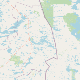
Use this park location map to pinpoint Paanajärvi National Park in Russia, understand its exact geographic position, and read its mapped placement within the surrounding landscape more clearly.

Pigeon | © OpenStreetMap contributors

Location context for Paanajärvi National Park

Republic of Karelia
Park atlas

Compare surrounding subarctic taiga reserves and connected northern wilderness areas.

Other Parks Near Paanajärvi National Park and Regional Protected Landscapes

Browse nearby national parks and protected areas sharing the rugged boreal terrain of northwestern Russia and Fennoscandia. Expanding the geographic scope helps place regional fells, river valleys, and glacial lake ecosystems into a broader conservation context.
Watercolor illustration of a landscape with lake, trees, and hills
National parkRepublic of Karelia
Mapped location lies within the park boundary#1 closest

Northwest

Paanajärvi National Park: Protected Boreal Wilderness and Karelian Landscape Atlas

Mapping the old growth taiga forests and mountain terrain of northwestern Russia.

Located in the Republic of Karelia, Paanajärvi National Park is a significant protected area of boreal forest and lake ecosystems. This landscape, characterized by the Maanselkä hills and the summit of Nuorunen, offers a pristine look at the intact wilderness of northern Europe. Examine the mapped boundaries and geographic features that define this essential transboundary conservation area.

Area
1,043.71 km²
Established
1992
IUCN
II
Relief
Highland
Watercolor illustration of a river flowing through a forested landscape with mountains in the background
National parkLapland
About 40 km away#2 closest

Northwest

Oulanka National Park: Protected Landscape Atlas and Geographic Context in Lapland

Explore mapped boundaries and regional terrain.

Discover Oulanka National Park as a distinct protected landscape entity within the extensive northern region of Lapland, Finland. This page provides structured geographic information, focusing on the park's mapped area, its regional setting, and its identity as a national park. MoriAtlas facilitates an atlas-driven understanding of Oulanka National Park's place in Finland's protected lands and its inherent natural terrain.

Area
270 km²
Established
1956
IUCN
II
Visitors
187.4K annual
Watercolor illustration showing a landscape with green vegetation, hills, and stylized human figures
National parkLapland
About 85 km away#3 closest

West

Riisitunturi National Park: Explore Protected Landscape and Lapland Geography

Mapped boundaries of a national park in northern Finland.

Delve into the protected landscape of Riisitunturi National Park, a key national park situated in the expansive region of Lapland, Finland. This MoriAtlas entry provides detailed geographic context, focusing on the park's mapped boundaries and its role within the natural terrain of northern Finland. Understand its identity as a protected area and its significance within a broader atlas of natural landscapes.

Area
77 km²
Established
1982
IUCN
II
Visitors
58.8K annual
Watercolor painting of a lake with trees and distant mountains under a soft sky
National parkFinland
About 87 km away#4 closest

Southwest

Hossa National Park: Detailed National Park and Protected Landscape Geography

Explore mapped boundaries and regional context within Finland.

Delve into the protected landscape of Hossa National Park, a designated national park in Finland. This page provides structured geographic information, focusing on its mapped boundaries and position within the country's natural terrain. Understand how Hossa National Park contributes to the atlas of protected areas in Northern Europe, offering insights into its specific landscape character and regional significance for geographic discovery.

Established
2017
IUCN
II
Scope
Terrestrial
Watercolor illustration showing a lake, trees, and hills under a light sky
National parkLapland
About 104 km away#5 closest

Northwest

Salla National Park: Mapped Protected Landscape in Lapland, Finland

Explore its geographic context and protected area identity.

Understand Salla National Park as a distinct protected landscape situated within the expansive northern Finnish region of Lapland. This MoriAtlas entry focuses on its identity as a national park, detailing its mapped boundaries and geographic setting. Discover how Salla National Park contributes to the atlas of protected areas, offering a specific point of reference for exploring the natural terrain and regional geography of this subarctic territory.

Area
99.83 km²
Established
2022
IUCN
II
Visitors
55.9K annual
Watercolor landscape featuring green hills, pine trees, and a yellowish field
National parkFinland
About 109 km away#6 closest

West

Syöte National Park: Mapped Protected Landscape and Fell Geography in Finland

Explore Finland's southernmost fell and diverse northern wilderness.

Delve into the protected territory of Syöte National Park, a key national park in northern Finland. This page highlights the park's distinct geographic features, including its southernmost fell, Iso-Syöte, alongside expansive mire systems and old-growth boreal forests. Understand the mapped boundaries and the unique ecological transition zone it represents within the Finnish atlas, offering a comprehensive view of its landscape context and protected area status.

Area
299 km²
Established
2000
IUCN
II
Visitors
88.2K annual
National parkRepublic of Karelia
About 131 km away#7 closest

South

Kalevalsky National Park: Protected Taiga and Boreal Landscapes in the Republic of Karelia

Ancient old-growth pine forests and glacial terrain.

Kalevalsky National Park protects one of the last remaining large, intact stretches of virgin taiga in Northern Europe. Situated along the border of the Republic of Karelia, this landscape includes dense coniferous forest, complex drainage networks, and peatland mires. The park functions as a major habitat for forest-dwelling mammals and maintains the ecological integrity of the Fennoscandian Shield region through its preserved forest cover and diverse freshwater environments.

Area
744 km²
Established
2007
IUCN
II
Relief
Lowland
National parkRepublic of Karelia
About 132 km away#8 closest

South

Kalevalsky National Park: Boreal Wilderness and Protected Landscapes in the Republic of Karelia

Ancient taiga ecosystems and glacial terrain mapped.

Located near the Russian-Finnish border, Kalevalsky National Park encompasses 74,400 hectares of rare primeval boreal forest. The park offers insight into the Baltic Shield's geological history and provides a map of extensive marshlands and lake basins that define this remote Karelian region.

Area
744 km²
Established
2007
IUCN
II
Relief
Lowland

Common questions about visiting, size, designation, and location context for Paanajärvi National Park

Paanajärvi National Park FAQs for park facts, access, geography, and protected area context

Find quick answers about Paanajärvi National Park, including protected-area facts, park geography, trail and visitor context, and how the park fits into its surrounding country and regional landscape.
MoriAtlas Explorer

Continue Your Protected Areas Search Across the Global Atlas

Deepen your exploration by continuing the structured search for national parks and protected areas worldwide. Utilize the comprehensive filtering capabilities to compare different conservation landscapes and refine your understanding of global park geography. Discover more about the distribution and characteristics of protected natural areas.

Global natural geography