
Mori Atlas logo
Wildlife reservePantanos de Villa Wildlife Refuge

Tracing the mapped boundaries and unique brackish marsh geography of this vital Pacific desert oasis

Pantanos de Villa Wildlife Refuge: A Protected Coastal Wetland Ecosystem within Metropolitan Lima, Peru

(Refugio de Vida Silvestre los Pantanos de Villa)

Pantanos de Villa Wildlife Refuge stands as a significant protected wetland habitat embedded directly within the coastal desert landscape of Lima, Peru. This refuge preserves a complex of brackish lagoons, reed beds, and water-dominated terrain that serves as a crucial sanctuary for diverse waterbird species. Spanning flat coastal plains, the area illustrates the interplay between urban-fed hydrology and surviving natural marshes, offering a distinct geographic contrast to the surrounding metropolitan environment.

urban wetlandcoastal wetlandbrackish lagoonRamsar sitewaterbird habitatbirdwatching
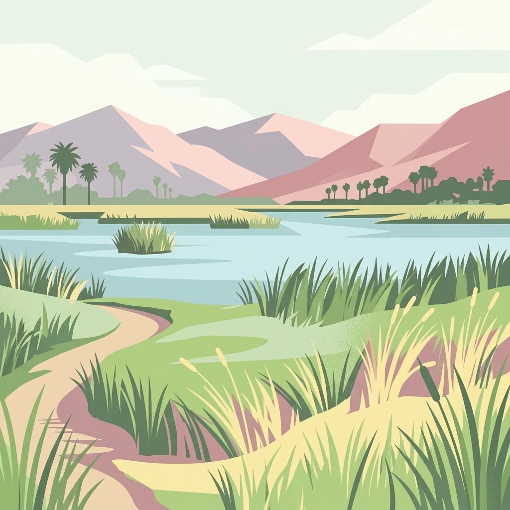
A stylized vector illustration of a wetland area with a winding dirt path, tall reeds, water, and distant hills under a pale sky.

Pantanos de Villa Wildlife Refuge

Wildlife reserve

Park overview

Structured park overview, official facts, and landscape profile for Pantanos de Villa Wildlife Refuge

Pantanos de Villa Wildlife Refuge park facts, protected area profile, and essential visitor context

Review the core facts for Pantanos de Villa Wildlife Refuge, including designation, size, terrain, visitor scale, habitats, and operating context in one park-focused overview.

About Pantanos de Villa Wildlife Refuge

Pantanos de Villa Wildlife Refuge protects a network of brackish-water lagoons and marshes that survive amid the urban fabric of Lima, Peru. The area lies in the Chorrillos district along the central Pacific coast, within a coastal desert region where freshwater wetlands are naturally scarce. The marshes owe their persistence to a combination of natural subsurface discharge and irrigation water that filters in from the canal system branching off the Rimac River, producing conditions suitable for emergent vegetation, lagoon habitats, and a rich aquatic food web.

Although the reserve is small relative to Peru's vast territorial parks, its ecological value is disproportionate to its size because of its coastal position and its proximity to seasonal migration routes along the Pacific flyway. The site's mix of resident and migratory waterbirds, waders, and predatory shorebirds makes it one of the most important biodiversity hotspots within Lima's metropolitan area. It has gained international recognition through its inclusion in the Ramsar Convention list of wetlands of global importance.

The refuge is also notable as a working example of urban conservation in a megacity. Despite being surrounded by residential neighborhoods, industrial facilities, roads, and infrastructure expansion, it has retained core wetland habitat and continues to function as a refuge for species that would otherwise be absent from Lima's surrounding desert landscape. Its situation illustrates both the pressures facing Pacific coastal wetlands and the possibility of preserving them even where urban growth is intense.

Quick facts and research context for Pantanos de Villa Wildlife Refuge

Pantanos de Villa is a protected wetland habitat in the Chorrillos district of Lima, on Peru's central Pacific coast. It was established as a wildlife refuge in 2006, with a longer management history dating back to 1977, and gained Ramsar status in 1997.

The refuge is approximately 263 hectares in size, with elevations ranging from sea level to only a few meters above. It supports brackish lagoons and reed-dominated marshes fed by irrigation canal filtration from the Rimac River system, and is recognized as one of the most important wetland areas for waterbirds on Peru's coast.

Protection and recognition

Documented terrestrial protection scope, designation year, and management records.

Pantanos de Villa Wildlife Refuge Protection Status and Designation History

Pantanos de Villa Wildlife Refuge maintains a documented terrestrial protection scope established in the year 2006. Structured management records outline the official designation history without imported international recognition sources.

Protection details

Protection scope
Terrestrial
Designated year
2006
Transboundary protection
No
Park context

Deeper park guide and search-rich context for Pantanos de Villa Wildlife Refuge

Pantanos de Villa Wildlife Refuge history, landscape, wildlife, and travel context

Explore Pantanos de Villa Wildlife Refuge through its history, landscape character, ecosystems, wildlife, conservation priorities, cultural context, and seasonal travel timing in a structured park guide built for atlas discovery and search intent.

Why Pantanos de Villa Wildlife Refuge stands out

Pantanos de Villa is best known as a coastal Pacific wetland refuge supporting an exceptional concentration of waterbirds, including gulls, grebes, pelicans, cormorants, ibises, oystercatchers, skimmers, and migratory shorebirds. It is one of the most significant bird habitats on Peru's central coast, and particularly valued for birdwatching during the austral summer. Equally distinctive is its location: the refuge is a functioning marsh ecosystem embedded inside metropolitan Lima, in a region otherwise dominated by the Pacific subtropical desert. This contrast between wetland and arid cityscape explains much of the refuge's identity and conservation significance.

A Great Grebe adult and a smaller chick swimming side by side on calm, rippled water.
A Great Grebe swimming with its chick in the Pantanos de Villa Wildlife Refuge.

Pantanos de Villa Wildlife Refuge history and protected-area timeline

The history of Pantanos de Villa as a protected site stretches back more than four decades. Local municipal authorities in Lima began managing the area in 1977 through the city's parks service, SERPAR, establishing early awareness of the marshes as a natural resource worth safeguarding.

In 1989, the Peruvian Ministry of Agriculture formally recognized the area's importance by declaring it a wildlife reserve, giving it a national-level protective status. Four years later, in 1993, the Municipality of Lima went further by establishing the Natural Metropolitan Park of Villa, and the following year created a special inter-institutional office combining members of the military, the Ministry of Agriculture, and the municipalities of Lima and Chorrillos to administer the area.

The year 1997 was a milestone: the reserve was designated a Ramsar site, placing it on the international list of wetlands of global significance. In 1998, municipal decrees reinforced protection and created PROHVILLA, a dedicated governing body for the wetland. In 2001, the area was declared a reserved zone, and in 2006 it was formally established as a Wildlife Refuge under national protected-area law, the category it holds today.

Pantanos de Villa Wildlife Refuge landscape and geographic character

The physical landscape of Pantanos de Villa is dominated by flat coastal terrain, with elevations ranging only from sea level to about five meters above. Visually and ecologically, it is a system of shallow brackish lagoons and reed-fringed marshes set against an unexpected backdrop: the surrounding plain is part of the Pacific subtropical desert, and the urban districts of southern Lima push right up to the refuge's edges.

The hydrology of the wetland is shaped by the irrigation network of the city. Water reaches the marshes largely through filtration and discharge from the Ate-Surco-Chorrillos canal, which itself branches off the Rimac River. Underground canals and subsurface flow supplement this inflow, allowing reed beds, open water, and wet meadows to persist in a region that would otherwise be largely dry.

Because the refuge sits so close to the Pacific Ocean, the coastal plain's flatness, and the way the marsh channels have evolved around the canal system, the area reads as a string of lagoons and reed beds separated by narrow strips of land. The result is a calm, low-lying, water-dominated landscape, visually distinct from both the desert hills around Lima and the residential neighborhoods that border it.
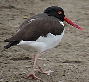
An American Oystercatcher bird with dark brown upper plumage, white underparts, a bright orange eye, and a long, slender orange-red bill standing on a brown, textured ground.
An American Oystercatcher observed at the Pantanos de Villa Wildlife Refuge.

Pantanos de Villa Wildlife Refuge ecosystems, habitats, and plant life

Ecologically, Pantanos de Villa is a vestige of the coastal Pacific wetland ecosystems that once fringed this part of Peru. Although it lies within the Pacific subtropical desert biome, the refuge behaves ecologically as a brackish wetland, dominated by emergent vegetation, aquatic plants, and open-water habitats. The contrast between dry desert surroundings and lush marsh interior defines the site's ecological character.

Native flora include a mix of reeds, sedges, samphire-like succulents, aquatics, and small floating plants. Characteristic species include Typha domingensis, Schoenoplectus americanus, Solanum pimpinellifolium, Persicaria hydropiperoides, Sarcocornia species, Ludwigia peruviana, Ludwigia peploides, Wolffia columbiana, Najas guadalupensis, Paspalum vaginatum, Distichlis spicata, and Sagittaria montevidensis. Together, these species structure the reed beds, margins, and open-water surfaces that support the food webs of the refuge.

The ecological value of the refuge is amplified by its position within the desert. Such wetlands function as biodiversity refuges in arid regions, concentrating productivity, feeding opportunities, and breeding habitat in ways that no surrounding drylands can. As a result, Pantanos de Villa has ecological importance far beyond what its modest size alone would suggest.

Pantanos de Villa Wildlife Refuge wildlife and species highlights

Pantanos de Villa's wildlife profile is overwhelmingly shaped by birds, with the refuge acting as a key waterbird site on Lima's coast. About two hundred bird species have been reported in and around the wetland, and even focused surveys over a few years routinely record dozens of resident and migratory species.

Typical species include the white-cheeked pintail, the great grebe, the Andean coot, the Neotropic cormorant, the Peruvian pelican, Franklin's gull, the gray-headed gull, the puna ibis, the black vulture, the Peruvian thick-knee, the black skimmer, the American oystercatcher, and Wilson's phalarope. The combination of pelicans, grebes, gulls, skimmers, and migratory shorebirds gives the refuge a distinctive coastal-wetland character.

In addition to birds, the wetland supports native fish populations including Bryconamericus peruanus, Lebiasina bimaculata, Mugil cephalus, and Andinoacara stalsbergi. Together, these fish and bird communities form the core of the refuge's faunal identity and the reason it is so heavily used for birdwatching and ecological research.

Pantanos de Villa Wildlife Refuge conservation status and protection priorities

Pantanos de Villa is a textbook example of ecological value concentrated in a small coastal wetland. Its status as a Ramsar site, designated in 1997, reflects international recognition of the refuge as a wetland of global significance, particularly for waterbird conservation along the Pacific coast of South America. Its current national category as a Wildlife Refuge, established in 2006, places it under the management of Peru's national protected-area agency, SERNANP.

The refuge's conservation importance is heightened by its location. The surrounding territory is almost entirely urban, and the broader coastal desert does not naturally replicate the wetland's habitat. As a result, the refuge performs a function that would otherwise be missing from the regional landscape: it provides irreplaceable habitat, feeding grounds, and refuge for waterbirds, native fish, and associated species in a region where few comparable sites remain.

At the same time, the refuge faces persistent pressures, including land invasion inside the protected area, chaotic urban expansion in surrounding neighborhoods, wastewater discharge from nearby areas, industrial plants within the buffer zone, and pollution or drying of the agricultural canals that nourish the marshes, especially the Surco canal. These threats make ongoing protection, institutional management, and local engagement essential to its long-term survival.

Pantanos de Villa Wildlife Refuge cultural meaning and human context

Although Pantanos de Villa is primarily defined by its ecological value rather than by historic human settlement, its long-running municipal protection from 1977 onward has made it part of Lima's environmental identity. It is a site that residents of Chorrillos and greater Lima have a long history of interacting with, particularly through birdwatching, school visits, and environmental education. Its position on the southern edge of Lima gives it a particular cultural resonance as a place where the city's residents can encounter wetland wildlife without leaving the metropolitan area.

Top sights and standout views in Pantanos de Villa Wildlife Refuge

Pantanos de Villa stands out for combining a rich waterbird fauna, including pelicans, grebes, gulls, skimmers, and migratory shorebirds, with the unusual geography of a thriving brackish wetland embedded in a coastal desert and a megacity.

It is also significant for the strength of its formal protections, including Ramsar designation and national wildlife refuge status under SERNANP, and for the long history of local institutional involvement that has helped maintain the wetland through decades of urban growth and environmental pressure.

Best time to visit Pantanos de Villa Wildlife Refuge

Pantanos de Villa is valuable year-round as a wetland habitat, but the austral summer months, roughly December through March, are considered the strongest period for birdwatching, when migratory and seasonal waterbird activity peaks. The austral winter brings the characteristic Pacific coast garua, a persistent light drizzle and high humidity, while summer is generally warmer and drier. Visitors planning a bird-focused visit will usually find summer more rewarding, although winter's quieter atmosphere has its own appeal.

Monthly climate preview

Long term monthly temperature and precipitation averages for representative park coordinates

Pantanos de Villa Wildlife Refuge Climate Normals and Annual Temperature Patterns

Representative coordinate measurements reveal the annual temperature and precipitation rhythm across Pantanos de Villa Wildlife Refuge from 1991 through 2020. Examining the complete twelve month climate profile provides deeper analytical insight into long term meteorological conditions at this location.
Annual mean18 °C
17 °C20 °C
Jan19°
Feb20°
Mar20°
Apr19°
May18°
Jun17°
Jul17°
Aug17°
Sep17°
Oct17°
Nov18°
Dec19°
Warmest month
March

20 °C

Coolest month
July

16.7 °C

Wettest month
February

0.2 mm/day

Driest month
June

0 mm/day

Park location guide

Geography guide, regional context, and park location map for Pantanos de Villa Wildlife Refuge

Pantanos de Villa Wildlife Refuge park geography, regions, and map view in Peru

Understand where Pantanos de Villa Wildlife Refuge sits in Peru through a broader geographic reading of the surrounding landscape, nearby location context, and its mapped position within the national park landscape.

How Pantanos de Villa Wildlife Refuge fits into Peru

Peru is a megadiverse country in western South America with a population of over 34 million. It spans three distinct geographic regions: the Pacific coastal desert in the west, the Andes mountains running north to south, and the Amazon rainforest in the east. The country has one of the longest histories of civilization in the world, tracing back to the Caral-Supe civilization of the 10th millennium BCE, and was home to the Inca Empire before Spanish colonization in the 16th century.

Wider geography shaping Pantanos de Villa Wildlife Refuge in Peru

Peru is located in western South America along the Pacific coast. The country encompasses three major geographic regions: the coastal desert plains along the Pacific, the Andes mountain range extending from north to southeast, and the Amazon basin rainforest in the eastern interior. It shares borders with Ecuador and Colombia to the north, Brazil to the east, Bolivia to the southeast, and Chile to the south.

Map view of Pantanos de Villa Wildlife Refuge

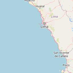
Use this park location map to pinpoint Pantanos de Villa Wildlife Refuge in Peru, understand its exact geographic position, and read its mapped placement within the surrounding landscape more clearly.

Pigeon | © OpenStreetMap contributors
Recorded earthquake history

Explore the Historical Earthquake Catalogue for Pantanos de Villa Wildlife Refuge

View a collection of seismic events recorded in the vicinity of Pantanos de Villa Wildlife Refuge. This MoriAtlas catalogue provides structured data on past earthquakes, including magnitudes and epicentre distances, for those interested in the geographic and seismic history of this protected wetland.

Pantanos de Villa Wildlife Refuge Earthquakes

Catalogued events

74 events

Strongest magnitude

Magnitude 5.6

Most recent event

Aug 19, 2026

This history includes earthquakes recorded inside the park or within 50 km of its borders

Visual exploration of coastal wetland habitats and protected desert surroundings

Pantanos de Villa Wildlife Refuge Photos and Mapped Landscape Scenery

Visual records document the shallow brackish lagoons, reed beds, and waterbird habitats defining Pantanos de Villa Wildlife Refuge. Photographic documentation reveals the striking contrast between the low-lying wetland ecosystem and the surrounding Peruvian coastal desert.

A Great Grebe adult and a smaller chick swimming side by side on calm, rippled water.

A wide view of a coastal wetland with a calm lagoon, surrounded by tall marsh grasses and reeds, with a low hill visible in the far distance under a hazy sky.

An American Oystercatcher bird with dark brown upper plumage, white underparts, a bright orange eye, and a long, slender orange-red bill standing on a brown, textured ground.

Park atlas

Compare nearby coastal wetlands and protected landscapes across the surrounding region

Other Parks Like Pantanos de Villa Wildlife Refuge and Regional Protected Areas

Browse other parks near Pantanos de Villa Wildlife Refuge to examine related coastal wetlands and arid desert ecosystems. Expanding into regional protected areas provides broader geographic context for coastal conservation landscapes along the Pacific.
Nature reserveLima Region
About 54 km away#1 closest

Northwest

Ancón Reserved Zone: Protected Coastal Desert and Bay Ecosystems in Lima Region

Coastal desert landscapes and marine habitat protection

The Ancón Reserved Zone represents a key protected area where the dry coastal plains of Peru reach the Pacific Ocean. Its mapped boundaries encompass a critical transition zone between arid desert terrain and marine environments, offering a concentrated look at specialized regional ecology within the Lima Province.

Area
21.93 km²
Established
2013
Relief
Lowland
Climate
Arid
A horizontal watercolor illustration depicting rolling green hills and foreground vegetation on a white background.
Nature reserveLima Region
60 km away#2 closest

Northeast

Bosque de Zárate Reserved Zone: Mapped Geography and Protected Landscape Analysis

Andean fog forest terrain within the Lima Region

Bosque de Zárate Reserved Zone provides a distinct look at the transition from arid western Andean slopes to lush mist forests. The reserve preserves critical habitat for endemic bird species and stabilizes vital gorge terrain along the San Bartolomé River, serving as a model for protected landscapes in central Peru.

Area
5.46 km²
Established
2010
Water
Minor water
A flat-style vector illustration of a mountain valley with a central blue lake, surrounding peaks, and a winding dirt path.
Protected landscapeLima Region
99 km away#3 closest

East

Nor Yauyos-Cochas Landscape Reserve: Mapped Geography and Protected Andean Terrain

High-altitude glacial landscape and karst geology

Investigate the high-Andean environment of Nor Yauyos-Cochas Landscape Reserve, a protected area in the Lima Region spanning glacial lakes and deep valleys. Focus on the topographic diversity of the Pariacaca massif and the global significance of its subterranean karst features. This atlas provides a detailed spatial look at how these high-elevation ecosystems and traditional cultural landscapes integrate into the broader Peruvian geography.

Area
2,212.68 km²
Established
2001
IUCN
V
Relief
Mountain
Nature reservePeru
183 km away#4 closest

North

Cordillera Huayhuash Reserved Zone: Protected Mountain Geography and Andean Watersheds

High-altitude glacial terrain in central Peru

Cordillera Huayhuash Reserved Zone comprises a dense concentration of glacial peaks and highland basins. As a major source of water for both the Pacific coast and the Amazon, this protected area represents a unique geographic crossroads where ice fields and alpine puna support critical regional ecosystems in the heart of the Andes.

Area
675.9 km²
Established
2002
Relief
Mountain
Climate
Alpine
National parkAncash
236 km away#5 closest

North

Huascarán National Park: Protected Landscape and Regional Geography in Ancash, Peru

Explore the mapped boundaries of this significant national park.

Huascarán National Park is a protected national park located in the Ancash region of Peru, offering valuable insights for geographic and atlas exploration. This destination provides detailed information on the park's mapped boundaries, its designation as a national park, and its integration into the regional geography. Understanding Huascarán National Park helps contextualize protected land distribution and landscape features within Peru for those interested in structured geographic discovery and atlas-style mapping.

Area
3,400 km²
Established
1975
IUCN
II
Relief
Mountain
National parkPasco Region
249 km away#6 closest

Northeast

Yanachaga, Chemillén National Park: Protected Area in Pasco Region, Peru

Mapped terrain, Pleistocene refuge, and rich biodiversity.

Yanachaga, Chemillén National Park, a national park situated in Peru's Pasco Region, preserves over 122,000 hectares of mountainous cloud forest and rainforest ecosystems. Its landscape is characterized by dramatic canyons and steep forested slopes, creating significant altitudinal variation from 460 to 3,643 meters. Recognized as a Pleistocene refuge, the park shelters ancient forest remnants and harbors exceptional biodiversity, including hundreds of bird species and iconic mammals, offering rich context for geographic and protected-area exploration.

Area
1,220 km²
Established
1986
IUCN
II
Relief
Mountain
A horizontal watercolor painting showing rolling green hills and pinkish ground vegetation under a soft, light-yellow sky.
Protected areaPasco Region
265 km away#7 closest

Northeast

San Matías, San Carlos Protection Forest: Geographic Boundaries and Protected Landscape Context

A vital watershed corridor in the Pasco Region of central Peru.

San Matías, San Carlos Protection Forest protects fragile mountain soils and downstream infrastructure from erosion and flooding. Stretching from 300 to 2,250 metres in elevation, the reserve supports a continuous block of highland habitat that serves as a bridge between the Peruvian Yungas and Ucayali moist forest ecoregions, while acting as a cornerstone of the Oxapampa-Asháninka-Yánesha Biosphere Reserve.

Area
1,458 km²
Established
1987
IUCN
VI
Relief
Mountain
Protected areaOxapampa Province
273 km away#8 closest

Northeast

Yanesha Communal Reserve: Geography and Protected Area Context in Oxapampa Province

A vital transition zone between the Andes and the Amazon

Gain insight into the physical character of Yanesha Communal Reserve, where humid tropical forests and river channels converge to form a complex ecosystem. This protected area offers a look at how sustainable land use and conservation intersect within the Palcazu River basin. Browse the geographic boundaries and mapped landscape features that define this essential region in central Peru.

Area
347.45 km²
Established
1988
IUCN
VI
Scope
Terrestrial

Common questions about visiting, size, designation, and location context for Pantanos de Villa Wildlife Refuge

Pantanos de Villa Wildlife Refuge FAQs for park facts, access, geography, and protected area context

Find quick answers about Pantanos de Villa Wildlife Refuge, including protected-area facts, park geography, trail and visitor context, and how the park fits into its surrounding country and regional landscape.
MoriAtlas Explorer

Continue Your Protected Areas Search Across the Global Atlas

Deepen your exploration by continuing the structured search for national parks and protected areas worldwide. Utilize the comprehensive filtering capabilities to compare different conservation landscapes and refine your understanding of global park geography. Discover more about the distribution and characteristics of protected natural areas.

Global natural geography