
Mori Atlas logo
National parkParc national du Grand Bois

A critical high-elevation cloud forest reserve defined by its isolated peak and endemic biodiversity

Parc national du Grand Bois: Mapping the Protected Montane Landscapes of Haiti's Sud Region

(Parc national naturel du Grand Bois)

Parc national du Grand Bois represents a vital protected landscape within Haiti, preserving one of the last primary tropical cloud forests on the isolated Morne Grand Bois peak. Rising above 1,200 meters in the Sud department, the park features a distinct basin-like summit that serves as an ecological island for rare endemic birds, frogs, and plants. This high-elevation terrain manages vital watershed resources, standing as a primary example of conservation within the Massif de la Hotte mountain system.

cloud forestprimary tropical forestmontane ecosystemendemic wildlifeHispaniola biodiversityHaiti protected area
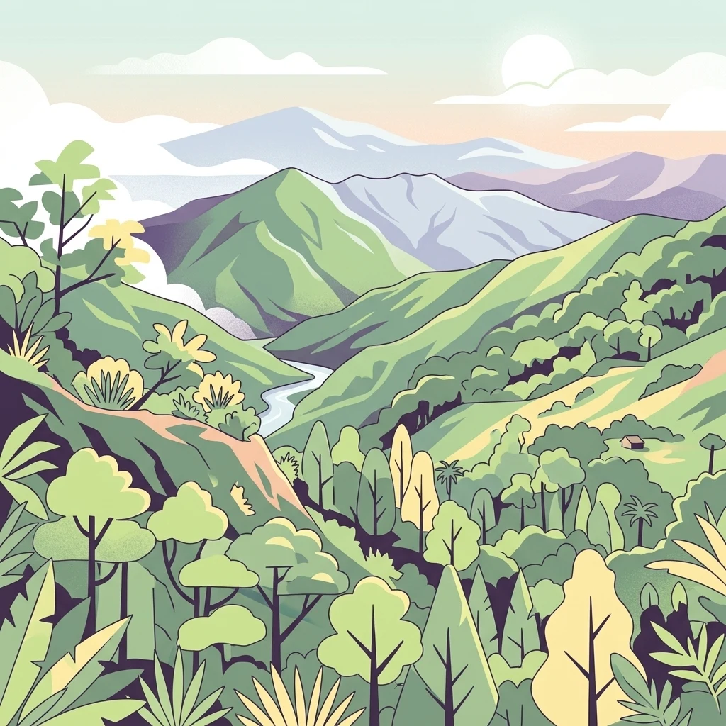
A stylized digital illustration of a mountainous rainforest landscape with rolling green hills, dense trees, a winding river in the valley, and distant peaks under a soft sky.

Parc national du Grand Bois

National park

Park overview

Structured park overview, official facts, and landscape profile for Parc national du Grand Bois

Parc national du Grand Bois park facts, protected area profile, and essential visitor context

Review the core facts for Parc national du Grand Bois, including designation, size, terrain, visitor scale, habitats, and operating context in one park-focused overview.

About Parc national du Grand Bois

Parc national du Grand Bois occupies a unique position among Haiti's protected areas because it preserves a type of ecosystem that has effectively disappeared from most of the country. The park is built around Morne Grand Bois, a freestanding mountain in the southwest of the Tiburon Peninsula whose summit forms a broad, basin-like depression. Rising sharply from the surrounding landscape, Morne Grand Bois retains humid tropical forest and cloud forest vegetation, an ecological feature that is both rare in Haiti and significant within the broader Caribbean context.

The park's small footprint is misleading when measured against its biological importance. Because Grand Bois lies within the Massif de la Hotte, a center of endemism for Hispaniola, it supports species found nowhere else. Field surveys have documented a remarkable number of vertebrates in this compact zone, along with endemic plants such as Magnolia ekmanii, a tree considered exceptionally rare. The forests also host threatened frogs tied to clean, flowing streams, including Eleutherodactylus semipalmatus, a species classified as critically endangered.

Beyond its ecological value, the park plays a practical role for surrounding communities. The forests above 1,000 meters act as a sponge for rainfall, feeding the springs and streams that supply the village of Sevré and the broader Tiburon watershed. Protecting Grand Bois is therefore linked not only to biodiversity preservation but also to maintaining drinking water quality and flow in a region where deforestation has long reshaped the hydrology. Since 2019, when the lands were acquired by Haiti National Trust and Société Audubon Haïti, the park has also come to represent a new model of conservation land ownership in the country, blending national designation with private stewardship supported by international NGO funding.

Quick facts and research context for Parc national du Grand Bois

Grand Bois is a Haitian national park located in the Sud department on the southwestern Tiburon Peninsula. It covers roughly 370 hectares and centers on the Morne Grand Bois, an isolated peak reaching about 1,262 meters in elevation. The protected area was officially created by government decree on September 23, 2015, and in 2019 its territory was acquired by the Haiti National Trust in partnership with Société Audubon Haïti. The IUCN categorizes it as a Category II protected area. The park is recognized as one of the most important primary forest refuges remaining in Haiti and within the Caribbean.

Protection and recognition

Examine documented protection records and official conservation designations

Parc national du Grand Bois Protection Status and International Recognition

Examine the verified protection status and recorded administrative framework governing Parc national du Grand Bois within global conservation databases. Reference structured data records to understand official designations and international recognition parameters associated with the protected territory.

Protection details

WDPA ID
555643721
Park context

Deeper park guide and search-rich context for Parc national du Grand Bois

Parc national du Grand Bois history, landscape, wildlife, and travel context

Explore Parc national du Grand Bois through its history, landscape character, ecosystems, wildlife, conservation priorities, cultural context, and seasonal travel timing in a structured park guide built for atlas discovery and search intent.

Why Parc national du Grand Bois stands out

Grand Bois is internationally known for being one of the last surviving stands of primary tropical and cloud forest in Haiti, perched high on an isolated peak of the Massif de la Hotte. It shelters an exceptional concentration of endemic species for such a small area, including rare birds of Hispaniola and several threatened frog species that depend on intact forest streams. The park has also become a flagship example of private and NGO-led conservation in Haiti, after its lands were purchased outright by conservation organizations in 2019.
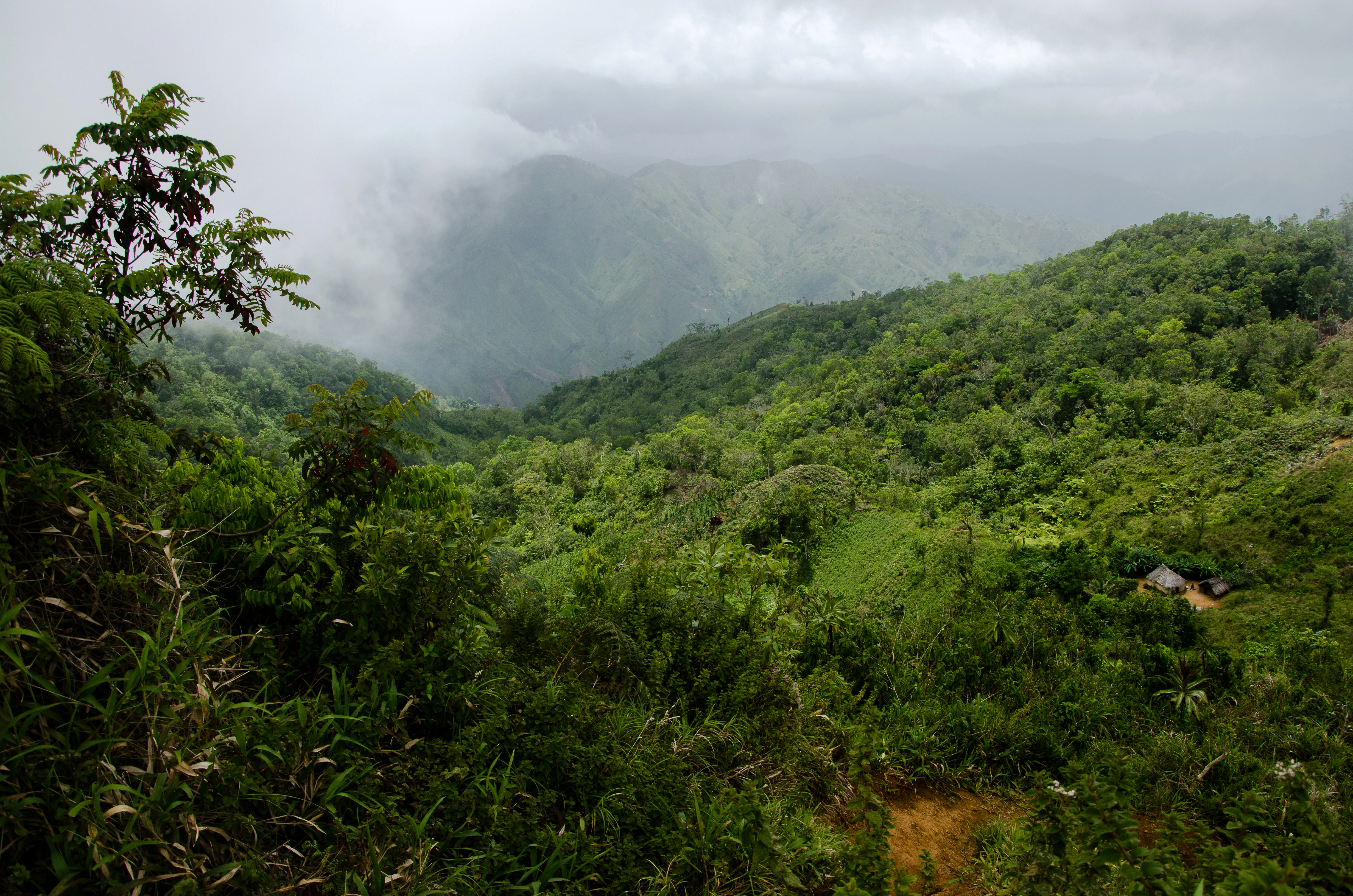
A wide, slightly elevated view of a lush green mountain valley under a cloudy, misty sky, with dense tropical forest covering the slopes.
A misty valley view within the rainforest landscape of Parc national du Grand Bois.

Parc national du Grand Bois history and protected-area timeline

The Parc national naturel du Grand Bois was established by Haitian government decree on September 23, 2015, with the explicit goal of protecting one of the last primary forest refuges in the country. At the moment of its creation, the park was a national designation on state-recognized land in the Sud department, near the town of Tiburon.

A defining moment came in January 2019, when the territory of the park was sold to the NGO Haiti National Trust in partnership with Société Audubon Haïti. This acquisition, financed in part by exceptional donations from Global Wildlife Conservation and Rainforest Trust, marked the first time that a private Haitian conservation foundation purchased a national park outright. Roughly 400 hectares in the Morne-Grand-Bois area were acquired, transferring stewardship from mere designation to active land ownership.

In 2020 and 2021, the German organization Arbeiter-Samariter-Bund provided additional funding to Haiti National Trust, supporting reforestation and protection within the park and in the nearby village of Sevré along the Tiburon River. That work has focused on replanting endemic species in the higher forest zones of the park to reinforce the existing primary ecosystem. Throughout its short history, the park has been shaped as much by this blended national, NGO, and community-based stewardship as by its original decree.

Parc national du Grand Bois landscape and geographic character

The defining feature of Grand Bois is the Morne Grand Bois itself, an isolated mountain standing roughly 1,262 meters tall and forming a shallow, basin-like summit in the southwest of Haiti. Cut off from larger mountain chains, the morne rises sharply above surrounding terrain, which gives the protected area a clear topographic identity and visible boundaries when seen from the regional lowlands.

The park's slopes still hold forest cover above the 1,000-meter line, with roughly half of this upper zone, about 207 hectares, retaining primary tree cover. Below that elevation the landscape transitions rapidly into deforested terrain, a contrast that makes the surviving forest on the upper Morne appear almost island-like when viewed from a distance. Streams and small rivers drain the upper basin, feeding downstream tributaries that link the mountain to the broader hydrography of the Tiburon region.

Because the park sits within the Massif de la Hotte system, its terrain combines steep slopes, dissected valleys, and high-elevation soils that favor moisture retention. These conditions create the persistent humidity that supports cloud forest formations higher on the mountain, a landscape pattern that is increasingly uncommon across Haiti as a whole.

Parc national du Grand Bois ecosystems, habitats, and plant life

Ecologically, Grand Bois represents a surviving fragment of Haiti's original tropical forest cover, anchored within the broader Massif de la Hotte ecosystem. The park protects both low-elevation humid tropical forest and higher-elevation cloud forest, the latter draped around the upper slopes of Morne Grand Bois. This layered vegetation creates a vertical gradient of habitats, from shaded streamside zones up through mossy montane ridges, supporting a relatively high diversity of plants and animals within a small area.

The forest functions as a true primary ecosystem in a country where most remaining woodland is secondary growth. It retains canopy structure, deep leaf litter, and undisturbed streambeds, all of which are unusual conditions in modern Haiti. The cloud forest character of the higher slopes helps maintain the constant moisture that many of the park's endemic amphibians and plants require to survive.

Parc national du Grand Bois wildlife and species highlights

Despite its modest size, Grand Bois supports a notable concentration of fauna, including roughly 68 vertebrate species documented across the site. The park is particularly important for endemic birds of Hispaniola, with species such as the Hispaniolan Lizard Cuckoo and the Hispaniolan Trogon depending on the remaining primary forest. At least two threatened bird species have been recorded within the park boundaries.

Amphibians are another highlight, with 19 frog species documented in this small zone, a figure that stands out within the Caribbean. Among these is Eleutherodactylus semipalmatus, a critically endangered frog tied to the forest's clean streams. New frog species have also been identified from the area in recent surveys, reinforcing its importance as a center of amphibian diversity.

Because surrounding forest has largely been lost, Grand Bois effectively serves as a refugium for species that would otherwise have nowhere to go in Haiti. The combination of intact canopy, persistent streams, and relative isolation gives these animal communities a chance to persist in conditions that no longer exist elsewhere in the country.

Parc national du Grand Bois conservation status and protection priorities

Grand Bois holds an exceptional conservation value because it protects one of the very last patches of primary tropical and cloud forest left in Haiti. In a country where most original forest cover has been removed, the park offers a living baseline for understanding what Haitian ecosystems once were, and a reservoir of genetic diversity for species that have been pushed out of the rest of the landscape.

Since 2019, the park has also become a pioneering example of privately owned protected area management in Haiti. With the acquisition of the territory by Haiti National Trust and Société Audubon Haïti, conservation moved beyond paper designation into direct land stewardship. International partners such as Global Wildlife Conservation, Rainforest Trust, and the German organization Arbeiter-Samariter-Bund have supported reforestation with endemic species and protection of the upper forest zones.

The park's conservation importance extends beyond its biodiversity into the hydrology of southwestern Haiti. By protecting forests above 1,000 meters, Grand Bois helps regulate the flow and quality of the streams that supply communities such as Sevré and the broader Tiburon area. This links the park's ecological mission directly to human well-being, giving it a dual significance increasingly recognized by Haitian and international conservation organizations.

Parc national du Grand Bois cultural meaning and human context

Grand Bois lies in a rural part of Haiti's Sud department, within a landscape shaped by long-standing patterns of agriculture, charcoal production, and small-scale settlement. Its forest stands out against a backdrop where most similar terrain has been converted to other uses, making it a localized symbol of what the country's natural heritage once looked like.

The community relationships around the park are central to its identity. The village of Sevré, located near the boundary along the Tiburon river, shares both watersheds and economic life with the protected area. Conservation work at Grand Bois has therefore emphasized reforestation and water security as community priorities, rather than treating the forest as an isolated reserve. Involvement of Haitian institutions such as Société Audubon Haïti and the Haiti National Trust has also tied the park to a growing national conversation about how private, NGO, and state conservation can work together.

Top sights and standout views in Parc national du Grand Bois

One of Haiti's last primary tropical and cloud forest reserves, located on an isolated southern peak above 1,200 meters; a critical refuge for endemic birds, frogs, and rare plants within the Massif de la Hotte; a pioneer private-acquisition conservation model in Haiti, purchased and managed by Haiti National Trust and Société Audubon Haïti; an important watershed forest whose streams supply drinking water to nearby communities including Sevré; and a hotspot of amphibian diversity with 19 recorded frog species in a very small area.

Best time to visit Parc national du Grand Bois

Information on optimal visiting conditions is limited, as Grand Bois is primarily a conservation site rather than a high-traffic tourist destination. The cloud forest character of the upper slopes means that cooler, mistier conditions often prevail on Morne Grand Bois throughout the year, while lower-elevation areas around the park share the general tropical climate of southwestern Haiti, with a drier period often associated with the regional dry season. Travelers interested in the park generally benefit from periods of stable weather that allow safer access to the steeper terrain, though conditions in any given year depend on broader Caribbean weather patterns.
Monthly climate preview

Long-term average temperature and monthly precipitation patterns recorded across representative coordinates

Parc national du Grand Bois Climate Normals and Annual Temperature Rhythm

Historical data records a steady annual temperature progression alongside fluctuating monthly precipitation levels at a representative coordinate within Parc national du Grand Bois. Analyzing the full twelve-month climate profile reveals comprehensive weather by month averages for ongoing geographic research.
Annual mean27 °C
26 °C29 °C
Jan26°
Feb26°
Mar26°
Apr27°
May28°
Jun28°
Jul28°
Aug29°
Sep28°
Oct28°
Nov27°
Dec26°
Warmest month
August

28.5 °C

Coolest month
January

25.6 °C

Wettest month
October

3.5 mm/day

Driest month
March

0.8 mm/day

Park location guide

Geography guide, regional context, and park location map for Parc national du Grand Bois

Parc national du Grand Bois park geography, regions, and map view in Haiti

Understand where Parc national du Grand Bois sits in Haiti through a broader geographic reading of the surrounding landscape, nearby location context, and its mapped position within the national park landscape.

How Parc national du Grand Bois fits into Haiti

Haiti is a Caribbean country occupying the western third of Hispaniola Island in the Caribbean Sea. It gained independence from France in 1804 following the Haitian Revolution, becoming the first sovereign state established by a slave revolt and the second independent nation in the Americas. The country is known for its complex political history, economic challenges, and cultural significance in the Caribbean.

Wider geography shaping Parc national du Grand Bois in Haiti

Haiti occupies the western third of Hispaniola Island in the Caribbean, sharing the island with the Dominican Republic. The country is positioned in the Caribbean Sea, east of Cuba and south of the Bahamas. Haiti's terrain is predominantly mountainous, with valleys and coastal plains. The country borders the Caribbean Sea on its western, southern, and southwestern coasts.

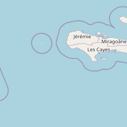
Map view of Parc national du Grand Bois

Use this park location map to pinpoint Parc national du Grand Bois in Haiti, understand its exact geographic position, and read its mapped placement within the surrounding landscape more clearly.

Pigeon | © OpenStreetMap contributors

Location context for Parc national du Grand Bois

Sud

Visualizing the primary forest canopy, montane terrain, and protected habitats of southern Haiti

Parc national du Grand Bois Photos, Landscapes, and Cloud Forest Scenery

Examine high-resolution park imagery capturing the steep mountain slopes, dense cloud forest canopy, and isolated topography of Parc national du Grand Bois. Visual documentation reveals the distinct ecological boundaries and protected habitats defining this vital primary forest refuge.

A wide, slightly elevated view of a lush green mountain valley under a cloudy, misty sky, with dense tropical forest covering the slopes.

A small brown mottled frog perched on a wet mossy rock face near a stream, surrounded by greenery.

Park atlas

Compare adjacent mountain reserves and regional conservation landscapes across the southwestern peninsula

Explore Other Parks Near Parc National Du Grand Bois And Surrounding Protected Areas

Visitors exploring the montane cloud forests of Parc national du Grand Bois can continue examining related protected areas and regional reserves across the surrounding landscape. Comparing adjacent tropical forest habitats and watershed zones provides deeper geographic context for the mountain ecosystems of Hispaniola.
National parkSud
About 0 km away#1 closest

Northeast

Grand Bois National Park National Park: Protected Mountain Landscape in Sud, Haiti

Discover Haiti's vital primary rainforest and endemic species refuge.

Grand Bois National Park is a critical conservation area in Haiti's Sud region, established to protect the rare primary rainforest ecosystem found on the isolated Morne Grand Bois peak. This national park safeguards approximately 3.7 square kilometers of mountainous terrain above 900 meters, featuring a unique cloud forest environment. It is a vital refuge for endemic species, including rediscovered amphibians and rare flora, making it a significant site for Caribbean biodiversity and landscape conservation. The park's importance lies in preserving one of Haiti's last intact forest ecosystems.

Area
3.7 km²
Established
2015
IUCN
II
Relief
Mountain
National parkHaiti
About 10 km away#2 closest

Northeast

Deux Mamelles National Park: Protected Cloud Forest and Mountain Terrain in Haiti

Explore Haiti's critical highland cloud forest ecosystem.

Deux Mamelles National Park is a protected area in Haiti renowned for preserving one of the Caribbean's last remaining cloud forest ecosystems. Located on the Tiburon Peninsula, the park centers around Morne Deux Mamelles, a mountain rising to 1,276 meters. Its rugged, dissected limestone terrain supports primary forest at high elevations, making it a significant biodiversity hotspot and a key site for watershed protection. This park offers a glimpse into the unique natural heritage of Haiti's highlands.

Area
22.65 km²
Established
2015
IUCN
II
Relief
Mountain
Watercolor painting of a mountainous landscape with green valleys and distant peaks.
National parkHaiti
About 21 km away#3 closest

East

Grande Colline National Park: Remote Haitian Mountain Protected Landscape

Unique cloud forest, giant tree ferns, and rugged terrain in Haiti.

Grande Colline National Park safeguards crucial montane cloud forest ecosystems in Haiti's Massif de la Hotte. Characterized by its five named peaks and steep ridges, this protected area preserves a landscape of towering tree ferns and intact hardwood forests above 1,800 meters. Its establishment highlights scientific exploration and the ongoing need for conservation in one of the Caribbean's most biodiverse regions, offering a unique glimpse into isolated montane geography.

Area
15.1 km²
Established
2014
IUCN
II
Relief
Mountain
A watercolor illustration showing a band of lush green tropical foliage, ferns, and pink flowering plants against a soft, light background.
National parkSud
About 21 km away#4 closest

East

Parc national naturel de Grande Colline: Mountain Geography and Protected Area Atlas

A remote, high-altitude primary forest reserve in the Massif de la Hotte

Trace the boundaries of Parc national naturel de Grande Colline, an inaccessible mountain sanctuary characterized by deep ravines, cloud forests, and permanent rivers. As a central biodiversity site within Haiti, the terrain spans five major summits and protects key headwaters for the southern coastline. This atlas entry provides an overview of the park's geographic significance and primary forest habitat.

Area
15.1 km²
Established
2014
IUCN
II
Relief
Mountain
Natural monumentFinland
About 25 km away#5 closest

Southeast

Grotte Marie-Jeanne Natural Monument: Exploring the Geography of Haiti's Longest Cave System

A complex karst labyrinth of limestone galleries and cultural heritage

Grotte Marie-Jeanne represents a premier karst landscape feature in southern Haiti, offering a deep look into a subterranean network of over 50 distinct chambers. This natural monument reveals a multi-tiered geological structure characterized by diverse speleothems and historical inscriptions. The site serves as a vital anchor for understanding the regional karst topography, combining natural formation processes with long-standing human cultural presence within its limestone walls.

Relief
Upland
Climate
Tropical
Access
Access unknown
Scope
Terrestrial
National parkSud
About 29 km away#6 closest

East

Parc national de Macaya: Mountain Geography and Protected Area Map of Southern Haiti

Cloud forest summits and hydrological landscapes in Sud

This protected area represents one of the most significant biodiversity reserves in the Caribbean. By safeguarding high-elevation cloud forests and steep mountain terrain within the Sud region, the park sustains rare endemic flora and vital watersheds that define the southern Haitian landscape.

Area
20 km²
Established
1983
IUCN
II
Protected areaHaiti
About 29 km away#7 closest

East

Massif de la Hotte Protected Area: Geography, Mapped Ridges, and Haitian Mountain Terrain

Exploring the ecological architecture of the Tiburon Peninsula.

Massif de la Hotte serves as a pivotal mountainous protected area in southwestern Haiti, known for its dense cloud forest coverage and steep, rugged topography. This overview provides insight into the massif’s formation, its role as a regional biodiversity anchor, and its vertical landscape that rises sharply from the surrounding coastal lowlands.

Relief
Mountain
Scope
Terrestrial
Water
Minor water
Forest
Mostly forested
National parkHaiti
About 30 km away#8 closest

East

Pic Macaya National Park: Haiti's Protected Cloud Forest and Mountain Geography

Explore critical endemic species within Haiti's mountainous protected areas.

Pic Macaya National Park stands as a significant natural sanctuary in Haiti, preserving the island's final remnants of virgin cloud forest within the challenging terrain of the Massif de la Hotte. This protected area is defined by its high-altitude volcanic and karstic landscape, including Pic Macaya, the second-highest peak in Haiti. The park is a crucial stronghold for biodiversity, harboring numerous species endemic to Hispaniola, making it an essential site for conservation and a focal point for understanding regional natural landscapes.

Area
80 km²
Established
1984
IUCN
II
Relief
Mountain

Common questions about visiting, size, designation, and location context for Parc national du Grand Bois

Parc national du Grand Bois FAQs for park facts, access, geography, and protected area context

Find quick answers about Parc national du Grand Bois, including protected-area facts, park geography, trail and visitor context, and how the park fits into its surrounding country and regional landscape.
MoriAtlas Explorer

Continue Your Protected Areas Search Across the Global Atlas

Deepen your exploration by continuing the structured search for national parks and protected areas worldwide. Utilize the comprehensive filtering capabilities to compare different conservation landscapes and refine your understanding of global park geography. Discover more about the distribution and characteristics of protected natural areas.

Global natural geography