
Mori Atlas logo
Protected landscapeParc naturel Viroin-Hermeton

Mapping the karst geology, limestone grasslands, and biogeographical zones of southern Namur

Parc naturel Viroin-Hermeton: A Comprehensive Protected Landscape and Regional Map Analysis

Parc naturel Viroin-Hermeton represents a major protected landscape in southern Belgium, spanning diverse terrain from the rolling Condroz plateau to the rugged Ardenne forests. This mapping platform highlights the unique Calestienne limestone belt, where hundreds of karst cavities and rare orchid-rich grasslands create a distinctive natural identity. Users can examine the geographic convergence of the Eau Noire and Eau Blanche rivers while exploring the complex topography that defines this significant Walloon conservation area.

limestone landscapeskarstfondryscalestiennewild orchidsbroadleaf forest
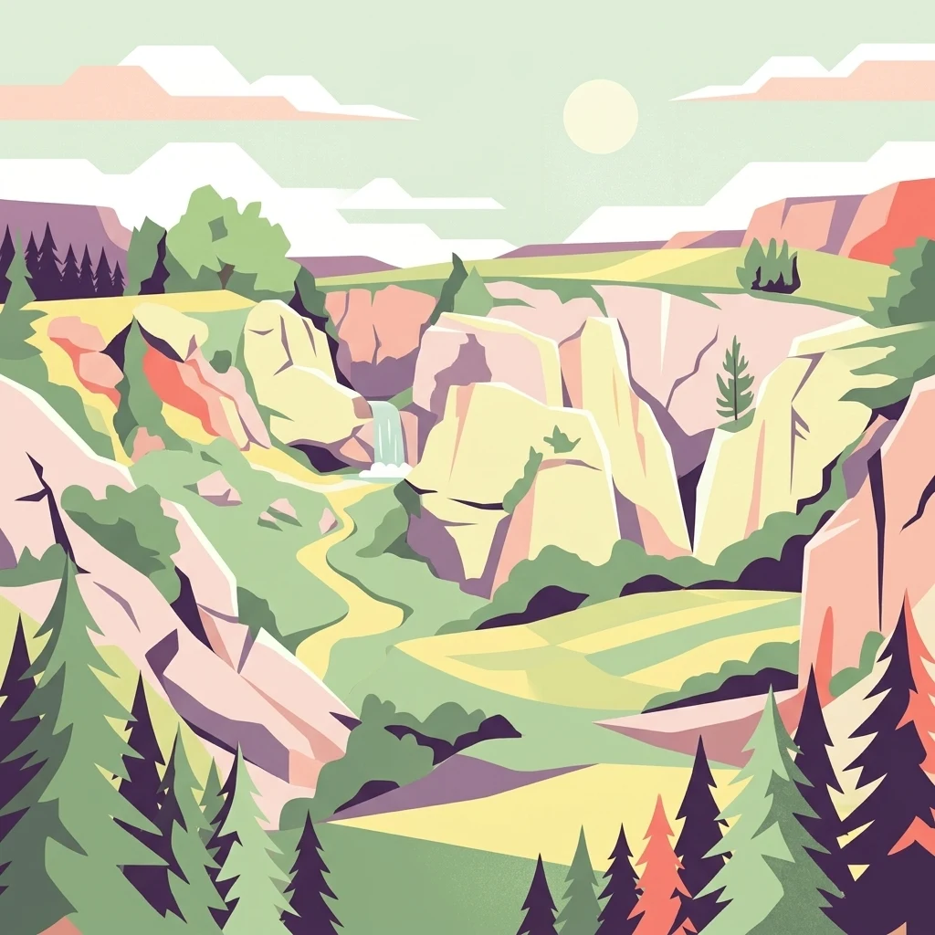
A digital illustration of a valley with light-colored limestone cliffs, a small waterfall, and coniferous forests, rendered in a flat, graphic style.

Parc naturel Viroin-Hermeton

Protected landscape

Park overview

Structured park overview, official facts, and landscape profile for Parc naturel Viroin-Hermeton

Parc naturel Viroin-Hermeton park facts, protected area profile, and essential visitor context

Review the core facts for Parc naturel Viroin-Hermeton, including designation, size, terrain, visitor scale, habitats, and operating context in one park-focused overview.

About Parc naturel Viroin-Hermeton

Parc naturel Viroin-Hermeton lies in the southern corner of Wallonia, pressed against the Franco-Belgian border, where the landscape transitions from the gentle ridges of the Condroz down through the Fagne depression into the rocky Calestienne and finally into the forested Ardenne. This layering of contrasting physical regions within a relatively compact territory is central to what makes the park distinctive. The territory spans about 48,000 hectares and crosses three municipalities: Viroinval, Couvin, and Philippeville. Approximately 30,000 people live within its boundaries, giving the park a strong rural and village character rather than that of a purely wild reserve.

The protected area's status dates to 4 June 1998, with IUCN Category V recognition as a protected landscape. Since 2022, large sections of the park have also been incorporated into the wider National Park L'Entre-Sambre-et-Meuse framework, reinforcing its role within the European network of protected landscapes. Several zones within the park are designated Natura 2000 sites, adding a layer of European conservation significance.

What visitors and researchers encounter here is a striking geological and ecological gradient. The Calestienne, a band of limestone that cuts through the park, has weathered into a landscape of dry grasslands, warm microclimates, and deep karst cavities. Beyond it, the Ardenne portion of the park is dominated by broadleaf forests, including the Woud van Chimay (Forêt du Pays de Chimay). The park's rivers, notably the Eau Noire, the Eau Blanche, and the Viroin, link these landscapes through deep valleys and dramatic limestone bluffs.

The park is also recognised for its cultural depth. Four museums are concentrated in the village of Treignes, including an ecomuseum of traditional crafts, an archaeological museum related to the writer Arthur Masson, a heritage steam railway museum, and the long-established Centre Marie-Victorin, a botanical education centre that has operated in the region since 1958. Combined with more than 300 kilometres of marked hiking paths, scenic villages such as Vierves-sur-Viroin, and a network of heritage steam trains, the park offers an unusually rich blend of natural and cultural heritage.

Quick facts and research context for Parc naturel Viroin-Hermeton

Parc naturel Viroin-Hermeton is a Walloon natural park covering approximately 48,000 hectares and home to around 30,000 residents across the communes of Viroinval, Couvin, and Philippeville. Established on 4 June 1998, it falls under IUCN Category V (protected landscape or seascape) and is registered in the World Database on Protected Areas.

The park spans the international border region with France in the province of Namur. Its geography is defined by four biogeographical zones, including the Calestienne, a limestone belt noted for karst features such as gorges, chasms, and the characteristic fondry cavities. Portions of the park are designated as Natura 2000 sites, and large areas have been incorporated into the broader National Park L'Entre-Sambre-et-Meuse framework since 2022.

Protection and recognition

Explore terrestrial protection records, management scope, and verified international data.

Parc naturel Viroin-Hermeton Protection Status and Designated Area Facts

Parc naturel Viroin-Hermeton maintains a documented terrestrial protection scope within the global protected area registry. Structured records outline baseline designation details and official database identifiers for conservation analysis.

Protection details

Protection scope
Terrestrial
Transboundary protection
No
WDPA ID
386079
Park context

Deeper park guide and search-rich context for Parc naturel Viroin-Hermeton

Parc naturel Viroin-Hermeton history, landscape, wildlife, and travel context

Explore Parc naturel Viroin-Hermeton through its history, landscape character, ecosystems, wildlife, conservation priorities, cultural context, and seasonal travel timing in a structured park guide built for atlas discovery and search intent.

Why Parc naturel Viroin-Hermeton stands out

Parc naturel Viroin-Hermeton is best known for its extraordinary concentration of karst phenomena, with more than four hundred caves, chasms, and fissures collectively referred to as fondrys. The Fondry des Chiens and Fondry Matricolo near Nismes are among the most celebrated examples, and some cavities reach nearly 100 metres in length and more than 20 metres in depth. Equally distinctive is the park's botanical richness on the dry limestone grasslands of the Calestienne. These sunny, calcareous 'tienne' hills host abundant wild orchids, anemones, gentians, and globeflowers, creating a microhabitat that draws butterflies and other insects in May and June. Together, the geological drama of the fondrys and the floral abundance of the tiennes form the park's defining natural signature.
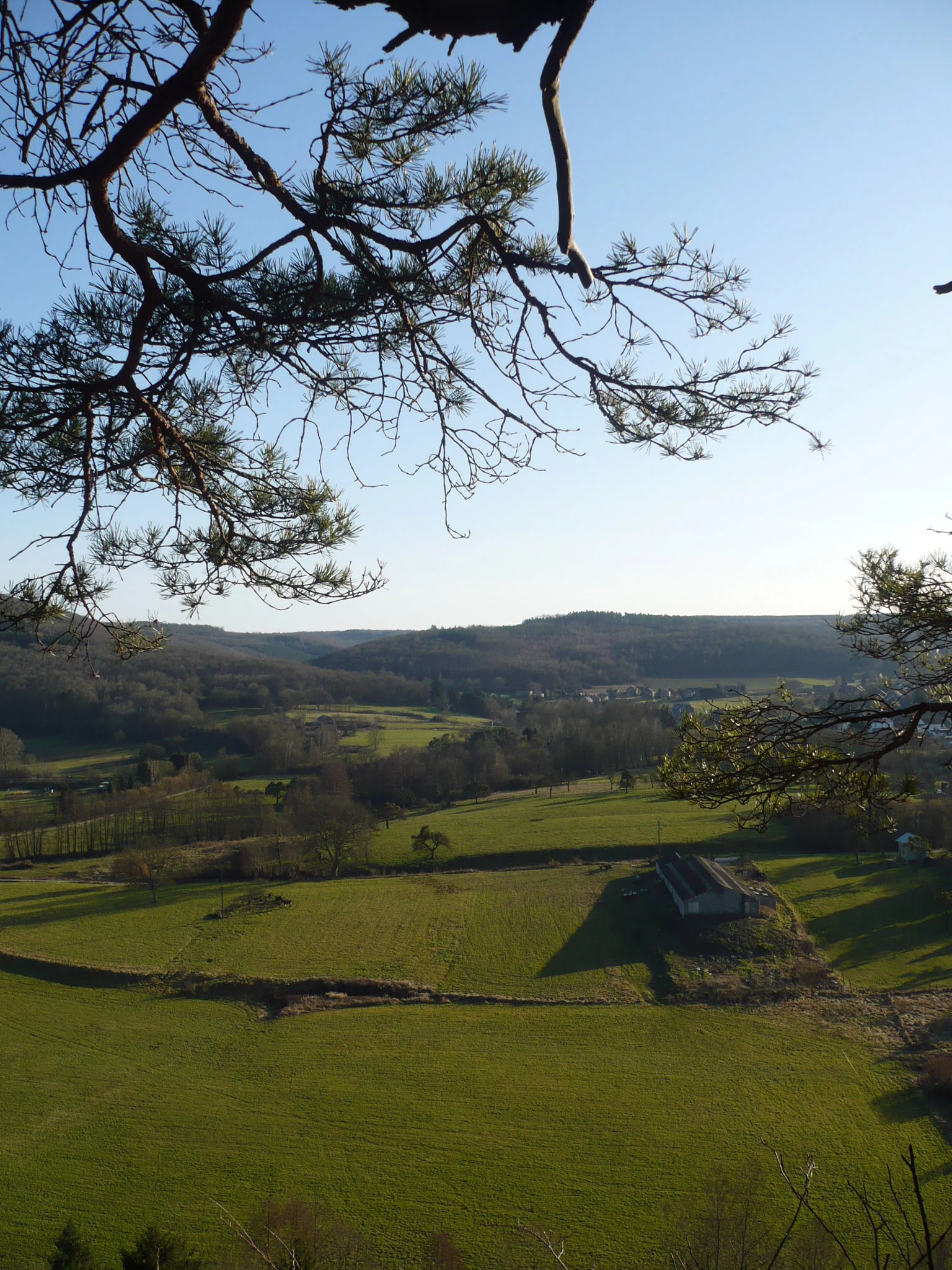
A high-angle view looking down over green fields, agricultural land, and rolling hills with pine tree branches in the foreground.
A scenic view over the valley and village of Olloy-sur-Viroin from a hilltop vantage point.

Parc naturel Viroin-Hermeton history and protected-area timeline

The initiative to create the natural park was launched in 1977 by the Cercles des Naturalistes de Belgique, a Belgian naturalists' association. After more than two decades of preparation, the park was officially established on 4 June 1998 with the communes of Viroinval and Doische as founding members, initially covering slightly more than 20,000 hectares.

A first major change came on 18 December 2003, when the commune of Doische withdrew from the partnership. The park's area consequently shrank to around 12,090 hectares, and the territory lost its direct connection to the Hermeton valley for more than fifteen years.

A second, transformative phase began in 2016 and concluded in May 2019, when the communes of Couvin and Philippeville joined the natural park. This reunified the territory with the Hermeton valley, expanded the protected surface to roughly 48,000 hectares, and raised the resident population to nearly 30,000 inhabitants, restoring the park to a much larger and more ecologically coherent footprint.

Parc naturel Viroin-Hermeton landscape and geographic character

The landscape of the park is shaped by four clearly distinguishable biogeographical zones. From north to south, these are the Condroz, with its rolling agricultural plateau and gentle valleys; the Fagne, a lower and historically marshy depression; the Calestienne, a band of limestone hills with caves, tiennes, and chasms; and the Ardenne, where forests dominate and elevations rise again toward the south.

The Calestienne belt is the most visually dramatic element of the park. Hundreds of karst cavities carve its surface, including fissures, sinkholes, and dolines known locally as fondrys or abannets, some of which reach around 100 metres in length and over 20 metres in depth. Dry limestone grasslands and exposed rocky 'tienne' hills create a warm microclimate that contrasts sharply with the cooler, wooded Ardenne slopes further south.

Water shapes the park just as strongly as rock. The Eau Noire and the Eau Blanche converge at Dourbes beneath a tall limestone bluff called the Roche à l'Homme, forming the Viroin river. These rivers carve narrow valleys through the limestone, producing some of the steepest and most scenic terrain in the region, while offering corridors of forest, meadow, and cliff habitat.
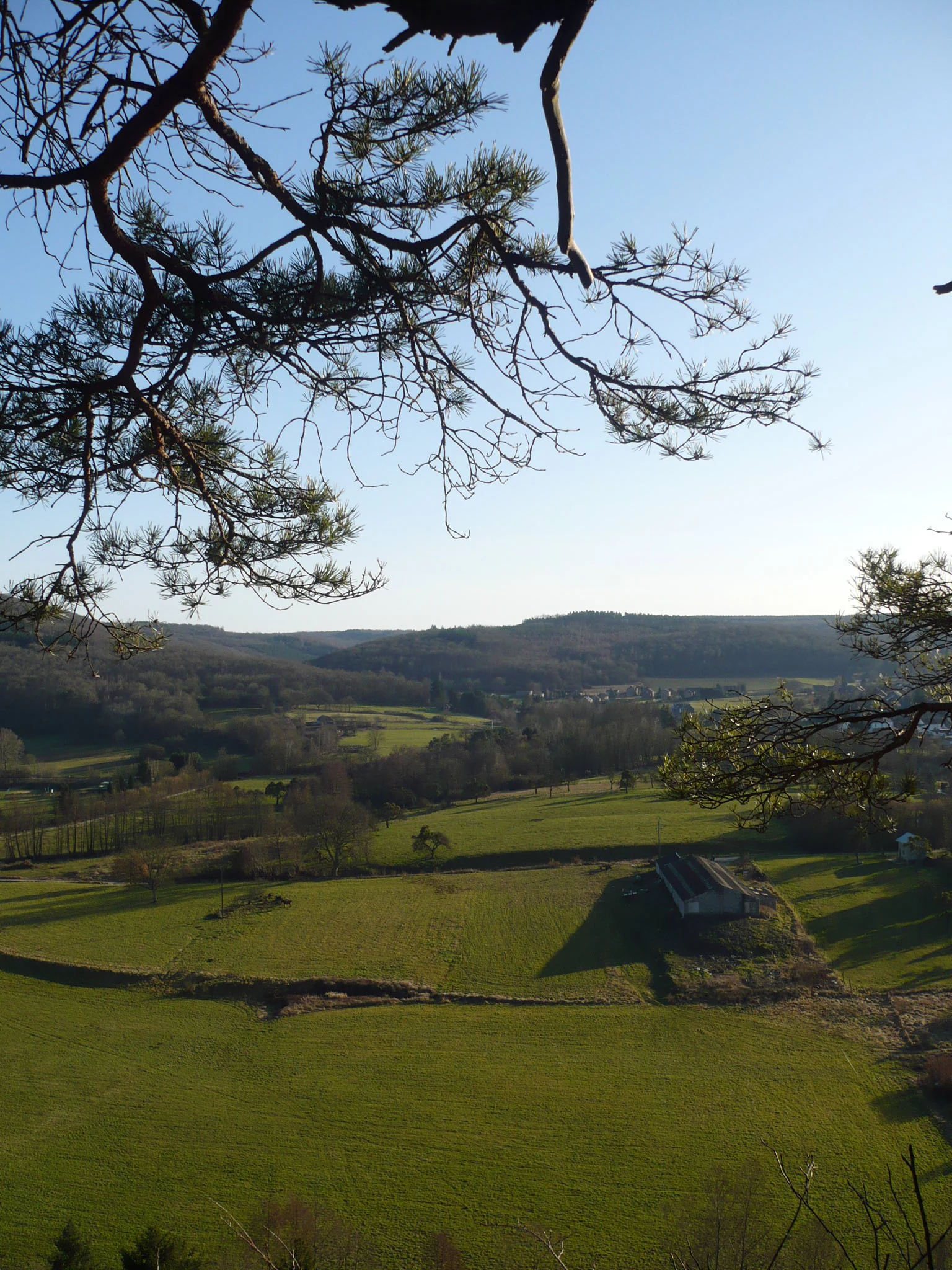
A high-angle view overlooking green fields, rolling hills, and distant woodland, viewed through the framing branches of pine trees.
A scenic overlook of the countryside near Olloy-sur-Viroin, framed by pine branches.

Parc naturel Viroin-Hermeton ecosystems, habitats, and plant life

Parc naturel Viroin-Hermeton harbours a remarkably diverse natural environment considering its relatively compact size. The dominant ecosystems include dry calcareous grasslands on the tiennes, broadleaf forests of the Ardenne, riverine habitats along the Viroin and its tributaries, and specialised karst environments beneath and around the fondrys.

The limestone grasslands of the Calestienne are recognised as one of the park's most ecologically precious features. The combination of thin, calcareous soils and warm exposures gives rise to a specialised flora including wild orchids, anemones, gentians, and globeflowers. These plants, in turn, support a rich entomological community, particularly butterflies drawn to the blooming period in May and June.

In the south, the Ardenne portion of the park transitions into extensive deciduous woodlands, including the Forêt du Pays de Chimay. Here, oak and beech forests, combined with cooler, wetter conditions, create a different botanical character. Several zones of the park are formally protected as Natura 2000 sites, recognising their European-level ecological value, and large areas have been incorporated into the National Park L'Entre-Sambre-et-Meuse since 2022.
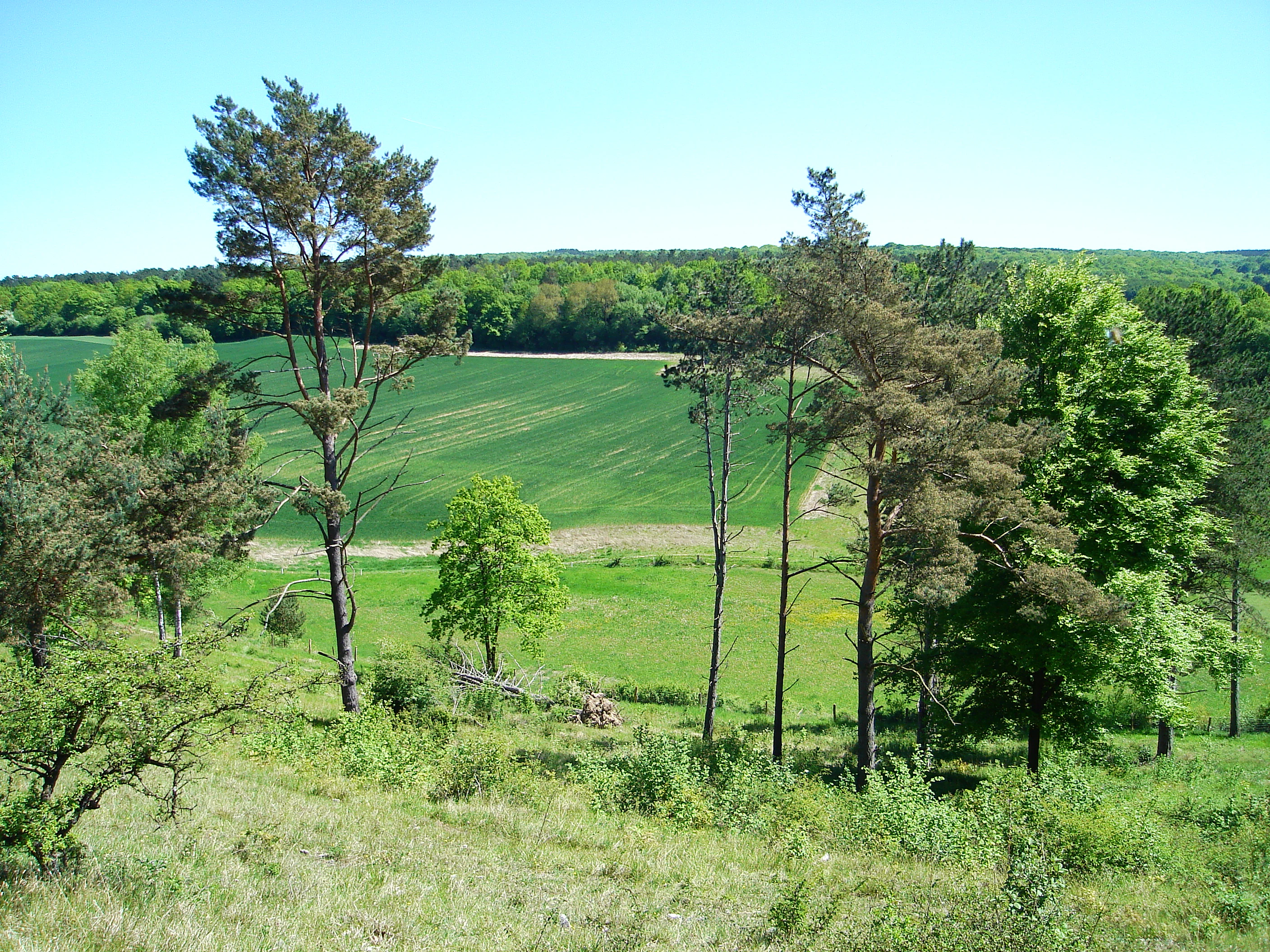
A wide view of a rolling green landscape in Belgium with scattered pine trees in the foreground and a dense forest line in the background under a clear sky.
A rural landscape featuring rolling green meadows and clusters of pine and deciduous trees in the Viroinval region.

Parc naturel Viroin-Hermeton wildlife and species highlights

The wildlife character of the park follows its ecological gradients. The dry limestone grasslands of the Calestienne support a particularly rich insect fauna, including diverse butterfly populations that peak during the spring orchid bloom in May and June. The karst cavities of the fondrys provide shelter for cave-dwelling invertebrate communities and species adapted to constant, cool underground conditions.

The broader mosaic of forests, meadows, and river corridors across the Condroz, Fagne, and Ardenne zones sustains typical Walloon wildlife including deer, wild boar, and a wide range of forest birds associated with mature broadleaf woodland. Bats are also a recognised conservation interest in the region, as documented by the park's own published outreach work on local chiropteran fauna.

Rivers such as the Viroin, Eau Noire, and Eau Blanche add aquatic and riparian habitat complexity to the park, supporting fish, amphibians, and bird species associated with woodland streams and limestone riverbanks. The combination of these habitats within a single protected territory gives the park a strong claim as one of the most ecologically diversified natural parks in Wallonia.

Parc naturel Viroin-Hermeton conservation status and protection priorities

Parc naturel Viroin-Hermeton plays an important role in Wallonia's conservation framework. It is classified as an IUCN Category V protected landscape, recognising its combined natural, cultural, and rural character. Several zones within the park have been formally designated as Natura 2000 sites, anchoring its conservation relevance at the European level.

An important institutional development occurred in 2022, when large parts of the park were integrated into the broader National Park L'Entre-Sambre-et-Meuse framework. This integration strengthened the long-term protection of the Calestienne's karst systems, limestone grasslands, and orchid-rich tiennes, along with the extensive Ardenne forests in the south.

The park's own conservation work combines habitat protection with active management. Its programmes include the planting and pruning of traditional orchard varieties, support for biodiversity-friendly agriculture through local producers' markets, and education initiatives centred on the Centre Marie-Victorin. Together these efforts reflect a model of conservation that integrates ecological protection with the continued presence of rural communities and cultural heritage.

Parc naturel Viroin-Hermeton cultural meaning and human context

The cultural identity of the park is woven tightly into its natural landscape. Four museums are concentrated in the village of Treignes alone, including an ecomuseum that preserves traditional rural crafts such as coopering, blacksmithing, and clog-making; an archaeological museum inspired by local Walloon writer Arthur Masson; a heritage steam railway museum located in the former international station; and the Centre Marie-Victorin, a botanical and educational centre that has operated in the area since 1958.

The region's villages contribute their own cultural weight. Vierves-sur-Viroin is recognised among the Most Beautiful Villages of Wallonia, while heritage steam trains running between Mariembourg and Treignes recall the era when this borderland was crossed by international rail traffic. Local traditions, including the Fagne jam-making culture and Condroz regional identity, remain active threads in the daily life of the park's roughly 30,000 residents.

Top sights and standout views in Parc naturel Viroin-Hermeton

Among the park's standout natural highlights are the Fondry des Chiens and Fondry Matricolo near Nismes, classic examples of the karst cavities that give the Calestienne its distinctive character. The Roche à l'Homme limestone cliff above Dourbes, where the Eau Noire and Eau Blanche meet to form the Viroin, is another signature landscape, while the orchid-rich tiennes of the Calestienne offer some of the richest wildflower viewing in Belgium during late spring.

Equally notable are the cultural anchors of the park: the cluster of four museums at Treignes, the heritage steam trains of the Trois Vallées, and the villages of Nismes and Vierves-sur-Viroin. Combined with more than 300 kilometres of marked hiking trails, these features make the park one of the most rewarding nature destinations in Wallonia for visitors interested in geology, botany, and rural heritage.

Best time to visit Parc naturel Viroin-Hermeton

Late spring, particularly May and June, is widely regarded as the most rewarding time to experience the natural character of the park. During these months the limestone grasslands of the Calestienne erupt with wild orchids, anemones, gentians, and globeflowers, drawing large numbers of butterflies and other pollinators to the tienne slopes.

Summer brings longer days and warmer conditions suitable for exploring the broader network of marked trails, river valleys, and Ardenne forests, as well as the seasonal steam railway services between Mariembourg and Treignes. The calmer months of early autumn offer another strong window, when the broadleaf forests of the Ardenne portion of the park turn colour and visitor pressure is lighter than in midsummer.

Monthly climate preview

Long-term representative temperature and precipitation patterns across the protected landscape

Parc naturel Viroin-Hermeton Climate Normals and Weather by Month

Long-term measurements record annual temperature ranges and monthly precipitation distributions across the representative park coordinate. Examining the complete twelve-month normals profile provides deeper analytical context for understanding local weather patterns.
Annual mean9 °C
1 °C18 °C
Jan
Feb
Mar
Apr
May12°
Jun15°
Jul18°
Aug17°
Sep14°
Oct10°
Nov
Dec
Warmest month
July

17.5 °C

Coolest month
January

1.4 °C

Wettest month
December

3.2 mm/day

Driest month
April

1.8 mm/day

Park location guide

Geography guide, regional context, and park location map for Parc naturel Viroin-Hermeton

Parc naturel Viroin-Hermeton park geography, regions, and map view in Belgium

Understand where Parc naturel Viroin-Hermeton sits in Belgium through a broader geographic reading of the surrounding landscape, nearby location context, and its mapped position within the national park landscape.

How Parc naturel Viroin-Hermeton fits into Belgium

Belgium is a parliamentary constitutional monarchy and federal state in Northwestern Europe. Located in the Low Countries, it borders the Netherlands, Germany, Luxembourg, France, and the North Sea. The country has three autonomous regions and three official languages, with Brussels as both the capital and largest city. Belgium is a founding member of the European Union and hosts its de facto capital in Brussels.

Wider geography shaping Parc naturel Viroin-Hermeton in Belgium

Belgium occupies a coastal lowland region in Northwestern Europe known as the Low Countries. It is bordered by the Netherlands to the north, Germany to the east, Luxembourg to the southeast, France to the south, and the North Sea to the west. The country also shares a maritime boundary with the United Kingdom to the northwest.

Map view of Parc naturel Viroin-Hermeton

Use this park location map to pinpoint Parc naturel Viroin-Hermeton in Belgium, understand its exact geographic position, and read its mapped placement within the surrounding landscape more clearly.

Pigeon | © OpenStreetMap contributors

Location context for Parc naturel Viroin-Hermeton

NamurWallonia
Recorded earthquake history

View the Documented Earthquake History of Parc naturel Viroin-Hermeton

Investigate the historical record of seismic activity identified near Parc naturel Viroin-Hermeton. This structured catalogue allows you to trace recorded events by proximity and magnitude, offering a clear view of the seismic context surrounding this protected landscape in the Namur province.

Parc naturel Viroin-Hermeton Earthquake History

Catalogued events

15 events

Strongest magnitude

Magnitude 5.5

Most recent event

Sep 13, 2008

This history includes earthquakes recorded inside the park or within 50 km of its borders

Visual reference for limestone terrain, karst formations, and river valley habitats

Parc naturel Viroin-Hermeton Landscapes, Scenery, and Protected-Area Photos

Visual documentation of Parc naturel Viroin-Hermeton reveals the dramatic karst topography of the Calestienne belt and the wooded slopes of the southern Ardenne. Examining these protected landscapes provides clear insight into the geological contrasts and diverse habitats defining the region.

A high-angle view looking down over green fields, agricultural land, and rolling hills with pine tree branches in the foreground.

A sunny, eye-level landscape shot of a rocky limestone quarry or ravine with sparse vegetation, green trees at the edges, and a walking path winding through the rocks, with two small figures visible in the distance.

A high-angle view overlooking green fields, rolling hills, and distant woodland, viewed through the framing branches of pine trees.

A wide view of a rolling green landscape in Belgium with scattered pine trees in the foreground and a dense forest line in the background under a clear sky.

Park atlas

Compare limestone landscapes, river valleys, and connected regional terrain.

Other Parks Near Parc naturel Viroin-Hermeton and Protected Areas in the Region

Visitors exploring Parc naturel Viroin-Hermeton can examine adjacent protected landscapes and nearby nature reserves to compare regional geological formations. Expanding the geographic scope reveals how similar conservation zones span the surrounding border terrain and river valleys.
Watercolor illustration showing a winding river flowing through a lush green valley with distant hills under a soft pink and yellow sky.
Nature reserveGrand Est
About 6.6 km away#1 closest

Northeast

Réserve naturelle nationale de la pointe de Givet: Protected Nature Reserve and Geological Atlas

Limestone cliffs, Meuse valley geography, and botanical enclaves in Grand Est

Covering 354 hectares of fragmented terrain, this nature reserve protects a vital corridor of limestone pavements, rocky scree, and dry grasslands. It hosts the internationally recognized Givétian geological stage and provides critical habitat for protected southern plant species. The area offers a distinct geographic profile where medieval fortifications and Vauban military history intersect with specialized forest and cave ecosystems along the Meuse river.

Area
3.54 km²
Established
1999
IUCN
III
Relief
Upland
Nature reserveHauts-de-France
12 km away#2 closest

West

Réserve naturelle régionale des monts de Baives: Protected Limestone and Calcareous Landscapes

Ecological geography and regional conservation map context

Encompassing roughly 19 hectares, the Réserve naturelle régionale des monts de Baives protects a specialized ecosystem at the edge of the Ardennes foothills. The site is recognized for its south-facing limestone slopes, orchid-rich grasslands, and historical quarry habitats that support regional bat colonies and unique botanical species.

Area
0.188 km²
Established
1996
IUCN
IV
Relief
Upland
Nature reserveHauts-de-France
14 km away#3 closest

Southwest

Réserve naturelle régionale des prairies humides de la ferme du Moulin Fontaine Protected Area

Wet meadow conservation in the Hauts-de-France region

Spanning 38 hectares in the Aisne department, this nature reserve focuses on the protection of humid grasslands. The site exemplifies regional efforts to maintain semi-natural habitats through a mosaic of hedgerows, moist meadows, and historic farm architecture in the Thiérache landscape.

Area
0.381 km²
Established
2014
IUCN
IV
Nature reserveArdennes
About 26 km away#4 closest

South

Réserve naturelle régionale de la côte de Bois-en-Val: Ardennes Protected Nature Reserve

A study in post-industrial rewilding and mapped biodiversity.

Located in the Ardennes department, this 24-hectare reserve demonstrates how limestone quarry faces, calcicole woodlands, and marshy hollows support a high density of plant and wildlife species. It provides an accessible look at local geology and habitat recovery within a compact, protected geographic frame.

Area
0.24 km²
Established
2008
IUCN
IV
Nature reserveHauts-de-France
39 km away#5 closest

Northwest

Réserve naturelle régionale de Pantegnies: Protected Landscape and Regional Map Overview

A managed nature reserve in the Hauts-de-France region

Réserve naturelle régionale de Pantegnies covers 37 hectares of protected terrain near Pont-sur-Sambre. This IUCN Category IV site serves as a vital anchor for regional biodiversity management, offering a clear case study in the preservation of northern French landscapes through formal regional nature reserve status.

Area
0.37 km²
Established
2013
IUCN
IV
Scope
Terrestrial
Watercolor illustration of a landscape with rolling hills, a river, and green vegetation
Protected areaProvince of Luxembourg
42 km away#6 closest

Southeast

Gaume Natural Park: A Protected Area Defining the Landscape of Province of Luxembourg

Explore its mapped natural landscape and geographic context.

Gaume Natural Park is a protected area offering a unique perspective on the natural landscapes found within Belgium's Province of Luxembourg. As a key geographic entity, it provides a vital component for atlas exploration, showcasing distinct mapped boundaries and regional terrain. Understand its significance as a protected natural space contributing to the Ardennes region's extensive geography, making it an essential point for structured discovery of protected lands.

Area
581.04 km²
Established
2014
IUCN
V
Relief
Lowland
A watercolor painting showing a soft, panoramic landscape with green hills in the distance, a meandering stream in the foreground, and grassy banks with subtle pink floral highlights.
Nature reserveHauts-de-France
44 km away#7 closest

West

Réserve naturelle régionale des Prairies du Val de Sambre: Regional Nature Reserve Atlas

Wetland floodplain meadows in the middle Sambre valley

The Réserve naturelle régionale des Prairies du Val de Sambre protects essential wet grassland habitats in northern France. Spanning approximately 49 hectares along the canalised Sambre, this protected area maintains traditional meadow systems that support wetland-dependent species; it represents a key junction in the regional landscape between the Mormal forest and Thiérache bocage.

Area
0.494 km²
Established
2012
IUCN
IV
A horizontal watercolor illustration depicting rolling green hills, meadows, and a small stream or body of water.
Protected landscapeProvince de Hainaut
About 47 km away#8 closest

Northwest

Parc naturel des Hauts-Pays: Geography and Protected Landscape Analysis

Tracing the forest corridors and river valleys of the Walloon region

Situated along the Franco-Belgian border, Parc naturel des Hauts-Pays offers a rare look at an intact bocage and forest landscape. The area is defined by the Grande Honnelle river valley, calcareous grasslands, and high-quality broadleaf woods. Its unique geographic location acts as a critical refuge for rare plant species and preserves a traditional rural identity that has survived across a complex watershed divide.

Area
157 km²
Established
2000
IUCN
V

Common questions about visiting, size, designation, and location context for Parc naturel Viroin-Hermeton

Parc naturel Viroin-Hermeton FAQs for park facts, access, geography, and protected area context

Find quick answers about Parc naturel Viroin-Hermeton, including protected-area facts, park geography, trail and visitor context, and how the park fits into its surrounding country and regional landscape.
MoriAtlas Explorer

Continue Your Protected Areas Search Across the Global Atlas

Deepen your exploration by continuing the structured search for national parks and protected areas worldwide. Utilize the comprehensive filtering capabilities to compare different conservation landscapes and refine your understanding of global park geography. Discover more about the distribution and characteristics of protected natural areas.

Global natural geography