
Mori Atlas logo
Protected landscapePark Krajobrazowy Sudetów Wałbrzyskich

Analyzing the forested ridges and erosional rock formations of the Central Sudetes

Park Krajobrazowy Sudetów Wałbrzyskich Protected Landscape and Regional Geography

Park Krajobrazowy Sudetów Wałbrzyskich encompasses a distinct mountainous belt in the Lower Silesian Voivodeship. This protected landscape is defined by the high forested ridges of the Góry Kamienne range and the prominent Waligóra summit. Mapped data reveals complex topography including narrow stream valleys and erosional features such as Czerwone Skałki and the Rybna river capture, tracing the geological heritage of the Central Sudetes.

SudetesCentral Sudetesmountain landscapeforested ridgeslandscape parkrock formations
A minimalist, flat-design vector illustration showing a tall waterfall flowing down a rocky canyon flanked by pine trees and layers of cliffs.

Park Krajobrazowy Sudetów Wałbrzyskich

Protected landscape

Park overview

Structured park overview, official facts, and landscape profile for Park Krajobrazowy Sudetów Wałbrzyskich

Park Krajobrazowy Sudetów Wałbrzyskich park facts, protected area profile, and essential visitor context

Review the core facts for Park Krajobrazowy Sudetów Wałbrzyskich, including designation, size, terrain, visitor scale, habitats, and operating context in one park-focused overview.

About Park Krajobrazowy Sudetów Wałbrzyskich

Park Krajobrazowy Sudetów Wałbrzyskich is a regional-scale landscape park in Lower Silesia, Poland, designed to protect a representative cross-section of the Central Sudetes. Although its name suggests a dedicated mountain range, there is no formally named Wałbrzych Sudetes massif; the park instead gathers together the high, forested ridges that lie between and around the better-known ranges of the area.

The park's territory extends across the highest, central section of the Góry Kamienne, including the Lesista range, the western portions of the Góry Suche that contain Waligóra, and the eastern edge of the Góry Wałbrzyskie around the Borowa massif and the Rybnicki Grzbiet. Together these uplands form a continuous, heavily forested landscape that drops from the Waligóra summit at 936 meters down to valley floors near 400 meters above sea level.

Administratively, the park lies within six communes and city territories, including the rural municipalities of Czarny Bór, Mieroszów, and Głuszyca, and the urban municipalities of Wałbrzych, Boguszów-Gorce, and Jedlina-Zdrój. This jurisdictional mix reflects the close relationship between the protected area and the surrounding spa towns, historic mining communities, and residential areas of the Wałbrzych region.

An important aspect of the park's geography is its cross-border character. Along its southern edge it adjoins the Czech CHKO Broumovsko, creating a continuous protected landscape corridor across the Polish-Czech border along the Central Sudetes. This adjacency reinforces the park's role as part of a wider transnational system of Sudeten landscape protection rather than an isolated Polish reserve.

From a visitor perspective, the park functions both as a natural setting for the surrounding towns and as a hiking and nature destination in its own right. Trails connect settlements such as Jedlina-Zdrój and Mieroszów with mountain hostels like Andrzejówka and the Waligóra summit area, and the protected rock formations serve focal points for short excursions and educational visits within the broader Sudeten trail network.

Quick facts and research context for Park Krajobrazowy Sudetów Wałbrzyskich

Park Krajobrazowy Sudetów Wałbrzyskich is a Polish landscape park in the Lower Silesian Voivodeship, created in 1998 by a regulation of the Wałbrzych governor. The park covers about 65 square kilometers and is surrounded by a buffer zone of roughly 29 square kilometers.

It spans parts of six administrative units, including the municipalities of Czarny Bór, Mieroszów, Głuszyca, the cities of Wałbrzych, Boguszów-Gorce, and Jedlina-Zdrój. The highest point is Waligóra at 936 meters, and the lowest areas lie near 400 meters above sea level. To the south, the park directly adjoins the Czech CHKO Broumovsko protected landscape.

Protection and recognition

Terrestrial protected area designation records and conservation framework

Park Krajobrazowy Sudetów Wałbrzyskich Protection Status And Recognition

Park Krajobrazowy Sudetów Wałbrzyskich maintains a documented terrestrial protection scope without external international recognition sources. Reviewing these verified facts clarifies the official conservation framework governing this regional landscape.

Protection details

Protection scope
Terrestrial
Transboundary protection
No
Buffer area
28.94 km²
Park context

Deeper park guide and search-rich context for Park Krajobrazowy Sudetów Wałbrzyskich

Park Krajobrazowy Sudetów Wałbrzyskich history, landscape, wildlife, and travel context

Explore Park Krajobrazowy Sudetów Wałbrzyskich through its history, landscape character, ecosystems, wildlife, conservation priorities, cultural context, and seasonal travel timing in a structured park guide built for atlas discovery and search intent.

Why Park Krajobrazowy Sudetów Wałbrzyskich stands out

The park is best known for protecting the forested high ridges of the Central Sudetes immediately south of Wałbrzych, most notably the Góry Kamienne range and the summit of Waligóra, the highest peak in the park at 936 meters. Its defining scenic identity combines dense spruce and mixed forest cover with distinctive erosional rock formations protected as natural monuments, including Czerwone Skałki, Małpia Skała, Stożek Wielki, Szczeliny Wiatrowe, and Zamkowa Góra. The landscape is also recognized for the unusual hydrological feature called the Rybna river capture, where headward erosion diverted an upper stream into a different drainage basin.
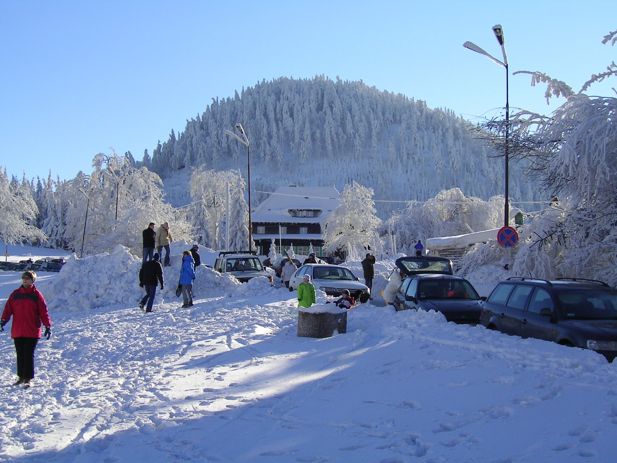
A snow-covered parking area in winter with a forest-covered mountain peak in the background.
A winter scene at the foot of Waligora peak in the Wałbrzych Mountains.

Park Krajobrazowy Sudetów Wałbrzyskich history and protected-area timeline

Park Krajobrazowy Sudetów Wałbrzyskich was established in 1998 by Regulation No. 20/98 of the Wałbrzych Voivode, dated 29 December 1998. Its creation formed part of the broader wave of landscape park designations across Polish voivodeships during the late 1990s, when many regional authorities formalized protection for important scenic and ecological areas outside of national parks.

The park consolidated protection over ridges that had historically been influenced by intensive forestry, small-scale agriculture, and the long mining and industrial heritage of the Wałbrzych region. By drawing together the Góry Kamienne, parts of the Góry Suche, and the eastern Góry Wałbrzyskie into a single landscape park, the designation aimed to safeguard the forested mountain backdrop of these communities while allowing traditional land uses to continue under regulated conditions.

Following Polish administrative reforms after 1998, responsibility for managing the park eventually shifted to the Dolnośląski Zespół Parków Krajobrazowych, the regional body that oversees landscape parks in Lower Silesia. The park's southern boundary with the Czech Broumovsko protected landscape has helped anchor its role within transnational Sudeten conservation efforts.

Park Krajobrazowy Sudetów Wałbrzyskich landscape and geographic character

The landscape of Park Krajobrazowy Sudetów Wałbrzyskich is defined by the elevated, heavily forested ridges of the Central Sudetes. Rather than dramatic peaks, the scenery is characterized by long, rounded ridges and broad, deeply incised valleys typical of the middle-elevation Sudeten ranges. The view often shifts between dense spruce cover and open meadows, with sudden rock outcrops and cliff faces interrupting the forest.

Elevations range from valley floors near 400 meters up to the Waligóra summit at 936 meters, making Waligóra the visual and topographic anchor of the park. Other prominent high points include the Borowa massif within the Góry Wałbrzyskie at 854 meters and the Lesista range within the Góry Kamienne. Together these areas give the protected zone a strong sense of vertical relief despite their generally rounded, weathered character.

Scenically, the park is also shaped by isolated rock formations that rise abruptly from the forested slopes. Several of these are legally protected as natural monuments and have become recognizable landscape features. They include Czerwone Skałki, known for its reddish rock surface, Małpia Skała, Stożek Wielki, the wind-shaped Szczeliny Wiatrowe, and Zamkowa Góra. These formations add geological texture to an otherwise forest-dominated mountain landscape.

The hydrological setting plays a major role in shaping the terrain. Streams such as the Rybna, Sokołowiec, Złota Woda, and Grzędzki Potok have carved narrow valleys through the ridges. The most unusual landscape feature is the Rybna capture, where headward erosion deflected the upper portion of the Ścinawka catchment into the Rybna and from there into the Bystrzyca drainage, leaving an unusually deep, through-like valley that cuts sharply across the local ridge pattern.

Park Krajobrazowy Sudetów Wałbrzyskich ecosystems, habitats, and plant life

The park protects a representative example of Central Sudeten montane forest ecosystems, dominated historically by spruce stands that clothe the ridges from the valleys up to the summits. At lower elevations and along the valley edges, mixed forest communities with beech and other broadleaved species add structural variety, while small clearings, meadows, and former agricultural openings create habitat mosaics within an otherwise continuous forest cover.

The lower slopes and valley corridors harbor more diverse vegetation, including communities associated with cool, moist Sudeten microclimates. Rocky outcrops and cliff habitats support specialized plant communities adapted to thin soils and exposed conditions, which is part of the reason that the park's rock formations are individually protected as natural monuments.

Although the park does not include strict nature reserves, its large, connected forest blocks function as an important refuge and corridor for Central Sudeten flora and fauna. The relatively limited road and settlement density within the protected area helps maintain ecological continuity between Polish forests and the adjoining Czech Broumovsko landscape, supporting broader biodiversity patterns across the Central Sudetes.

Park Krajobrazowy Sudetów Wałbrzyskich wildlife and species highlights

Wildlife in Park Krajobrazowy Sudetów Wałbrzyskich reflects typical Central Sudeten forest fauna, with species well adapted to extensive spruce-dominated woodlands and the mosaic of meadows, cliffs, and valley habitats that punctuate them. Large, contiguous forest blocks provide habitat for ungulates and other forest-dependent mammals typical of Polish mountain regions.

Raptors and other cliff-nesting birds are associated with the park's rock formations and larger forested slopes, where the combination of open foraging terrain and secluded nesting sites supports stable populations. Forest bird communities, including species typical of mature spruce and mixed stands, are a regular presence along the ridges and valley forests.

The cross-border connection with the Czech CHKO Broumovsko reinforces the park's value for wildlife, as the continuous forest belt on both sides of the border reduces isolation between subpopulations and creates more viable habitat for less mobile forest species. This makes the park an ecologically meaningful link in the wider Central Sudeten wildlife network rather than a small, isolated refuge.

Park Krajobrazowy Sudetów Wałbrzyskich conservation status and protection priorities

From a conservation perspective, the park's central importance lies in safeguarding a large, connected strip of Central Sudeten forest that would otherwise be vulnerable to fragmented management across multiple communes. Its designation as a landscape park allows protective oversight while maintaining traditional land uses such as forestry and limited agriculture under regulated conditions.

The natural monument status given to formations like Czerwone Skałki, Małpia Skała, Stożek Wielki, Szczeliny Wiatrowe, and Zamkowa Góra extends protection to specific geological features that anchor the park's scenic and scientific identity. Together with the broader landscape category, this approach combines ecosystem-level and feature-level conservation within a single framework.

The park's direct adjacency to the Czech CHKO Broumovsko gives it additional transnational conservation significance. The two protected areas together form a continuous landscape corridor along the Polish-Czech border, strengthening ecosystem connectivity, supporting migratory and wide-ranging species, and integrating the park into the broader European network of protected Sudeten landscapes.

Park Krajobrazowy Sudetów Wałbrzyskich cultural meaning and human context

The park lies within a historically layered Sudeten landscape shaped by centuries of forestry, small-scale mountain agriculture, and intensive industrial development centered on Wałbrzych and its surrounding towns. Communities such as Jedlina-Zdrój, a historic spa resort, and mining-influenced towns like Boguszów-Gorce and Wałbrzych itself have long interacted with the forested ridges that the park now protects.

Traditional Sudeten mountain culture, expressed in small settlements, mountain huts, and long-established trail networks, continues to shape how the landscape is used and experienced. The Andrzejówka mountain hostel, situated on park territory, reflects the enduring role of Sudeten hiking culture in connecting towns and ridges across the border area with Czech Broumovsko.

Names of rock formations and ridges carry traces of regional folklore and historical land use, even where no detailed cultural narrative is recorded in modern sources. The park's presence has reinforced the identity of surrounding communities as mountain landscape communities, where protection efforts, tourism, and local heritage are closely intertwined.

Top sights and standout views in Park Krajobrazowy Sudetów Wałbrzyskich

The park's standout features include the high, forested ridge system of the Góry Kamienne and the Waligóra summit, which at 936 meters is the highest point in the protected area. Equally distinctive are the protected rock formations such as Czerwone Skałki, Małpia Skała, Stożek Wielki, Szczeliny Wiatrowe, and Zamkowa Góra, which give the forested landscape a memorable geological character.

The Rybna river capture is another defining feature, producing an unusually deep through valley that dramatically demonstrates the erosional history of the Central Sudetes. Combined with the cross-border connection to the Czech CHKO Broumovsko, these highlights make the park a significant landscape-level stronghold of the Polish-Czech Sudeten border region.

Best time to visit Park Krajobrazowy Sudetów Wałbrzyskich

Late spring through early autumn is generally the most rewarding period to experience the park, when forest trails are accessible, the rock formations are most safely approached, and views from the higher ridges such as Waligóra are at their clearest. Summer brings the fullest vegetation and the warmest conditions for longer hikes across the Góry Kamienne and Góry Wałbrzyskie portions of the park.

Winter transforms the park into a quieter, snow-covered landscape suited to shorter excursions toward the higher summits and mountain hostels like Andrzejówka. Snow conditions highlight the relief of the ridges and the depth of the river valleys, though visitors should be prepared for more demanding terrain and limited daylight in the deeper valleys.


Monthly climate preview

Long-term temperature ranges and monthly precipitation data for Park Krajobrazowy Sudetów Wałbrzyskich

Park Krajobrazowy Sudetów Wałbrzyskich Climate Normals and Annual Weather Patterns

Park Krajobrazowy Sudetów Wałbrzyskich exhibits a measured annual temperature and precipitation rhythm spanning sub-zero winter minimums and warm summer maximums. Reviewing the comprehensive monthly climate profile provides detailed long-term meteorological metrics recorded across the representative coordinate.
Annual mean7 °C
-4 °C18 °C
Jan-4°
Feb-3°
Mar
Apr
May12°
Jun16°
Jul18°
Aug18°
Sep13°
Oct
Nov
Dec-3°
Warmest month
July

17.9 °C

Coolest month
January

-4 °C

Wettest month
July

3.1 mm/day

Driest month
April

1.5 mm/day

Park location guide

Geography guide, regional context, and park location map for Park Krajobrazowy Sudetów Wałbrzyskich

Park Krajobrazowy Sudetów Wałbrzyskich park geography, regions, and map view in Poland

Understand where Park Krajobrazowy Sudetów Wałbrzyskich sits in Poland through a broader geographic reading of the surrounding landscape, nearby location context, and its mapped position within the national park landscape.

How Park Krajobrazowy Sudetów Wałbrzyskich fits into Poland

Poland, officially the Republic of Poland, is a Central European country spanning from the Baltic Sea in the north to the Carpathian Mountains in the south. It borders Germany, Czech Republic, Slovakia, Ukraine, Belarus, Lithuania, and Kaliningrad Oblast. The country has a temperate climate, diverse landscapes, and is known for its rich history, cultural heritage, and strong economic position within the EU.

Wider geography shaping Park Krajobrazowy Sudetów Wałbrzyskich in Poland

Poland occupies 312,696 km2 in Central Europe, extending from the Baltic Sea coast in the north to the Sudetes and Carpathian Mountains in the south. It borders Germany to the west, Czech Republic and Slovakia to the south, Ukraine and Belarus to the east, and Lithuania and Kaliningrad Oblast to the northeast. The landscape includes lowland plains, uplands, and mountain ranges.

Map view of Park Krajobrazowy Sudetów Wałbrzyskich

Use this park location map to pinpoint Park Krajobrazowy Sudetów Wałbrzyskich in Poland, understand its exact geographic position, and read its mapped placement within the surrounding landscape more clearly.

Pigeon | © OpenStreetMap contributors

Location context for Park Krajobrazowy Sudetów Wałbrzyskich

Lower Silesian Voivodeship
Recorded earthquake history

View Historical Earthquake Records for Park Krajobrazowy Sudetów Wałbrzyskich

Browse the documented seismic history associated with the ridges of Park Krajobrazowy Sudetów Wałbrzyskich. This MoriAtlas collection maps historical events and magnitudes to provide context for seismic activity recorded near the park and throughout the surrounding Sudetes region.

Sudetów Wałbrzyskich Earthquake Records

Catalogued events

161 events

Strongest magnitude

Magnitude 4.9

Most recent event

Oct 25, 2005

This history includes earthquakes recorded inside the park or within 50 km of its borders

Visualizing the forested ridges, rock formations, and mountain terrain of Lower Silesia

Park Krajobrazowy Sudetów Wałbrzyskich Photos and Forest Scenery

Visual documentation reveals the dense spruce forests, deep river valleys, and prominent rock outcrops that define the protected landscape. Examining these field photographs provides a clear perspective on the rugged topography and natural habitats preserved across the Central Sudetes.

A snow-covered parking area in winter with a forest-covered mountain peak in the background.

A red park boundary sign with the Polish national emblem and text reading Park Krajobrazowy Sudetów Wałbrzyskich mounted on a wooden post in a snowy forest, with a colorful trail marker on a nearby tree.

Park atlas

Compare connected Central Sudetes mountain ridges and neighboring protected landscapes.

Other Parks Near Park Krajobrazowy Sudetów Wałbrzyskich and Surrounding Regional Protected Areas

Browse nearby protected areas and forested mountain ranges adjacent to Park Krajobrazowy Sudetów Wałbrzyskich. Evaluating surrounding regional terrain provides deeper geographic context for cross border conservation zones.
Watercolor illustration of a mountain range with green hills, pink and yellow sky, and sparse vegetation
National parkPoland
16 km away#1 closest

West

Karkonosze National Park: A Premier National Park in Poland's Giant Mountains

Discover alpine terrain and unique glacial landscapes.

Karkonosze National Park is a significant protected area in Poland, renowned for its dramatic alpine topography carved by ancient glaciers. As the highest range in the Polish Sudetes, it features striking U-shaped valleys, U-shaped glacial cirques, and diverse subalpine to alpine ecosystems. This national park provides a rich context for understanding Central European mountain geography and exploring its mapped protected boundaries.

IUCN
II
Relief
Mountain
Scope
Terrestrial
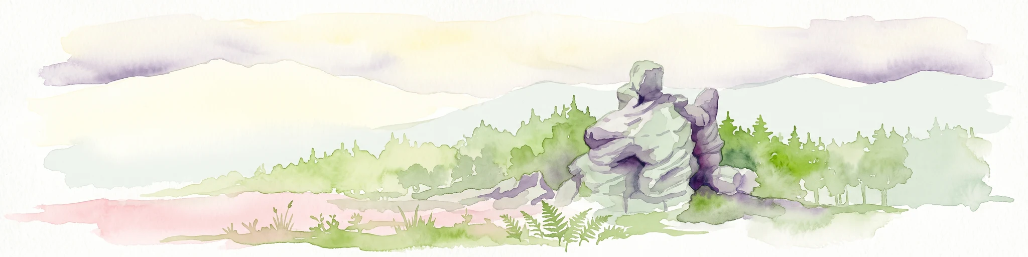
A horizontal watercolor illustration depicting a prominent weathered sandstone rock formation surrounded by forest, set against a soft, light-filled sky.
National parkDolnośląskie
17 km away#2 closest

South

Park Narodowy Gór Stołowych: A Geologic Atlas of Table Mountains in Lower Silesia

Mapping sandstone labyrinths and protected forest plateaus in the Sudetes

Explore the definitive map and geographic profile of Park Narodowy Gór Stołowych, a protected area characterized by its horizontal sandstone layers and dramatic rock towers. This atlas entry provides insight into the park's sedimentary landscape, covering iconic summit plateaus, dense forest environments, and the contrasting igneous geology of the surrounding terrain.

Area
63.402 km²
Established
1993
Visitors
1.3M annual
Relief
Mountain
Watercolor artwork depicting a landscape with green hills, distant mountains, and pastel sky
National parkLower Silesian Voivodeship
17 km away#3 closest

South

Stołowe Mountains National Park: Explore Poland's Sandstone Rock Cities and Protected Terrain

National Park in Lower Silesian Voivodeship: Geological Wonders.

Stołowe Mountains National Park is a protected national park in Poland celebrated for its unparalleled sandstone geological features. Within the Lower Silesian Voivodeship, the park showcases a dramatic landscape dominated by flat-topped rock plateaus, natural labyrinths, and vertical sandstone formations that create a visually stunning and geologically significant environment. Its protected status ensures the preservation of these unique landforms and the rare ecosystems, such as raised peat bogs, offering extensive opportunities for atlas exploration and understanding the region's distinct natural context.

Area
63.39 km²
Established
1993
IUCN
II
Visitors
1.3M annual
Watercolor painting showing green forests, a valley, and distant mountains under a soft sky
National parkLiberec Region
19 km away#4 closest

West

Krkonoše National Park: Central European Alpine Protected Area and Map Context

Discover glacial landforms and unique ecosystems in the Giant Mountains.

Krkonoše National Park, situated in the Liberec Region, is a premier example of a protected alpine landscape in Central Europe. This page facilitates exploration of its significant glacial geography, including distinct cirques, rockfields, and valleys, providing vital context for understanding its protected area status. Engage with the mapped terrain and discover the unique ecological features that make this national park a cornerstone of conservation and geographic study within the Czech Republic.

Area
363.52 km²
Established
1963
IUCN
II
Visitors
12.1M annual
Protected landscapeLower Silesian Voivodeship
22 km away#5 closest

North

Park Krajobrazowy Chełmy: Protected Landscape and Volcanic Geography in Southwestern Poland

Geological atlas of the Kaczawskie Foothills

Deep dive into the complex terrain of Park Krajobrazowy Chełmy, a protected area in Lower Silesia renowned for its layered volcanic history and unique floristic composition. This site showcases an intricate network of ravines and basalt-crowned hills that define the edge of the Sudetes, offering a comprehensive look at the region's ancient geological development and ecological heritage.

Area
159.91 km²
Established
1992
Relief
Mountain
Climate
Temperate
Protected areaLower Silesian Voivodeship
22 km away#6 closest

Northwest

Trzcińskie Mokradła Protected Area: Geographic Overview and Mapped Sudeten Wetland Landscape

Located in the Lower Silesian Voivodeship of Poland

Trzcińskie Mokradła stands as a significant mire complex in the Jelenia Góra Basin, providing a rare look at peat-forming habitats in the Sudetes. This protected area offers deep insight into regional wetland conservation and the environmental history of southwestern Poland, serving as an essential reference for researchers and landscape enthusiasts interested in intramontane basin geography.

Area
0.753 km²
Established
2011
Scope
Terrestrial
Water
Major water bodies
A minimalist watercolor illustration depicting rolling, layered mountain ridges in soft shades of green, yellow, and light pink against a white background.
National parkDolnośląskie Voivodeship
22 km away#7 closest

West

Karkonoski Park Narodowy: Mapping Protected Granite Peaks and Glacial Terrain in Poland

High-mountain landscapes in the Dolnośląskie Voivodeship

Trace the diverse geography of Karkonoski Park Narodowy, where granite blockfields and glacial cirques define the high-altitude terrain. This protected area represents one of Central Europe's most significant upland ecosystems, showcasing a vertical transition from dense forest to alpine tundra.

Area
59.51 km²
Established
1959
Visitors
2M annual
Relief
Mountain
A soft watercolor painting of gentle rolling green hills and meadows with patches of trees, set against a background of distant mountains.
Natural monumentKrálovéhradecký kraj
About 24 km away#8 closest

West

Sklenářovické údolí Natural Monument: Geography, Terrain, and Protected Land Features

Meadow-rich valley ecosystems in the Krkonoše foothills

Sklenářovické údolí stands as a significant protected natural monument in the Královéhradecký kraj region. Its geography consists of a deeply carved stream valley that shelters an unusually high concentration of rare orchid species and sensitive wetland habitats. The area provides a clear look at historical land-use restoration, where meadow and forest boundaries are maintained to protect diverse raptor nesting grounds and fragile montane flora within the broader Czech landscape network.

Area
1.806 km²
Established
2009
IUCN
III
Relief
Mountain

Common questions about visiting, size, designation, and location context for Park Krajobrazowy Sudetów Wałbrzyskich

Park Krajobrazowy Sudetów Wałbrzyskich FAQs for park facts, access, geography, and protected area context

Find quick answers about Park Krajobrazowy Sudetów Wałbrzyskich, including protected-area facts, park geography, trail and visitor context, and how the park fits into its surrounding country and regional landscape.
MoriAtlas Explorer

Continue Your Protected Areas Search Across the Global Atlas

Deepen your exploration by continuing the structured search for national parks and protected areas worldwide. Utilize the comprehensive filtering capabilities to compare different conservation landscapes and refine your understanding of global park geography. Discover more about the distribution and characteristics of protected natural areas.

Global natural geography