


Mori Atlas logo
Protected landscapeParque Ecológico Lago de Texcoco

A vast protected landscape in the State of Mexico blending saline wetlands and historical basin terrain.

Parque Ecológico Lago de Texcoco: Mapping the Ecological Restoration of the Ancient Basin

(Área de Protección de Recursos Naturales Lago de Texcoco)

Parque Ecológico Lago de Texcoco represents a major urban ecological restoration effort situated in the former lakebed of the eastern Valley of Mexico. This protected landscape encompasses a complex hydrological system of wetlands, saline flats, and constructed water bodies that serve as vital habitat for migratory birds. The area provides unique insight into the intersection of modern environmental engineering and the historic geography of the region, anchored by the ancient hydrological legacy of the basin.

urban ecological parkwetland restorationRamsar siteImportant Bird Areamigratory birdssaline wetlands
A flat-style vector illustration depicting a wetland landscape with a winding river, distant hills, and reeds in the foreground under a stylized sun.

Parque Ecológico Lago de Texcoco

Protected landscape

Park overview

Structured park overview, official facts, and landscape profile for Parque Ecológico Lago de Texcoco

Parque Ecológico Lago de Texcoco park facts, protected area profile, and essential visitor context

Review the core facts for Parque Ecológico Lago de Texcoco, including designation, size, terrain, visitor scale, habitats, and operating context in one park-focused overview.

About Parque Ecológico Lago de Texcoco

The Parque Ecológico Lago de Texcoco is an urban ecological park located in the eastern Valley of Mexico, within the State of Mexico and adjacent to the Mexico City metropolitan area. It is established within the larger Lago de Texcoco Natural Resources Protection Area, an extensive landscape that once formed part of the ancient lake system fed by the rivers that drain the Valley of Mexico, including tributaries such as the San Juan Teotihuacán, Papalotla, Xalapango, Coaxcacoac, Texcoco, Chapingo, San Bernardino, Santa Mónica, and Coatepec.

The park's setting combines a high-altitude basin environment, saline soils, and a continental climate, producing a landscape shaped by scarcity of water, salt flats, and halophyte vegetation rather than by forests or tropical ecosystems. Its protected area designation recognizes it both as a Ramsar site of international importance for wetlands and as an Important Bird Area, highlighting its particular value for migratory and resident waterbirds that depend on the few remaining wetland systems in central Mexico.

In addition to ecological restoration, the park has been designed for public recreation, education, and social integration. The recreational subzone includes sports facilities, cycling paths, camping areas, urban furniture, parking areas, a nursery covering approximately ten hectares, a biofilter, and a pavilion for school visits, workshops, and conferences. The design intentionally integrates architecture, urban planning, and landscape architecture to create accessible public space in a landscape that was previously off-limits to most residents of the metropolitan region.

The park also carries strong cultural and historical weight because the Lake of Texcoco was historically one of the principal water bodies of the Valley of Mexico. The hydrological basin that included the lake supported Tenochtitlan, the antecedent city of modern Mexico City, and the national coat of arms itself visually references this lacustrine origin. In this sense, the park is not only a modern ecological project but also a reconnection with a defining geographic and cultural element of Mexican national identity.

Quick facts and research context for Parque Ecológico Lago de Texcoco

The Parque Ecológico Lago de Texcoco lies inside the APRN Lago de Texcoco, a protected natural area covering roughly 14,000 hectares across the municipalities of Texcoco, Atenco, Chimalhuacán, Ecatepec de Morelos, and Nezahualcóyotl in the State of Mexico. The park itself occupies a much smaller fraction of that total, with documented polygon areas in the public-use subzone where the recreational infrastructure sits.

The site sits at an altitude of roughly 2,240 to 2,260 meters above sea level on predominantly saline Solonchak soils, supporting characteristic halophyte vegetation. It is classifed under two main climate types: a temperate semiarid climate and a temperate subhumid climate. The area is administered jointly by Mexico's federal environmental authorities for the protected area and by the national water commission for the park infrastructure, and it is internationally recognized both as a Ramsar site and as an Important Bird and Biodiversity Area.

Protection and recognition

Explore documented terrestrial protection metrics and management scope for this protected area.

Parque Ecológico Lago de Texcoco Protection Status and Designation History

Terrestrial protection status for Parque Ecológico Lago de Texcoco establishes a designated baseline established in 2022. Structured conservation records provide verified administrative details and official designation history for regional analysis.

Protection details

Protection scope
Terrestrial
Designated year
2022
Transboundary protection
No
Core area
2.5 km²
Park context

Deeper park guide and search-rich context for Parque Ecológico Lago de Texcoco

Parque Ecológico Lago de Texcoco history, landscape, wildlife, and travel context

Explore Parque Ecológico Lago de Texcoco through its history, landscape character, ecosystems, wildlife, conservation priorities, cultural context, and seasonal travel timing in a structured park guide built for atlas discovery and search intent.

Why Parque Ecológico Lago de Texcoco stands out

The park is best known for the ecological restoration of a former lake bed on the edge of Mexico City, transforming a drained and degraded basin into a mosaic of wetlands, saline vegetation zones, and public recreational areas. It hosts large numbers of migratory and resident waterbirds and is part of a designated Important Bird Area that attracts tens of thousands of migratory birds annually. It is also recognized as a Ramsar wetland of international importance and as a rare example in Latin America of a metropolitan-scale restoration project built on the site of a cancelled infrastructure project. Combined with its location in the Valley of Mexico, this gives the park a distinctive identity that blends wetland conservation, urban ecological recovery, and direct connection to the historic Lake of Texcoco that once surrounded Tenochtitlan.
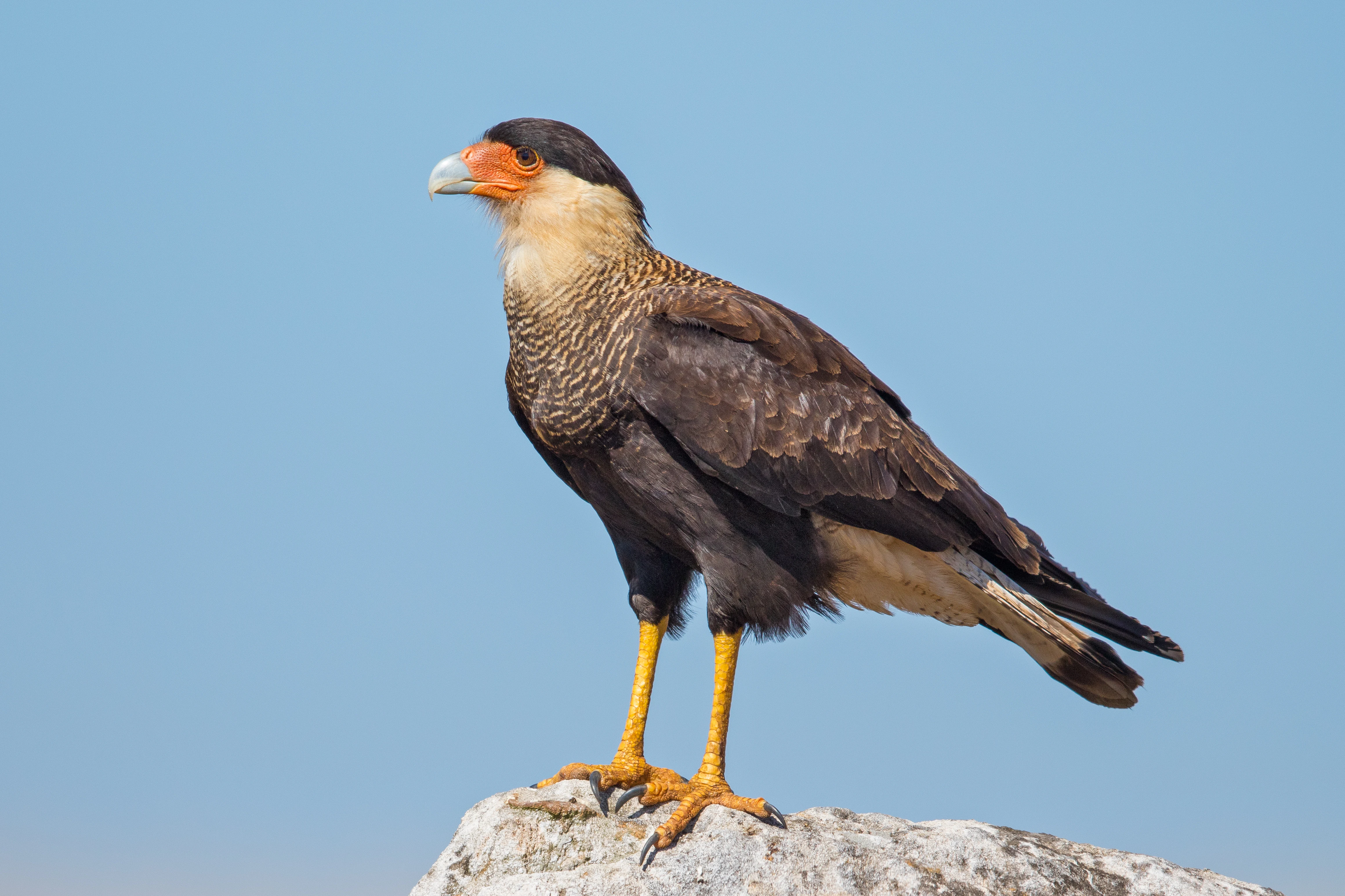
A southern crested caracara bird perched on a light-colored rock against a clear blue sky, viewed from the side.
A southern crested caracara perched against a clear sky.

Parque Ecológico Lago de Texcoco history and protected-area timeline

The Lake of Texcoco was once the principal body of water in the basin of the Valley of Mexico, formed by the historic union of several connected lakes around the predecessor city of Tenochtitlan. Over centuries, the lake was progressively drained, and by the twentieth century its exposed bed had become a degraded, partly desertified area with saline soils. Beginning in 1971, an environmental improvement program began attempts to rehabilitate the ecosystem, in some cases using exotic species.

In the early twenty-first century, large portions of the former lakebed were assigned for the construction of a new international airport for Mexico City. That airport project was cancelled in early 2019, after which the Mexican government decided to repurpose the site as an ecological and recreational project. In August 2020 the ecological park project was officially announced, with funding drawn primarily from federal public investment.

On 22 March 2022, the area was formally declared a Natural Resources Protection Area, coinciding with World Water Day. The park's construction followed over the next two years, with steady increases in reported progress including substantial work on water bodies, sports facilities, and ecological infrastructure. The Parque Ecológico Lago de Texcoco was formally inaugurated on 30 August 2024 by the President of Mexico, accompanied by national, state, and local officials.

Parque Ecológico Lago de Texcoco landscape and geographic character

The park's landscape is defined by the geology and hydrology of a former lacustrine basin. The basin sits at a high elevation of roughly 2,240 to 2,260 meters above sea level and is dominated by saline Solonchak soils, with secondary areas of Vertisol and water bodies. The terrain is largely flat to gently undulating, shaped by ancient lake sediments, drainage channels, and the gradual infilling of basins by treated sediment used in restoration.

Water shapes both the visual and functional structure of the park. The hydrological system is fed by a network of rivers and drainage channels converging on the basin, including restored wetland areas such as the Ciénega de San Juan and the Laguna de Xalapango, plus constructed water bodies like the Nabor Carrillo lake, the regulation lagoons, and the so-called El Caracol area. Together these create a mosaic of open water, saline flats, and recharged wetland habitat amid the surrounding Mexico City conurbation.

Two small hill areas, the Cerros Tepetzingo and Huautepec, rise above the general flatness of the basin and provide a different visual element, carrying archaeological remnants and petroglyphs of cultural significance. Elsewhere, the landscape is characterized by vast open horizons, low halophyte scrub, large water surfaces, and engineered earthworks such as berms and rehabilitation of pre-existing roadways that mark out the park's spatial organization.
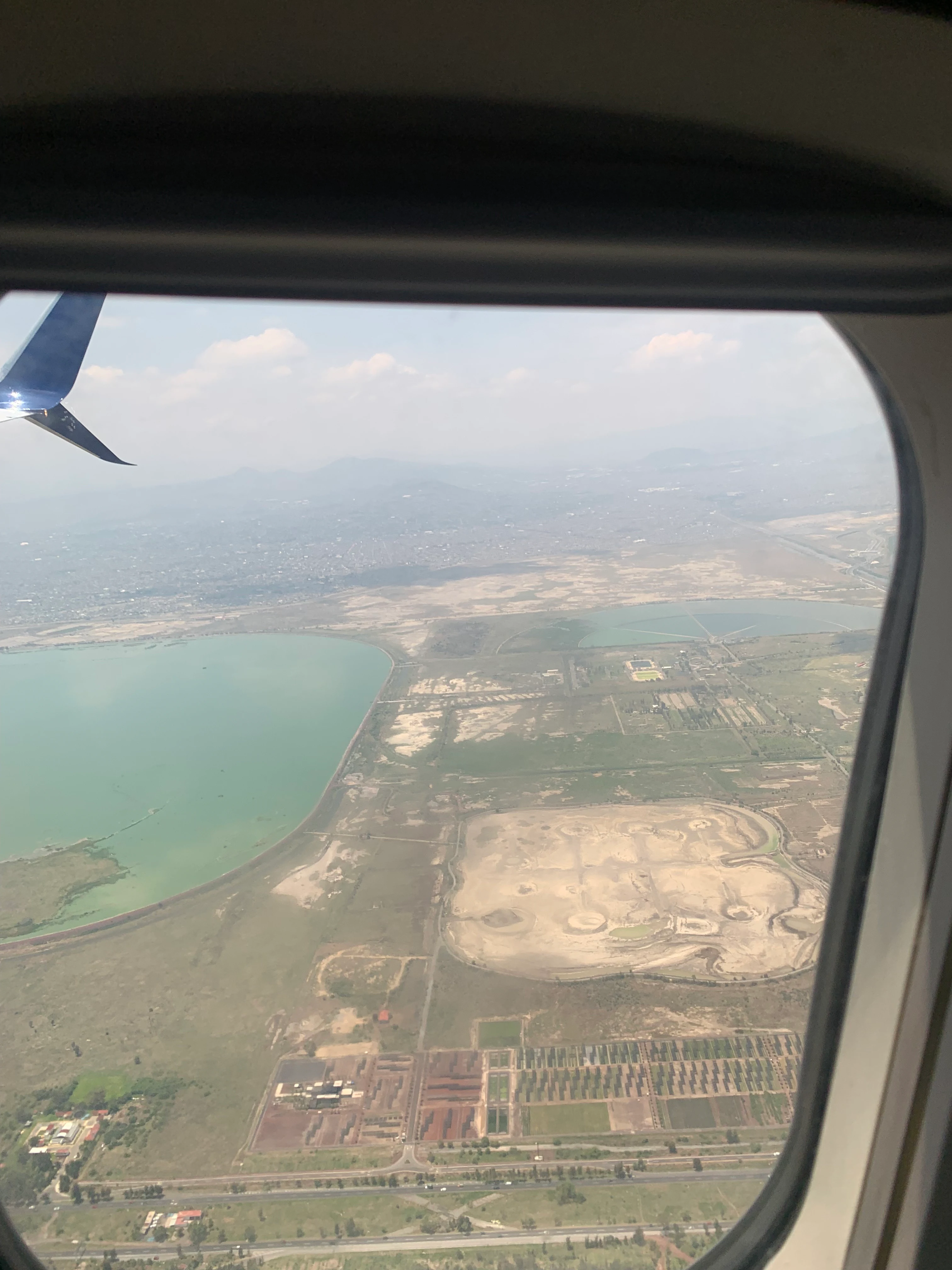
An aerial view of the Parque Ecológico Lago de Texcoco and the Nabor Carrillo reservoir, captured through an airplane window with a winglet visible in the upper left corner.
Aerial view of the Parque Ecológico Lago de Texcoco and Lake Nabor Carrillo as seen from an aircraft.

Parque Ecológico Lago de Texcoco ecosystems, habitats, and plant life

The park's ecological character is dominated by saline and semi-arid wetland systems on the central Mexican highlands. Soils in the broader protected area are roughly 77 percent Solonchak, 16 percent Vertisol, and the remainder water bodies, supporting plant communities adapted to high salinity and seasonal drought, including a wide range of halophyte species and saline-loving grasses.

Halophyte vegetation forms one of the defining ecological signatures of the park. Massive restoration efforts have focused on propagating salt-tolerant plants and on rebuilding aquatic and semi-aquatic habitats in former lakebed areas. Wetland features include the Ciénega de San Juan, the Laguna de Xalapango, the Laguna Casa Colorada, and a series of regulation lagoons, each offering differing combinations of open water, marsh edge, and saline flats. These wetland units tie the site into broader migratory bird flyways and are central to its Ramsar and Important Bird Area designations.

Ecological management explicitly addresses biological invasions, with the protected area hosting both notable native biodiversity and a substantial number of exotic and invasive species that require active control. The work of restoration is positioned as a long-term project that combines habitat reconstruction, water regulation, and recovery of a regional ecological identity shaped by the old lake system.
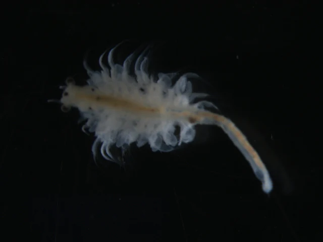
A microscopic view of a translucent, elongated brine shrimp (Artemia franciscana) floating against a solid black background.
A specimen of the brine shrimp Artemia franciscana, a species adapted to the saline environments found within the Lago de Texcoco ecosystem.

Parque Ecológico Lago de Texcoco wildlife and species highlights

The park's wildlife profile is dominated by birds, reflecting the importance of its wetland habitats for migratory and resident species. The broader protected area records more than two hundred bird species, including waterfowl, shorebirds, raptors, hummingbirds, and a spectrum of passerines. The site receives an average of around 150,000 migratory birds annually, drawn especially to the regulation lagoons, the Ciénega de San Juan, and the Laguna de Xalapango.

Among the most notable species groups are migratory waterfowl such as northern pintail, green-winged teal, cinnamon teal, blue-winged teal, redhead, and ring-necked duck. Shorebirds and waders are also strongly represented, with snowy plover nesting locally and various sandpipers, stilts, and avocets using the shallow lagoons during migration. Raptors including osprey, Cooper's hawk, sharp-shinned hawk, peregrine falcon, and northern harrier use the open basin for hunting and passage.

Beyond birds, the site supports a modest but ecologically valuable mammal assemblage that includes Mexican ground squirrels, black-tailed jackrabbits, desert cottontails, opossums, long-tailed weasels, and various rodent species adapted to the saline and semi-arid conditions. Reptiles and amphibians such as Montezuma's frog, the Mexican tree frog, and several garter snake species occupy the wetter habitats, while invertebrates from brine shrimp to monarch butterflies contribute to the broader food web of this restored lake system.
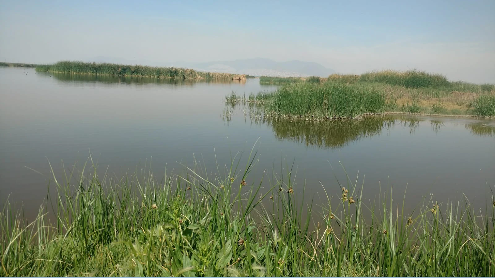
A wide view of the Cienega de San Juan wetland with calm, still water and dense clusters of reeds and tall grasses protruding from the water under a soft, hazy sky.
The Cienega de San Juan wetland area within Parque Ecológico Lago de Texcoco.

Parque Ecológico Lago de Texcoco conservation status and protection priorities

The Lago de Texcoco protected area was formally declared a Natural Resources Protection Area on 22 March 2022, giving it a statutory role in safeguarding saline wetlands, halophyte vegetation, and the hydrological functions of the eastern Valley of Mexico. It also holds international recognition as Ramsar site number 2469, placing it within the global network of wetlands of international importance, and it has been formally recognized as an Important Bird and Biodiversity Area.

From a conservation perspective, the site's importance lies in its combination of hydrological and ecological functions. It acts as a water regulation basin that helps manage flooding, sanitation, and potable water supply for surrounding communities, while also providing habitat for resident and migratory birds in a region where wetlands have been dramatically reduced. Beyond its ecological functions, it protects cultural and archaeological values, including the ceremonial hills of Tepetzingo and Huautepec, and helps preserve traditional ecological knowledge tied to the lake, such as the harvest of tequesquite, romeritos, spirulina, and other lake-associated products.

The management program also recognizes ongoing ecological challenges, particularly the presence of multiple invasive and exotic species that compete with native flora and fauna. Restoration is framed as a long-term effort requiring active reforestation, habitat reconstruction, control of invasive species, and continuous monitoring of the recovering ecosystems, aiming ultimately to recover both the ecological and the biocultural significance of the historical Lake of Texcoco.

Parque Ecológico Lago de Texcoco cultural meaning and human context

The park occupies land tied directly to the founding geography of Mexico-Tenochtitlan, the predecessor city of modern Mexico City. The historical Lake of Texcoco was the principal body of water of the Valley of Mexico basin, and the regional hydrology that fed it supported the rise of the Aztec capital. The national coat of arms itself visually references this lake setting, embedding the site into the symbolic landscape of Mexican national identity.

Indigenous and local communities have maintained continuous relationships with the lake landscape, including traditional harvesting of salt deposits (tequesquite), romeritos, spirulina algae, and other lake-derived products, along with ceremonial practices associated with the hills of Tepetzingo and Huautepec. The cultural context of the park therefore includes not only modern urban recreation but also the persistence of ancestral land uses and ritual traditions that have been formally recognized in the area's zoning as part of the living cultural heritage of the basin.

The creation of the park also emerged from a contested social process. Community organizations and local water defenders highlighted the need to involve affected ejidos and rural communities in decisions about the lake's future, arguing that conservation should integrate the social and territorial claims of surrounding communities. The park's eventual design therefore sits at the intersection of national policy, metropolitan planning, indigenous heritage, and ongoing local struggles over land and water in the Valley of Mexico.

Top sights and standout views in Parque Ecológico Lago de Texcoco

Among the strongest distinguishing features of the Parque Ecológico Lago de Texcoco is its scale and ambition: it is positioned among the largest urban ecological parks of its kind, occupying a substantial portion of a former lakebed in the eastern Valley of Mexico and combining ecological restoration with dense metropolitan context. Its recognition as a Ramsar site and Important Bird Area places it within the international framework of wetland conservation.

Equally distinctive is its origin story. The park was built on a site once earmarked for a major international airport and transformed, after the cancellation of that project, into an ecological and recreational landscape. This shift effectively converted a planned infrastructure project into a protected area, redefining the relationship between the metropolitan area and one of its most symbolic historical landscapes. The resulting park combines restored wetlands, halophyte rehabilitation, public recreation, and a strong cultural narrative rooted in the history of Tenochtitlan and the Lake of Texcoco.

Best time to visit Parque Ecológico Lago de Texcoco

The park's climate is generally temperate, with semiarid and subhumid variants, and at high elevation in central Mexico this typically translates into mild temperatures year-round. Cool, dry conditions during the winter months tend to be especially favorable for outdoor recreation and for observing migratory waterbirds, when large flocks of ducks, shorebirds, and other species use the regulation lagoons and the Ciénega de San Juan.

Warmer months bring greener conditions in the restored vegetation and can also offer rewarding views of breeding and resident bird activity, including summer visitors such as the snowy plover. Rainy-season visits bring replenishment of wetland areas and the most lush halophyte growth, though visitors should be prepared for the typical afternoon showers of central Mexico. Overall, late autumn through early spring is often considered especially rewarding because of the concentration of migratory waterbirds and the clearer, drier weather typical of the cool season in the Valley of Mexico.
Monthly climate preview

Long-term temperature and precipitation patterns across representative coordinates

Parque Ecológico Lago de Texcoco Climate Normals and Annual Weather Rhythm

Representative coordinate records show measured monthly temperature variations and precipitation distribution across the protected area. Examining the complete twelve-month profile provides deeper context on long-term climate patterns and seasonal averages.
Annual mean13 °C
10 °C17 °C
Jan10°
Feb12°
Mar14°
Apr16°
May17°
Jun16°
Jul15°
Aug14°
Sep14°
Oct13°
Nov11°
Dec10°
Warmest month
May

16.8 °C

Coolest month
January

10.1 °C

Wettest month
September

5.8 mm/day

Driest month
December

0.4 mm/day

Park location guide

Geography guide, regional context, and park location map for Parque Ecológico Lago de Texcoco

Parque Ecológico Lago de Texcoco park geography, regions, and map view in Mexico

Understand where Parque Ecológico Lago de Texcoco sits in Mexico through a broader geographic reading of the surrounding landscape, nearby location context, and its mapped position within the national park landscape.

How Parque Ecológico Lago de Texcoco fits into Mexico

Mexico, officially the United Mexican States, is a country in North America spanning the Sierra Madre mountain ranges, coastal plains, and tropical regions. It borders the United States to the north, Guatemala and Belize to the southeast, and has coastlines along the Pacific Ocean, Gulf of Mexico, and Caribbean Sea. With a population exceeding 130 million, Mexico is home to one of the world's most significant concentrations of Indigenous languages alongside Spanish.

Wider geography shaping Parque Ecológico Lago de Texcoco in Mexico

Mexico occupies a land area of 1,972,550 km2, making it the thirteenth-largest country in the world. The terrain is highly diverse, featuring the Sierra Madre Occidental and Sierra Madre Oriental mountain ranges, the Mexican Plateau, coastal lowlands along the Pacific and Gulf/Caribbean margins, and the Yucatan Peninsula. The country spans multiple climate zones from desert in the north to tropical rainforest in the south.

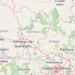
Map view of Parque Ecológico Lago de Texcoco

Use this park location map to pinpoint Parque Ecológico Lago de Texcoco in Mexico, understand its exact geographic position, and read its mapped placement within the surrounding landscape more clearly.

Pigeon | © OpenStreetMap contributors

Location context for Parque Ecológico Lago de Texcoco

Estado de México

Visual reference of restored wetlands, saline flats, and protected basin terrain

Parque Ecológico Lago de Texcoco Photos and Landscape Scenery Exploration

Photographic records capture the expansive open horizons, restored water bodies, and halophyte vegetation defining the restored lacustrine basin. Visual exploration reveals the environmental scale of the protected wetland habitats and modern ecological recovery across the valley floor.

A southern crested caracara bird perched on a light-colored rock against a clear blue sky, viewed from the side.

A white great egret with a yellow beak standing in shallow water, showing its reflection.

An aerial view of the Parque Ecológico Lago de Texcoco and the Nabor Carrillo reservoir, captured through an airplane window with a winglet visible in the upper left corner.

A microscopic view of a translucent, elongated brine shrimp (Artemia franciscana) floating against a solid black background.

A wide view of the Cienega de San Juan wetland with calm, still water and dense clusters of reeds and tall grasses protruding from the water under a soft, hazy sky.

Park atlas

Compare regional geography and connected protected landscapes across the Valley of Mexico

Explore Other Parks Near Parque Ecológico Lago de Texcoco and Protected Areas

Compare Parque Ecológico Lago de Texcoco with other protected areas across the surrounding regional geography and basin terrain. Broaden your park discovery by examining adjacent wetland reserves and urban ecological zones.
National parkMexico
About 12 km away#1 closest

West

El Tepeyac National Park: Protected National Park Landscape and Regional Geography

Explore mapped boundaries and the park's geographic context.

Gain a detailed understanding of El Tepeyac National Park, a protected national park situated within Mexico. This entry provides essential geographic context, focusing on its mapped boundaries and its role as a protected landscape. It is designed to support users interested in the atlas-level exploration of natural areas, offering foundational information about the park's identity and its position within the broader geographic framework of Mexico.

Area
15 km²
Established
1937
IUCN
VI
Relief
Upland
National parkState of Mexico
About 16 km away#2 closest

East

Molino de Flores Nezahualcóyotl National Park: National Park Protected Landscape Exploration

Mapped geographic context within the State of Mexico.

Access structured details about Molino de Flores Nezahualcóyotl National Park, a significant protected area designated as a national park. This entry focuses on its role as a mapped landscape, providing essential geographic context for understanding its boundaries and natural terrain. Discover how this protected area contributes to the broader atlas of conservation lands in the region.

Area
0.49 km²
Established
1937
IUCN
II
Visitors
10K annual
National parkMexico City
About 20 km away#3 closest

Southwest

Cerro de la Estrella National Park: Mapped Protected Landscape and Regional Geography

Explore the national park's mapped boundaries within Mexico City.

Cerro de la Estrella National Park represents a key protected area for geographic study and atlas exploration within the urban landscape of Mexico City. This entry provides detailed insight into the park's mapped boundaries and its role as a national park, highlighting its unique protected landscape character. Understand its position within the regional geography and explore what makes this park an important feature for mapped terrain and conservation awareness.

Area
1.5 km²
Established
1938
IUCN
II
Relief
Mixed relief
National parkMexico State
About 28 km away#4 closest

West

Los Remedios National Park: Protected Landscape and Historical Geography of Mexico State

Mapped terrain and cultural heritage within this unique national park.

Delve into the protected landscape of Los Remedios National Park, a national park situated in Mexico State. This page provides detailed geographic context, focusing on its volcanic terrain, mapped boundaries, and the convergence of pre-Hispanic and colonial heritage. Understand its role as a protected area within the western Valley of Mexico and explore the mapped elements that define its cultural and natural identity.

Area
4 km²
Established
1938
IUCN
II
Relief
Mountain
National parkMexico
About 31 km away#5 closest

Southwest

Fuentes Brotantes de Tlalpan National Park: National Park Geographic Atlas and Terrain Exploration

Explore protected land boundaries and mapped natural landscapes.

Delve into the geographic specifics of Fuentes Brotantes de Tlalpan National Park, a protected national park situated within Mexico. This detailed view highlights the park's mapped terrain and its significance as a distinct natural landscape. Understand its role in the country's protected area network and its contribution to the broader atlas of natural geography.

Area
0.08 km²
Established
1936
IUCN
II
Relief
Upland
National parkMexico City
About 39 km away#6 closest

Southwest

Desierto de los Leones National Park: Protected National Park and its Geographic Setting

Explore mapped boundaries and regional landscape context near Mexico City.

Delve into the specifics of Desierto de los Leones National Park, a designated national park recognized for its protected landscape. This MoriAtlas entry focuses on its geographic presence within the Mexico City region, providing clear insights into its mapped boundaries and the surrounding natural terrain. Understand the park's importance as a conservation area and its contribution to the regional geography through dedicated atlas data.

Area
18.67 km²
Established
1917
IUCN
II
Visitors
205K annual
National parkMexico
About 42 km away#7 closest

Southwest

Cumbres del Ajusco National Park: Exploring Mexico's National Park Protected Landscape

Discover mapped boundaries and regional geography.

Cumbres del Ajusco National Park is an important national park offering rich opportunities for geographic exploration. This detailed profile focuses on its identity as a protected landscape within Mexico, providing essential context for map-based discovery. Understand the park's specific location, its mapped territory, and its role within the nation's network of conservation areas, facilitating a structured atlas view.

Area
9.2 km²
Established
1936
IUCN
II
Relief
Mountain
National parkMexico
About 45 km away#8 closest

Southwest

La Marquesa National Park: Atlas of Protected Highland Forests in Mexico's Sierra de las Cruces

Explore its mapped boundaries and regional geographic context.

La Marquesa National Park represents a critical protected natural zone in Mexico's central highlands, specifically within the Sierra de las Cruces mountain range. Its landscape is defined by rugged volcanic terrain, featuring steep slopes and deep ravines densely covered by pine and oak woodlands. Designated as an early national park, it plays a crucial role in watershed protection for the surrounding region, preserving unique highland forest ecosystems and their associated biodiversity. This park offers a tangible example of protected landscape within Mexico's atlas, highlighting its ecological significance and geographic positioning.

IUCN
II

Common questions about visiting, size, designation, and location context for Parque Ecológico Lago de Texcoco

Parque Ecológico Lago de Texcoco FAQs for park facts, access, geography, and protected area context

Find quick answers about Parque Ecológico Lago de Texcoco, including protected-area facts, park geography, trail and visitor context, and how the park fits into its surrounding country and regional landscape.
MoriAtlas Explorer

Continue Your Protected Areas Search Across the Global Atlas

Deepen your exploration by continuing the structured search for national parks and protected areas worldwide. Utilize the comprehensive filtering capabilities to compare different conservation landscapes and refine your understanding of global park geography. Discover more about the distribution and characteristics of protected natural areas.

Global natural geography