
Why Parque Nacional Esteros de Farrapos e Islas del Río Uruguay stands out
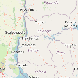
Esteros de Farrapos is best known for its expansive riverine wetland system, where a chain of sediment islands, esteros, and coastal ridges forms a continuous mosaic along the Río Uruguay. The park is distinguished by the way inland freshwater environments, riparian forests, and open marshes blend in a single protected landscape. It also stands out for combining recognized international wetland protection with national park status. The Ramsar designation and the national park designation together highlight both the global importance of its wetlands and the regional importance of its biodiversity, particularly for waterbirds, amphibians, and wetland mammals.
Parque Nacional Esteros de Farrapos e Islas del Río Uruguay history and protected-area timeline
The broader Esteros de Farrapos area was internationally recognized as a Ramsar wetland site in 2004, with 17,496 hectares designated under the international convention for the protection of wetlands. This designation set the foundation for stronger national protection and brought broader attention to the ecological value of the river islands and esteros along this stretch of the Río Uruguay.
In 2008, the Uruguayan state formalized domestic protection of a 6,327-hectare core area as a national park through Decree 579/2008. The protected zone included the continental area near San Javier along with two important islands, Barco Grande and La Paloma. Earlier administrative history also played a role: until 2001, the land belonged to the Ministry of Livestock, Agriculture and Fisheries and was managed by the National Colonization Institute, which never subdivided the flood-prone terrain. In 2001, the territory was transferred to what is now the Ministry of Environment, paving the way for its later designation as a national park.
Parque Nacional Esteros de Farrapos e Islas del Río Uruguay landscape and geographic character
The landscape of Esteros de Farrapos is defined by the lowland character of the Río Uruguay basin. The area is composed of high and low plains crossed by several small streams and dominated by flat, flood-prone terrain. Geologically, the surface is built from silts of the Fray Bentos formation, producing soils that are predominantly gleysoils, characterized by long-lasting or permanent flooding. Associated soils include brunosols, solonetz, and other soils of variable alkalinity.
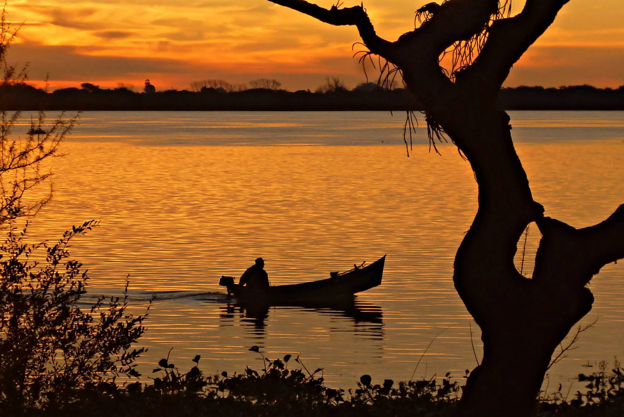
Along the river, the formation of albardones, or natural embankments, plays a central role in shaping the visible terrain. These ridges limit the drainage of rainwater, encouraging the formation of permanent pools and peat-rich soils in the low-lying zones. The result is a layered landscape in which former coastlines, current riverbanks, marshlands, and river islands coexist within a relatively small, water-dominated system. The combination of esteros, channels, riparian forest edges, and open marshes gives the park a strongly fluvial visual identity.
Parque Nacional Esteros de Farrapos e Islas del Río Uruguay ecosystems, habitats, and plant life
Ecologically, Esteros de Farrapos is a mosaic of wetland, riparian, and terrestrial habitats. The vegetation reflects the gradient from permanently flooded soils to drier uplands. Aquatic and hydrophilic communities dominate the wettest areas, with dense pajonales and floating meadows shaped by species of Axonopus, Sporobolus, and Stenotaphrum forming the base of the summer prairie.
In the transitional zones between open marshland and riparian forest, characteristic native species such as espinillo, palo de fierro, tala, and blanquillo appear. Further into the riparian woodland, more diverse tree and shrub communities develop, including sarandí blanco, sarandí negro, vivaró, curupí, mataojo, palo cruz, sauce, tembetarí, ingá, and guayabo blanco. Together, these plant communities create a layered ecological structure that supports a wide range of amphibians, fish, mammals, and birds across the differing moisture regimes of the park.
Parque Nacional Esteros de Farrapos e Islas del Río Uruguay wildlife and species highlights
The fauna of Esteros de Farrapos reflects the productivity and habitat diversity of the river and its wetlands. Fourteen amphibian species have been documented in the area, including toads of the genus Bufo, several Hyla and Leptodactylus frogs, lizards such as Tupinambis merianae, and freshwater turtles like Phrynops hilarii. The combination of permanent water, seasonal flooding, and sheltered banks provides ideal breeding conditions for these species.
The birdlife is particularly significant, with around 104 recorded species inhabiting or visiting the park. Typical species include the great egret, the snowy egret, the turkey vulture, the southern screamer, and the dusky-legged guan, among many other waterbirds and woodland species. The mammal fauna includes 15 species, with capybaras, crab-eating foxes, and insectivorous bats being among the most representative. The rivers and channels also host numerous fish species, including catfish of the family Pimelodidae such as the porteño catfish, white catfish, yellow catfish, and toad catfish.
Parque Nacional Esteros de Farrapos e Islas del Río Uruguay conservation status and protection priorities
Esteros de Farrapos holds an important place in both national and international wetland conservation. Its 2004 designation as a Ramsar site recognized the area as globally significant for the protection of wetlands, an important step that helped strengthen national interest in protecting the broader river corridor.
In 2008, through Decree 579/008, the Uruguayan state established the national park as part of the National System of Protected Areas (SNAP). This designation formalized protections for a representative portion of the esteros, focusing on state-owned lands and two key islands, Barco Grande and La Paloma. The park's conservation approach emphasizes maintaining natural flooding dynamics, preserving riparian habitats, and protecting the mosaic of esteros, islands, channels, and paleocoast formations that together support the area's biodiversity and ecological functions.
Parque Nacional Esteros de Farrapos e Islas del Río Uruguay cultural meaning and human context
The toponym "Farrapos" has become part of the cultural memory of the region. Popularly, it is sometimes linked to soldiers defeated in the Farroupilha Revolution of 1845, but a more widely accepted explanation suggests that the name arose from a Portuguese administrator's remark that the lands were "in farrapos," referring to the state of the marshy, fragmented terrain. This phrase, roughly equivalent to "in tatters" in Spanish, captures the historical perception of the landscape as difficult and inhospitable, while the park today reframes that same landscape as a site of ecological and conservation value.
Top sights and standout views in Parque Nacional Esteros de Farrapos e Islas del Río Uruguay
The park's standout feature is the continuity of its river-island and estuary complex, which functions as a single ecological corridor along the Río Uruguay. Within this corridor, the dense pajonales, riparian forests, and shallow channels create a habitat mosaic that supports high biodiversity.
Another distinctive element is the dual recognition the area enjoys, as both a national park and a Ramsar site, placing it within an international framework for wetland protection. The combination of fluvial islands, esteros, albardón ridges, and paleocoast zones gives the park a layered physical geography that is rare along Uruguay's river frontiers.
Best time to visit Parque Nacional Esteros de Farrapos e Islas del Río Uruguay
The character of Esteros de Farrapos shifts with the seasonal rhythms of water. During periods of higher river flow, the esteros, channels, and lowlands expand their flooded surface, intensifying the wetland visual character and offering strong conditions for observing waterbirds and other wetland fauna. In drier periods, more of the albardón ridges and upland areas become accessible on foot, and the riparian forests and prairie communities are more prominent.
For visitors interested in birdlife and wetland landscapes, periods of moderate to high water generally offer richer observations. The transitional seasons between dry and wet conditions often reveal the full range of habitats, from open marshes to flooded forest edges, with strong seasonal contrasts in vegetation and water levels.