
Mori Atlas logo
Protected landscapeParque rural de Doramas

Mapping the deep barrancos and humid monteverde ecosystems of this historical Macaronesian territory.

Parque rural de Doramas: A Protected Landscape of Laurel Forest and Volcanic Ravines in Gran Canaria

Parque rural de Doramas sits across the northern midlands of Gran Canaria, forming a vital refuge for remnants of the ancient Selva de Doramas. This protected landscape is defined by its dramatic volcanic terrain and deeply incised barrancos, including the high-value ecological corridors of Barranco de los Tilos and Barranco Oscuro. Within these sheltered ravine walls, fragments of humid laurisilva forest persist alongside traditional rural farmlands, illustrating a complex intersection of endemic biodiversity and historical island land use.

laurisilvalaurel forestmonteverdebarrancosnorthern Gran Canariarural park
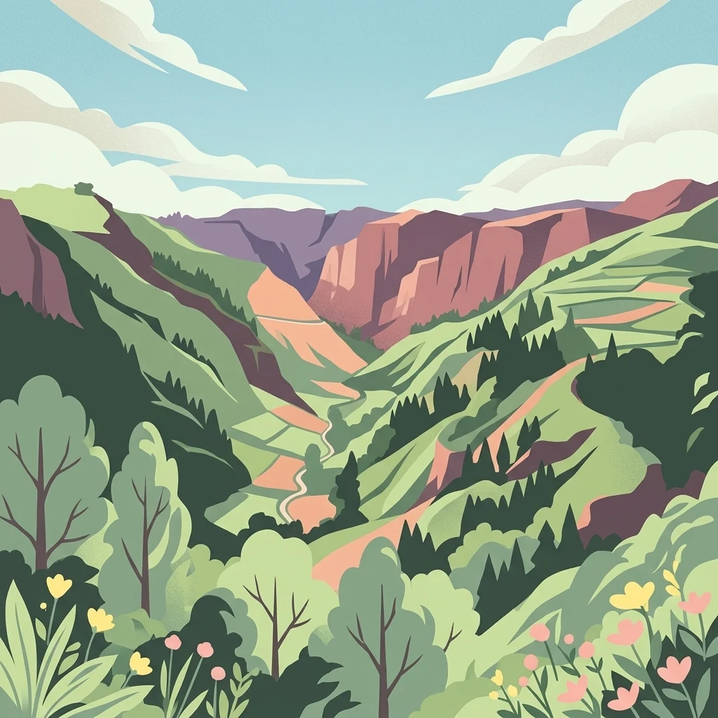
A stylized illustration of a deep, green valley nestled between steep, rocky mountains under a blue sky with soft white clouds, featuring foreground wildflowers.

Parque rural de Doramas

Protected landscape

Park overview

Structured park overview, official facts, and landscape profile for Parque rural de Doramas

Parque rural de Doramas park facts, protected area profile, and essential visitor context

Review the core facts for Parque rural de Doramas, including designation, size, terrain, visitor scale, habitats, and operating context in one park-focused overview.

About Parque rural de Doramas

Parque rural de Doramas is a protected rural landscape occupying a broad swath of the northern midlands of Gran Canaria, in the Canary Islands. Designated as a rural park, it occupies around 3,586 hectares across six municipal territories, blending cultural landscapes shaped by generations of farming with ecosystems that hold exceptional ecological value.

The park's environmental importance stems largely from its surviving patches of laurisilva, the humid laurel forest ecosystem that once cloaked much of the Macaronesian islands. On Gran Canaria, centuries of clearance for agriculture and settlement have reduced this forest to scattered fragments, and Doramas now harbors some of the most significant of these remnants. Ravines such as Barranco de los Tilos, Azuaje, and Barranco Oscuro have escaped large-scale clearance thanks to their steep, inaccessible terrain, and they preserve a layered, evergreen forest of laurels, parchment-leaf trees, and other Macaronesian relicts.

Geographically, the area lies in the wetter, cloud-influenced northern belt of Gran Canaria, where moisture-laden trade winds and orographic condensation sustain richer vegetation than the arid southern lowlands. This climatic setting explains why laurel forest relict species can still survive in interior ravines while most of the surrounding slopes have shifted to drier shrubland, pine plantations, and cultivated terraces.

Beyond its ecological role, the park continues to function as a working rural landscape. Agriculture, livestock, and small settlements are part of its identity, and the designation as a rural park reflects the deliberate balance between preserving traditional livelihoods and protecting biodiversity. Together, the historical forest memory of the Selva de Doramas, the surviving laurel forest patches, and the ongoing rural life of the northern municipalities give the park a layered cultural and natural significance that distinguishes it from more strictly protected reserves on the island.

Quick facts and research context for Parque rural de Doramas

Parque rural de Doramas covers roughly 3,586 hectares in the north of Gran Canaria, in the Canary Islands of Spain. It is classified as a parque rural, or rural park, a protected-area category devoted to conserving landscapes where traditional human activity and natural values coexist.

The park spans six municipalities: Arucas, Firgas, Moya, Santa María de Guía, Teror, and Valleseco. Its principal natural landmarks include the barrancos of Los Tilos, Azuaje, and Barranco Oscuro, which together shelter some of the last surviving laurel forest on the island. The park is also a refuge for endemic plant and animal species, including three plant species that grow exclusively within its boundaries.

Protection and recognition

Terrestrial conservation framework, designation history, and administrative scope

Parque Rural de Doramas Protection Status and Recognition Data

Documented protection status records outline the terrestrial conservation framework established for Parque rural de Doramas. Official administrative scopes and available international recognition details provide structured insight into the managed landscape.

Protection details

Protection scope
Terrestrial
Transboundary protection
No
Park context

Deeper park guide and search-rich context for Parque rural de Doramas

Parque rural de Doramas history, landscape, wildlife, and travel context

Explore Parque rural de Doramas through its history, landscape character, ecosystems, wildlife, conservation priorities, cultural context, and seasonal travel timing in a structured park guide built for atlas discovery and search intent.

Why Parque rural de Doramas stands out

The park is best known as the last major refuge of Canarian laurel forest in Gran Canaria, a humid, evergreen broadleaf ecosystem that once covered much of the island's northern midlands but has been drastically reduced over centuries. Deep ravines such as Barranco de los Tilos, Azuaje, and Barranco Oscuro still hold laurisilva fragments of exceptional botanical value. It is equally recognized for its concentration of endemic wildlife, including three plant species found nowhere else in the world and several endemic bird and reptile species characteristic of the Canarian monteverde. The park stands as a living remnant of the Selva de Doramas, a legendary forest tied to the cultural memory of indigenous Canarian history.
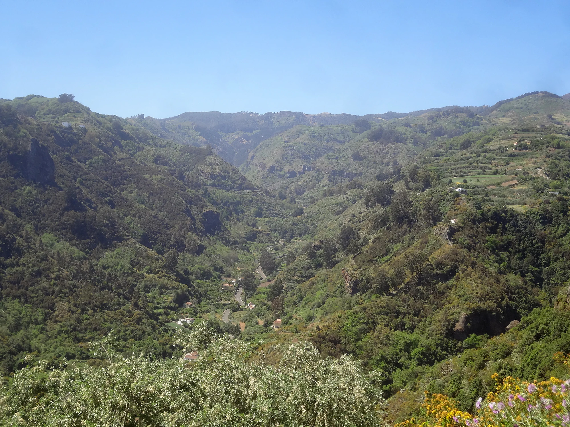
A wide, panoramic view of a deep, green, forested ravine in the Valleseco area of Gran Canaria, with steep terraced slopes and distant rolling mountains under a clear blue sky.
A view of the ravine landscape in the Valleseco area of the Parque Rural de Doramas.

Parque rural de Doramas history and protected-area timeline

The cultural memory of the area reaches far back into the indigenous history of the Canary Islands. The name Doramas refers to the legendary aboriginal warrior Doramas, and the broader landscape was once known as the Selva de Doramas, a famously lush forest in the north of Gran Canaria celebrated in Canarian historical and literary tradition as one of the great natural landmarks of the island before extensive clearance.

Over the centuries, expansion of agriculture, settlement, and forestry reduced the original Selva de Doramas to fragments. The establishment of the Parque rural de Doramas as a protected rural landscape reflects a modern effort to conserve what remains of this once-extensive forest, together with the rural environments that grew up around it. As a rural park designation, it formally recognizes both the surviving natural values of the laurel forest ravines and the long-standing human presence in the surrounding municipalities, including Arucas, Firgas, Moya, Santa María de Guía, Teror, and Valleseco.

The park's protected status has since focused attention on its small but ecologically critical ravine refuges, such as Barranco de los Tilos and Barranco Oscuro, anchoring conservation work on the recovery and study of Canarian laurel forest and its associated endemic species.

Parque rural de Doramas landscape and geographic character

The landscape of Parque rural de Doramas is defined by the rugged mid-elevation terrain of northern Gran Canaria, where a series of deep barrancos cut steeply into the volcanic slopes toward the Atlantic coast. The park's interior is shaped by pronounced ravines, cliff walls, and humid valley bottoms, with altitudes and exposures that create strong contrasts between shady, moss-rich recesses and dry, sun-exposed upper slopes.

The principal scenic features of the park are its three flagship barrancos: Barranco de los Tilos near Moya, the ravines around Azuaje, and Barranco Oscuro. These narrow, steep-sided valleys descend from the interior highlands and concentrate the moisture, cloud influence, and shelter that allow evergreen laurisilva forest to persist. Outside the ravines, the terrain opens into broader slopes with cultivated terraces, small farmsteads, and patches of monteverde transitioning into drier pine-forested hillsides.

The combination of incised ravines, forested midslopes, and rural plateau scenery gives the park a varied topography. It is at once a working agricultural landscape and a deeply dissected volcanic terrain, where natural and human-shaped features are tightly interwoven in the geography of northern Gran Canaria.

Parque rural de Doramas ecosystems, habitats, and plant life

Ecologically, Parque rural de Doramas is a stronghold of Canarian laurel forest, known locally as laurisilva canaria, and its associated monteverde vegetation. This humid, evergreen broadleaf ecosystem once extended across the Macaronesian islands but has been reduced on Gran Canaria to scattered relict fragments, several of which survive inside the park's ravines. Species characteristic of the laurisilva, including laurels, Til or parchment-leaf trees, and other evergreen Macaronesian relicts, still thrive in the protected barrancos.

The park's flora is remarkably diverse for its size. Roughly 8,000 vascular plant species are recorded across its territory, of which 30 are endemic to Gran Canaria, 126 are endemic to the Canary Islands as a whole, and 30 belong to the wider Macaronesian flora. Three plant species are found nowhere outside the park: the cresta de gallo (Isoplexis chalcantha), the rejalgadera de Doramas (Solanum vespertilio subsp. doramae), and the salvia blanca (Sideritis discolor), giving the area outstanding botanical significance.

The park also marks a clear ecological transition between humid monteverde communities and drier Canarian vegetation types. Upper slopes and edges of the protected area grade into shrublands, pine formations, and cultivated land, illustrating how the surviving laurel forest persists as a fragmented enclave within a more open anthropogenic matrix.

Parque rural de Doramas wildlife and species highlights

The park supports a rich vertebrate fauna for an island environment, with around 49 recorded vertebrate species. Birdlife is particularly notable and includes several endemics of the Canary Islands, such as the Gran Canaria subspecies of the great spotted woodpecker (Dendrocopos major thanneri), the Canarian long-eared owl (Asio otus canariensis), and the Canarian buzzard (Buteo buteo insularum).

Common woodland birds of the monteverde are also well represented, including the Canarian robin (Erithacus rubecula superbus), the Canarian chaffinch (Fringilla coelebs tintillon), and the Canarian blue tit (Parus caeruleus teneriffae). These species occupy the laurel forest tree canopy and understory in the park's more humid ravines, contributing to the distinctive character of Canarian laurel forest bird communities.

Reptiles include the Gran Canaria skink (Chalcides sexlineatus) and the large Gran Canaria lizard (Gallotia stehlini), both characteristic elements of the island's native herpetofauna. Native amphibians are largely absent, but introduced species such as the Mediterranean tree frog (Hyla meridionalis) and the Iberian water frog (Pelophylax perezi) inhabit suitable wet areas. Among mammals, the Osorio shrew (Crocidura russula osorio) is a notable endemic subspecies restricted to northern and northwestern Gran Canaria.

Invertebrate diversity is also significant, with the park hosting rare and endemic species such as Machado's snail (Plutonia machadoi), a critically endangered slug found only in this part of the Canary Islands. The combination of endemic birds, reptiles, mammals, and invertebrates reinforces the park's importance for the conservation of Canarian island biodiversity.

Parque rural de Doramas conservation status and protection priorities

Parque rural de Doramas is of high conservation value because it protects some of the last surviving fragments of Canarian laurel forest on Gran Canaria, an ecosystem that has been lost across most of the island. Within the park's barrancos, the surviving laurisilva acts as a genetic and ecological reservoir for species that depend on the cool, humid conditions of the northern midlands, making these patches disproportionately important for the long-term survival of Canarian laurel forest biodiversity.

The protection of three plant species found exclusively within the park, Isoplexis chalcantha, Solanum vespertilio subsp. doramae, and Sideritis discolor, gives the area a particularly strong botanical conservation role. Their survival depends directly on the preservation of the specific microclimates of the park's moist ravines, where laurel forest vegetation moderates temperature and humidity.

The park also contributes to broader conservation goals by maintaining habitat for endemic birds, reptiles, and invertebrates, including species of conservation concern such as the critically endangered Machado's snail. Its designation as a rural park, rather than a strictly protected reserve, reflects an approach that integrates biodiversity conservation with the maintenance of traditional land uses, helping to keep the mosaic of forest, farm, and human settlement that characterizes northern Gran Canaria intact.

Parque rural de Doramas cultural meaning and human context

The cultural identity of the park is closely tied to the historical forest of Doramas, the Selva de Doramas, once celebrated across the Canary Islands as one of the great natural treasures of Gran Canaria. That forest was so closely linked to local memory that it gave its name to a legendary aboriginal warrior, Doramas, and became a recurring motif in Canarian history and literature as a symbol of lost natural abundance.

While the original forest has been greatly reduced, the continued presence of rural communities across the six municipalities of Arucas, Firgas, Moya, Santa María de Guía, Teror, and Valleseco preserves a living cultural layer in the landscape. Agricultural terraces, traditional farmsteads, and centuries of interaction with the steep barranco terrain have shaped a vernacular rural culture tightly woven into the geography of the protected area. The current park designation honors both this rural heritage and the natural heritage of the original Selva de Doramas that it once sustained.

Top sights and standout views in Parque rural de Doramas

Among the most distinctive features of Parque rural de Doramas are its flagship barrancos: Barranco de los Tilos, Azuaje, and Barranco Oscuro, each harboring exceptional fragments of Canarian laurel forest and serving as refuges for endemic species found in few other places. These ravines concentrate the park's ecological importance in a very small proportion of its surface area, making them focal points for both conservation and scientific study.

The park is also notable for its exclusive flora, including three plant species that grow only within its boundaries, and for its unusually rich birdlife, marked by multiple Canary Island endemics adapted to laurel forest and monteverde habitats. Combined with six municipalities of traditional rural landscape and a deep historical resonance drawn from the Selva de Doramas, the park offers a compact but remarkably layered intersection of forest, farmland, and cultural memory.

Best time to visit Parque rural de Doramas

The park's humid northern midland climate keeps temperatures mild relative to the rest of Gran Canaria year-round, and the laurel forest ravines remain green and atmospherically rich in all seasons. Spring tends to bring renewed vegetation activity in the monteverde, with fresh growth in the laurel forest understory and active bird presence as breeding seasons progress, making it a rewarding period for botanical and ornithological interest.

Autumn and winter, when the Canarian trade wind influence and occasional Atlantic weather systems increase humidity and cloud cover, can enhance the atmosphere of the barrancos and reinforce the lush character of the surviving laurisilva. Summer visits are cooler than in the island's south and offer stable conditions for walking the rural trails, though the trade wind cloud belt still affects the northern barrancos. Choosing a season depends largely on whether visitors prioritize laurel forest atmosphere, mild temperatures, or rural cultural landscapes.
Monthly climate preview

Long term temperature and precipitation measurements sampled at representative coordinates

Parque rural de Doramas Climate Normals and Annual Weather by Month

Representative point records show average temperatures ranging from 17.49 degrees Celsius to 22.84 degrees Celsius alongside low daily precipitation values across the sampled climatology period. Examining the complete monthly distribution reveals detailed seasonal variations in temperature and precipitation across the protected area.
Annual mean20 °C
17 °C23 °C
Jan18°
Feb17°
Mar18°
Apr18°
May19°
Jun21°
Jul22°
Aug23°
Sep23°
Oct22°
Nov21°
Dec19°
Warmest month
September

22.8 °C

Coolest month
February

17.5 °C

Wettest month
December

0.9 mm/day

Driest month
July

0.1 mm/day

Park location guide

Geography guide, regional context, and park location map for Parque rural de Doramas

Parque rural de Doramas park geography, regions, and map view in Spain

Understand where Parque rural de Doramas sits in Spain through a broader geographic reading of the surrounding landscape, nearby location context, and its mapped position within the national park landscape.

How Parque rural de Doramas fits into Spain

Spain, officially the Kingdom of Spain, is a unitary parliamentary constitutional monarchy located in Southern and Western Europe. The country occupies most of the Iberian Peninsula and includes territories in the Mediterranean and Atlantic. With a population of approximately 49.6 million and an area of 506,030 km², Spain is a major European economy and cultural force. Its capital is Madrid, and the country is known for its diverse landscapes ranging from mountainous regions to coastal areas.

Wider geography shaping Parque rural de Doramas in Spain

Spain occupies the Iberian Peninsula in Southern and Western Europe. Peninsular Spain is bordered to the north by France, Andorra, and the Bay of Biscay; to the east and south by the Mediterranean Sea and Gibraltar; and to the west by Portugal and the Atlantic Ocean. The territory includes the Canary Islands in the Atlantic Ocean, the Balearic Islands in the Mediterranean Sea, and the autonomous cities of Ceuta and Melilla in mainland Africa. Spain features diverse terrain including the Pyrenees in the northeast, the Sierra Nevada in the south, and the Meseta Central plateau.

Map view of Parque rural de Doramas

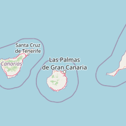
Use this park location map to pinpoint Parque rural de Doramas in Spain, understand its exact geographic position, and read its mapped placement within the surrounding landscape more clearly.

Pigeon | © OpenStreetMap contributors

Location context for Parque rural de Doramas

Canarias

Explore protected area views, rugged barrancos, and surviving laurel forest habitats.

Visualizing Parque rural de Doramas Photos, Landscapes, and Scenery

Visual documentation captures the rugged mid elevation terrain, steep barrancos, and deep valley refuges defining Parque rural de Doramas. Photographic records reveal the protected rural landscapes, humid laurisilva fragments, and botanical diversity characterizing northern Gran Canaria.

A wide, panoramic view of a deep, green, forested ravine in the Valleseco area of Gran Canaria, with steep terraced slopes and distant rolling mountains under a clear blue sky.

Park atlas

Compare regional volcanic terrain, humid laurel forests, and surrounding protected landscapes across Gran Canaria.

Explore Protected Areas and Parks Near Parque Rural de Doramas

Visitors exploring Parque rural de Doramas can browse nearby protected areas and adjacent natural reserves across the northern Canary Islands. Comparing regional park geography reveals broader patterns of island biodiversity, endemic laurel forests, and rugged volcanic terrain.
Watercolor painting of a light-filled landscape featuring soft green hills, clusters of pine trees, and distant ridgelines in muted pinks and purples.
Protected landscapeCanary Islands
About 11 km away#1 closest

South

Parque rural del Nublo: Volcanic Peaks and Protected Highland Terrain in Gran Canaria

Mapping the dramatic erosional landscapes and endemic ecosystems of central Gran Canaria.

Spanning the core of Gran Canaria, Parque rural del Nublo is a vast protected landscape characterized by its rugged volcanic topography. The area features the iconic Roque Nublo monolith, deeply incised barrancos, and a mosaic of pine forests and endemic scrubland. This territory represents a critical intersection of geological evolution and aboriginal history, containing major UNESCO-listed cultural sites within its complex highland boundaries.

Area
267.64 km²
Established
1994
IUCN
VI
Relief
Mountain
Watercolor painting of soft, layered mountain ridges in shades of green, purple, and pale yellow, set against a white background.
Protected landscapeCanarias
About 74 km away#2 closest

Northwest

Parque rural de Anaga: Mapping the Volcanic Relief and Laurisilva Forests of Canarias

A detailed geographic overview of the Anaga massif protected landscape.

Parque rural de Anaga preserves a dramatic landscape of volcanic plugs, deeply incised valleys, and endemic-rich cloud forests in the Canary Islands. Understand the complex terrain and protected area boundaries that define this historic massif, from its coastal cliffs to its high mountain ridges.

Area
144.187 km²
Established
1994
Relief
Mountain
Climate
Subtropical
Watercolor illustration of a mountainous landscape with green and purple hues, featuring rolling hills, distant mountains, and a light sky.
National parkTenerife
About 92 km away#3 closest

West

Teide National Park: Spain's Highest Peak and Distinctive Volcanic Landscape

Explore protected volcanic terrain and mapped geography on Tenerife.

Teide National Park protects the highest point in Spain, Mount Teide, within a spectacular caldera and surrounding volcanic terrain on Tenerife. This national park offers a unique landscape for geographic discovery, showcasing dramatic lava flows, volcanic cones, and endemic flora. Its protected boundaries define a significant area of natural interest, making it a key landmark for atlas exploration of island geography and protected lands.

Area
189.9 km²
Established
1954
IUCN
II
Visitors
4.5M annual
A soft watercolor painting depicting green rolling hills and layered mountain ridges against a white background.
Protected landscapeTenerife
About 120 km away#4 closest

West

Parque rural de Teno: Volcanic Massif and Protected Landscape Geography in Tenerife

Coastal cliffs, volcanic barrancos, and laurel forest ecosystems.

Parque rural de Teno serves as a primary geographic anchor for northwest Tenerife, encompassing a triangular volcanic block defined by vertical sea cliffs and steep, eroded ravines. This protected landscape preserves unique biodiversity and traditional cultural architecture, offering a comprehensive look at the island's geological and ecological variety from the shoreline to the mist-prone summits.

Area
80.636 km²
Established
1987
Relief
Mountain
Climate
Mediterranean
A soft watercolor illustration of a landscape with muted green and purple hills against a white background.
Protected landscapeCanarias
About 154 km away#5 closest

East

Parque rural de Betancuria: Protected Landscape, Fuerteventura, Canarias

A rugged volcanic and geological interior landscape

Investigate the topographical intensity of Parque rural de Betancuria, home to the Betancuria Massif and unique Basal Complex exposures. This protected landscape documents a long history of geological transformation and traditional human adaptation to the arid Fuerteventura environment.

Area
165.443 km²
Established
1987
Relief
Mountain
Climate
Arid
National parkSpain
About 157 km away#6 closest

West

Garajonay National Park: Ancient Laurisilva Forest and Volcanic Landscapes

Explore Spain's unique protected area with rich geographic context.

Garajonay National Park, a treasure of La Gomera, preserves one of the last stands of Europe's ancient laurisilva forest atop dramatic volcanic terrain. This national park offers a rare opportunity to explore a landscape shaped by persistent cloud cover and unique island evolution. Examine the park's mapped boundaries and distinctive natural features through its detailed geographic profile.

Area
40 km²
Established
1981
IUCN
II
Visitors
450K annual
Watercolor painting of a landscape with grassy areas, a winding river, and mountains under a light sky
National parkCanary Islands
About 201 km away#7 closest

Northeast

Timanfaya National Park: Dramatic Volcanic Landscape in the Canary Islands

Explore Spain's unique geological national park.

Timanfaya National Park offers an extraordinary exploration of volcanic terrain, a protected area that defines geological conservation in the Canary Islands. Its landscape, shaped by powerful eruptions, features vast lava fields, striking volcanic cones, and visible geothermal activity. As Spain's only purely geological national park, Timanfaya provides a unique context for understanding volcanic processes and appreciating the raw beauty of its protected natural environment, serving as a key landmark within the archipelago's geography.

Area
51.07 km²
Established
1974
IUCN
II
Relief
Mountain
Watercolor illustration showing a mountainous landscape with green forests, a winding river, and distant hills
National parkSpain
About 230 km away#8 closest

West

Caldera de Taburiente National Park: National Park & Geological Heritage Site

Explore its volcanic caldera, mapped ravines, and pine forests.

Caldera de Taburiente National Park is a protected natural area on the island of La Palma, Spain. It encompasses a vast, approximately 10-kilometer-wide volcanic caldera, characterized by immense cliffs, deep ravines, and extensive Canary Island Pine forests. This national park is recognized for its significant geological features and unique landscape, making it a key destination for understanding protected area geography and regional natural heritage.

Area
46.9 km²
Established
1954
IUCN
II
Visitors
389K annual

Common questions about visiting, size, designation, and location context for Parque rural de Doramas

Parque rural de Doramas FAQs for park facts, access, geography, and protected area context

Find quick answers about Parque rural de Doramas, including protected-area facts, park geography, trail and visitor context, and how the park fits into its surrounding country and regional landscape.
MoriAtlas Explorer

Continue Your Protected Areas Search Across the Global Atlas

Deepen your exploration by continuing the structured search for national parks and protected areas worldwide. Utilize the comprehensive filtering capabilities to compare different conservation landscapes and refine your understanding of global park geography. Discover more about the distribution and characteristics of protected natural areas.

Global natural geography