
Mori Atlas logo
Protected landscapeParque rural de Teno

A detailed geographic analysis of the Teno massif, coastal cliffs, and inland ravines.

Parque rural de Teno: Exploring the Protected Volcanic Landscapes of Northwest Tenerife

Parque rural de Teno covers the ancient volcanic massif in the extreme northwest of Tenerife, showcasing a compressed vertical sequence of environments ranging from arid coastal scrub to humid laurel forests. The terrain is characterized by sheer coastal cliffs, deeply incised barrancos, and isolated ridgelines that provide a distinct window into the volcanic geography of the Canary Islands.

canary islandsteneriferural parkvolcanic massifcoastal cliffsbarrancos
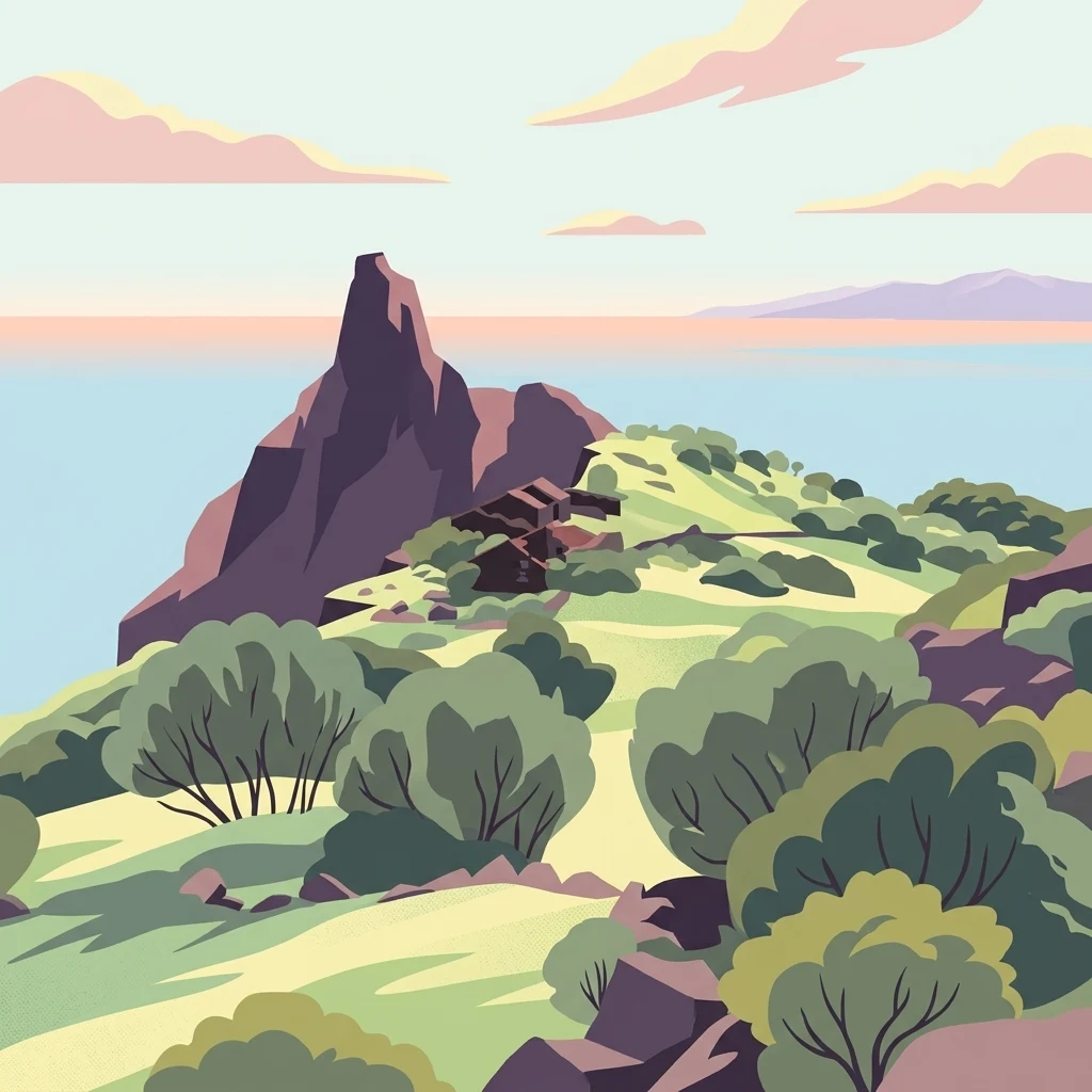
A digital illustration showing a rocky, pointed volcanic peak rising above a green hillside with sparse shrubs, set against a calm sea and soft sunset sky.

Parque rural de Teno

Protected landscape

Park overview

Structured park overview, official facts, and landscape profile for Parque Rural de Teno

Parque Rural de Teno park facts, protected area profile, and essential visitor context

Review the core facts for Parque Rural de Teno, including designation, size, terrain, visitor scale, habitats, and operating context in one park-focused overview.

About Parque Rural de Teno

Parque Rural de Teno protects the northwestern corner of Tenerife, an area shaped by some of the oldest geology on the island. The Teno massif is an ancient volcanic structure whose erosion over millions of years has produced a landscape of plunging coastal cliffs, deep barrancos carved into the interior, and a high ridgeline that still preserves fragments of the humid laurel forests that once covered much of the Canary Islands.

Within the protected area the elevation runs from sea level up to the highest summits of the massif, producing a strong altitudinal zonation of vegetation. Below the ridgeline, the terrain falls toward the sea through a network of ravines and abrupt walls of rock, interrupted by small pockets of flat agricultural land and dispersed hamlets. Five inhabited settlements, all part of the municipality of Buenavista del Norte, still lie inside the park: Los Carrizales, Masca, El Palmar, Las Portelas, and Teno Alto. These communities preserve a heritage of vernacular architecture, old agricultural terraces, and local traditions that complement the natural values of the area.

The protected area's scientific, landscape, ethnographic, and historical interest is substantial. Its geomorphological structures include deeply cut barrancos, abrupt cliffs, escarpments, isolated rock outcrops, volcanic dykes, and a coastal platform, all of which contribute to a striking diversity of scenery. Its natural values include well-preserved laurel forests, dense stands of Canarian spurge and cardón-type vegetation along the coast, and significant rupicolous plant communities on the cliff faces. Its cultural values are expressed through the architectural heritage, archaeological sites, and living traditions of the five settlements. Together, these features make Teno one of the most layered and representative protected landscapes in the Canary Islands.

Quick facts and research context for Parque Rural de Teno

Parque Rural de Teno lies on the northwestern tip of Tenerife and occupies the Teno massif, the oldest volcanic building on the island. The park covers a roughly triangular area defined on two sides by the Atlantic Ocean and on the inland side by younger central volcanic flows. Its highest axis runs roughly southeast to northwest along the Cruz de Gala-Baracán ridge, which also divides the drainage.

The park was first declared a natural area in 1987 and was reclassified as a rural park in 1994 under Canary Islands natural-area legislation. It spans four municipalities: Buenavista del Norte, Los Silos, Santiago del Teide, and El Tanque, with Buenavista del Norte holding the largest share of the total area. The wider massif is also a European Union Special Protection Area for birds.

Protection and recognition

Documented terrestrial protection history established in 1994

Parque Rural de Teno Protection Status and Designated History

Parque rural de Teno maintains a documented terrestrial protection status established in 1994. Verified historical records trace the designated management scope without international recognition sources.

Protection details

Protection scope
Terrestrial
Designated year
1994
Transboundary protection
No
Park context

Deeper park guide and search-rich context for Parque Rural de Teno

Parque Rural de Teno history, landscape, wildlife, and travel context

Explore Parque Rural de Teno through its history, landscape character, ecosystems, wildlife, conservation priorities, cultural context, and seasonal travel timing in a structured park guide built for atlas discovery and search intent.

Why Parque Rural de Teno stands out

Teno is best known for combining three very different Canary Island landscapes inside a single protected area: the towering Los Gigantes cliffs, deeply incised barrancos that cut inland from the coast, and surviving patches of laurisilva (laurel forest) on the higher slopes. The park is also recognized for its strong endemic character. The laurel forests of Monte del Agua and Cumbre de Baracán, the tabaibal-cardonal formations at Punta de Teno, and rare rupicolous plant communities on the seaward cliffs together give Teno one of the richest concentrations of native vegetation on Tenerife. Wildlife highlights include the endemic spotted lizard of Teno, two laurel-forest pigeons, and important seabird colonies along the cliffs. The inland hamlet of Masca and the headland of Punta de Teno have become especially iconic viewpoints within the park.
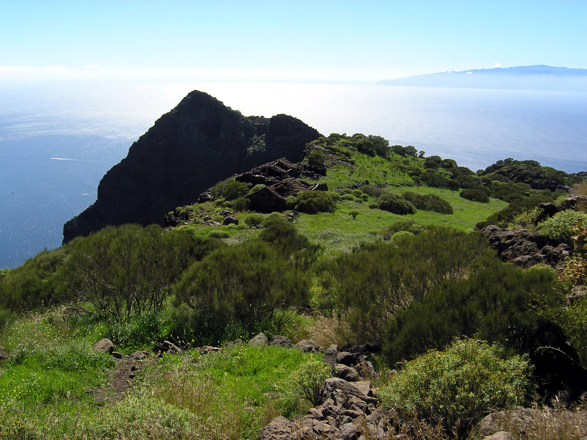
A high angle view of a grassy, volcanic ridgeline with small stone ruins, overlooking the Atlantic Ocean with a distant island visible on the horizon.
The Finca de Guergues estate situated on the volcanic ridges of Parque Rural de Teno, Tenerife.

Parque Rural de Teno history and protected-area timeline

The Teno area received its first formal natural-area protection in 1987, when it was declared a natural park under the Ley 12/1987 de declaración de Espacios Naturales de Canarias.

Seven years later, in 1994, the area was reclassified under the Ley 12/1994 de Espacios Naturales de Canarias, gaining its current designation as a rural park. The wider framework for its management today rests on Decreto Legislativo 1/2000, passed on 8 May, which continues to govern natural-area policy for the Canarian protected-area network. The European Union's later recognition of the massiff as a Special Protection Area for birds further strengthened Teno's conservation profile.

Parque Rural de Teno landscape and geographic character

The landscape of Parque Rural de Teno is defined by the triangular, deeply eroded Teno massif in the northwest of Tenerife. On two of its sides the terrain meets the Atlantic directly, producing some of the most dramatic coastal scenery in the Canary Islands. The Los Gigantes cliffs fall vertically for several hundred meters in places, with sections exceeding 500 meters of sheer drop.

Inside the triangle the terrain is cut by a network of barrancos, narrow and steep ravines that channel water from the central ridge down toward the coast. Between these ravines lie isolated ridges, escarpments, roques (prominent rock outcrops), volcanic dykes, and a narrow coastal platform. The highest elevations follow a southeast to northwest axis along the Cruz de Gala-Baracán ridgeline, which also acts as the park's main drainage divide.

This combination of high cliffs, deeply cut ravines, isolated rock formations, and a long coastline gives Teno an unusually compressed sense of relief. From the shoreline at Punta de Teno, the land climbs through dry lowlands and into the mist-prone upper slopes of the massif within just a few kilometers, producing some of the most varied terrain on Tenerife.

Parque Rural de Teno ecosystems, habitats, and plant life

Parque Rural de Teno preserves a remarkably complete vertical sequence of Canarian ecosystems, from xeric coastal formations near sea level to humid laurel forests on the highest slopes. The altitudinal range and the contrast between windward and leeward microclimates support both zonal and azonal vegetation types within a relatively small area.

The most distinctive natural value of the upper massif is laurisilva, the Macaronesian laurel forest. Best-developed stands occur in Monte del Agua and on the slopes of the Cumbre de Baracán, where persistent humidity allows this relict Tertiary vegetation type to survive. On the lower slopes and on the sunnier ridges between barrancos, retamales (brooms-dominated shrublands) and tabaibal-cardonal formations take over, with one of the largest and best-preserved examples found at Punta de Teno on the coast.

The towering coastal cliffs of Los Gigantes, with sheer drops of over 500 meters in places, support a very different flora: extensive rupicolous plant communities adapted to bare rock and salt-sprayed conditions. The park's combination of cliffs, barrancos, laurel forest, broom shrubland, and coastal xerophytic vegetation gives Teno some of the highest vegetation diversity on Tenerife and a high share of endemic species.

Parque Rural de Teno wildlife and species highlights

The wildlife of Teno is unusually rich for a protected area of its size, and the wider Teno massif was officially recognized by the European Union as a Special Protection Area for birds in response to this importance. The park is also notable as the locality in which the Teno spotted lizard was first described as a species for science, adding to the area's endemic character.

Birdlife is especially diverse because of the range of habitats present. In the laurel forest zone two endemic pigeons, the laurel pigeon (paloma rabiche) and the Bolle's pigeon (paloma turqué), are characteristic, alongside the local goshawk population. The open plains of Teno Alto still hold rock sparrows (gorrión chillón) in small numbers, while linnets, corn buntings, canaries, and Berthelot's pipits are common throughout the upland areas.

Teno is also one of the most important sites in Tenerife for birds of prey. It remains the last refuge on the island for the osprey and the Barbary falcon, while populations of the Canary Islands buzzard and the Canary kestrel remain stable. Along the cliffs and even inland, colonies of Cory's shearwater and Manx shearwater (pardelas cenicienta and pichoneta) breed in significant numbers, contributing to the marine-terrestrial ecological mosaic of the park.

Parque Rural de Teno conservation status and protection priorities

The conservation significance of Parque Rural de Teno rests on the fact that one of the oldest and most eroded volcanic massifs on Tenerife still contains the full set of Canarian vegetation belts from the coast to the summit. The park safeguards one of the best-preserved tabaibal-cardonal coastal formations in the Canary archipelago, the largest surviving laurisilva patches of Monte del Agua and Cumbre de Baracán, and exceptional rupicolous plant communities on the cliffs of Los Gigantes.

These habitats shelter high levels of endemism, both plant and animal, including the Teno spotted lizard and the endemic pigeons and shearwaters that depend on the laurel forest and cliff environment. The European Union's formal designation of the wider massif as a Special Protection Area for birds underlines the international importance of Teno for the conservation of Canarian avifauna, particularly the most threatened raptor and seabird species.

The protected-area designation also recognizes the cultural landscape, including the inhamlets of Los Carrizales, Masca, El Palmar, Las Portelas, and Teno Alto, whose agricultural terraces and vernacular architecture are integral to the long-term maintenance of the surrounding ecosystems. This combination of geological, ecological, and cultural values places Teno among the most strategically important protected areas in the Canary Islands.

Parque Rural de Teno cultural meaning and human context

The interior of Teno still holds five small inhabited settlements: Los Carrizales, Masca, El Palmar, Las Portelas, and Teno Alto, all belonging to the municipality of Buenavista del Norte. These communities preserve a heritage of traditional rural architecture, agricultural terracing, and local customs that have shaped the landscape of the park over centuries.

The cultural layer of the park is reinforced by a significant inventory of archaeological sites scattered across the massiff, reflecting long-standing human presence in what is otherwise an extremely rugged terrain. Masca in particular has become a cultural as well as a scenic landmark of Teno, historically associated with the rural identity of northwestern Tenerife.

Top sights and standout views in Parque Rural de Teno

Parque Rural de Teno concentrates a remarkable range of landscapes into a single protected area: the towering Los Gigantes cliffs, deep barrancos such as those around Masca, the laurel forests of Monte del Agua, and the dry coastal scrub at Punta de Teno.

Its ecological highlights include one of the highest concentrations of endemic species on Tenerife, an EU-recognized Special Protection Area for birds, and a globally distinctive population of the Teno spotted lizard. Its cultural highlights include the five traditional hamlets inside the park, the iconic viewpoint at Masca, and an archaeological and architectural heritage that complements the natural values of the massiff.

Best time to visit Parque Rural de Teno

Teno's climate contrasts strongly between its dry, sunny coast and its humid, mist-prone upper slopes, which makes the park attractive across much of the year. Spring tends to be a particularly rewarding season, when coastal vegetation is in bloom and cooler, clearer conditions are common in the higher barrancos and laurel forest zones.

Autumn and winter bring the clearest expression of the laurel forest environment, with the upper massiff often cloaked in mist and the cliffs at their greenest. Summer is generally dry and warm along the coast, which suits visiting the lower elevations around Punta de Teno and Masca, while the high ridges can remain cool and overcast even in the warmer months.
Monthly climate preview

Long term temperature and precipitation patterns across representative coordinates

Parque rural de Teno Climate Normals and Measured Weather by Month

Representative coordinate measurements record twelve month temperature and precipitation rhythms across the protected area. Examining the complete monthly climate profile reveals detailed long term variations in thermal averages and daily rainfall.
Annual mean20 °C
17 °C23 °C
Jan18°
Feb17°
Mar18°
Apr18°
May19°
Jun21°
Jul22°
Aug23°
Sep23°
Oct22°
Nov21°
Dec19°
Warmest month
September

23 °C

Coolest month
February

17.4 °C

Wettest month
December

1.4 mm/day

Driest month
July

0.1 mm/day

Park location guide

Geography guide, regional context, and park location map for Parque Rural de Teno

Parque Rural de Teno park geography, regions, and map view in Spain

Understand where Parque Rural de Teno sits in Spain through a broader geographic reading of the surrounding landscape, nearby location context, and its mapped position within the national park landscape.

How Parque Rural de Teno fits into Spain

Spain, officially the Kingdom of Spain, is a unitary parliamentary constitutional monarchy located in Southern and Western Europe. The country occupies most of the Iberian Peninsula and includes territories in the Mediterranean and Atlantic. With a population of approximately 49.6 million and an area of 506,030 km², Spain is a major European economy and cultural force. Its capital is Madrid, and the country is known for its diverse landscapes ranging from mountainous regions to coastal areas.

Wider geography shaping Parque Rural de Teno in Spain

Spain occupies the Iberian Peninsula in Southern and Western Europe. Peninsular Spain is bordered to the north by France, Andorra, and the Bay of Biscay; to the east and south by the Mediterranean Sea and Gibraltar; and to the west by Portugal and the Atlantic Ocean. The territory includes the Canary Islands in the Atlantic Ocean, the Balearic Islands in the Mediterranean Sea, and the autonomous cities of Ceuta and Melilla in mainland Africa. Spain features diverse terrain including the Pyrenees in the northeast, the Sierra Nevada in the south, and the Meseta Central plateau.

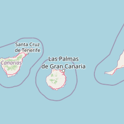
Map view of Parque Rural de Teno

Use this park location map to pinpoint Parque Rural de Teno in Spain, understand its exact geographic position, and read its mapped placement within the surrounding landscape more clearly.

Pigeon | © OpenStreetMap contributors

Location context for Parque Rural de Teno

CanariasTenerife
Recorded earthquake history

Explore Historical Earthquake Records Associated with Parque rural de Teno

Review a structured database of recorded seismic events that have occurred in the vicinity of the Teno massif. This collection provides an objective look at historical seismic data, tracking epicentres and event details across the protected terrain of the park.

Parque rural de Teno Earthquake History

Catalogued events

5 events

Strongest magnitude

Magnitude 4.1

Most recent event

Nov 22, 2005

This history includes earthquakes recorded inside the park or within 50 km of its borders

Visual exploration of coastal cliffs, deep ravines, and upland laurel forests across Tenerife

Parque rural de Teno Photos, Scenery, and Protected Landscape Views

Visual documentation of Parque rural de Teno reveals the dramatic topography of towering ocean cliffs, steep inland ravines, and ancient laurel forests. Examining these protected habitats provides clear insight into the complex volcanic terrain and rich endemic vegetation defining the northwest massif of Tenerife.

A high angle view of a grassy, volcanic ridgeline with small stone ruins, overlooking the Atlantic Ocean with a distant island visible on the horizon.

Park atlas

Compare surrounding regional landscapes and connected volcanic terrain

Explore Protected Areas and Parks Near Parque rural de Teno

Visitors exploring Parque rural de Teno can examine neighboring protected areas and adjacent volcanic reserves across the regional terrain. Comparing these connected landscapes reveals broader ecological patterns and diverse coastal topography throughout the surrounding territory.
Watercolor illustration of a mountainous landscape with green and purple hues, featuring rolling hills, distant mountains, and a light sky.
National parkTenerife
7.1 km away#1 closest

East

Teide National Park: Spain's Highest Peak and Distinctive Volcanic Landscape

Explore protected volcanic terrain and mapped geography on Tenerife.

Teide National Park protects the highest point in Spain, Mount Teide, within a spectacular caldera and surrounding volcanic terrain on Tenerife. This national park offers a unique landscape for geographic discovery, showcasing dramatic lava flows, volcanic cones, and endemic flora. Its protected boundaries define a significant area of natural interest, making it a key landmark for atlas exploration of island geography and protected lands.

Area
189.9 km²
Established
1954
IUCN
II
Visitors
4.5M annual
National parkSpain
35 km away#2 closest

Southwest

Garajonay National Park: Ancient Laurisilva Forest and Volcanic Landscapes

Explore Spain's unique protected area with rich geographic context.

Garajonay National Park, a treasure of La Gomera, preserves one of the last stands of Europe's ancient laurisilva forest atop dramatic volcanic terrain. This national park offers a rare opportunity to explore a landscape shaped by persistent cloud cover and unique island evolution. Examine the park's mapped boundaries and distinctive natural features through its detailed geographic profile.

Area
40 km²
Established
1981
IUCN
II
Visitors
450K annual
Watercolor painting of soft, layered mountain ridges in shades of green, purple, and pale yellow, set against a white background.
Protected landscapeCanarias
48 km away#3 closest

Northeast

Parque rural de Anaga: Mapping the Volcanic Relief and Laurisilva Forests of Canarias

A detailed geographic overview of the Anaga massif protected landscape.

Parque rural de Anaga preserves a dramatic landscape of volcanic plugs, deeply incised valleys, and endemic-rich cloud forests in the Canary Islands. Understand the complex terrain and protected area boundaries that define this historic massif, from its coastal cliffs to its high mountain ridges.

Area
144.187 km²
Established
1994
Relief
Mountain
Climate
Subtropical
Watercolor illustration showing a mountainous landscape with green forests, a winding river, and distant hills
National parkSpain
96 km away#4 closest

Northwest

Caldera de Taburiente National Park: National Park & Geological Heritage Site

Explore its volcanic caldera, mapped ravines, and pine forests.

Caldera de Taburiente National Park is a protected natural area on the island of La Palma, Spain. It encompasses a vast, approximately 10-kilometer-wide volcanic caldera, characterized by immense cliffs, deep ravines, and extensive Canary Island Pine forests. This national park is recognized for its significant geological features and unique landscape, making it a key destination for understanding protected area geography and regional natural heritage.

Area
46.9 km²
Established
1954
IUCN
II
Visitors
389K annual
A soft watercolor painting showing a rolling landscape with green hills, a small tree in the foreground, and pale blue mountains in the background.
Protected landscapeCanarias
About 120 km away#5 closest

East

Parque rural de Doramas Protected Landscape: Gran Canaria Geographic and Terrain Atlas

Exploring laurel forest strongholds and rugged ravine geography.

Parque rural de Doramas encompasses over 3,500 hectares of diverse northern Gran Canaria terrain, where steep-sided barrancos support rare laurisilva and monteverde vegetation. This protected landscape serves as a living remnant of the island's once-vast indigenous forests, offering a unique opportunity to study the relationship between human-influenced agricultural slopes and wild, humid forest refuges found deep within the island's northern flanks.

Area
35.86 km²
Relief
Upland
Climate
Mediterranean
Scope
Terrestrial
Watercolor painting of a light-filled landscape featuring soft green hills, clusters of pine trees, and distant ridgelines in muted pinks and purples.
Protected landscapeCanary Islands
About 121 km away#6 closest

East

Parque rural del Nublo: Volcanic Peaks and Protected Highland Terrain in Gran Canaria

Mapping the dramatic erosional landscapes and endemic ecosystems of central Gran Canaria.

Spanning the core of Gran Canaria, Parque rural del Nublo is a vast protected landscape characterized by its rugged volcanic topography. The area features the iconic Roque Nublo monolith, deeply incised barrancos, and a mosaic of pine forests and endemic scrubland. This territory represents a critical intersection of geological evolution and aboriginal history, containing major UNESCO-listed cultural sites within its complex highland boundaries.

Area
267.64 km²
Established
1994
IUCN
VI
Relief
Mountain
A soft watercolor illustration of a landscape with muted green and purple hills against a white background.
Protected landscapeCanarias
About 266 km away#7 closest

East

Parque rural de Betancuria: Protected Landscape, Fuerteventura, Canarias

A rugged volcanic and geological interior landscape

Investigate the topographical intensity of Parque rural de Betancuria, home to the Betancuria Massif and unique Basal Complex exposures. This protected landscape documents a long history of geological transformation and traditional human adaptation to the arid Fuerteventura environment.

Area
165.443 km²
Established
1987
Relief
Mountain
Climate
Arid
Watercolor painting of a landscape with grassy areas, a winding river, and mountains under a light sky
National parkCanary Islands
298 km away#8 closest

East

Timanfaya National Park: Dramatic Volcanic Landscape in the Canary Islands

Explore Spain's unique geological national park.

Timanfaya National Park offers an extraordinary exploration of volcanic terrain, a protected area that defines geological conservation in the Canary Islands. Its landscape, shaped by powerful eruptions, features vast lava fields, striking volcanic cones, and visible geothermal activity. As Spain's only purely geological national park, Timanfaya provides a unique context for understanding volcanic processes and appreciating the raw beauty of its protected natural environment, serving as a key landmark within the archipelago's geography.

Area
51.07 km²
Established
1974
IUCN
II
Relief
Mountain

Common questions about visiting, size, designation, and location context for Parque Rural de Teno

Parque Rural de Teno FAQs for park facts, access, geography, and protected area context

Find quick answers about Parque Rural de Teno, including protected-area facts, park geography, trail and visitor context, and how the park fits into its surrounding country and regional landscape.
MoriAtlas Explorer

Continue Your Protected Areas Search Across the Global Atlas

Deepen your exploration by continuing the structured search for national parks and protected areas worldwide. Utilize the comprehensive filtering capabilities to compare different conservation landscapes and refine your understanding of global park geography. Discover more about the distribution and characteristics of protected natural areas.

Global natural geography