
Mori Atlas logo
National parkPieniny National Park

Examining the karst terrain, ancient forest boundaries, and transboundary mountain geography of northern Slovakia

Pieniny National Park: A Deep Dive Into Protected Limestone Landscapes and River Gorge Geography

(Pieninský národný park)

Pieniny National Park represents a significant protected area within the Prešov Region, defined by dramatic limestone cliffs and deep river gorges carved by the Dunajec. This detailed atlas entry explores the park’s flysch geology, endemic plant habitats, and its historical role as part of Europe’s first international conservation landscape. Understand the spatial characteristics of the Lesser Pieniny sub-ranges and the surrounding basin interfaces that shape this unique cross-border mountain environment.

national parkCarpathian mountainslimestone gorgesriver canyonsendemic speciescross-border protection
Stylized illustration of green mountains, a river gorge, rocky cliffs with a lone tree, and a sunlit sky with clouds

Pieniny National Park

National park

Park overview

Structured park overview, official facts, and landscape profile for Pieniny National Park

Pieniny National Park park facts, protected area profile, and essential visitor context

Review the core facts for Pieniny National Park, including designation, size, terrain, visitor scale, habitats, and operating context in one park-focused overview.

About Pieniny National Park

Pieniny National Park occupies a remarkable position in the Carpathian mountain system, protecting a distinctive landscape where the Pieniny Mountains rise along the Slovakia-Poland border. The park's compact size belies its ecological significance; it contains one of Europe's most impressive river gorges, the Dunajec River canyon, which has been carved through millennia by the river as it flows from the Tatra Mountains northward into Poland. The terrain is characterized by steep limestone cliffs, rocky ridges, and forested slopes that create a dramatic backdrop for the river's meandering course. Beyond the gorge, the park encompasses the Lesser Pieniny range, a boundary ridge between the two countries featuring several smaller cliffs and rocky outcrops. The park's administrative center is located in the village of Červený Kláštor, a settlement known for its traditional folk architecture and cultural significance. The park's establishment in 1967 represented the formal protection of a landscape that had been recognized for its natural value since the early twentieth century, when the cross-border Zamagurie region became the first internationally protected nature park in Europe in 1932.

Quick facts and research context for Pieniny National Park

Pieniny National Park sits in the Prešov Region of northeastern Slovakia, spanning the districts of Kežmarok and Stará Ľubovňa. The park is Slovakia's smallest national park at just 37.5 km², though its protective buffer zone extends across 224.44 km². The landscape is characterized by flysch and limestone geology, with the Dunajec River carving a spectacular canyon through the mountains. The region has been protected since 1932, making it one of the oldest protected areas in Central Europe. The park is home to notable endemic plant species and serves as a habitat for brown bears, wolves, lynx, and chamois.

Protection and recognition

Explore terrestrial protection scope, transboundary boundaries, and Natura 2000 listings.

Pieniny National Park Protection Status and International Recognition Data

Pieniny National Park maintains documented terrestrial protection status alongside verified transboundary boundaries. Official conservation records capture international recognition frameworks including Natura 2000 designations across the protected landscape.

International recognition

Protection details

Protection scope
Terrestrial
Transboundary protection
Yes
Buffer area
224.44 km²
Park context

Deeper park guide and search-rich context for Pieniny National Park

Pieniny National Park history, landscape, wildlife, and travel context

Explore Pieniny National Park through its history, landscape character, ecosystems, wildlife, conservation priorities, cultural context, and seasonal travel timing in a structured park guide built for atlas discovery and search intent.

Why Pieniny National Park stands out

Pieniny National Park is best known for the spectacular Dunajec River Gorge, a dramatic limestone canyon that offers some of the most impressive river scenery in the Carpathians. The park is famous for its traditional wooden rafting tradition along the Dunajec, as well as the picturesque village of Červený Kláštor, which houses a Museum of National Culture showcasing regional folk heritage. The park protects rare endemic plant species including Chrysanthemum zawadzkii and the Tertiary relict Juniperus sabina (dwarf pine), which grows only in the Pieniny Mountains within the Western Carpathians. The limestone cliffs also provide nesting habitat for eagles and support populations of chamois on the rocky terrain.
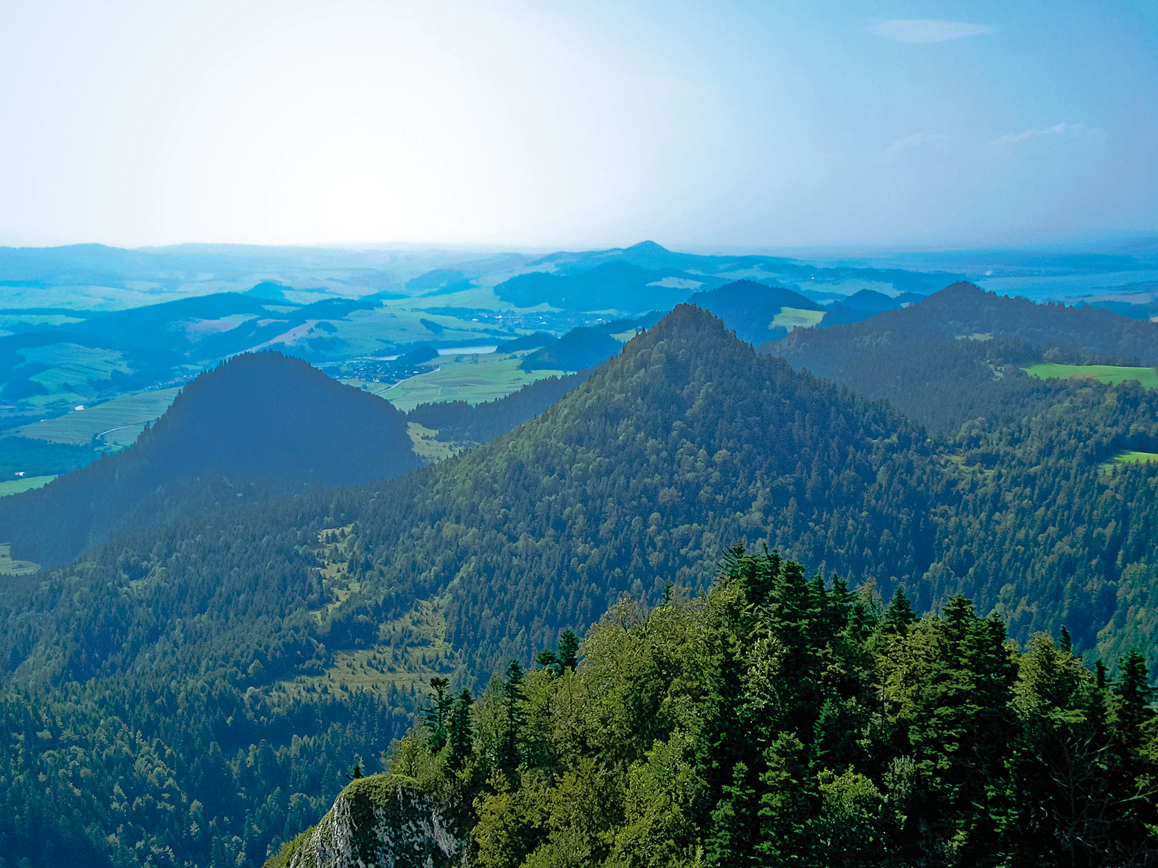
Panoramic view of forested mountains and valleys under a clear sky
Panoramic view of Pieniny National Park from Trzy Korony

Pieniny National Park history and protected-area timeline

The protection of the Pieniny region has roots extending back to the early twentieth century. In 1921, Professor Władysław Szafer of Poland's State Commission for Nature Protection first proposed protecting the Pieniny area as a unified transboundary landscape. The following year, Professor Stanisław Kulczyński developed the first protection project covering 216.5 square kilometers of the central Pieniny. After years of negotiation between Polish and Czechoslovak authorities, the first nature reserve was established on the Polish side in 1929, with the Czechoslovak side following in 1932. On July 17, 1932, the Slovak nature reserve in Pieniny was declared at Červený Kláštor, simultaneously marking the creation of Europe's first international nature park. This cross-border cooperation was groundbreaking for its era. After World War II, the Czechoslovak side created the Pieniny Nature Reserve in Červený Kláštor in 1958, and the national park was formally established on January 16, 1967, making it Slovakia's second-oldest national park after the Tatra National Park. The park underwent name changes in 1994 and border adjustments in 1997, expanding to its current extent.

Pieniny National Park landscape and geographic character

The Pieniny landscape is defined by its distinctive limestone and flysch geology, which has produced a terrain of remarkable visual drama despite the mountains' relatively modest elevation. The Dunajec River has carved a deep canyon through the mountains, with vertical gray limestone cliffs rising hundreds of meters above the water. The most spectacular section is the Prielom Dunajca (Dunajec Gorge), where the river makes four tight meanders within a dramatic canyon setting. The park also includes the Prielom Lesnickeho potoka, a nearly 300-meter-deep gorge carved through hard limestone by the Lesnicky Potok brook. The Lesser Pieniny (Malé Pieniny) forms the eastern boundary ridge between Slovakia and Poland, characterized by several rocky cliffs and the park's highest point at Vysoké skalky (1,050m). The southern boundary reaches into the Popradská kotlina basin and the Ždiarska brázda furrow, which lie at the interface between the Pieniny and the High Tatras. The landscape is heavily influenced by its karst geology, with the limestone supporting distinctive plant communities and creating unique microhabitats throughout the park.
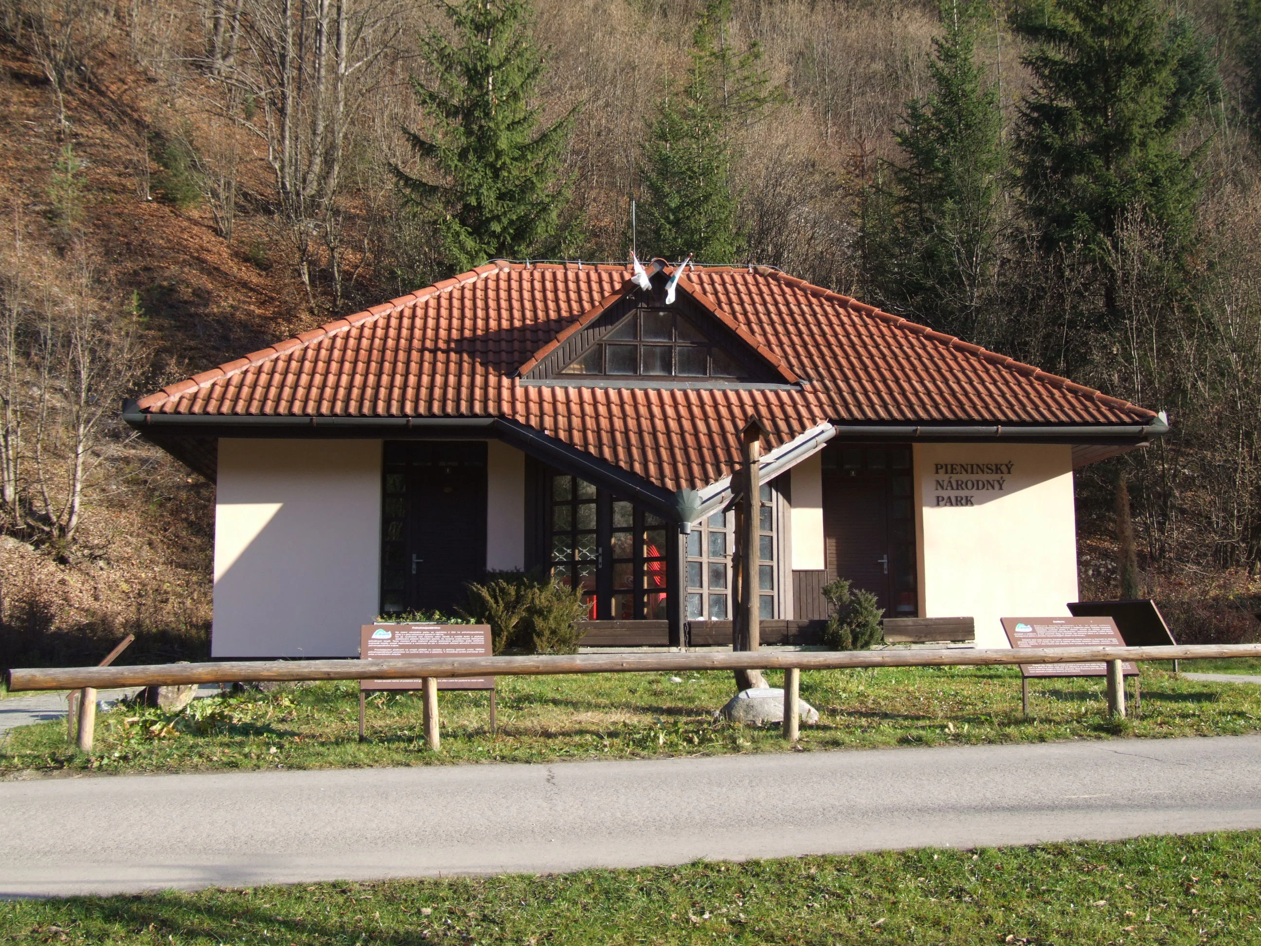
A white building with a red-tiled roof and wooden fence, situated in a forested area with trees and grass
Pieniny National Park information center building with adjacent mountain hostel

Pieniny National Park ecosystems, habitats, and plant life

The vegetation of Pieniny National Park is organized across several altitude tiers, reflecting the mountains' position at the crossroads of different climatic influences. The original forest cover would have been beech forest in the lower basins and furrows, though centuries of human activity have altered much of the landscape. The park is notable for its exceptional botanical importance, harboring numerous endemic species found nowhere else in the world. The most remarkable is Chrysanthemum zawadzkii (now Dendranthema zawadzkii), known as the Pieniny chrysanthemum, which grows only on the Polish and Slovak sides of these mountains. Another significant species is Juniperus sabina (dwarf juniper), a Tertiary relict that survives in the Pieniny at the very edge of its western Carpathian distribution. The original forest community would have been fir-beech forest, though this has been largely replaced by spruce forests with scattered beech. In rocky ridge areas, interesting lime-loving grasslands have developed on the calcareous substrate, supporting species typical of both Mediterranean and alpine origins.
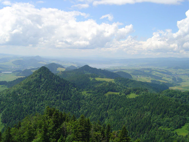
Panoramic landscape view showing rolling green mountains, dense forests, and a valley under a partly cloudy sky
Panoramic view of Pieniny National Park from Trzy Korony peak

Pieniny National Park wildlife and species highlights

Pieniny National Park supports a diverse mammalian fauna that reflects its position in the Carpathian mountain system. The park is home to several large carnivores including the brown bear (Ursus arctos), wolf (Canis lupus), and Eurasian lynx (Lynx lynx), representing the full suite of Carpathian apex predators. Alpine species such as chamois (Rupicapra rupicapra) and alpine marmot (Marmota marmota) inhabit the rocky cliff zones, while the river otter (Lutra lutra) hunts in the Dunajec and its tributaries. The avifauna includes eagles nesting on inaccessible cliff faces and white storks that breed in the region. The park's isolation and unique geological setting have also produced remarkable invertebrate diversity; studies have documented that approximately 50% of Carpathian centipede species occur here, and the region supports numerous endemic and Carpathian species including the ground beetle Cylindroiulus luridus burzeneandicus and the pygmy grasshopper Isophya pyrenea pieninensis.
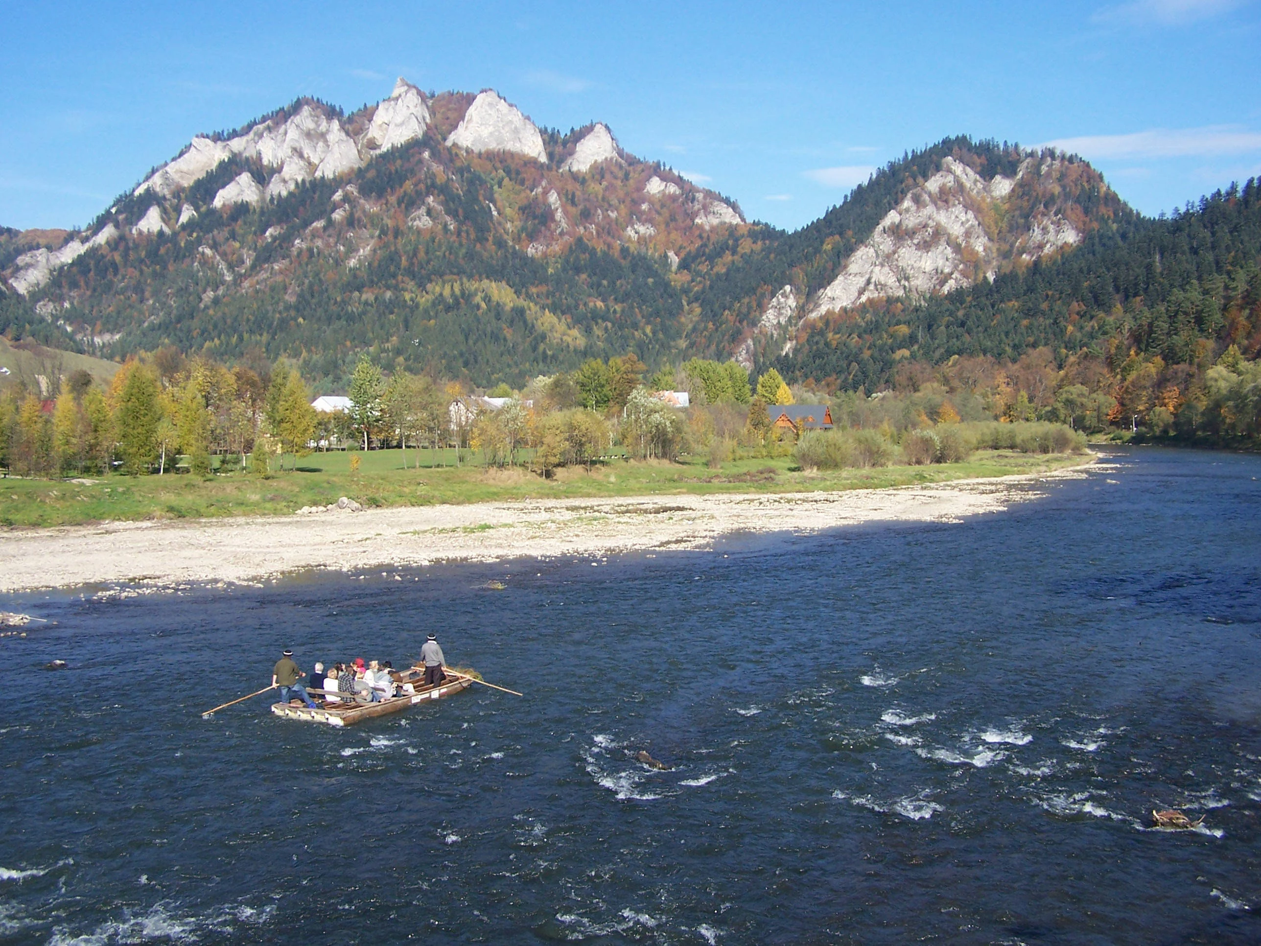
People rafting on a river with mountains and trees in the background
Rafting on the Dunajec River with mountainous backdrop in Pieniny National Park

Pieniny National Park conservation status and protection priorities

Pieniny National Park represents one of the oldest and most significant conservation achievements in Central Europe, stemming from early twentieth-century transboundary cooperation between Poland and Czechoslovakia. The 1932 establishment of protected areas on both sides of the border created Europe's first international nature park, a pioneering model for cross-border conservation. The park protects a distinctive Carpathian landscape with exceptional botanical significance, harboring species endemic to the Pieniny Mountains including the Pieniny chrysanthemum and dwarf juniper, a Tertiary relict species. The Dunajec River Gorge provides migration corridors and habitat for aquatic species, while the limestone cliffs support specialized rock-dwelling flora and nesting raptors. The park forms part of a larger protected landscape complex that includes the Polish Pieniny National Park on the opposite side of the border, ensuring continuity of protection across the international boundary.

Pieniny National Park cultural meaning and human context

The Pieniny region has been inhabited for centuries by communities whose lives have been intimately connected to the landscape. The village of Červený Kláštor serves as the park's administrative center and represents the cultural heart of the area, featuring traditional folk architecture and housing the Museum of National Culture that showcases regional heritage. The area is known for its distinctive wooden rafting tradition on the Dunajec River, a practice that has continued for generations and remains an important cultural activity and tourist attraction. The name Zamagurie refers to the broader region encompassing the Pieniny and surrounding areas, a term that reflects the shared cultural and historical identity of the borderland communities. Several villages within and adjacent to the park, including Lesnica, Haligovce, Kamienka, Lechnica, and Stráňany, maintain traditional settlement patterns and agricultural practices that contribute to the region's cultural landscape.
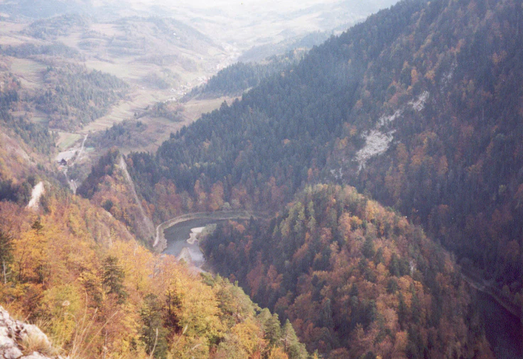
Wide landscape view of a river flowing through mountain valleys surrounded by autumn-colored forests
Dunajec River winding through the Pieniny Mountains with autumn foliage on the hillsides

Top sights and standout views in Pieniny National Park

The Dunajec River Gorge stands as the park's most spectacular feature, a dramatic limestone canyon offering world-class scenery and the traditional wooden raft rides that have defined the region for centuries. The village of Červený Kláštor provides cultural immersion through its folk architecture and the Museum of National Culture, offering insight into traditional Carpathian life. The rare endemic flora, particularly the Pieniny chrysanthemum and Tertiary-relict dwarf juniper, represents botanical significance found nowhere else on Earth. The transboundary protected landscape with Poland creates one of Europe's oldest international conservation areas, with a history dating to 1932. The park's compact size makes it highly accessible while delivering outsized natural and cultural experiences, from eagle nests on sheer cliffs to traditional wooden churches in surrounding villages.

Best time to visit Pieniny National Park

The Pieniny Mountains can be visited throughout the year, though each season offers a distinctly different experience. Summer months bring the most active period for rafting on the Dunajec River, with warm conditions ideal for exploring the gorge and hiking the trail network. The river raft rides operate from spring through autumn, with summer offering the most reliable water levels and the fullest access to the attractions. Autumn brings spectacular fall colors to the forests and often produces crisp, clear weather that showcases the limestone cliffs to best advantage. Winter transforms the landscape into a quieter, more austere environment suitable for winter hiking on maintained trails, though some routes may be closed or require caution. The shoulder seasons of spring and autumn typically offer fewer visitors while still providing comfortable conditions for outdoor activities, making them appealing for those seeking a more tranquil experience.


Monthly climate preview

Long-term temperature and precipitation patterns across representative coordinates

Pieniny National Park Climate Normals and Monthly Weather Records

Pieniny National Park exhibits a measured annual climate cycle defined by long-term monthly temperature averages and daily precipitation rates recorded at a representative elevation point. Reviewing the complete twelve-month profile provides deeper context for examining sustained seasonal weather variations across the protected terrain.
Annual mean7 °C
-5 °C18 °C
Jan-5°
Feb-3°
Mar
Apr
May12°
Jun16°
Jul18°
Aug17°
Sep12°
Oct
Nov
Dec-3°
Warmest month
July

17.5 °C

Coolest month
January

-4.6 °C

Wettest month
July

4 mm/day

Driest month
January

1.5 mm/day

Park location guide

Geography guide, regional context, and park location map for Pieniny National Park

Pieniny National Park park geography, regions, and map view in Slovakia

Understand where Pieniny National Park sits in Slovakia through a broader geographic reading of the surrounding landscape, nearby location context, and its mapped position within the national park landscape.

How Pieniny National Park fits into Slovakia

Slovakia is a landlocked Central European country with a population of over 5.4 million. It became independent from Czechoslovakia in 1993 and is a member of the European Union. The country features mountainous terrain, with the Carpathian Mountains running through its territory. Bratislava serves as the capital and largest city, while Košice is the second-largest city.

Wider geography shaping Pieniny National Park in Slovakia

Slovakia is located in Central Europe, landlocked between Poland to the north, Ukraine to the east, Hungary to the south, Austria to the west, and the Czech Republic to the northwest. The territory is mostly mountainous, with the Carpathian Mountains, including the High Tatras, dominating the northern region. The Danube River forms part of the southern border with Hungary.

Map view of Pieniny National Park

Use this park location map to pinpoint Pieniny National Park in Slovakia, understand its exact geographic position, and read its mapped placement within the surrounding landscape more clearly.

Pigeon | © OpenStreetMap contributors

Location context for Pieniny National Park

Prešov Region
Natural feature types

Explore the Named Natural Formations of Pieniny National Park

Delve into the precise natural landscape of Pieniny National Park by examining its cataloged geologic and hydrologic features. MoriAtlas provides a clear, data-driven perspective on the cliffs, canyons, and peaks that form the regional identity of this protected mountainous territory.
Recorded earthquake history

Review the Documented Earthquake History of Pieniny National Park

Examine the formal catalogue of recorded seismic events associated with the Pieniny National Park geography. MoriAtlas provides this structured repository for historical review, allowing users to trace documented earthquake occurrences and epicentre distributions relative to the park boundaries without requiring external datasets.

Pieniny National Park Earthquake History

Catalogued events

10 events

Strongest magnitude

Magnitude 4.8

Most recent event

Jun 25, 2006

This history includes earthquakes recorded inside the park or within 50 km of its borders

Explore limestone gorges, river canyons, and protected mountain habitats through high-resolution photography.

Pieniny National Park Photos and Visual Landscape Guide

Visual documentation captures the dramatic vertical limestone cliffs and deep river canyons of the protected Carpathian terrain. Examining real park imagery reveals the distinct geological character, river meanders, and rare botanical habitats preserved across the mountain environment.

Panoramic view of forested mountains and valleys under a clear sky

A mountain peak with steep rocky cliffs surrounded by autumn-colored trees and forested hills in the background

A white building with a red-tiled roof and wooden fence, situated in a forested area with trees and grass

Panoramic landscape view showing rolling green mountains, dense forests, and a valley under a partly cloudy sky

People rafting on a river with mountains and trees in the background

Pine tree with twisted trunk growing on rocky cliff edge with mountain landscape and forested valley in background

Wide landscape view of a river flowing through mountain valleys surrounded by autumn-colored forests

Park atlas

Compare adjacent mountain terrain and cross border conservation areas across the region

Explore Other Parks Near Pieniny National Park and Surrounding Protected Landscapes

Visitors exploring Pieniny National Park can discover nearby protected areas and adjacent mountain reserves across the regional terrain. Comparing these connected landscapes reveals broader geological patterns and regional conservation history throughout the wider Carpathian mountain system.
A horizontal watercolor painting showing stylized Pieniny mountain ridges, coniferous forests, and a prominent limestone rock formation against a soft pastel landscape.
National parkLesser Poland Voivodeship
Park boundaries overlap#1 closest

East

Pieniński Park Narodowy: Mapping the Limestone Mountains of Lesser Poland Voivodeship

A historic protected area featuring the iconic Dunajec River gorge

Discover the unique geography of Pieniński Park Narodowy, an essential protected area in the Polish Carpathians. The terrain spans limestone cliffs, deep river gorges, and mountain ridges, offering deep insights into the region's karstic landscape and natural history.

Area
23.46 km²
Established
1932
Visitors
815K annual
Relief
Mountain
Watercolor illustration of a mountainous landscape with green forests and a river
National parkLesser Poland Voivodeship
Park boundaries overlap#2 closest

Northwest

Pieniny National Park: Geographic and Protected Area Map Analysis of Lesser Poland

Limestone karst landscapes and Carpathian mountain terrain

Examine the topography of Pieniny National Park, from the towering Trzy Korony peaks to the narrow channels of the Dunajec River gorge. This detailed overview covers the protected limestone ridges and species-rich meadows that define one of the most prominent natural landscapes in the Lesser Poland region.

Area
23.46 km²
Established
1932
IUCN
II
Visitors
815K annual
Protected areaLesser Poland Voivodeship
0.3 km away#3 closest

Northeast

Środkowy Dunajec z dopływami: Protected River Habitats and Carpathian Foothills Geography

Exploring the river corridor and riparian ecosystems of southern Poland

Spanning 755 hectares across four connected enclaves, Środkowy Dunajec z dopływami protects the vital riverine systems of the middle Dunajec and its tributaries. This site offers a unique look at the fluvial processes and biodiversity of Carpathian mountain streams, showcasing diverse habitat structures from pioneer gravel banks to mature riparian forests.

Area
7.56 km²
Relief
Upland
Scope
Terrestrial
Water
Major water bodies
Protected areaLesser Poland Voivodeship
1.5 km away#4 closest

East

Ostoja Popradzka: Mapped Protected Landscapes and Geographic Context in Southern Poland

A core conservation site within the Beskid Sadecki mountain range

Spanning extensive river valleys and alpine meadows, Ostoja Popradzka serves as a primary habitat network in the Polish Carpathians. This entry details its layered geography, including protected forest reserves, karst cave systems, and essential corridors for large carnivores, framed within the administrative boundaries of the Lesser Poland Voivodeship.

Area
579.31 km²
Established
2008
Relief
Mountain
Scope
Terrestrial
Nature reserveLesser Poland Voivodeship
About 10 km away#5 closest

Northwest

Rezerwat przyrody Modrzewie: Mapping Protected Larch Woodland Geography in Lesser Poland

Nature reserve on the southern slopes of the Gorce mountains

The Rezerwat przyrody Modrzewie nature reserve protects a rare stand of old-growth larch trees within the Gorce mountain range. Located on the southern slopes of Lubań in the Lesser Poland Voivodeship, this site provides valuable data on Carpathian forest ecology, displaying distinct tree populations that contrast with the surrounding alpine meadows and montane landscapes of southern Poland.

Area
0.107 km²
Established
1959
Relief
Mountain
Climate
Temperate
Watercolor painting showing a lake surrounded by trees and mountains in the background
National parkSlovakia
16 km away#6 closest

Southwest

Tatra National Park: Mapping the Alpine Peaks and Glacial Landscapes of Slovakia

Protected Mountain Terrain in the Carpathian Range

Examine the geographic framework of Tatra National Park, a significant protected area in Slovakia defined by dramatic glacial valleys, over three hundred caves, and high-altitude mountain ecosystems. This authoritative entry provides a detailed look at the park's alpine boundaries, hydrological networks, and role as a transboundary biosphere reserve in the Carpathian Mountains.

Area
738 km²
Established
1949
IUCN
II
Relief
Mountain
Nature reserveLesser Poland Voivodeship
17 km away#7 closest

Northwest

Ostoja Gorczańska: Protected Area Mapping and Carpathian Mountain Geography in Lesser Poland

Ecological corridors across the Gorce and Beskid Wyspowy ranges

Covering nearly 18,000 hectares, Ostoja Gorczańska represents a significant biodiversity reservoir in the Polish Carpathians. The site integrates multiple protection frameworks, safeguarding varied habitats from subalpine grasslands to dense montane forests and peatland depressions. Use this resource to examine the structural connectivity of these mountain units and the expansive wilderness corridors found within the Lesser Poland Voivodeship.

Area
179.979 km²
Established
2008
Relief
Mountain
Climate
Temperate
Watercolor painting showing rolling green hills, forests, and distant mountains under a pale sky
National parkLesser Poland Voivodeship
19 km away#8 closest

Northwest

Gorce National Park: A Comprehensive Geographic Profile and Protected Area Analysis

Mountain meadows and Carpathian forest landscapes in southern Poland

Gorce National Park preserves an essential segment of the Western Beskids, offering a look into the region's arched ridges and forested terrain. The area serves as a critical protected landscape featuring significant biodiversity, ancient woodland, and open mountain meadows that distinguish the local geography of the Lesser Poland Voivodeship.

Area
70.3 km²
Established
1981
IUCN
II
Visitors
80K annual

Common questions about visiting, size, designation, and location context for Pieniny National Park

Pieniny National Park FAQs for park facts, access, geography, and protected area context

Find quick answers about Pieniny National Park, including protected-area facts, park geography, trail and visitor context, and how the park fits into its surrounding country and regional landscape.
MoriAtlas Explorer

Continue Your Protected Areas Search Across the Global Atlas

Deepen your exploration by continuing the structured search for national parks and protected areas worldwide. Utilize the comprehensive filtering capabilities to compare different conservation landscapes and refine your understanding of global park geography. Discover more about the distribution and characteristics of protected natural areas.

Global natural geography