
Mori Atlas logo
State or regional parkPinecone Burke Provincial Park

Tracing the wild terrain from Metro Vancouver urban edges to remote alpine ridges

Pinecone Burke Provincial Park: A Comprehensive Atlas of Protected Coast Mountain Landscapes

(Pinecone-Burke Provincial Park)

Pinecone Burke Provincial Park stands as a expansive wilderness anchor within the southwestern Coast Mountains of British Columbia. This protected area connects the lower mainland suburban fringe with vast backcountry environments, encompassing old-growth coniferous forests, remnant ice fields, and deep river valleys. The mapped terrain transitions from the tidewaters of Pitt Lake and the wetlands of Widgeon Valley up to the high-elevation summits of Pinecone Peak and Meslilloet Mountain, providing a vital corridor for diverse ecological habitats.

wilderness parkCoast Mountainsold-growth forestalpine meadowsbackcountry hikingbackcountry skiing
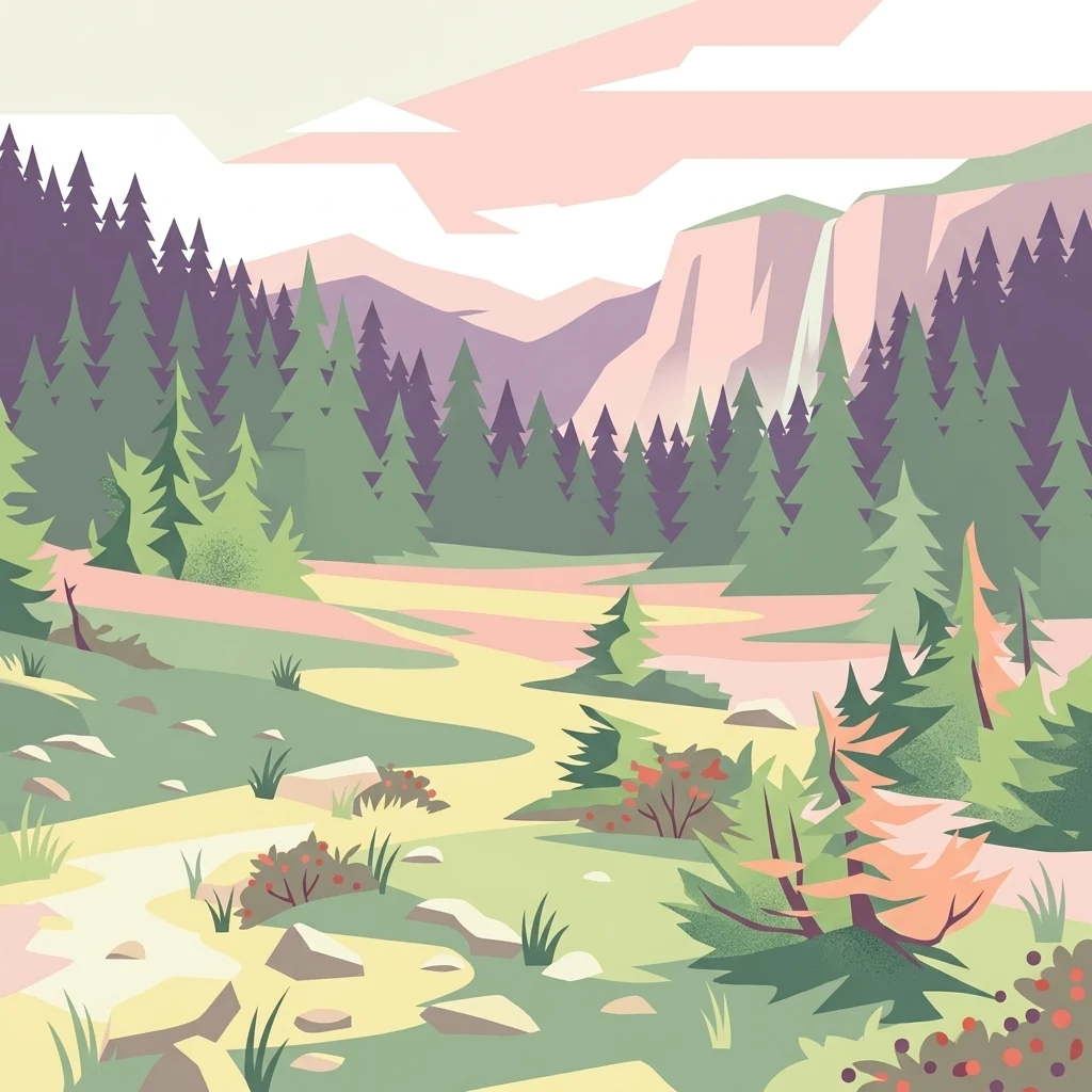
A graphic illustration showing a mountain valley with coniferous trees, a path, and distant mountain peaks in pastel tones.

Pinecone Burke Provincial Park

State or regional park

Park overview

Structured park overview, official facts, and landscape profile for Pinecone Burke Provincial Park

Pinecone Burke Provincial Park park facts, protected area profile, and essential visitor context

Review the core facts for Pinecone Burke Provincial Park, including designation, size, terrain, visitor scale, habitats, and operating context in one park-focused overview.

About Pinecone Burke Provincial Park

Pinecone Burke Provincial Park occupies a sweeping stretch of the southern Coast Mountains in British Columbia, forming one of the largest protected natural areas near the Metro Vancouver region. Its boundaries create a long north to south corridor of wilderness that begins at sprawling Garibaldi Provincial Park in the north, drops down along the western shore and headwaters around Pitt Lake, and reaches into the fringes of Coquitlam where it meets the slopes of Burke Mountain.

At around 38,000 hectares, the park is unusual in British Columbia for the way it combines rugged alpine country with relatively low-elevation coastal forest and important freshwater systems. The terrain includes the high peaks of Pinecone Peak and Meslilloet Mountain, remnant ice fields in the upper elevations, and a rolling series of ridges and valleys. Lower down, the park protects stands of old-growth coniferous forest dominated by western hemlock, Douglas fir, bigleaf maple, and red alder, along with wetlands such as the Widgeon Valley system. Pitt Lake, the largest freshwater tidal lake in North America, forms much of the eastern boundary.

The significance of the park extends beyond its geography. It is part of the Lower Mainland Nature Legacy, a collection of southwestern British Columbia parks judged to be ecologically important. The region also carries deep cultural meaning, overlapping with the traditional territories of the Katzie, Kwikwetlem, and Stó:lō peoples. Pinecone Burke has therefore come to serve both as a refuge for wildlife and as a focal point for conservation and Indigenous land relationships near one of Canada's most urbanized regions.

Quick facts and research context for Pinecone Burke Provincial Park

Pinecone Burke Provincial Park is a roughly 38,000-hectare IUCN Category II protected area in Metro Vancouver and the Fraser Valley, governed by BC Parks. It runs from the edge of Coquitlam at Burke Mountain northward along the west shore of Pitt Lake to the southwestern boundary of Garibaldi Provincial Park. The landscape spans old-growth coniferous forest, deep river valleys, subalpine ridges, alpine meadows, and remnant ice fields. The park is significant for its wildlife diversity, its Indigenous territorial overlap with the Katzie, Kwikwetlem, and Stó:lō peoples, and its role in the Lower Mainland Nature Legacy of ecologically important parks.

Protection and recognition

Documented terrestrial protection metrics and official designation data.

Pinecone Burke Provincial Park Protection Status and Regional Conservation Scope

Pinecone Burke Provincial Park maintains a documented terrestrial protection scope and management framework within regional conservation records. Structured geographic data details the established protected area designation, supporting ongoing geographical analysis and ecological research.

Protection details

Protection scope
Terrestrial
Transboundary protection
No
Park context

Deeper park guide and search-rich context for Pinecone Burke Provincial Park

Pinecone Burke Provincial Park history, landscape, wildlife, and travel context

Explore Pinecone Burke Provincial Park through its history, landscape character, ecosystems, wildlife, conservation priorities, cultural context, and seasonal travel timing in a structured park guide built for atlas discovery and search intent.

Why Pinecone Burke Provincial Park stands out

Pinecone Burke Provincial Park is best known for its sheer transition from urban-edge wilderness near Coquitlam to remote Coast Mountains interior. Sections of the park preserve old-growth coniferous forest, high alpine terrain including Pinecone Peak, and pockets of nationally recognized wetlands around Widgeon Valley near Pitt Lake, the largest freshwater tidal lake in North America. The park also stands out for its accessibility despite its wild character, offering canoe-in trailheads, rough backcountry trails, and a network of old logging roads that serve as routes for hiking, mountain biking, and backcountry skiing.
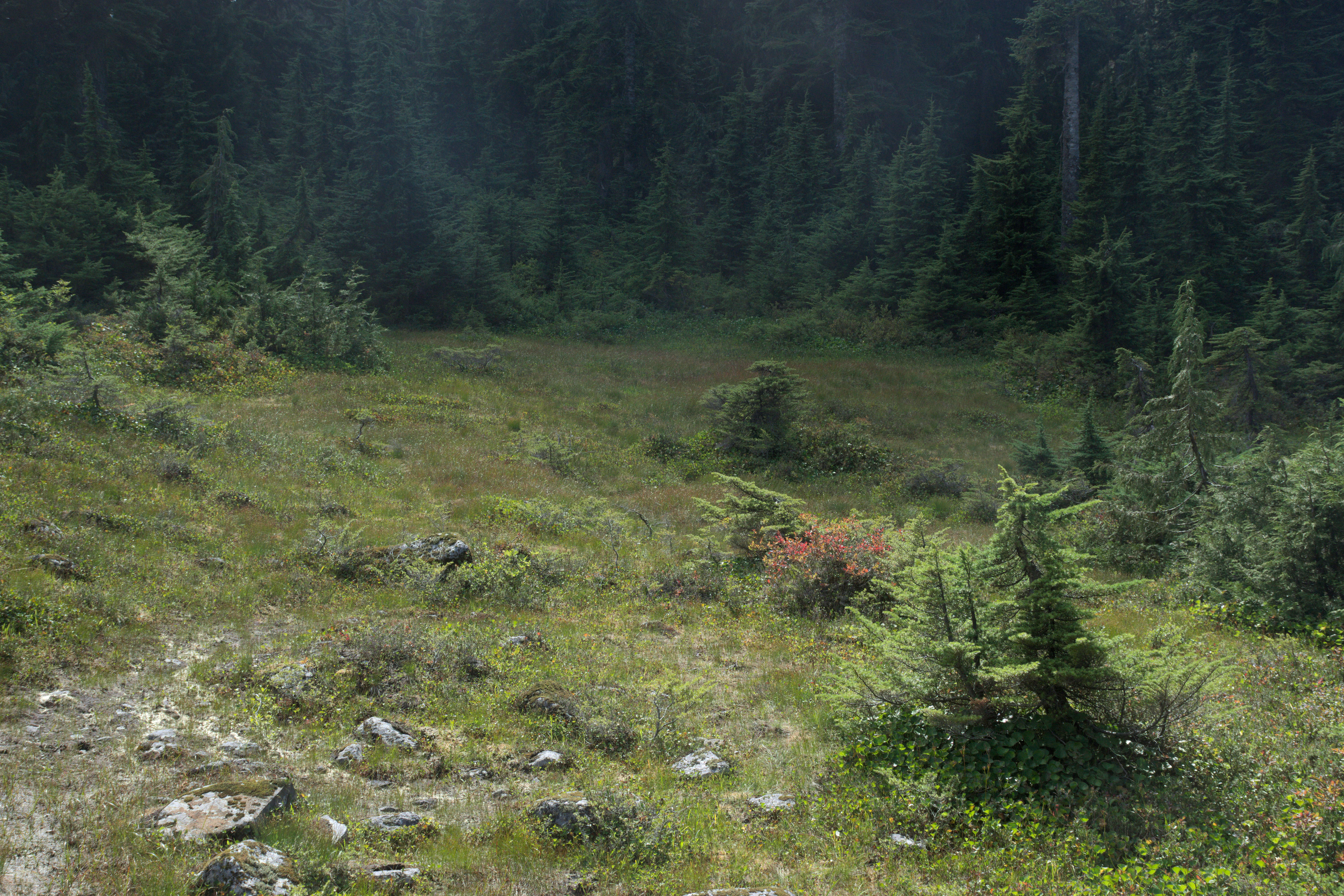
A green mountain meadow clearing surrounded by a dense conifer forest.
A forest clearing near Dennett Lake in Pinecone Burke Provincial Park.

Pinecone Burke Provincial Park history and protected-area timeline

The land that is now Pinecone Burke Provincial Park has been part of the territories of the Katzie, Kwikwetlem, and Stó:lō peoples for roughly ten thousand years. The Katzie in particular have long used the area for hunting and gathering, and today the nation continues to advocate for traditional stewardship principles within the park.

European-era activity in the area was largely extractive. In the 1920s, the Canadian Robert Dollar Company of Dollarton logged the lower slopes of Burke Mountain using a steam railway that ran in from Port Moody and crossed the Coquitlam River on a trestle. Early residents even referred to the summit as Dollar Mountain in reflection of that activity. After the rail-era population declined, bush logging and gravel mining continued for decades, leaving behind old steam donkey equipment and forgotten mine tunnels as scattered reminders of the area's industrial past.

During the late 1980s and early 1990s, logging companies proposed increasing their harvest within what would become the park. In response, citizen groups such as Friends of Burke Mountain and Burke Mountain Naturalists formed to oppose further extraction and to push for formal protection. With growing public support and advocacy from organizations like the Western Canada Wilderness Committee, the provincial government designated the park in 1995. A subsequent memorandum of understanding between BC Parks and the Katzie First Nation, with a joint management plan completed in late 2014, set the stage for more collaborative management in the years since.

Pinecone Burke Provincial Park landscape and geographic character

Pinecone Burke is shaped by the dramatic relief of the southern Coast Mountains. The highest point in the park is Pinecone Peak, which rises above 2,000 meters, followed by Meslilloet Mountain nearby. These summits are flanked by remnant ice fields, exposed ridges, and alpine basins where meadows open up during the short summer season.

Away from the high country, the park drops through forests and valleys toward the eastern water systems. The headwaters around Pitt Lake, Pitt River, and Widgeon Valley form a long, rugged eastern flank that is difficult to access by road. Lower slopes feature thick coniferous cover and a scattering of small lakes, including Widgeon Lake, which is reached by a chain of canoe routes and hiking trails rather than by vehicle.

Towards its southern boundary, the landscape softens into Burke Mountain, whose slopes are crossed by a network of old logging roads and trails. Here, the terrain shows the marks of historical logging and mining but has largely returned to a forested, mountainous character that visually and ecologically connects the park with the broader Coast Mountain landscape.

Pinecone Burke Provincial Park ecosystems, habitats, and plant life

Pinecone Burke Provincial Park protects an unusually wide ecological gradient for a park so close to a major urban region. Lower elevations fall within a classic coastal rainforest environment, with tall conifers forming a continuous canopy and understory plants like western sword fern, vine maple, and swamp currant filling in the shaded spaces. Bog Labrador tea, bearberry, and licorice fern thrive in the wetter areas near the Widgeon Valley wetlands, where nationally important peatland habitats support moisture-loving plant communities.

Above the coastal forest, the park transitions into montane and subalpine zones, with stunted tree growth, alpine meadows, and patches of lingering snow and ice even in late summer. Fungi such as hair ice forms, common bonnets, and turkey-tail grow throughout the forested portions, while the mosaic of wetland, forest, river, and alpine environments supports a broad inventory of flora documented by both researchers and community observers.

The combination of cold, oxygen-rich streams, old-growth shaded habitat, lakes, and alpine terrain gives the park a layered ecological identity that is rare in the lower mainland context. This mosaic structure is the foundation that supports its wildlife diversity as well as its conservation value within the regional park network.

Pinecone Burke Provincial Park wildlife and species highlights

The park's mix of habitats supports a substantial range of wildlife. Among the larger mammals, black-tailed deer, mountain goats, bobcats, black bears, and grizzly bears have all been recorded within its boundaries. The presence of both bear species highlights the relatively intact nature of the landscape, even with the park's proximity to Coquitlam and other urban centers.

The waters around Pitt Lake, Pitt River, and the connected streams are important for fish, including Pacific salmon, cutthroat trout, steelhead, and the migratory Dolly Varden char. Amphibians also play a visible role in the ecosystem, with five species documented in the park, including the tailed frog, which is associated with cool, clean forested streams.

Birdlife is similarly varied. BC wildlife inventories have recorded dozens of bird species, among them sensitive or vulnerable species such as the great blue heron, Vaux's swift, and Hutton's vireo. Other species of conservation concern tracked in the park include the shrew mole and the Pacific jumping mouse, adding to the park's role as a refuge for species that are under pressure elsewhere in the region.

Pinecone Burke Provincial Park conservation status and protection priorities

Pinecone Burke Provincial Park holds important conservation value because it preserves a large block of relatively unmodified Coast Mountain wilderness near the heart of Metro Vancouver. Its 38,000 hectares include stands of old-growth coniferous forest, alpine lakes, remnant ice fields, and wetland systems that together sustain a wide variety of species. The park is one of the anchor areas of the Lower Mainland Nature Legacy, a group of southwestern British Columbia parks recognized for their ecological significance.

The park also has special conservation importance for several sensitive and vulnerable species. The documented presence of great blue heron, tailed frog, shrew mole, Vaux's swift, Hutton's vireo, and Pacific jumping mouse gives it a direct role in maintaining populations that are under pressure in surrounding landscapes.

Management responsibility falls to BC Parks, which has been working alongside the City of Coquitlam and the Katzie First Nation on a collaborative management plan. The plan emphasizes expanding nature-based recreation in a way that protects ecosystems, supports the Katzie First Nation's stewardship principles, and limits ecological damage while strengthening the park's role as a regional conservation area.

Pinecone Burke Provincial Park cultural meaning and human context

The park lies within the territories of three First Nations: the Katzie, the Kwikwetlem, and the Stó:lō. These connections stretch back many thousands of years, and the Katzie in particular historically used the park area for hunting and gathering. The Katzie First Nation has continued to assert its stewardship relationship with the land, working to ensure that the area is managed according to its traditional principles.

A formal memorandum of understanding between BC Parks and the Katzie First Nation, followed by a joint management plan finalized in late 2014, embedded Indigenous collaboration into the park's management framework. The park is also touched by more recent histories of logging, mining, and settler recreation, including the steam-era logging operations of the Robert Dollar Company and the early mountaineering interest in features like the Five Fingers area north of Widgeon Lake.

Top sights and standout views in Pinecone Burke Provincial Park

Pinecone Burke Provincial Park stands out for combining vast, mostly unserviced wilderness with surprisingly varied access points, including canoe-in routes, old logging roads, and foot trails. Its 38,000 hectares protect old-growth coniferous forest, subalpine and alpine terrain, and remarkable freshwater systems linked to Pitt Lake and Widgeon Valley.

The park's wildlife profile is another key highlight, with both grizzly and black bears present alongside mountain goats, deer, abundant birdlife, and salmon-bearing waters. At the same time, its collaborative relationship with the Katzie First Nation and its inclusion in the Lower Mainland Nature Legacy help it function as both an ecological refuge and a site of ongoing cultural stewardship in one of Canada's most populated regions.

Best time to visit Pinecone Burke Provincial Park

Summer is the most suitable time for most visitors, when trails on Burke Mountain are accessible, canoe routes into the Widgeon Valley and Pitt Lake are open, and alpine conditions are relatively stable for backcountry hiking and camping. The longer daylight and milder weather make it easier to reach remote areas like Widgeon Lake and to explore the high country around Pinecone Peak and Meslilloet Mountain.

Winter brings a quieter but distinct experience, with the park's terrain drawing backcountry skiers and snowshoers, especially in areas accessible from the Coquitlam side. Visitors in winter should expect significant snow, limited services, and true backcountry conditions. The transitional shoulder seasons can be appealing for fewer crowds, but snow lingering at higher elevations can complicate access to the more alpine parts of the park.
Monthly climate preview

Long term average temperature and monthly precipitation recorded at representative park coordinates

Pinecone Burke Provincial Park Climate Normals and Annual Temperature Patterns

Representative coordinate data reveals annual temperature ranges and monthly precipitation variations across Pinecone Burke Provincial Park. Examining the complete twelve month profile provides deeper insight into measured long term climate norms.
Annual mean5 °C
-4 °C15 °C
Jan-3°
Feb-3°
Mar
Apr
May
Jun12°
Jul15°
Aug15°
Sep12°
Oct
Nov
Dec-4°
Warmest month
July

15.4 °C

Coolest month
December

-3.7 °C

Wettest month
November

11.9 mm/day

Driest month
July

2.2 mm/day

Park location guide

Geography guide, regional context, and park location map for Pinecone Burke Provincial Park

Pinecone Burke Provincial Park park geography, regions, and map view in Canada

Understand where Pinecone Burke Provincial Park sits in Canada through a broader geographic reading of the surrounding landscape, nearby location context, and its mapped position within the national park landscape.

How Pinecone Burke Provincial Park fits into Canada

Canada is a federal parliamentary constitutional monarchy spanning North America from the Atlantic to the Pacific and Arctic Oceans. With a population of over 41 million, it is officially bilingual in English and French at the federal level. The country gained independence from the United Kingdom through a gradual process culminating in 1982.

Wider geography shaping Pinecone Burke Provincial Park in Canada

Canada occupies the northern portion of North America, sharing its longest international border with the United States. The country extends from the Atlantic Ocean to the Pacific Ocean and northward into the Arctic Ocean, giving it the longest coastline of any nation.

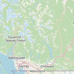
Map view of Pinecone Burke Provincial Park

Use this park location map to pinpoint Pinecone Burke Provincial Park in Canada, understand its exact geographic position, and read its mapped placement within the surrounding landscape more clearly.

Pigeon | © OpenStreetMap contributors

Location context for Pinecone Burke Provincial Park

British Columbia
Recorded earthquake history

Explore Historical Earthquake Records for Pinecone Burke Provincial Park

Examine the historical data of seismic events associated with Pinecone Burke Provincial Park through our structured catalogue. Review individual event metrics, including magnitude and proximity, to better understand the seismic history within this rugged region of the British Columbia Coast Mountains.

Pinecone Burke Provincial Park Earthquake History

Catalogued events

12 events

Strongest magnitude

Magnitude 4.8

Most recent event

Feb 21, 2025

This history includes earthquakes recorded inside the park or within 50 km of its borders

Visualizing alpine terrain, old-growth forests, and rugged park scenery

Pinecone Burke Provincial Park Photos and Coast Mountain Landscapes

Examine detailed park imagery to observe the rugged Coast Mountain terrain, dense coniferous forests, and high alpine ridges defining Pinecone Burke Provincial Park. Visual records reveal the dramatic environmental transitions across remote watersheds and protected backcountry habitats.

A green mountain meadow clearing surrounded by a dense conifer forest.

Park atlas

Compare adjacent Coast Mountain protected areas and regional conservation corridors

Explore Other Parks Near Pinecone Burke Provincial Park and Surrounding Wilderness

Discover related protected areas that share the rugged terrain and dense forests surrounding Pinecone Burke Provincial Park. Comparing these neighboring wilderness habitats reveals the broader geographic spread of conservation lands across southwestern British Columbia.
A horizontal watercolor painting depicting a light, airy landscape with distant snow-capped mountains, rolling green hills, and coniferous forest edges.
State or regional parkBritish Columbia
Park boundaries overlap#1 closest

North

Garibaldi Provincial Park: An Atlas of Volcanic and Glacial Terrain in British Columbia

Protected wilderness in the Garibaldi Volcanic Belt

Garibaldi Provincial Park preserves a massive expanse of mountainous wilderness, defined by iconic landmarks such as The Black Tusk and Garibaldi Lake. The park represents a crucial study in vertical zonation, transitioning from temperate coastal forests to vast alpine meadows, glaciers, and jagged volcanic summits. Analyze the geological history and mapped protected boundaries that shape this significant British Columbia conservation area.

Area
1,950 km²
Established
1920
IUCN
II
Visitors
136K annual
A watercolor painting showing a soft-focus landscape with rolling green hills, distant mountains, and a central river or water feature.
State or regional parkBritish Columbia
1.4 km away#2 closest

East

Golden Ears Provincial Park: Geographic Atlas and Protected Landscape Overview

Coast Mountains terrain and protected wilderness boundaries

Golden Ears Provincial Park is a major protected wilderness in British Columbia, defined by the twin peaks of the Golden Ears massif and vast glacial lake systems like Alouette and Pitt. This site serves as a vital ecological corridor where lowland forests meet high subalpine ridges. Explore the park through its mapped boundaries and diverse ecological zones within the Pacific Northwest mountain landscape.

Area
609 km²
Established
1967
IUCN
II
Visitors
956.5K annual
A soft watercolor painting of a landscape featuring a lake, low rolling hills in the background, and grassy vegetation along the foreground shoreline under a warm, pale yellow sky.
State or regional parkFraser Valley Regional District
About 21 km away#3 closest

Southeast

Rolley Lake Provincial Park: An Atlas of Protected Landscapes and Regional Geography

Lakeshore forest terrain and protected park geography

Delve into the geographic identity of Rolley Lake Provincial Park, a state-protected landscape in the Fraser Valley Regional District. This documentation traces the park's internal map, including its central freshwater lake, loop trail connectivity, and surrounding second-growth forest topography, providing essential context for understanding this localized wilderness zone.

Area
1.15 km²
Established
1961
IUCN
II
A horizontal watercolor illustration depicting soft green rolling hills and distant purple mountains above a flat shoreline with patches of marsh grasses.
State or regional parkBritish Columbia
24 km away#4 closest

West

Porteau Cove Provincial Park: Mapping Coastal Protected Landscapes in British Columbia

Geography of Howe Sound shorelines and marine habitats

Porteau Cove Provincial Park offers a unique geographic vantage point at the meeting of granite-sloped mountains and the Pacific waters of Howe Sound. This park detail covers the coastal landscape, including protected intertidal zones, artificial reef structures, and the surrounding terrain that characterizes this segment of the British Columbia coastline.

Area
0.5 km²
Established
1981
IUCN
II
Visitors
611.8K annual
A watercolor painting showing a soft, hazy landscape of a lake with green forest along the shore and distant purple mountains under a pale sky.
State or regional parkBritish Columbia
About 27 km away#5 closest

Southeast

Davis Lake Provincial Park: Protected Forest and Lake Geography in British Columbia

Regional protected area with old-growth forest and waterfalls

Davis Lake Provincial Park represents a significant protected area in the Fraser Valley, characterized by its undisturbed Western Hemlock forest and the scenic descent of Murdo Creek into McDonald Falls. The park provides an essential look at the regional geography of southwestern British Columbia, balancing dense coniferous canopy with accessible lake-based terrain in a quiet, natural setting.

Area
0.75 km²
Established
1963
IUCN
II
Relief
Upland
A horizontal watercolor painting depicting a soft-toned landscape with green trees, rolling hills, a calm body of water, and distant pale mountains.
State or regional parkBritish Columbia
33 km away#6 closest

South

Peace Arch Park: Mapped Geography and Protected Landscapes of the Canada and US Border

Coastal binational protected area in British Columbia

Peace Arch Park is a notable protected landscape positioned directly on the international border. This site acts as a continuous green space between Canada and the United States, offering an unusual study of territorial boundaries and coastal geography. Spanning manicured terrain and historic monument grounds, the park provides an essential vantage point for understanding land-based connectivity in the Pacific Northwest region.

Area
0.17 km²
Established
1939
Visitors
500K annual
Access
Easy access
State or regional parkBritish Columbia
About 46 km away#7 closest

West

Plumper Cove Marine Provincial Park: Protected Marine Geography and Coastal Landscapes in Howe Sound

Exploring the forested trails and sheltered marine anchorages of Keats Island.

Plumper Cove Marine Provincial Park represents a vital protected landscape on the coast of British Columbia, defined by its blend of upland coastal forest and intimate, boat-accessed marine anchorages. This geography-focused profile traces the park's terrain, including its rocky shorelines, forest-covered bluffs, and the trail networks that connect visitors to the broader Howe Sound maritime environment.

Area
0.66 km²
Established
1960
IUCN
II
Relief
Upland
State or regional parkBritish Columbia
About 48 km away#8 closest

Southeast

Kilby Provincial Park: Protected Riverfront Geography and Historic Sites in BC

A unique riparian landscape along the Harrison River

Kilby Provincial Park offers an intimate look at the flood plain geography of the Harrison River. The site features an elevated, boardwalk-linked heritage environment integrated with sandy riverfronts and seasonal wildlife corridors. This protected area stands out for its combination of historical pioneer preservation and river-based ecosystem monitoring within the Upper Fraser Valley region of British Columbia.

Area
0.03 km²
Established
1973
IUCN
II
Relief
Lowland

Common questions about visiting, size, designation, and location context for Pinecone Burke Provincial Park

Pinecone Burke Provincial Park FAQs for park facts, access, geography, and protected area context

Find quick answers about Pinecone Burke Provincial Park, including protected-area facts, park geography, trail and visitor context, and how the park fits into its surrounding country and regional landscape.
MoriAtlas Explorer

Continue Your Protected Areas Search Across the Global Atlas

Deepen your exploration by continuing the structured search for national parks and protected areas worldwide. Utilize the comprehensive filtering capabilities to compare different conservation landscapes and refine your understanding of global park geography. Discover more about the distribution and characteristics of protected natural areas.

Global natural geography