
Mori Atlas logo
Protected landscapePoint Reyes National Seashore

Mapping the geological drama of the San Andreas Fault and diverse coastal wilderness areas

Point Reyes National Seashore: A Defining Protected Landscape on the California Coastline

Point Reyes National Seashore preserves a distinct peninsula in Marin County, serving as a vital protected landscape where the San Andreas Fault shapes the surrounding terrain. This coastal region spans rugged cliffs, secluded estuaries, and forested ridges, supporting rare marine megafauna and diverse plant communities. By tracing the park boundaries, users can analyze the complex interaction between the Salinian Block geology and the Pacific marine environment.

coastal cliffstule elkelephant sealsbirdwatchingmarine protected areasSan Andreas Fault
A digital illustration of a lighthouse on a cliff overlooking the ocean with a small boat in the water, rolling green hills, and a sunset in the background.

Point Reyes National Seashore

Protected landscape

Park overview

Structured park overview, official facts, and landscape profile for Point Reyes National Seashore

Point Reyes National Seashore park facts, protected area profile, and essential visitor context

Review the core facts for Point Reyes National Seashore, including designation, size, terrain, visitor scale, habitats, and operating context in one park-focused overview.

About Point Reyes National Seashore

Point Reyes National Seashore is a coastal preserve on the Point Reyes Peninsula in Marin County, California, west of the San Francisco Bay Area. It protects a long stretch of Pacific shoreline, dramatic headlands, estuaries, and forested ridges, while also preserving a working landscape of historic ranches. The seashore's combination of geological drama, biological richness, and cultural depth has made it one of the most studied and visited protected seascapes on the U.S. West Coast.

The peninsula is structurally distinct from the surrounding mainland, separated by the San Andreas Fault and rising as Inverness Ridge across the Salinian Block. This tectonic boundary explains the scattered inlets, including Tomales Bay, and supports a mosaic of habitats ranging from coastal scrub and Douglas-fir forest to freshwater and brackish marshes and ocean-facing beaches. Elevations climb to Mount Wittenberg, the highest point in the park, while much of the coast remains low, wave-driven, and fringed with cliffs.

The seashore carries a layered human story as well. Coast Miwok peoples lived along these shores for thousands of years, followed by Spanish exploration including a 1579 visit associated with Sir Francis Drake, and later by ranching settlements that shaped much of the nineteenth- and twentieth-century landscape. The peninsula was protected as a national seashore in 1962, largely to shield it from development pressure, and about half of the area is now designated wilderness within the Phillip Burton Wilderness. Marine protected areas adjoining the shoreline extend the conservation footprint into adjacent waters.

Point Reyes functions as both a wilderness sanctuary and a living cultural landscape. Historic ranches still operate under long-standing arrangements, the recreated Coast Miwok village of Kule Loklo offers an interpretive glimpse into pre-contact life, and the historic lifeboat station and lighthouse remain tangible links to the area's maritime past. For visitors, the seashore offers one of the most complete portraits of California's coastal environment within a single protected boundary.

Quick facts and research context for Point Reyes National Seashore

Point Reyes National Seashore occupies a roughly triangular peninsula in western Marin County, California, bounded by the Pacific Ocean, Tomales Bay, and Bolinas Lagoon. The peninsula sits on the Salinian Block, geologically offset from the mainland by the San Andreas Fault, which forms Tomales Bay along its northwestern flank.

About half of the seashore is designated as the Phillip Burton Wilderness, one of only three designated wilderness areas on the California coast. The protected landscape is home to reintroduced tule elk, northern elephant seal breeding colonies, more than 400 bird species, and an unusually high number of rare, threatened, and endemic plants. Point Reyes is part of the Golden Gate Biosphere Network, recognized in the World Network of Biosphere Reserves.

Protection and recognition

Documented conservation scope, management frameworks, and official protected status

Point Reyes National Seashore Protection Status and International Recognition Data

Point Reyes National Seashore brings together documented protection status, management scope, and verified designation records. Structured records outline international recognition sources and legal frameworks governing the protected area.

Protection details

Protection scope
Mixed
Transboundary protection
No
Park context

Deeper park guide and search-rich context for Point Reyes National Seashore

Point Reyes National Seashore history, landscape, wildlife, and travel context

Explore Point Reyes National Seashore through its history, landscape character, ecosystems, wildlife, conservation priorities, cultural context, and seasonal travel timing in a structured park guide built for atlas discovery and search intent.

Why Point Reyes National Seashore stands out

Point Reyes is best known for the dramatic geological setting on the San Andreas Fault, and for being the only U.S. national park south of Alaska with both breeding elk and breeding elephant seals on the same landscape. The seashore is closely identified with the wild Pacific headlands, the historic Point Reyes Lighthouse, the Drakes Bay shoreline, and the Tomales Point tule elk reserve. Equally central to the park's identity is its ecological richness. The convergence of marine influences here produces habitats ranging from coastal strand and submarine estuaries to Douglas-fir forest and bishop pine stands. This mix supports an exceptional abundance of seabirds, marine mammals, raptors, and rare coastal flora, making the seashore a focal point for West Coast conservation and wildlife observation.
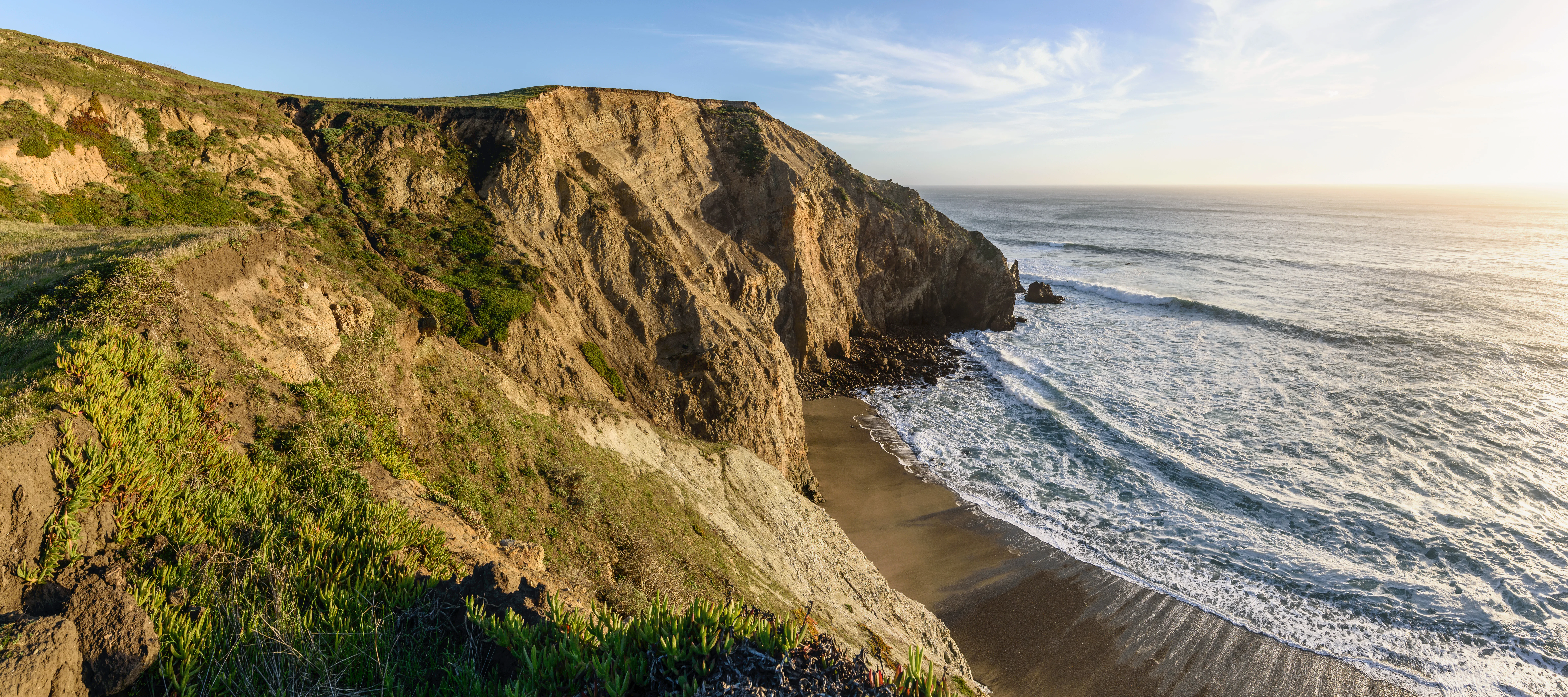
Panoramic view of rugged coastal cliffs descending into the Pacific Ocean, with crashing waves hitting a sandy beach under bright sunlight.
View of the coastal cliffs and beach along the Chimney Rock Trail at Point Reyes National Seashore.

Point Reyes National Seashore history and protected-area timeline

The area that is now Point Reyes National Seashore was occupied by Coast Miwok communities for thousands of years. Villages of seventy-five to several hundred people sustained an economy built on hunting, gathering, and fishing, using the shoreline as a year-round source of crab, clams, oysters, and game such as deer, quail, and rabbits.

European exploration began with Sir Francis Drake and the crew of the Golden Hind, who are believed to have camped along the coast in 1579 during their circumnavigation of the globe. Spanish Manila galleons later passed these waters, and in 1595 the Portuguese captain Sebastião Rodrigues Soromenho was shipwrecked in Drakes Bay. The headlands received their enduring name, "la Punta de los Reyes," in 1603 from Captain Sebastián Vizcaíno, who named them for Three Kings' Day in honor of Elizabeth I.

The peninsula subsequently became part of Rancho Punta de los Reyes and Rancho Punta de los Reyes Sobrante under Mexican land grants. In the nineteenth century the Shafter brothers acquired much of the area, and their heirs held the land into the early 1900s. Dairy and cattle ranching became the dominant land use through this period, reshaping vegetation patterns after Coast Miwok fire-management practices gave way to European settlement.

Protection came in 1962, when U.S. Congressman Clem Miller of Marin County wrote and introduced legislation establishing Point Reyes National Seashore, in part to prevent proposed residential development above Drakes Bay. Congress designated wilderness within the seashore in 1976 and later renamed it the Phillip Burton Wilderness in honor of Congressman Phillip Burton, who championed the California Wilderness Act of 1984.

Point Reyes National Seashore landscape and geographic character

The Point Reyes Peninsula is one of the most geologically distinctive pieces of coastline in California. A clear line of the San Andreas Fault traces along the base of the peninsula; the northern segment is submerged to form Tomales Bay, while the southern segment follows Olema Creek. East of the fault lies the Franciscan Complex with its own soils and flora, while the peninsula itself rides on the Salinian Block and rises as Inverness Ridge toward Mount Wittenberg, the park's highest point.

Physically, the landscape has many faces. The seaward side is shaped by steep cliffs, sea stacks such as Chimney Rock, sweeping sandy beaches like North Beach, South Beach, and Wildcat Beach, and pocket estuaries including Drakes Estero and Estero de Limantour. Inland, the terrain shifts to forested ridges of Douglas-fir, bishop pine groves on northern slopes, coastal scrub, and patches of northern coastal prairie near Abbotts Lagoon and Tomales Point.

Water defines much of the scenery. Named creeks feed a network of bays and lagoons, including Bolinas Lagoon, Drakes Estero, and Estero de Limantour, while features such as Alamere Falls, one of only two coastside waterfalls in California, add rare vertical drama to the coastal profile. Frequent Pacific fog, which the Point Reyes Lighthouse was specifically sited low to escape, softens and reshapes the visual mood across the peninsula.
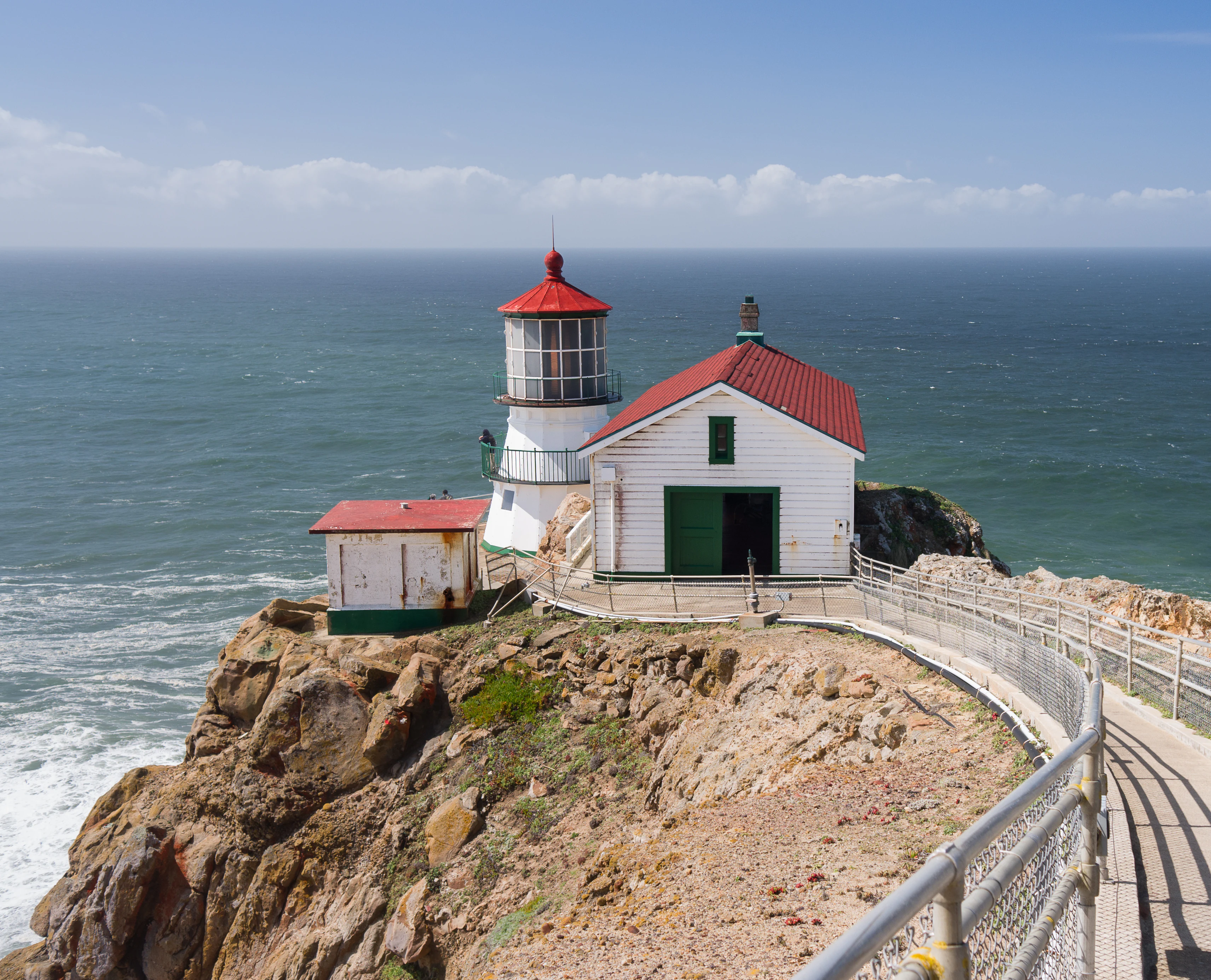
Point Reyes Lighthouse with a white exterior and red roof, situated on a rocky cliffside next to the ocean, with a metal railing along a walkway in the foreground.
The historic Point Reyes Lighthouse perched on a rugged cliff overlooking the Pacific Ocean.

Point Reyes National Seashore ecosystems, habitats, and plant life

Ecologically, Point Reyes sits at the meeting point of two marine provinces, the southern Oregonian and the northern Californian, which gives it a disproportionately rich flora and fauna. The seashore hosts a substantial share of California's documented plant species, including more than fifty rare, threatened, or endemic taxa, among them the endangered yellow larkspur, the endemic Sonoma shortawn foxtail, and the Sonoma spineflower, known here from its only known population.

The habitats protected within the seashore are unusually varied for a coastal park. Coastline stretches include subtidal seagrasses, tidal mudflats, and salt, brackish, and freshwater marshes adjacent to Drakes Estero and Abbotts Lagoon. Inland terraces support a coastal Douglas-fir forest with coast live oak, tanoak, and California bay; some unlogged stands contain trees over three centuries old and several feet in diameter. Bishop pine forests, cypress stands, coastal scrub dominated by coyote bush, and small pockets of northern coastal prairie and rangeland complete the terrestrial palette.

This habitat matrix is what allows so many species to flourish here, from shorebirds feeding on mudflats to forest interior raptors and the chaparral plants clinging to inland slopes. Beyond the shoreline, adjoining marine protected areas extend ecological protection into subtidal waters, helping safeguard ocean wildlife and seafloor ecosystems associated with the seashore.
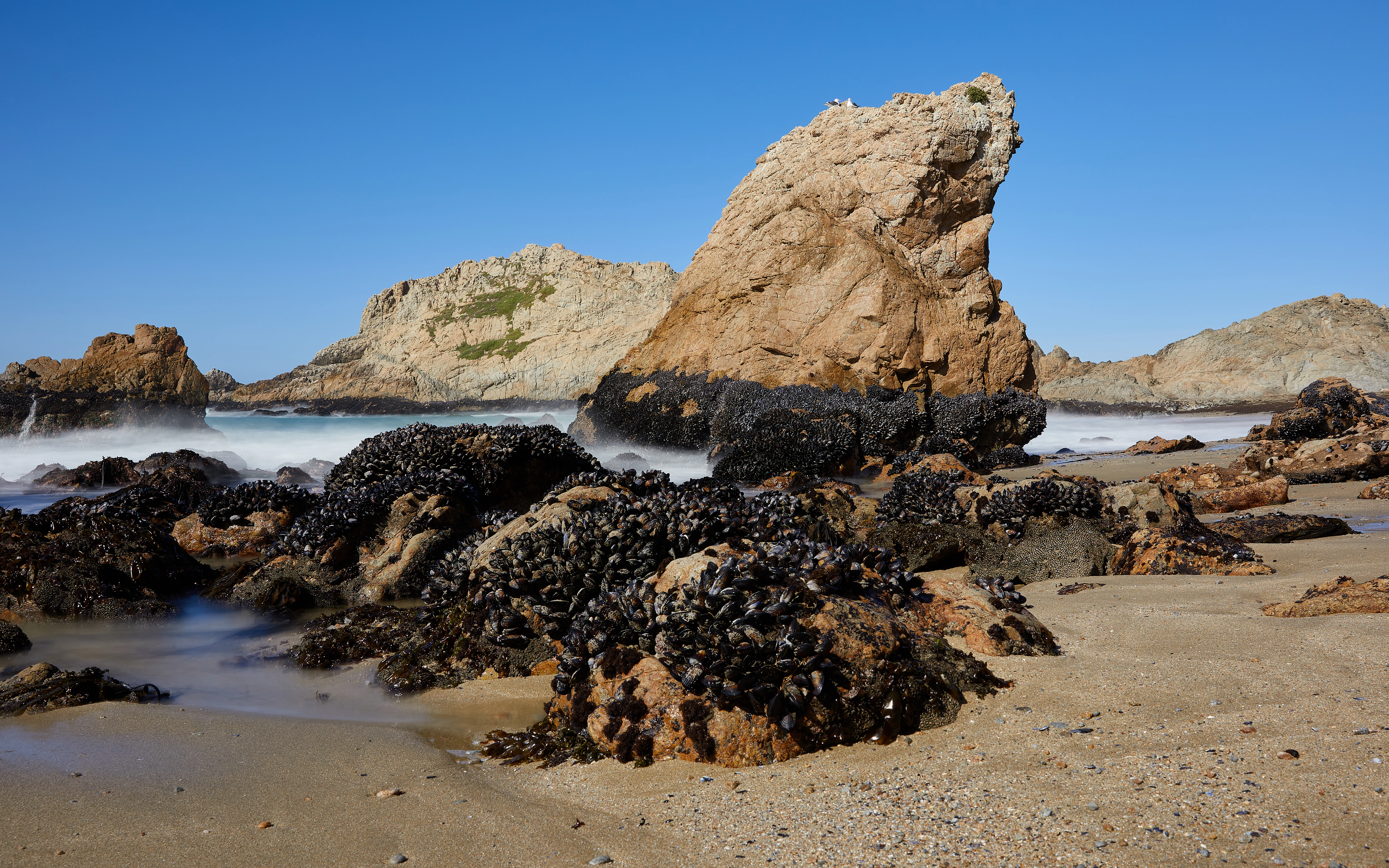
A wide angle view of a sandy beach featuring large rocky outcrops covered in dark mussels, with soft waves lapping against the base and a clear blue sky above.
Coastal rock formations covered in mussels at McClures Beach in Point Reyes National Seashore.

Point Reyes National Seashore wildlife and species highlights

Point Reyes is recognized for hosting an exceptional abundance of birds, recording well over four hundred species, a figure that reflects the peninsula's position where two marine provinces overlap. Raptors and shorebirds are especially prominent, and the western snowy plover, which nests here, is federally listed as threatened under the Endangered Species Act. The Point Reyes Lighthouse has become a traditional vantage for observing gray whale migration southbound in mid-January and northbound in mid-March.

The seashore's mammal fauna is equally distinctive. Northern elephant seals established a breeding colony at Point Reyes in 1981, which, combined with the presence of tule elk, makes the seashore the only U.S. national park south of Alaska with both breeding ungulates and breeding pinnipeds. Harbor seals and other marine mammals use the esteros and offshore waters, while land mammals in the park total close to forty species.

The tule elk story is one of the seashore's most closely watched conservation efforts. After being extirpated from the peninsula in the nineteenth century, tule elk were reintroduced to Tomales Point in 1978 from the San Luis National Wildlife Refuge. The herd grew substantially but was hard hit by the 2012 to 2015 drought, and the National Park Service ultimately breached the Tomales Point enclosure in late 2024 to allow the herd to roam more freely. Together with adjacent marine protected areas, these terrestrial populations place Point Reyes among the most wildlife-significant coastal preserves in the lower forty-eight states.
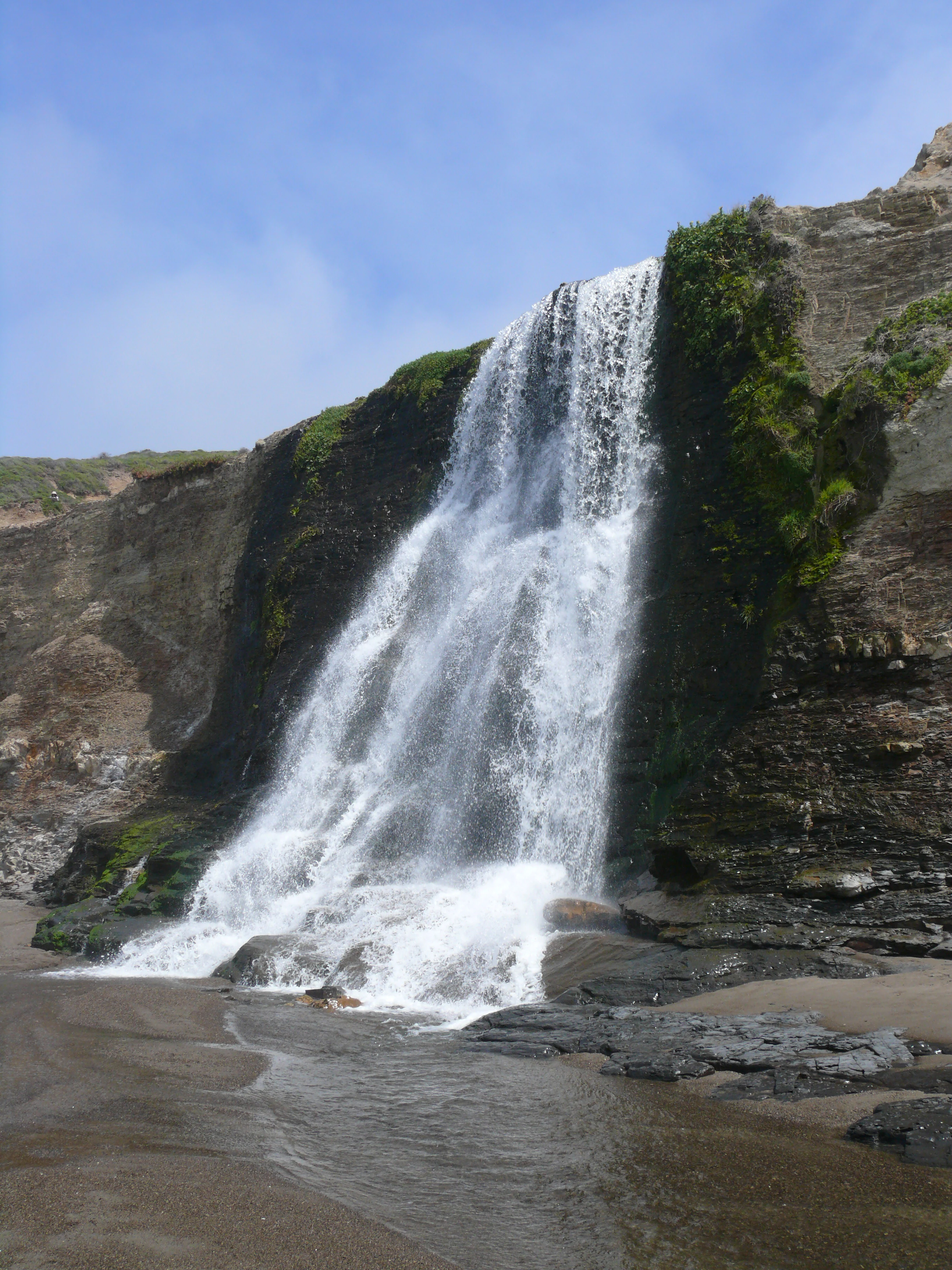
A waterfall cascading over rugged coastal cliffs directly onto a dark sand beach.
Alamere Falls flowing over coastal cliffs onto the beach at Point Reyes National Seashore.

Point Reyes National Seashore conservation status and protection priorities

Point Reyes National Seashore carries significant conservation weight on multiple fronts. It is the only U.S. national park south of Alaska where breeding tule elk and breeding northern elephant seals occur together, an unusual combination of terrestrial and marine megafauna within a single protected boundary. About half of the seashore, including the Drakes Estero area, is designated as the Phillip Burton Wilderness, one of only three designated wilderness areas along the California coast.

The seashore also lies at the heart of broader regional conservation networks. It is part of the Golden Gate Biosphere Network, recognized within UNESCO's World Network of Biosphere Reserves, and adjacent marine reserves, including the Point Reyes State Marine Reserve, the Estero de Limantour State Marine Reserve and Drakes Estero State Marine Conservation Area, and the Duxbury Reef State Marine Conservation Area, extend protection into surrounding waters. The seashore harbors more than fifty rare, threatened, or endangered plant species and is a key site for recovery efforts involving the yellow larkspur, the Sonoma shortawn foxtail, the Sonoma spineflower, and the western snowy plover.

Conservation here is not only about preservation but also about management choices. Long-running debates over the Drakes Bay oyster company, the fate of the Tomales Point elk fence, and water-quality impacts from working ranches have shaped modern park policy. The recent decision to breach the elk fence and the agreement brokered by The Nature Conservancy to consolidate ranching operations both reflect an evolving approach that aims to reduce ecological conflict while honoring the area's working landscape heritage.

Point Reyes National Seashore cultural meaning and human context

The cultural depth of Point Reyes begins with the Coast Miwok, whose villages once lined the peninsula's bays and whose management of the landscape through fire shaped the vegetation Europeans later encountered. The reconstructed Coast Miwok village of Kule Loklo, near the Bear Valley Visitor Center, keeps that heritage visible to visitors today and is a key interpretive site within the seashore.

European contact layered new narratives onto the landscape. The 1579 visit by Sir Francis Drake, the 1595 wreck of Sebastião Rodrigues Soromenho, and Vizcaíno's 1603 naming of the headlands established Point Reyes as a marker in the early cartography of the Pacific. Sites associated with these events are preserved within the Drakes Bay Historic and Archaeological District, which is a National Historic Landmark.

The dairy and cattle ranches that developed under Spanish, Mexican, and American ownership gave the peninsula its modern working landscape. Families such as the Felix family at Lairds Landing brought their own layered heritage of Filipino and Miwok ancestry, and ranch buildings there were later placed on the National Register of Historic Places. The Point Reyes Lifeboat Station, also a National Historic Landmark, preserves the area's maritime response history. Together, these strands of indigenous, exploratory, ranching, and maritime heritage shape a peninsula whose identity cannot be separated from its human story.
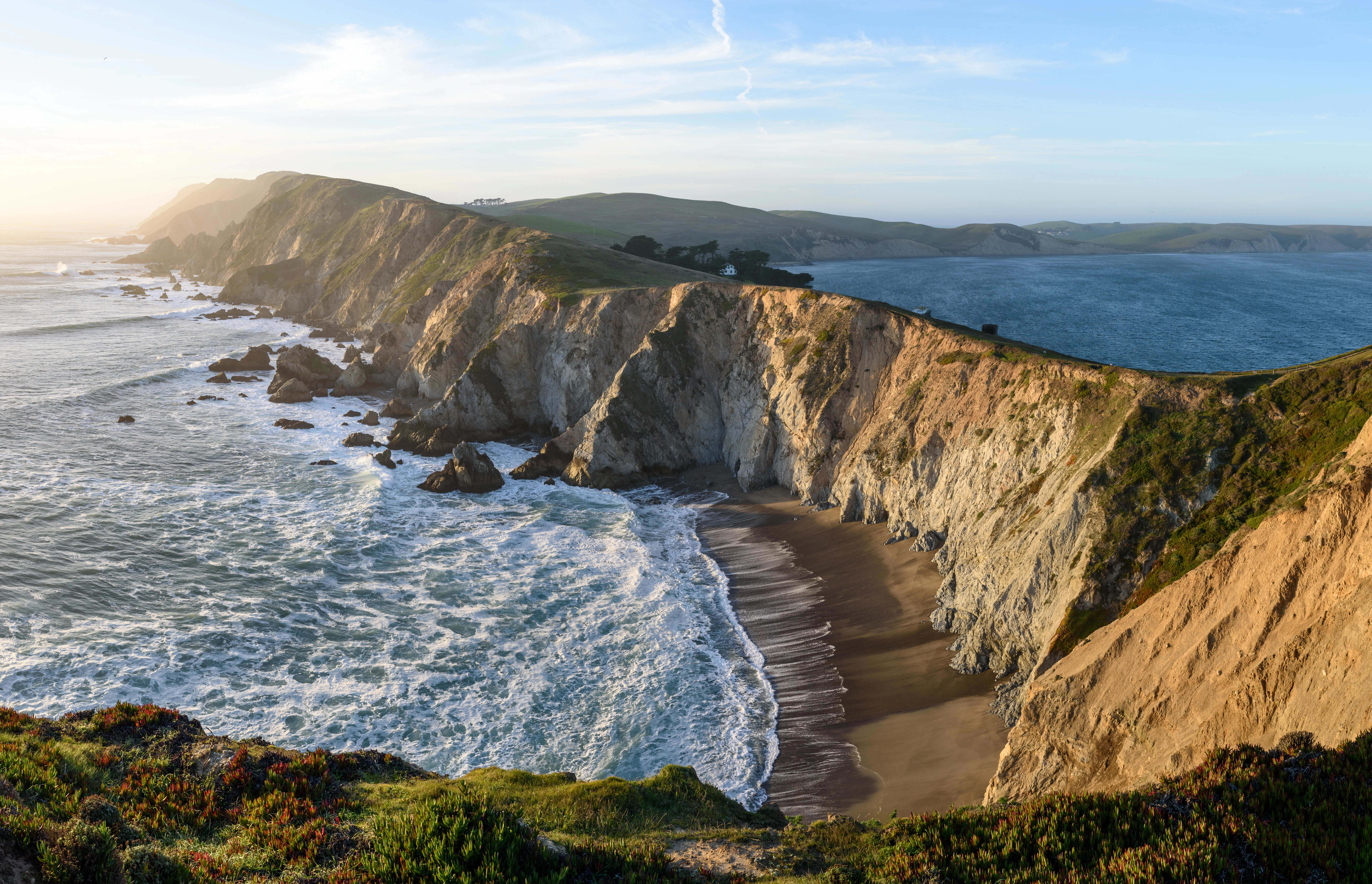
A wide panoramic shot of coastal cliffs meeting the Pacific Ocean with waves crashing against the sandy beach below under a clear sky.
A scenic view of the rugged headlands and coastal cliffs at Point Reyes National Seashore.

Top sights and standout views in Point Reyes National Seashore

Point Reyes is anchored by a small number of features that capture its identity at a glance: the San Andreas Fault forming Tomales Bay and separating the peninsula from the mainland; the rugged cliffs and headlands of the Pacific, including Chimney Rock and the Point Reyes Lighthouse; the estero and lagoon systems where Drakes Bay, Estero de Limantour, and Abbotts Lagoon shelter rich habitats; and the Tomales Point tule elk reserve, symbolizing the park's wildlife comeback story.

Just as important are the less carved but equally defining elements: the Douglas-fir forests along Inverness Ridge, the bishop pine stands of the central wilderness, and the wetlands that anchor the area's rare bird and plant communities. Whether measured by geological drama, ecological richness, or the layered history of Coast Miwok homelands and later mariners and ranchers, Point Reyes offers one of the most complete portraits of California's coast within a single protected landscape.
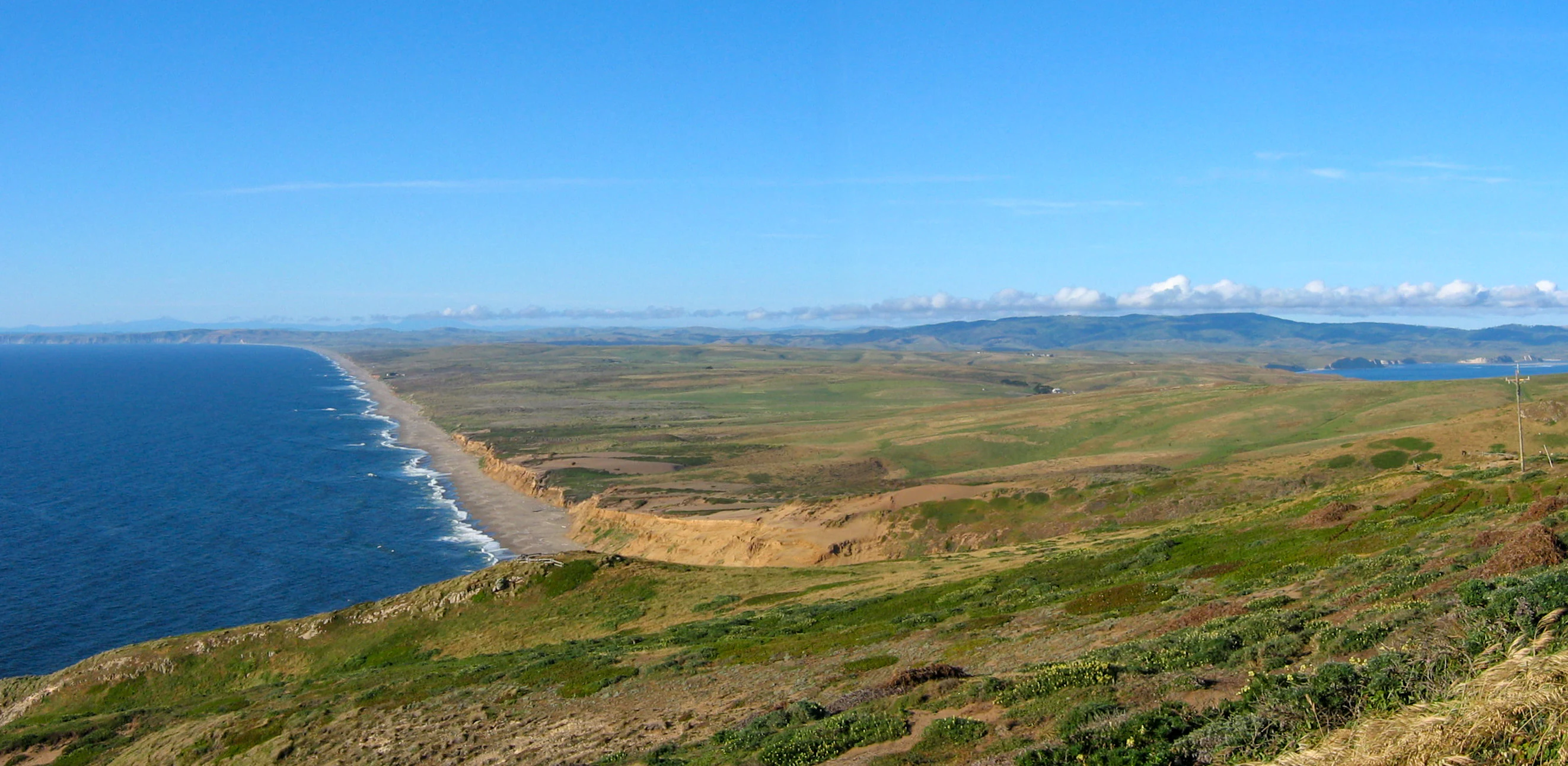
A high angle panoramic view of the Point Reyes coastline showing rolling grassy hills meeting steep cliffs above a sandy beach and the Pacific Ocean.
A panoramic view of the coastline at Point Reyes National Seashore.

Best time to visit Point Reyes National Seashore

Seasonality shapes Point Reyes in distinctive ways. Late winter through spring, roughly January into May, is the most biologically dynamic window, when gray whales pass the headlands on their migrations, elephant seal colonies are active on Drakes Bay, and wildflower displays such as those near Chimney Rock are at their peak. Rain arrives predominantly in the cooler months, leaving the landscape lush and the marshes full, while marine layer fog rolls in frequently during the warmer months and sits low across the coast.

Summer and early fall bring drier weather, calmer seas, and clearer skies inland, yet persistent coastal fog can blanket the headlands even when nearby inland valleys are warm and sunny. Backpacking is most comfortable in late spring and early fall when temperatures are moderate and the trails are not at their wettest. Wildlife viewing varies with the seasons, but the lighthouse area for whales, Drakes Beach for elephant seals, and Tomales Point for elk remain productive across much of the year for patient observers.

Monthly climate preview

Long-term temperature and precipitation patterns sampled from representative coastal coordinates

Point Reyes National Seashore Climate Normals and Monthly Weather Records

Point Reyes National Seashore exhibits a measured annual temperature range from 10.78 degrees Celsius to 15.45 degrees Celsius alongside distinct monthly precipitation variations across the sampled coordinate. Examining the complete twelve-month climatology profile provides deeper insight into long-term meteorological trends and seasonal baseline averages.
Annual mean13 °C
11 °C15 °C
Jan11°
Feb11°
Mar11°
Apr12°
May12°
Jun13°
Jul14°
Aug15°
Sep15°
Oct15°
Nov13°
Dec11°
Warmest month
September

15.5 °C

Coolest month
January

10.8 °C

Wettest month
December

4.6 mm/day

Driest month
July

0.1 mm/day

Park location guide

Geography guide, regional context, and park location map for Point Reyes National Seashore

Point Reyes National Seashore park geography, regions, and map view in United States of America

Understand where Point Reyes National Seashore sits in United States of America through a broader geographic reading of the surrounding landscape, nearby location context, and its mapped position within the national park landscape.

How Point Reyes National Seashore fits into United States of America

The United States of America is a federal presidential republic and one of the world's largest countries by area and population. It consists of 50 states across a vast territory spanning multiple time zones, with its capital in Washington, D.C. and largest city in New York City. The nation has a diverse economy, influential political system, and significant cultural and military presence globally.

Wider geography shaping Point Reyes National Seashore in United States of America

The United States occupies a vast territory in North America, bordered by Canada to the north and Mexico to the south. The 48 contiguous states stretch from the Atlantic to the Pacific Ocean, while Alaska occupies the northwestern region and Hawaii is an archipelago in the Pacific. The country encompasses diverse terrain including the Rocky Mountains, Appalachian Mountains, Great Plains, and extensive river systems.

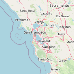
Map view of Point Reyes National Seashore

Use this park location map to pinpoint Point Reyes National Seashore in United States of America, understand its exact geographic position, and read its mapped placement within the surrounding landscape more clearly.

Pigeon | © OpenStreetMap contributors

Location context for Point Reyes National Seashore

CaliforniaMarin County
Recorded earthquake history

Examine the Historical Earthquake Catalogue for Point Reyes National Seashore

MoriAtlas maintains a precise historical catalogue of recorded seismic events associated with the Point Reyes National Seashore geography. Explore event records including date, magnitude, and depth to better understand the seismic history within this coastal region of Marin County.

Point Reyes National Seashore Earthquake History

Catalogued events

207 events

Strongest magnitude

Magnitude 6

Most recent event

Sep 3, 2026

This history includes earthquakes recorded inside the park or within 50 km of its borders

Visual reference for coastal terrain, foggy headlands, and protected habitats

Point Reyes National Seashore Photos: Pacific Scenery and Landscapes

Photographic collections reveal the rugged coastal terrain, dramatic sea cliffs, and diverse natural habitats spanning Point Reyes National Seashore. Visual documentation captures the unique ecological environment shaped by Pacific weather and active geological fault lines across the peninsula.

Panoramic view of rugged coastal cliffs descending into the Pacific Ocean, with crashing waves hitting a sandy beach under bright sunlight.

A close-up of a large male northern elephant seal with its mouth open on a sandy beach.

Point Reyes Lighthouse with a white exterior and red roof, situated on a rocky cliffside next to the ocean, with a metal railing along a walkway in the foreground.

A wide angle view of a sandy beach featuring large rocky outcrops covered in dark mussels, with soft waves lapping against the base and a clear blue sky above.

A waterfall cascading over rugged coastal cliffs directly onto a dark sand beach.

Coastal view from a grassy ridge looking out over rugged cliffs, a small sandy beach, and the ocean, with a distant pier visible in the bay.

A wide panoramic shot of coastal cliffs meeting the Pacific Ocean with waves crashing against the sandy beach below under a clear sky.

A high angle panoramic view of the Point Reyes coastline showing rolling grassy hills meeting steep cliffs above a sandy beach and the Pacific Ocean.

A wide, elevated view of a coastal bay with rolling grassy hills in the foreground and distant hills across the water.

Several Tule elk graze on a grassy, shrub-dotted coastal slope overlooking the Pacific Ocean and a sandy beach.

A small herd of tule elk grazing on a grassy hillside with a coastal bay and distant headlands in the background.

Coastal view from a high vantage point overlooking rugged cliffs, a narrow beach, and the Pacific Ocean.

A vintage color photograph of the Point Reyes coastline showing steep, light colored cliffs meeting the ocean with waves crashing against rocks in the foreground.

A wide, hazy view of a sandy beach bordered by steep coastal cliffs obscured by dense fog, with two distant figures walking near the surf.

A silhouette of marshland and a body of water under a soft purple and orange dusk sky.

A wide, eye-level view of a sandy beach at low tide with a small, calm pool of water in the foreground, rugged cliffs on the left, and rocky sea stacks rising out of the ocean in the distance under a cloudy sky.

Park atlas

Compare regional conservation landscapes, coastal reserves, and nearby habitats

Explore Parks Near Point Reyes National Seashore and Surrounding Protected Areas

Continue browsing other parks near Point Reyes National Seashore to examine shared coastal terrain, marine habitats, and protected fault geography. Comparing adjacent protected areas reveals broader regional conservation patterns and connected West Coast ecosystems.
Marine protected areaCalifornia
Park boundaries overlap#1 closest

South

Greater Farallones National Marine Sanctuary: Protected Marine Geography and Atlas Data

Essential marine protected area off the coast of California.

Greater Farallones National Marine Sanctuary protects a vital network of oceanic habitats off California, including sandy beaches, tidal flats, subtidal reefs, and open ocean waters. This marine protected area serves as a critical link in the Pacific coast's network of conservation landscapes, offering a deep look at the geographic connectivity between coastal estuaries and offshore continental shelf environments.

Area
8,530 km²
Established
1981
Relief
Lowland
Climate
Mediterranean
A soft watercolor painting of a shoreline with gentle green hills and pale purple water against a white background.
Marine protected areaCalifornia
7.1 km away#2 closest

South

Monterey Bay National Marine Sanctuary: California Marine Protected Area and Coastal Atlas

Mapping deep submarine canyons and expansive Pacific coastal ecosystems.

Monterey Bay National Marine Sanctuary represents one of the most biologically significant marine protected areas in the United States. Spanning 276 miles of California shoreline, the sanctuary encompasses varied aquatic terrain including towering kelp forests, rocky reefs, and the massive Monterey Submarine Canyon. This protected marine landscape serves as a crucial region for oceanic research and environmental conservation.

Area
15,780 km²
Established
1992
Relief
Mixed relief
Climate
Mediterranean
Marine protected areaCalifornia
9.7 km away#3 closest

West

Cordell Bank National Marine Sanctuary: Geographic Atlas and Marine Protected Area Context

Submerged granite seamount and offshore California marine ecosystem

Cordell Bank National Marine Sanctuary is an expansive protected marine zone situated off the California coast. The sanctuary preserves a rare granite underwater mountain that acts as a biodiversity hotspot. Learn about the submerged terrain, continental shelf boundaries, and ecological importance of this significant North American marine conservation area.

Area
3,330 km²
Established
1989
Relief
Lowland
Climate
Mediterranean
A horizontal watercolor painting showing a rolling landscape with a pond in the foreground, small hills in the background, and soft-colored wildflowers on the banks.
Protected landscapeCalifornia
About 23 km away#4 closest

Southeast

Golden Gate National Recreation Area: A Mapped Protected Landscape in California

Coastal geography and historical park terrain overview

An expansive network of protected lands encompassing Pacific shorelines, Marin headlands, and urban forest ecosystems. This recreation area provides a detailed look at the geographic connectivity between coastal redwood groves, military fortifications, and restored wetland corridors within the California Bay Area region.

Area
332.31 km²
Established
1972
IUCN
V
Visitors
15M annual
A watercolor illustration showing a soft, panoramic view of green trees and rolling hills against pale, pinkish-yellow mountains in the background.
Protected landscapeCalifornia
94 km away#5 closest

North

Mendocino National Forest: Mapping California's Remote Protected Mountain Landscape

Examining wilderness boundaries and rugged coastal terrain

Mendocino National Forest serves as a significant protected area in California, known for being the only national forest in the state without major paved access. Its terrain spans 913,000 acres of mountain peaks, deep river canyons, and old-growth conifer forests. Home to the unique tule elk population at Lake Pillsbury, this landscape provides a rare example of wilderness isolation, complex geothermal features, and rugged, largely untouched northern coastal topography.

Area
3,696.02 km²
Established
1907
Relief
Mountain
Climate
Mediterranean
Watercolor illustration of a low lying marsh landscape with distant soft pink hills and green vegetation under a white background.
Nature reserveCalifornia
About 148 km away#6 closest

Southeast

Elkhorn Slough National Estuarine Research Reserve: Protected Landscapes and Coastal Geography

Mapping the tidal ecosystems of Monterey Bay, California

Located near Watsonville, California, this nature reserve protects a vital estuarine ecosystem marked by tidal channels, mudflats, and oak woodlands. It functions as a key site for coastal research, providing a clear window into the ecology and protected terrain of one of the largest salt marshes remaining on the California coastline.

Area
6.9 km²
Relief
Lowland
Climate
Mediterranean
Access
Easy access
Watercolor painting of a mountain landscape with forested foothills and a valley in the foreground.
Protected landscapeCalifornia
183 km away#7 closest

Southeast

Los Padres National Forest: Geography and Protected Landscape Map of Central California

Extensive wilderness corridors and high mountain ridges

Spanning from the Big Sur coastline to the interior ranges of the Santa Lucia and San Rafael mountains, Los Padres National Forest represents a significant protected area in California. The region contains deep gorges, forest-covered canyons, and high-altitude pine ridges that provide essential habitat and support major river headwaters.

Area
7,700 km²
Established
1936
Relief
Mountain
Climate
Mediterranean
National parkCalifornia
199 km away#8 closest

Southeast

Pinnacles National Park: California National Park Geographic Discovery and Map Context

Explore unique protected landscape and regional terrain.

Delve into the protected landscape of Pinnacles National Park, a significant natural area within California. This page offers an atlas-centered view of its unique geological formations and mapped terrain, providing essential context for understanding its geographic identity. Explore the park's specific landscape characteristics and its relation to the broader regional geography and protected areas.

Area
107.67 km²
Established
2013
IUCN
II
Visitors
275K annual

Common questions about visiting, size, designation, and location context for Point Reyes National Seashore

Point Reyes National Seashore FAQs for park facts, access, geography, and protected area context

Find quick answers about Point Reyes National Seashore, including protected-area facts, park geography, trail and visitor context, and how the park fits into its surrounding country and regional landscape.
MoriAtlas Explorer

Continue Your Protected Areas Search Across the Global Atlas

Deepen your exploration by continuing the structured search for national parks and protected areas worldwide. Utilize the comprehensive filtering capabilities to compare different conservation landscapes and refine your understanding of global park geography. Discover more about the distribution and characteristics of protected natural areas.

Global natural geography